
Mori Atlas logo
Nature reservePovilnio rezervatas

Mapping the distinctive stream valley and forest mosaic of this strict nature reserve near Varėna

Povilnio Rezervatas Nature Reserve: Protected Landscapes and Glacial Valley Geography in Lithuania

(Povilnio gamtinis rezervatas)

Povilnio Rezervatas represents a key conservation area within the Varėna District, protecting the unique Povilnis stream valley and its surrounding forest mosaic. This nature reserve serves as an essential reference for understanding the glacial landforms and diverse habitats characteristic of the wider Dainava Forest. Explore the terrain, which ranges from lichen-rich pine stands on sandy dune crests to wet alder mires and spruce forests along the glacial spillway valley.

strict nature reserveIUCN Category Iaforest reserveDainava Forestsandy lowland forestpine forest
A flat-style digital illustration of a mountain valley with waterfalls, evergreen trees, and a river flowing through the center.

Povilnio rezervatas

Nature reserve

Park overview

Structured park overview, official facts, and landscape profile for Povilnio Rezervatas

Povilnio Rezervatas park facts, protected area profile, and essential visitor context

Review the core facts for Povilnio Rezervatas, including designation, size, terrain, visitor scale, habitats, and operating context in one park-focused overview.

About Povilnio Rezervatas

Povilnio Rezervatas sits in the heart of the Dainava Forest in southern Lithuania, a region defined by glacial sand plains, low dunes, and long-established woodland. The reserve was created to conserve a section of the Povilnis stream from its source area through its middle course, including associated slopes, mires, and the small Pavilnis lake that lies along the same drainage.

Beyond the stream itself, the reserve protects the surrounding forest communities that give this part of Lithuania its identity. Pine woods on sandy ridges, spruce forests on cooler and moister slopes, scattered broadleaf stands, and extensive alder mires along the watercourse together form a network of habitats of strong conservation interest. The protected area also safeguards over 80 moss species and more than 300 higher plant species, several of them rare or regionally important, tying the reserve into broader botanical and ecological efforts across Dzūkija National Park.

Because the territory is classified as a strict nature reserve, human activity is tightly restricted, allowing the ecological processes of the Dainava sand plain to continue with minimal disturbance. The reserve thus functions both as a refuge for sensitive species and as a relatively undisturbed reference area within one of Lithuania's most important forested landscapes.

Quick facts and research context for Povilnio Rezervatas

Povilnio Rezervatas is a small strict nature reserve in southeastern Lithuania, situated in Varėna district near the village of Zervynos inside Dzūkija National Park. It was established in 1997 and is managed by the Dzūkija National Park and Čepkeliai Reserve directorate. The reserve covers about 1.8 square kilometers and spans the upper and middle reaches of the Povilnis stream together with the Pavilnis lake.

Protection and recognition

Examine documented terrestrial conservation frameworks and designation records.

Povilnio Rezervatas Protection Status and Designated Conservation Scope

Povilnio rezervatas maintains a documented terrestrial protection scope within official conservation inventories. Official records assemble baseline designation data and administrative frameworks without external international recognition sources.

Protection details

Protection scope
Terrestrial
Transboundary protection
No
Park context

Deeper park guide and search-rich context for Povilnio Rezervatas

Povilnio Rezervatas history, landscape, wildlife, and travel context

Explore Povilnio Rezervatas through its history, landscape character, ecosystems, wildlife, conservation priorities, cultural context, and seasonal travel timing in a structured park guide built for atlas discovery and search intent.

Why Povilnio Rezervatas stands out

The reserve is best known for protecting the Povilnis stream as it flows through a pronounced glacial spillway valley, a distinctive landform known locally as a dubaklonis, surrounded by the dunes and forests of the Dainava Forest. It also preserves an unusually compact mosaic of forest and mire habitats, including lichen-rich pine stands on dune crests, spruce forests on valley slopes, and wet alder mires along the stream.
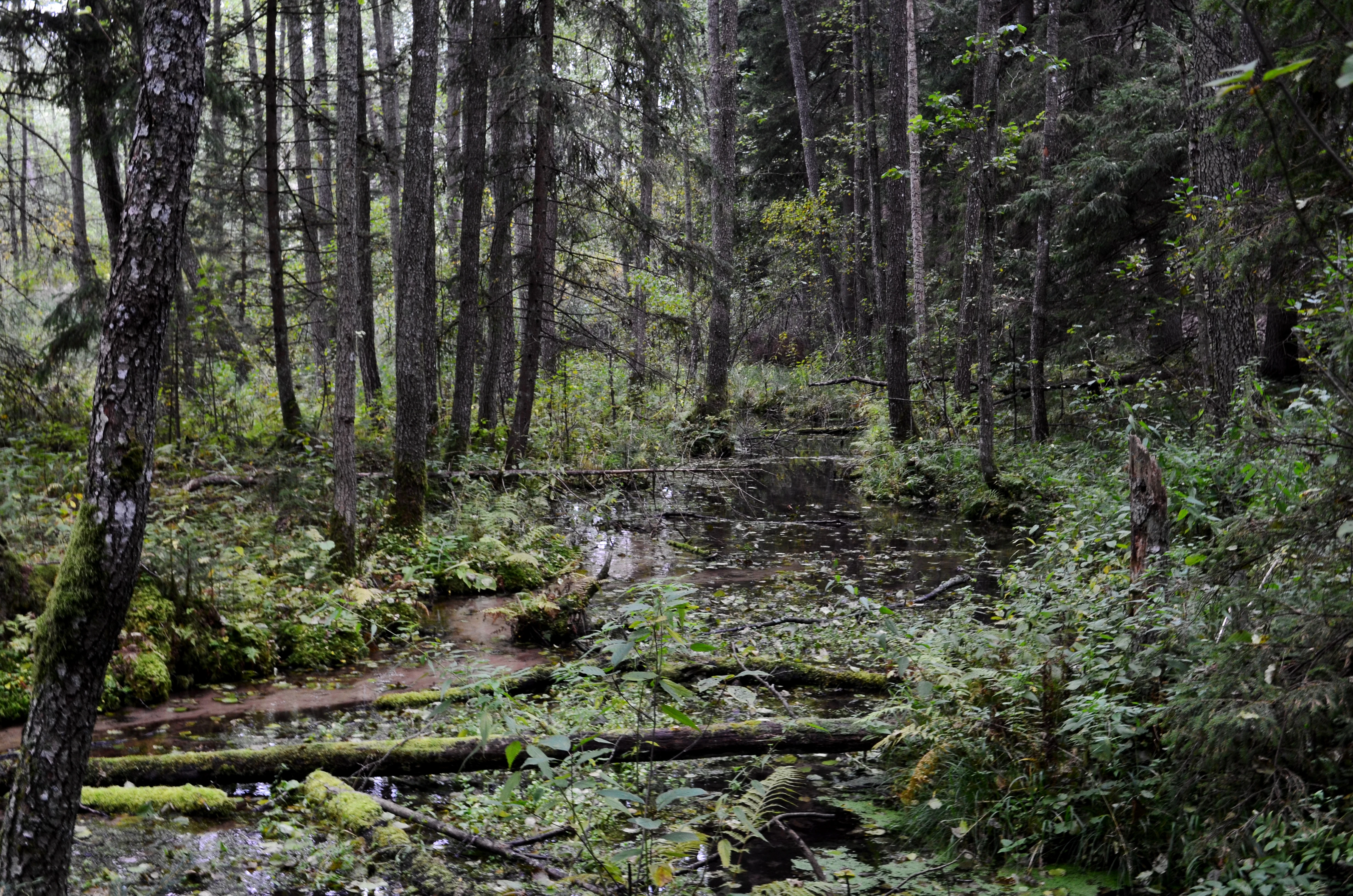
A slow-moving forest stream meanders through a dense, green woodland with fallen mossy logs in the water.
The upper reaches of the Povilnis stream flowing through a dense forest within Povilnio rezervatas.

Povilnio Rezervatas history and protected-area timeline

Povilnio Rezervatas was established in 1997 as a strict nature reserve in the Varėna district of southern Lithuania. Its creation reflected a growing recognition of the conservation value of the Povilnis stream valley and the surrounding Dainava Forest, and it was placed within the institutional framework of Dzūkija National Park. Since its establishment the reserve has been administered by the joint directorate of Dzūkija National Park and the Čepkeliai Reserve, which has overseen protection of the area's forest, mire, and freshwater habitats.

Povilnio Rezervatas landscape and geographic character

The terrain of Povilnio Rezervatas is shaped by the glacial history of southeastern Lithuania. Sandy lowlands and low dunes dominate the surrounding plateau, and the Povilnis stream has carved a distinct valley through these deposits. Locally this landform is known as a dubaklonis, a pronounced spillway-style valley that gives the reserve much of its topographic character.

On the higher, drier ground above the stream, lichen-rich pine heaths occupy the dune crests, reflecting the sandy, nutrient-poor soils typical of the Dainava sand plain. The valley slopes and cooler, moister microclimates support spruce forest, while the lowest and wettest zones along the stream are occupied by alder mires and sedge communities. Small bog fragments and the Pavilnis lake add further variety to this compact landscape mosaic.
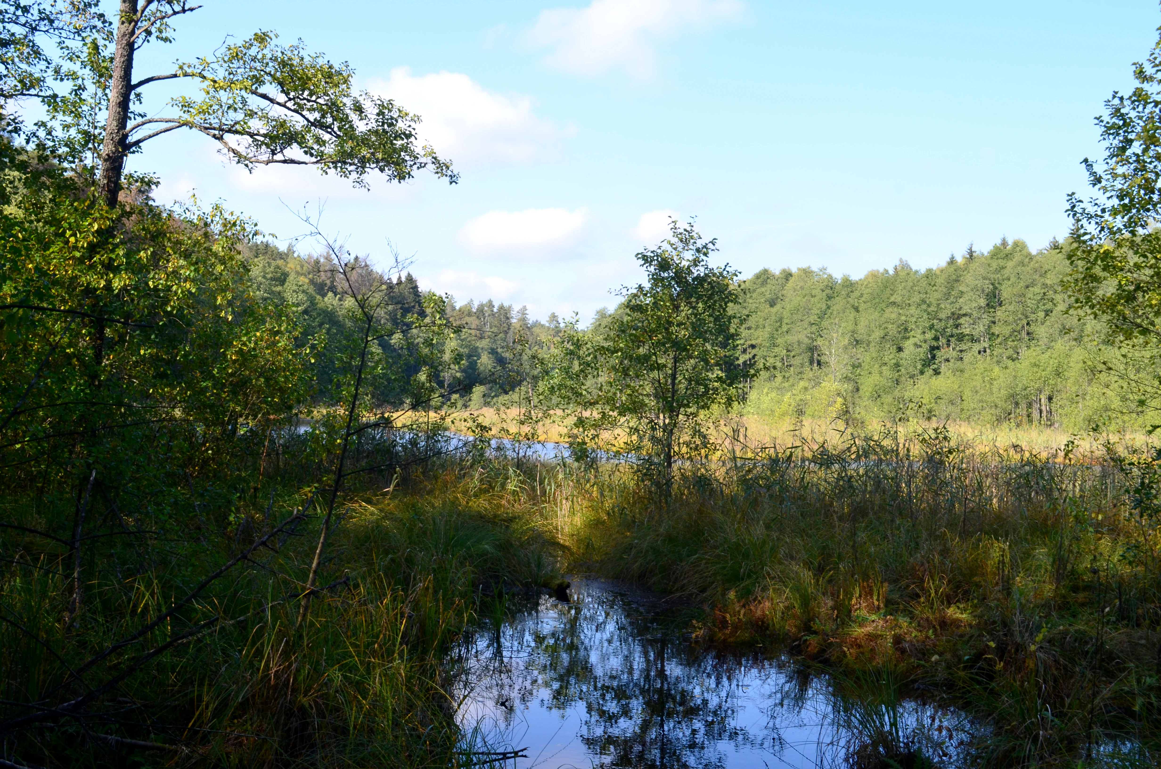
A peaceful, sunlit view of a small lake surrounded by lush green forest and marshy vegetation in the Povilnio Nature Reserve.
A view of the wetland and small lake basin within the Povilnio rezervatas nature reserve in Lithuania.

Povilnio Rezervatas ecosystems, habitats, and plant life

Ecologically, the reserve captures a clear cross-section of Dainava Forest habitats in a small area. Dry pine woods with rich lichen cover on the dunes give way to mixed and spruce-dominated forest on the slopes, with patches of broadleaf woodland and extensive wet alder mires along the stream.

The reserve's vegetation includes 11 distinct plant communities documented across these habitats. Botanists have recorded around 80 moss species, largely associated with the moister spruce and alder stands, as well as more than 300 higher plant species from 73 families. Several rare and regionally uncommon species have been documented here, including plants of conservation interest that are otherwise scarce in the Dzūkija region, underscoring the reserve's botanical importance within the national park.
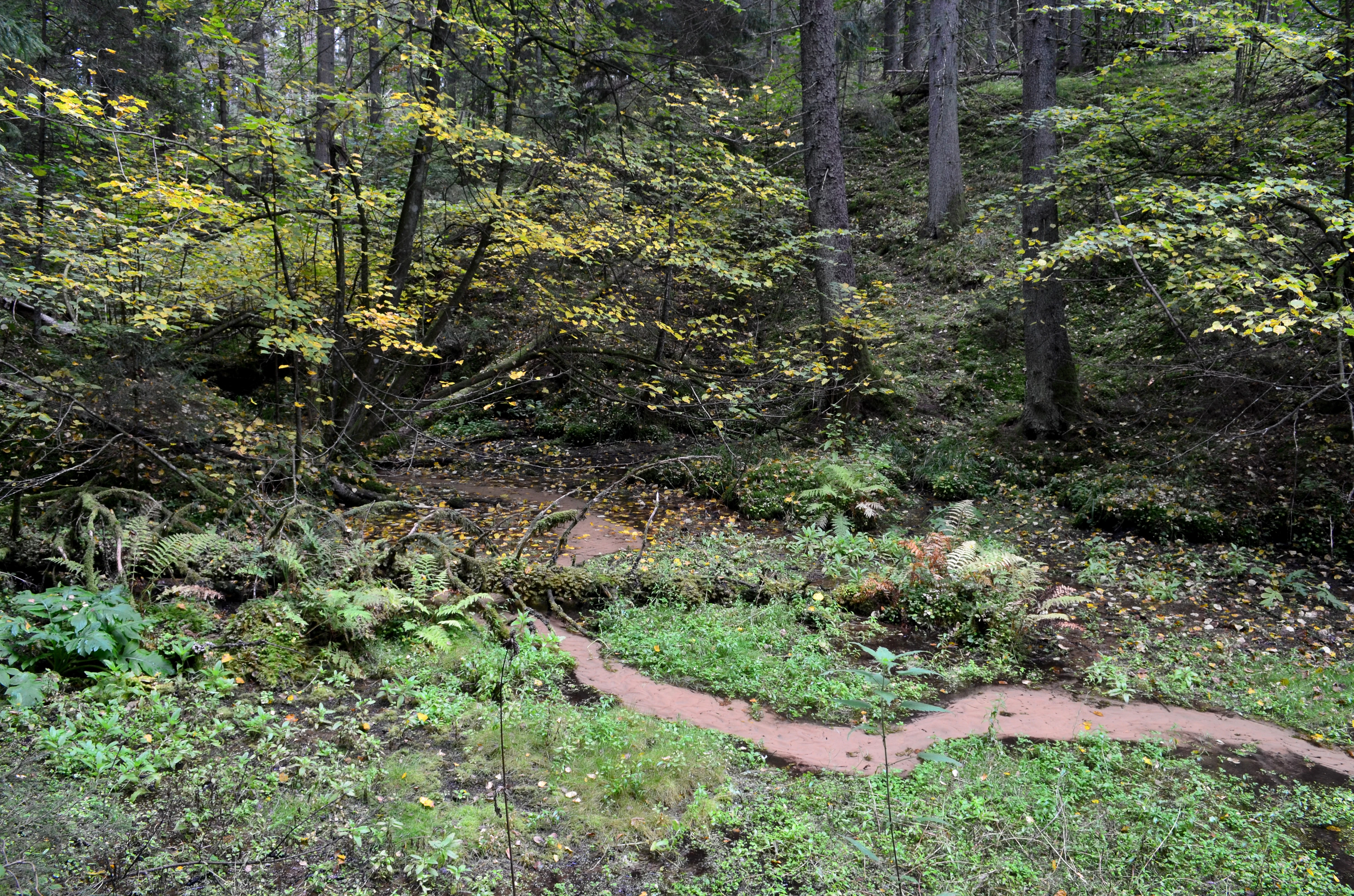
A small, narrow stream of water winds through a lush, green forest floor with ferns and fallen leaves.
The spring that serves as the source of the Povilnis stream in Povilnio rezervatas, Lithuania.

Povilnio Rezervatas conservation status and protection priorities

As an IUCN Category Ia strict nature reserve, Povilnio Rezervatas represents the highest level of nature protection applied in Lithuania, with management aimed primarily at preserving natural processes and habitats rather than accommodating visitors. Its designation reflects the conservation priority given to the Povilnis stream valley, the associated dubaklonis landform, and the surrounding forest and mire mosaic of the Dainava sand plain.

The reserve sits within Dzūkija National Park and is managed alongside the larger Čepkeliai Reserve, integrating it into a network of strictly protected areas across southeastern Lithuania. By safeguarding rare mosses, regionally uncommon vascular plants, and characteristic forest and mire communities in a compact territory, the reserve strengthens the broader conservation value of the national park landscape.

Top sights and standout views in Povilnio Rezervatas

Povilnio Rezervatas stands out for combining a striking glacial valley landform with one of the richest small-scale forest and mire mosaics in the Dainava Forest. Its eleven plant communities, unusually high moss diversity for its size, and concentration of rare plant species make it an important reference site for conservation within Dzūkija National Park.

Best time to visit Povilnio Rezervatas

As a strict nature reserve with restricted public access, Povilnio Rezervatas is primarily a site for conservation research rather than general visitation. For context, the surrounding Dzūkija National Park landscape is most evocative in late spring and summer, when forest vegetation and wetland communities are at their most expressive, and in autumn, when berry and mushroom traditions draw visitors to the broader Dainava Forest region.
Monthly climate preview

Track representative temperature ranges and precipitation patterns across the year

Povilnio Rezervatas Climate Normals and Long Term Weather by Month

Representative coordinate records show measured long term temperature variations and monthly precipitation rhythms across Povilnio rezervatas. Deeper twelve month climate profiles provide comprehensive averages for detailed meteorological comparison.
Annual mean7 °C
-6 °C19 °C
Jan-6°
Feb-5°
Mar
Apr
May13°
Jun16°
Jul19°
Aug18°
Sep13°
Oct
Nov
Dec-4°
Warmest month
July

18.6 °C

Coolest month
January

-5.7 °C

Wettest month
July

2.9 mm/day

Driest month
March

1.5 mm/day

Park location guide

Geography guide, regional context, and park location map for Povilnio Rezervatas

Povilnio Rezervatas park geography, regions, and map view in Lithuania

Understand where Povilnio Rezervatas sits in Lithuania through a broader geographic reading of the surrounding landscape, nearby location context, and its mapped position within the national park landscape.

How Povilnio Rezervatas fits into Lithuania

Lithuania is a unitary semi-presidential republic and one of three Baltic states in Northern Europe. It lies on the eastern coast of the Baltic Sea, with Vilnius as its capital and largest city. The country regained independence in 1990 after Soviet occupation and joined the European Union in 2004. Lithuania has a population of about 2.9 million and covers an area of 65,300 km².

Wider geography shaping Povilnio Rezervatas in Lithuania

Lithuania is situated on the eastern shore of the Baltic Sea in Northern Europe. It borders Latvia to the north, Belarus to the east and south, Poland to the south, and Russia's Kaliningrad Oblast to the southwest. The country also has a maritime border with Sweden to the west. The terrain is largely flat with rolling hills, numerous lakes, and rivers. The Nemunas River is the longest river in the country.

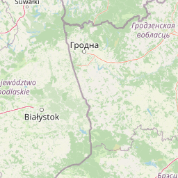
Map view of Povilnio Rezervatas

Use this park location map to pinpoint Povilnio Rezervatas in Lithuania, understand its exact geographic position, and read its mapped placement within the surrounding landscape more clearly.

Pigeon | © OpenStreetMap contributors

Location context for Povilnio Rezervatas

Varėna District Municipality

Visualizing the glacial valley, dune pine forests, and wet alder mires of the reserve

Povilnio Rezervatas Photos and Landscape Scenery

Examine high-resolution photography capturing the glacial spillway valley and diverse plant communities within the reserve. Visual documentation reveals the distinct topography and compact habitat mosaic formed across the southern Lithuanian sand plain.

A slow-moving forest stream meanders through a dense, green woodland with fallen mossy logs in the water.

A dense spruce forest interior with tall evergreen tree trunks, fallen logs on the forest floor, and a mossy, broken tree stump in the foreground.

A peaceful, sunlit view of a small lake surrounded by lush green forest and marshy vegetation in the Povilnio Nature Reserve.

A small, narrow stream of water winds through a lush, green forest floor with ferns and fallen leaves.

Park atlas

Compare nearby national parks and connected protected landscapes across the sandy plains.

Parks Near Povilnio Rezervatas and Other Protected Areas in the Surrounding Region

Browsing other parks near Povilnio Rezervatas reveals related forest reserves and glacial valley ecosystems across the surrounding region. Expanding beyond individual nature reserves helps connect regional terrain patterns, glacial landforms, and protected woodland habitats.
Watercolor illustration showing a landscape with forests, a river, and distant hills
National parkLithuania
Mapped location lies within the park boundary#1 closest

West

Dzūkija National Park: Explore Lithuania's Largest Protected Forest and Inland Dune Landscapes

Mapped protected area geography and natural terrain of the Dainava region.

Delve into the protected landscape of Dzūkija National Park, Lithuania's expansive national park renowned for its vast primeval pine forests and extraordinary inland dune formations. This page provides a detailed atlas-style view of the park's mapped boundaries, diverse terrain, and significant natural features, offering insight into its protected territory and regional geographic importance. Examine the unique wetland systems and forest ecosystems that make this a crucial area for protected land discovery.

Area
584.53 km²
Established
1991
IUCN
II
Visitors
30K annual
A watercolor painting showing a wide, panoramic view of a marshy wetland with patches of green vegetation, small trees, and low hills in the distance.
Nature reserveVarėna District Municipality
About 10 km away#2 closest

South

Čepkeliai Nature Reserve: Mapped Geography and Protected Wetland Landscape in Lithuania

A wild expanse of raised bogs and inland dunes.

Čepkeliai Nature Reserve features an exceptionally large and undisturbed raised bog complex situated in southern Lithuania. This protected territory within the Varėna District Municipality spans varied terrain, including stabilized sandy dunes, forested islands, and the Katra River valley. Its complex ecological structure preserves rare bird populations and deep peat deposits that reflect centuries of post-glacial history.

Area
112.12 km²
Established
1975
IUCN
Ia
Relief
Lowland
Watercolor illustration of a serene river landscape with green trees, grassy banks, and rolling hills in the background.
Nature reserveVarėna District Municipality
About 16 km away#3 closest

West

Skroblaus rezervatas: Protected Nature Reserve and Baltic Upland Geographic Reference Site

Natural hydrological basin and inland dune landscapes in Varėna District Municipality

Skroblaus rezervatas functions as a strict nature reserve protecting the natural hydrological regime of the Baltic uplands. Located in the Varėna District Municipality, the terrain features deep stream valleys, thermokarst depressions, and inland dune massifs. This mapped area offers a deep look into the geomorphology and forest ecology of southern Lithuania, providing essential context for understanding undisturbed upland water systems.

Area
8.107 km²
Established
1983
IUCN
Ia
Relief
Upland
Nature reserveTrakai District Municipality
About 57 km away#4 closest

North

Mergiškių gamtinis rezervatas Protected Nature Reserve in Trakai District Municipality

Strictly protected hornbeam woodland and hilly glacial terrain

Mergiškių gamtinis rezervatas is a protected area in Lithuania dedicated to conserving mature hornbeam-dominated hill forest. Located within the Trakai District Municipality, the reserve provides a critical habitat for threatened species and maintains the natural integrity of hilly glacial landscapes typical of the Aukštadvaris region.

Area
1.57 km²
Established
1996
IUCN
Ia
Relief
Upland
Watercolor painting showing green hills, trees, a body of water, and grassy vegetation
National parkLithuania
About 61 km away#5 closest

North

Trakai National Historic Park: Medieval Heritage and Lake District Protected Landscape

Explore Lithuania's historic park and its mapped geographic context.

Trakai National Historic Park offers a rich tapestry of medieval history intertwined with a captivating lake district landscape. As a protected area in southeastern Lithuania, it preserves significant architectural monuments, including the iconic Trakai Castle, set against a backdrop of interconnected lakes, forests, and wetlands. MoriAtlas provides a structured overview of its geographic boundaries and regional setting, facilitating atlas-style exploration of this historically significant protected landscape.

IUCN
V
Access
Moderate access
Scope
Mixed
Watercolor painting of a tranquil marshland scene with reeds in the foreground, rolling green hills, and a pale sky.
Nature reservePodlaskie Voivodeship
About 66 km away#6 closest

West

Ostoja Augustowska Nature Reserve: Protected Forest and Wetland Atlas of Podlaskie

Mapped wilderness corridors in the Polish lowlands

Ostoja Augustowska serves as a major ecological hub in Podlaskie Voivodeship, comprising extensive pine and spruce woodlands linked with diverse peatland systems. The site provides a critical corridor for rare forest wildlife while preserving ancient stands of old-growth timber. Gain insights into the complex geography of this Natura 2000 protected territory through its documented terrain, hydrological networks, and mosaic of rare boreal habitat types.

Area
1,070.69 km²
Established
2009
Relief
Lowland
Climate
Temperate
Watercolor painting showing a wetland scene with reeds, patches of water, and trees under a light sky
National parkPodlaskie Voivodeship
About 80 km away#7 closest

Southwest

Biebrza National Park: Protected Fenlands and River Basin Geography in Northeastern Poland

Tracing the largest lowland peat bog complex in the European landscape

Biebrza National Park serves as the premier protected wetland area in Poland, characterized by its vast, intact marshlands and the meandering Biebrza River valley. This geographic profile details the park's critical fen ecosystems, floodplain dynamics, and distinctive habitats that support diverse avian and mammalian populations within the Podlaskie region.

Area
592.23 km²
Established
1993
IUCN
II
Relief
Lowland
A watercolor painting of a flat wetland landscape with a winding river in the foreground, small clusters of trees, and rolling hills in the soft, distant background.
National parkPodlaskie Voivodeship
About 80 km away#8 closest

Southwest

Biebrzański Park Narodowy: A Protected Wetland Landscape in Podlaskie Voivodeship, Poland

Mapped river valley and peatland geography.

Located in the northeast of Poland, Biebrzański Park Narodowy protects a sprawling, flat basin defined by the slow-meandering Biebrza River. This critical protected area encompasses rare peat bogs, floodplain meadows, and alder carrs, functioning as a vital refuge for wetland species within the broader Podlaskie Voivodeship landscape.

Area
592.23 km²
Established
1993
Visitors
23.2K annual
Relief
Lowland

Common questions about visiting, size, designation, and location context for Povilnio Rezervatas

Povilnio Rezervatas FAQs for park facts, access, geography, and protected area context

Find quick answers about Povilnio Rezervatas, including protected-area facts, park geography, trail and visitor context, and how the park fits into its surrounding country and regional landscape.
MoriAtlas Explorer

Continue Your Protected Areas Search Across the Global Atlas

Deepen your exploration by continuing the structured search for national parks and protected areas worldwide. Utilize the comprehensive filtering capabilities to compare different conservation landscapes and refine your understanding of global park geography. Discover more about the distribution and characteristics of protected natural areas.

Global natural geography