Mori Atlas logo
Nature reservePunta Tombo

Discover the unique sandy peninsula, nesting colony geography, and marine-terrestrial boundaries

Punta Tombo Nature Reserve: Mapping the Protected Coastal Peninsula of Chubut Province

(Reserva Natural Turística Objetivo Específico Punta Tombo)

Punta Tombo serves as a critical protected landscape on the Atlantic coast of Argentina. This narrow peninsula features a distinct geological spine of pre-Jurassic rock overlain by compact sands and gravels, providing a vital habitat for Magellanic penguins and Patagonian steppe wildlife. Through its integrated land and marine reserve system, the area preserves a delicate coastal interface and offers significant insights into the regional ecology of Chubut Province.

Magellanic penguinseabird colonyPatagonian steppecoastal peninsulaAtlantic coastChubut Province

Punta Tombo

Nature reserve

Park overview

Structured park overview, official facts, and landscape profile for Punta Tombo

Punta Tombo park facts, protected area profile, and essential visitor context

Review the core facts for Punta Tombo, including designation, size, terrain, visitor scale, habitats, and operating context in one park-focused overview.

About Punta Tombo

Punta Tombo is a protected coastal peninsula on the Atlantic side of central Patagonia, in Chubut Province, Argentina. The landform itself is modest in size: a narrow strip roughly three kilometers long and about 600 meters wide, projecting into the sea and built on a base of pre-Jurassic crystalline rock that has resisted marine erosion. Above that base lie layers of compacted sand, gravel, and clay that create perfect burrowing substrate for nesting seabirds.

The reserve's identity is defined above all by penguins. Punta Tombo is one of the largest continental breeding colonies of the Magellanic penguin in Argentina and across the southern cone. The ground is so densely riddled with burrows that visitors walk along raised boardwalks, and during peak breeding months the colony is active from horizon to horizon. Beyond the penguins, the surrounding rocks and cliffs shelter seabirds including gulls, cormorants, and terns, while the interior of the peninsula still belongs ecologically to the Patagonian steppe, with guanacos, foxes, maras, and small native rodents roaming among the nests.

Administratively, the site has grown into a layered series of protections. The terrestrial reserve was created in 1972 and reinforced with provincial faunal reserve status in 1985. In 2015, a complementary marine protected area was established offshore to safeguard roughly 60 kilometers of coastline and about 3 nautical miles out to sea, covering approximately 31,000 hectares around Punta Tombo and Punta Clara. Together, the land and sea zones aim to protect the feeding routes and migratory pathways of the penguins, while also sheltering other marine species and seabirds.

Punta Tombo is one of the central pillars of nature tourism in Patagonia. Visitor numbers have grown substantially since the 1990s and now reach into the low six figures annually. The accessible boardwalks, the predictable behavior of the penguins, and the proximity to the main Patagonian tourism hub of Puerto Madryn make it both an iconic wildlife experience and a stop on broader Patagonian travel itineraries.

Quick facts and research context for Punta Tombo

Punta Tombo is a small Patagonian peninsula and protected area on the Atlantic coast of Chubut Province, Argentina, with the terrestrial reserve covering around 210 hectares. It was first established as a tourist natural reserve in 1972 and received formal provincial faunal reserve status in 1985, with permanent ranger presence from 1979 onward. The site is best known as one of the largest continental breeding colonies of the Magellanic penguin, with peak counts exceeding one million birds.

Protection and recognition

Examine the designated protection timeline and management scope for Punta Tombo.

Punta Tombo Protection Status and Terrestrial Conservation History

Punta Tombo maintains a documented terrestrial protection status established in 1979 across local management frameworks. Researchers and conservation planners consult these historical designation records to analyze protected area management scope.

Protection details

Protection scope
Terrestrial
Designated year
1979
Transboundary protection
No
Park context

Deeper park guide and search-rich context for Punta Tombo

Punta Tombo history, landscape, wildlife, and travel context

Explore Punta Tombo through its history, landscape character, ecosystems, wildlife, conservation priorities, cultural context, and seasonal travel timing in a structured park guide built for atlas discovery and search intent.

Why Punta Tombo stands out

Punta Tombo is best known for hosting one of the largest continental breeding colonies of the Magellanic penguin anywhere in South America. Each breeding season, the penguins arrive from late August, recondition or dig burrows, lay their eggs through September and October, and raise chicks through the austral summer before the juveniles head out to sea around April. The reserve is also distinguished by the unusually close and tolerant interaction between penguins and visitors. Because the penguins do not easily abandon their nests, raised walkways have been installed so observers can view the colony across just a few meters of ground without collapsing burrows. This combination of scale and accessibility has made Punta Tombo a flagship site for Patagonian coastal wildlife.
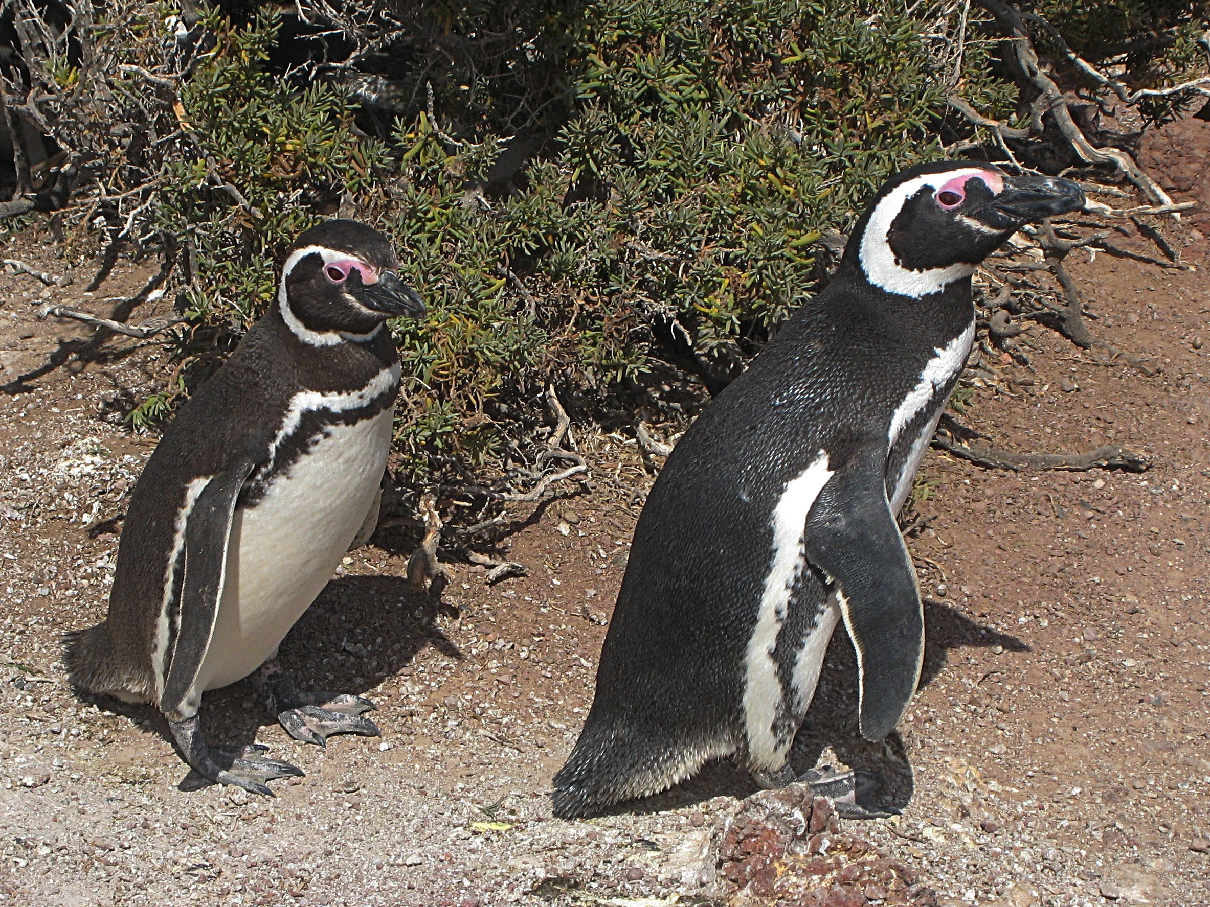
Two adult Magellanic penguins standing on a dirt path with low scrub vegetation in the background.
Two Magellanic penguins at the Punta Tombo reserve.

Punta Tombo history and protected-area timeline

The first formal protections for Punta Tombo arrived in 1972, when a provincial decree created a tourist natural reserve specifically aimed at safeguarding the Magellanic penguin colony and the supporting seabird ecosystem. That initial conservation focus was reinforced in 1985, when a new provincial law redesignated the area as a provincial faunal reserve and confirmed the original objective of protecting the penguin colony and the broader coastal bird community.

In 1979, the government of Chubut formally instituted controlled access and a permanent ranger service, marking the beginning of modern reserve management. The site also became an important international research subject: since 1982, the reserve has been studied in cooperation with organizations such as the Wildlife Conservation Society and the Zoological Society of New York, generating decades of long-term monitoring data on penguin populations.

In 2015, the protected area system around Punta Tombo was expanded seaward with the creation of the Punta Tombo Marine Protected Area. This offshore designation added roughly 31,000 hectares around Punta Tombo and Punta Clara to shield feeding and transit zones for the penguins from oil exploration, shipping, and unregulated fishing.

The reserve has also been marked by tragedies. A major oil spill in August 1991 coincided with the breeding migration and killed at least 16,000 Magellanic penguins, some of which arrived at Punta Tombo already oiled, with additional mortality believed to have occurred offshore. Penguin population counts reflect the impact: the colony exceeded one million birds in 1982, dropped by an estimated 37 percent between 1994 and 1995, and remained around 400,000 in 1999 before recovering toward the million-bird range by 2017. In late 2021, the reserve was further devastated by the unauthorized road construction and electrified fencing on adjacent private land, an event popularly known as the Punta Tombo Massacre, in which hundreds of nests and adult penguins were destroyed.

Punta Tombo landscape and geographic character

Punta Tombo is a narrow, low-lying peninsula that pushes out into the Atlantic Ocean from the otherwise straight Patagonian coast near Camarones. Its geology is unusually distinct for the region: a pre-Jurassic crystalline rock outcrop forms the resistant spine that has withstood long-term marine erosion, giving rise to the pronounced point itself. Overlying this rocky base are extensive patches of rounded gravel and, most importantly, broad stretches of fine, well-compacted sand that dominate the surface of the peninsula.

The peninsula measures roughly 3 kilometers in length by about 600 meters in width, so its topographic relief is limited. Across much of the surface, the ground is a soft, sandy plain whose gentle slopes ease the daily overland movement of penguins between their nesting burrows and the sea. Inland of the coastal strip, the terrain transitions into the characteristic arid, windswept profile of the Patagonian steppe, with sparse vegetation and wide open views across gravel flats.

Inland from the coast, low hills rise above the peninsula and provide long views over both the colony and the surrounding gulf. These hills carry archaeological traces of past human presence in the region and frame the peninsula visually from the interior. The offshore setting is equally important to the landscape identity of Punta Tombo: coastal cliffs, rock platforms, and islands close to the tip of the point form haul-out sites for sea lions and nesting platforms for seabirds, while the adjoining marine waters fall within the marine protected zone created to complement the terrestrial reserve.
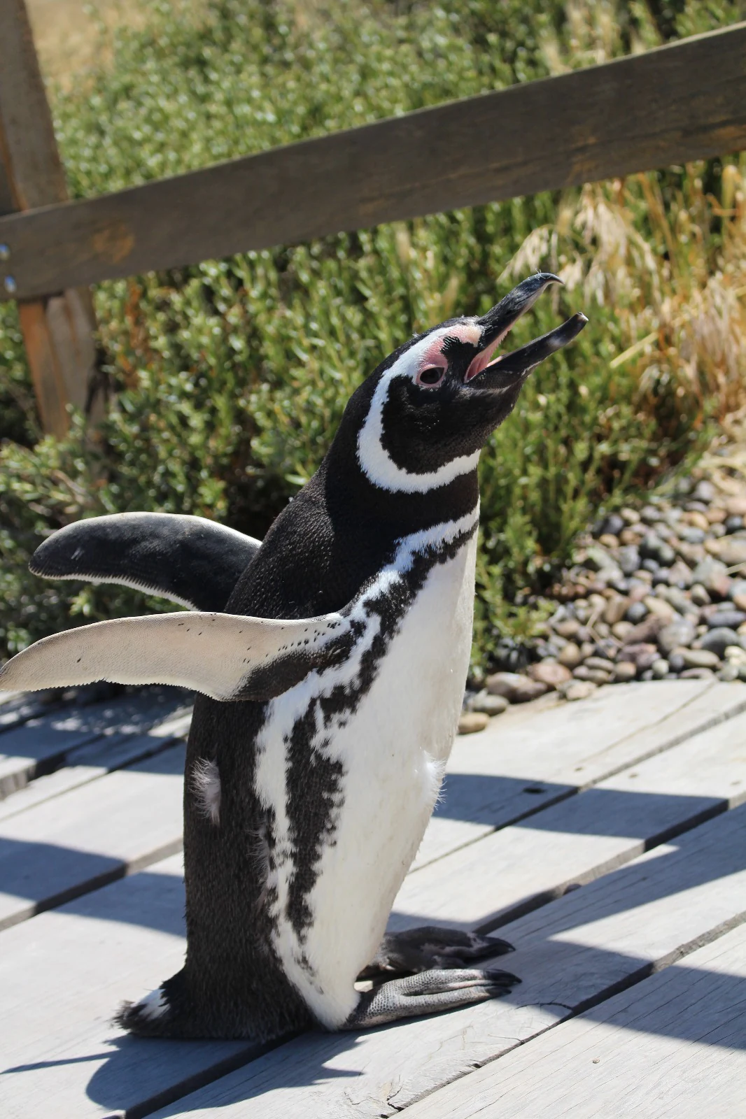
A black and white Magellanic penguin with its beak open and wings spread, standing on a wooden boardwalk in front of a low wooden fence and low shrubs.
A Magellanic penguin stands on a wooden boardwalk at the Punta Tombo reserve.

Punta Tombo ecosystems, habitats, and plant life

The terrestrial ecology of Punta Tombo belongs to the Patagonian steppe ecoregion, marked by aridity, sparse vegetation, low temperatures, and persistent winds. Soil conditions are poor, with sandy substrates that lack meaningful organic matter and limited fresh water, which together keep plant cover thin and patchy. Hardy shrubs and grasses such as quilimbai, colapiche, and amargo coirón grasses are among the most characteristic plant species in the reserve.

The coastal habitat is shaped as much by seabirds as by plants. The compacted sandy substrate and gentle relief of the peninsula create ideal conditions for burrow-nesting species, and large stretches of the surface are literally mined with shallow burrows dug year after year by returning penguins. Offshore rocks and small islets provide nesting ledges for cormorants, terns, and other seabirds, while the adjacent waters function as the feeding ground for the penguins and a transit corridor for other marine fauna.

The marine protected area established around Punta Tombo extends this ecological profile seaward, covering roughly 31,000 hectares of coastal and near-shore waters. The offshore environment is a foraging and migration zone for the penguins and supports additional marine life of interest to fisheries, making the integration of land and sea protections central to the reserve's ecological coherence.
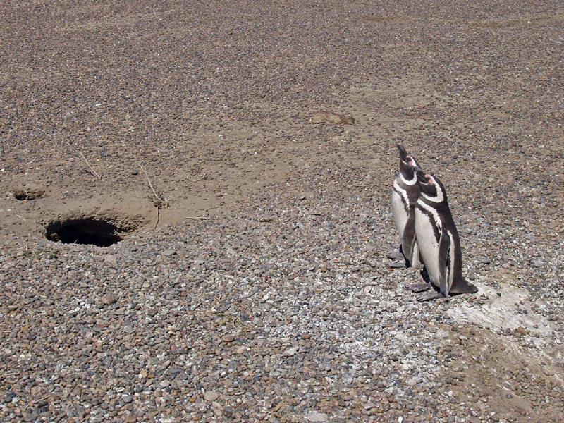
Two Magellanic penguins standing together on a gravelly surface next to a dark hole burrowed into the ground.
A pair of Magellanic penguins standing near their nest burrow at Punta Tombo.

Punta Tombo wildlife and species highlights

Punta Tombo is defined, above all, by penguins. The Magellanic penguin colony here is one of the largest continental breeding aggregations of the species anywhere in South America, with peak counts in recent strong seasons exceeding one million birds and active nest counts in the low hundreds of thousands. During breeding months, returning males reconstitute the same burrows from previous years, females lay two eggs per nest, and both parents share incubation and chick-rearing duties over the austral summer.

Beyond penguins, the reserve shelters a wide community of coastal birds. Kelp gulls, dolphin gulls, several species of terns, two species of cormorants, oystercatchers, both giant petrel species, native ducks, and herons all use the peninsula and its surrounding waters. South American sea lions haul out on rocky islets at the tip of the point, creating a year-round marine mammal presence alongside the seasonal seabird abundance.

The interior and edges of the peninsula are still inhabited by typical Patagonian steppe fauna. Guanacos regularly move among the penguin burrows, foxes, grisons, maras, hairy armadillos, and small native cavies all occur on land, and rheas are seen in the surrounding countryside. This overlap between Patagonian steppe mammals and a marine seabird concentration is one of the reserve's defining ecological themes.
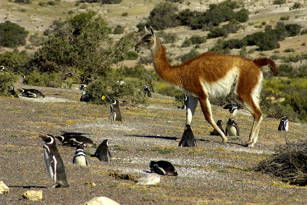
A brown and white guanaco stands on a dry, scrubby landscape surrounded by several black and white Magellanic penguins.
A guanaco walking among a colony of Magellanic penguins at Punta Tombo.

Punta Tombo conservation status and protection priorities

Punta Tombo has been the focus of conservation effort for more than five decades. The reserve was established in 1972 as a tourist natural reserve and strengthened in 1985 with provincial faunal reserve status, with permanent ranger presence organized since 1979. The underlying conservation logic has always been to protect the Magellanic penguin colony and the seabird community that depends on the same coastal habitat.

The site's conservation profile was significantly expanded in 2015 with the creation of the Punta Tombo Marine Protected Area, an offshore corridor of roughly 31,000 hectares that safeguards feeding and migratory zones for the penguins and also benefits other marine species. Long-term research partnerships, especially with the Wildlife Conservation Society and the Zoological Society of New York, have run since 1982 and have produced some of the most detailed long-term datasets on Magellanic penguins anywhere in the world.

The reserve also faces serious and ongoing conservation threats. Oil exploration and shipping close to the coast remain the most significant offshore hazards, and past spills have caused mass mortality, including the 1991 spill that killed at least 16,000 penguins during the breeding season. Overfishing of prey species and illegal hunting add further pressure. In 2021, an unauthorized rural road and electrified fence built on private land adjoining the reserve destroyed close to 200 nests and killed hundreds of adult penguins, an event now widely referred to as the Punta Tombo Massacre and one of the most serious conservation incidents in modern Argentine environmental history.

Punta Tombo cultural meaning and human context

Long before it became a wildlife reserve, Punta Tombo was part of the traditional seasonal range of the Tehuelche peoples of Patagonia. Archaeological traces, including remains of Tehuelche cemeteries, have been identified in the hills overlooking the peninsula, indicating that indigenous groups knew and used the area for generations as part of their seasonal movements across the Patagonian steppe.

In the 19th century, British mariners navigating this stretch of the South Atlantic knew Punta Tombo under the name Tombas, a historical variant that still surfaces occasionally in older sailing and exploration references. The site has no major modern settlement, but its surrounding estancias have gradually built a small rural tourism economy that complements visits to the reserve itself with regional hospitality and cuisine.

Today, Punta Tombo is a defining element of the identity of coastal Chubut and a flagship destination for Patagonian nature tourism in Argentina, regularly featured in national environmental policy discussions and in broader debates about conservation, indigenous heritage, and industrial pressure on coastal Patagonia.
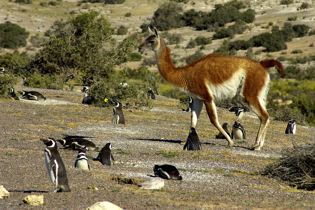
A brown and white guanaco standing on a dry, rocky slope surrounded by several black and white Magellanic penguins.
A guanaco walks among a nesting colony of Magellanic penguins in the arid coastal landscape of Punta Tombo.

Top sights and standout views in Punta Tombo

One of the largest continental Magellanic penguin colonies in South America, with peak counts above one million birds and tens of thousands of active breeding burrows spread across just a few square kilometers of sandy peninsula.

A compact, boardwalk-based wildlife experience where visitors can observe nesting penguins, grazing guanacos, resting sea lions, and diverse Patagonian seabirds within a single short visit.

A layered protected area system that combines a 1972 terrestrial faunal reserve with a 2015 offshore marine protected area, supported by long-term international research partnerships and a documented record of ecological threats, including the devastating 1991 oil spill and the 2021 Punta Tombo Massacre.
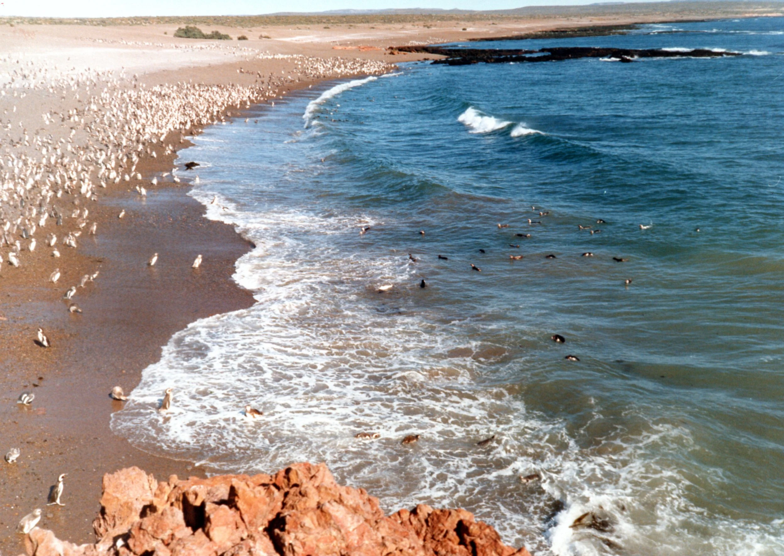
An aerial-style view looking down at a large colony of Magellanic penguins scattered along a sandy coastline, with several penguins swimming in the breaking ocean surf.
A dense colony of Magellanic penguins on the shores of Punta Tombo.

Best time to visit Punta Tombo

Punta Tombo is fundamentally a seasonal destination because the penguin colony itself is seasonal. The reserve is most alive between September and April of the austral spring and summer, when Magellanic penguins arrive to breed, dig or recondition burrows, incubate eggs, and raise chicks before fledging and departing for the open ocean. Outside this window the colony is largely empty.

Within that window, the experience shifts through the season. Males typically begin reclaiming burrows in late August, egg-laying follows in early October, and chicks become increasingly visible through November, December, and into the austral summer. By late April, the new juveniles are ready to swim, and the colony begins to disperse.

Beyond penguin activity, this is also the more temperate time of year in an otherwise windy and cool stretch of Patagonia, when conditions for walking the boardwalks and exploring nearby Patagonian steppe habitats are at their best. The reserve is generally closed or inactive during the colder off-season months outside the breeding period.

Monthly climate preview

Long-term representative records detailing average monthly temperature and precipitation cycles

Punta Tombo Climate Normals, Annual Temperature and Precipitation Rhythm

Representative coordinates track measured annual temperature swings alongside consistent monthly precipitation patterns across the protected terrain. Detailed monthly climate records reveal full seasonal baseline metrics for comparative analysis.
Annual mean12 °C
7 °C18 °C
Jan18°
Feb18°
Mar16°
Apr14°
May11°
Jun
Jul
Aug
Sep
Oct11°
Nov14°
Dec16°
Warmest month
January

18 °C

Coolest month
July

7 °C

Wettest month
June

1.5 mm/day

Driest month
December

0.8 mm/day

Park location guide

Geography guide, regional context, and park location map for Punta Tombo

Punta Tombo park geography, regions, and map view in Argentina

Understand where Punta Tombo sits in Argentina through a broader geographic reading of the surrounding landscape, nearby location context, and its mapped position within the national park landscape.

How Punta Tombo fits into Argentina

Argentina is a federal republic located in the southern cone of South America, bordering Chile, Bolivia, Paraguay, Brazil, Uruguay, and the Atlantic Ocean. With an area of 2,780,085 km², it is the second-largest country in South America and the eighth-largest globally. The capital and largest city is Buenos Aires, and the official language is Spanish. The country claims sovereignty over the Falkland Islands, South Georgia and the South Sandwich Islands, and a portion of Antarctica.

Wider geography shaping Punta Tombo in Argentina

Argentina occupies the southern portion of South America, sharing the Southern Cone region with Chile to the west. The country borders Bolivia and Paraguay to the north, Brazil to the northeast, Uruguay and the South Atlantic Ocean to the east, and the Drake Passage to the south. The Andes mountain range runs along the western border, while the Pampas plains dominate the central region. Argentina also claims territories in Antarctica.

Map view of Punta Tombo

Use this park location map to pinpoint Punta Tombo in Argentina, understand its exact geographic position, and read its mapped placement within the surrounding landscape more clearly.

Pigeon | © OpenStreetMap contributors

Location context for Punta Tombo

Chubut Province

Explore detailed imagery of nesting habitats, sandy terrain, and protected wildlife environments.

Punta Tombo Photos and Landscape Scenery: Visualizing the Patagonian Coastal Peninsula

Visual documentation captures the narrow Atlantic peninsula, gravel plains, and expansive nesting burrows that define the protected landscape. Examining authentic terrain photography helps researchers and observers understand the ecological scale of the continental penguin colony.

Two adult Magellanic penguins standing on a dirt path with low scrub vegetation in the background.

A wide angle view of a beach densely populated with hundreds of Magellanic penguins, with some standing on the grey rocky shore and others swimming in the Atlantic ocean.

A black and white Magellanic penguin with its beak open and wings spread, standing on a wooden boardwalk in front of a low wooden fence and low shrubs.

Two Magellanic penguins standing together on a gravelly surface next to a dark hole burrowed into the ground.

A brown and white guanaco stands on a dry, scrubby landscape surrounded by several black and white Magellanic penguins.

A high-angle view of a densely packed colony of penguins along a pebble beach and the edge of the ocean surf.

A brown and white guanaco standing on a dry, rocky slope surrounded by several black and white Magellanic penguins.

An aerial-style view looking down at a large colony of Magellanic penguins scattered along a sandy coastline, with several penguins swimming in the breaking ocean surf.

Park atlas

Compare adjacent Patagonian coastal reserves and regional wildlife habitats.

Explore Parks Near Punta Tombo and Surrounding Protected Areas

Visitors exploring Punta Tombo can continue browsing nearby national parks and coastal reserves across the Patagonian steppe. Comparing adjacent protected areas reveals broader geographic patterns in regional wildlife habitats and marine conservation zones.
National parkRío Negro Province
About 290 km away#1 closest

North

Islote Lobos National Park: Coastal Archipelago National Park in Río Negro Province

Mapping the dynamic intertidal zones and unique Patagonian marine geography.

Islote Lobos National Park is a notable national park on the Atlantic coast of Río Negro Province, Argentina. This protected area preserves a distinctive landscape of six rocky promontories emerging from San Matías Gulf, creating unique island ecosystems. The park's coastal and marine environments, characterized by significant tidal fluctuations and important habitats for marine fauna, are vital to the Patagonian natural heritage. Its mapped geography offers critical insights into regional conservation efforts.

Area
19.079 km²
Established
2020
IUCN
II
Relief
Lowland
Nature reserveRío Negro Province
About 330 km away#2 closest

Northwest

Somuncurá Provincial Reserve: Mapped Geography of the Patagonian Basalt Plateau

Protected volcanic steppe and wetland landscapes in Río Negro Province

Somuncurá Provincial Reserve encompasses a dramatic volcanic tableland in northern Patagonia. This protected area features basalt steps, arid steppe plains, and small lagoons that support endemic life. The region provides a deep look at the geological forces and isolated ecosystems that shape the high-elevation terrain spanning across Río Negro Province.

Relief
Highland
Climate
Arid
Access
Access unknown
Scope
Terrestrial
National parkArgentina
About 441 km away#3 closest

Southwest

Bosques Petrificados de Jaramillo National Park: Argentina's Jurassic Petrified Forest Landscape

Explore mapped fossil trees across the Patagonian steppe.

Bosques Petrificados de Jaramillo National Park is a protected national park in Argentina's Santa Cruz Province, celebrated for its extensive collection of Jurassic period fossilized trees. Spanning nearly 80,000 hectares of Patagonian steppe, the park's unique landscape is defined by exposed petrified trunks, some of remarkable size, providing crucial evidence of the region's ancient ecosystems and paleoclimatic history. Discover this extraordinary site through its mapped geography and protected landscape identity.

Area
785.43 km²
Established
2012
IUCN
II
Relief
Mixed relief
Watercolor painting depicting mountains, a lake, and grassy shoreline
National parkArgentina
About 533 km away#4 closest

West

Los Alerces National Park: Ancient Alerce Forests and Glacial Terrain in Argentina

Discover the park's protected landscape and regional geography.

Los Alerces National Park in Argentina is a globally significant protected area, celebrated for its ancient alerce forests, some of the longest-living trees on Earth. This national park showcases a dramatic landscape shaped by glaciers, featuring a series of interconnected lakes and rugged Andean terrain. Explore the unique ecosystem and mapped geography of this UNESCO World Heritage site to understand its profound natural and conservation value.

Area
2,599 km²
Established
1937
IUCN
II
Relief
Mountain
Watercolor painting of a stylized, abstract mountain ridgeline and landscape in pale green, yellow, and soft purple tones against a white background.
Protected areaSanta Cruz Province
About 549 km away#5 closest

Southwest

Cueva de las Manos: Protected Area and Geological Landscapes in Santa Cruz Province

Archaeological mapping in the Pinturas River Canyon

Situated in the deep ravines of the Pinturas River Canyon, Cueva de las Manos is a primary protected area illustrating the intersection of prehistoric human activity and Patagonian geology. This site serves as a vital anchor for regional archaeology, featuring rock art layered across volcanic cliff walls that define the unique topography of northwestern Santa Cruz Province.

Area
6 km²
Established
1999
Visitors
8K annual
Relief
Upland
Watercolor illustration of rolling hills, a river flowing through a valley, and forested areas
National parkAysén del General Carlos Ibáñez del Campo Region
About 549 km away#6 closest

West

Queulat National Park: Patagonian Andes Glacier and Rainforest Discovery

Mapped protected area in Aysén del General Carlos Ibáñez del Campo Region.

Queulat National Park is a vast protected wilderness in southern Chile, renowned for its dramatic glacial alpine terrain and lush temperate rainforests. The park's geography is defined by steep glacial valleys, ice fields, and the iconic Queulat Hanging Glacier cascading from sheer cliffs. Discover the mapped boundaries of this significant Patagonian national park, offering unparalleled insight into its unique ecosystems and dramatic landscapes shaped by ice and forest.

Area
1,541 km²
Established
1983
IUCN
II
Relief
Mountain
Watercolor illustration showing a lake surrounded by forested hills and mountains
National parkChubut Province
About 557 km away#7 closest

West

Lago Puelo National Park: A Unique Protected Landscape at the Intersection of Biomes

Explore its glacial terrain and Andean-Patagonian geographic context.

Lago Puelo National Park, located in Argentina's Chubut Province, stands out as a significant protected area due to its remarkable ecological diversity. This park is distinguished by its rare transition zone where the Patagonian forest converges with the Andean steppe, incorporating flora typically found in the Valdivian temperate rainforest. The mountainous landscape, carved by glaciers, features the striking turquoise waters of Puelo Lake and surrounding river systems. Understanding Lago Puelo National Park's geography provides insight into the complex natural systems of Patagonia and its unique protected biomes.

Area
276.74 km²
Established
1971
IUCN
II
Relief
Mountain
National parkAysén del General Carlos Ibáñez del Campo Region
About 562 km away#8 closest

Southwest

Cerro Castillo National Park: Dramatic Granite Peaks and Patagonian Protected Landscape

Mapped geography and huemul conservation in Chile's Aysén Region.

Cerro Castillo National Park is a premier protected area in southern Chile, celebrated for its iconic Cerro Castillo granite mountain that dominates the landscape. This national park, spanning over 1,700 square kilometers in the Aysén del General Carlos Ibáñez del Campo Region, showcases a dynamic Patagonian terrain shaped by glaciers and rivers. Its significance extends to being a vital corridor for endangered huemul, offering critical habitat within a broader regional conservation strategy and the famous Route of Parks.

Area
1,795.5 km²
Established
1970
IUCN
II
Relief
Mountain

Common questions about visiting, size, designation, and location context for Punta Tombo

Punta Tombo FAQs for park facts, access, geography, and protected area context

Find quick answers about Punta Tombo, including protected-area facts, park geography, trail and visitor context, and how the park fits into its surrounding country and regional landscape.
MoriAtlas Explorer

Continue Your Protected Areas Search Across the Global Atlas

Deepen your exploration by continuing the structured search for national parks and protected areas worldwide. Utilize the comprehensive filtering capabilities to compare different conservation landscapes and refine your understanding of global park geography. Discover more about the distribution and characteristics of protected natural areas.

Global natural geography