
Mori Atlas logo
National parkRamsagar National Park

Discover the mapped boundaries and regional context of this protected natural area.

Ramsagar National Park: National Park Protected Landscape and Geographic Atlas

Ramsagar National Park represents a significant protected area within Dinajpur District, Bangladesh, identified as a national park. This page offers detailed geographic context, focusing on the park's mapped boundaries and its role within the regional landscape. Users can explore its place in a broader atlas of protected lands, understanding its specific geographic identity and landscape context for informed discovery.

wetland reservehistoric lakebirdwatchingBangladesh protected areanorthwest BangladeshIUCN Category IV
Illustration of mountains with waterfall, river or road, and trees

Ramsagar National Park

National park

Park overview

Structured park overview, official facts, and landscape profile for Ramsagar National Park

Ramsagar National Park park facts, protected area profile, and essential visitor context
Review the core facts for Ramsagar National Park, including designation, size, terrain, visitor scale, habitats, and operating context in one park-focused overview.

About Ramsagar National Park

Ramsagar National Park occupies a distinctive position among Bangladesh's protected areas as a wetland-focused conservation space in the country's northwest. The park's central feature is Ramsagar, an expansive artificial lake that dominates the landscape and defines the ecological character of the reserve. This reservoir was excavated during the 18th century under the direction of Raja Ramnath, the reigning Maharaja of Dinajpur, and represents a significant example of historical water management infrastructure in the region. The lake stretches approximately 1,079 meters in length with a width of 192.6 meters, creating a substantial water body surrounded by earthen embankments. The soil composition throughout the park consists of red-yellow clay, a characteristic substrate of the area. The park was formally established as a protected sanctuary in 1960 and received national park designation in 2001, providing institutional protection under the Bangladesh wildlife preservation framework. Unlike many national parks characterized by extensive forest coverage, Ramsagar functions primarily as a wetland conservation area where the water body and its immediate margins form the core habitat. The park is situated at Tajpur in Sadar Upazila, serving as an important green space near the regional center of Dinajpur town.

Quick facts and research context for Ramsagar National Park

Ramsagar National Park is a small but ecologically significant protected area in Dinajpur District, Bangladesh, established as a national park in 2001. The park encompasses a historic lake excavated in the 18th century by the Maharaja of Dinajpur. It covers approximately 27.75 hectares around a lake measuring 1,079 meters in length and 192.6 meters in width. The park is managed by a small staff of eight personnel including forest officers, gardeners, and guards. The protected area supports 272 plant species across 132 families and hosts numerous bird and animal species typical of wetland habitats in the region.

Park context

Deeper park guide and search-rich context for Ramsagar National Park

Ramsagar National Park history, landscape, wildlife, and travel context
Explore Ramsagar National Park through its history, landscape character, ecosystems, wildlife, conservation priorities, cultural context, and seasonal travel timing in a structured park guide built for atlas discovery and search intent.

Why Ramsagar National Park stands out

Ramsagar National Park is best known for its historic man-made reservoir, one of the largest traditional tanks in the Dinajpur region, and its wetland ecosystem supporting significant birdlife. The park provides habitat for water birds including white-breasted waterhen, jacanas, river tern, kingfishers, grey heron, and purple heron. It also supports terrestrial wildlife such as Bengal fox, golden jackal, fishing cat, and jungle cat. The lake contains diverse fish species, turtles, and snakes. The park's historical significance stems from its creation in the 18th century, with the excavation attributed to Raja Ramnath using labor from an estimated 15 million workers.
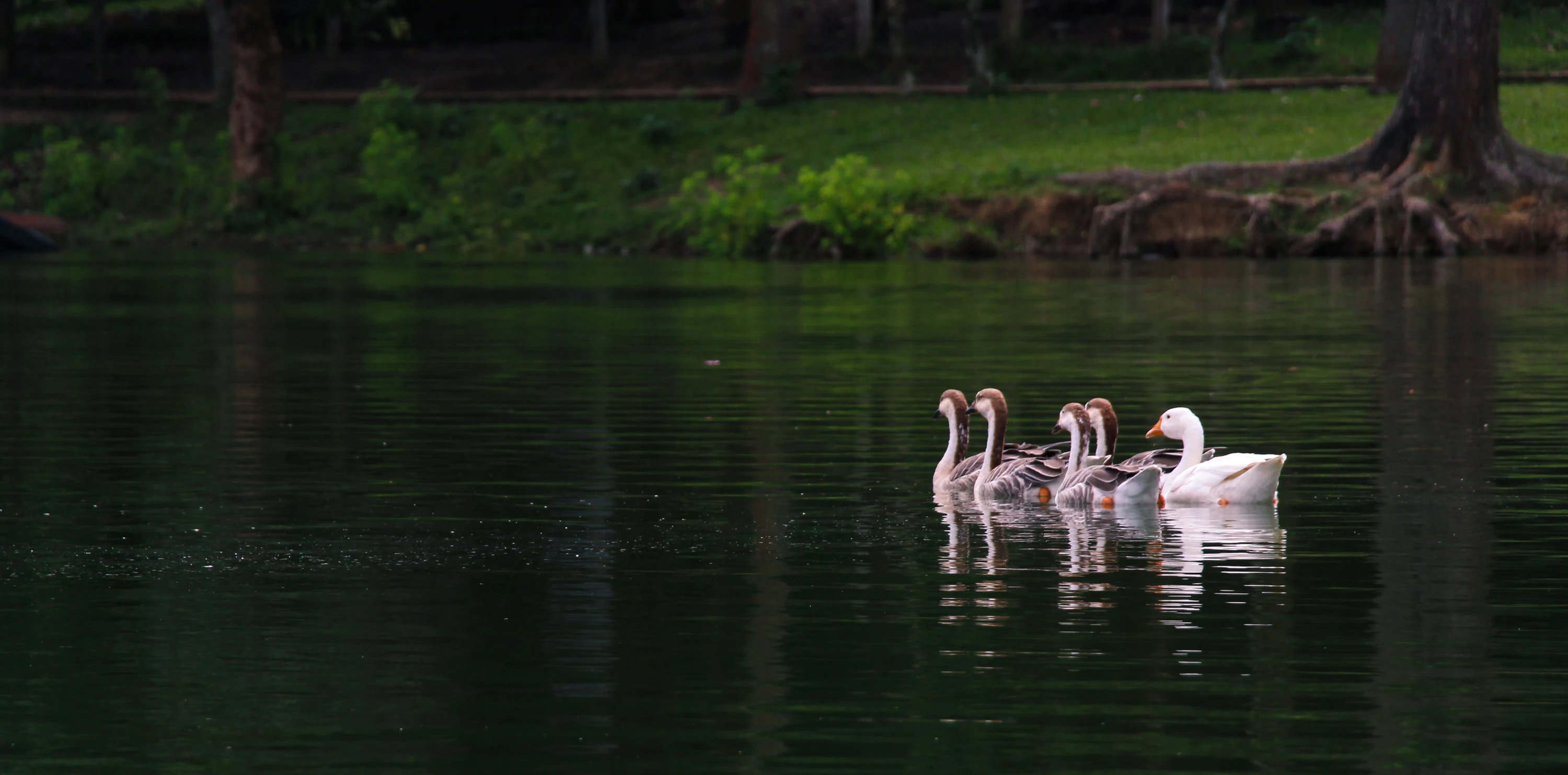
A group of geese swimming on a calm body of water with grassy and tree-lined shore in the background
Geese swimming on a calm lake with a tree-lined shore

Ramsagar National Park history and protected-area timeline

The history of Ramsagar National Park is closely tied to the creation of its central lake, which was excavated in the 18th century during the reign of Raja Ramnath, the Maharaja of Dinajpur. According to local tradition, the reservoir was named after the maharaja himself, preserving his legacy in the landscape. The excavation represents an extraordinary undertaking for its time, reportedly involving approximately 15 million workers at a cost of 30,000 Taka. This monumental project created one of the largest traditional tanks in the Dinajpur region, serving as both a water resource and a landmark of regional heritage. The area surrounding the lake was first established as a protected space in 1960, providing initial conservation recognition. In 1971, during the period of East Pakistan, the Government of East Pakistan recommended developing the area as a class-B national park with objectives focused on recreation and education. This recommendation came to fruition on 30 April 2001, when the Bangladesh government formally declared Ramsagar a national park under the Bangladesh wildlife (Preservation) Amendment Act, 1947. The park has been managed by a small team of eight staff members, including one forest officer, three gardeners, three forest guards, and one watchman.

Ramsagar National Park landscape and geographic character

The landscape of Ramsagar National Park is defined primarily by its central water body and the surrounding terrain. The park covers approximately 27.75 hectares of land organized around Ramsagar, a large artificial lake with a length of 1,079 meters and a width of 192.6 meters. The lake is encompassed by earthen embankments that create the boundaries between the water and the surrounding land. Unlike typical national parks with rolling terrain or mountainous features, this park's topography is relatively flat, consistent with the low-lying agricultural landscape of Dinajpur District. The soil throughout the park consists of red-yellow clay, a distinctive substrate common to this part of Bangladesh. The absence of significant elevation changes means the park does not offer panoramic vistas or varied terrain, but rather presents an open landscape where the lake serves as the dominant visual and ecological feature. The surrounding area consists of embankment zones and marginal land rather than dense forest.
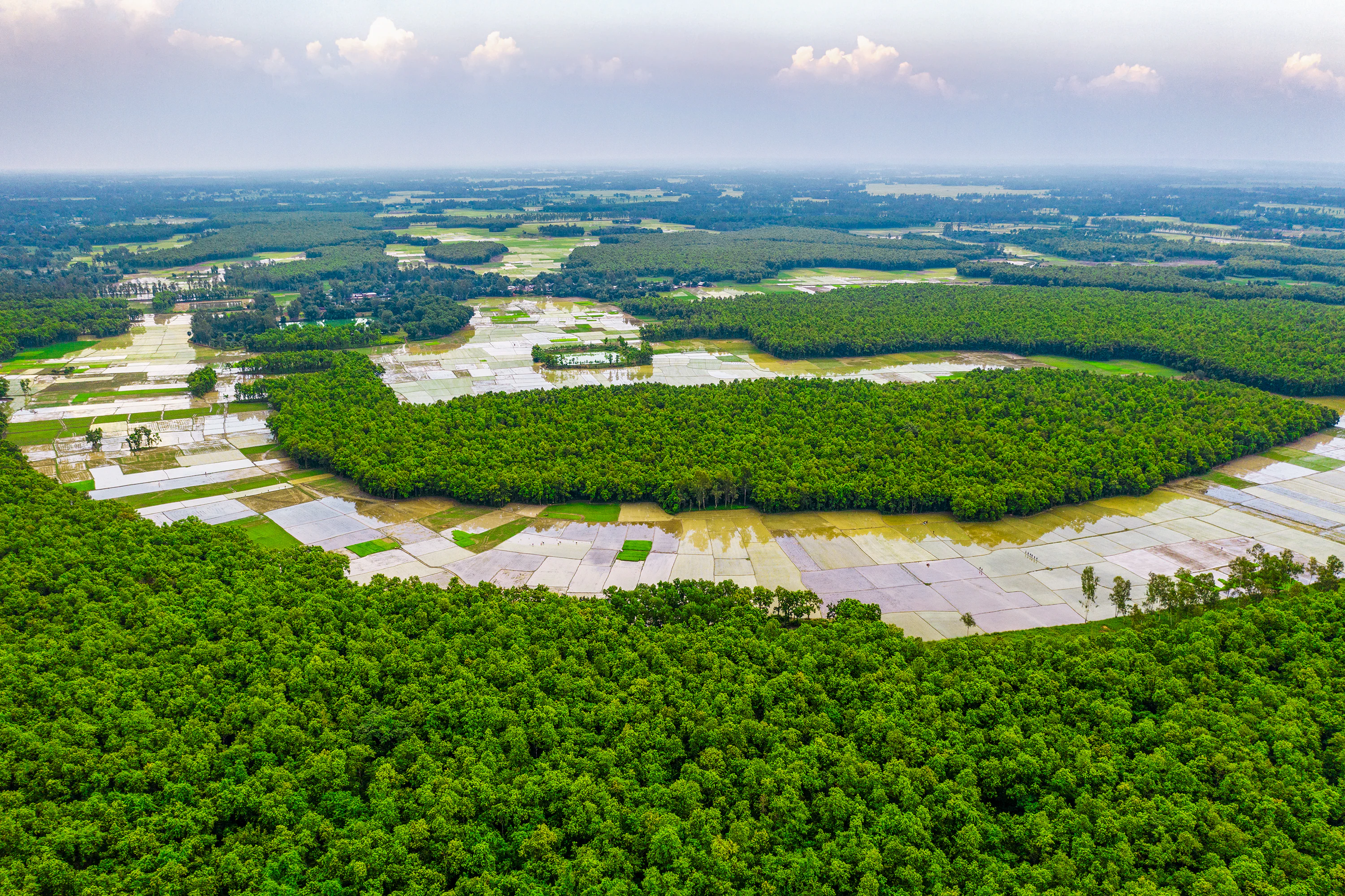
Aerial view of a large water reservoir surrounded by dense green forest and agricultural fields under a partly cloudy sky.
Aerial view of Ramsagar National Park's reservoir and surrounding forested areas.

Ramsagar National Park ecosystems, habitats, and plant life

The nature of Ramsagar National Park is fundamentally wetland-based, with the lake and its associated habitats forming the ecological core of the protected area. Despite the absence of large trees within the park boundaries, the ecosystem supports remarkable biodiversity adapted to wetland conditions. The park contains 272 plant species distributed across 132 families, demonstrating significant floristic diversity relative to its small area. Tree species present include Mangifera indica (mango), Syzygium cumini (jambul), Tamarindus indica (tamarind), and Semecarpus anacardium, representing species typical of the region's rural landscapes. The wetland ecosystem is characterized by aquatic vegetation, emergent plants along the lake margins, and terrestrial species on the embankments and surrounding areas. The lake itself supports a complex aquatic food web and provides critical habitat for water-dependent species. The park's designation as an IUCN Category IV protected area reflects its management focus on maintaining specific habitats and supporting particular species populations.
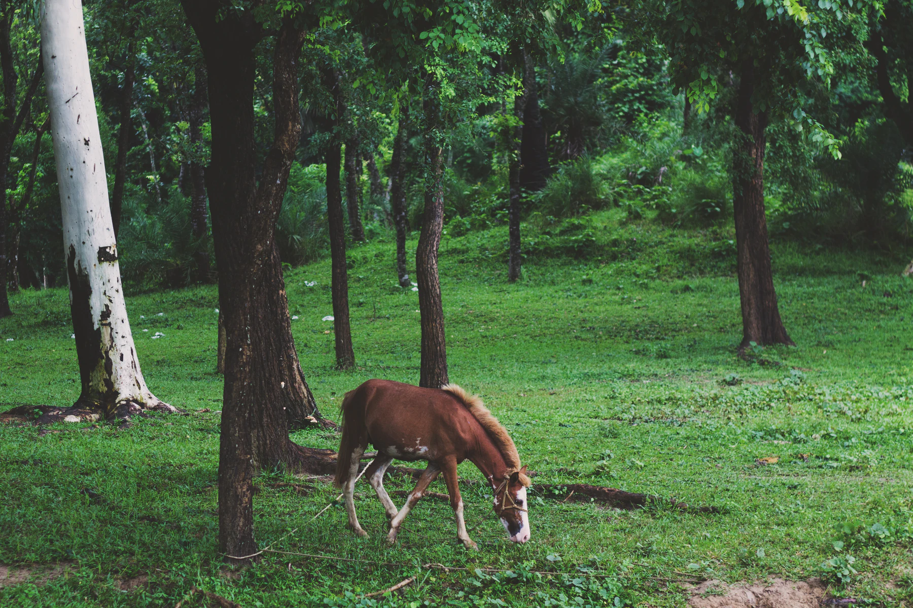
Brown horse grazing on grass near trees in Ramsagar National Park.
Brown horse grazing in a forested area of Ramsagar National Park.

Ramsagar National Park wildlife and species highlights

Ramsagar National Park supports a diverse assemblage of wildlife adapted to its wetland environment. The lake contains numerous fish species, representing an important aquatic resource and food base for other wildlife. Reptile populations include turtles and snakes that inhabit the lake and its margins. Mammal species documented in the park include Bengal fox, golden jackal, fishing cat, and jungle cat, representing both predator and mesopredator species. The park is particularly notable for its avifauna, with water birds forming a significant component of the wildlife community. Species observed include white-breasted waterhen, jacanas, river tern, kingfishers, ringed plover, grey heron, and purple heron. These species utilize the lake for feeding, breeding, and resting, making the park an important bird habitat in the region. Some sources also reference historically present larger species including Indian tiger, Indian leopard, Indian rhinoceros, Indian elephant, and Indian peafowl, though these are described as extinct from the park area.
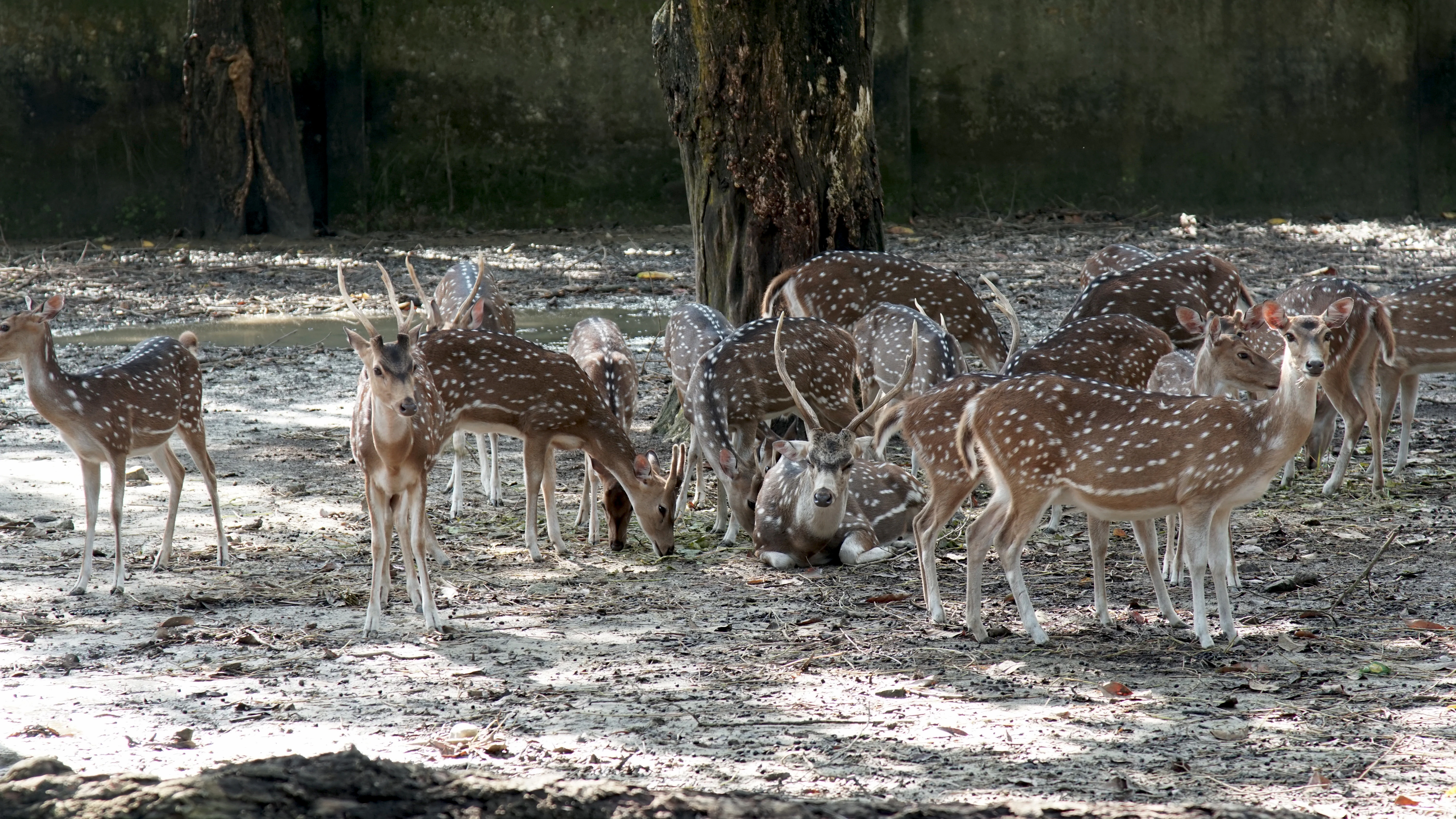
Group of spotted deer standing and grazing in a forested area with a large tree
Deer grazing in Ramsagar National Park, Bangladesh

Ramsagar National Park conservation status and protection priorities

Ramsagar National Park faces several conservation challenges that affect its ecological integrity. Local communities utilize plants within the park for various purposes including food, fodder, furniture making, medicine, and fuel, resulting in habitat modification and species removal. Fish populations have declined due to overexploitation, threatening the aquatic ecosystem balance. Agricultural pollution from surrounding farmland introduces nutrients and potentially harmful substances into the lake system. Siltation from upstream runoff reduces water depth and quality. Disease outbreaks and flooding events further stress the ecosystem. The park's small staff of eight personnel works with limited resources to manage these threats. The wetland ecosystem, while resilient, requires active management to maintain its biodiversity values. Conservation efforts focus on protecting the remaining wildlife, managing visitor impact, and coordinating with local communities to reduce harmful activities.

Ramsagar National Park cultural meaning and human context

Ramsagar National Park carries significant cultural heritage value rooted in its historical creation. The lake was excavated in the 18th century by Raja Ramnath, the Maharaja of Dinajpur, and bears his name, creating a direct link between the landscape and regional history. The monumental scale of the original excavation, reportedly involving 15 million workers, reflects the historical importance of water resources in this region and the capacity for large-scale public works during the maharaja's reign. The reservoir has served as a vital water source for the surrounding community for centuries. The park is located near the ruins of a royal palace, adding historical depth to the landscape. The area represents a intersection of natural conservation and cultural heritage, where ecological protection preserves both habitat and the memory of regional governance and achievement.
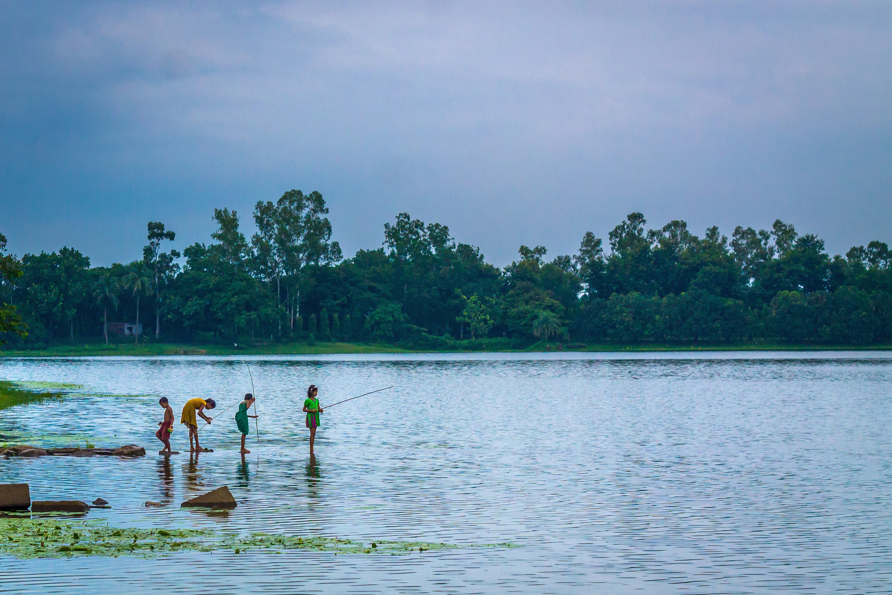
Four people fishing in shallow water at Ramsagar National Park with trees in the background.
People fishing in the shallow waters of Ramsagar National Park.

Top sights and standout views in Ramsagar National Park

Ramsagar National Park stands out as a historic wetland conservation area in Bangladesh's northwest, centered on an 18th-century royal reservoir. The park provides important habitat for water birds including herons, kingfishers, jacanas, and river terns. The lake supports fish populations and is home to turtles and snakes. Terrestrial wildlife includes Bengal fox, golden jackal, fishing cat, and jungle cat. The park contains 272 plant species across 132 families. The historical excavation by Raja Ramnath in the 18th century represents significant regional heritage. The park was officially designated in 2001 under Bangladesh wildlife protection legislation.
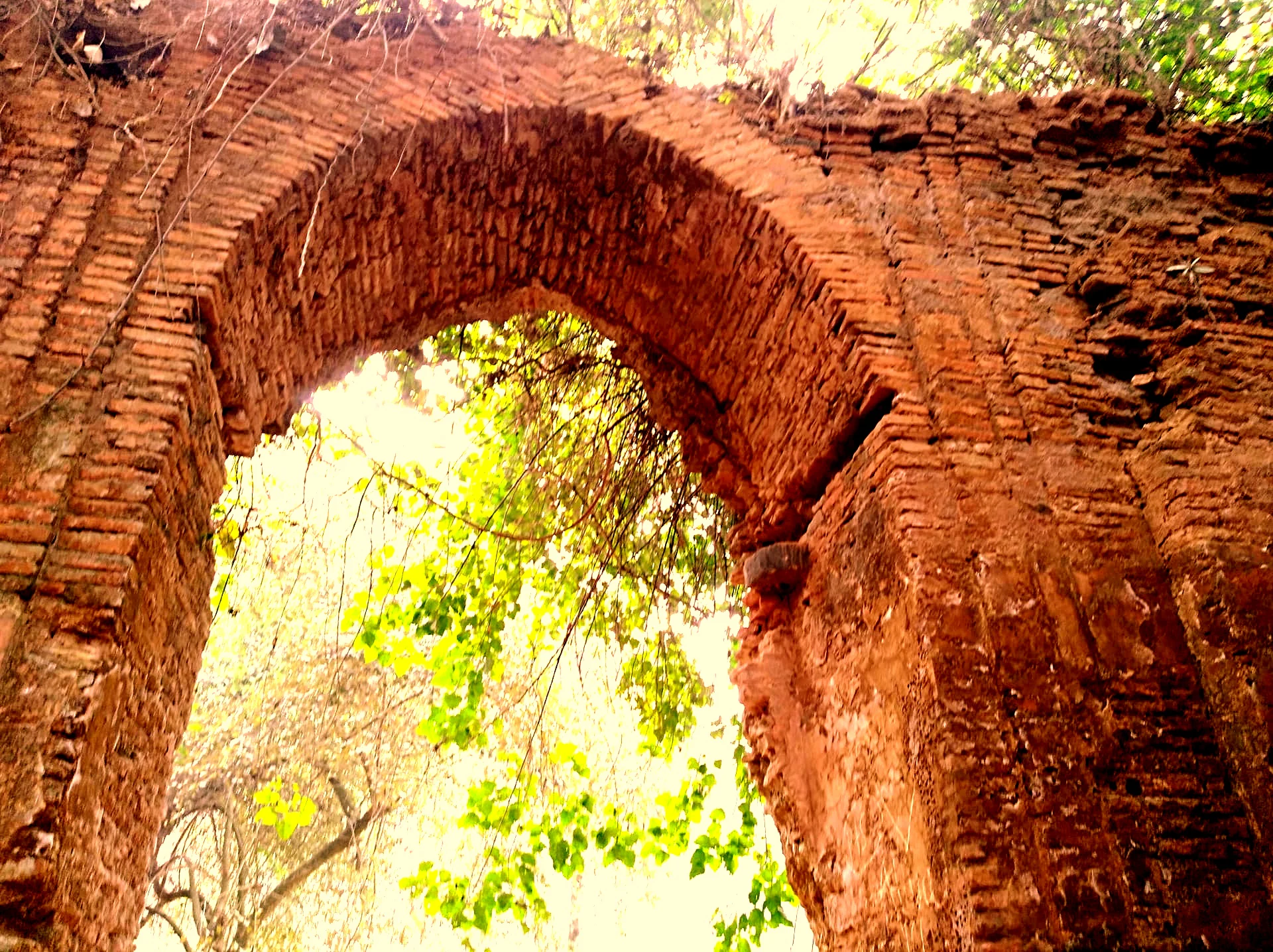
Brick arch ruins with green foliage visible through the archway
Ramsagar Rajbari ruins with brick arch and greenery

Best time to visit Ramsagar National Park

The best time to visit Ramsagar National Park corresponds with the cooler, drier months from October through March, when weather conditions are more comfortable for outdoor exploration and wildlife activity is more predictable. During this period, water levels in the lake remain stable and bird populations are more easily observable along the margins. The winter months may bring migratory bird species to the wetland, enhancing birdwatching opportunities. The monsoon season from June to September brings rainfall that can affect accessibility and may increase flooding within the park, though the wetland ecosystem thrives during this period. The hot summer months from April to June can be uncomfortable for visitors and may see reduced wildlife activity near the water during peak heat. Visitors seeking to observe water birds should plan morning visits when birds are most active on the lake.
Park location guide

Geography guide, regional context, and park location map for Ramsagar National Park

Ramsagar National Park park geography, regions, and map view in Bangladesh
Understand where Ramsagar National Park sits in Bangladesh through a broader geographic reading of the surrounding landscape, nearby location context, and its mapped position within the national park landscape.

How Ramsagar National Park fits into Bangladesh

Bangladesh, officially the People's Republic of Bangladesh, is a South Asian country known for its high population density and deltaic geography formed by the Ganges-Brahmaputra river system. It gained independence from Pakistan in 1971 following a liberation war. The country operates as a unitary parliamentary republic with Dhaka as its capital and largest city, while Chittagong serves as the second-largest city and main port.

Wider geography shaping Ramsagar National Park in Bangladesh

Bangladesh occupies the delta region at the confluence of the Ganges, Brahmaputra, and Meghna rivers in South Asia. The country shares land borders with India to the north, west, and east, and Myanmar to the southeast, while its southern boundary is along the Bay of Bengal. The terrain is predominantly low-lying deltaic plain, making it susceptible to flooding. The country is separated from Bhutan and Nepal by the Siliguri Corridor and from China by the Indian state of Sikkim.

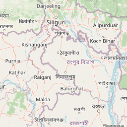
Map view of Ramsagar National Park

Use this park location map to pinpoint Ramsagar National Park in Bangladesh, understand its exact geographic position, and read its mapped placement within the surrounding landscape more clearly.

Pigeon | © OpenStreetMap contributors

Location context for Ramsagar National Park

Dinajpur District

Discover the defining wetland habitats, historic lake terrain, and unique protected-area character through detailed imagery.

Explore Ramsagar National Park Photos: Visualizing Wetland Landscapes and Protected Area Scenery
Browse comprehensive imagery of Ramsagar National Park to understand its distinct wetland landscapes, the vast artificial lake, and the unique flat terrain of Dinajpur District. These visuals offer essential context for exploring the park's protected status, birdlife habitats, and overall environmental character, aiding in deeper geographical comprehension.

A group of geese swimming on a calm body of water with grassy and tree-lined shore in the background

Pink water lilies with green lily pads floating on calm water in a reservoir

Aerial view of a large water reservoir surrounded by dense green forest and agricultural fields under a partly cloudy sky.

Brown horse grazing on grass near trees in Ramsagar National Park.

Group of spotted deer standing and grazing in a forested area with a large tree

Tall trees with sparse and dense foliage under a clear blue sky, with various shrubs and plants in the foreground

Four people fishing in shallow water at Ramsagar National Park with trees in the background.

Brick arch ruins with green foliage visible through the archway

Dirt road in a forested area with tall trees on both sides and people on vehicles in the distance

Green and white entrance sign with Bengali text, metal gate structure, and trees surrounding it at Ramsagar National Park entrance

Park atlas

Compare wetland reserves, historic lakes, and diverse conservation landscapes across the surrounding region.

Explore Nearby National Parks and Protected Areas Around Ramsagar National Park
Browse an array of national parks and protected areas geographically proximate to Ramsagar National Park, tracing diverse conservation landscapes and wetland habitats in northwest Bangladesh. Continue your atlas-style exploration by comparing these entities for their unique terrain, specific conservation focus, and regional spread of protected natural areas.
National parkDinajpur District

Dharmapur National Park: Sal Forest Ecosystem and Protected Landscape in Dinajpur District

Mapped geography and birdwatching habitats within northern Bangladesh.

Dharmapur National Park, designated as a national park in Dinajpur District, northern Bangladesh, spans 704.70 hectares across 21 revenue villages. It is characterized by dense Sal forests, a distinctive ecosystem forming the ecological core of the protected area. The landscape features semi-deciduous forest terrain, shaped by the Bijra and Nona rivers, offering riparian zones within its relatively flat geography. This protected forest serves as a significant habitat for numerous bird species and mammals, making it a key point of interest for understanding the region's natural landscape and conservation efforts. Explore its mapped boundaries and geographic significance.

Area
7.047 km²
Established
2021
Relief
Lowland
Climate
Tropical
Watercolor illustration showing a landscape with grassy areas, trees, and distant mountains under a pinkish sky
National parkDinajpur District

Birgonj National Park: Protected Sal Forest Landscape in Dinajpur District, Bangladesh

Explore mapped boundaries and regional geographic context.

Birgonj National Park, located in Dinajpur District, offers a focused exploration of a protected sal forest ecosystem. As a designated National Park in Bangladesh, it preserves a significant area of Shorea robusta forest, providing valuable insight into deciduous forest landscapes and their conservation. This park serves as a critical reference point for understanding protected areas within northern Bangladesh and their role in regional geographic context, making it an important destination for atlas-based discovery of natural landscapes.

Area
1.686 km²
Established
2011
IUCN
IV
Climate
Tropical
National parkBangladesh

Singra National Park: Bangladesh National Park Atlas and Protected Landscape Context

Mapped geographic identity of a protected national park.

Singra National Park is a significant protected area in Bangladesh, identified as a national park. This platform facilitates an atlas-style exploration of its geographic placement and protected landscape characteristics. Users can discover its mapped boundaries and understand its context within the regional geography of South Asia, contributing to a comprehensive understanding of national park significance.

Area
3.057 km²
Established
2010
Relief
Lowland
Climate
Tropical
National parkBangladesh

Nawabganj National Park: Bangladesh National Park Geographic Identity and Atlas Exploration

Mapped boundaries and protected landscape context.

Delve into the detailed geographic profile of Nawabganj National Park, a protected national park located in Bangladesh. This resource facilitates an atlas-style discovery of its specific mapped boundaries and its contribution to the region's natural landscape character. Understand how this protected area fits within the broader context of South Asian geography and conservation.

Area
5.176 km²
Established
2010
IUCN
IV
Access
Easy access
Watercolor painting of a river flowing through a valley surrounded by hills and dense green vegetation
National parkNaogaon District

Altadighi National Park: Bangladesh's Protected Wetland Reserve in Naogaon District

Explore its mapped terrain and unique wetland ecosystem.

Altadighi National Park in Naogaon District, Bangladesh, is a protected nature reserve notable for its significant reservoir and wetland environment. Designated as a national park, it plays a crucial role in conserving a distinctive ecosystem within the country's protected landscape network. The park's geography, centered around its large water body, provides vital habitat and offers a unique subject for geographic and atlas-based discovery in northern Bangladesh, distinguishing it from more terrestrial protected areas.

Area
2.641 km²
Established
2011
IUCN
IV
Relief
Lowland
National parkJalpaiguri district

Gorumara National Park: India National Park Atlas and Protected Landscape Geography

Discover the mapped boundaries and regional terrain.

Gorumara National Park stands as a vital protected natural area within India's Jalpaiguri district. This entry provides detailed atlas-focused information, detailing the park's geographic identity and its position within the regional landscape context. Understand the mapped protected boundaries and explore the unique terrain that characterizes Gorumara National Park as a key national park entity. It serves as a foundational point for geographic discovery within India's network of protected lands.

Area
79.99 km²
Established
1992
IUCN
II
Relief
Mixed relief
National parkAlipurduar district

Jaldapara National Park: India's Premier Grassland and Rhino Conservation Landscape

Explore mapped boundaries and savanna terrain in Alipurduar district.

Jaldapara National Park is a protected national park in India's Alipurduar district, celebrated for its expansive rolling grasslands and significant population of Indian one-horned rhinoceros. This protected area showcases a distinctive savanna landscape, an unusual feature among Indian national parks, interspersed with riverine forests. Its elevation of 61 meters above sea level positions it at the edge of the Eastern Himalayas, offering a unique geographic setting for understanding regional biodiversity and conservation efforts.

Area
216.51 km²
Established
1941
IUCN
II
Relief
Lowland
Watercolor painting of rolling green hills, a meandering stream, and a soft pastel sky
National parkWest Garo Hills district

Nokrek National Park: Protected Mountain Landscape and Regional Geography

Explore its mapped boundaries and diverse natural terrain.

Nokrek National Park is a vital protected mountain wilderness situated in the West Garo Hills district, Meghalaya, India. Its rugged terrain, characterized by ancient geological formations and dense evergreen forests, supports remarkable biodiversity. As a key component of the Nokrek Biosphere Reserve, it offers a unique glimpse into the region's ecological significance, serving as an important source for major rivers and a sanctuary for diverse flora and fauna.

Area
47.48 km²
Established
1986
IUCN
II
Relief
Mountain

Common questions about visiting, size, designation, and location context for Ramsagar National Park

Ramsagar National Park FAQs for park facts, access, geography, and protected area context
Find quick answers about Ramsagar National Park, including protected-area facts, park geography, trail and visitor context, and how the park fits into its surrounding country and regional landscape.
MoriAtlas Explorer

Continue Your Protected Areas Search Across the Global Atlas

Deepen your exploration by continuing the structured search for national parks and protected areas worldwide. Utilize the comprehensive filtering capabilities to compare different conservation landscapes and refine your understanding of global park geography. Discover more about the distribution and characteristics of protected natural areas.

Global natural geography