
Streams
Park geography
Detailed geographic mapping, terrain elevations, and environmental features of Rajasthan
Ranthambore National Park Geography: Boundary Analysis and Regional Landscape Profile
This geographic profile covers the regional context, recorded boundary metrics, and physical terrain of Ranthambore National Park. Analyze the spatial extent, elevation ranges from 215 to 505 meters, and the distribution of forest, river, and lake systems within the Rajasthan landscape.
Related tags
Tiger ReserveDry Deciduous ForestRajasthan National ParkProject Tiger ReserveWildlife Conservation
Royal tiger reserve blending ancient fort ruins with dry deciduous forests in Rajasthan
Ranthambore National Park
Ranthambore National Park is a premier tiger reserve in the Indian state of Rajasthan, spanning approximately 1,334 square kilometers of diverse terrain in the Sawai Madhopur district. The park derives its name from the historic Ranthambore Fort, a 10th-century fortress that stands prominently within the protected area and adds a remarkable cultural dimension to the landscape. Situated between the Banas River to the north and the Chambal River to the south, the park encompasses a mix of dry deciduous forests, open grassy meadows, rocky terrain, and numerous lakes that create a distinctive semi-arid ecosystem in northwestern India. The park is internationally renowned for its Bengal tiger population, which has become one of the most accessible tiger populations in the world due to the relatively open terrain and successful conservation efforts under Project Tiger. Beyond its big cat credentials, Ranthambore supports a rich diversity of wildlife including spotted deer, sambar deer, blackbuck, nilgai, leopard, striped hyena, and over 270 bird species. The combination of historical architecture, thriving wildlife, and the dramatic backdrop of the Aravalli hills makes Ranthambore one of India's most visited and photographed national parks.
- Location
- India
- Park type
- National park
- Established
- 1980
- Area
- 1,334 km²
Location overview
Regional administrative alignment within India and Rajasthan
Ranthambore National Park Geographic Location and Regional Setting
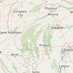
Ranthambore National Park spans regional territories within Rajasthan and Sawai Madhopur in India. Map data documents the park's administrative placement across recorded sovereign jurisdictions.
- Countries
- India
- Regions
- Rajasthan, Sawai Madhopur
- Primary location
- Rajasthan
- Geographic setting
- Inland
Boundary and coordinates
Ranthambore National Park’s outline frames 1,334 km²
Ranthambore National Park mapped boundary and 1,334 km² area
Ranthambore National Park has one stored boundary geometry measuring 472.418 km², while the separate park-fact area is 1,334 km²; the entity is terrestrial, but land allocation and perimeter are null. Because the two area fields differ in scope or source, the boundary page reports them distinctly rather than treating the polygon as proof of the entire stated park extent.
- Boundary area
- 472.4 km²
- Boundary perimeter
- 158.6 km
- Northernmost point
- 26.1881° N
- Southernmost point
- 25.874° N
- Easternmost point
- 76.6552° E
- Westernmost point
- 76.3135° E
- Geographic centre
- 26.0208° N, 76.4974° E
- North–south span
- 34.8 km
- East–west span
- 34.2 km
Elevation and terrain
Mixed relief profiles and recorded internal water bodies
Ranthambore National Park Terrain and Elevation Summary
Recorded elevation metrics span from two hundred fifteen meters to five hundred five meters across mixed terrain classifications. Associated feature records detail named rivers, streams, ponds, and peaks located within the protected area boundary.
- Minimum elevation
- 215 m
- Maximum elevation
- 505 m
Selected named natural features
Streams
Galendi
Rivers
Banas River
Streams
Samran Nadi
Ponds
Padamavati Talab
Rivers
Kharar
Environmental setting
Recorded habitat types, arid climate zones, and forest cover profiles
Environmental Classifications and Physical Setting of Ranthambore National Park
Stored landscape features and habitat types serve as interpretive categories for reading the physical setting of Ranthambore National Park. Recorded classifications link directly to relevant atlas destinations across forest covers, arid zones, and mixed relief.
- Relief
- Mixed relief
- Climate
- Arid
- Water
- Minor water
- Forest cover
- Mostly forested
- Seasonality
- Year-round
Landscape features
Forest · Valleys · Lakes · Rivers
Habitat types
Temperate broadleaf forest · Grassland · Shrubland · Wetland
Park atlas
Trace the regional park geography and diverse protected landscapes, comparing areas adjacent to Ranthambore National Park.
Discover Nearby National Parks and Protected Areas Beyond Ranthambore National Park
Explore additional national parks and protected areas near Ranthambore National Park, tracing the regional spread of India's conservation landscapes, diverse ecosystems, and wildlife habitats. This atlas view offers contextual comparison, allowing you to map adjacent protected terrain and understand broader geographic patterns of natural heritage beyond the iconic tiger reserve.
National parkMadhya Pradesh
About 68 km away#1 closest
Southeast

Kuno National Park: Madhya Pradesh National Park Atlas and Protected Landscape
Explore its diverse dry deciduous forests and savannah terrain.
Kuno National Park is a protected area in Madhya Pradesh, India, renowned for its dry deciduous forest and savannah grassland ecosystems. This national park, bisected by the Kuno River, offers a significant landscape for understanding regional geography and conservation efforts within India. Its varied terrain provides essential habitat and contributes to the broader atlas of protected lands, making it a key destination for geographic discovery.
- Area
- 748.76 km²
- Established
- 2018
- IUCN
- II
- Relief
- Lowland
National parkRajasthan
About 121 km away#2 closest
Southwest
Mukundara Hills National Park: Rajasthan's Protected Landscape for Tigers and Diverse Habitats
Explore its dry deciduous forests, rocky hills, and riverine ecosystems.
Mukundara Hills National Park is a significant national park and tiger conservation landscape situated in eastern Rajasthan, India. This protected area features a varied terrain encompassing rocky hills, dry deciduous forests, and crucial grassland patches, all intersected by major rivers like the Chambal. Its ecological importance lies in providing vital habitat for Bengal tigers and a mosaic of landscapes that support a wide array of wildlife. Understanding its mapped boundaries and geographic context reveals its critical role in regional conservation efforts and provides a rich atlas-level view of protected lands in western India.
- Area
- 759.99 km²
- Established
- 2004
- IUCN
- II
- Relief
- Mountain
National parkMadhya Pradesh
About 134 km away#3 closest
Southeast
Madhav National Park: National Park Atlas and Protected Landscape Identity
Mapping the geography and protected boundaries of Madhav National Park.
Delve into the detailed geographic profile of Madhav National Park, a vital national park situated in Madhya Pradesh, India. This section offers an atlas-centric perspective, highlighting the park's protected landscape characteristics and its precise location within the regional geography. Uncover its mapped boundaries and understand its role as a key protected area for comprehensive geographic exploration.
- Area
- 354 km²
- Established
- 1956
- IUCN
- II
- Visitors
- 500 annual
National parkIndia
140 km away#4 closest
Northeast
Keoladeo National Park: India's Renowned Wetland Bird Sanctuary and Protected Landscape
Explore its mapped terrain and critical avian habitat near Bharatpur.
Keoladeo National Park, a designated national park in India, represents a critical hub for wetland conservation and avian biodiversity. The park's meticulously managed wetland system, a mosaic of shallow waters and grasslands, provides essential habitat for thousands of resident and migratory birds from across Eurasia. Situated near Bharatpur, this protected landscape offers a unique opportunity to study the intersection of arid and fertile plains geography and serves as a vital stopover point on major bird flyways, underscoring its importance in regional conservation efforts.
- Area
- 28.7 km²
- Established
- 1982
- IUCN
- II
- Visitors
- 147K annual
Protected areaIndia
About 165 km away#5 closest
Northwest
Sambhar Salt Lake: Geographic Boundaries and Saline Landscape Profile in Rajasthan, India
A vital Ramsar wetland and inland salt-pan ecosystem
Sambhar Salt Lake is characterized by its dramatic shifts in surface area, ranging from shallow brine to vast arid flats depending on seasonal monsoon cycles. Framed by the ancient Aravali Range, this protected area features a unique mosaic of natural hypersaline waters and centuries-old salt harvesting pans. Its status as an essential migratory bird sanctuary makes it a central site for understanding the geography and conservation challenges of desert wetlands.
- Water
- Water-dominated
Wildlife reserveUttar Pradesh
170 km away#6 closest
Northeast
Sur Sarovar Wildlife Reserve: A Protected Wetland Sanctuary in Uttar Pradesh
Mapped freshwater landscapes and migratory bird habitats.
Sur Sarovar serves as a significant wildlife reserve in Uttar Pradesh, characterized by the distinct geometric shape of Keetham Lake. This protected wetland provides essential breeding habitat for diverse waterbird species across its shallow margins and islands. The area also hosts a vital sloth bear rescue center, anchoring its status as a key site for wildlife rehabilitation and conservation efforts within the broader Gangetic plains region.
- Area
- 7.13 km²
- Established
- 1991
- Water
- Water-dominated
Wildlife reserveUttar Pradesh
About 246 km away#7 closest
Northeast
Shekha Bird Sanctuary: Wildlife Reserve and Wetland Geography in the Uttar Pradesh Ganges Plain
A perennial freshwater lake habitat for migratory waterbirds.
Located near Aligarh in the upper Ganges plain, Shekha Bird Sanctuary functions as a high-value wildlife reserve. This protected wetland, fed by local canal systems, supports a concentrated population of resident and migratory waterbirds, offering a clear window into the ecological importance of small-scale freshwater landscapes in densely populated agricultural regions.
- Area
- 0.25 km²
- Established
- 2009
- IUCN
- IV
- Relief
- Lowland
National parkHaryana
253 km away#8 closest
North
Sultanpur National Park: Haryana's Designated Protected Landscape and Atlas Context
Mapped boundaries and regional geographic significance.
Delve into Sultanpur National Park, an important protected area within Haryana, India, viewed through an atlas and map-driven lens. This entry details the park's designation as a national park, offering insights into its specific geographic footprint and its relation to the surrounding regional terrain. Understand how Sultanpur National Park contributes to the protected landscape mosaic of North India, providing critical data for those exploring India's geography and conservation areas.
- Area
- 1.43 km²
- Established
- 1991
- IUCN
- II
- Relief
- Lowland
MoriAtlas Explorer
Continue Exploring Ranthambore National Park's Mapped Terrain and Regional Geography
Delve deeper into the geographic identity and atlas significance of Ranthambore National Park. Understanding its protected boundaries, landscape character, and ecological context within Rajasthan provides essential insights for landscape and conservation studies. This park entry serves as a gateway to appreciating the structured geographic data available for this vital protected area.
Browse next
Global natural geography
Explore related park routes
Explore MoriAtlas Global ParksBrowse All MoriAtlas ParksGlobal Park Map DiscoveryMoriAtlas: Browse All CountriesBrowse All MoriAtlas ContinentsNational Park Environment AtlasGrand Canyon National Park AtlasYellowstone National Park AtlasYosemite National Park Atlas and GeographySerengeti National Park AtlasGalápagos National Park Protected LandscapeBanff National Park Geography and AtlasKruger National Park Atlas EntryUluṟu-Kata Tjuṯa National Park AtlasExplore Uluru-Kata Tjuta National Park GeographyPlitvice Lakes National Park AtlasFiordland National Park Protected LandscapeGreat Smoky Mountains National Park AtlasAfghanistan National Parks and Protected AreasAlbania National Parks and Protected AreasAlgeria National Parks and Protected AreasAmerican Samoa National Parks and Protected AreasAndorra National Parks and Protected AreasAngola National Parks and Protected AreasAntarctica National Parks and Protected AreasAntigua and Barbuda Park List