Mori Atlas logo
Nearby park discovery

Mapping the surrounding Jura landscape and regional protected land connectivity

Geographic Survey of National Parks and Protected Areas Near Regionaler Naturpark Thal

Identify the distribution of protected landscapes and natural parks situated within the immediate geographic vicinity of Regionaler Naturpark Thal in northwestern Switzerland. This survey provides a clear view of how regional parks, mountain ridges, and stream valleys are spatially organized across the canton of Solothurn and the broader Jura chain. Use this mapping data to analyze regional terrain characteristics and the proximity of neighboring conservation areas.

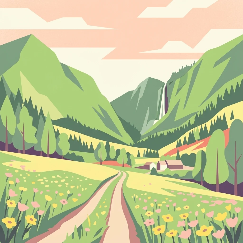
A flat-style digital illustration showing a dirt trail leading through a meadow filled with yellow and pink wildflowers toward mountains, a forest, and a distant waterfall.

A gentle Jura landscape park in the Solothurn district, shaped by pasture woodland and traditional farming.

Regionale Naturpark Thal

Regionale Naturpark Thal is a park of national significance in northwestern Switzerland, covering the entire Thal district in the canton of Solothurn. The park follows the contours of the eastern Jura chain and is characterized by a soft, agriculturally shaped mountain landscape rather than by dramatic alpine peaks. Its hills, elevated pastures, mixed forests, and stream valleys form a cohesive rural environment where traditional farming and natural habitats remain closely intertwined. The park's defining character lies in the balance between cultural landscape and ecological value. Extensive cattle grazing on the Jura heights maintains species-rich dry meadows, while beech, fir-beech, and pine forests line the slopes. The valley floor near Balsthal is the most intensively cultivated area, but the surrounding heights and the upper Dünnern river valley retain a near-natural character that supports diverse wildlife. Beyond its landscape value, the park is notable for a long-running European bison reintroduction project near Welschenrohr, and for hosting one of Switzerland's important bird ringing stations. Together these features make it a park where conservation, regional identity, and contemporary wildlife management meet on the Jura highlands.

Location
Switzerland
Park type
Regional park
Established
2009
Area
139 km²
Regionaler Naturpark Thal Geography
Regional park map

See the ranked park cluster in its geographic setting

Nearby parks around Regionale Naturpark Thal

This regional map shows the same 20 nearby parks ranked below around Regionale Naturpark Thal. Select a ranked marker to highlight that park’s boundary where boundary data is available.
Reference park: Regionale Naturpark ThalRanked nearby park20 nearby parks shown
20 nearby parks

Distance ranked collection and regional park geography for comparative analysis

Parks and Protected Areas Geographically Near Regionaler Naturpark Thal

Examine the ranked collection of protected areas situated geographically near Regionaler Naturpark Thal by spatial separation and direction. Review surrounding park environments and regional boundary contexts to compare diverse conservation landscapes across the territory.
A horizontal watercolor painting of a winding river flowing through green rolling hills and wooded areas, with soft-colored mountain silhouettes in the background.
Protected landscapeSwitzerland
About 12 km away#1 closest

Southeast

Aareknie Wolfwil-Wynau: Geographic Profile of a Swiss Protected River Landscape

Mapping dynamic river bends and lowland floodplains in the Swiss Mittelland.

Aareknie Wolfwil-Wynau preserves a rare, non-engineered river reach where the Aare cuts through molasse rock. The area is defined by its active gravel bars, rapids, and federally protected floodplain habitats. This site provides a critical look at how lowland river ecosystems function alongside historic cultural landmarks like the medieval church at Wynau.

Area
1.1 km²
Established
1996
Relief
Lowland
Climate
Temperate
A soft watercolor painting depicting a calm river winding through a green, hazy floodplain environment.
Nature reserveSolothurn
About 23 km away#2 closest

Southwest

Naturschutzgebiet Aare bei Altreu: Protecting Aare Valley Floodplains and Alluvial Forest

Riverine meander habitat in the Solothurn canton landscape.

Naturschutzgebiet Aare bei Altreu serves as a vital refuge for floodplain flora and fauna, standing out for its intact meander loops and silver willow gallery forests. Located in the Solothurn region, this protected area preserves a rare stretch of the Aare river ecosystem that contrasts sharply with adjacent canalized banks. Studying its terrain reveals the importance of alluvial corridors in maintaining wetland connectivity within the Swiss Mittelland.

Area
0.205 km²
Established
1992
IUCN
IV
Relief
Lowland
A watercolor painting showing a panoramic view of green rolling hills and wooded ridges under a soft light.
Regional parkAargau
About 34 km away#3 closest

Northeast

Jurapark Aargau: Geographic Overview of a Swiss Regional Nature Park and Jura Landscapes

Protected Jura mountain terrain and regional landscape mapping

Located in northern Switzerland, Jurapark Aargau encompasses a vast, connected perimeter defined by the interaction of tabular limestone plateaus and dramatic folded mountain ridges. This regional nature park serves as an essential refugium for native flora, preserving ancient geological history through fossil-rich sediments, steep escarpments, and traditional rural land use that persists between the Aargau, Zurich, and Basel regions.

Area
299 km²
Established
2012
Relief
Mountain
Climate
Temperate
A horizontal watercolor illustration showing a winding river through a flat, green landscape with distant hills under a soft pink and yellow sky.
Nature reserveHaut-Rhin
About 35 km away#4 closest

North

Réserve naturelle nationale de la Petite Camargue alsacienne: Protected Rhine Floodplain Geography

A unique wetland and alluvial forest habitat in Haut-Rhin

Investigate the geographic significance of the Réserve naturelle nationale de la Petite Camargue alsacienne. This site acts as a protected reference for Upper Rhine floodplain ecology, showcasing a rare intersection of relict river meanders, marshy depressions, and diverse vegetation types near the French, Swiss, and German borders.

Area
9.04 km²
Established
1982
IUCN
IV
Relief
Lowland
A watercolor painting showing a soft, impressionistic landscape with rolling green hills, forest patches, and pale distant mountains under a light sky.
Protected landscapeBaden-Württemberg
About 35 km away#5 closest

Northeast

Obersäckingen Protected Landscape: Regional Geography and Map Context in Baden-Württemberg

A preserved mosaic of southern Black Forest meadows and mixed woodland habitats

Located in the Waldshut district, the Obersäckingen protected landscape showcases a balanced environmental mosaic of oat-grass meadows, hedgerows, and field copses. This area serves as a key piece of the regional conservation network, closely overlapping with the Murg zum Hochrhein Natura 2000 site to maintain the visual and ecological character of the southern Black Forest countryside.

Area
0.415 km²
Established
2004
IUCN
V
A horizontal watercolor painting depicting a landscape with soft rolling hills, green meadows, and wild grasses under a pale sky.
Nature reserveBaden-Württemberg
About 35 km away#6 closest

North

Dinkelberg und Röttler Wald: Geographic Overview of this Baden-Württemberg Nature Reserve

Protected karst landscapes and mature beech forest habitat

Uncover the ecological and physical geography of Dinkelberg und Röttler Wald, a protected area stretching across diverse limestone plateaus and sandstone slopes in Germany. This site offers a valuable look at managed cultural landscapes that bridge the gap between rural meadows and wild forest reserves, providing critical habitat for European bat populations and rare flora across its varied elevational zones.

Area
46.47 km²
Established
2015
Protected landscapeBaden-Württemberg
About 37 km away#7 closest

Northeast

Südwestlicher Dinkelberg Protected Landscape and Dinkelberg Plateau Geography

Karst terrain and forest habitats in Baden-Württemberg

Located in the Lörrach district, Südwestlicher Dinkelberg protects a diverse mix of ravine forests, dry grasslands, and mires. The area preserves essential ecological corridors within the Lörrach-Basel region, showcasing complex geological features such as stream sinks and dry valleys that define the plateau edge.

Area
13.89 km²
Established
2013
IUCN
V
Relief
Upland
A soft watercolor painting of rolling hills and distant mountains in light green and muted tones.
Biosphere reserveLucerne
About 42 km away#8 closest

South

Entlebuch Biosphere Reserve: Mapped Protected Landscapes in the Canton of Lucerne

Exploring karst formations and alpine wetland ecosystems

Entlebuch stands as a pioneering example of community-driven conservation in the Swiss Alps. This protected landscape encompasses extensive peatlands, forested slopes, and the iconic Schrattenfluh karst massif. Use this geographic entry to understand the regional topography and the spatial distribution of protected habitats throughout this central Swiss valley.

Area
397 km²
Established
2001
Relief
Mountain
Climate
Alpine
Watercolor painting of a green forested landscape with rolling hills under a soft pink and yellow sunrise sky.
Nature reserveJura
About 46 km away#9 closest

West

Franches-Montagnes Nature Reserve: A Detailed Atlas of Jura Plateau and Peat Bog Geography

Protected karst limestone landscapes and highland pasture geography.

The Franches-Montagnes nature reserve spans a unique high plateau in the Swiss Jura, characterized by its complex karst substrate and iconic raised bog systems like the Etang de la Gruère. This protected area supports a mosaic of traditional wooded pastures and wetlands, serving as a primary site for understanding the intersection of human pastoral heritage and sensitive highland ecology.

Area
39.57 km²
Established
1977
Relief
Upland
Climate
Temperate
A horizontal watercolor illustration depicting rolling green hills, a winding lake shore, and distant mountains in a soft, muted palette.
Protected landscapeCanton of Bern
About 47 km away#10 closest

Southwest

Linkes Bielerseeufer Protected Landscape: Map and Regional Geography in Canton of Bern

Protected Jura lakeshore and vineyard terrain

Investigate the precise boundaries and varied micro-landscape of Linkes Bielerseeufer. This protected area showcases a dramatic rise from Lake Biel into the Jura range, encompassing karst topography, historic dry-stone terraces, and diverse forest ecosystems within the Canton of Bern.

Area
7.079 km²
Relief
Mountain
Climate
Temperate
Access
Easy access
Nature reserveGrand Est
About 47 km away#11 closest

Northwest

Réserve naturelle régionale Im'Berg: Mapping a Unique Protected Nature Reserve in France

A rare calcareous grassland habitat in the Grand Est region.

Réserve naturelle régionale Im'Berg preserves a sun-drenched limestone slope in the commune of Tagolsheim. Known as the Buxberg, this protected area guards one of the most significant natural boxwood populations in Europe alongside specialized dry-habitat flora. The reserve functions as an essential geographic reference for studying how steep, calcareous terrain creates isolated, warm microclimates within the broader Alsatian landscape.

Area
0.017 km²
Established
2013
IUCN
IV
A watercolor illustration of a river landscape with a gentle bend, shoreline greenery, and distant low hills, rendered with soft, faded edges.
Protected landscapeCanton of Bern
About 48 km away#12 closest

Southwest

Stausee Niederried Protected Landscape: A Geographic Map and Atlas of Swiss Floodplains

Mapped alluvial terrain and sandstone cliffs in the Canton of Bern.

Stausee Niederried functions as a vital protected landscape, blending a historic hydroelectric reservoir with a four-kilometer riverine floodplain. The area is characterized by high geomorphic contrast, ranging from the vast Runtigenfluh molasse cliff to critical riparian marshes and orchid-rich pine forests. This entry provides a structured look at the park boundaries, geological features, and the wider fluvial mosaic found near the confluence of the Aare and the Saane.

Area
2.97 km²
Established
1991
IUCN
V
Relief
Mixed relief
Nature reserveAargau
About 51 km away#13 closest

Northeast

Klingnauer Stausee Nature Reserve: Aargau Wetland and Aare River Floodplain Landscapes

Protected riparian habitat in the northern Swiss Jura

Klingnauer Stausee stands as a primary example of integrated hydropower and conservation. This artificial reservoir and its surrounding wetlands, located in the Aargau region, encompass a variety of protected habitats ranging from open still waters to alluvial forests. These landscapes provide essential refuge for migratory waterbirds and preserve unique remnants of the historical Aare River floodplain structure.

Area
1.16 km²
Established
1935
Relief
Lowland
Climate
Temperate
Watercolor painting of a river landscape with lush green riverbanks, patches of grass in the foreground, and gentle rolling hills in the background.
Protected landscapeAargau
About 52 km away#14 closest

Northeast

Aarelandschaft bei Klingnau: A Protected Riverine Landscape in Northern Switzerland

Wetland geography, alluvial forests, and floodplain corridors

The Aarelandschaft bei Klingnau preserves a unique riverine mosaic where the Aare River meets the Rhine in northern Aargau. This protected landscape encompasses the Klingnauer Stausee reservoir, rich alluvial forests, and remnant oxbows. It serves as a vital migratory node for avian populations and provides a structured look at the interplay between human-engineered power infrastructure and protected natural river channels.

Area
3.6 km²
Established
1996
IUCN
V
Relief
Lowland
A pale, abstract watercolor painting showing rolling green hills and distant mountain ridgelines on a white background.
Nature reserveCanton of Bern
About 52 km away#15 closest

West

Combe Grède Nature Reserve: Geological Gorge and Protected Mountain Landscape in Bern

Folded Jura limestone terrain and biodiversity hotspots.

The Combe Grède nature reserve presents a striking half-cluse gorge carved into Cretaceous limestone. This protected area within the Canton of Bern showcases an instructive geological sequence, ancient pine stands, and diverse mountain habitats that span from shaded cliffs to alpine pastures.

Area
12 km²
Established
1932
Relief
Mountain
Climate
Temperate
A soft watercolor illustration of rolling hills, forested slopes, and meadow vegetation with a light, airy aesthetic.
Nature reserveBaden-Württemberg
About 53 km away#16 closest

North

Belchen Nature Reserve: Exploring the Mountain Geography of the High Black Forest

A diverse protected landscape in Baden-Württemberg

Belchen represents an essential protected area in the southern Black Forest, known for its compressed ecological profile ranging from lowland beech forests to exposed subalpine summits. The site maps a complex mosaic of scree slopes, mires, and rocky habitats that sustain specialized bat species and rare montane flora, offering a detailed perspective on central European highland ecosystems.

Area
29.072 km²
Established
2019
Relief
Mountain
Climate
Temperate
A soft watercolor painting of a river flowing through a green landscape with rolling hills and trees in the distance.
Protected landscapeKanton Bern
About 54 km away#17 closest

South

Aarelandschaft zwischen Thun und Bern: Protected Landscape and River Corridor Geography

Mapping the floodplain remnants of the Aare river corridor

The Aarelandschaft zwischen Thun und Bern protects a unique corridor of riparian forest, wet meadows, and springs along the Aare river. Situated in the Kanton Bern, this landscape retains evidence of historic river engineering alongside ongoing restoration programs that reconnect vital lowland ecosystems. It stands as a significant natural corridor in a densely populated region, marked by its molasse hills and varied alluvial topography.

Area
10.4 km²
Established
1983
Relief
Lowland
Climate
Temperate
A panoramic watercolor painting depicting a calm wetland or marsh with pink and yellow reeds in the foreground, green trees in the midground, and soft purple mountains in the background.
Nature reserveHaut-Rhin
About 60 km away#18 closest

Northwest

Réserve naturelle régionale des marais et landes du Rothmoos Protected Landscape and Geography

Regional nature reserve in the Haut-Rhin department of Alsace

The Réserve naturelle régionale des marais et landes du Rothmoos encompasses a rare inland saline habitat complex within the Nonnenbruch forest. Its terrain is defined by stable pools created from mining subsidence, transitioning into heathland and oak forests. This protected area stands as an ecological refuge for migratory waterbirds and specialized aquatic species within an industrial-legacy environment.

Area
1.457 km²
Established
1988
IUCN
IV
Relief
Lowland
Watercolor painting of a pastoral landscape featuring soft, rolling green hills and a small group of evergreen trees, with light pastel mountains in the background.
Protected landscapeBaden-Württemberg
About 62 km away#19 closest

Northeast

St. Blasien Protected Landscape: Geographic Profile and Glacial Mapping

Southern Black Forest protected area in Baden-Württemberg.

The St. Blasien Protected Landscape represents a significant conservation zone in the southern Black Forest. Defined by its strong glacial influence, the area showcases a complex terrain of trough valleys, moraine ridges, and rocky crests alongside centuries-old alpine pastures. Its role in the regional conservation network makes it a key site for understanding the intersection of Pleistocene geography and traditional land management in Germany.

Area
35.754 km²
Established
2002
IUCN
V
A soft watercolor painting of a mountain landscape with rolling hills, pine forests, and a meadow in light green and muted earth tones.
Regional parkCanton of Bern
About 63 km away#20 closest

South

Regionaler Naturpark Gantrisch: Protected Terrain and Map Exploration in Canton of Bern

A diverse transition zone from glacial moraines to high mountain ridges.

Spanning over 400 square kilometers, Regionaler Naturpark Gantrisch offers a unique look at the Swiss landscape. Its boundaries encompass everything from low-lying agricultural valleys and historic castles to the steep, forested gorges of the Sense and Schwarzwasser rivers and the high-altitude vistas of the southern Gantrisch mountain range.

Area
414 km²
Established
2012
Relief
Mountain
Climate
Alpine
Distance methodology

Geographic measurements, not driving distances

How nearby park distances are calculated

Distances use park boundaries whenever the available geometry allows it. When one or both boundaries are missing, the mapped park locations provide a clearly labelled estimate. Every value represents straight-line geographic separation and does not use roads or routing.

Boundary distance

Calculated between the nearest points of both park boundaries.

Location-to-boundary estimate

Estimated from one mapped park location to the nearest boundary of the other park.

Mapped-location estimate

Estimated between the mapped locations of both parks.

MoriAtlas Explorer

Continue Exploring the Protected Landscapes of Regionaler Naturpark Thal

Trace the boundaries and ecological features of Regionaler Naturpark Thal through our specialized MoriAtlas mapping tools. Understanding this regional park reveals how alpine foothills and traditional farming sustain a complex Swiss environment. Deepen your geographic knowledge of these protected Jura corridors and their specific mountain terrain.

Global natural geography