Mori Atlas logo
Park earthquake history

A curated collection of historical seismic events catalogued by epicentre proximity to the reserve

Historical Earthquake Records Associated with Réserve naturelle nationale du Vallon de Bérard

This historical catalogue aggregates seismic events identified in proximity to the high-altitude landscapes of Réserve naturelle nationale du Vallon de Bérard in Haute-Savoie. Each entry links to standard record sets providing magnitude, focal depth, and calculated distance from the protected area boundaries. The collection serves to provide insight into documented regional activity without assessment of current hazard or future probability.

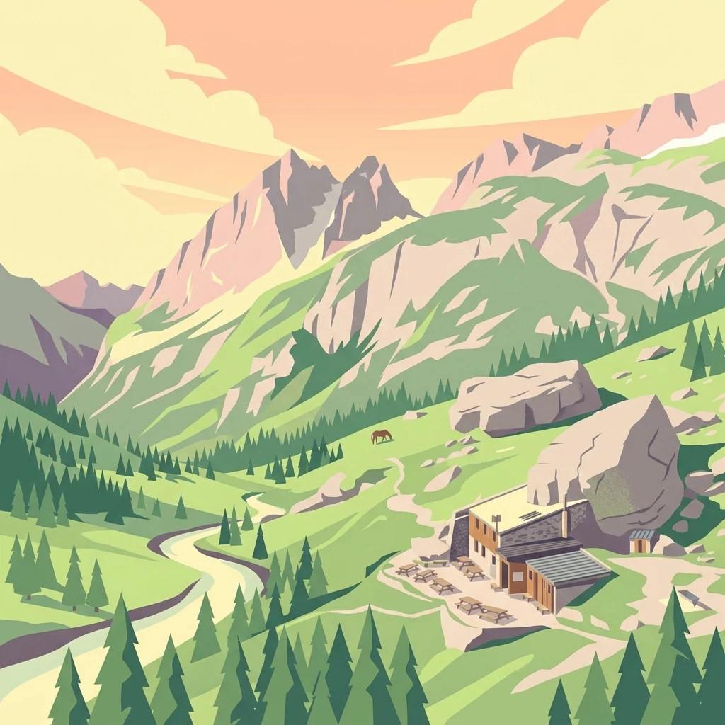
A digital illustration showing a mountain landscape with a small stone refuge building, a winding river, pine trees, and jagged mountain peaks at sunset.

An alpine sanctuary in the Aiguilles Rouges massif, protecting glacial relics, high-mountain wildlife, and a key migratory corridor between France and Switzerland.

Vallon de Bérard National Nature Reserve

The Vallon de Bérard National Nature Reserve is a high-altitude protected area in the Haute-Savoie department of France, set against the northern flank of the Aiguilles Rouges massif near Chamonix. Covering around 540 hectares, the reserve climbs from montane forest near the Eau de Bérard torrent up to jagged alpine summits above 2,900 meters, including the Aiguilles de Mesure, Morris, Martin and the Aiguille du Belvédère. It is fundamentally an alpine and nival landscape, sculpted by past glaciations and still bearing small suspended glaciers that recall the ice ages. Ecologically, the reserve is significant for its mosaic of rhododendron thickets, bog whortleberry dwarf shrublands, curved sedge alpine meadows, and avalanche corridors colonized by green alder. It shelters typical Alpine fauna such as ibex, chamois, and ptarmigan, while also functioning as an important migration corridor that links bird and insect populations between the Swiss Rhône Valley and the French Rhône Valley. Established in 1992 as a national nature reserve and managed by ASTERS, the Conservatoire d'espaces naturels of Haute-Savoie, the Vallon de Bérard complements the neighboring Aiguilles Rouges National Nature Reserve. It protects a fragile mountain environment that is otherwise under pressure from tourism, mountaineering, and infrastructure development in one of Europe's most visited mountain regions.

Location
France
Park type
Nature reserve
Established
1992
Area
5.4 km²
Highest point
2,965 m
Réserve naturelle nationale du Vallon de Bérard Protected Area

Examine Réserve naturelle nationale du Vallon de Bérard events by distance

Explore earthquakes near Réserve naturelle nationale du Vallon de Bérard

Search earthquake reports around Réserve naturelle nationale du Vallon de Bérard, a 5.3969 km² Alpine reserve in Haute-Savoie spanning recorded elevations of 1,700–2,965 metres; Inspect event date, place, magnitude, depth and source, with calculated distance providing the park relationship. Nearby records do not prove an epicentre inside the reserve or amount to a hazard judgement.

Sort by
Magnitude
Location

This page describes catalogued earthquakes associated with the park by epicentre location and distance. It does not establish causation, assess current danger, or predict future earthquakes.

No earthquake records match the current filters

Park atlas

Open another protected-place page after this mountain valley, cliff, river and glacier reserve

Explore beyond Vallon de Bérard’s earthquake records

Réserve naturelle nationale du Vallon de Bérard ends its earthquake section with a route to a separate atlas destination; the source reserve covers 5.3969 km² of mountain terrain with valleys, cliffs, forest, rivers and glacier features. The onward page does not imply the same designation, landscape, closeness, geology, seismic history, present hazard or risk.
Watercolor painting of a soft green alpine landscape with rolling hills, a central body of water, and evergreen trees against a light mountain background.
Nature reserveSavoie
About 36 km away#1 closest

Southwest

Réserve naturelle régionale de la tourbière des Saisies - Beaufortain - Val d'Arly Protected Area Map

High-altitude peatland geography in the Savoie department.

Investigate the complex topography and conservation significance of the Réserve naturelle régionale de la tourbière des Saisies - Beaufortain - Val d'Arly. This protected area stands as a unique alpine landmark, recognized for its subalpine boreal vegetation, rich bird populations, and critical role as a regional peatland sanctuary within the Savoie mountain range.

Area
2.93 km²
Established
2013
IUCN
IV
Watercolor illustration depicting green valleys, forests, and distant mountain peaks
National parkItaly
42 km away#2 closest

Southeast

Gran Paradiso National Park: Italy's National Park Protected Landscape Atlas

Mapped boundaries and regional geography for a key Italian protected area.

Gran Paradiso National Park is a distinct national park entity within Italy, offering rich potential for atlas-driven geographic discovery. This MoriAtlas profile focuses on its protected landscape identity, providing essential context for understanding its mapped boundaries and its role within the regional geography of Italy. Explore the structured geographic details that make Gran Paradiso National Park a valuable component of any mapped landscape analysis.

Area
703 km²
Established
1922
IUCN
II
Relief
Mountain
Watercolor painting depicting mountains, a river, and trees under a light sky
National parkSavoie
47 km away#3 closest

South

Vanoise National Park: Explore France's Original National Park in the Savoie Alps

Mapped Alpine geography, glacial terrain, and protected landscape.

Vanoise National Park is France's pioneering national park, a protected landscape of immense alpine beauty situated in the Savoie department. Renowned for its dramatic glacial terrain, over 100 peaks above 3,000 meters, and the iconic Alpine ibex, this park offers a profound geographic context. Explore its mapped boundaries and discover the unique atlas-level insights into France's mountainous protected areas and their ecological significance.

Area
534 km²
Established
1963
IUCN
II
Relief
Mountain
A horizontal watercolor painting depicting a gentle mountain silhouette behind a forested shoreline sloping toward the water.
Nature reserveFrance
About 54 km away#4 closest

West

Roc de Chère Nature Reserve: Mapping the Botanical Diversity and Geological Features of Haute-Savoie

A protected alpine promontory bordering Lake Annecy

Roc de Chère stands as a distinct geological landmark where limestone and sandstone soils create sharp microclimate contrasts. This protected reserve provides a critical habitat for diverse plant species and rare dragonflies within a small, defined area of the French Alps. The site acts as a key element of the Lake Annecy landscape, offering insight into the post-glacial environmental history of the Savoie region through its protected cliffs and hollows.

Area
0.69 km²
Established
1977
Relief
Mountain
Climate
Temperate
A soft, horizontal watercolor painting depicting a winding river flowing through a lush, green landscape with distant hills and sparse trees.
Nature reserveVaud
About 62 km away#5 closest

Northwest

Chanivaz, Delta de l’Aubonne: Geography, Map, and Protected Landscape Context

A rare glacial geotope and river delta on Lake Geneva.

Chanivaz, Delta de l’Aubonne provides a rich look at the alluvial fan of the River Aubonne. Explore its layered terrace terrain, protected reedbeds, and riparian forests in the canton of Vaud, representing one of the best-preserved natural river mouths remaining on the northern shore of Lake Geneva.

Area
3 km²
Established
2003
Relief
Lowland
Climate
Temperate
A watercolor landscape painting showing green hills, trees, and marshy river banks.
Nature reserveGeneva
About 67 km away#6 closest

West

Naturschutzgebiet Moulin de Vert: Protected Wetland and Forest Geography in Geneva

Detailed nature reserve map and regional landscape context

The Naturschutzgebiet Moulin de Vert nature reserve protects a mosaic of riverside woodland, meadows, and managed pond systems along the Rhône in the Canton of Geneva. Spanning approximately 132 hectares, this conservation area is recognized for supporting extensive biodiversity, from nesting peregrine falcons to diverse amphibian populations. Access this detailed geographic perspective to visualize the park boundaries, internal terrain features, and its ecological connection to the broader Swiss river landscape.

Area
1.32 km²
Established
2001
IUCN
IV
Wildlife reserveBourgogne-Franche-Comté
79 km away#7 closest

Northwest

Tourbières et lacs de la montagne jurassienne: Mapping High-Altitude Wetlands and Glacial Landscapes

A vast protected wildlife reserve in the Bourgogne-Franche-Comté region

Covering more than 12,000 hectares, this wildlife reserve forms a crucial conservation benchmark for peatland and glacial lake systems in the Jura Massif. The landscape encompasses deep combes, broad plateaus, and clear-water basins like Lac de Saint-Point, providing a vital habitat mosaic for diverse flora and fauna across the French highlands.

Area
121.56 km²
Established
2021
Relief
Mountain
Climate
Temperate
A watercolor painting showing a panoramic view of layered rolling hills and mountains in purple, green, and yellow hues against a white background.
Protected landscapeSwitzerland
About 82 km away#8 closest

Northeast

Diemtigtal: Protected Alpine Landscape in the Bernese Oberland, Switzerland

Mapped valley geography and mountain terrain context

Explore the structured geography of Diemtigtal, a regional nature park in the Bernese Oberland. This valley landscape is defined by its enclosed U-shaped topography, the Niesenkette skyline, and a network of traditional settlements nested between mountain ridges and alpine streams. Gain insight into the protected boundaries and the distinctive terrain of this Swiss Alpine region.

Established
2009
Relief
Mountain
Climate
Alpine
Scope
Terrestrial
MoriAtlas Explorer

Continue exploring the alpine geography of Réserve naturelle nationale du Vallon de Bérard

Examine the detailed landscape features, protected boundaries, and glacial terrain of this significant French nature reserve. Learn how MoriAtlas maps these high-altitude environments to provide a clear understanding of the ecological importance held by the Aiguilles Rouges massif and its surrounding mountain corridors.