Mori Atlas logo
National parkRishiri-Rebun-Sarobetsu National Park

Discover the mapped boundaries and unique subarctic landscapes of Japan's northernmost protected areas.

Rishiri-Rebun-Sarobetsu National Park: Volcanic Islands and Wetland Ecosystems in Hokkaido

(Rishiri Rebun Sarobetsu Kokuritsu Kōen)

Rishiri-Rebun-Sarobetsu National Park represents a distinctive protected area ensemble on the northwestern tip of Hokkaido, Japan. This national park safeguards dramatic volcanic islands rising from the Sea of Japan and the expansive, ecologically vital Sarobetsu Plain wetland ecosystem. Its unique subarctic environment supports remarkable alpine flora, defining a protected landscape that offers rich avenues for geographic and atlas-based discovery.

Alpine FloraVolcanic IslandsWetland EcosystemSubarctic EnvironmentRamsar SitePeat Bogs

Rishiri-Rebun-Sarobetsu National Park

National park

Park overview

Structured park overview, official facts, and landscape profile for Rishiri-Rebun-Sarobetsu National Park

Rishiri-Rebun-Sarobetsu National Park park facts, protected area profile, and essential visitor context

Review the core facts for Rishiri-Rebun-Sarobetsu National Park, including designation, size, terrain, visitor scale, habitats, and operating context in one park-focused overview.

About Rishiri-Rebun-Sarobetsu National Park

Rishiri-Rebun-Sarobetsu National Park occupies a strategic position at Japan's northern frontier, where the Sea of Japan meets the subarctic climate zone. The park's territory spans three distinct landscape elements: the volcanic island of Rishiri with its iconic peak, the smaller but equally distinctive Rebun Island, and the Sarobetsu coastal plain with its extensive wetlands. These diverse habitats are unified by their subarctic character and their position at the edge of Japan's inhabited frontier. The islands have supported human communities historically, though today their primary significance lies in their ecological and scenic values. The park provides critical protection for alpine ecosystems that exist at the southern limit of many subarctic species' ranges, while the wetland plains maintain ecological processes that have shaped the regional landscape for thousands of years. Access to the islands remains via ferry from Wakkanai, the northernmost major city on Hokkaido, emphasizing the park's remote and wilderness character.

Quick facts and research context for Rishiri-Rebun-Sarobetsu National Park

Rishiri-Rebun-Sarobetsu National Park occupies the remote northwestern coastline of Hokkaido, Japan's northernmost main island, extending across two volcanic islands and a coastal wetland plain. The park was established in 1974 and covers approximately 241 square kilometers of terrestrial and coastal ecosystems. Mount Rishiri on Rishiri Island reaches 1,721 meters as a prominent extinct volcano, while Rebun Island reaches its peak at Rebundake. The Sarobetsu Plain encompasses roughly 150 square kilometers of peat bogs and marshland fed by the Teshio River system, designated as a Ramsar Wetland in 2005. The surrounding marine waters are productive fishing grounds with extensive kelp beds.

Protection and recognition

Documented terrestrial conservation scope and official geographic designations

Rishiri-Rebun-Sarobetsu National Park Protection Status and Designation

National park status provides a formal framework for safeguarding the unique terrestrial environments of Rishiri-Rebun-Sarobetsu. Reviewing the documented designation details and management scope clarifies the official protection framework governing these northern island and coastal landscapes.

Protection details

Protection scope
Terrestrial
Transboundary protection
No
Park context

Deeper park guide and search-rich context for Rishiri-Rebun-Sarobetsu National Park

Rishiri-Rebun-Sarobetsu National Park history, landscape, wildlife, and travel context

Explore Rishiri-Rebun-Sarobetsu National Park through its history, landscape character, ecosystems, wildlife, conservation priorities, cultural context, and seasonal travel timing in a structured park guide built for atlas discovery and search intent.

Why Rishiri-Rebun-Sarobetsu National Park stands out

This park is best known for its remarkable alpine flora, which includes numerous endemic species adapted to the harsh subarctic conditions. The twin islands of Rishiri and Rebun present textbook examples of volcanic cone formations rising dramatically from the Sea of Japan, offering iconic scenery that defines the northern maritime landscape of Hokkaido. The Sarobetsu Plain represents one of Japan's largest and most ecologically significant peat bog complexes, supporting specialized wetland vegetation and birdlife in a region where such habitats are increasingly rare. The marine erosion formations along the island coastlines showcase geological processes that have shaped these volcanic landforms over millennia.

Rishiri-Rebun-Sarobetsu National Park history and protected-area timeline

The national park was formally established on September 20, 1974, as part of Japan's expanding network of protected areas during the post-war period of environmental consciousness. The selection of this area reflected growing recognition of the ecological significance of Japan's northern frontier landscapes, particularly the unique alpine and wetland ecosystems found in the subarctic zone. The Sarobetsu Plain received additional international recognition when it was designated as a Ramsar Wetland of International Importance on November 8, 2005, joining the global network of protected wetlands under the Ramsar Convention. This designation acknowledged the plain's exceptional peat bog communities and its role as a habitat for migratory waterbirds. The park remains under the administration of Japan's Ministry of the Environment, which coordinates protection and management activities across the island and coastal components.

Rishiri-Rebun-Sarobetsu National Park landscape and geographic character

The park's landscape character is defined by the contrast between the steep volcanic cones of the two islands and the flat, expansive wetlands of the Sarobetsu Plain. Rishiri Island presents a near-perfect conical form rising to 1,721 meters, the remnant of an extinct volcano whose slopes descend to a coastline of varying character. The island measures approximately 63 kilometers in circumference and covers 183 square kilometers. Rebun Island, lying approximately 30 kilometers west of Wakkanai, reaches a maximum altitude at Rebundake and spans 72 kilometers in circumference across 82 square kilometers. The Sarobetsu Plain extends approximately 17 kilometers along the coast, covering roughly 150 square kilometers of low-lying marshland and peat bog. The plain is intersected by the Teshio and Sarobetsu Rivers, which deposit sediments to create the floodplain environment. Marine erosion continues to shape the coastlines, particularly on the western sides of the islands facing the Sea of Japan.

Rishiri-Rebun-Sarobetsu National Park ecosystems, habitats, and plant life

The ecological character of Rishiri-Rebun-Sarobetsu reflects the park's position in the subarctic zone, with vegetation patterns that differ markedly from Japan's more temperate southern regions. The alpine zones on both islands support specialized plant communities adapted to cool temperatures, short growing seasons, and exposure. The Sarobetsu Plain represents the park's wetland ecological core, where extensive peat bogs have developed over thousands of years in the poorly drained coastal terrain. These peat deposits store significant carbon and support specialized bog flora including mosses, sedges, and heath plants. The surrounding marine environment contributes additional ecological value, with the coastal waters supporting rich kelp communities and serving as productive fishing grounds. The intersection of terrestrial, wetland, and marine ecosystems within a relatively compact protected area creates unusual ecological diversity.

Rishiri-Rebun-Sarobetsu National Park wildlife and species highlights

The park's wildlife reflects the subarctic setting and the variety of habitats present across islands and wetlands. The Sarobetsu Plain, as a Ramsar-designated wetland, supports significant populations of waterbirds including migratory species that use the area as a staging ground during their seasonal movements. The surrounding fishing grounds attract seabirds and marine mammals that exploit the productive coastal waters. The alpine zones provide habitat for species adapted to high-elevation conditions, though the islands' relatively small size limits the diversity of larger terrestrial wildlife. The kelp forests along the coast support their own communities of marine organisms, contributing to the overall biodiversity that makes this park significant within Japan's northern ecosystems.

Rishiri-Rebun-Sarobetsu National Park conservation status and protection priorities

Rishiri-Rebun-Sarobetsu holds particular conservation significance as Japan's northernmost national park and as a site that protects complete volcanic island ecosystems. The Sarobetsu Plain's Ramsar designation acknowledges its international importance as a wetland habitat, particularly for migratory birds. The park protects intact examples of subarctic peat bog ecosystems, which have been heavily modified in other parts of Japan. The alpine flora communities represent conservation priorities, as many species exist at the southern edge of their ranges here and are vulnerable to climate change. The marine component, including the productive kelp beds and fishing grounds, benefits from the coastal protection that the park provides, creating a buffer against development pressures that might otherwise affect these waters.

Rishiri-Rebun-Sarobetsu National Park cultural meaning and human context

The islands of Rishiri and Rebun have supported human communities for centuries, though the harsh subarctic climate and limited agricultural potential meant populations remained modest. The communities that did develop adapted to the maritime environment, with fishing serving as a traditional livelihood. Wakkanai, the gateway city for the park, represents the northernmost significant settlement on Hokkaido and serves as a cultural crossroads between the Japanese mainland and the islands of the Sea of Japan. The landscape has been shaped by the interaction between human activity and the natural environment, though the park's primary cultural significance today lies in its scenic and ecological values rather than extensive historical heritage sites.

Top sights and standout views in Rishiri-Rebun-Sarobetsu National Park

The iconic profile of Mount Rishiri rising from the sea represents the park's most recognizable image and a defining landmark of Hokkaido's northern coast. The alpine flower displays on both islands, particularly during the brief summer growing season, attract visitors seeking to witness subarctic flora at its most vibrant. The Sarobetsu Plain offers a contrasting landscape of open wetland and peat bog, with boardwalk trails allowing access to experience this rare habitat type. The ferry journey between Wakkanai and the islands provides maritime views of the volcanic silhouettes that characterize this coast. The combination of volcanic island, wetland plain, and marine environments within a single protected area creates unusual diversity for a Japanese national park.

Best time to visit Rishiri-Rebun-Sarobetsu National Park

The summer months from June through August offer the most accessible and comfortable conditions for exploring the park, with temperatures moderated by the maritime position and the alpine flora at its peak display. The brief summer season allows visitors to experience the subarctic plant communities in their most vibrant condition, particularly the alpine flowers that color the island slopes. Winter visits are challenging due to heavy snowfall and reduced access, though the snow-covered volcanic cones present a different but equally striking landscape. The shoulder seasons of spring and autumn offer fewer visitors but also more variable conditions. The ferry schedule to the islands operates year-round but is more frequent during the summer tourist season.
Monthly climate preview

Long-term temperature averages and monthly precipitation data in Northern Hokkaido

Climate Profile and Monthly Weather for Rishiri-Rebun-Sarobetsu National Park

Long-term measurements at a representative coastal elevation show average temperatures ranging from below freezing in winter to peak averages near twenty degrees Celsius in late summer. Comparing monthly climate statistics provides a clearer outlook on historical temperature fluctuations and daily precipitation averages across the yearly cycle.
Annual mean8 °C
-2 °C20 °C
Jan-2°
Feb-2°
Mar
Apr
May
Jun13°
Jul18°
Aug20°
Sep18°
Oct13°
Nov
Dec
Warmest month
August

20 °C

Coolest month
January

-2.4 °C

Wettest month
September

4.4 mm/day

Driest month
April

2 mm/day

Park location guide

Geography guide, regional context, and park location map for Rishiri-Rebun-Sarobetsu National Park

Rishiri-Rebun-Sarobetsu National Park park geography, regions, and map view in Japan

Understand where Rishiri-Rebun-Sarobetsu National Park sits in Japan through a broader geographic reading of the surrounding landscape, nearby location context, and its mapped position within the national park landscape.

How Rishiri-Rebun-Sarobetsu National Park fits into Japan

Japan is an island nation in East Asia comprising over 14,000 islands in the Pacific Ocean. The country operates as a unitary parliamentary constitutional monarchy with Emperor Naruhito as the reigning monarch and Prime Minister Sanae Takaichi leading the government. With a population of approximately 123 million, Japan is the world's 11th most populous country and a major economic power with one of the strongest militaries, though it has constitutionally renounced its right to declare war.

Wider geography shaping Rishiri-Rebun-Sarobetsu National Park in Japan

Japan is an island nation in the Pacific Ocean, bordered to the west by the Sea of Japan and extending from the Sea of Okhotsk in the north to the East China Sea in the south. The Japanese archipelago lies off the northeast coast of the Asian mainland. Approximately 75% of Japan's terrain is mountainous and heavily forested, with agricultural land and urbanized populations concentrated along the eastern coastal plains. The country is divided into 47 administrative prefectures and eight traditional regions.

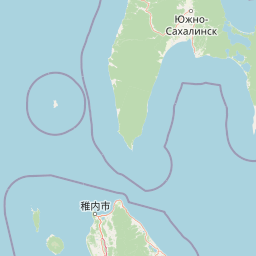
Map view of Rishiri-Rebun-Sarobetsu National Park

Use this park location map to pinpoint Rishiri-Rebun-Sarobetsu National Park in Japan, understand its exact geographic position, and read its mapped placement within the surrounding landscape more clearly.

Pigeon | © OpenStreetMap contributors

Location context for Rishiri-Rebun-Sarobetsu National Park

Hokkaido
Park atlas

Explore regional park geography and connected protected landscapes in Japan for deeper atlas comparison.

Discover Related National Parks and Protected Areas Near Rishiri-Rebun-Sarobetsu

Continue your exploration from Rishiri-Rebun-Sarobetsu National Park to browse other protected areas within Northern Japan, including volcanic island landscapes and significant wetland ecosystems. Comparing these national parks and regional conservation sites offers a broader understanding of Japan's subarctic environments and diverse protected-area network.
National parkJapan
About 205 km away#1 closest

Southeast

Daisetsuzan National Park: Japan's Premier Volcanic Alpine Protected Landscape

Explore Hokkaido's largest national park and its vast mountain terrain.

Daisetsuzan National Park is a monumental protected area, covering extensive mountainous territory in Hokkaido, Japan. This national park is characterized by its dramatic volcanic geography, featuring numerous peaks over 2,000 meters and a rugged backcountry that defines Japan's northern alpine wilderness. Delve into the mapped boundaries and regional context of this significant protected landscape to understand its unique geological identity and ecological importance.

Area
2,267.64 km²
Established
1934
IUCN
II
Visitors
6M annual
National parkHokkaido
About 282 km away#2 closest

South

Shikotsu-Tōya National Park: Hokkaido's Premier Volcanic National Park with Caldera Lakes

Explore mapped terrain, geothermal features, and active volcanoes.

Shikotsu-Tōya National Park, located in Hokkaido, Japan, is a prime example of a protected area defined by its intense volcanic geology. The park features prominent caldera lakes, including Lake Shikotsu and Lake Tōya, surrounded by active volcanic cones and dramatic geothermal landscapes. Its distinctive terrain makes it a key destination for understanding regional geography and the mapped protected areas of Japan's northern island, offering a unique glimpse into dynamic geological processes.

Area
994.73 km²
Established
1949
IUCN
II
Relief
Mountain
National parkHokkaido
About 303 km away#3 closest

Southeast

Akan Mashu National Park: Hokkaido National Park Geography and Protected Landscape

Mapped protected area boundaries and regional landscape context.

Delve into the distinct geographic identity of Akan Mashu National Park, a protected national park located in Hokkaido, Japan. This page provides detailed atlas-level information focusing on its mapped boundaries, regional landscape context, and the broader geographical significance of this protected natural area. Understand the park's terrain and its role within the Hokkaido region's natural geography for informed discovery.

Area
914.13 km²
Established
1934
IUCN
V
Relief
Mountain
Watercolor painting showing a river flowing through a forested valley with mountains in the background
National parkPrimorsky Krai
About 305 km away#4 closest

Northwest

Bikin National Park: Protected Landscapes and Geographic Boundaries in Primorsky Krai

Old-growth forest wilderness in the Sikhote-Alin range

Spanning over 1.16 million hectares, Bikin National Park protects one of the most biodiverse temperate forest ecosystems in the Northern Hemisphere. The mountainous terrain and the Bikin River basin provide essential habitats for rare wildlife, representing a world-class conservation landscape within the Russian Far East.

Area
11,600 km²
Established
2015
IUCN
II
Relief
Mountain
National parkHokkaido
About 319 km away#5 closest

East

Shiretoko National Park: Hokkaido's Protected Natural Landscape and Geography

Explore mapped boundaries and regional park context.

Shiretoko National Park, designated as a national park in Hokkaido, Japan, serves as a vital point for understanding regional geography and protected landscape exploration. This entry offers a structured view of the park's geographic scope, focusing on its mapped boundaries and natural terrain. Discover how Shiretoko National Park contributes to the broader atlas of conservation lands in the Hokkaido region, providing context for its unique ecological and geographic significance.

Area
386.36 km²
Established
1964
IUCN
II
Relief
Mountain
Abstract watercolor painting with soft green and light blue hues on white background
National parkHokkaido
About 340 km away#6 closest

Southeast

Hidakasanmyaku-Erimo-Tokachi National Park: Japan's Largest Protected Landscape Atlas

Volcanic peaks, coastal cliffs, and Hokkaido's expansive geography.

Hidakasanmyaku-Erimo-Tokachi National Park represents Japan's largest national park, offering a comprehensive exploration of its protected landscape. This vast area in Hokkaido combines the rugged topography of the Hidaka volcanic mountain range with the striking maritime environment of Cape Erimo. Users can explore detailed geographic contexts, understand the park's extensive boundaries, and appreciate its role as a crucial protected natural area at the intersection of alpine and coastal ecosystems.

Area
2,456.68 km²
Established
2024
IUCN
II
Relief
Mountain
Watercolor painting of a wetland landscape with reeds, trees, and distant hills
National parkHokkaido
About 342 km away#7 closest

Southeast

Kushiro-Shitsugen National Park: Protected Wetland Ecosystems and Landscape

Explore the mapped terrain of eastern Hokkaido's vital peatlands.

Kushiro-Shitsugen National Park is a national park in eastern Hokkaido, Japan, safeguarding the nation's largest wetland and peatland. The park encompasses the expansive Kushiro Wetlands, characterized by vast reedbeds and a network of meandering rivers, making it a critical habitat for species like the endangered red-crowned crane. This protected area offers a unique landscape for understanding Japan's freshwater ecosystems and their geographic distribution within the region.

Area
268.61 km²
Established
1987
IUCN
II
Visitors
460K annual
National parkPrimorsky Krai
About 396 km away#8 closest

Northwest

Bikin National Park: Protected Landscape Map and Regional Geography in Primorsky Krai

A vast wilderness corridor in the Sikhote-Alin mountain range

Bikin National Park is a prominent protected area in Primorsky Krai, encompassing the Bikin River valley and surrounding mountain ridges. This wilderness preserve is integral to the survival of the Amur tiger and features a distinct mix of coniferous and broadleaf forest ecosystems. The geography highlights a transition between boreal and temperate forest zones, maintained as a largely untouched natural landscape within the Russian Far East.

Area
11,604.7 km²
Established
2015
IUCN
II
Relief
Mountain

Common questions about visiting, size, designation, and location context for Rishiri-Rebun-Sarobetsu National Park

Rishiri-Rebun-Sarobetsu National Park FAQs for park facts, access, geography, and protected area context

Find quick answers about Rishiri-Rebun-Sarobetsu National Park, including protected-area facts, park geography, trail and visitor context, and how the park fits into its surrounding country and regional landscape.
MoriAtlas Explorer

Continue Your Protected Areas Search Across the Global Atlas

Deepen your exploration by continuing the structured search for national parks and protected areas worldwide. Utilize the comprehensive filtering capabilities to compare different conservation landscapes and refine your understanding of global park geography. Discover more about the distribution and characteristics of protected natural areas.

Global natural geography