
Mori Atlas logo
Protected areaRopar Wetland

A vital riverine and lacustrine ecosystem where the Sutlej River meets the Himalayan plains.

Ropar Wetland Protected Area: Mapping the Freshwater Landscape of the Punjab Foothills

Ropar Wetland functions as a critical freshwater reservoir and protected landscape, established on the Sutlej River within the Shivalik foothills of northern India. This managed ecosystem bridges the rugged Himalayan terrain and the vast Punjab plains, creating a mosaic of marshes, riparian forest, and open water. Scientific records highlight its role in sustaining endangered reptilian species and diverse migratory bird populations, while its hydrological history underscores the complex interaction between human irrigation infrastructure and natural biodiversity.

Ramsar wetlandfreshwater lakeriverine wetlandlacustrine wetlandShivalik foothillsSutlej River
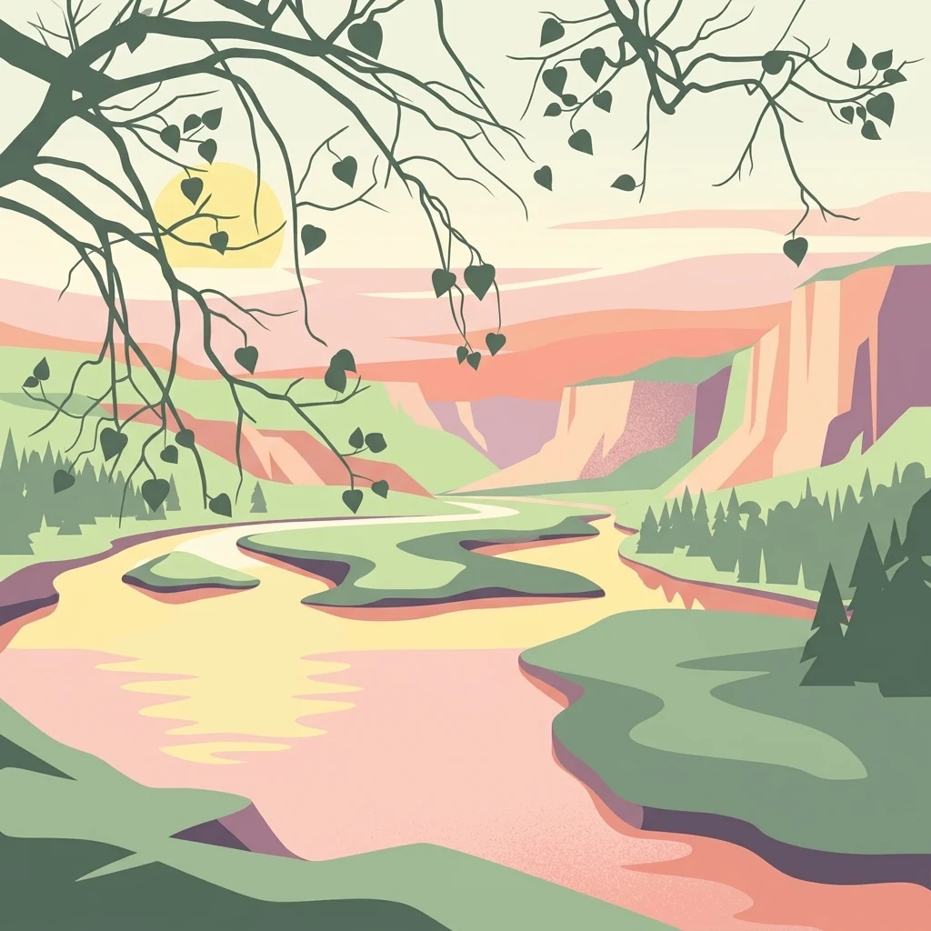
An illustrative style image of a winding river flowing through a lush valley at sunset, framed by overhanging tree branches.

Ropar Wetland

Protected area

Park overview

Structured park overview, official facts, and landscape profile for Ropar Wetland

Ropar Wetland park facts, protected area profile, and essential visitor context

Review the core facts for Ropar Wetland, including designation, size, terrain, visitor scale, habitats, and operating context in one park-focused overview.

About Ropar Wetland

Ropar Wetland represents a unique category of protected landscape in India: a deliberately engineered freshwater wetland that has, over decades, developed into a thriving ecological zone of international recognition. Created in 1952 through the construction of a head regulator on the Sutlej River, the wetland's original purpose was utilitarian. It was designed to store and divert water for irrigation, industrial supply, and domestic consumption across parts of Punjab.

Over time, the impoundment and regulation of the Sutlej at this location produced a combined riverine and lacustrine system with diverse shoreline habitats, marshy zones, and adjacent forest patches. The surrounding topography contributes strongly to the wetland's character. Hills in the northwest shelter the wetland basin, while flatter agricultural land stretches to the south and southeast, producing a clear ecological gradient between barren slopes, marsh, forest, and open water.

In 2002, the Ramsar Convention formally recognized Ropar Wetland for its role in conserving biodiversity and sustaining hydrological functions, placing it among India's listed wetlands of international importance. The site's biodiversity profile includes mammals, a substantial bird list that combines local, migratory, rare, and common species, numerous fish species, tortoises and turtles, snakes, lizards, frogs, arthropods, rotifers, crustaceans, and protozoans. The presence of endangered Indian turtles and the threatened Indian python gives the site additional conservation significance.

Although originally a popular site for boating and birdwatching with on-site tourism infrastructure, the visitor experience today reflects both the wetland's enduring natural appeal and the pressures it has faced. The wetland is therefore not only a place of ecological value but also a working landscape shaped by hydrology, agriculture, industry, and human settlement.

Quick facts and research context for Ropar Wetland

Ropar Wetland is a Ramsar-listed freshwater wetland in Punjab, India, located in the Shivalik foothills along the Sutlej River. Designated under the Ramsar Convention in January 2002 as site number 1161, the wetland covers roughly 1,365 hectares in total, including reservoir area, surrounding forest, and marshy zones.

The wetland was created in 1952 by the construction of a head regulator on the Sutlej River for irrigation, drinking water, and industrial supply. It lies close to Rupnagar city, about 45 kilometers northwest of Chandigarh, and spans parts of Rupnagar and Shaheed Bhagat Singh Nagar districts. Reports indicate the presence of at least several dozen mammal species and well over a hundred bird species, alongside diverse fish, reptile, and invertebrate communities.

Protection and recognition

Documented terrestrial conservation scope and official establishment timeline

Ropar Wetland Protection Status and International Designation History

Ropar Wetland maintains a documented terrestrial protection status established in 2002 across its managed boundaries. Official records organize international recognition frameworks, designation history, and conservation administrative scope.

Protection details

Protection scope
Terrestrial
Designated year
2002
Transboundary protection
No
Park context

Deeper park guide and search-rich context for Ropar Wetland

Ropar Wetland history, landscape, wildlife, and travel context

Explore Ropar Wetland through its history, landscape character, ecosystems, wildlife, conservation priorities, cultural context, and seasonal travel timing in a structured park guide built for atlas discovery and search intent.

Why Ropar Wetland stands out

Ropar Wetland is best known as a Ramsar-recognized freshwater wetland at the interface of the Himalayan foothills and the Indo-Gangetic plains. It is valued particularly for its combined riverine and lacustrine character, formed where the Sutlej River meets a regulated reservoir system. The wetland is also distinguished by the presence of endangered and threatened reptile species, including the Indian narrow-headed softshell turtle and the Indian python. Its birdlife, spanning resident, migratory, rare, and common species, adds to its profile as a birdwatching destination in northern India.
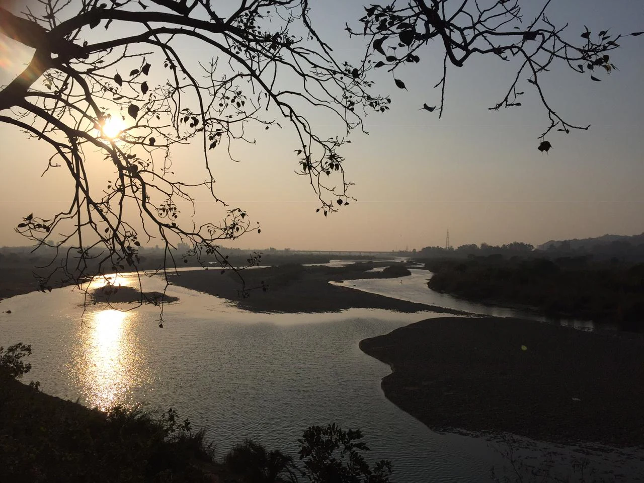
A sunset view looking over the winding Sutlej River at Ropar Wetland, with silhouetted tree branches in the foreground.
Sunset over the Ropar Wetland on the Sutlej River.

Ropar Wetland history and protected-area timeline

The modern history of Ropar Wetland begins in 1882 with the construction of a small headwork on the right bank of the Sutlej River near Ropar town, supplying water to the Sirhind Canal. In 1952, a larger head regulator was built to divert water to the Bist Doab Canal, the Sirhind Canal, and the Bhakra Main Canal upstream of the wetland, supporting irrigation, industry, and domestic use.

The area surrounding the wetland has a much older history. Rupnagar, adjacent to the wetland, contains a 21-meter-high ancient mound known as Nalagarh Tibbi, which overlays Shiwalik deposition on the left bank of the Sutlej. Archaeological excavations here have revealed a sequence of six cultural phases spanning from Harappan times to the present, indicating continuous habitation. The Archaeological Survey of India museum at Ropar displays artifacts from these excavations, including a deep well bearing a stone inscription of Mughal Emperor Shah Jahan, dating to 1627-1658.

A more recent historical landmark is the 1831 Anglo-Sikh meeting along the banks of the Sutlej. On 26 October 1831, Maharaja Ranjit Singh and Lord William Bentinck, the British Governor General, signed an agreement under an old ficus tree defining the Anglo-Sikh relationship and territorial arrangements. The site of this meeting is marked as Shahi Mulakaat Sthan and remains a place of regional historical importance near the wetland.

Ropar Wetland landscape and geographic character

The wetland's landscape is defined by its position along the Sutlej River at the point where the Shivalik hills give way to the Punjab plains. The catchment rises into the Himalayan foothills to the north and west, forming a backdrop of hills with thin vegetation and significant grazing pressure, while flatter alluvial farmland stretches south and southeast of the water body.

The wetland surface itself combines an open reservoir of roughly 800 hectares with surrounding marsh areas absorbing about 30 hectares of rooted vegetation, alongside a 30-hectare forest patch known as Sadavarat Forest. Hills surrounding the catchment are often barren or sparsely vegetated, which subjects the wetland to ongoing siltation pressure and highlights the contrast between rugged slopes and the calm freshwater reservoir below.

The ecological interface between water, marsh, forest, and farmland produces a layered shoreline environment. Submerged and emergent aquatic plants coexist with marsh species like Typha, Eleocharis, and Sagittaria, while the deeper open water transitions into riparian forest. This mosaic gives Ropar Wetland its recognizable visual identity, even though the hills themselves remain exposed and somewhat fragile.
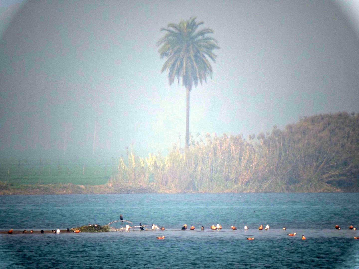
A wide shot of a river scene during a foggy day, with a small flock of birds gathered on a sandy island in the middle ground and a single tall palm tree standing on the bank.
A flock of migratory birds resting on a sandbar at Ropar Wetland during a misty winter morning.

Ropar Wetland ecosystems, habitats, and plant life

Ropar Wetland supports a layered ecological system that combines deep and shallow water habitats, marshy margins, forest patches, and agricultural surroundings. The mixture of riverine inflow from the Sutlej and standing reservoir water creates conditions favorable for both lotic and lentic species.

Terrestrial vegetation at the wetland includes 19 tree species and 14 species of bushes and grasses, with characteristic species including Acacia catechu, Dalbergia sissoo, Bombax ceiba, Ficus benghalensis, Ficus religiosa, Mangifera indica, Syzygium cumini, and Ziziphus jujuba. Aquatic vegetation includes submerged, floating, and emergent hydrophytes such as Typha, Eleocharis, Sagittaria, Nymphaea, Potamogeton, Vallisneria, Eichhornia, and Lemna, along with filamentous algae, diatoms, chlorococcales, and flagellates.

The wetland's food web is described as well-balanced and broadly self-sufficient, with decomposition driven by bacteria, actinomycetes, and fungi, herbivores including mollusks, crustaceans, rotifers, and insects, and a range of carnivores culminating in fish-eating birds and human fishers. These linked processes support a wide spectrum of microscopic, invertebrate, and vertebrate communities.
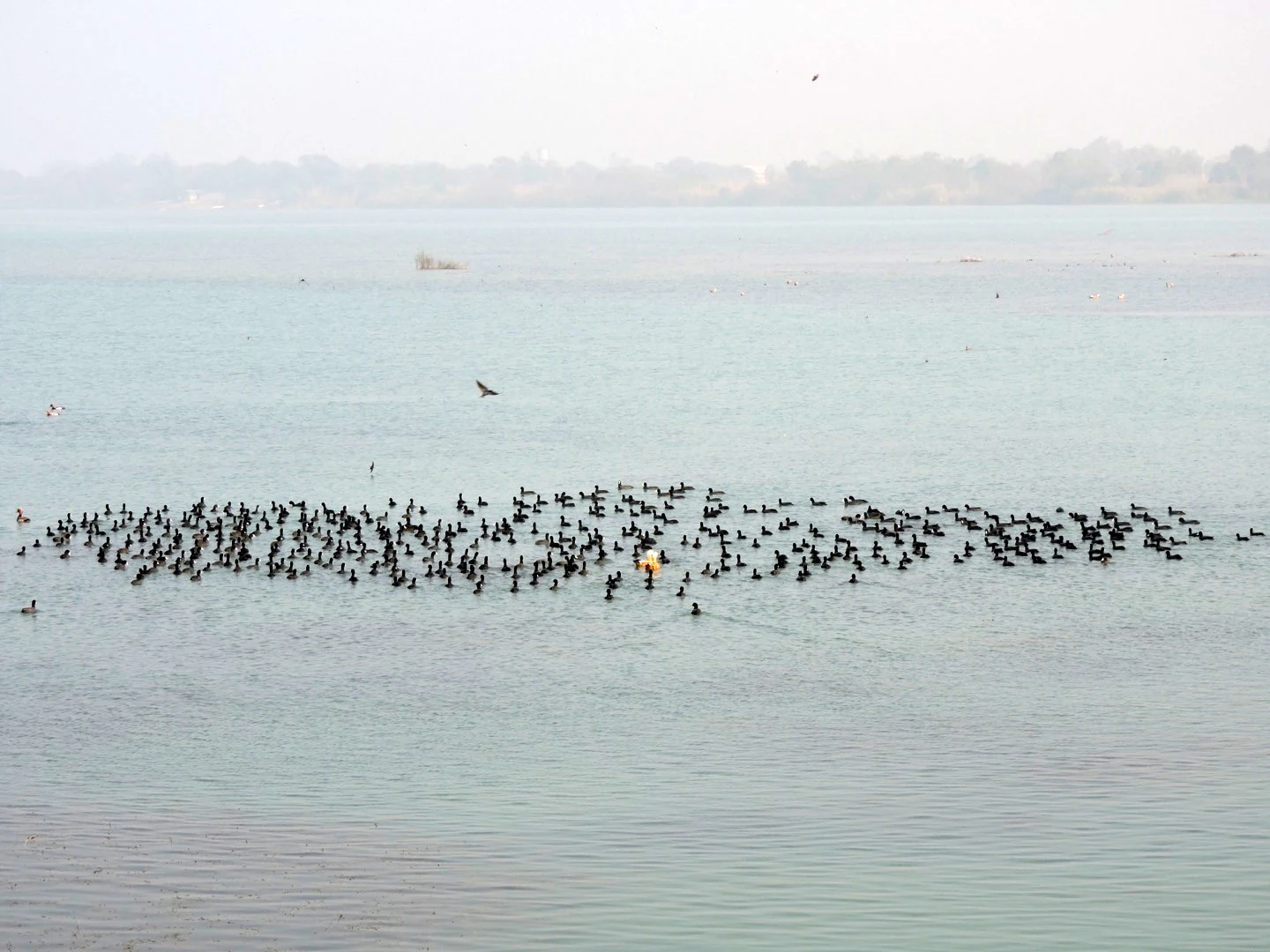
A wide shot showing a large, dense flock of black birds swimming in a calm, light blue lake, with a hazy shoreline in the distance.
A large flock of migratory birds gathered on the waters of Ropar Wetland.

Ropar Wetland wildlife and species highlights

Wildlife at Ropar Wetland is one of its most distinctive features, with notable diversity across birds, reptiles, fish, amphibians, and mammals. The birdlife is especially well documented, with records covering 49 local bird species, 11 migratory species, 3 rare species, and 54 common species. Rare migratory species include the golden-backed woodpecker, the crimson-breasted barbet, and the green barbet, along with other seasonal visitors observed in winter months.

Reptile diversity is also significant. Two species of tortoises are recorded, Geoclemys hamiltonii and Chitra indica, both classified as endangered on the IUCN Red List. The threatened Python molurus, or Indian python, is noted as a resident of the wetland. In addition, five species of lizards and eleven species of snakes have been documented, alongside several frog species.

Aquatic wildlife contributes strongly to the wetland's identity as a fishery. Reported fish species include rohu, various Labeo species, Catla, mrigal, common carp, mirror carp, grass carp, Wallago attu, Mastacembelus armatus, and snake-headed fish. The combination of resident and migratory birdlife with endangered reptiles and a productive fishery underlines Ropar Wetland's ecological importance.
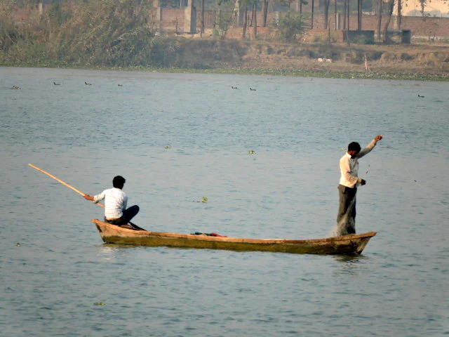
Two people in a small wooden boat on the Ropar Wetland in Punjab, India; one sits at the stern steering with a pole while the other stands near the bow.
Local fishermen navigating a traditional wooden boat on the waters of the Ropar Wetland.

Ropar Wetland conservation status and protection priorities

Ropar Wetland gained formal international conservation recognition when it was designated a Ramsar site on 22 January 2002 under reference number 1161. The designation highlights the wetland's role in conserving global biological diversity and in sustaining ecological and hydrological functions that benefit both wildlife and human populations.

Despite this recognition, the wetland faces ongoing threats. Siltation from barren and erosion-prone catchment hills reduces the wetland's open water area over time. Industrial effluents from facilities such as the fertilizer plant at Nangal and the thermal power plant at Ropar, combined with agricultural chemical runoff and urban sewage, have contributed to declining water quality downstream of the lake. Water quality monitoring by the Punjab Pollution Control Board in the late 1990s recorded a transition from category A at the river's entry point into Punjab to category D below the lake. Unwarranted disturbance to birds, unauthorized fishing, poaching, and the spread of invasive weeds further add to these pressures.

Conservation responses have been led by the Punjab State Council for Science and Technology with support from the Ministry of Environment and Forests. Programs have included awareness campaigns, public participation initiatives, afforestation and soil conservation in erosion-prone catchment zones, fencing of strategic areas to prevent exploitation and encroachment, remote sensing surveys, detailed taxonomic studies, and the expansion of fish seed farms to balance fishery needs with broader biodiversity protection.

Ropar Wetland cultural meaning and human context

The Ropar Wetland sits within a landscape of significant cultural and historical depth. The neighboring town of Rupnagar contains evidence of Harappan-era habitation, with archaeological excavations at Nalagarh Tibbi revealing a continuous cultural sequence spanning from the Indus Valley Civilization to the modern era. The Archaeological Survey of India museum at Ropar preserves many of these findings, including a Mughal-era well inscription linked to Emperor Shah Jahan.

A defining cultural landmark of the area is the Anglo-Sikh meeting site along the Sutlej riverbank. The 1831 agreement between Maharaja Ranjit Singh and Lord William Bentinck, signed under an old ficus tree, established a relationship that shaped Punjab's political history and remains a point of regional memory, commemorated at the nearby Shahi Mulakaat Sthan. The ficus tree itself, a species that thrives around the wetland, has become a tangible link between natural and human history at the site.

Today, the wetland is also part of an everyday cultural landscape where local agriculture, fishing, grazing, and rural settlement shape the relationship between communities and the wetland environment.
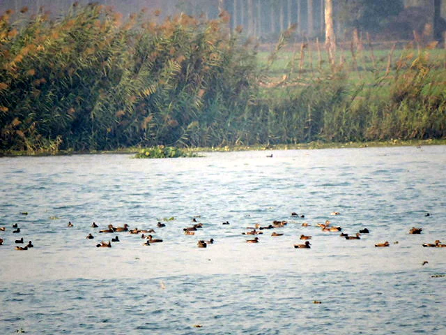
A wide shot of a river surface with a large flock of small dark ducks swimming; dense green reeds and vegetation line the bank in the background.
A flock of migratory birds on the Ropar Wetland in Punjab, India.

Top sights and standout views in Ropar Wetland

Ropar Wetland's strongest points of distinction are its dual nature as a man-made reservoir that has matured into a Ramsar-recognized ecological site, its location at the Shivalik-Punjab plains transition, and its unusually rich mix of freshwater, marsh, and forest habitats within a compact area.

The presence of endangered reptiles, including the spotted pond turtle and the Indian narrow-headed softshell turtle, alongside the threatened Indian python, gives the site a conservation profile beyond ordinary freshwater lakes. Birdwatching remains a defining appeal, with strong records of migratory, resident, rare, and common species, while the wetland's archaeological and Anglo-Sikh heritage adds a historical layer that complements its natural significance.
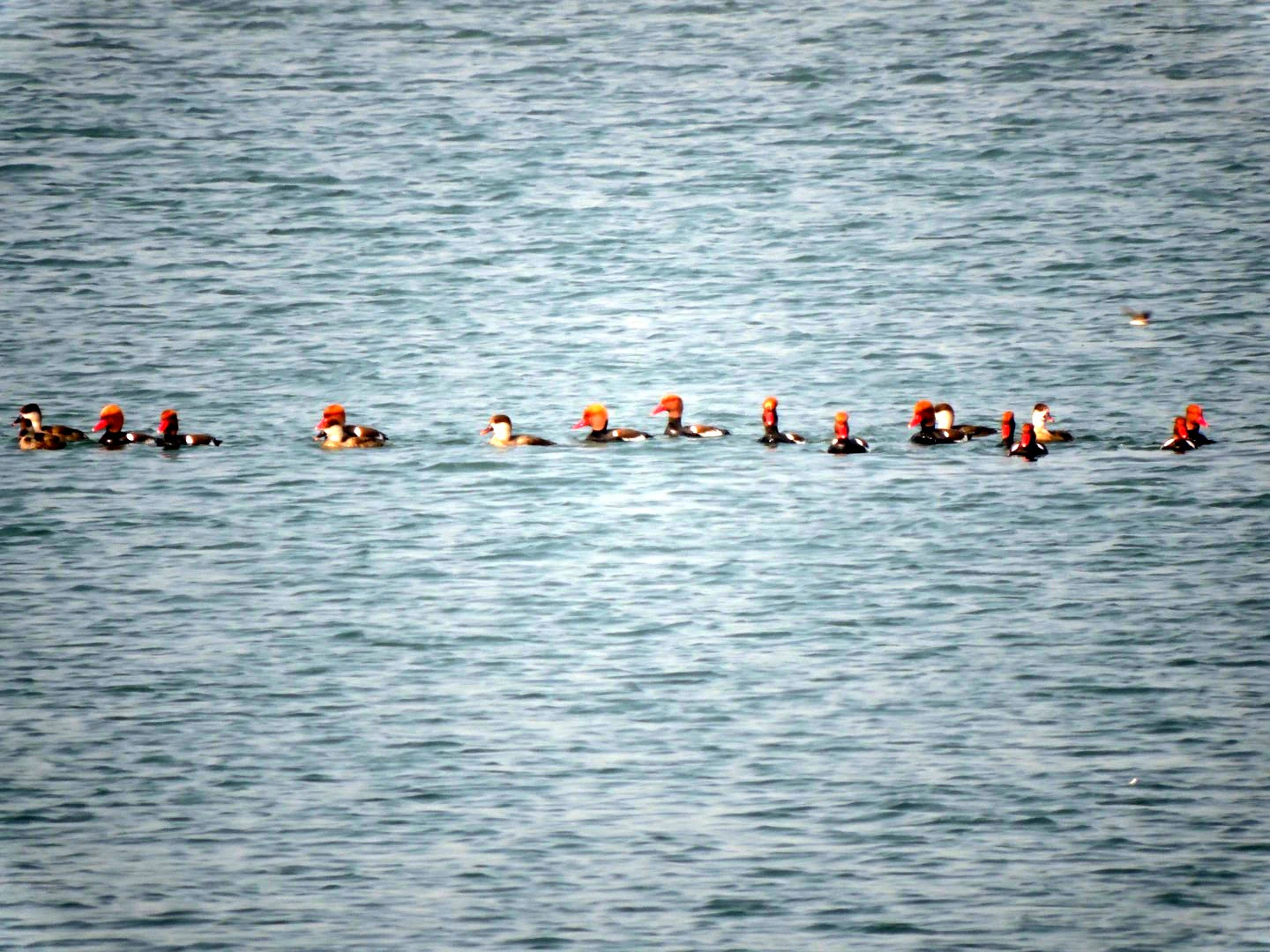
A group of ducks with distinctive reddish heads swimming in a line across open water.
A small flock of red-crested pochards swimming across the water at Ropar Wetland.

Best time to visit Ropar Wetland

The wetland falls within Punjab's semi-arid climatic zone, with a mean annual rainfall reported around 1,518 mm, mostly concentrated during the monsoon months. Winters are typically cooler and drier, supporting migratory bird arrivals and clearer viewing conditions along the open water and marshes.

The late autumn and winter months are broadly the most rewarding period for observing migratory bird species, as the wetland hosts visiting flocks during this time, as illustrated by the documented January 2018 gatherings of migratory birds. Summers can be hot and may reduce water clarity, while monsoon rainfall can increase water levels and bring lush growth to surrounding vegetation. Visitors with an interest in birdwatching generally find the cooler months most attractive.
Monthly climate preview

Long-term monthly temperature averages and precipitation measurements for Punjab

Ropar Wetland Climate Normals, Annual Temperature and Precipitation Patterns

Ropar Wetland records long-term monthly temperature variations alongside recorded precipitation levels across representative coordinates from 1991 to 2020. Examining the complete twelve-month climatology profile reveals deeper patterns in average minimum and maximum temperature distributions.
Annual mean25 °C
13 °C35 °C
Jan13°
Feb16°
Mar22°
Apr28°
May34°
Jun35°
Jul33°
Aug30°
Sep28°
Oct25°
Nov20°
Dec15°
Warmest month
June

35.2 °C

Coolest month
January

13.2 °C

Wettest month
August

6.8 mm/day

Driest month
November

0.2 mm/day

Park location guide

Geography guide, regional context, and park location map for Ropar Wetland

Ropar Wetland park geography, regions, and map view in India

Understand where Ropar Wetland sits in India through a broader geographic reading of the surrounding landscape, nearby location context, and its mapped position within the national park landscape.

How Ropar Wetland fits into India

India is a South Asian country bordered by the Indian Ocean, Arabian Sea, and Bay of Bengal. It shares land borders with Pakistan, China, Nepal, Bhutan, Bangladesh, and Myanmar. The country has a population of over 1.4 billion people and operates as a federal parliamentary republic with its capital in New Delhi.

Wider geography shaping Ropar Wetland in India

India occupies the Indian subcontinent in South Asia, bordered by the Arabian Sea to the southwest, the Bay of Bengal to the southeast, and the Indian Ocean to the south. It shares land borders with Pakistan to the west, China, Nepal, and Bhutan to the north, and Bangladesh and Myanmar to the east. The territory also includes the Andaman and Nicobar Islands in the Indian Ocean.

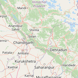
Map view of Ropar Wetland

Use this park location map to pinpoint Ropar Wetland in India, understand its exact geographic position, and read its mapped placement within the surrounding landscape more clearly.

Pigeon | © OpenStreetMap contributors

Location context for Ropar Wetland

Punjab

Visualizing the riverine habitats, marshlands, and Himalayan foothill terrain

Ropar Wetland Photos and Landscape Imagery: Exploring Protected Scenery

Examine detailed Ropar Wetland photos to understand the unique terrain where the Sutlej River meets the Punjab plains. Visual documentation reveals the interplay of open freshwater reservoirs, marsh vegetation, and surrounding protected landscapes.

A sunset view looking over the winding Sutlej River at Ropar Wetland, with silhouetted tree branches in the foreground.

A small bird with green plumage, a red forehead patch, and yellow facial markings perched on a brown tree branch.

A wide shot of a river scene during a foggy day, with a small flock of birds gathered on a sandy island in the middle ground and a single tall palm tree standing on the bank.

A wide shot showing a large, dense flock of black birds swimming in a calm, light blue lake, with a hazy shoreline in the distance.

Two people in a small wooden boat on the Ropar Wetland in Punjab, India; one sits at the stern steering with a pole while the other stands near the bow.

A brown and white goose with a bright orange beak swims across the calm surface of a wetland.

A wide shot of a river surface with a large flock of small dark ducks swimming; dense green reeds and vegetation line the bank in the background.

A group of ducks with distinctive reddish heads swimming in a line across open water.

Park atlas

Compare surrounding regional geography and connected protected habitats

Explore Parks Near Ropar Wetland and Related Protected Landscapes

Discover protected areas near Ropar Wetland to examine shared riverine terrain, wetland ecosystems, and regional conservation networks. Expanding the geographic comparison reveals broader ecological patterns across the surrounding northern plains and foothills.
Wildlife reservePunjab
About 42 km away#1 closest

North

Nangal Wildlife Sanctuary: A Protected Wetland Refuge in the Punjab Foothills

Mapped riparian landscapes and reservoir habitats in the Sutlej River basin

Located within the Shivalik foothills, Nangal Wildlife Sanctuary preserves a unique man-made reservoir ecosystem. This record details the park's protected boundaries, riparian vegetation, and its role as a essential wetland habitat for regional migratory waterbirds and threatened species in the Punjab river landscape.

Area
1.16 km²
Established
2009
IUCN
IV
Relief
Upland
Watercolor painting of a lake surrounded by palms, reeds, and soft hills in the background.
Wildlife reserveHimachal Pradesh
About 102 km away#2 closest

Southeast

Renuka Sanctuary: Protected Wildlife Reserve and Ramsar Wetland Site in Himachal Pradesh

Ecological catchment and forest basin in the low Himalayan hills

Renuka Sanctuary is a dedicated wildlife reserve in Himachal Pradesh defined by the expansive Renuka Lake and its surrounding dry deciduous forest cover. This Ramsar wetland area protects the critical catchment zone of the state's largest natural lake, offering a unique intersection of conservation land and culturally significant natural terrain.

Area
4.028 km²
Water
Major water bodies
National parkIndia
About 113 km away#3 closest

Southeast

Simbalbara National Park: National Park in India's Himalayan Foothills

Explore its dense sal forests and unique terrain.

Simbalbara National Park is a protected area recognized for its extensive sal forests and its role as a vital habitat for tigers and other large mammals in the Himalayan foothills of India. The park's landscape is defined by the Kiyarda Dun valley, featuring a mix of dense forest-covered slopes, open grassy glades, and a perennial stream. This protected area offers a representative sample of the sal-dominated forest ecosystems at lower Himalayan elevations, providing a distinct geographic and ecological context for exploration.

Area
27.88 km²
Established
2010
IUCN
II
Relief
Upland
National parkHimachal Pradesh
About 116 km away#4 closest

Northeast

Great Himalayan National Park: Protected Landscape and Mapped Geography

Explore this national park's dramatic elevation and rich biodiversity.

Great Himalayan National Park is a vital protected area within India's Himachal Pradesh, celebrated for its exceptional biodiversity and dramatic mountain geography. This national park encompasses a remarkable range of elevations, creating distinct ecological zones from lower forest elevations to high alpine meadows and glacial zones. Its significance as a mapped protected landscape makes it essential for understanding regional natural heritage and conservation efforts within the Himalayas.

Area
1,171 km²
Established
1984
IUCN
II
Relief
Mountain
Wildlife reservePunjab
About 116 km away#5 closest

Northwest

Kanjli Wetland Wildlife Reserve: Punjab Regional Geography and Protected Area Atlas

Hydrological boundaries and wetland ecosystems of central Punjab

Kanjli Wetland functions as a critical freshwater habitat and irrigation reservoir within the Punjab river basin. This protected area supports a diverse array of aquatic and terrestrial life, offering a unique window into the intersection of historical royal infrastructure and modern conservation efforts. Use this detailed geographic profile to understand the wetland's physical landscape, its role within the Beas basin, and its status as a key component of the regional protected network.

Area
4.9 km²
Established
1870
Relief
Lowland
Climate
Subtropical
A watercolor painting showing soft rolling hills and green pine trees against a light sky.
Protected areaHimachal Pradesh
About 117 km away#6 closest

North

Pong Dam Lake Protected Area: Geography, Mapped Terrain, and Himachal Pradesh Wetlands

A vast reservoir bordering the Dhauladhar range

Pong Dam Lake is a sprawling reservoir in Himachal Pradesh that serves as a vital protected area for waterfowl and regional ecosystems. Its geography combines high-altitude dam engineering with the natural relief of the Siwalik foothills, offering a distinct landscape of seasonally shifting shorelines, forested ridges, and deep-water habitats that anchor the local environment.

Area
240 km²
Established
1975
Visitors
5K annual
Relief
Upland
Wildlife reservePunjab
About 118 km away#7 closest

West

Beas Conservation Reserve: Geographic Atlas of a Punjab Protected Wildlife Landscape

Braided River Systems and Freshwater Biodiversity

Located in northwestern India, the Beas Conservation Reserve protects a vital 185 km river corridor. The reserve is characterized by a complex, shifting mosaic of sand bars and islands that support rare freshwater species. This entry provides detailed insight into the protected boundaries, hydrological features, and regional geography of this unique wetland conservation area in Punjab.

Established
2017
Relief
Lowland
Scope
Terrestrial
Water
Water-dominated
National parkHaryana
About 123 km away#8 closest

Southeast

Kalesar National Park: Exploring Haryana's Unique Sal Forest Protected Landscape

Discover mapped terrain and regional geography within the Shivalik foothills.

Kalesar National Park, located in the Shivalik foothills of Haryana, is a crucial protected area renowned for its natural sal forest, a rare ecological feature in the state. Spanning approximately 53 square kilometers, the park's diverse terrain offers insights into regional geography and conservation, serving as a vital habitat for leopards and a corridor for wild elephants. Its mapped boundaries encompass a unique landscape that contrasts sharply with surrounding agricultural lands, making it a significant point of study for protected-area enthusiasts.

Area
53 km²
Established
2003
IUCN
IV
Relief
Highland

Common questions about visiting, size, designation, and location context for Ropar Wetland

Ropar Wetland FAQs for park facts, access, geography, and protected area context

Find quick answers about Ropar Wetland, including protected-area facts, park geography, trail and visitor context, and how the park fits into its surrounding country and regional landscape.
MoriAtlas Explorer

Continue Your Protected Areas Search Across the Global Atlas

Deepen your exploration by continuing the structured search for national parks and protected areas worldwide. Utilize the comprehensive filtering capabilities to compare different conservation landscapes and refine your understanding of global park geography. Discover more about the distribution and characteristics of protected natural areas.

Global natural geography