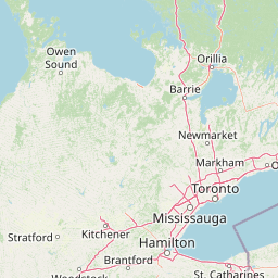
Why Rouge National Urban Park stands out
Rouge National Urban Park is best known as North America's largest urban protected area, providing a rare interface between a major metropolitan city and preserved natural landscapes. The park is renowned for its exceptional biodiversity, hosting over 1,700 species of plants, animals and fungi within an urban context, making it one of Canada's most ecologically diverse locations. It encompasses the Rouge River, one of the healthiest rivers flowing through the City of Toronto, and protects significant archaeological sites including Bead Hill, a 17th-century Seneca village designated as a National Historic Site. The park also preserves the historic Toronto Carrying-Place Trail, an Indigenous portage route linking Lake Ontario to Lake Simcoe that was designated a National Historic Event.
Rouge National Urban Park history and protected-area timeline
The human history of Rouge National Urban Park extends back over 10,000 years, with archaeological evidence showing continuous Indigenous presence through the Palaeolithic period, Iroquoian farming communities, and early European exploration. The Toronto Carrying-Place Trail, a historic portage route along the Rouge River to the Holland River connecting Lake Ontario to Lake Simcoe, was created by Indigenous Peoples and later used by European traders and settlers. This route was designated a National Historic Event in 1969. Bead Hill, an archaeological site containing the remains of an intact 17th-century Seneca village and an Archaic campsite dating approximately 3,000 years old, was designated a National Historic Site in 1991. The original Rouge Park was established in 1995 by the Province of Ontario in partnership with local municipalities and the Toronto and Region Conservation Authority, covering approximately 40 square kilometres. Parks Canada committed to creating a national urban park in 2011, and after extensive consultation with over 20,000 Canadians and 200 organizations, the Rouge National Urban Park Act came into force on May 15, 2015, formally establishing the park. Land transfers have occurred progressively, with Transport Canada transferring the final portion of the Pickering Airport Lands in January 2025.
Rouge National Urban Park landscape and geographic character
The park's landscape encompasses a varied terrain shaped by glacial processes during the last Ice Age, approximately 12,000 years ago. Glacial meltwaters formed ancestral Lake Ontario, which covered this entire region before eventually draining to form the Great Lakes as known today. Visible rock outcrops and bluffs throughout the park date from this glacial period and remain important for geologists studying seismic activity in the Greater Toronto Area. The landscape transitions from low-lying wetlands and river marshes near Lake Ontario northward through the Rouge River valley system, which forms part of the larger Toronto ravine network. The northern reaches of the park approach the Oak Ridges Moraine, a significant post-glacial landform that serves as a watershed divide and groundwater recharge zone. The park also includes the former Beare Road Landfill site, which has been partly reforested and converted to wetland, with plans to develop it as Beare Hill Park with public access. Agricultural fields, particularly in the northern sections, feature Class 1 farmland representing some of Canada's most productive soil.
Rouge National Urban Park ecosystems, habitats, and plant life
Rouge National Urban Park protects a remarkable diversity of habitats within an urban setting, supporting ecosystems that range from wetlands and marshes to forests and agricultural lands. The Rouge River watershed forms the ecological backbone of the park, with the river itself remaining the healthiest urban river in Toronto. Wetlands within the park provide critical ecological services including flood reduction, nutrient filtering, and habitat for semi-aquatic species. The park's forests include interior forest habitat significant for area-sensitive bird species, while hedgerows and riparian zones provide wildlife corridors connecting larger natural areas. Since 2015, Parks Canada has completed 31 conservation and agricultural enhancement projects, restoring over 32 hectares of wetland and riparian habitat and 20 hectares of forest, alongside planting more than 38,000 native trees and shrubs. The park's ecological significance is further enhanced by its position along the Oak Ridges Moraine, which influences groundwater flow and creates unique site conditions supporting specialized plant communities.
Rouge National Urban Park wildlife and species highlights
The park hosts exceptional biodiversity for an urban protected area, with over 1,700 species of plants, animals and fungi documented through BioBlitz surveys in 2012 and 2013. The mammal population includes white-tailed deer, coyotes, red foxes, river otters, beavers, raccoons, opossums, and smaller species including various shrews, moles, and bats. Bird diversity is particularly notable, with 261 species recorded including five nationally rare breeding birds and four breeding birds of special concern. Raptors such as bald eagles, golden eagles, hawks, and kestrels hunt throughout the park, while waterfowl including ducks and swans frequent wetland areas. The park supports significant reptile and amphibian populations, including Blanding's turtles, a threatened species in Ontario that Parks Canada has been rearing and releasing since 2014, with 113 turtles released into the park. Fish diversity includes 65 species, two of which are nationally vulnerable, while the 1,006 plant species documented include six nationally rare and 92 regionally rare varieties.
Rouge National Urban Park conservation status and protection priorities
Rouge National Urban Park holds significant conservation importance as North America's largest urban protected area and as a model for integrating conservation with urban development. The Rouge National Urban Park Act (Bill C-40) provides tailored federal protection for the park's ecosystems, cultural artifacts, and wildlife, complementing Ontario's Greenbelt Act and obligating the Canadian government to protect these values. The park faces notable conservation challenges given its location within a major metropolitan area, including urban pollution from highways, golf courses, and historic land use, as well as pressure from surrounding development. Conservation programs include wetland and habitat restoration, species recovery initiatives such as the Blanding's turtle breeding program conducted in partnership with the Toronto Zoo, and invasive species management. The park's farmland preservation program maintains agricultural operations while enhancing ecological connectivity, and Parks Canada works collaboratively with ten First Nations through the Rouge National Urban Park First Nations Advisory Circle on restoration, monitoring, and cultural programming.
Rouge National Urban Park cultural meaning and human context
The park encompasses a rich cultural landscape reflecting thousands of years of human habitation and land use. Indigenous peoples, including various Iroquoian nations, historically lived in the area, with the Seneca establishing villages such as the one at Bead Hill. The Toronto Carrying-Place Trail represents an Indigenous-created route of significant historical importance, serving as a vital transportation corridor linking Lake Ontario to the interior of what is now Ontario. European settlement brought farming to the Rouge Valley, with agricultural use continuing for centuries and Class 1 farmland still actively cultivated within the park today. The artist F.H. Varley of the Group of Seven painted the banks of the Rouge River in Markham during the 1950s, capturing the landscape's scenic value. The park's establishment involved extensive consultation with Indigenous communities, and Parks Canada's Indigenous partners contribute to all aspects of park operations including ecosystem restoration, traditional programming, and archaeological monitoring.
Top sights and standout views in Rouge National Urban Park
The park offers visitors a unique combination of natural exploration, historical discovery, and agricultural experiences within a major metropolitan setting. The Rouge River trail system provides access to diverse landscapes, from wetland boardwalks at Rouge Beach to forested ravines and agricultural fields in the north. The Bead Hill archaeological site represents a significant First Nations heritage location, while the Toronto Carrying-Place Trail connects visitors to centuries of travel and trade history. Wildlife viewing opportunities are exceptional for an urban park, with documented sightings of bald eagles, deer, beavers, and seasonal migrations. The park's farmers markets at Reesor's Farm Market and the former Whittamore's Farm provide direct connections to local agriculture, while educational programming includes Learn-to-Camp, guided walks, and seasonal festivals. The Rouge App, developed in partnership with University of Toronto Scarborough, offers an interactive guide available in English, French, and Simplified Chinese.
Best time to visit Rouge National Urban Park
The park is accessible year-round with free admission, offering distinct seasonal experiences throughout the year. Spring and fall migration periods provide excellent birdwatching opportunities as species move through the corridor. Summer months offer the warmest conditions for hiking and wetland exploration, though the park's ponds and shaded ravines provide relief from urban heat. Fall brings spectacular foliage colour changes throughout the valley and forest areas, while winter trails offer peaceful exploration of the dormant landscape, though some areas may have limited maintenance. The park's location within the Greater Toronto Area means it can experience high visitation on weekends and holidays, particularly during peak summer months. Early mornings on weekdays generally offer the quietest conditions for wildlife viewing and trail exploration.