
Mori Atlas logo
Nature reserveRound Island

Mapping the dramatic slopes and restored endemic landscapes of this Mauritian nature reserve

Round Island Nature Reserve: An Atlas of Volcanic Terrain and Protected Island Geography

Round Island stands as a vital volcanic landmark in the Indian Ocean, situated north of Mauritius. This protected islet, encompassing roughly 1.69 square kilometres of steep ridges and recovering native forests, offers a unique study in island restoration science. Explore the mapped terrain and geological characteristics that define this essential habitat for rare endemic reptiles and nesting seabird colonies.

uninhabited islandisland restorationnature reserveImportant Bird Areavolcanic islandendemic reptiles
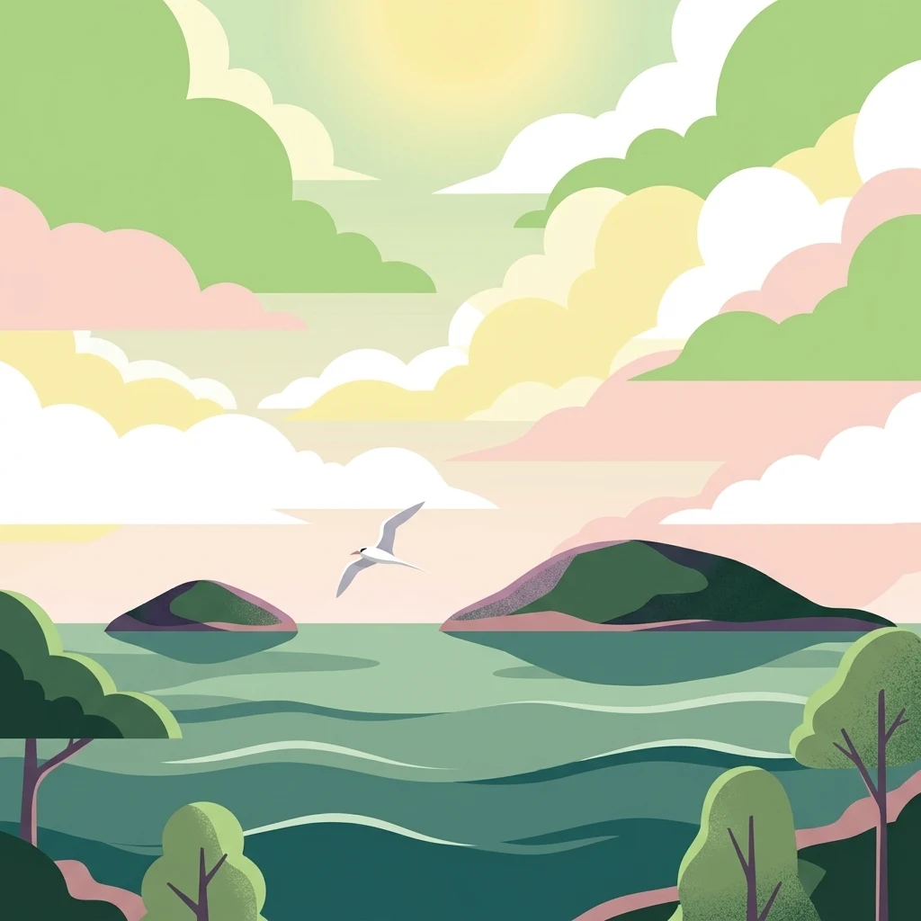
A stylized digital illustration featuring a calm green sea with two islands, a single bird flying in the sky, and lush trees in the foreground against a pastel sunset sky.

Round Island

Nature reserve

Park overview

Structured park overview, official facts, and landscape profile for Round Island

Round Island park facts, protected area profile, and essential visitor context

Review the core facts for Round Island, including designation, size, terrain, visitor scale, habitats, and operating context in one park-focused overview.

About Round Island

Round Island is a tiny but ecologically extraordinary volcanic islet in the Mascarene archipelago of the western Indian Ocean. Lying roughly 22.5 kilometres north of mainland Mauritius, it is administered as a nature reserve and is internationally recognised as both an Important Bird Area and a flagship site for long-term island restoration. The island's rugged topography, small size, and complete absence of permanent human settlement have combined to make it a refuge for a remarkable suite of endemic plants and animals.

The islet's modern identity is inseparable from the long conservation story that has shaped it. Once heavily degraded by goats and rabbits introduced during the 19th century, the island's native flora and fauna were pushed to the edge of collapse. A sustained programme of ecological restoration, beginning in earnest in the 1970s and driven by partnerships between the Mauritian government, the Durrell Wildlife Conservation Trust, and local conservation organisations, removed the invasive herbivores and allowed the native plant communities to rebuild. This in turn supported the recovery of endemic reptiles that depend on those habitats.

Today Round Island functions simultaneously as a protected area, a research site, and a demonstration of what sustained, science-based conservation can achieve on a small oceanic island. Seabirds nest on its cliffs, rare reptiles move through recovering palm and screw-pine forest, and conservation staff continue active management to keep invasive plants and invertebrates in check. The result is a living example of biodiversity recovery in one of the world's most threatened island ecosystems.

Quick facts and research context for Round Island

Round Island is an uninhabited islet about 22.5 kilometres north of Mauritius, with an area of approximately 1.69 square kilometres and a maximum elevation of 280 metres. It has been designated a nature reserve since 1957, is recognised as an Important Bird Area by BirdLife International, and is administered jointly by the National Parks and Conservation Service and the Mauritian Wildlife Foundation.

Protection and recognition

Examine the documented conservation framework and recognized protection scope.

Round Island Protection Status and Terrestrial Conservation Scope

Round Island maintains a defined terrestrial protection scope within the regional conservation inventory. Documented administrative records outline the established designation framework and governing management status.

Protection details

Protection scope
Terrestrial
Park context

Deeper park guide and search-rich context for Round Island

Round Island history, landscape, wildlife, and travel context

Explore Round Island through its history, landscape character, ecosystems, wildlife, conservation priorities, cultural context, and seasonal travel timing in a structured park guide built for atlas discovery and search intent.

Why Round Island stands out

Round Island is most renowned for being one of the world's longest-running island restoration projects, with a dramatic recovery of endemic vegetation and reptile fauna following the eradication of introduced goats and rabbits. The islet is also distinguished by an unusual concentration of endemic reptiles, including the Round Island boa, the Round Island day gecko, and several other gecko and skink species found nowhere else on Earth.
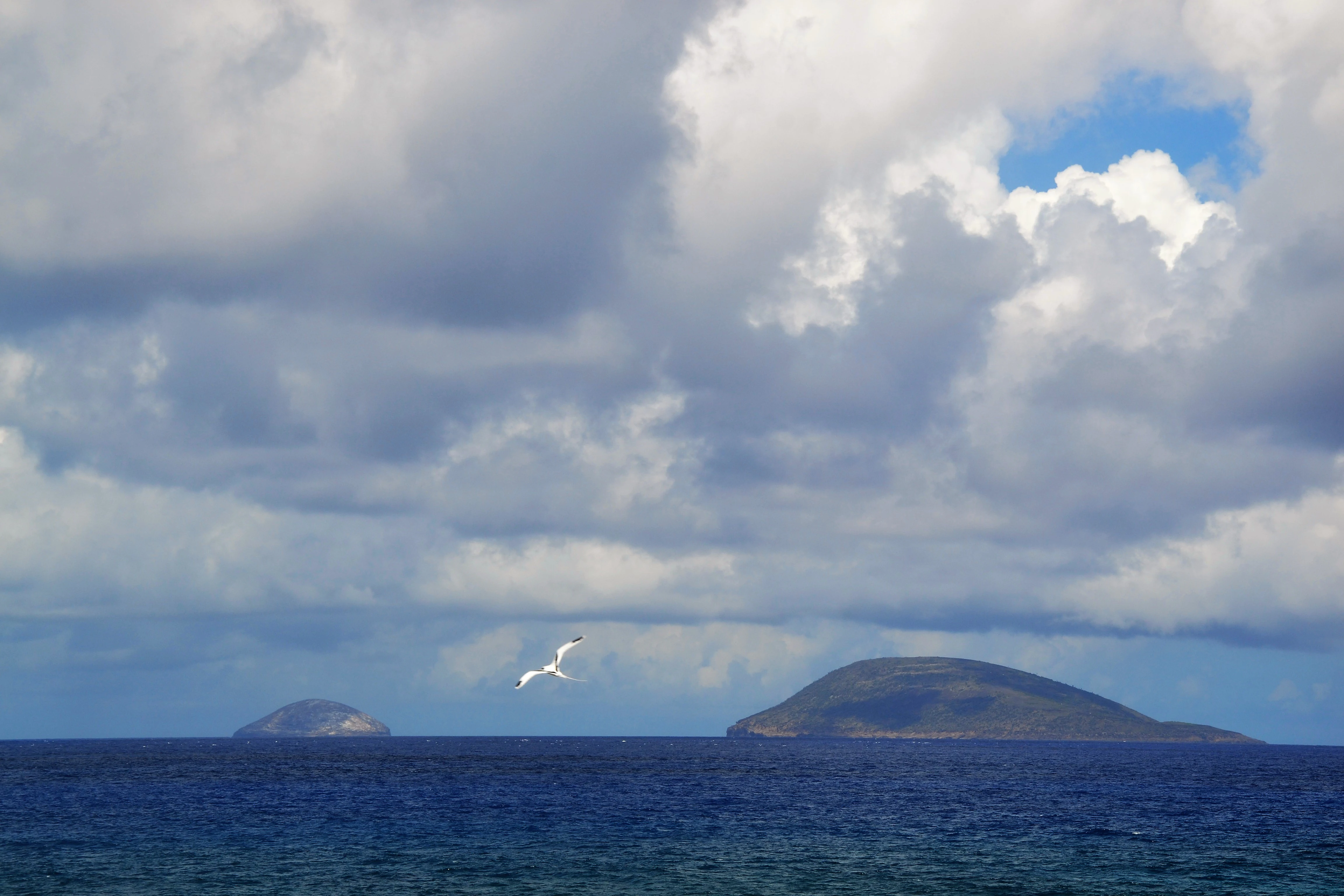
A distant view across a dark blue ocean toward two rocky islands on the horizon under a cloudy sky, with a small bird in flight.
Round Island and Serpent Island, two remote islets north of Mauritius in the Indian Ocean.

Round Island history and protected-area timeline

Round Island's formal history of protection began in 1957, when it was designated a nature reserve through the efforts of the then Colonial Secretary Robert Newton, a keen birdwatcher who recognised that nesting seabirds faced direct pressure from people, primarily fishermen collecting them for food. Earlier biological records, including the first serious report on the island's fauna since 1869, had already been produced by the Mauritian zoologist Jean Vinson in 1948, with further field surveys in 1952, 1954, and 1957 documenting the precarious state of the native vegetation.

By the early 1960s, two major cyclones in 1960 and 1962 had stripped much of the island's palm and screw-pine cover, leaving recovering growth exposed to grazing by the introduced goats and rabbits. Goats had arrived between 1846 and 1868, while rabbits had been present in large numbers before 1810, and their combined pressure was rapidly turning the island into an ecological wasteland. Vinson campaigned internationally for their removal through the mid-1960s, including a special report to the IUCN in 1965, but died unexpectedly in May 1966 before lasting action could be taken.

A more systematic phase began in 1976, when Gerald Durrell and the Jersey Wildlife Preservation Trust, later renamed the Durrell Wildlife Conservation Trust, sponsored conservation work on critically endangered Mauritian birds and the broader ecological restoration of Round Island. Between 1976 and 1979 the goat population was eliminated, and in 1986 a team led by Don Merton completed the eradication of rabbits using brodifacoum poison. A 1984 conservation agreement with the Mauritian government broadened the focus from single species to ecosystem-scale management, helping build the local capacity that supports ongoing work today.

The island also carries a small military footnote. On 22 October 1794, British and French naval squadrons fought the inconclusive Battle of Île Ronde in the waters off the island, a minor but notable engagement in the broader struggle for control of the Indian Ocean during the French Revolutionary Wars.

Round Island landscape and geographic character

Round Island is a small, rugged volcanic islet of roughly 1.69 square kilometres, rising to a maximum elevation of 280 metres. Its terrain is shaped by steep slopes and exposed rock, with thin volcanic soils that are highly vulnerable to erosion once the protective plant cover is removed. The island's coastline is broken by sea cliffs and rocky shores, the setting for nesting seabirds, while the interior supports recovering palm forest and screw-pine stands that have re-established themselves after the removal of invasive herbivores.

The small scale of the islet makes its landforms feel concentrated: rises, ridges, and sheltered gullies all occur within walking distance, and the same island that presents dramatic coastal cliffs also harbours pockets of closed-canopy native forest on more sheltered slopes. Because of this compactness, even minor disturbances such as cyclone damage or heavy grazing have historically had a disproportionate effect on the whole island's ecological condition.

Round Island ecosystems, habitats, and plant life

Round Island's ecological identity is defined by a striking contrast between the island's tiny area and the unusual concentration of endemic species it supports. Native plant communities are dominated by palms and screw-pines, with four endemics, Latania loddigesii, Dictyosperma album, Pandanus vandermeerschii, and Hyophorbe lagenicaulis, having historically formed the backbone of the island's forest. After the removal of goats and rabbits, these species have recovered strongly, reshaping vegetation structure across the islet.

The recovering forest in turn underpins reptile populations and provides habitat structure that is rare elsewhere in the Mascarene islands. The island's natural recovery over recent decades is widely regarded as a textbook example of how removing introduced herbivores from oceanic islands can rapidly restore native vegetation communities, with cascading benefits for dependent animal species. Conservation work now focuses on keeping invasive plants and invertebrates under control, so that the recovery process is not undermined by new threats.

Round Island wildlife and species highlights

Although Round Island has no land mammals aside from historical invasive species, its reptile fauna is exceptional. Endemic reptiles include the Round Island boa, also known as Casarea dussumieri, a distinctive snake unique to the island, along with the Round Island day gecko and several other gecko species such as Phelsuma ornata and Nactus serpensinsula, and skinks including Leiolopisma telfairii and Gongylomorphus bojerii. The Round Island burrowing boa, once part of this unique fauna, is now considered extinct.

The island's seabird life is also a defining part of its wildlife profile. Nesting species reported around Round Island include the white-tailed tropicbird, red-tailed tropicbird, Trindade petrel, masked booby, and wedge-tailed shearwater. The combination of recovering native vegetation for terrestrial reptiles and active seabird colonies on the surrounding cliffs gives Round Island a layered, multi-habitat wildlife character that is rare for such a small land area.

Round Island conservation status and protection priorities

Round Island is one of the most important conservation sites in the Indian Ocean and a global reference point for island restoration. Designated a nature reserve in 1957, it has been the focus of continuous conservation intervention for more than six decades, with the modern era of systematic work beginning in 1976 under the sponsorship of Gerald Durrell and the Jersey Wildlife Preservation Trust, now the Durrell Wildlife Conservation Trust. Administration is shared between the Mauritian National Parks and Conservation Service and the Mauritian Wildlife Foundation.

The island's conservation significance rests on the successful removal of introduced goats, completed by 1979, and rabbits, removed in 1986, which halted the collapse of endemic vegetation and triggered broad ecosystem recovery. That recovery has been especially strong for four endemic plant species and for six reptile species whose populations have rebounded in tandem with the restored plant communities. Round Island's importance for birds has also been formally recognised through its designation as an Important Bird Area by BirdLife International.

Ongoing management continues to address invasive plants and invertebrates, a reminder that removal of one threat often reveals the next. The island's history offers one of the clearest demonstrations anywhere in the world of how sustained, multi-decade conservation effort can reverse ecosystem collapse on a small oceanic island.

Round Island cultural meaning and human context

Round Island has no permanent human population and no continuous indigenous cultural tradition tied directly to the islet itself, but it sits within the broader cultural and natural heritage of Mauritius and the Mascarene archipelago. Historically, local fishermen visited the island to collect seabirds and eggs for food, an activity that contributed to the early threat facing nesting birds and helped motivate the island's formal protection in 1957. Its offshore position, north of the Mauritian mainland, has also given it a small place in regional maritime memory, including the 1794 Battle of Île Ronde between British and French naval forces.

Top sights and standout views in Round Island

Round Island's standout qualities include its status as one of the world's longest-running island restoration projects, its exceptional concentration of endemic reptiles such as the Round Island boa and Round Island day gecko, and its dramatic recovery of native palm and screw-pine forest after the eradication of introduced herbivores. The islet's recognition as an Important Bird Area, combined with its seabird colonies and ongoing active management, gives it an unusually complete profile for a landmass of just 1.69 square kilometres.

Best time to visit Round Island

Round Island is uninhabited and is managed as a strictly protected nature reserve, so visits are limited to authorised conservation, research, and monitoring activity rather than general tourism. From an ecological perspective, the cooler and drier southern hemisphere winter months typically offer calmer seas and more favourable conditions for seabird observation and fieldwork, while the cyclone season between roughly November and April can disrupt access and pose real risks to the island's recovering vegetation. Anyone interested in the site is generally best served by approaching it as a conservation subject rather than a conventional travel destination.
Monthly climate preview

Trace measured monthly temperature and precipitation rhythms across the protected landscape

Round Island Climate Normals and Long Term Temperature Patterns

Representative point measurements reveal sustained annual temperature ranges alongside distinct monthly precipitation variations for Round Island. Examining the complete twelve month dataset provides granular insight into long term climatological averages.
Annual mean25 °C
22 °C27 °C
Jan27°
Feb27°
Mar27°
Apr26°
May25°
Jun24°
Jul23°
Aug22°
Sep23°
Oct24°
Nov25°
Dec26°
Warmest month
February

27.3 °C

Coolest month
August

22.5 °C

Wettest month
February

4.1 mm/day

Driest month
September

0.8 mm/day

Park location guide

Geography guide, regional context, and park location map for Round Island

Round Island park geography, regions, and map view in Mauritius

Understand where Round Island sits in Mauritius through a broader geographic reading of the surrounding landscape, nearby location context, and its mapped position within the national park landscape.

How Round Island fits into Mauritius

Mauritius is an island nation in the Indian Ocean and part of the Mascarene Islands. The country gained independence from Britain in 1968 and became a republic in 1992. It is characterized by a diverse population of primarily Indian and Creole descent, with English and French as official languages and Mauritian Creole as the dominant spoken language.

Wider geography shaping Round Island in Mauritius

Mauritius is located in the Indian Ocean approximately 2,000 km east of Africa and east of Madagascar. The main island is volcanic in origin, and the country also includes the islands of Rodrigues, Agaléga, and St. Brandon (Cargados Carajos shoals). The territory is part of the Mascarene Islands, with nearby Réunion being a French overseas department.

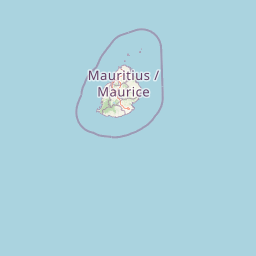
Map view of Round Island

Use this park location map to pinpoint Round Island in Mauritius, understand its exact geographic position, and read its mapped placement within the surrounding landscape more clearly.

Pigeon | © OpenStreetMap contributors

Explore photographic views of rugged volcanic slopes, recovering palm forests, and coastal cliffs.

Round Island Photos and Landscape Scenery: Visualizing Volcanic Terrain and Habitats

Visual documentation of Round Island reveals the rugged volcanic terrain, steep sea cliffs, and recovering palm forests that define its protected landscape. Examining these field photographs provides a clearer understanding of the rare island habitats, native plant communities, and ecological restoration work shaping the nature reserve.

A distant view across a dark blue ocean toward two rocky islands on the horizon under a cloudy sky, with a small bird in flight.

Park atlas

Continue comparing island reserves and protected landscapes across the western Indian Ocean

Exploring Other Parks Near Round Island and Protected Areas in the Surrounding Region

Visitors reviewing Round Island can browse adjacent protected areas to compare regional island restoration projects and volcanic landforms. Examining nearby reserves provides wider context on marine conservation landscapes and endemic species recovery.
A minimalist, flat vector illustration showing a colorful island scene with a waterfall, forest, and surrounding water.
Protected areaRivière du Rempart District
About 13 km away#1 closest

West

Île Plate: Protected Area Geography and Natural Features in Rivière du Rempart District

Island biodiversity and volcanic landscapes in northern Mauritius

Île Plate is a compact island covering approximately 2.5 square kilometres, notable for its basalt geology and status as a protected area. It anchors a wider system of islets, offering a rich study of indigenous vegetation, seabird habitats, and tangible maritime history in the Indian Ocean.

Area
2.53 km²
Relief
Lowland
Access
Moderate access
Scope
Mixed
Watercolor illustration of a forest scene with trees, ferns, and distant mountains
National parkMauritius
About 33 km away#2 closest

South

Bras d'Eau National Park: Mauritius National Park Protected Landscape Discovery

Explore coastal terrain, endemic species habitats, and wetland geography.

Bras d'Eau National Park, situated on Mauritius, offers an in-depth look at a protected coastal lowland landscape vital for conservation. This national park showcases remnant forest patches critical for endemic flora and fauna, complemented by a unique system of four mares, including the mangrove-rich Mare sarcelle. Its mapped geography provides context for island ecosystems and serves as a key location for understanding Mauritius's protected natural areas.

Area
4.97 km²
Established
2011
Relief
Lowland
Climate
Tropical
A minimalist watercolor painting showing green rolling hills and distant terrain on a white background.
Nature reserveMoka District
About 47 km away#3 closest

Southwest

Le Pouce Nature Reserve: Volcanic Geography and Protected Upland Habitat in Mauritius

A rugged basalt peak in the Moka District mountain range.

Le Pouce Nature Reserve guards a critical 0.69 square kilometer patch of upland forest on the slopes of the third highest mountain in Mauritius. This protected area is recognized for its dramatic volcanic terrain and as the rare surviving home for the critically endangered Le Pouce Mountain Screwpine, providing an essential window into the island's unique ecological and geological history within the Moka Range.

Area
0.69 km²
Established
1951
Relief
Mountain
Climate
Tropical
Nature reserveGrand Port District
About 57 km away#4 closest

South

Vallée de Ferney Nature Reserve: Protected Mountain Landscapes in the Grand Port District

Indigenous rainforest, volcanic terrain, and conservation refuge

Located in the Bambou mountains of southeastern Mauritius, Vallée de Ferney is a 200-hectare nature reserve known for its protected indigenous rainforest and ongoing rewilding projects. As a key conservation site in the Grand Port District, the reserve offers a look at rare endemic species and the unique moisture-loving vegetation of the island's eastern volcanic series. Explore the mapped boundaries and natural terrain of this significant protected landscape.

Area
2 km²
Established
2006
Relief
Mountain
Climate
Tropical
A horizontal watercolor painting showing green coastal vegetation, a small waterway, and distant hills under a soft sky.
National parkMauritius
About 60 km away#5 closest

South

Île aux Fouquets National Park: Coral Islet Geography and Lighthouse Heritage in Mauritius

Protected maritime landscape and offshore reef terrain

This compact coral island represents a critical piece of the national park system in Mauritius. Known for its distinct limestone geology and nineteenth-century lighthouse ruins, it provides a unique window into the maritime history and offshore reef ecosystems of the Indian Ocean, contrasting with the volcanic landforms of the mainland.

Area
0.025 km²
Established
2004
Relief
Lowland
Access
Remote access
Nature reserveMauritius
About 61 km away#6 closest

Southwest

Monvert Nature Park: Exploring Protected Indigenous Landscapes in Mauritius

Regenerated highland forest and endemic flora reserve

Located in the central highlands of Mauritius near Curepipe, Monvert Nature Park protects a significant portion of recovering indigenous woodland. The park functions as a major botanical conservation site, featuring an arboretum with over 150 endemic species and a network of nature trails that traverse its unique highland terrain. This reserve offers a grounded look at the island's botanical diversity and ongoing forest restoration efforts.

Relief
Upland
Climate
Subtropical
Access
Easy access
Scope
Terrestrial
Nature reserveMauritius
About 63 km away#7 closest

South

Ile aux Aigrettes: Exploring the Protected Coral Coastal Landscape of Mauritius

A critical nature reserve and rewilding site in the Grand Port bay

Ile aux Aigrettes represents a unique geographic outpost off the south-east coast of Mauritius, defined by its flat coral limestone terrain. As a protected nature reserve, it offers insights into the recovery of rare dry coastal forest ecosystems and the ongoing scientific efforts to maintain endemic biodiversity on a small maritime scale.

Area
0.27 km²
Established
1965
Relief
Lowland
Access
Easy access
Watercolor painting showing mountains in the distance, a body of water, and green vegetation in the foreground
National parkMauritius
About 63 km away#8 closest

Southwest

Black River Gorges National Park: Key Protected Landscape and National Park in Mauritius

Explore mapped boundaries and endemic wildlife conservation in the southwest highlands.

Black River Gorges National Park is the largest protected area on Mauritius, critically preserving native rainforest and unique endemic species. This national park encompasses approximately 67.54 square kilometers, showcasing varied ecosystems from humid upland forests to marshy heathlands within its rugged highland terrain. The park's geography, characterized by deep gorges and steep slopes, provides essential habitats and plays a crucial role in the island's conservation efforts, making it a significant site for understanding Mauritius's natural heritage.

Area
67.54 km²
Established
1994
Relief
Upland
Climate
Tropical

Common questions about visiting, size, designation, and location context for Round Island

Round Island FAQs for park facts, access, geography, and protected area context

Find quick answers about Round Island, including protected-area facts, park geography, trail and visitor context, and how the park fits into its surrounding country and regional landscape.
MoriAtlas Explorer

Continue Your Protected Areas Search Across the Global Atlas

Deepen your exploration by continuing the structured search for national parks and protected areas worldwide. Utilize the comprehensive filtering capabilities to compare different conservation landscapes and refine your understanding of global park geography. Discover more about the distribution and characteristics of protected natural areas.

Global natural geography