

Mori Atlas logo
Protected areaRudrasagar Lake

Analyzing the hydrological dynamics, sediment-rich basin, and cultural heritage of this vital northeastern wetland

Rudrasagar Lake: A Ramsar-Designated Freshwater Wetland and Protected Landscape in Tripura India

Rudrasagar Lake stands as a significant freshwater wetland and Ramsar-listed protected area in the Sipahijala district of Tripura. This basin acts as a major sedimentation reservoir sustained by perennial stream inflow and seasonal monsoonal rainfall, creating a low-relief landscape framed by gentle sedimentary hillocks. Beyond its ecological function as an Important Bird Area for wintering waterfowl, the site maintains a dual identity through the historic Neermahal Water Palace.

freshwater wetlandRamsar siteImportant Bird Areawintering waterfowlmonsoonal lakesedimentation reservoir

Rudrasagar Lake

Protected area

Park overview

Structured park overview, official facts, and landscape profile for Rudrasagar Lake

Rudrasagar Lake park facts, protected area profile, and essential visitor context

Review the core facts for Rudrasagar Lake, including designation, size, terrain, visitor scale, habitats, and operating context in one park-focused overview.

About Rudrasagar Lake

Rudrasagar Lake is a freshwater wetland located near the town of Melaghar in the Sipahijala district of Tripura, in the far northeastern corner of India. The lake, known in the local Kok Borok language as Twijilikma, lies roughly 52 kilometers from Agartala, the state capital, and forms part of the broader lowland riverine landscape that characterizes much of western Tripura.

Hydrologically, Rudrasagar behaves as a natural sedimentation reservoir. Three perennial streams, Noacherra, Durlavnaraya cherra, and Kemtali cherra, deliver water and sediment into the basin. The silt settles into the lake bed, while clearer water exits via the Kachigang channel into the Gumati River. The result is a lake bottom composed of clay loam silt above sandy layers, with no rock formation in the upper 50 meters of the substrate. Surrounding hillocks are formed of soft sedimentary rock, shaping a low-relief catchment that channels both water and sediment toward the basin.

The lake's climatic setting reflects the monsoonal character of northeastern India. Annual rainfall averages around 2,500 millimeters, concentrated between June and September and punctuated by several flood peaks. Despite this seasonality, perennial base flow keeps the streams feeding Rudrasagar active year-round. Water depths vary from roughly 2 to 9 meters, and overall water level fluctuation ranges from about 9 to 16 meters, indicating a dynamic wetland that expands and contracts notably with the seasons.

Ecologically, Rudrasagar is significant as both a national and an international conservation site. India's Ministry of Environment, Forest and Climate Change identified it as a Wetland of National Importance for conservation and sustainable use, citing its biodiversity and socioeconomic value. In 2005, the lake was added to the list of Ramsar Wetlands of international importance, with formal communication of this status sent by the Indian government in early 2007. The lake is also recognized as an Important Bird Area, drawing large numbers of migratory and resident waterfowl each winter.

Culturally, Rudrasagar is anchored by Neermahal, the Water Palace, standing near the northeastern bank. Constructed between 1935 and 1938 as a summer residence by Maharaja Bir Bikram Kishore Manikya Bahadur, the palace visually and historically defines the lakeshore experience, blending royal Tripuri heritage with the lake's natural setting. Together, the wetland's ecological designations and its association with Neermahal position Rudrasagar as one of Tripura's most distinctive inland sites.

Quick facts and research context for Rudrasagar Lake

Rudrasagar Lake is a freshwater body covering roughly 5.3 square kilometers, situated in the Melaghar block of Sipahijala district in Tripura, about 52 kilometers from the state capital. Hydromorphologically, it functions as a natural sedimentation reservoir receiving flow from three perennial streams before discharging clarified water into the Gumati River.

The lake was listed as one of India's Wetlands of National Importance by the Ministry of Environment, Forest and Climate Change, and it was declared a Ramsar Wetland on 8 November 2005 with reference number 1572. The area experiences annual rainfall concentrated between June and September and supports a recognized Important Bird Area status, with documented winter sightings of endangered and near-threatened duck species.

Protection and recognition

Documented terrestrial protection scope, designation history, and Ramsar wetland recognition

Rudrasagar Lake Protection Status and International Ramsar Recognition

Rudrasagar Lake maintains a documented terrestrial protection status established in 2005 alongside official Ramsar wetland recognition. Structured conservation records compile designation history and international recognition sources for this protected wetland geography.

International recognition

Protection details

Protection scope
Terrestrial
Designated year
2005
Park context

Deeper park guide and search-rich context for Rudrasagar Lake

Rudrasagar Lake history, landscape, wildlife, and travel context

Explore Rudrasagar Lake through its history, landscape character, ecosystems, wildlife, conservation priorities, cultural context, and seasonal travel timing in a structured park guide built for atlas discovery and search intent.

Why Rudrasagar Lake stands out

Rudrasagar Lake is best known as a Ramsar-listed freshwater wetland of international importance that combines ecological significance with a striking cultural landmark, the Neermahal Water Palace, on its shore. It is recognized for hosting important congregations of winter waterfowl, including the endangered Baer's pochard and the near-threatened ferruginous duck, which place it firmly within India's network of Important Bird Areas. Equally, the lake is identified for its sedimentation-driven hydrology, in which silt-laden stream inflow gradually builds up the lake bed and shapes water quality, depth, and seasonal fluctuation. These dynamics, combined with the lake's silt-rich substrate and surrounding soft sedimentary hillocks, give Rudrasagar its characteristic wetland character and underline why it has received national and international wetland designations.
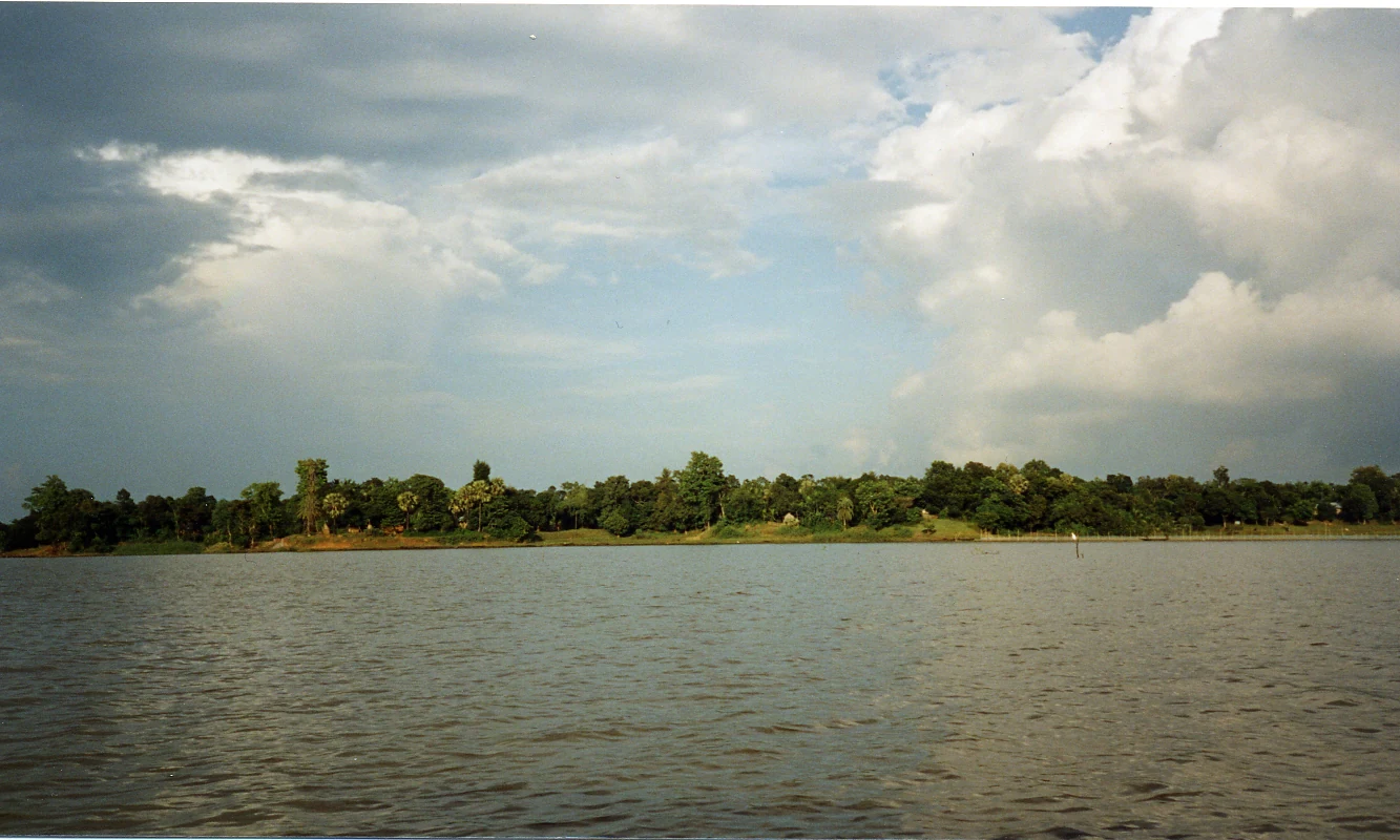
A wide view of a calm lake with a dense tree-lined shoreline in the distance under a partly cloudy sky.
A view across the waters of Rudrasagar Lake.

Rudrasagar Lake history and protected-area timeline

Rudrasagar's modern history is defined less by ancient narrative and more by its recognition as a formally protected wetland over the course of the twenty-first century. The Government of India, through its Ministry of Environment, Forest and Climate Change, identified the lake as one of the country's Wetlands of National Importance on the basis of its biodiversity and socioeconomic significance. Building on this national recognition, the lake was officially designated as a Ramsar Wetland of international importance on 8 November 2005, under reference number 1572.

The formal communication of the Ramsar designation to Indian authorities by the secretary general of the Ramsar Convention was relayed by the Ministry of Environment and Forests on 29 February 2007, marking Rudrasagar's formal entry into the global network of internationally important wetlands. Throughout this period, the lake has also been catalogued as an Important Bird Area, reflecting its long-standing role as a wintering ground for waterfowl species.

The lake's cultural history is closely tied to the construction of Neermahal, the Water Palace, on its northeastern shore. The palace was commissioned by the reigning king of Tripura, Maharaja Bir Bikram Kishore Manikya Bahadur, and built between 1935 and 1938 as a summer retreat. Neermahal remains the most visible historical landmark associated with Rudrasagar and continues to define the cultural context of the lake for visitors and researchers alike.

Equally important in the lake's history is the long-running pattern of habitat change. Local accounts and conservation assessments indicate that Rudrasagar's surface extent was once close to 1,000 hectares before 1950, but has since contracted dramatically. Siltation driven by catchment erosion, deforestation, expanding agriculture and settlement, and recurring monsoon flooding has contributed to a substantial reduction in area, framing much of the modern conservation concern around the lake.

Rudrasagar Lake landscape and geographic character

The physical setting of Rudrasagar Lake is shaped by the low-relief topography of western Tripura and the dynamics of a sediment-fed freshwater basin. The lake itself occupies a roughly 5.3-square-kilometer surface area within the Melaghar block of Sonamura sub-division. Its shoreline lies among gentle sedimentary hillocks formed from soft rock, giving the surrounding catchment a soft, undulating character rather than a sharply mountainous backdrop.

Water depth within the lake varies considerably, generally between 2 and 9 meters depending on season and inflow, while broader water level fluctuations span 9 to 16 meters across the annual cycle. This seasonal swing reflects the heavy monsoon influence of the region and the lake's role as a natural sediment trap. The lake bed itself is composed of clay loam silt in its upper layers, transitioning to sand at depth, with no rocky substrate within at least the top 50 meters of sediment.

The downstream area of about 750 hectares experiences wide temperature variation, from roughly 37 to 50 degrees Celsius during the warmer months, while rainfall in the broader catchment follows the regional monsoon rhythm, with most precipitation falling between mid-May and mid-October. Together, these features describe a lowland freshwater lake in a monsoonal, sediment-rich landscape, framed by gentle hillocks and drained outward into the Gumati River system.

Rudrasagar Lake ecosystems, habitats, and plant life

Rudrasagar Lake functions ecologically as a productive lowland freshwater wetland set within a monsoonal catchment of northeastern India. Its silty clay loam soils, shifting water depths, and substantial seasonal fluctuation produce a mosaic of open water, fringing shallows, and adjacent lowland vegetation that supports a diverse community of aquatic and semi-aquatic life.

The lake's inflow regime, fed by three perennial streams, sustains a constant renewal of fresh water that keeps pollution levels low and helps maintain the basin's ecological character. This consistent hydrological input, combined with deep silt deposits that store nutrients, creates favorable conditions for both resident aquatic species and seasonal visitors. The wetland's productivity underpins both its biodiversity value and the socioeconomic activities, such as fishing and irrigation, that local communities depend on.

Rudrasagar's ecological identity is closely linked to its role in supporting migratory and wintering waterfowl. The lake's status as an Important Bird Area reflects the quality and extent of habitat available for waterbirds during the colder months, when many species move into the region. Beyond its bird importance, the surrounding catchment includes forested hillocks, agricultural margins, and rural settlement, creating a transition zone where aquatic, wetland, and terrestrial habitats overlap.

Rudrasagar Lake wildlife and species highlights

Rudrasagar Lake's most prominent wildlife value lies in its birdlife, particularly the waterfowl that congregate on its open water and fringing shallows each winter. The lake qualifies as an Important Bird Area precisely because of the scale and significance of these seasonal gatherings, which draw both common waterbirds and species of conservation concern.

Among the rarer species recorded at Rudrasagar are Baer's pochard, listed as endangered, and the ferruginous duck, classified as near-threatened. These records underline the lake's importance as a refuge for waterfowl that are under pressure elsewhere in their range, and they place Rudrasagar within a select set of wetlands contributing to broader species survival.

Beyond these headline species, Rudrasagar supports a broader winter waterbird community typical of large, shallow, monsoonal freshwater lakes, including various ducks, waders, and other waterfowl that depend on open water and emergent margins. The lake's aquaculture and fish resources also sustain local fishing activity, which forms part of the broader human, ecological, and economic relationship with the wetland.

Rudrasagar Lake conservation status and protection priorities

Rudrasagar Lake holds a layered conservation profile that combines national and international recognition with ongoing environmental pressures. On the formal side, the lake was declared one of India's Wetlands of National Importance for conservation and sustainable use by the Ministry of Environment, Forest and Climate Change, an acknowledgment of its biodiversity and socioeconomic value. This was followed by designation as a Ramsar Wetland of international importance on 8 November 2005, with the certificate of designation formally communicated by the Indian government in early 2007.

These designations position Rudrasagar within the broader framework of globally significant wetlands, alongside its parallel recognition as an Important Bird Area. The lake's importance to endangered and near-threatened waterfowl, including Baer's pochard and ferruginous duck, gives its conservation status a tangible species-level meaning, not just a formal designation.

At the same time, the lake faces substantial conservation challenges. Pollution pressures include agricultural runoff, untreated or inadequately treated domestic and industrial effluents, and the cultural practice of idol immersion during religious festivals, which contributes to metallic pollution. Eutrophication has been observed in the form of invasive water hyacinth proliferation and excessive algal growth, reducing aquatic biodiversity. The catchment itself is under pressure from deforestation, unplanned urbanization, and agricultural expansion, all of which accelerate soil erosion and silt deposition into the lake basin.

The cumulative effect of these pressures is reflected in dramatic changes to the lake's physical extent. The lake area has reportedly shrunk from close to 1,000 hectares prior to 1950 to a fraction of that size, driven by long-term siltation combined with catchment degradation and flood-driven disturbance. Conservation of Rudrasagar therefore requires not only formal designation but also integrated management of water quality, invasive species, catchment land use, and the cultural practices that shape inputs to the lake.

Rudrasagar Lake cultural meaning and human context

Rudrasagar Lake carries strong regional cultural significance in Tripura, anchored primarily by Neermahal, the Water Palace, which stands near the northeastern bank of the lake. Built between 1935 and 1938 by Maharaja Bir Bikram Kishore Manikya Bahadur, Neermahal was conceived as a summer residence and reflects the royal architectural traditions of the ruling dynasty of Tripura.

The lake also features in everyday cultural and economic life through local fishing, water use for irrigation, and shoreline settlement. Religious practices, including immersion of idols during specific festivals, are a recurring cultural activity around Rudrasagar, even as they contribute to metallic pollution and siltation. Together, these traditions place Rudrasagar at the intersection of natural and cultural landscapes, where royal heritage, contemporary livelihoods, and religious custom all shape the experience of the lake and frame its conservation challenges.

Top sights and standout views in Rudrasagar Lake

Rudrasagar Lake stands out as a Ramsar-listed freshwater wetland that combines internationally recognized ecological importance with one of northeastern India's most distinctive cultural landmarks morphology, the Neermahal Water Palace. Its dual identity as both a conservation site and a heritage location makes it unusual among Indian wetlands.

Ecologically, the lake is significant for its Important Bird Area status and its role as a wintering ground for endangered Baer's pochard and near-threatened ferruginous duck, while physically it reads as a classic sedimental reservoir sustained by perennial streams and monsoonal rainfall. Together, these qualities give Rudrasagar a profile that is simultaneously natural, hydrological, and cultural.

Best time to visit Rudrasagar Lake

The character of a visit to Rudrasagar Lake shifts significantly with the monsoonal rhythm of the region. The rainy season, roughly June through September, brings around 2,500 millimeters of annual rainfall concentrated in this period, punctuated by multiple flood peaks that dramatically raise water levels and can make shoreline areas less accessible, while also increasing silt-laden inflow into the lake.

The cooler, drier months outside the monsoon are typically the most rewarding window for birdwatching, as the lake hosts its major congregations of winter waterfowl. The downstream area experiences wide seasonal temperature variation, peaking well above 37 degrees Celsius during the warm months, so timing visits outside peak summer heat can make exploration of the lake and the Neermahal shoreline considerably more comfortable.

Monthly climate preview

Long-term temperature ranges and precipitation rhythm for Tripura

Rudrasagar Lake Climate Normals and Monthly Weather Patterns

Historical averages for Rudrasagar Lake record sustained monthly temperatures alongside pronounced shifts in daily precipitation from dry winter intervals to heavier summer rainfall. Examining the complete twelve-month climatology provides deeper analytical context on long-term meteorological patterns across the protected landscape.
Annual mean25 °C
17 °C29 °C
Jan17°
Feb21°
Mar26°
Apr29°
May29°
Jun28°
Jul28°
Aug28°
Sep27°
Oct26°
Nov22°
Dec19°
Warmest month
April

28.8 °C

Coolest month
January

17.5 °C

Wettest month
July

13.6 mm/day

Driest month
January

0.3 mm/day

Park location guide

Geography guide, regional context, and park location map for Rudrasagar Lake

Rudrasagar Lake park geography, regions, and map view in India

Understand where Rudrasagar Lake sits in India through a broader geographic reading of the surrounding landscape, nearby location context, and its mapped position within the national park landscape.

How Rudrasagar Lake fits into India

India is a South Asian country bordered by the Indian Ocean, Arabian Sea, and Bay of Bengal. It shares land borders with Pakistan, China, Nepal, Bhutan, Bangladesh, and Myanmar. The country has a population of over 1.4 billion people and operates as a federal parliamentary republic with its capital in New Delhi.

Wider geography shaping Rudrasagar Lake in India

India occupies the Indian subcontinent in South Asia, bordered by the Arabian Sea to the southwest, the Bay of Bengal to the southeast, and the Indian Ocean to the south. It shares land borders with Pakistan to the west, China, Nepal, and Bhutan to the north, and Bangladesh and Myanmar to the east. The territory also includes the Andaman and Nicobar Islands in the Indian Ocean.

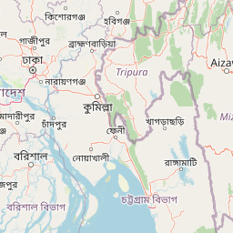
Map view of Rudrasagar Lake

Use this park location map to pinpoint Rudrasagar Lake in India, understand its exact geographic position, and read its mapped placement within the surrounding landscape more clearly.

Pigeon | © OpenStreetMap contributors

Location context for Rudrasagar Lake

Tripura

Visualizing wetland habitats, shoreline hillocks, and protected water palace heritage.

Rudrasagar Lake Photos and Landscape Scenery Explorer

Examine detailed visual documentation of Rudrasagar Lake to understand its unique freshwater basin, seasonal water fluctuations, and soft sedimentary terrain. Photographic records provide direct insight into wetland habitats, winter waterfowl congregations, and the surrounding monsoonal landscape character.

A wide view of a calm lake with a dense tree-lined shoreline in the distance under a partly cloudy sky.

Park atlas

Compare regional biodiversity, lowland catchments, and nearby conservation areas.

Explore Other Parks Near Rudrasagar Lake and Surrounding Protected Wetland Landscapes

Visitors exploring Rudrasagar Lake can examine other protected wetlands and regional nature reserves across the surrounding landscape. Comparing adjacent habitats provides deeper geographic context for monsoonal basins, sediment-fed water bodies, and avian sanctuaries.
National parkTripura
About 18 km away#1 closest

North

Clouded Leopard National Park: National Park Protected Area in Tripura's Forested Landscape

Mapped primate habitat and regional geography in Northeast India.

Clouded Leopard National Park serves as a critical protected area within Tripura, India, focusing on the conservation of its forest ecosystems and primate populations, including the Phayre's langur. As part of the larger Sepahijala Wildlife Sanctuary, its mapped boundaries contribute to the regional protected landscape. This national park offers valuable insight into the natural terrain and biodiversity specific to Northeast India, providing a unique geographic focus for atlas exploration.

Area
5.08 km²
Established
2007
IUCN
II
Climate
Tropical
National parkTripura
About 26 km away#2 closest

South

Rajbari National Park: National Park Protected Landscape within Tripura's Geography

Mapped terrain and protected land context for the region

Rajbari National Park is a significant protected area offering insight into the natural landscapes and geographic character of Tripura, India. This MoriAtlas detail page provides specific atlas-focused information, highlighting the park's identity as a national park and its placement within the broader regional geography. Explore the mapped context and protected boundaries that define this unique natural landscape.

Area
31.63 km²
Established
2007
Climate
Tropical
Scope
Terrestrial
National parkHabiganj District
About 70 km away#3 closest

North

Satchari National Park: Mapped Protected Landscape in Habiganj District

Discover regional geography and park boundaries.

Satchari National Park represents a significant protected area within Bangladesh, situated in Habiganj District. This entry focuses on its identity as a national park, detailing its geographic footprint and landscape context. Explore the mapped dimensions of this protected land to better understand its role in the regional atlas and its specific natural terrain.

Area
2.43 km²
Established
2005
IUCN
II
Relief
Highland
National parkChittagong District
About 101 km away#4 closest

South

Baroiyadhala National Park: A Vital Wildlife Corridor and Protected Forest Landscape in Bangladesh

Discover its terrain, mapped boundaries, and regional significance.

Baroiyadhala National Park, situated in Bangladesh's Chittagong District, stands as a critical national park dedicated to preserving forest ecosystems and functioning as an essential wildlife corridor. The park's undulating terrain and dense vegetation are vital for supporting threatened species and maintaining habitat connectivity. This page offers an atlas-style exploration of Baroiyadhala National Park, detailing its protected area status, geographic context within the Chittagong region, and its significance for conservation in South Asia, providing a rich understanding of its natural landscape.

Area
29.34 km²
Established
2010
IUCN
II
Climate
Tropical
National parkMoulvibazar District
About 102 km away#5 closest

Northeast

Lawachara National Park: Protected National Park Landscape in Moulvibazar District

Mapped Terrain and Endangered Primate Habitat Exploration

Delve into the protected landscape of Lawachara National Park, a key national park located in the distinct undulating terrain of Moulvibazar District, Bangladesh. This area is recognized for its ecological significance, particularly as a sanctuary for endangered primates, including the critically important western hoolock gibbon population. Users can explore the park's mapped boundaries, understand its semi-evergreen forest ecosystem, and appreciate its geological features like sandstone hillocks and sandy-bedded streams, making it a valuable point of discovery for regional geography and conservation landscapes.

Area
12.5 km²
Established
1996
IUCN
II
Relief
Upland
National parkBangladesh
About 114 km away#6 closest

Northwest

Bhawal National Park: Mapped Protected Landscape in Bangladesh

Explore its national park designation and regional geography.

Bhawal National Park represents a key protected landscape within Bangladesh. This entry provides detailed information on its identity as a national park, focusing on its mapped geography and protected area significance. Users can explore the park's specific context within the broader South Asian region, understanding its contribution to the nation's conserved natural areas and gaining insight into its landscape character through an atlas-driven perspective.

Area
50.22 km²
Established
1982
IUCN
IV
Relief
Lowland
National parkBhaluka Upazila
About 136 km away#7 closest

Northwest

Kadigarh National Park National Park: Protected Landscape Atlas and Geographic Overview

Understand Kadigarh National Park's mapped boundaries and regional geography.

Kadigarh National Park is a distinct national park recognized for its protected status within Bhaluka Upazila, Bangladesh. This entry offers an atlas-centric perspective, detailing the park's geographic boundaries and its contribution to the regional landscape. Examine the mapped extent of this protected area and understand its role within the surrounding natural geography, providing a factual basis for exploring its protected landscape identity.

Area
3.441 km²
Established
2010
Climate
Tropical
Access
Easy access
National parkRangamati District
About 143 km away#8 closest

Southeast

Kaptai National Park: Protected Landscape and Geographic Context in Rangamati District

Explore its mixed evergreen forest and lakeside terrain.

Kaptai National Park is a crucial protected area located in Bangladesh's Rangamati District, renowned for its mixed evergreen forests and unique position adjacent to Kaptai Lake. This detail page provides an atlas-oriented perspective on the park's geographic identity, mapped boundaries, and its role within the diverse Chittagong Hill Tracts region. Understand the terrain, from rolling hills to lakeside environments, and appreciate its conservation significance as a national park.

Area
54.64 km²
Established
1999
IUCN
II
Climate
Subtropical

Common questions about visiting, size, designation, and location context for Rudrasagar Lake

Rudrasagar Lake FAQs for park facts, access, geography, and protected area context

Find quick answers about Rudrasagar Lake, including protected-area facts, park geography, trail and visitor context, and how the park fits into its surrounding country and regional landscape.
MoriAtlas Explorer

Continue Your Protected Areas Search Across the Global Atlas

Deepen your exploration by continuing the structured search for national parks and protected areas worldwide. Utilize the comprehensive filtering capabilities to compare different conservation landscapes and refine your understanding of global park geography. Discover more about the distribution and characteristics of protected natural areas.

Global natural geography