Mori Atlas logo
National parkSamursky National Park

Discover the protected landscape and regional setting of Samursky National Park.

Samursky National Park: National Park Mapping and Geographic Context in Dagestan

(National Park Samursky)

Samursky National Park is a designated national park situated within the diverse federal subject of Dagestan, Russia. This page provides an atlas-driven perspective on the park, detailing its geographic boundaries and its role as a protected landscape within the broader context of the North Caucasus region. Explore the mapped terrain and understand how Samursky National Park contributes to the unique geography of Dagestan.

National ParksLiana ForestsCaspian CoastCaucasus MountainsWetland ReservesBirdwatching

Samursky National Park

National park

Park overview

Structured park overview, official facts, and landscape profile for Samursky National Park

Samursky National Park park facts, protected area profile, and essential visitor context
Review the core facts for Samursky National Park, including designation, size, terrain, visitor scale, habitats, and operating context in one park-focused overview.

About Samursky National Park

Samursky National Park occupies a remarkable geographic position at the interface between the Caspian Sea basin and the Greater Caucasus mountain range in southern Dagestan. The park's dual-sector design reflects the dramatic ecological transition from lowland delta to high mountain that occurs along this stretch of Russia's southern border. The coastal delta sector encompasses approximately 10,134 hectares of the Samur River floodplain, where shifting river channels, coastal lagoons, spring streams, and beaches create a complex wetland mosaic. This area lies in the Derbentsky and Magaramkentsky Districts, directly adjacent to the Azerbaijan border. The larger mountain sector, covering 38,139 hectares, occupies the northern slopes of the Caucasus in the Dokuzparinsky and Akhtynsky Districts, incorporating the Bazardyuzi-Shalbuzdag highlands. The park's southern boundary also marks the frontier between Russia and Azerbaijan. Beyond the terrestrial territory, the park protects a strip of shallow Caspian Sea waters adjacent to the delta, extending the protected zone into the marine environment. The establishment of Samursky National Park in 2019 marked an important addition to Russia's protected area network, particularly for preserving the country's rare subtropical forest elements and the ecological corridor that connects lowland wetlands to alpine terrain.

Quick facts and research context for Samursky National Park

Samursky National Park covers 48,273 hectares in southeastern Dagestan, Russia, spanning from the Samur River delta on the Caspian coast to alpine peaks exceeding 4,400 meters. The park is divided into a coastal delta sector and a mountainous sector known as Shalbuzdag, with Mount Bazardüzü reaching 4,466 meters as the highest point. The delta sector contains Russia's only extensive liana forest, while the mountain sector features alpine meadows, scree fields, and glaciers above 3,000 meters. Over 1,000 vascular plant species have been recorded across the park, and more than 300 bird species have been observed, representing 38 percent of all bird species known in Russia.

Park context

Deeper park guide and search-rich context for Samursky National Park

Samursky National Park history, landscape, wildlife, and travel context
Explore Samursky National Park through its history, landscape character, ecosystems, wildlife, conservation priorities, cultural context, and seasonal travel timing in a structured park guide built for atlas discovery and search intent.

Why Samursky National Park stands out

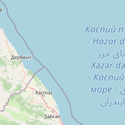
Samursky National Park is distinguished primarily for protecting Russia's unique liana forest ecosystem, a rare temperate-subtropical woodland type found nowhere else in the country. The Samur delta supports dense forests of English oak, common hornbeam, white poplar, alder, and white willow intertwined with extensive vine systems. The park also encompasses Mount Bazardüzü and the southernmost extreme point in Russian territory, making it a place where Caspian coastal lowlands meet Caucasian alpine peaks within a single protected boundary. The bird diversity is exceptional, with the delta serving as a critical wintering area for waterfowl and supporting nesting populations for over 130 species.

Samursky National Park history and protected-area timeline

Samursky National Park was officially established on December 25, 2019, making it one of Russia's more recently created national parks. The park's creation reflected a growing recognition of the ecological significance of Dagestan's southern frontier, where unique forest ecosystems and important bird habitats had long been under pressure from agricultural development and logging. Prior to national park designation, the Samur delta forests and surrounding landscapes existed in a less protected status, with various regional land-use designations that did not provide the comprehensive conservation framework that a national park affords. The selection of this area for national park status followed systematic surveys of the region's biodiversity, particularly documentation of the liana forest's extent and the exceptional bird species count. The park's establishment also aligned with broader Russian conservation policy aims to expand protected area coverage in ecologically significant but under-protected regions. The mountainous sector's inclusion reflected goals to preserve complete altitudinal ecological gradients from sea level to alpine summits, a conservation principle that ensures representation of diverse habitats within a single protected area.

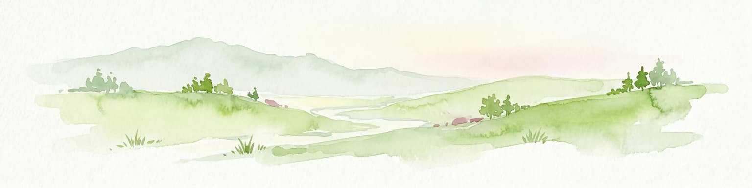
Samursky National Park landscape and geographic character

The landscape of Samursky National Park presents two contrasting faces within one protected boundary. The delta sector features flat, low-lying terrain characteristic of river floodplains entering the Caspian. The Samur River delta consists of ever-shifting branches, seasonal streams, coastal lakes, sheltered lagoons, and narrow beaches where the river meets the sea. The wetland character is pronounced, with water channels threading through forested areas and creating a landscape of islands, marshes, and seasonally flooded zones. The liana forest itself creates a distinctive visual character, with vines draped between tree canopies creating a layered, almost tropical appearance unusual in Russian vegetation. In contrast, the mountain sector displays the dramatic relief of the Greater Caucasus. The Shalbuzdag highlands feature steep-sided valleys, sharp ridgelines, and massive peaks. Mount Bazardüzü and Mount Shalbuzdag rise to over 4,000 meters, their upper slopes bare rock and talus. Between approximately 3,000 and 4,000 meters, alpine and subalpine steppe meadows occupy the terrain, while below this elevation the landscape transitions through forest zones before reaching the delta plain. The visual contrast between the verdant coastal forest and the stark alpine peaks defines the park's striking landscape diversity.

Samursky National Park ecosystems, habitats, and plant life

The ecological character of Samursky National Park is defined by the meeting of two major biomes within a compact protected area. The delta sector lies at the eastern edge of the Caucasus mixed forests ecoregion, but its position near the Caspian and the influence of warm air masses from the south give it a distinctly subtropical character. The liana forest represents the most significant ecological feature, consisting of temperate tree species draped in extensive vine systems that create multiple canopy layers. Over 500 vascular plant species have been documented in the delta alone, while the park as a whole supports more than 1,000 plant species. The dominant tree species include English oak, common hornbeam, white poplar, alder, and white willow, forming a diverse hardwood forest. The altitudinal gradient in the mountain sector creates ecological zonation from forest through subalpine meadow to alpine scree and glacier. The climate classification for the delta is humid subtropical with warm summers, no month averaging below freezing, and precipitation distributed relatively evenly throughout the year. This climate supports the liana forest's existence far north of typical subtropical zones.

Samursky National Park wildlife and species highlights

The wildlife profile of Samursky National Park is exceptional, particularly for avian diversity. More than 300 bird species have been recorded within the park, a remarkable figure representing 38 percent of all bird species known throughout Russia. The Samur delta functions as a critically important wintering area for waterfowl and near-water bird species, providing sheltered wetland habitat when cold temperatures freeze northern breeding grounds. At least 130 bird species are confirmed to nest within the park, indicating successful breeding populations for both resident and migratory species. The combination of wetland habitat in the delta, forest cover, and alpine terrain creates diverse ecological niches supporting this extraordinary bird community. The mammalian and other faunal communities are less extensively documented in available sources, but the varied habitats from wetland through forest to alpine support characteristic Caucasus species. The high-elevation zones provide habitat for mountain-adapted species, while the forests shelter typical European and Caucasus forest fauna.

Samursky National Park conservation status and protection priorities

Samursky National Park serves multiple conservation functions within Russia's protected area system. The primary conservation significance lies in preserving Russia's only extensive liana forest, a rare ecosystem type that exists in limited quantity anywhere in the country. This forest represents a distinct ecological community requiring specific protection to maintain its integrity. The park also maintains important bird habitat conservation values, with the delta serving as a key wintering ground and the overall area supporting more than 300 bird species, an exceptional concentration that warrants protection. The inclusion of the mountain sector ensures protection of complete altitudinal ecological gradients from sea level to alpine summits, following conservation principles that advocate for preserving entire ecosystem complexes rather than isolated habitats. The marine component, protecting near-shore Caspian waters, extends conservation into the coastal zone. The IUCN category II designation reflects the national park's dual function of ecosystem conservation and compatible public use, though the primary conservation focus remains on maintaining ecological integrity across the diverse habitats represented.

Samursky National Park cultural meaning and human context

The cultural context of Samursky National Park relates to its position in southern Dagestan, a region of complex ethnic composition and historical significance at the crossroads of Europe and Asia. The park lies in an area adjacent to the Azerbaijan border, where the Samur River has historically marked a boundary zone between different regional populations. The city of Derbent, identified as the nearest major settlement, is one of the oldest continuously inhabited cities in the world with a rich historical heritage dating back to ancient times. The landscape has been shaped by centuries of human presence, though the specific cultural heritage within the park boundaries is less documented than at some other Russian protected areas. The mountainous sector lies within territories traditionally associated with local Dagestani peoples, and the park's establishment has implications for traditional land-use patterns. The region's position along historical trade routes and between cultural spheres has influenced the human history of these landscapes, though the primary focus of the national park remains on ecological conservation rather than cultural heritage preservation.

Top sights and standout views in Samursky National Park

The dual-landscape character of Samursky National Park, spanning from Caspian delta wetlands to Caucasian alpine summits, represents the park's most distinctive quality. The liana forest of the Samur delta is ecologically unique within Russia, offering a visual and biological character found nowhere else in the country. Mount Bazardüzü at 4,466 meters provides access to high-altitude terrain and the southernmost point of Russian territory. The extraordinary bird diversity, with over 300 species recorded in a single park, positions this area as a destination of particular interest for ornithological observation and study. The combination of forest, wetland, mountain, and marine environments within one protected area creates exceptional ecological diversity. The park's recent establishment in 2019 reflects ongoing expansion of Russia's protected area network into ecologically significant but previously under-protected regions.

Best time to visit Samursky National Park

The optimal time to visit Samursky National Park depends on the specific experience sought. For bird observation, the delta wetlands are most active during winter months when waterfowl congregate in significant numbers, though spring migration periods also offer excellent viewing opportunities as breeding species return. Summer months bring warm conditions to the delta sector and allow access to higher elevations in the mountain sector, though July and August may be quite hot in the lowland areas. The mountainous sector is best accessed during the short summer season when snow has melted from the access routes and trails, typically from July through September. Autumn offers pleasant conditions in the delta and can provide good wildlife viewing as species begin seasonal movements. Winter visits to the delta are possible but require preparation for cold, wet conditions, while the mountain sector is effectively inaccessible during winter months due to snow and harsh conditions.

Park location guide

Geography guide, regional context, and park location map for Samursky National Park

Samursky National Park park geography, regions, and map view in Russia
Understand where Samursky National Park sits in Russia through a broader geographic reading of the surrounding landscape, nearby location context, and its mapped position within the national park landscape.

How Samursky National Park fits into Russia

Russia is a transcontinental nation spanning eleven time zones, bordered by fourteen countries. It is the world's largest country by area, covering 17,098,246 km². Moscow is the capital and largest city, while Saint Petersburg is the second-largest and a major cultural centre.

Wider geography shaping Samursky National Park in Russia

Russia spans Eastern Europe and North Asia, covering 17,098,246 km². It shares land borders with fourteen countries, more than any other nation, and spans eleven time zones. The landscape includes vast plains, mountain ranges such as the Urals and Caucasus, and extensive coastlines along the Arctic Ocean, Pacific Ocean, Baltic Sea, Black Sea, and Caspian Sea.

Map view of Samursky National Park

Use this park location map to pinpoint Samursky National Park in Russia, understand its exact geographic position, and read its mapped placement within the surrounding landscape more clearly.

Pigeon | © OpenStreetMap contributors

Location context for Samursky National Park

Dagestan
Park atlas

Trace the geographic spread of protected areas surrounding Samursky National Park, comparing coastal liana forests with rugged Caucasus mountain parks.

Discover More Protected Areas Near Samursky National Park, Exploring Caucasus Landscapes and Caspian Delta Wetlands
Continue your exploration beyond Samursky National Park to browse other national parks and protected areas across the greater Caucasus region and Caspian Sea coastline. This structured atlas view allows you to compare diverse landscapes, from unique liana forests to alpine peaks, placing Samursky National Park within its broader conservation context.
National parkKhachmaz Rayon

Samur-Yalama National Park: Caspian Coastal Forest Protected Area

Mapped protected landscape in Azerbaijan's Khachmaz Rayon.

Delve into the protected geography of Samur-Yalama National Park, a key national park established in 2012 within Azerbaijan's Khachmaz Rayon. This 11,772-hectare area meticulously preserves vital Caspian coastal forest ecosystems, characterized by dominant chestnut oak and Persian ironwood stands. The park’s diverse terrain ranges from littoral zones to inland steppe, offering significant insights into regional landscape context and protected area management for atlas exploration and geographic analysis.

Area
117.72 km²
Established
2012
Relief
Mixed relief
Scope
Mixed
Watercolor painting of layered mountains with green, yellow, and pink hues.
National parkAzerbaijan

Shahdag National Park: Azerbaijan's Largest National Park and Highest Mountain Landscape

Explore the Greater Caucasus protected area and its unique ecosystems.

Shahdag National Park is the largest protected area in Azerbaijan, encompassing a significant portion of the Greater Caucasus mountain range. This national park is renowned for its dramatic elevation changes, creating diverse ecosystems that transition from dense, old-growth montane forests to high-alpine meadows and rugged, rocky summits. The park's landscape is defined by its towering peaks, including Mount Bazardüzü, the nation's highest point, and provides critical habitat for endemic species like the East Caucasian tur. Use this page to begin your atlas-based exploration of Shahdag National Park's protected geography and its distinctive natural terrain.

Area
1,305.08 km²
Established
2006
Relief
Mountain
Scope
Terrestrial
National parkAzerbaijan

Altyaghach National Park: Azerbaijan's Protected Natural Area & Forested Geography

Explore the mapped boundaries and temperate deciduous forests.

Altyaghach National Park is a key protected area in Azerbaijan, safeguarding a significant portion of the Greater Caucasus's temperate deciduous broadleaved forest ecosystems. Covering over 11,000 hectares, the park is instrumental in preserving biodiversity and restoring natural habitats, notably providing refuge for the rare East Caucasian tur and other protected species. Its landscape, characterized by rolling to steep terrain and diverse forest cover reaching approximately 941 meters in elevation, makes it a representative example of Caucasus mountain conservation within the country.

Area
110.35 km²
Established
2004
Relief
Mixed relief
Climate
Temperate
Watercolor painting showing green hills, a river, and distant purple and orange mountains
National parkDedoplistsqaro Municipality

Vashlovani National Park: Georgia's Unique Lowland Desert and Badland Protected Landscape

Discover distinct semi-arid terrain and rare forest ecosystems.

Vashlovani National Park in Dedoplistsqaro Municipality represents a significant protected area preserving Georgia's rare lowland desert and semi-arid steppe ecosystems. This national park is characterized by its striking badland topography, known as the "Sharp Walls," wild pistachio forests, and riparian habitats along the Alazani River. Its unique geographic setting, far removed from Georgia's typical mountainous landscapes, makes Vashlovani a crucial site for understanding regional biodiversity and conservation within the Caucasus.

Area
442.51 km²
Established
1935
IUCN
II
Relief
Lowland
National parkAzerbaijan

Ag-Gel National Park

Azerbaijan Protected Wetland & Bird Sanctuary

Ag-Gel National Park is a protected wetland significant for migratory birds. Its landscape features a complex lake system and extensive reed beds, making it a vital conservation area in the Caspian region.

Area
179.24 km²
Established
2003
Relief
Lowland
Climate
Arid
Watercolor painting of rolling hills, a body of water, and vegetation
National parkBaku

Absheron National Park: Coastal Azerbaijan National Park with Caspian Seal Habitats

Explore mapped geography and semi-desert terrain near Baku.

Absheron National Park, located near Baku on the Absheron Peninsula, is a significant national park safeguarding coastal Caspian Sea environments. Its protected landscapes feature semi-arid terrain and are vital for the conservation of Caspian seals and migratory waterbirds. MoriAtlas provides a structured overview of this unique protected area, focusing on its geographic features, ecological importance, and its role as a key national park within Azerbaijan's atlas of natural reserves.

Area
7.83 km²
Established
2005
Relief
Lowland
Climate
Arid
National parkAzerbaijan

Göygöl National Park: Iconic Alpine Lakes and Protected Caucasus Forest Landscape

Explore Azerbaijan's most visited national park and its rich geographic context.

Göygöl National Park is a key protected area in Azerbaijan, renowned for the crystal-clear alpine Lake Göygöl and its surrounding dense forests within the Lesser Caucasus mountains. This national park showcases over 420 plant species, significant wildlife populations, and dramatic mountainous terrain, making it a prime destination for understanding regional landscape diversity and protected land value. Use MoriAtlas to explore its mapped boundaries and connect it to the broader geographic context of Azerbaijan.

Area
127.55 km²
Established
2008
Relief
Mountain
Climate
Temperate
National parkGeorgia

Tusheti National Park National Park: Geographic Exploration of Caucasus Protected Landscapes

Mapped protected area boundaries and alpine terrain in Georgia.

Tusheti National Park offers a deep dive into the rugged geography of the Greater Caucasus. This national park, situated in a remote corner of Georgia, protects a dramatic landscape characterized by high mountain ridges, glacial valleys, and diverse ecosystems. The park's mapped boundaries encompass significant alpine terrain, providing essential habitat and serving as a critical area for understanding regional protected land distribution and landscape context. Explore the unique geographic identity of Tusheti National Park.

Area
1,276.43 km²
Established
2003
IUCN
II
Relief
Mountain

Common questions about visiting, size, designation, and location context for Samursky National Park

Samursky National Park FAQs for park facts, access, geography, and protected area context
Find quick answers about Samursky National Park, including protected-area facts, park geography, trail and visitor context, and how the park fits into its surrounding country and regional landscape.
MoriAtlas Explorer

Continue Your Protected Areas Search Across the Global Atlas

Deepen your exploration by continuing the structured search for national parks and protected areas worldwide. Utilize the comprehensive filtering capabilities to compare different conservation landscapes and refine your understanding of global park geography. Discover more about the distribution and characteristics of protected natural areas.

Global natural geography