Mori Atlas logo
Nearby park discovery

Geographic mapping of nearby wilderness, alpine terrain, and protected mountain regions.

Parks and Protected Landscapes Surrounding San Juan National Forest in Colorado

Explore the regional geography of the Southern Rockies through a mapped collection of protected areas near San Juan National Forest. This dataset provides spatial context for surrounding wilderness areas, high-alpine zones, and diverse canyon terrains across the Colorado landscape. Visualize the distribution of preserved lands and river valleys that characterize the geographic footprint of this mountain region.

Related tags

national forestSan Juan MountainsSouthern RockiesColoradowilderness areas

A vast Southern Rockies national forest covering most of the western slope of Colorado's San Juan Mountains.

San Juan National Forest

San Juan National Forest is a large U.S. National Forest in western Colorado, covering more than 1.8 million acres across ten counties from Durango and Pagosa Springs south toward the New Mexico border. The forest encompasses most of the southern portion of the San Juan Mountains west of the Continental Divide, an alpine and subalpine landscape of high peaks, deep canyons, dense conifer forests, broad mesa country, and the headwaters of several major river systems. Its scale and ecological diversity make it one of the most significant national forests in the Southern Rockies, supporting large wilderness tracts, multiple wilderness areas, scenic byways, and a long history of human use from ancestral Puebloan sites to 19th-century mining boomtowns. The forest is administered by the U.S. Forest Service, with its headquarters in Durango and ranger districts in Bayfield, Dolores, and Pagosa Springs. Designated in 1905 by President Theodore Roosevelt, San Juan National Forest has long been recognized for its blend of rugged mountain scenery and accessible Southwestern Colorado landscapes. It borders the Uncompahgre National Forest to the north and the Rio Grande National Forest to the east, and its wilder corners include some of the most remote terrain in the lower 48 states. Although very large and heavily forested, San Juan National Forest is also known for cultural sites, alpine recreation, and the historic Durango and Silverton Narrow Gauge Railroad, whose route threads through the heart of the forest. The forest has also gained modern recognition through national monument designations at Chimney Rock, preserving ancestral Puebloan archaeological landscapes that complement the surrounding natural environment.

Location
United States of America
Park type
Protected landscape
Established
1905
Area
7,603.4 km²
San Juan National Forest Geography
Regional park map

See the ranked park cluster in its geographic setting

Nearby parks around San Juan National Forest

This regional map shows the same 20 nearby parks ranked below around San Juan National Forest. Select a ranked marker to highlight that park’s boundary where boundary data is available.
Reference park: San Juan National ForestRanked nearby parkSelected boundary: San Juan National Forest20 nearby parks shown
20 nearby parks

Ranked regional park geography and surrounding protected landscapes

Parks and protected areas geographically near San Juan National Forest

Spatial proximity measurements establish a ranked sequence of protected areas surrounding San Juan National Forest based on direct boundary separation. Evaluating these neighboring locations highlights broader regional conservation patterns and diverse terrain variations across the surrounding territory.
Wildlife reserveColorado
Park boundaries overlap#1 closest

Northwest

Lizard Head Wilderness: Mapping the San Juan Mountains Protected Alpine Terrain

High elevation geography and volcanic wilderness in Colorado

Lizard Head Wilderness is a federally protected area in southwestern Colorado characterized by steep ridgelines, dramatic volcanic geology, and alpine basins. It protects a rugged mountain landscape featuring the iconic Lizard Head spire and a cluster of high-elevation peaks including Mount Wilson, El Diente Peak, and Wilson Peak. The area offers a significant study in remote high-mountain geography and watershed protection within the San Juan range.

Area
167.17 km²
Established
1980
IUCN
Ib
Relief
Mountain
Watercolor painting of soft, layered mountain ranges behind green hills and patches of evergreen trees on a white background.
Protected landscapeColorado
Park boundaries overlap#2 closest

East

Rio Grande National Forest: Atlas and Geographic Profile of a Southern Colorado Landscape

Watershed geography and Continental Divide terrain analysis.

Rio Grande National Forest represents an immense protected landscape encompassing diverse terrain from high desert steppe to rugged alpine peaks. This profile details the forest's hydrological significance as the source of the Rio Grande and its role as a massive ecological transition zone in the Mountain West. Examine the boundaries and mountain geography that define this critical protected area.

Area
7,500 km²
Established
1908
Relief
Mountain
Climate
Boreal
Protected landscapeColorado
About 9.4 km away#3 closest

North

Uncompahgre National Forest: Protected Landscapes and Geographic Features in Colorado

Mapping the arid plateau and high-country San Juan wilderness zones.

Uncompahgre National Forest represents a vast protected area in the American West, spanning iconic landscapes from the dry, pinyon-juniper covered Uncompahgre Plateau to the dramatic, jagged ridges of the northern San Juan Mountains. This atlas entry provides essential context on its alpine wilderness designations, high-country topography, and the unique geological transitions that define its status as a critical Colorado resource for regional landscape analysis.

Area
3,865.68 km²
Established
1905
Relief
Mountain
Climate
Alpine
National parkMontezuma County
10 km away#4 closest

Southwest

Mesa Verde National Park: Protected Landscape Atlas and Geographic Identity

Discover the mapped terrain and regional context of this national park.

Mesa Verde National Park serves as a critical protected landscape within Montezuma County, offering distinct insights into regional geography and mapped terrain. This entry details the park's identity as a National Park, emphasizing its geographic setting and providing a foundation for atlas-driven exploration. Understand the park's place within the broader landscape context and its significance as a mapped protected area, ideal for focused geographic study.

Area
212.4 km²
Established
1906
IUCN
II
Visitors
463.1K annual
Watercolor painting of a mountain landscape with light green rolling hills in the midground and pale, soft-toned mountain peaks in the background.
Protected areaColorado
11 km away#5 closest

North

Mount Sneffels Wilderness: Mapping the High Alpine Terrain of the San Juan Mountains

Protected mountain geography in southwestern Colorado

Mount Sneffels Wilderness protects a dramatic cluster of peaks in the San Juan range, characterized by glacial cirques, expansive talus fields, and sharp ridgelines. As a vital component of the Colorado backcountry, this area provides a window into high-altitude ecological transition zones, from dense conifer forests to exposed granite summits that define the character of the Uncompahgre National Forest.

Area
67.04 km²
Established
1980
IUCN
Ib
Relief
Mountain
A pale watercolor painting showing a panoramic view of mountain ranges in the background, a coniferous forest on a small hill, and a meadow with wildflowers in the foreground.
Wildlife reserveColorado
28 km away#6 closest

Northeast

La Garita Wilderness: Exploring the High Alpine Geography of Southern Colorado

Volcanic terrain and protected mountain wilderness atlas

La Garita Wilderness serves as a primary example of protected high-alpine geography in southern Colorado. This atlas entry examines the undulating volcanic ridges, glacial cirques, and alpine basins that define the area, including the prominent peak of San Luis. It highlights the integration of significant trail systems within this protected landscape, offering a clear perspective on the physical geography and conservation value of the La Garita mountain range.

Area
524.58 km²
Established
1964
IUCN
Ib
Relief
Mountain
A horizontal watercolor painting depicting soft green rolling hills and distant mountains under a white sky.
Wildlife reserveColorado
38 km away#7 closest

Northeast

Powderhorn Wilderness: A High-Elevation Protected Landscape in the San Juan Mountains

Basaltic plateaus and vast alpine tundra in Colorado

Powderhorn Wilderness protects a distinct highland environment in southwestern Colorado. Characterized by dark basaltic caprocks and deep glacial cirques, this area serves as a critical headwaters system for the Gunnison River, supporting a complex transition from sagebrush steppe to subalpine forest and wind-swept tundra. The geography remains largely defined by its volcanic heritage and the primitive character of its remote plateau summits.

Area
251.1 km²
Established
1993
IUCN
Ib
Relief
Mountain
A watercolor painting showing a panoramic view of rolling green mountains with a winding stream through a forested valley.
Protected landscapeUtah
50 km away#8 closest

Northwest

Manti, La Sal National Forest: Geographic Overview of Utah's Mountain and Canyon Landscapes

Mapped protected forest boundaries across the Colorado Plateau

Spanning over one million acres, Manti, La Sal National Forest defines a critical segment of Utah geography. This protected landscape encompasses diverse terrain including subalpine mountains, aspen-rich uplands, and deep canyon networks. Use this atlas to examine the distinct environmental characteristics that separate the northern forested plateaus from the southern wilderness canyons.

Area
5,143.09 km²
Established
1950
IUCN
V
Visitors
900K annual
Watercolor painting of a gentle, rolling landscape with a small stream, a small waterfall, and scattered trees under a soft, light sky.
Protected landscapeNew Mexico
58 km away#9 closest

Southeast

Santa Fe National Forest: Geographic Atlas and Protected Landscape Overview

New Mexico mountain geography and wilderness mapping

Santa Fe National Forest spans more than 1.5 million acres of Northern New Mexico, featuring a dramatic transition from canyon river systems to the high elevations of the Pecos Wilderness. This protected landscape contains a complex network of forest districts across the Jemez and Sangre de Cristo Mountains, defined by volcanic plateaus, alpine basins, and seasonal aspen forests. Use this resource to understand the park boundaries, regional mountain geography, and the interconnected nature of these protected lands.

Area
6,306.83 km²
Established
1915
Relief
Mountain
Access
Easy access
National parkMontrose County
67 km away#10 closest

North

Black Canyon of the Gunnison National Park: Protected Area Geography and Mapped Landscape

Explore the natural terrain and protected boundaries in Montrose County.

Black Canyon of the Gunnison National Park is a national park defined by its profound geological features and its status as a protected landscape. Located within Montrose County, it offers a distinct geographic profile for atlas-based exploration. Users can understand the park's mapped boundaries, its relation to the surrounding regional geography, and the unique natural terrain that defines this protected area, contributing to a structured discovery of its natural landscape identity.

Area
124.4 km²
Established
1999
IUCN
II
Visitors
357.1K annual
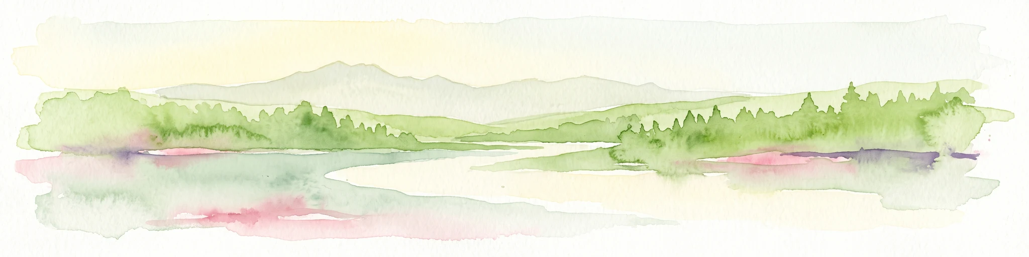
A minimalist watercolor illustration showing soft green hills, purple mountains in the background, and a reflective water body in the foreground.
Protected areaColorado
About 69 km away#11 closest

North

Curecanti National Recreation Area: Mapped Geography and Protected Landscapes of Western Colorado

River-based recreation and volcanic canyon terrain

Curecanti National Recreation Area stretches across Gunnison and Montrose counties, serving as a primary water-based protected landscape in Colorado. The area preserves the geologic transitions from the broad expanse of Blue Mesa Reservoir to the granite-walled canyons of Morrow Point and Crystal, offering a deep look into the regional geography and historical infrastructure of the Gunnison basin.

Area
174.4 km²
Established
1965
Visitors
807.1K annual
Relief
Mountain
National parkUtah
76 km away#12 closest

West

Canyonlands National Park: A Mapped Protected Landscape in Utah's Geography

Explore its vast geography and protected area boundaries.

Canyonlands National Park stands as a significant protected entity within the state of Utah, characterized by its immense scale and dramatic geological formations. This page facilitates an atlas-style exploration of its terrain, emphasizing its mapped boundaries and its crucial role as a protected landscape. Gain a deeper appreciation for its unique geographic setting and its place within the broader regional context.

Area
1,366.21 km²
Established
1964
IUCN
II
Visitors
818.5K annual
Wildlife reserveColorado
86 km away#13 closest

Northwest

Dominguez Canyon Wilderness: Protected Sandstone Canyons of the Uncompahgre Plateau

An expansive BLM wilderness area in western Colorado.

Dominguez Canyon Wilderness protects a diverse landscape of sandstone cliffs, benches, and deep drainage systems that descend from the Uncompahgre Plateau. The geography spans high-desert mesa tops and lush riparian canyons, offering a significant protected area within the Dominguez-Escalante National Conservation Area framework.

Area
268.2 km²
Established
2009
IUCN
Ib
Relief
Upland
A horizontal watercolor illustration depicting soft layers of green rolling hills, a band of trees, and distant pinkish mountain peaks against a white background.
Protected landscapeColorado
About 98 km away#14 closest

North

Gunnison National Forest: Atlas and Geographic Overview of a Colorado Protected Landscape

Mapping deep wilderness areas and high mountain watersheds

Spanning over one million acres in western Colorado, this protected landscape features dramatic glaciated valleys, subalpine meadows, and iconic volcanic features. The forest anchors the Gunnison River headwaters and offers significant insights into the ecological structure of the Southern Rocky Mountains and its dense concentration of wilderness zones.

Area
6,766.89 km²
Established
1905
Relief
Mountain
Climate
Alpine
National parkUtah
102 km away#15 closest

Northwest

Arches National Park: Utah National Park Protected Landscape Exploration

Explore mapped terrain and geographic context.

Delve into the specifics of Arches National Park, a protected national park located in Utah. This atlas-focused entry provides detailed insight into the park's protected landscape features and geographic distribution. Understand the mapped park boundaries and the unique natural terrain that shapes this significant conservation area within the United States' broader regional geography.

Area
310.31 km²
Established
1971
IUCN
II
Visitors
1.5M annual
Watercolor painting of a serene mountain landscape featuring rolling hills, coniferous trees, and a lake in the foreground, rendered in light pastel tones.
Protected landscapeColorado
103 km away#16 closest

East

San Isabel National Forest: Geographic Overview and Protected Mountain Landscape Atlas

Central Colorado alpine terrain and designated wilderness areas

Spanning eleven counties in central Colorado, San Isabel National Forest serves as a cornerstone of the Southern Rocky Mountains. The forest landscape is dominated by the Sawatch and Sangre de Cristo ranges, offering a unique atlas of alpine tundra, dense coniferous forests, and high-altitude peaks that define the character of the region. This protected area provides a vital habitat and a vast, rugged environment characterized by volcanic formations like the Spanish Peaks and glacial geological features.

Area
4,533.42 km²
Established
1902
Relief
Mountain
Climate
Alpine
A soft watercolor illustration depicting a flat-topped mountain landscape with a line of trees and a foreground meadow.
Protected landscapeColorado
104 km away#17 closest

North

Grand Mesa National Forest: A Comprehensive Atlas of Colorado High-Plateau Geography

Mapping the basalt-capped flat-top mountain terrain

Grand Mesa National Forest stands as a primary protected landscape within the Colorado Rockies, characterized by its signature basalt-capped plateau. This forest unit serves as a vital geographic landmark, offering unique insights into high-altitude mountain terrain, subalpine water systems, and historical forest conservation. Learn about the boundaries and physical landscape features that define this massive elevated tableland above the surrounding dry valleys.

Area
1,402.46 km²
Established
1892
Relief
Highland
Climate
Alpine
Watercolor painting of a green forest, calm water, and distant mountain silhouettes against a light sky.
Wildlife reserveNew Mexico
104 km away#18 closest

Southeast

Latir Peak Wilderness: Mapped Geography of the Sangre de Cristo Mountains

High-elevation wilderness reserves in northern New Mexico

Latir Peak Wilderness presents a distinct vertical landscape within the northern Sangre de Cristo Mountains. This protected area features a unique combination of high-altitude summits, rounded alpine mesas, and cold-water trout habitats. Mapped terrain includes the significant Lake Fork of Cabresto Creek drainage and dense conifer forests that define this 20,506-acre wilderness unit.

Area
82.98 km²
Established
1980
IUCN
Ib
Relief
Mountain
National parkColorado
About 106 km away#19 closest

East

Great Sand Dunes National Park and Preserve: Colorado's Unique Mapped Landscape

Explore the natural terrain and protected boundaries.

Great Sand Dunes National Park and Preserve offers a unique protected landscape within Colorado, characterized by its distinct natural terrain and extensive dune fields. This destination provides valuable context for atlas exploration, detailing the park's mapped boundaries and its specific geographic setting. Understand its significance as a protected area and appreciate the unique natural features that define its landscape for a richer geographic discovery.

Area
603.1 km²
Established
2004
IUCN
V
Visitors
432.5K annual
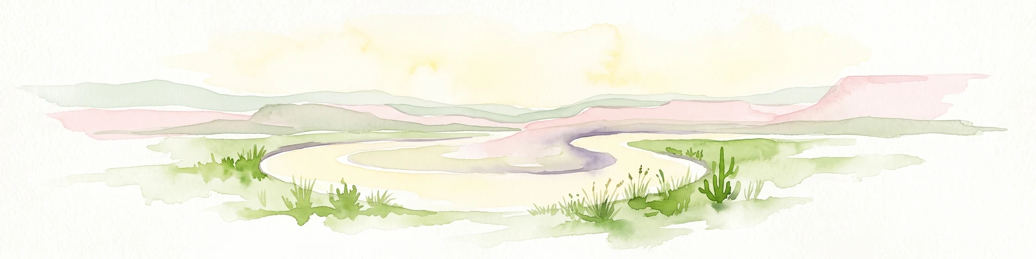
A horizontal watercolor painting showing a soft-focus landscape with a pale river winding through desert terrain under a hazy sky, with stylized cacti in the foreground.
Protected landscapeUnited States of America
107 km away#20 closest

West

Glen Canyon National Recreation Area: Protected Landscape and High Desert Geography Map

Colorado Plateau canyons, sandstone strata, and reservoir environments

Explore the geological architecture of Glen Canyon National Recreation Area, a vast federal protected landscape. The area showcases towering Navajo Sandstone cliffs, deep blue reservoir arms, and remote backcountry canyons that exemplify the distinct high desert terrain of the Colorado Plateau in the United States.

Area
5,075.23 km²
Established
1972
Visitors
5.2M annual
Relief
Upland
Distance methodology

Geographic measurements, not driving distances

How nearby park distances are calculated

Distances use park boundaries whenever the available geometry allows it. When one or both boundaries are missing, the mapped park locations provide a clearly labelled estimate. Every value represents straight-line geographic separation and does not use roads or routing.

Boundary distance

Calculated between the nearest points of both park boundaries.

Location-to-boundary estimate

Estimated from one mapped park location to the nearest boundary of the other park.

Mapped-location estimate

Estimated between the mapped locations of both parks.

MoriAtlas Explorer

Examine the Mapped Landscapes and Geographic Boundaries of San Juan National Forest

Continue exploring the high-alpine terrain and diverse mountain ecosystems of San Juan National Forest. MoriAtlas provides a clear view of these protected boundaries, helping you understand the scale of one of the largest wilderness regions in Colorado and its significant role within the Southern Rockies geographic corridor.

Global natural geography