
Mori Atlas logo
National parkShuklaphanta National Park

Discover the mapped boundaries and regional geography of this significant national park.

Shuklaphanta National Park: Protected Landscape and Geographic Context in Sudurpashchim Province

Shuklaphanta National Park represents a vital protected area within Nepal's Sudurpashchim Province. This national park serves as a key geographic feature, offering insights into regional landscapes and conservation efforts. Our platform enables detailed exploration of Shuklaphanta National Park's mapped boundaries and its place within the broader natural geography, providing a structured understanding of this protected national park.

grassland ecosystemTerai lowlandsbarasingha conservationBengal florican habitattransboundary protected areawetland ecosystem
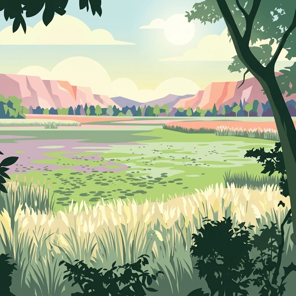
Stylized illustration showing tall grasses in the foreground, a body of water, green fields, and mountains under a partly cloudy sky

Shuklaphanta National Park

National park

Park overview

Structured park overview, official facts, and landscape profile for Shuklaphanta National Park

Shuklaphanta National Park park facts, protected area profile, and essential visitor context
Review the core facts for Shuklaphanta National Park, including designation, size, terrain, visitor scale, habitats, and operating context in one park-focused overview.

About Shuklaphanta National Park

Shuklaphanta National Park represents one of Nepal's most important lowland protected areas, spanning 305 square kilometers of diverse Terai habitat in the country's far-western region. The park's landscape is characterized by an extensive mosaic of grasslands, sal forests, riverine woodlands, and wetlands that create ideal conditions for a wide variety of flora and fauna. The elevation gradient from 174 meters in the river valleys to 1,386 meters in the Siwalik foothills contributes to habitat diversity, supporting species adapted to both the tropical lowlands and the sub-montane zones. The park's location along the Nepal-India border places it within a transboundary conservation landscape that facilitates seasonal wildlife movements across international boundaries. The Mahakali River forms a natural boundary along the western and southern edges, while the Syali River delineates the eastern extent. A wildlife corridor in the southern portion connects Shuklaphanta to Pilibhit Tiger Reserve in India, enabling species to migrate between the two protected areas. The park's history as a royal hunting ground before its formal protection reflects a transition from exclusive recreational use to inclusive conservation, with the reserve originally covering 155 square kilometers before expansion to its present extent in the late 1980s.

Quick facts and research context for Shuklaphanta National Park

Shuklaphanta National Park encompasses 305 square kilometers in Sudurpashchim Province, Nepal, at the far-western edge of the Terai belt. The protected area was originally designated as a wildlife reserve in 1973 and elevated to national park status in 2017. The park features the largest continuous grassland in Nepal, known as Shukla Phanta, which spans approximately 16 square kilometers. Annual rainfall averages 1,579 millimeters, with a subtropical monsoonal climate characterized by distinct wet and dry seasons. A buffer zone of 243.5 square kilometers was added in 2004, providing additional ecological connectivity. The park contains over 700 floral species, 456 bird species, 56 reptile species, and 15 amphibian species, making it one of Nepal's most biodiverse lowland protected areas.

Park context

Deeper park guide and search-rich context for Shuklaphanta National Park

Shuklaphanta National Park history, landscape, wildlife, and travel context
Explore Shuklaphanta National Park through its history, landscape character, ecosystems, wildlife, conservation priorities, cultural context, and seasonal travel timing in a structured park guide built for atlas discovery and search intent.

Why Shuklaphanta National Park stands out

Shuklaphanta National Park is best known for harboring the world's largest population of barasingha (swamp deer), with approximately 1,674 individuals counted in 2007. The park's signature feature is the Shukla Phanta, the largest continuous grassland in Nepal, which forms the core habitat for this endangered cervid. The park also serves as a critical refuge for Bengal floricans,arge raptors, and waterfowl. Its position in the far-western Terai makes it an important corridor for wildlife migration between Nepal and India, connecting to Pilibhit Tiger Reserve through a southern wildlife corridor. The park supports significant populations of Indian rhinoceros, Asian elephants, and predators including tigers and leopards.
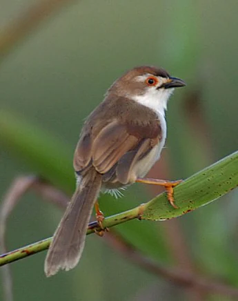
Small bird with brown upperparts, white underparts, and black facial markings perched on a green stem against a blurred green background
A Chrysomma sinense bird perched on a green stem in Shuklaphanta National Park

Shuklaphanta National Park history and protected-area timeline

The name Shuklaphanta derives from the grassland known as phanta within the protected area, with the main Shukla Phanta representing the largest continuous grassland in Nepal at approximately 16 square kilometers. The area served as an exclusive hunting ground for Nepal's ruling class before its formal protection, receiving royal designation as a hunting reserve in 1969. In 1973, the area was gazetted as the Royal Shuklaphanta Wildlife Reserve, initially covering 155 square kilometers. The reserve was expanded to its present size during the late 1980s through the incorporation of additional forest and grassland areas. A buffer zone encompassing 243.5 square kilometers was established in May 2004, providing a transitional zone between the core protected area and surrounding agricultural lands. In 2017, the status of the protected area was elevated from wildlife reserve to national park, reflecting both the ecological importance of the area and Nepal's evolving approach to protected area management. The park is governed by the Department of National Parks and Wildlife Conservation under the Ministry of Forests and Environment.

Shuklaphanta National Park landscape and geographic character

The physical landscape of Shuklaphanta National Park consists of a characteristic Terai topography shaped by alluvial processes and the foothills of the Siwalik range. The park occupies a floodplain environment with soils ranging from sandy loam to clay, exhibiting slight alkalinity. The terrain is predominantly flat to gently undulating in the lower sections, rising toward the northern boundary where the Siwalik Hills begin to emerge. The Mahakali River, a significant Himalayan tributary, forms the western and southern boundary, influencing the hydrology and creating riverine habitat zones. Several small lakes, including Rani Tal, dot the eastern portion of the park, providing permanent water sources amid the seasonal wetlands. The grassland patches, locally called phantas, represent the most distinctive landscape feature, maintained by a combination of seasonal flooding and fire regimes that prevent forest encroachment. The forest cover consists primarily of sal (Shorea robusta) forest in the higher areas, with riverine vegetation along watercourses dominated by Acacia catechu and Dalbergia sissoo.
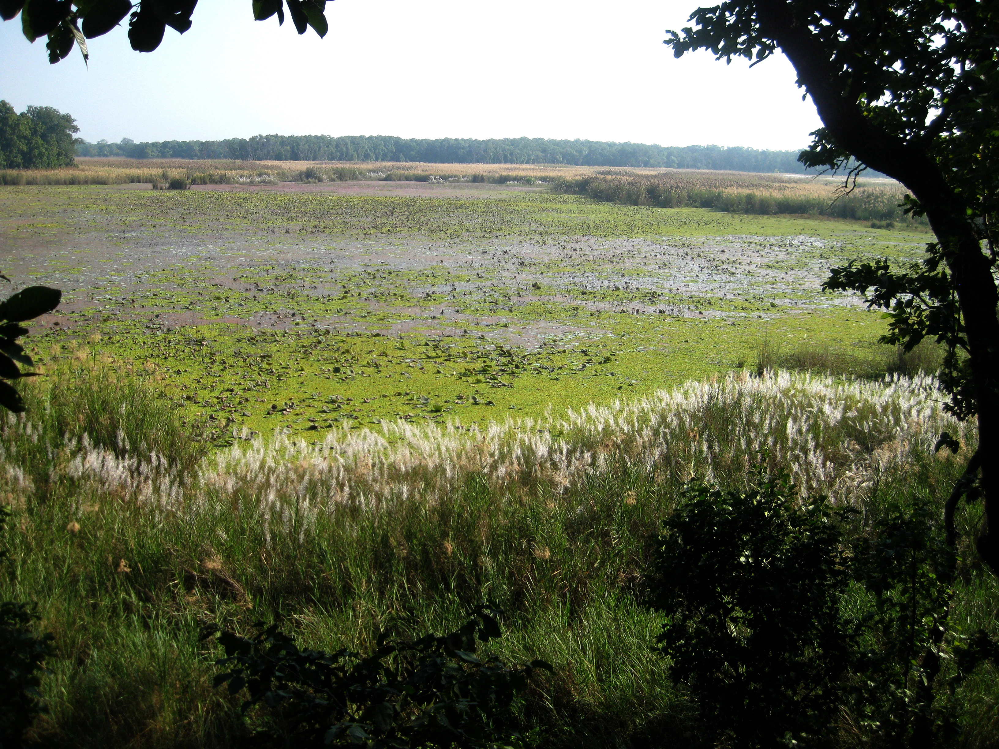
A lake with floating vegetation surrounded by tall grasses and trees, viewed from a shaded vantage point
Ranitaal Lake within Shuklaphanta National Park, showcasing wetlands and surrounding grasslands

Shuklaphanta National Park ecosystems, habitats, and plant life

The ecological character of Shuklaphanta National Park is defined by its position within the Terai-Duar savanna and grasslands, a UNESCO recognized ecoregion that once covered extensive portions of the Himalayan foothill belt. The park supports approximately 700 plant species, including 553 vascular plants, 18 pteridophytes, 410 dicots, and 125 monocots. The grasslands are characterized by Imperata cylindrica and Heteropogon contortus as dominant grass species, while marshes surrounding the lakes feature Phragmites karka and Saccharum spontaneum. Sal (Shorea robusta) forms the dominant tree species in the forested areas, creating a canopy that supports diverse understory vegetation. The wetlands represent a critical component of the park's ecological value, providing habitat for waterfowl, amphibians, and mammals adapted to moist environments. The ecosystem faces challenges from grassland encroachment by tree and shrub saplings, which threatens the long-term persistence of the open grassland habitats that support specialized species. The park's inclusion in the Terai Arc Landscape connects it to a broader network of protected areas aimed at maintaining ecological corridors across the Nepal-India border region.
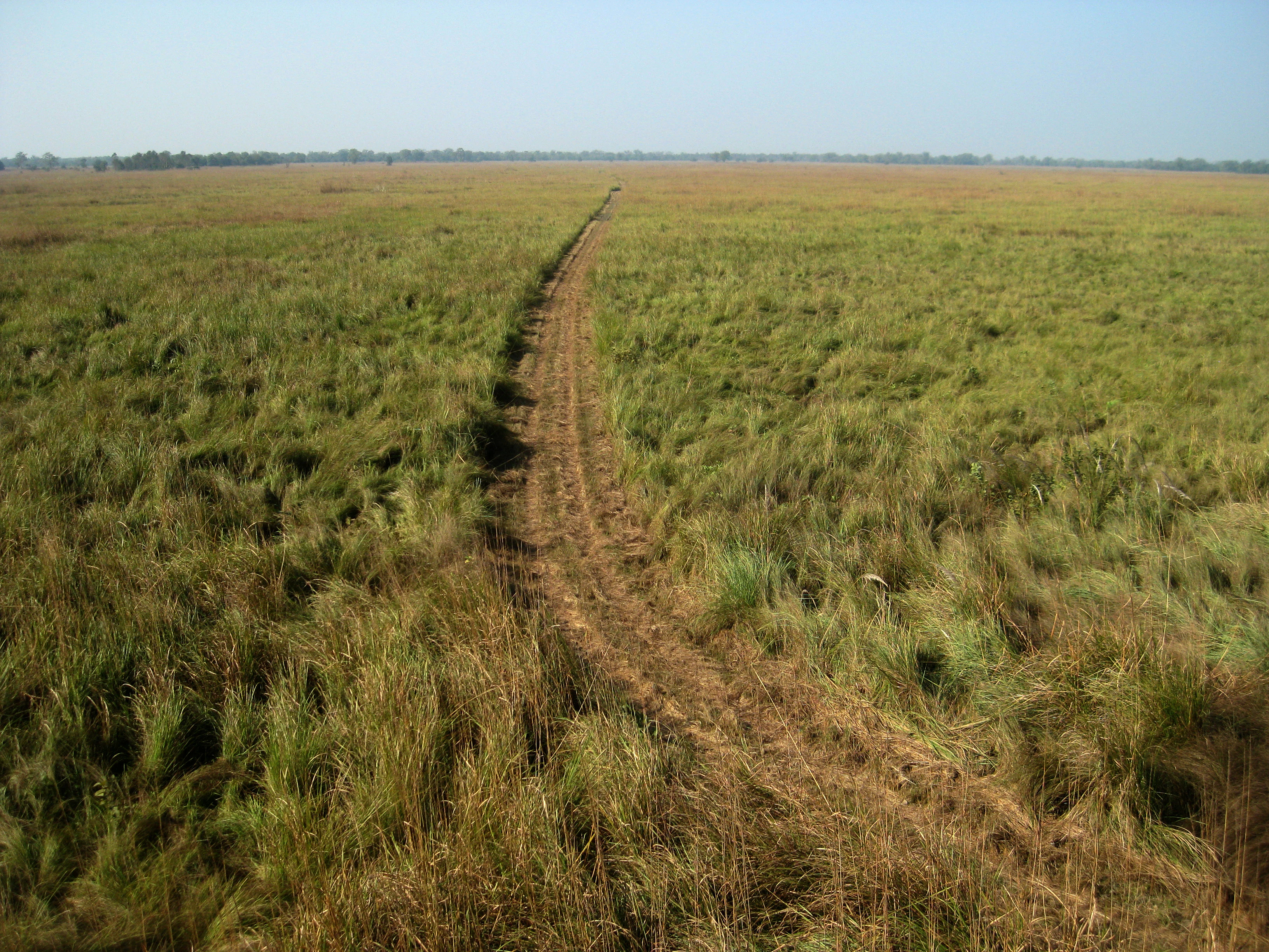
Dirt jeep track running through tall grasses in an open grassland field
Jeep track through grasslands in Shuklaphanta National Park

Shuklaphanta National Park wildlife and species highlights

Shuklaphanta National Park supports remarkable wildlife diversity, with the barasingha (swamp deer) population representing the park's most significant conservation achievement as the largest known population in the world at approximately 1,674 individuals. The grasslands provide essential habitat for Bengal floricans, with the park supporting the largest population in Nepal estimated at 20 to 28 individuals. The mammal community includes significant populations of Indian rhinoceros, with individuals translocated from Chitwan National Park since 2015 increasing the population to 17 individuals by 2021. Camera trapping surveys have documented 11 tigers and nine leopards in the southern portion of the park, while the rare rusty-spotted cat was photographed for the first time in spring 2016. The avifauna comprises over 450 species, including the white-rumped vulture, slender-billed vulture, lesser adjutant, and sarus crane. The reptile fauna includes 56 species, with the mugger crocodile present in Rani Tal and venomous species such as king cobra, Indian cobra, and Russell's viper recorded throughout the park. The gharial, which became extinct in the park in 1993, was reintroduced to the Chaudhar River in March 2024.

Shuklaphanta National Park conservation status and protection priorities

Shuklaphanta National Park plays a critical role in Nepal's conservation landscape, serving as a refuge for several endangered and threatened species. The park's significance for barasingha conservation cannot be overstated, as it maintains the world's largest population of this vulnerable cervid species. The Bengal florican population represents the species' stronghold in Nepal, making the park essential for the bird's survival in the country. The reintroduction of Indian rhinoceros from Chitwan National Park represents a deliberate effort to establish a third viable population in Nepal, contributing to the species' national recovery strategy. The reintroduction of gharial in 2024 demonstrates ongoing commitment to restoring extinct species within the protected area. The buffer zone established in 2004 provides a transition area that helps reduce human-wildlife conflict while extending conservation benefits to surrounding communities. The wildlife corridor connecting the park to Pilibhit Tiger Reserve in India maintains transboundary ecological connectivity essential for species that require large home ranges. The park's inclusion in the Terai Arc Landscape reflects its role within a broader regional conservation framework.

Shuklaphanta National Park cultural meaning and human context

Shuklaphanta National Park is located in the far-western Terai region of Nepal, an area historically characterized by relatively low population density due to its historical status as a royal hunting preserve. The local communities in the surrounding areas have traditional connections to the land, though the park's origins as a royal hunting ground meant restricted access for local populations during the monarchy period. The buffer zone established in 2004 recognizes the importance of engaging local communities in conservation, providing a framework for collaborative resource management. The park's name in Nepali, शुक्लाफाँट (Shuklaphanta), directly references the grassland ecosystem that defines much of the protected area's character. The region's proximity to the Indian border has created historical connections between communities on both sides of the boundary, with wildlife movements reflecting the interconnected nature of the landscape regardless of political borders.

Top sights and standout views in Shuklaphanta National Park

The Shuklaphanta grassland represents the park's most distinctive feature, being the largest continuous grassland in Nepal and the primary habitat for the world's largest barasingha population. The wetlands and lakes, particularly Rani Tal, provide year-round water sources that support diverse wildlife concentrations and excellent birdwatching opportunities. The wildlife corridor connecting to Pilibhit Tiger Reserve enables seasonal migrations that maintain genetic connectivity for wide-ranging species. The presence of all four large mammal predators (tiger, leopard, leopard cat, and fishing cat) indicates a healthy ecosystem with complete predator guilds. The reintroduction of gharial marks a significant conservation milestone, restoring an extinct species to the park's aquatic systems. The Bengal florican population represents a globally significant concentration of this endangered bird. The park offers a relatively remote and less-visited alternative to more famous Terai parks, providing opportunities for wildlife observation in a quieter setting.

Best time to visit Shuklaphanta National Park

The optimal time to visit Shuklaphanta National Park spans from October through March, when the weather is dry and wildlife viewing conditions are most favorable. The post-monsoon period from October to November offers green landscapes with clear skies and moderate temperatures, making it comfortable for game drives and wildlife observation. The winter months from December to February provide the best opportunities for spotting large mammals, as animals congregate near water sources and the dry grassland vegetation offers better visibility. December and January can be cold, with daytime temperatures ranging from 7 to 12 degrees Celsius and occasional frost, requiring warm clothing for early morning excursions. The pre-monsoon period from March to May sees rising temperatures reaching 42 degrees Celsius by late April, but this season offers excellent birdwatching as summer migrants arrive and resident birds are more active around water sources. The monsoon season from June to September brings heavy rainfall averaging 1,579 millimeters annually, making some areas inaccessible and reducing visibility for wildlife observation.

Park location guide

Geography guide, regional context, and park location map for Shuklaphanta National Park

Shuklaphanta National Park park geography, regions, and map view in Nepal
Understand where Shuklaphanta National Park sits in Nepal through a broader geographic reading of the surrounding landscape, nearby location context, and its mapped position within the national park landscape.

How Shuklaphanta National Park fits into Nepal

Nepal is a federal parliamentary republic in South Asia, landlocked between China and India. It spans the Himalayas and includes eight of the world's ten highest mountains. Kathmandu is the capital and largest city.

Wider geography shaping Shuklaphanta National Park in Nepal

Nepal is located in South Asia, landlocked between China to the north and India to the south, east, and west. The country occupies the Himalayan region in the north and extends into the Indo-Gangetic Plain in the south. Terrain includes the Terai lowlands, subalpine hills, and the Himalayas with peaks including Mount Everest.

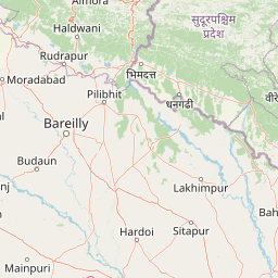
Map view of Shuklaphanta National Park

Use this park location map to pinpoint Shuklaphanta National Park in Nepal, understand its exact geographic position, and read its mapped placement within the surrounding landscape more clearly.

Pigeon | © OpenStreetMap contributors

Location context for Shuklaphanta National Park

Sudurpashchim Province

Visualize the park's alluvial terrain, distinctive phanta grasslands, riverine forests, and vital wetland ecosystems.

Shuklaphanta National Park Imagery: Explore Terai Lowland Landscapes, Grasslands, and Wildlife Habitats
Browse comprehensive imagery from Shuklaphanta National Park to understand its unique Terai lowlands, expansive grasslands, dense sal forests, and critical wetland ecosystems. These visual references offer essential context for appreciating the park's protected landscapes, barasingha habitat, and diverse wildlife environment.

Small bird with brown upperparts, white underparts, and black facial markings perched on a green stem against a blurred green background

Barasingha deer with antlers standing in a meadow with white wildflowers and trees

A lake with floating vegetation surrounded by tall grasses and trees, viewed from a shaded vantage point

Dirt jeep track running through tall grasses in an open grassland field

Park atlas

Compare protected areas and trace the regional context of Nepal's Terai lowlands, exploring parks with similar geographic or ecological features.

Discover Nearby National Parks and Protected Areas Beyond Shuklaphanta National Park
Explore other national parks and protected areas near Shuklaphanta National Park, tracing their geographic spread across Nepal's Terai lowlands and the broader Terai Arc Landscape. Compare regional park geography, diverse conservation landscapes, and ecological features to understand the protected zones within this vital transboundary region.
National parkLakhimpur Kheri district

Dudhwa National Park: Terai Grasslands and Alluvial Plain Geography within Lakhimpur Kheri

Discover the mapped protected landscape of this vital Indian national park.

Dudhwa National Park in Lakhimpur Kheri district stands as a crucial example of the Terai grassland ecosystem, characterized by its expansive alluvial plains and marshy habitats. This page provides an atlas-style exploration of its protected landscape, detailing the unique terrain and geographic context essential for understanding its conservation significance.

Area
614 km²
Established
1977
IUCN
II
Visitors
26K annual
National parkNepal

Khaptad National Park: Nepal's National Park Landscape and Protected Area Geography

Explore the mapped terrain and regional context of this protected landscape.

Khaptad National Park is a designated national park in Nepal, offering a unique entry point for exploring protected landscapes and regional geography. This entry details the park's mapped boundaries and its significance within the broader atlas of natural terrain. Users can delve into the specific geographic context of this protected area, understanding its role within Nepal and the wider South Asian context for structured landscape discovery.

Area
225 km²
Established
1984
IUCN
II
Relief
Mountain
National parkBardiya District

Bardiya National Park: Nepal's Expansive Terai Protected Landscape and Atlas

Mapped geography, tiger habitat, and rhino conservation in Bardiya District.

Bardiya National Park represents a significant protected area within Nepal's Terai lowlands, providing an exceptional resource for geographic discovery. Its diverse terrain, including vast grasslands and dense forests bisected by major river systems like the Karnali and Babai, creates unique ecosystems. As the largest national park in Nepal, it is instrumental in mapping wildlife corridors and understanding regional landscape dynamics, particularly for endangered species such as Bengal tigers and Indian rhinoceroses. This park offers a profound glimpse into the mapped natural heritage of the Bardiya District.

Area
968 km²
Established
1988
IUCN
II
Relief
Mixed relief
National parkUttarakhand

Jim Corbett National Park: Uttarakhand National Park and Protected Landscape Atlas

Mapped Boundaries and Regional Geographic Context

Jim Corbett National Park offers a specific entry point for understanding protected landscapes and their geographic significance. As a designated national park within Uttarakhand, India, it provides a distinct case study for exploring mapped boundaries and regional natural terrain. This detailed view allows for a deep dive into the park's identity as a protected area, highlighting its placement within the larger atlas of India's natural heritage and its contribution to the Himalayan geographic narrative.

Area
1,288.31 km²
Established
1936
IUCN
II
Visitors
365K annual
National parkUttarakhand

Nanda Devi National Park: High-Altitude Protected Landscape and Himalayan Geography

Explore mapped glacial basins and alpine terrain in Uttarakhand.

Nanda Devi National Park is a prime example of a high-altitude protected area, nestled in the Garhwal Himalayas of Uttarakhand, India. Established in 1982, this national park protects a vast glacial sanctuary, renowned for its dramatic peaks, including Nanda Devi, India's second-highest mountain. The park's landscape is defined by rugged terrain, extensive glaciers like the Uttari Rishi and Dakshini Rishi, and a striking ring of mountains over 6,000 meters, providing critical context for understanding protected land geography and Himalayan atlas exploration.

Area
630.33 km²
Established
1982
IUCN
II
Relief
Mountain
National parkNepal

Banke National Park: Nepal National Park with Distinct Protected Landscape Geography

Explore the mapped terrain and regional atlas context of Banke National Park.

Banke National Park represents a vital protected area within Nepal's diverse geography, offering a focused point for atlas and map-based discovery. As a national park, its designated status highlights its importance in conserving natural landscapes and understanding regional protected-area distribution across South Asia. This entry provides detailed geographic context, enabling users to explore the park's mapped boundaries and appreciate its role within Nepal's broader natural territory.

Area
550 km²
Established
2010
IUCN
II
Relief
Upland
National parkNepal

Rara National Park: Nepal's National Park with Mapped Protected Landscape Context

Discover its geographic setting and park boundaries

Rara National Park is a key protected area within Nepal, offering a distinct focus for geographic exploration. This page details its identity as a national park, highlighting its mapped boundaries and its contribution to the country's atlas of natural landscapes. Understand the park's specific role and regional geographic context, providing a solid foundation for atlas-driven discovery of Nepal's protected areas.

Area
106 km²
Established
1976
IUCN
II
Relief
Mountain
National parkChamoli district

Valley of Flowers National Park: National Park Protected Landscape and Geographic Context

Explore the mapped terrain and regional boundaries of this Himalayan national park.

Valley of Flowers National Park is a distinct protected area within India's Garhwal region, situated in the Chamoli district. This park detail page facilitates atlas-focused discovery, highlighting its mapped boundaries and geographic significance. Users can explore the protected landscape's role within its regional context, providing essential data for understanding its ecological and geographical importance for landscape exploration.

Area
87.5 km²
Established
1982
Relief
Mountain
Climate
Alpine

Common questions about visiting, size, designation, and location context for Shuklaphanta National Park

Shuklaphanta National Park FAQs for park facts, access, geography, and protected area context
Find quick answers about Shuklaphanta National Park, including protected-area facts, park geography, trail and visitor context, and how the park fits into its surrounding country and regional landscape.
MoriAtlas Explorer

Continue Your Protected Areas Search Across the Global Atlas

Deepen your exploration by continuing the structured search for national parks and protected areas worldwide. Utilize the comprehensive filtering capabilities to compare different conservation landscapes and refine your understanding of global park geography. Discover more about the distribution and characteristics of protected natural areas.

Global natural geography