
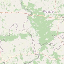
Rivers
Park geography
Analyzing the lowland terrain, river systems, and forest cover of this protected landscape
Comprehensive Geographic Profile and Mapped Boundaries of Smolny National Park, Russia
This geographic profile covers the technical distribution and environmental characteristics of Smolny National Park within the Republic of Mordovia. The data includes recorded boundary dimensions of 365 square kilometers, elevation metrics ranging from 93 to 217 meters, and the presence of river systems such as the Ashnya, Kalysha, and Yazovka. Discover how lowland relief and temperate forest habitats define this protected region.
Protected wetland and deciduous forest refuge in Mordovia's Volga Uplands
Smolny National Park
Smolny National Park is a protected natural area in the northeastern corner of the Republic of Mordovia, Russia, situated within the East European Plain at the northwestern edge of the Volga Uplands. Established in 1995, the park covers approximately 36,500 hectares of representative lowland river environment, deciduous forest, and wetlands centered around the Alatyr River floodplain. The landscape is predominantly flat to slightly hilly, with elevations ranging from 93 to 217 meters above sea level. The park was created to protect the region's distinctive deciduous forest ecosystem and the significant wetlands that serve as a refuge for birds of international importance. It occupies portions of the Ichalkovsky District and Bolsheignatovsky District in Mordovia.
- Location
- Russia
- Park type
- National park
- Established
- 1995
- Area
- 365 km²
Location overview
Regional placement within the Republic of Mordovia, Russia
Geographic Setting and Location of Smolny National Park
Smolny National Park is situated entirely within the Republic of Mordovia in Russia. As a fully inland protected area, it is a non-transboundary territory with no marine or coastal borders.
- Countries
- Russia
- Regions
- Republic of Mordovia
- Primary location
- Republic of Mordovia
- Geographic setting
- Inland
Boundary and coordinates
Interactive boundary geometry and calculated area metrics
Smolny National Park Boundary Map and Spatial Extent
Mapped park geometry outlines the protected perimeter and spatial layout for geographic context. Accompanying boundary facts detail the recorded area span, coordinate limits, and regional extent.
- Boundary area
- 350.9 km²
- Boundary perimeter
- 160.3 km
- Northernmost point
- 54.8855° N
- Southernmost point
- 54.7222° N
- Easternmost point
- 45.6222° E
- Westernmost point
- 45.2082° E
- Geographic centre
- 54.8093° N, 45.4022° E
- North–south span
- 18.2 km
- East–west span
- 26.6 km
Elevation and terrain
Recorded lowland relief and internal hydrologic features
Smolny National Park Terrain and Elevation Summary
Recorded elevation metrics span from ninety-three to two hundred seventeen meters across lowland terrain within Smolny National Park. Associated cards detail recorded rivers and streams located within protected boundaries.
- Minimum elevation
- 93 m
- Maximum elevation
- 217 m
Selected named natural features
Streams
Язовка
Rivers
Ashnya
Environmental setting
Temperate lowland terrain, wetland networks, and forest cover
Smolny National Park Environmental Classifications and Physical Setting
Recorded landscape features, habitat types, and climatic zones form complementary perspectives on the physical setting of Smolny National Park. These structured classifications connect recorded environmental categories to related atlas destinations across the protected area.
- Relief
- Lowland
- Climate
- Temperate
- Water
- Major water bodies
- Forest cover
- Mostly forested
- Seasonality
- Year-round
Landscape features
Forest · Wetland · Rivers · Bog · Marsh · Grassland · Hills
Habitat types
Temperate broadleaf forest · Temperate coniferous forest · Wetland · Riverine habitat · Grassland · Heath
Park atlas
Trace the regional protected landscapes and discover other national parks within Mordovia and the East European Plain.
National Parks and Protected Areas Near Smolny, Mordovia, and the East European Plain
Browse national parks and protected areas geographically connected to Smolny National Park, extending across Mordovia and the broader East European Plain. Compare their diverse wetland, forest, and riverine landscapes to understand regional conservation efforts and distinct ecological zones.
Protected areaRussia
About 107 km away#1 closest
East

Chuvash Forest Protected Area: Explore Russian Volga Region's Mixed Woodland Ecosystems
Discover mapped boundaries and regional landscape context.
Chuvash Forest stands as a protected area defined by its mixed woodland ecosystems within Russia's Volga region. This entry provides detailed geographic context, highlighting the park's mapped boundaries and its role as a distinct natural landscape. It serves as an essential point for understanding the environmental character and regional significance of protected lands in Eastern Europe, aiding structured atlas exploration of Russia's natural geography.
- IUCN
- II
- Climate
- Temperate
- Access
- Access unknown
- Scope
- Terrestrial
National parkNizhny Novgorod Oblast
About 175 km away#2 closest
North
Nizhegorodskoe Povolzhie National Park: Geographic Boundaries and Protected Area Identity
Regional Russian park network spanning five distinct ecological clusters.
Spanning across nine districts in Nizhny Novgorod Oblast, this federal national park protects a vast array of natural environments within a single designation. From the dark coniferous stands of the Kilemarsky Taiga to the limestone sinkholes of Ichalkovsky Bor and the Volga river floodplains, the park offers a detailed look at the intersection of boreal and central Russian ecosystems.
- Area
- 658.02 km²
- Established
- 2024
- Relief
- Mixed relief
- Climate
- Temperate
National parkRussia
About 204 km away#3 closest
Southeast
Sengileevskie Mountains National Park: National Park Protected Area and Mapped Landscape Context
Explore protected boundaries and regional geography.
Uncover the geographic specifics of Sengileevskie Mountains National Park, a designated national park. This entry provides detailed insights into its protected area status, mapped landscape features, and regional context, serving as a foundational element for atlas-based exploration and understanding of Russia's conservation areas.
- IUCN
- II
National parkMari El
215 km away#4 closest
Northeast
Mariy Chodra National Park: Regional Geography and Protected Forest Atlas
Mapped terrain, karst lake systems, and woodland corridors in Mari El
Deepen your understanding of Mariy Chodra National Park through its distinct geological and forest features. This overview examines the intersection of rolling upland blocks, sandy terrain, and the varied hydrology of the Ilet River drainage basin within the Volga region.
- Area
- 366 km²
- Established
- 1985
- IUCN
- II
- Relief
- Upland
National parkRussia
About 223 km away#5 closest
Northeast
Mariy Chodra National Park: Geographic and Protected Area Mapping for Russian Forests
Regional forest landscapes and protected Russian terrain
Mariy Chodra National Park is an essential protected natural area located in Russia, distinguished by its forest-dominated ecosystems. This entry provides detailed geographic context and boundary information for those studying the distribution of protected landscapes across the Russian Federation.
- IUCN
- II
National parkSamara Oblast
282 km away#6 closest
Southeast
Samarskaya Luka National Park: Mapped Geography and Protected Area Landscape Context
An atlas-focused overview of the Zhiguli Mountains and Volga River meander.
Samarskaya Luka National Park covers 134,000 hectares of diverse terrain in Samara Oblast. This overview examines the protected area's karst limestone uplands, dense forests, and river floodplains. Access map-integrated data on the Volga River bend and the unique geological formations defining this regional ecosystem.
- Area
- 1,340 km²
- Established
- 1984
- IUCN
- II
- Relief
- Mixed relief
National parkSamara Oblast
282 km away#7 closest
Southeast
Samarskaya Luka National Park: Geography, Karst Terrain, and Volga River Boundaries
Protected mountain, forest, and floodplain landscapes in Samara Oblast
Samarskaya Luka National Park anchors the Middle Volga Biosphere Reserve with its rugged limestone cliffs, extensive karst sinkholes, and rare steppe-forest habitats. The park represents a key geographic transition zone where high-elevation mountain terrain meets the expansive Volga floodplains and reservoirs, providing a vital study area for regional forest-steppe ecosystems.
- Area
- 1,319 km²
- Established
- 1984
- IUCN
- II
- Relief
- Mountain
National parkSaratov Oblast
About 302 km away#8 closest
Southeast
Khvalynsky National Park: Protected Landscape and Regional Geography Atlas
Discover mapped park boundaries in Saratov Oblast
Khvalynsky National Park is a significant protected area designated as a national park within the Saratov Oblast. This entry provides detailed atlas-based insights into its geographic scope, protected landscape features, and its context within the wider regional geography of Southeastern European Russia. Explore the mapped terrain and understand how this park contributes to the conservation landscape of the Volga region.
- Area
- 255 km²
- Established
- 1994
- IUCN
- II
- Visitors
- 35K annual
MoriAtlas Explorer
Continue Exploring Smolny National Park's Geographic and Protected Landscape Identity
Deepen your understanding of Smolny National Park by continuing your exploration of its specific mapped boundaries and regional geographic context. This detailed atlas view provides foundational information for appreciating the park's unique protected landscape. By examining its placement within the Republic of Mordovia, you can build a more comprehensive picture of Russia's network of protected natural areas.
Browse next
Global natural geography
Explore related park routes
Explore MoriAtlas Global ParksBrowse All MoriAtlas ParksGlobal Park Map DiscoveryMoriAtlas: Browse All CountriesBrowse All MoriAtlas ContinentsNational Park Environment AtlasGrand Canyon National Park AtlasYellowstone National Park AtlasYosemite National Park Atlas and GeographySerengeti National Park AtlasGalápagos National Park Protected LandscapeBanff National Park Geography and AtlasKruger National Park Atlas EntryUluṟu-Kata Tjuṯa National Park AtlasExplore Uluru-Kata Tjuta National Park GeographyPlitvice Lakes National Park AtlasFiordland National Park Protected LandscapeGreat Smoky Mountains National Park AtlasAfghanistan National Parks and Protected AreasAlbania National Parks and Protected AreasAlgeria National Parks and Protected AreasAmerican Samoa National Parks and Protected AreasAndorra National Parks and Protected AreasAngola National Parks and Protected AreasAntarctica National Parks and Protected AreasAntigua and Barbuda Park List