Mori Atlas logo
National parkSoomaa National Park

Mapping the extensive peat bogs and dynamic floodplains of a unique Baltic region protected area.

Soomaa National Park: Estonia's Premier Protected Wilderness and Wetland Landscape

(Soomaa rahvuspark)

Soomaa National Park represents one of Europe's largest intact peat bog wilderness areas, situated in south-western Estonia within Viljandi County. This protected landscape is globally significant for its vast raised bogs, meandering rivers, and seasonally inundated floodplains, which create a unique dynamic aquatic environment known as the 'fifth season.' As a key entity in the Baltic region's protected areas atlas, Soomaa offers unparalleled opportunities to explore its mapped boundaries, diverse terrain, and the intricate geography of Northern Europe's extensive wetland systems.

National ParkPeat BogsWetlandsFloodplainsBirdwatchingWilderness Area
Illustration showing a mountain range with a waterfall, river flowing through a forested valley, and a partly cloudy sky

Soomaa National Park

National park

Park overview

Structured park overview, official facts, and landscape profile for Soomaa National Park

Soomaa National Park park facts, protected area profile, and essential visitor context
Review the core facts for Soomaa National Park, including designation, size, terrain, visitor scale, habitats, and operating context in one park-focused overview.

About Soomaa National Park

Soomaa National Park protects one of the most significant wilderness areas in the Baltic region, encompassing a complex of interconnected raised bogs, river floodplains, and peat forests in south-western Estonia. The park's landscape was shaped during the retreat of the Baltic Ice Lake approximately 11,200 to 10,600 years ago, when sand deposits formed the distinctive dune ridges that now mark the park's north-western and western boundaries. The territory consists of five major bog systems—Valgeraba, Öördi, Riisa, Kikepera, and Kuresoo—separated by the river valleys of the Pärnu River basin. Kuresoo, the largest bog in Estonia, comprises three distinct sections: Suitsna, Leetva, and Toonoja. The park's eastern edge contains the Ruunaraipe Dunes, the highest dunes on the Estonian mainland, rising 12 metres above the surrounding landscape. Soomaa occupies a transitional position between Low Estonia and High Estonia, where the waters flowing from the Sakala Upland meet the flat Pärnu Lowland. This geological and hydrological setting creates the conditions for the extraordinary flood dynamics that define the park's character.

Quick facts and research context for Soomaa National Park

Soomaa National Park lies in the transition zone between Low Estonia and High Estonia, spanning the Sakala Upland's western slope and the Pärnu Lowland in Viljandi and Pärnu counties. The park protects five major bog systems, with Kuresoo Bog being the largest in Estonia. The landscape is characterized by extensive raised bogs, river floodplains, and some of the highest sand dunes on the Estonian mainland, including the Ruunaraipe Dunes reaching 12 metres in height. The park's rivers—Navesti, Halliste, Raudna, and Lemmjõgi—drain from the Sakala Upland and feed the Pärnu River system. The region experiences dramatic spring flooding known as the "fifth season," when water can rise by a metre per day for three to four consecutive days.

Park context

Deeper park guide and search-rich context for Soomaa National Park

Soomaa National Park history, landscape, wildlife, and travel context
Explore Soomaa National Park through its history, landscape character, ecosystems, wildlife, conservation priorities, cultural context, and seasonal travel timing in a structured park guide built for atlas discovery and search intent.

Why Soomaa National Park stands out

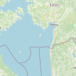
Soomaa is renowned for its dramatic seasonal floods, which create the largest regularly flooded area in Estonia and all of Northern Europe. The Riisa flood area can cover up to 175 square kilometres, transforming the wetland into a vast inland sea where raised bogs appear as islands in the water. The park contains Kuresoo Bog, one of the two best-preserved large bogs in Estonia with exceptional species diversity. Soomaa also preserves the tradition of dugout canoe (haabjas) building, believed to be the only place in Europe where this ancient craft survived into the 21st century. The PAN Parks certification awarded in 2009 recognizes Soomaa as one of Europe's premier wilderness areas.

A bog landscape with dry grasses, scattered pine trees, and a lake under a partly cloudy sky.
Öördi bog within Soomaa National Park, Estonia.

Soomaa National Park history and protected-area timeline

Soomaa National Park was established on 8 December 1993 to protect the extensive bog systems, floodplains, and natural landscapes of south-western Estonia. The park was created in response to growing recognition of the ecological value of Estonia's remaining wilderness areas and the need to preserve the country's largest intact peat bog complex. The name "Soomaa" was coined by academic Theodor Lippmaa to describe the bog landscapes spanning the border between South-Central and South-Western Estonia. Prior to establishment, the area had been subject to varying degrees of human activity, including limited forestry and agricultural use, but the remote and wet conditions prevented extensive development. In 1989, the area was designated an Important Bird Area, recognizing its significance for migratory and breeding bird populations. The Ramsar Convention designated Soomaa as a protected wetland site in 1997, and the park became part of the European Union's Natura 2000 network in 2004. In 2009, Soomaa achieved PAN Parks certification, becoming the largest certified wilderness area in Europe at that time, recognizing the park's success in combining strict nature protection with sustainable tourism development.

Soomaa National Park landscape and geographic character

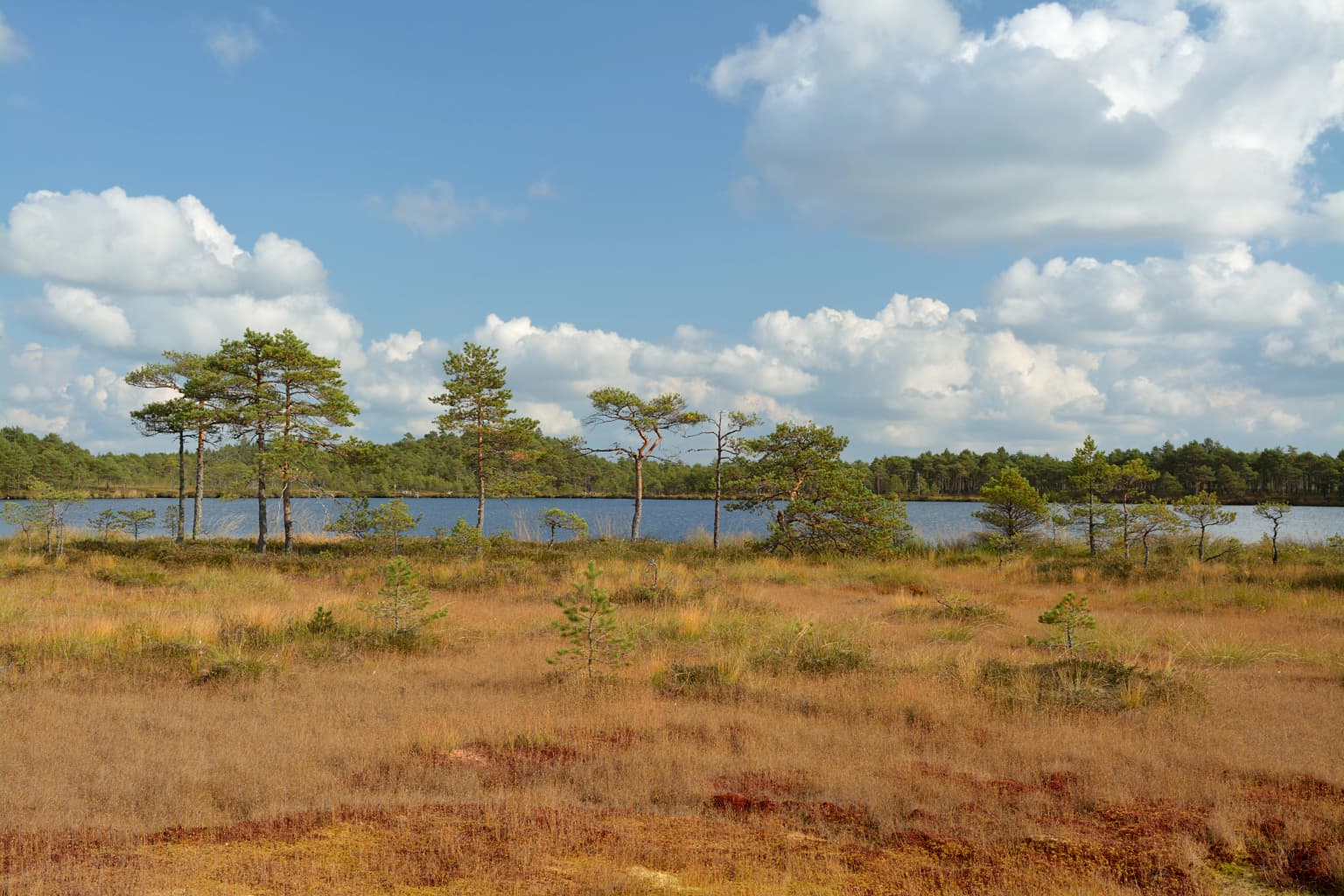
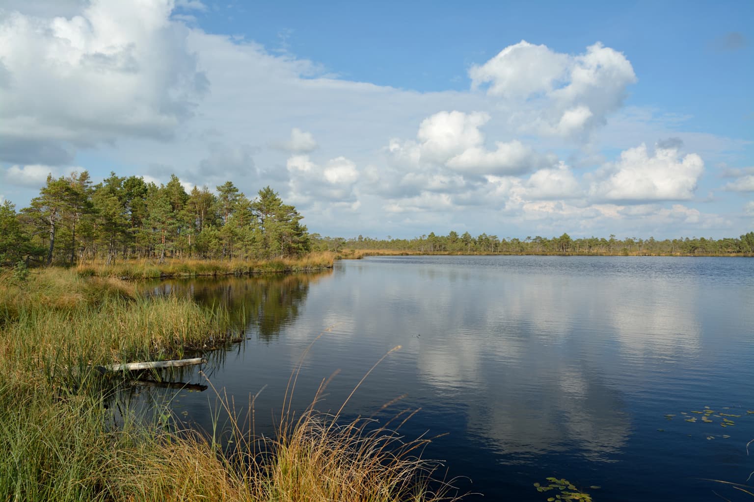
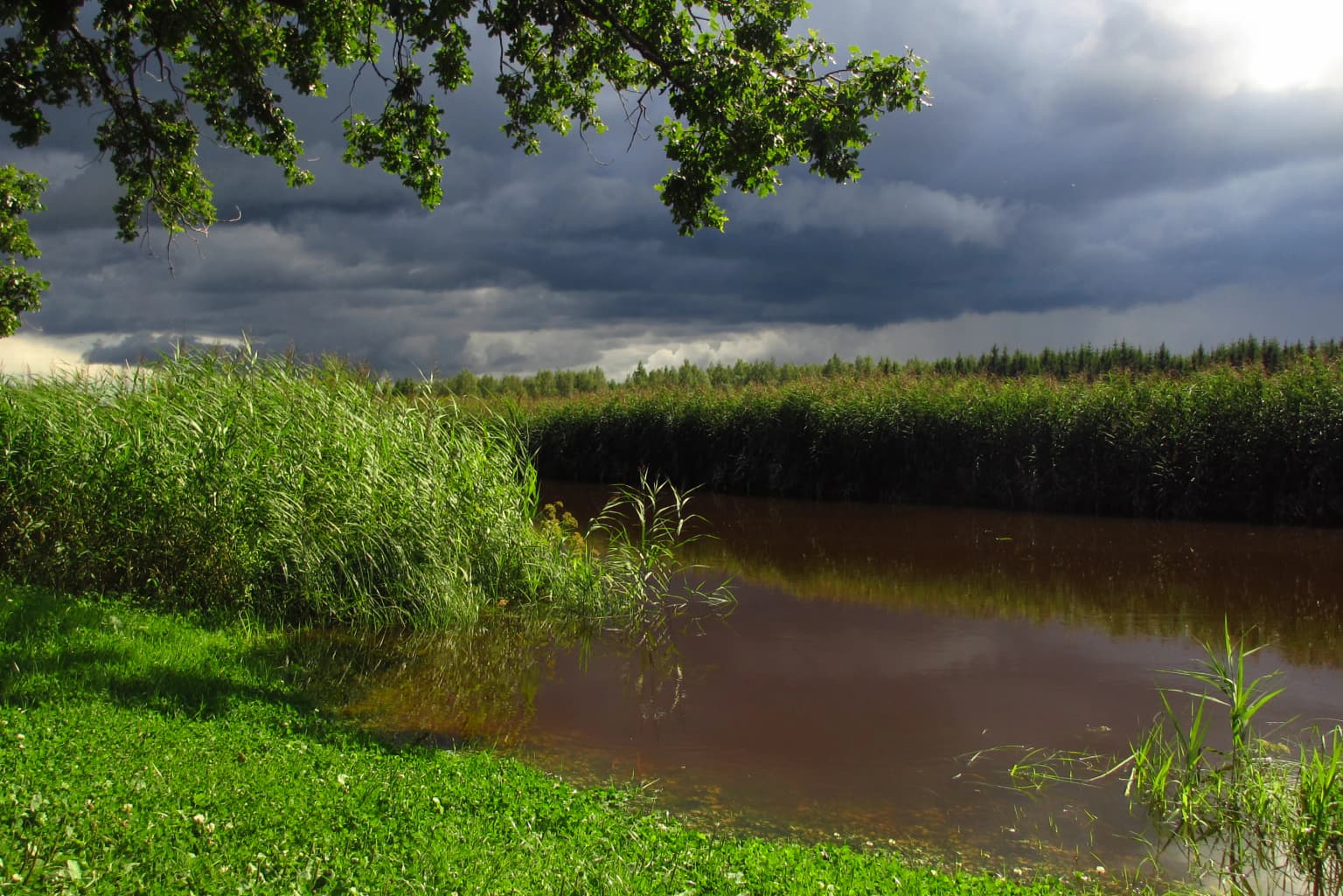
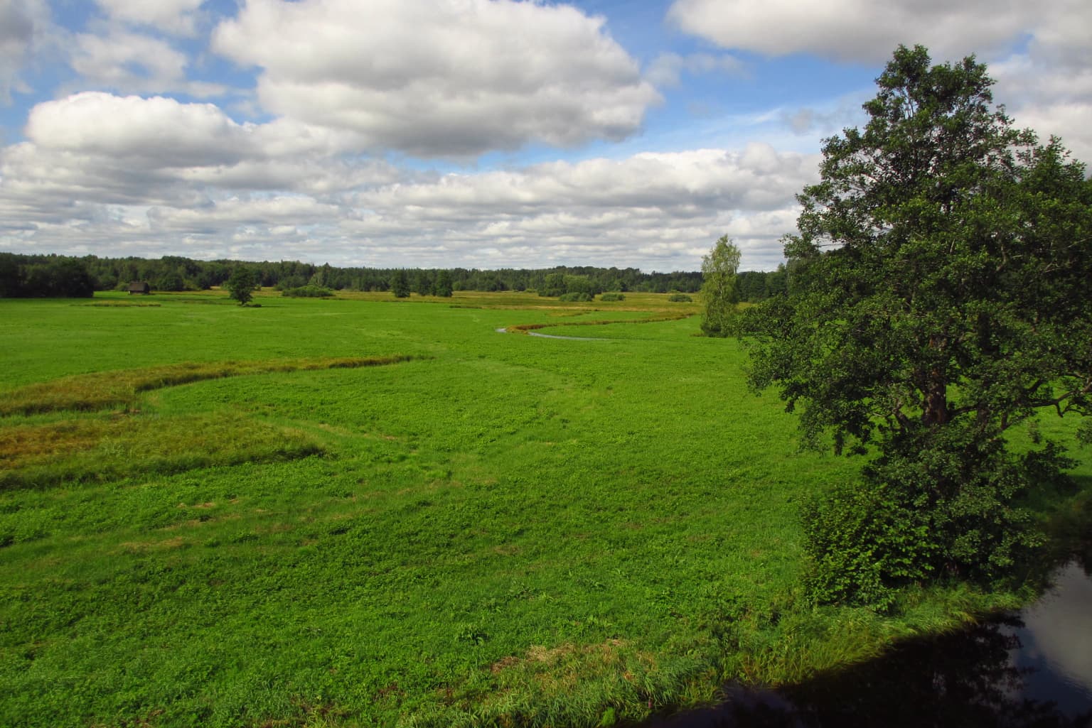
The physical landscape of Soomaa National Park is defined by its extensive peat bog systems, river valleys, and ancient dune formations. The raised bogs, some of the most pristine in Europe, form the park's core, with the steep southern slope of Kuresoo Bog rising eight metres over a distance of just 100 metres where it meets the Lemmejõgi river. The river system—comprising the Navesti, Halliste, Raudna, and Lemmjõgi—drains from the Sakala Upland and creates the corridors that separate the major bog complexes. The eastern edge of the park preserves the highest dunes on the Estonian mainland, relicts of the Baltic Ice Lake's predecessor coastline positioned approximately 50 kilometres inland from the contemporary Baltic Sea. The Ruunaraipe Dunes form a 1.2-kilometre-long sand ridge running northwest to southeast, reaching a maximum height of 12 metres. The flood plains between the bogs and rivers form seasonally inundated grasslands that become vast sheets of water during the spring melt, creating the phenomenon known as the "fifth season" when the entire wetland system transforms into a dynamic water landscape.

Wooden boardwalk leading through green forest with large curved tree trunk arch and small building on right
Entrance to Soomaa National Park featuring a wooden boardwalk through forest with natural arch structure

Soomaa National Park ecosystems, habitats, and plant life

Soomaa National Park contains remarkable ecological diversity across its bog, forest, and wetland habitats. The park supports approximately 540 species of vascular plants, over 200 species of mosses, and around 360 species of fungi, with at least 29 protected species among them. The alluvial meadows and forests along the riverbanks hold particular botanical value, supporting species such as Gladiolus imbricatus, Iris sibirica, and Sedum telephium. The unique swamp forests known as carr surrounding the water bodies represent a specialized habitat type of special interest. The raised bogs support distinctive bog vegetation adapted to acidic, nutrient-poor conditions, while the paludified forests—woodlands growing on peat soils—create transition zones between open bog and upland forest. The flood plain grasslands provide seasonal habitat for numerous species, and the river systems connect the various habitat types, supporting aquatic life throughout the year.

A calm lake reflecting the sky with tall grasses and trees along the shore under a partly cloudy sky
Öördi lake within Soomaa National Park's wetland landscape under a partly cloudy sky

Soomaa National Park wildlife and species highlights

Soomaa supports exceptional wildlife populations that reflect its status as one of Estonia's most important wilderness areas. The bird fauna is particularly notable, with the park regularly supporting more than one percent of the European populations of Bewick's swan and common crane. During autumn migration, approximately 1,000 common crane and 500 Bewick's swan use the area as a stopover and roosting site, while spring migration brings around 2,000 Bewick's swan. Kuresoo Bog hosts one of the most representative bird communities in Estonia, including golden eagle, more than 100 pairs of Eurasian whimbrel, approximately 150 pairs of European golden plover, dunlin, merlin, willow ptarmigan, and Montagu's harrier. The floodplain meadows support 50 to 100 pairs of corncrake. The park serves as important spawning ground for northern pike. Large mammals include roe deer, elk, and wild boar as the most numerous species, along with Eurasian beaver, Eurasian lynx, grey wolf, and brown bear. The park and its surroundings serve as one of the main research areas for large carnivores in Estonia, with telemetry studies on lynx and wolf populations conducted since 2004.

Three people working on a wooden dugout canoe with a fire and grassy background
People constructing a dugout canoe at Basecamp Karuskose in Soomaa National Park

Soomaa National Park conservation status and protection priorities

Soomaa National Park represents one of the most significant conservation areas in the Baltic region and holds multiple international designations recognizing its ecological importance. The park's designation as an Important Bird Area since 1989 reflects its critical role for migratory waterfowl and breeding bog birds. Its Ramsar status since 1997 recognizes the international significance of its wetland ecosystems, while inclusion in Natura 2000 since 2004 integrates it into Europe's protected area network under the EU Birds and Habitats Directives. The PAN Parks certification awarded in 2009 recognized Soomaa as the largest intact peat bog system in Europe preserved as wilderness, highlighting its exceptional value for biodiversity conservation. The European Commission's designation of Soomaa as a supreme nature holiday destination in 2009 further acknowledged the park's success in balancing conservation with sustainable visitor experiences. The park's extensive peat stores also represent significant carbon reserves, and the intact hydrological systems maintain water quality and regulate flow for downstream areas.

Soomaa National Park cultural meaning and human context

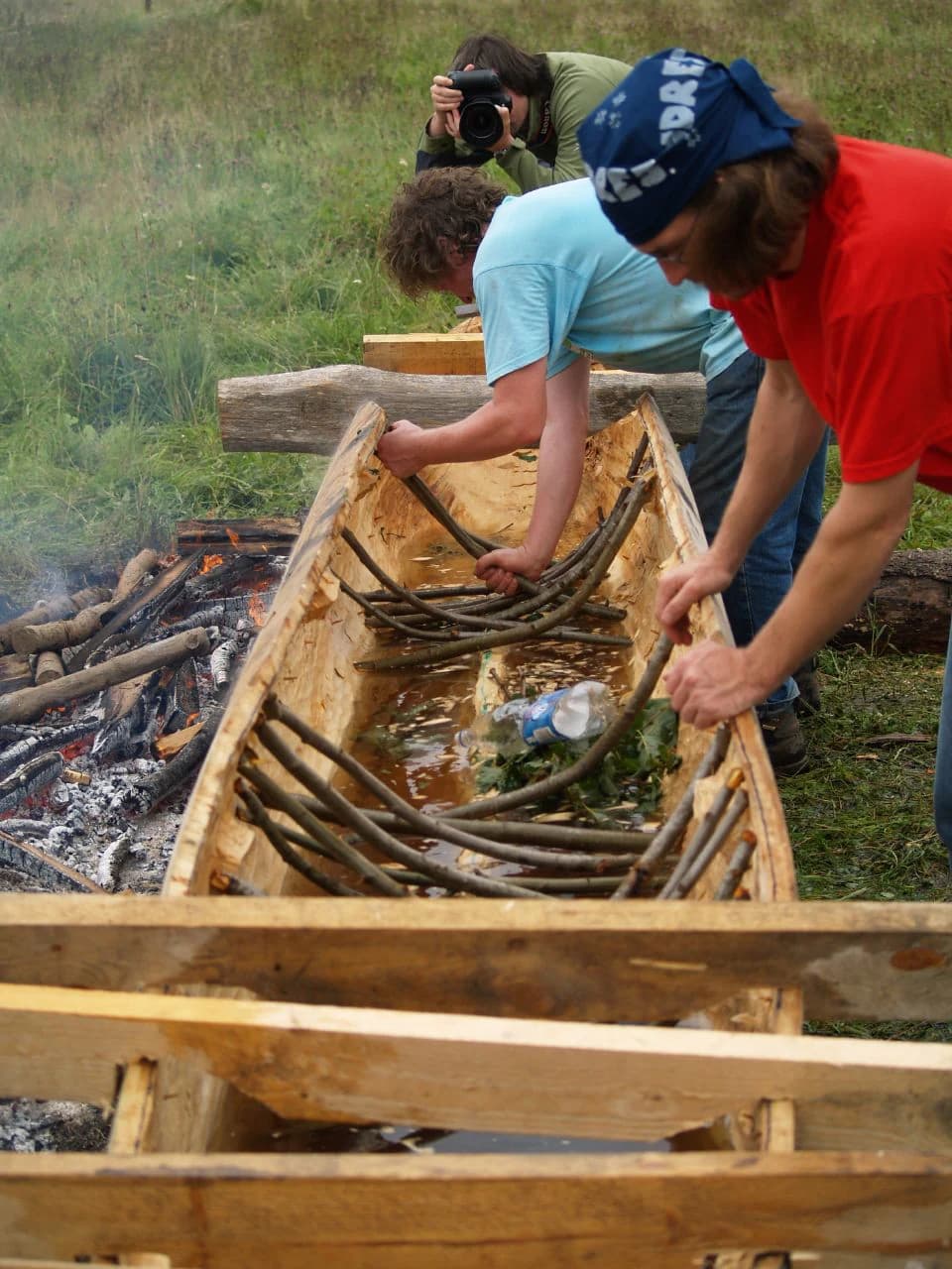
The Soomaa region has experienced dramatic demographic changes over the past century, with the human population decreasing more than tenfold since the mid-20th century to just 87 residents according to 2011 municipal records. This depopulation has resulted in the loss of both tangible and intangible cultural heritage, though efforts to preserve remaining traditions and knowledge continue through various projects. The remote character of Soomaa preserved a unique tradition of dugout canoe (haabjas) building that likely survived nowhere else in Europe, continuing into the 20th and 21st centuries. Recent decades have seen a revival of interest in this traditional craft, with log-boat building camps organized during summer months. The landscape contains traditional place names (toponyms) that reveal historical land use patterns and hold cultural significance for modern conservation efforts. Organizations including the Estonian Fund for Nature, the Tipu Nature School, and Mardu Studio work to support the park's administration and preserve remaining cultural heritage through educational programs and community initiatives.

A calm brown river bordered by tall green reeds and grasses under an overcast sky with tree branches overhead
Raudna River flowing through lush green wetlands under a cloudy sky in Soomaa National Park

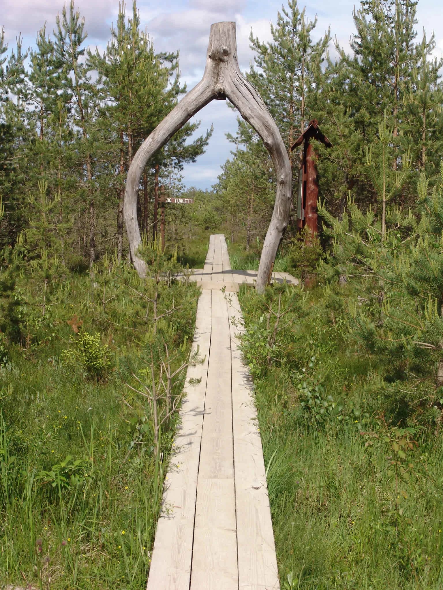
Top sights and standout views in Soomaa National Park

Soomaa National Park protects one of Europe's largest intact peat bog wilderness areas, with five major bog systems forming the core of a dynamic wetland landscape. The dramatic spring floods, known as the "fifth season," create Northern Europe's largest regularly flooded area, transforming the park into a vast aquatic landscape where raised bogs appear as islands. The park's bird populations are internationally significant, supporting major concentrations of Bewick's swan, common crane, and breeding populations of waders and birds of prey. Kuresoo Bog ranks among Estonia's two best-preserved large bogs. The park preserves Europe's only surviving tradition of dugout canoe building. The PAN Parks certification recognizes excellence in combining strict wilderness protection with sustainable tourism. The ancient dune formations on the park's eastern edge preserve landscape features from the Baltic Ice Lake period.

Landscape of Lati Marsh in Soomaa National Park with green wetlands, a tree, and partly cloudy sky
View from observation tower overlooking Lati Marsh in Soomaa National Park

Best time to visit Soomaa National Park

Soomaa can be explored throughout the year, with each season offering distinct experiences. The spring flood season, typically occurring at the end of March or early April, creates the park's most dramatic landscape transformation when water can rise by a metre per day, flooding the river valleys and creating the famous "fifth season" experience. This is the optimal time for canoeing through the flooded areas, though conditions require careful timing and local knowledge. The summer months from May through August offer stable conditions for hiking the network of trails, with the visitor centre providing maps and guides for self-guided exploration. The autumn migration from September to November brings large concentrations of cranes and swans, making this an excellent season for birdwatching. Winter, when the wetlands freeze solid, enables snowshoe and cross-country skiing excursions across the frozen bogs. The canoeing season extends from April through October, with the traditional dugout canoe trips providing a distinctive way to experience the waterways.

Park location guide

Geography guide, regional context, and park location map for Soomaa National Park

Soomaa National Park park geography, regions, and map view in Estonia
Understand where Soomaa National Park sits in Estonia through a broader geographic reading of the surrounding landscape, nearby location context, and its mapped position within the national park landscape.

How Soomaa National Park fits into Estonia

Estonia is a parliamentary republic and member of the European Union and NATO. With a population of about 1.4 million, it is one of the least populous EU member states. The official language is Estonian, and the currency is the Euro.

Wider geography shaping Soomaa National Park in Estonia

Estonia is situated on the eastern coast of the Baltic Sea in Northern Europe. It borders the Gulf of Finland to the north, Latvia to the south, and Russia to the east. The territory includes the mainland, the islands of Saaremaa and Hiiumaa, and over 2,300 smaller islands and islets.

Map view of Soomaa National Park

Use this park location map to pinpoint Soomaa National Park in Estonia, understand its exact geographic position, and read its mapped placement within the surrounding landscape more clearly.

Pigeon | © OpenStreetMap contributors

Location context for Soomaa National Park

Viljandi County

Explore the distinctive scenery, habitats, and ecological character of this Baltic protected area through immersive imagery.

Soomaa National Park Photos: Visual Guide to Estonia's Unique Peat Bogs and Wetland Landscapes
Browse imagery capturing the dynamic environments of Soomaa National Park, including its vast peat bog systems, seasonally flooded river plains, and ancient dune formations. Understand the park's unique protected landscapes and wetland ecology, visually illustrating its famous 'fifth season' floods and diverse natural habitats.

A bog landscape with dry grasses, scattered pine trees, and a lake under a partly cloudy sky.

A calm body of water reflecting clouds and sky, bordered by green vegetation and trees in a wetland landscape

Wooden boardwalk leading through green forest with large curved tree trunk arch and small building on right

A calm lake reflecting the sky with tall grasses and trees along the shore under a partly cloudy sky

Three people working on a wooden dugout canoe with a fire and grassy background

A wide grassy meadow with a dirt path winding through it, a small water channel on the left, scattered trees in the distance, and a partly cloudy sky

A calm brown river bordered by tall green reeds and grasses under an overcast sky with tree branches overhead

Landscape of Lati Marsh in Soomaa National Park with green wetlands, a tree, and partly cloudy sky

Red canoe resting on a calm river with grassy banks and forest in the background under overcast sky.

Frost-covered grassy wetland with calm water and scattered pine trees under clear sky.

Waterlogged landscape with houses partially submerged in calm water, leafless trees in background, and overcast sky

Park atlas

Compare other protected landscapes and wetland systems across Estonia, tracing their regional geography and conservation contexts.

Explore Nearby National Parks and Protected Areas Beyond Soomaa National Park
Discover other national parks, extensive peat bogs, and significant protected areas located geographically near Soomaa National Park in the Baltic region. This allows for a deeper exploration of regional wetland systems, comparing diverse conservation landscapes and understanding their unique geographic distribution.
Watercolor illustration showing a wetland landscape with grassy fields, a river, and trees in the background
National parkLääne County

Matsalu National Park: Explore Estonia's Premier Wetland National Park Geography and Protected Area

Discover mapped landscapes and bird migration routes in Lääne County.

Matsalu National Park, located in Lääne County, Estonia, is a prime example of a protected wetland ecosystem of international significance. This page delves into the park's unique geographic features, including the shallow brackish Matsalu Bay, the expansive Kasari River delta, and the numerous islands that form its coastal mosaic. Users can explore the park's protected boundaries and understand its critical function as a major staging area for migratory birds, offering a detailed atlas-level view of this important natural landscape.

Area
486.1 km²
Established
1957
Relief
Lowland
Climate
Temperate
Watercolor illustration showing rolling hills, meadows, wildflowers, and distant mountains
National park

Karula National Park: Detailed Map and Protected Landscape Context in Southern Estonia

Explore Karula Uplands' rolling terrain, lakes, and forests.

Karula National Park, Estonia's smallest national park, presents a densely clustered landscape of rolling hills, over 40 lakes, and extensive forest cover across the Karula Uplands. This protected area is a vital component of southern Estonia's natural geography, offering a rich mosaic of habitats. MoriAtlas facilitates a structured exploration of its mapped boundaries and the diverse ecosystems that define this distinctive natural landscape.

Area
123.64 km²
Established
1979
Relief
Upland
Climate
Temperate
Watercolor illustration of a river flowing through a valley with hills and greenery
National park

Gauja National Park: Latvia's Largest National Park Atlas and Protected Landscape

Mapped terrain and diverse natural heritage in Vidzeme.

As Latvia's largest national park, Gauja offers a deep dive into a protected landscape defined by the ancient Gauja River valley and its spectacular Devonian sandstone cliffs. This page provides essential geographic context and atlas-style information, detailing the park's mapped boundaries, unique geological formations, and the rich tapestry of natural and cultural heritage that makes it a cornerstone of the region's protected lands. Explore the varied terrain, from river valleys to rolling uplands, all within a meticulously mapped conservation area.

Area
917.87 km²
Established
1973
IUCN
II
Relief
Mixed relief
National park

Lahemaa National Park: Explore Estonia's Coastal Geography and Protected Landscape Atlas

Mapped terrain, bogs, and coastal peninsulas of a major protected area.

Delve into the detailed geography of Lahemaa National Park, Estonia's largest national park situated on the southern coast of the Gulf of Finland. This protected landscape encompasses a diverse range of terrain, from the deeply indented coastline and ancient glacial boulders to expansive raised bogs and rolling boreal forests. Understand the park's mapped boundaries and its significance as a premier destination for exploring distinct Baltic natural environments and historical coastal villages. The park's unique blend of natural features and cultural heritage makes it a key point of reference in any protected-area atlas.

Area
747 km²
Established
1971
IUCN
II
Relief
Lowland
Watercolor illustration of a lake, forests, and hills
National park

Alutaguse National Park: Eastern Estonia's Vast Peat Bog and Forest Protected Landscape

Mapping Protected Wetlands and Boreal Ecosystems in Estonia

Alutaguse National Park, a newly established national park in eastern Estonia, offers a unique atlas perspective on extensive peat bog ecosystems and boreal forests. Covering over 443 square kilometers, it represents some of the most intact wetland landscapes in the country. The park's creation unified eleven protected areas, safeguarding a critical habitat for rare species and showcasing the distinctive geography of the Alutaguse Lowland.

Area
443.31 km²
Established
2018
Relief
Lowland
Climate
Temperate
National parkUusimaa

Ekenäs Archipelago National Park: Mapped Baltic Sea Archipelago Landscape

Protected marine area with island geography in Uusimaa, Finland.

Delve into the unique protected landscape of Ekenäs Archipelago National Park, a premier example of a Baltic Sea marine protected area. Located in the Uusimaa region, this national park encompasses a vast expanse of coastal waters dotted with hundreds of rocky islets and skerries. MoriAtlas provides detailed geographic context, allowing for exploration of its mapped boundaries, island formations, and critical role as a sanctuary for breeding aquatic birds. Understand its place within Finland's protected areas atlas and appreciate its distinctive marine archipelago character.

Area
52 km²
Established
1989
IUCN
II
Visitors
53.6K annual
Marine protected areaSaare County

Vilsandi National Park: Marine Protected Area Atlas and Archipelago Geography

Explore the protected landscape of Western Saaremaa's coast.

Vilsandi National Park is an integral part of Saare County's protected lands, recognized as a significant marine protected area. This page offers an atlas-style exploration of its geography, focusing on the distinctive archipelago terrain, coastal formations along Saaremaa's western edge, and its vital importance as a stopover for migratory birds. Understand the park's mapped boundaries and its place within the broader Baltic Sea ecosystem through detailed geographic context.

Area
241 km²
Established
1957
Relief
Lowland
Climate
Temperate
Watercolor illustration of a river flowing through a forested landscape with mountains in the background
National park

Slītere National Park: Latvia's Protected Coastal Landscape with Blue Hills and Bird Flyways

Explore the unique terrain and protected geography of this Baltic national park.

Slītere National Park represents a distinctive protected landscape on Latvia's Courland Peninsula, celebrated for its ancient geological formations like the Blue Hills (Zilie Kalni) and its role as a crucial bird migration corridor. The park's geography encompasses varied dune systems, wetland habitats, and rich broadleaf forests, offering a unique mapped environment. Discover the park's protected area boundaries and its significance within the regional Baltic geography, highlighting its unique ecosystem features and landscape context.

Area
164.14 km²
Established
2000
IUCN
II
Relief
Mixed relief

Common questions about visiting, size, designation, and location context for Soomaa National Park

Soomaa National Park FAQs for park facts, access, geography, and protected area context
Find quick answers about Soomaa National Park, including protected-area facts, park geography, trail and visitor context, and how the park fits into its surrounding country and regional landscape.
MoriAtlas Explorer

Continue Your Protected Areas Search Across the Global Atlas

Deepen your exploration by continuing the structured search for national parks and protected areas worldwide. Utilize the comprehensive filtering capabilities to compare different conservation landscapes and refine your understanding of global park geography. Discover more about the distribution and characteristics of protected natural areas.

Global natural geography