Mori Atlas logo
National parkSouth East Forests National Park

Explore the mapped boundaries and natural landscape context of this protected area.

South East Forests National Park: A Protected National Park in New South Wales

(South East Forest National Park)

South East Forests National Park represents a significant protected national park entity within the geographic region of New South Wales, Australia. As part of MoriAtlas, this page serves as a gateway to understanding the park's mapped landscape and its place in the broader regional geography. Users can explore the defined boundaries and natural features that characterize this protected area, gaining insights into its environmental context without operational or travel specifics.

National ParkOld-Growth ForestTemperate RainforestEucalyptus ForestWilderness AreaNew South Wales

South East Forests National Park

National park

Park overview

Structured park overview, official facts, and landscape profile for South East Forests National Park

South East Forests National Park park facts, protected area profile, and essential visitor context

Review the core facts for South East Forests National Park, including designation, size, terrain, visitor scale, habitats, and operating context in one park-focused overview.

About South East Forests National Park

South East Forests National Park represents one of the most significant conservation achievements in southeastern Australia, protecting a remarkable diversity of forest ecosystems within a single protected area. The park spans a geographically diverse landscape that transitions from wet eucalypt forests on the western slopes to moist temperate rainforests in protected gullies and subalpine wetlands at higher elevations. The combination of old-growth forest, rainforest, and subalpine bog creates a complex ecological mosaic supporting high biodiversity. The park's establishment marked the culmination of decades of campaigning by conservationists who opposed extensive logging operations that had targeted the area since 1969. Today, the protected area serves as a crucial reference site for understanding the pre-settlement character of forests in this region and provides habitat for numerous species of conservation concern. The park's location bridging the Monaro and South Coast regions reflects its role as an ecological crossroads, with species from both humid coastal and more arid inland environments finding refuge within its boundaries.

Quick facts and research context for South East Forests National Park

The park covers 1,151.77 square kilometres (444.70 square miles) of protected terrain in southeastern New South Wales, situated between the Monaro and South Coast regions. It was established on 1 January 1997 through the consolidation of five former national parks. The area features old-growth eucalypt forests dominating 42% of the park, with temperate rainforest in protected gullies and subalpine bogs at higher elevations. The park is managed by the National Parks and Wildlife Service of New South Wales.

Protection and recognition

Mapping the terrestrial boundaries, official status, and regional protection framework.

South East Forests National Park Protection Status and Conservation Designation

Geographic records outline the terrestrial protection status and documented conservation framework of South East Forests National Park. Evaluating the official designation scope and verified administrative boundaries helps researchers understand how the regional forest system fits into broader conservation datasets.

Protection details

Protection scope
Terrestrial
Transboundary protection
No
Park context

Deeper park guide and search-rich context for South East Forests National Park

South East Forests National Park history, landscape, wildlife, and travel context

Explore South East Forests National Park through its history, landscape character, ecosystems, wildlife, conservation priorities, cultural context, and seasonal travel timing in a structured park guide built for atlas discovery and search intent.

Why South East Forests National Park stands out

South East Forests National Park is renowned for its extensive old-growth eucalyptus forests, which represent some of the finest remaining examples of this forest type in southeastern Australia. The park protects critical remnants of temperate rainforest that persist in sheltered valleys and creek lines, creating a mosaic of forest communities. It forms a vital component of a larger trans-frontier wilderness system connecting southeastern New South Wales with eastern Victoria, providing connectivity for wildlife movement across an otherwise fragmented landscape.

South East Forests National Park history and protected-area timeline

The creation of South East Forests National Park followed a protracted conservation battle spanning nearly three decades. Until 1968, much of the inland southeastern corner of New South Wales remained as vacant crown land known as the Wallagaraugh Wilderness, a rugged forested terrain. That year, a scientific committee appointed by the state government recommended protecting approximately 100,000 hectares as a national park. However, the Japanese company Harris-Daishowa sought to log the area for woodchips, and most land was reclassified as state forest, with only Nalbaugh and Nungatta National Parks declared in 1972 and 1973. Logging operations commenced in October 1969 and continued for 25 years despite intensifying opposition. The Unsworth Labor government proposed an 80,000-hectare park as an election promise in 1988 but was not re-elected. Under the Fahey government, five national parks (Genoa, Tantawangalo, Bemboka, Yowaka and Coolangubra) were gazetted in 1994, and these were amalgamated into South East Forests National Park on 1 January 1997.

South East Forests National Park landscape and geographic character

The park encompasses a varied landscape ranging from steep ridges and broad plateaus to deep gullies and sheltered valleys. The western portions of the park transition into more open terrain characteristic of the Monaro region, while the eastern areas feature the denser vegetation associated with the South Coast. Temperate rainforest occurs in the most sheltered positions, particularly along watercourses and in amphitheatre-like valleys that trap moisture. At higher elevations, the forest gives way to subalpine bogs and heathlands on poorly drained soils. The Black-Allan Line, which marks the border between New South Wales and Victoria, runs along much of the park's western boundary, separating the park from Coopracambra National Park in Victoria.

South East Forests National Park ecosystems, habitats, and plant life

The park supports an exceptional diversity of forest types, with wet sclerophyll eucalypt forests covering approximately 42 percent of the total area. These forests are characterised by tall eucalypts including several species that achieve their finest development in this region. The temperate rainforest communities represent outliers of the more extensive rainforests found further north along the Great Dividing Range and in southeastern Victoria. These rainforests contain species such as the black olive berry and soft tree fern, which create a distinctive understory. The subalpine bogs at higher elevations support specialised plant communities adapted to waterlogged conditions, adding further ecological complexity to the park. This mosaic of habitats ensures that the park retains high biodiversity values across multiple forest types.

South East Forests National Park wildlife and species highlights

The park provides habitat for a notable array of fauna, including several threatened species. The smoky mouse, a small native rodent listed as threatened, inhabits the old-growth forests and feeds on seeds and fungi. The olive whistler, a bird species vulnerable in New South Wales, is found throughout the park's forested areas. The park forms part of the Ulladulla to Merimbula Important Bird Area, identified by BirdLife International for its significance to the swift parrot, a migratory species that visits the region during the southern winter. The old-growth forest structure, with its abundance of hollows in older trees, provides crucial nesting and shelter resources for arboreal mammals and birds.

South East Forests National Park conservation status and protection priorities

South East Forests National Park represents a significant conservation outcome in a region that was extensively logged for more than two decades. The park protects some of the highest quality old-growth forest remaining in southeastern Australia, an ecosystem type that has been vastly reduced by historical clearing and forestry operations. The protection of this forest estate ensures the survival of numerous species that depend on mature forest structure, including hollow-dependent fauna and plants requiring stable microclimates. The park's connectivity with Coopracambra National Park in Victoria creates a transfrontier conservation landscape spanning the Black-Allan Line, facilitating wildlife movement across an area of approximately 100,000 hectares of contiguous protected land from Bombala to Cann River.

South East Forests National Park cultural meaning and human context

The park occupies a landscape that was historically part of the broader Wallagaraugh Wilderness, a remote and rugged area that remained largely unsettled due to its difficult terrain. The land was managed as vacant crown land prior to the mid-twentieth century, with limited traditional use records explicitly documented in available sources. The region's isolation contributed to the survival of forest ecosystems that were cleared or heavily modified in surrounding areas.

Top sights and standout views in South East Forests National Park

The park protects exceptional old-growth eucalypt forests among the finest in southeastern Australia, together with significant temperate rainforest remnants in sheltered valleys and subalpine bogs at higher elevations. It forms part of a contiguous 100,000-hectare wilderness system with Coopracambra National Park in Victoria. The park provides critical habitat for threatened species including the smoky mouse and serves as an important area for migratory birds such as the swift parrot. The landscape offers a transition between Monaro and South Coast regional characteristics, supporting diverse ecological communities within a single protected area.

Best time to visit South East Forests National Park

The park can be visited throughout the year, though the changing seasons bring different characters to the landscape. Autumn and winter months often provide clearer visibility and the opportunity to observe wildlife as animals become more active during cooler periods. The wet eucalypt forests are particularly atmospheric during the cooler months when mist often settles in the valleys. Spring brings wildflower displays in the more open areas and subalpine bogs. Summer offers opportunities for exploring higher elevation trails but visitors should be prepared for variable weather conditions typical of this elevated terrain.

Monthly climate preview

Track long-term temperature ranges and precipitation trends across New South Wales forest habitats

Climate and Monthly Weather Normals for South East Forests National Park

Long-term climatology data at a representative coordinate of 562 meters elevation reveal a seasonal cycle transitioning from warm peak-month averages to cool mid-year minimums. Accessing the complete monthly profile provides historical statistics on daily precipitation, average maximums, and daily temperature thresholds throughout the year.
Annual mean13 °C
6 °C20 °C
Jan20°
Feb19°
Mar17°
Apr13°
May10°
Jun
Jul
Aug
Sep10°
Oct13°
Nov15°
Dec17°
Warmest month
January

19.7 °C

Coolest month
July

6.5 °C

Wettest month
February

2.8 mm/day

Driest month
May

1.5 mm/day

Park location guide

Geography guide, regional context, and park location map for South East Forests National Park

South East Forests National Park park geography, regions, and map view in Australia

Understand where South East Forests National Park sits in Australia through a broader geographic reading of the surrounding landscape, nearby location context, and its mapped position within the national park landscape.

How South East Forests National Park fits into Australia

Australia is a constitutional monarchy and federal parliamentary democracy comprising six states and ten territories. With a population of nearly 28 million, it is one of the world's most urbanised countries, with most people concentrated on the eastern seaboard. The country has a high Human Development Index and is known for its cultural diversity, ancient Aboriginal heritage, and unique wildlife.

Wider geography shaping South East Forests National Park in Australia

Australia occupies the entire Australian continent, the island of Tasmania, and numerous smaller islands. It is the world's flattest and driest inhabited continent, featuring vast deserts in the interior (the Outback), tropical rainforests along the eastern coast, and a coastline bordering the Indian and Pacific Oceans.

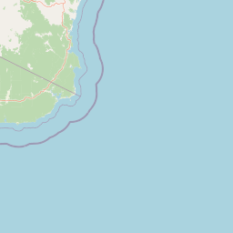
Map view of South East Forests National Park

Use this park location map to pinpoint South East Forests National Park in Australia, understand its exact geographic position, and read its mapped placement within the surrounding landscape more clearly.

Pigeon | © OpenStreetMap contributors

Location context for South East Forests National Park

New South Wales
Natural feature types

Browse the Geography and Natural Features of South East Forests National Park

Navigate the diverse landscape of South East Forests National Park through our structured collection of named features and terrain types. MoriAtlas provides detailed geographic context for the forests, valleys, and elevated landforms defining this significant protected wilderness in New South Wales.
Recorded earthquake history

Examine Historical Seismic Data for South East Forests National Park

Browse the documented catalogue of past seismic activity associated with the landscapes of South East Forests National Park. This MoriAtlas resource tracks historical earthquake occurrences and geographic epicentre data to provide a clear view of the regional seismic record.

South East Forests National Park Earthquake History

Catalogued events

2 events

Strongest magnitude

Magnitude 3.4

Most recent event

Dec 1, 2003

This history includes earthquakes recorded inside the park or within 50 km of its borders

Park atlas

Trace the Geographic Spread of National Parks and Protected Areas Across Southeastern New South Wales and Adjacent Victoria, Australia

Explore Connected Protected Landscapes and Regional Parks Near South East Forests National Park, Australia

After exploring South East Forests National Park, discover additional national parks and protected landscapes within southeastern New South Wales and the adjacent Victorian border region. This regional park atlas view helps compare their distinct geographic features, ecological connections, and the broader conservation landscape beyond a single protected area.
National parkAustralia
Park boundaries overlap#1 closest

Southwest

Coopracambra National Park: Remote Mountainous Protected Landscape in Victoria

Explore its transboundary wilderness role and tall forest terrain.

Coopracambra National Park stands as a significant protected landscape in Victoria, Australia, renowned for its rugged mountainous terrain and extensive tall eucalypt forests. This remote national park serves as the crucial Victorian component of a vast transboundary wilderness corridor, linking protected areas across the state border into New South Wales. Its geographic identity is shaped by prominent peaks such as Mount Coopracambra and the unique Black-Allan Line boundary, offering users a detailed atlas view of its conservation significance and natural features within south-eastern Australia.

Area
388 km²
Established
1988
IUCN
II
Relief
Mountain
National parkNew South Wales
Park boundaries overlap#2 closest

North

Wadbilliga National Park: Exploring New South Wales' Rugged Protected Landscape

Discover its mapped terrain and diverse ecosystem geography.

Wadbilliga National Park in New South Wales is a prime example of a large, remote protected area characterized by its rugged natural terrain and diverse ecosystems. Spanning approximately 985 square kilometres, the park features dramatic geographic contrasts, from deep gorges carved by rivers like the Tuross to expansive plateaus and sheltered gullies supporting varied vegetation communities. Its designation as a national park underscores its importance for conservation and provides a unique opportunity for understanding the mapped landscape context of southeastern Australia.

Area
985.3 km²
Established
1979
IUCN
Ib
Relief
Mountain
National parkNew South Wales
0.1 km away#3 closest

Southeast

Mount Imlay National Park: Protected Land Geography and Mapped Boundaries in New South Wales

Explore the geographic context of this Australian national park.

Mount Imlay National Park serves as a significant protected area within New South Wales, providing a focal point for understanding regional geography and mapped natural landscapes. As a national park, its boundaries and terrain offer valuable insights for atlas-based discovery, highlighting Australia's commitment to conserving diverse geographic entities and showcasing its role in the broader national landscape context.

Area
48 km²
Established
1972
IUCN
II
Relief
Mountain
Nature reserveNew South Wales
About 3.2 km away#4 closest

Northeast

Brogo Reserve Nature Reserve: Atlas Overview of Protected Landscapes in the Bega Valley

Geographic mapping of ridges, gullies, and riparian forest corridors

Brogo Reserve protects a 120-hectare mosaic of granite-based forest communities near the Bega Valley. The site includes dry rainforest, wet shrub forest, and riparian woodland, offering a concentrated look at regional biodiversity and habitat structure within a distinct geographic corridor of New South Wales.

Area
1.2 km²
Established
1995
Relief
Upland
Climate
Temperate
Watercolor illustration showing a coastal landscape with green hills, blue water, and distant mountains
National parkNew South Wales
5.7 km away#5 closest

Northeast

Bournda National Park: A Protected National Park in New South Wales

Explore mapped boundaries and regional geographic context.

Bournda National Park represents a key protected area within the state of New South Wales, Australia. This page offers focused discovery of its protected landscape identity, situated within the broader geographic framework of the region. Examine the park's mapped boundaries and understand its significance as a component of Australia's network of natural landscapes.

Area
26.55 km²
Established
1947
IUCN
II
Relief
Lowland
National parkNew South Wales
6.8 km away#6 closest

Southeast

Beowa National Park: Protected Landscape and Coastal Geography in New South Wales

Mapped terrain and unique erosion sites within this national park.

Delve into the protected landscape of Beowa National Park, situated in the coastal region of New South Wales. This national park showcases a varied terrain, from heathland headlands to eucalypt woodlands, with the visually dramatic Pinnacles erosion gully as a key highlight. Its geographic setting within Twofold Bay provides a compelling focus for atlas exploration of Australia's protected natural areas.

Area
104.86 km²
Established
1971
IUCN
II
Relief
Lowland
Watercolor illustration showing a landscape with green trees, rolling hills, and a path
National parkNew South Wales
7.5 km away#7 closest

Northeast

Biamanga National Park: Protected National Park with Volcanic Landscape & Regional Geography

Discover mapped terrain and natural park boundaries.

Biamanga National Park is a significant protected area in New South Wales, Australia, notable for its volcanic mountain landscape dominated by Mumbulla Mountain. This national park provides valuable context for understanding regional geography, offering insights into its unique terrain, granite formations, and creek systems. Explore its protected boundaries and the ecological significance of this distinct natural landscape.

Area
137.49 km²
Established
1994
IUCN
II
Relief
Mountain
Nature reserveNew South Wales
About 10 km away#8 closest

East

Eagles Claw Nature Reserve: Mapping Coastal Protected Landscapes in New South Wales

Coastal terrain, sea gutters, and penguin nesting habitat

Eagles Claw Nature Reserve is a distinctive protected area on the NSW far south coast, known for its rugged shoreline of sea gutters and low cliffs. The site features dense coastal scrub dominated by bracelet honey myrtle, providing essential nesting shelter for little penguins. This atlas overview details the reserve's topography and its function as a vital coastal sanctuary.

Area
0.01 km²
Established
1986
IUCN
IV
Relief
Lowland

Common questions about visiting, size, designation, and location context for South East Forests National Park

South East Forests National Park FAQs for park facts, access, geography, and protected area context

Find quick answers about South East Forests National Park, including protected-area facts, park geography, trail and visitor context, and how the park fits into its surrounding country and regional landscape.
MoriAtlas Explorer

Continue Your Protected Areas Search Across the Global Atlas

Deepen your exploration by continuing the structured search for national parks and protected areas worldwide. Utilize the comprehensive filtering capabilities to compare different conservation landscapes and refine your understanding of global park geography. Discover more about the distribution and characteristics of protected natural areas.

Global natural geography