Mori Atlas logo
National parkSynevyr National Nature Park

Detailed geographic context and mapped park boundaries for a key Ukrainian protected area.

Synevyr National Nature Park: Protected Landscape in Zakarpattia Oblast, Ukraine

Synevyr National Nature Park stands as a significant protected landscape within the Carpathian Mountains of Ukraine's Zakarpattia Oblast. This dedicated national park offers a crucial entry point for understanding the regional geography and the distribution of protected lands across western Ukraine. Engage with its mapped boundaries and geographic setting to grasp its role in the broader atlas of natural areas. Explore the terrain and regional context that define this important Ukrainian conservation area.

National parkCarpathian mountainsOld-growth forestAlpine lakeRamsar siteUNESCO World Heritage

Synevyr National Nature Park

National park

Park overview

Structured park overview, official facts, and landscape profile for Synevyr National Nature Park

Synevyr National Nature Park park facts, protected area profile, and essential visitor context
Review the core facts for Synevyr National Nature Park, including designation, size, terrain, visitor scale, habitats, and operating context in one park-focused overview.

About Synevyr National Nature Park

Synevyr National Nature Park protects a significant portion of the Ukrainian Carpathians in Zakarpattia Oblast, the westernmost region of Ukraine that borders Hungary, Slovakia, Poland, and Romania. The park's establishment in 1974 reflected growing recognition of the Carpathian mountains' ecological importance, as the region contains some of Europe's last extensive tracts of unmodified forest and serves as a refuge for species that have been displaced from more heavily developed lowland areas. The park's landscape is dominated by mountain slopes ascending to ridgelines, with forest covering the majority of the terrain. Synevyr Lake occupies a glacial cirque basin, its dark waters providing a dramatic focal point within the mountain landscape. Beyond the lake, the park contains numerous streams and smaller water bodies that drain the highland terrain. The protected area extends across multiple altitudinal zones, creating habitat diversity that supports both forest-dwelling species and species associated with higher-elevation open terrain. Visitors to the park can access trails that lead to the lake and onward into the surrounding mountains, with the Khust area serving as the primary population center for park operations and visitor services.

Quick facts and research context for Synevyr National Nature Park

Synevyr National Nature Park occupies a substantial area of roughly 40,400 hectares in the Zakarpattia Oblast of western Ukraine, within the Carpathian mountain system. The park was formally established in 1974 as part of Ukraine's network of national parks. The region's position in the Carpathians means the park features rugged mountain terrain, dense forest coverage, and the notable Synevyr Lake. In July 2004, Synevyr Lake was designated as a Ramsar Wetland of International Importance, recognizing its ecological significance as a freshwater habitat. The park's diverse mammalian fauna includes brown bears, wolves, lynxes, and otters, while its avifauna features capercaillies, various owl species, and woodpeckers.

Park context

Deeper park guide and search-rich context for Synevyr National Nature Park

Synevyr National Nature Park history, landscape, wildlife, and travel context
Explore Synevyr National Nature Park through its history, landscape character, ecosystems, wildlife, conservation priorities, cultural context, and seasonal travel timing in a structured park guide built for atlas discovery and search intent.

Why Synevyr National Nature Park stands out

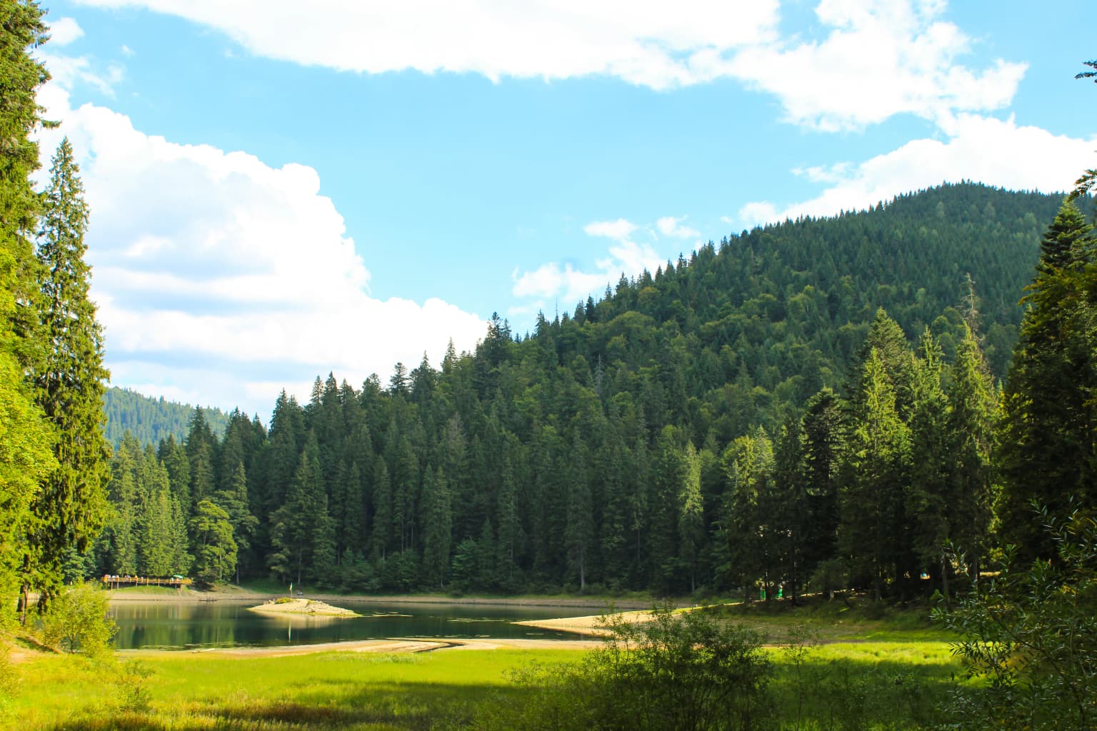
Synevyr National Nature Park is most renowned for two interconnected features: its namesake alpine lake, which is one of the most picturesque bodies of water in the Ukrainian Carpathians, and its exceptional old-growth beech forests. The Carpathian beech primeval forests represent some of the last remaining unmodified forest ecosystems in Europe, and several sections of the park were inscribed on the UNESCO World Heritage List in 2017 as part of a broader transnational designation covering beech forests across multiple European countries. The park also maintains a brown bear sanctuary, providing protection for one of the Carpathian region's most iconic large mammals.

Synevyr National Nature Park history and protected-area timeline

The establishment of Synevyr National Nature Park in 1974 marked an important milestone in the conservation of Ukraine's Carpathian region. During the Soviet era, the creation of protected areas reflected both scientific interest in preserving unique ecosystems and a broader recognition that certain landscapes held national significance beyond their economic potential. The park was formally designated to protect the Synevyr Lake area and the surrounding forest ecosystems. Following Ukraine's independence in 1991, the park's status and management continued under Ukrainian jurisdiction, with ongoing recognition of its ecological value. A significant development occurred in 2004 when Synevyr Lake received Ramsar Convention designation, formally recognizing its importance as a wetland habitat of international significance. The most recent major recognition came in 2017, when portions of the park's old-growth beech forests were included in the UNESCO World Heritage List as part of the "Primeval Beech Forests of the Carpathians and Other Regions of Europe" transnational inscription, acknowledging these forests as irreplaceable examples of forest ecosystem evolution.

Synevyr National Nature Park landscape and geographic character

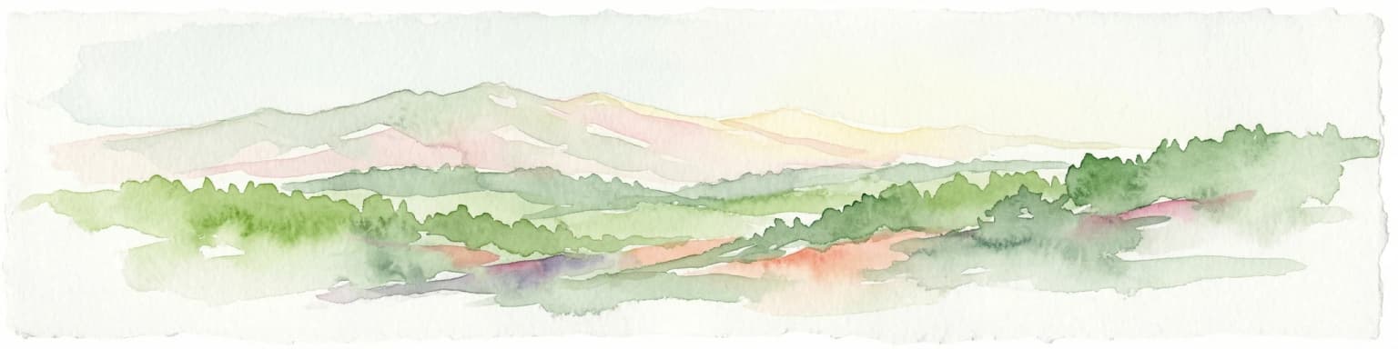
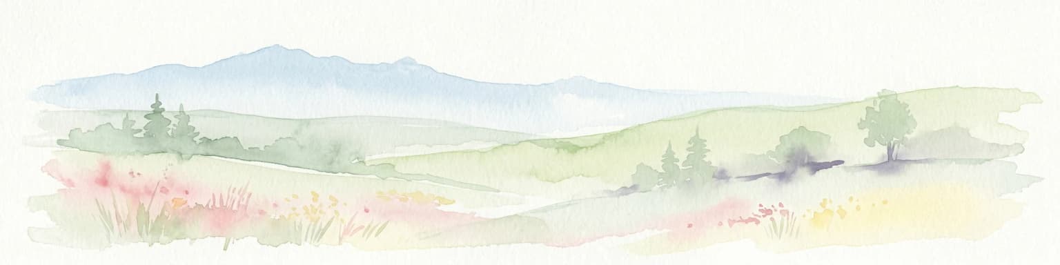
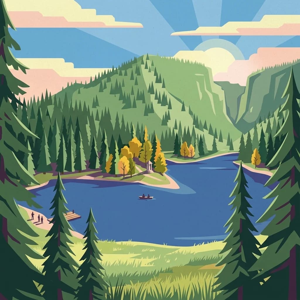
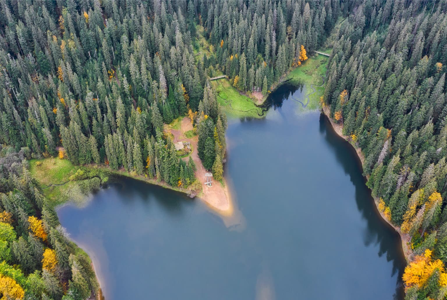
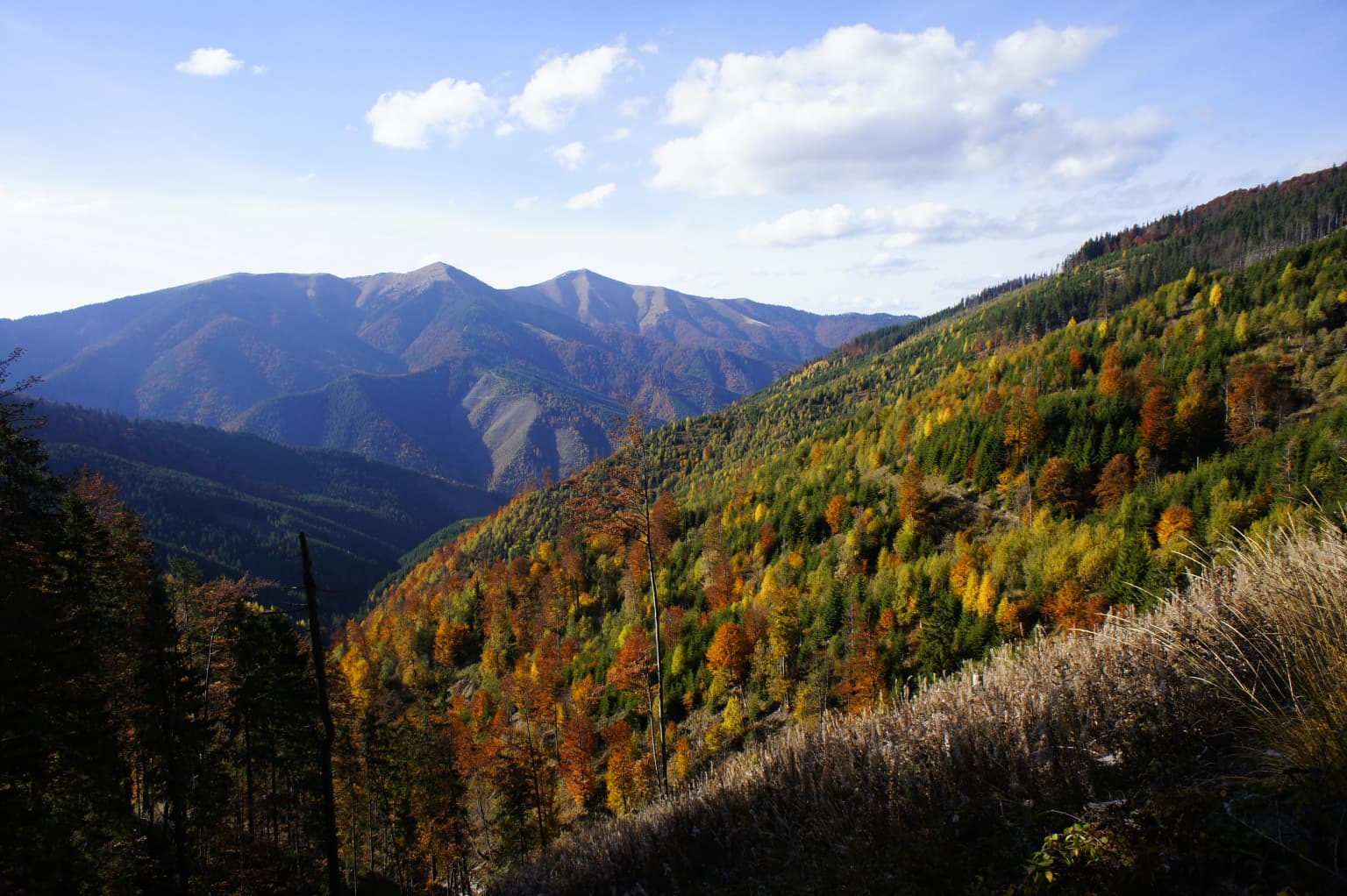
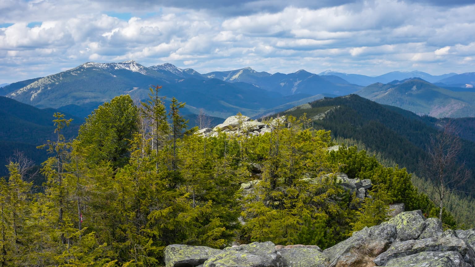
The physical landscape of Synevyr National Nature Park is defined by its position within the Carpathian mountain range, a major European mountain system that runs through central and eastern Europe. The park encompasses steep mountain slopes, ridgelines, and valley areas, with elevation changes creating dramatic topographic variation across the protected area. The dominant feature is Synevyr Lake, a glacial lake formed in a cirque basin where ice age glaciers carved out a deep depression that subsequently filled with water. The lake sits at an elevation that places it in the subalpine zone, surrounded by slopes that rise above it toward higher peaks. Forest covers most of the park's area, with the tree line varying depending on slope aspect and local conditions. The park contains numerous mountain streams that cascade down slopes, draining into larger watercourses that flow through the valleys. The overall character is one of wild, mountainous terrain with limited human infrastructure visible from most vantage points, creating an environment that feels far removed from the populated lowlands below.

Synevyr National Nature Park ecosystems, habitats, and plant life

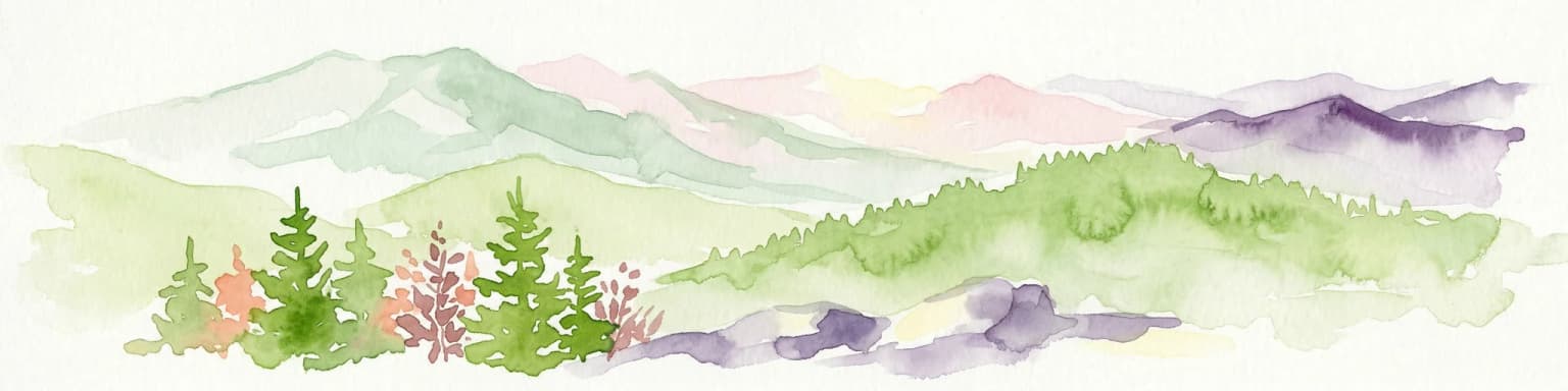
The ecological character of Synevyr National Nature Park reflects its location in one of Europe's most biodiversity-rich mountain regions. The park spans multiple altitudinal zones, from valley forests up through montane and subalpine levels, creating a diversity of habitats within a relatively compact area. The most celebrated ecological feature is the old-growth beech forest, which represents forest that has developed over centuries without significant human intervention. These forests contain large beech trees of considerable age, complex canopy structures, and the accumulated organic matter that supports diverse communities of forest organisms. The Carpathian beech forests are considered among the finest examples of this forest type in Europe, which is why they merited UNESCO World Heritage recognition. Beyond the beech-dominated forests, the park contains other forest types including mixed forests with coniferous species. The lake and streams support aquatic ecosystems, while rocky areas and clearings add further habitat variation. This ecological diversity underlies the park's significance as a conservation area.

Synevyr National Nature Park wildlife and species highlights

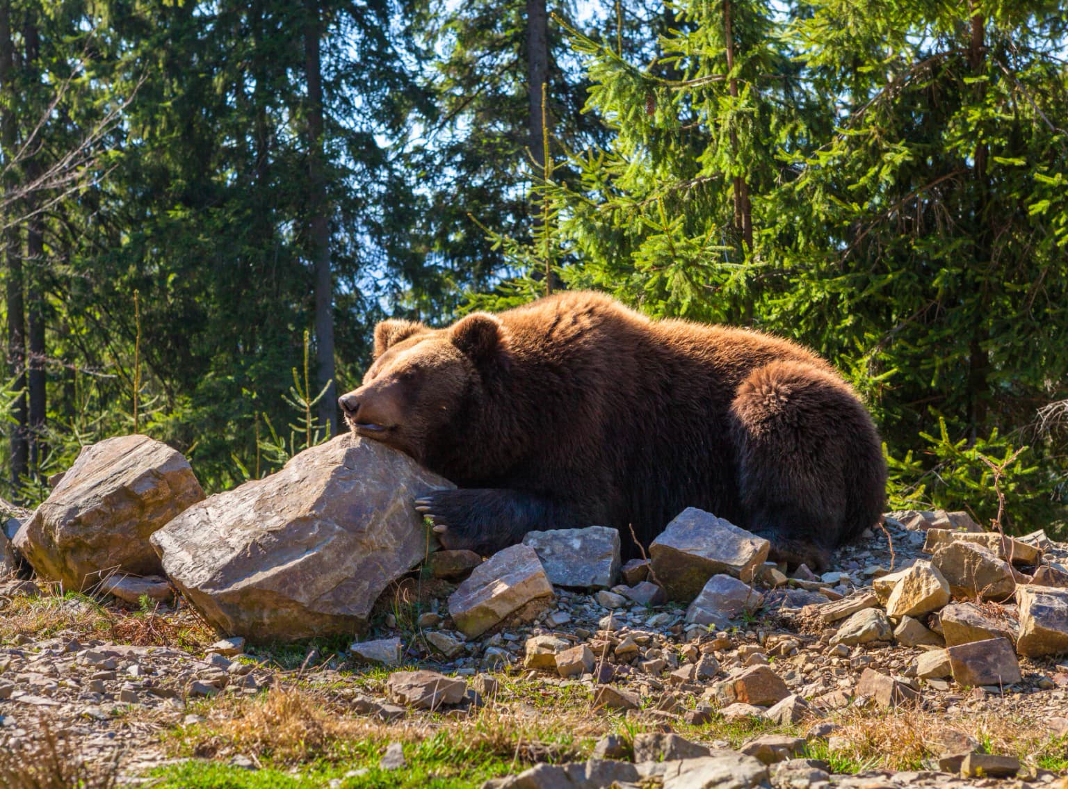
The mammalian fauna of Synevyr National Nature Park includes several species that define the Carpathian wilderness character. Brown bears are the park's most iconic large mammal, present in numbers that allow for dedicated brown bear viewing opportunities within the protected area. Wolves persist as a top predator within the ecosystem, their presence indicating a healthy predator-prey balance. Lynxes represent a more elusive feline predator, adapted to hunting in the dense forest. Smaller mammals include wild boars, otters, badgers, and ermines, each occupying different niches within the park's ecosystems. The avifauna is particularly diverse, with capercaillie being a notable species associated with coniferous forest habitats. Various raptor species including buzzards patrol the skies, while the forest canopy supports multiple owl species and several woodpecker species. The ring ouzel, a thrush related to the more widespread blackbird but associated with mountain streams, adds to the park's bird diversity. Mountain streams contain trout, grayling, and minnow, supporting fish populations despite the cold, fast-flowing nature of these waters. Amphibians including the spotted salamander, Carpathian newt, and Alpine newt inhabit the park's wetlands and forested areas.

Synevyr National Nature Park conservation status and protection priorities

Synevyr National Nature Park holds significant conservation importance at both national and international levels. The park's core conservation value lies in its old-growth beech forests, which represent some of Europe's last remaining unmodified forest ecosystems. In 2017, portions of these forests were inscribed on the UNESCO World Heritage List as part of the transnational "Primeval Beech Forests of the Carpathians and Other Regions of Europe" designation, recognizing their outstanding universal value as examples of forest ecosystem evolution. This inscription encompasses forest massifs across multiple European countries, with Synevyr representing one of the finest Carpathian examples. The designation of Synevyr Lake as a Ramsar Wetland in 2004 further underscores the site's conservation significance, formally recognizing the lake's importance as a freshwater habitat. The park's brown bear population benefits from protection within the reserve, as this species requires large territories and intact habitats. The overall conservation framework maintains the park's role as a core area within the Carpathian mountain conservation landscape, connecting with other protected areas across the region.

Synevyr National Nature Park cultural meaning and human context

The cultural context of Synevyr National Nature Park relates to the broader Carpathian region's history of traditional mountain life and the specific communities of Zakarpattia Oblast. The park lies within an area historically associated with Hutsul culture, a distinctive ethnographic group known for their traditional dress, wooden architecture, and pastoral practices. The town of Khust, where the park's headquarters are located, has historical roots going back centuries as a settlement in this mountainous border region. The landscape has supported human communities for generations, with traditional land uses including seasonal pastoralism and forest resource utilization. While the park itself is focused on ecological protection, the surrounding region maintains cultural connections to the mountain environment that shaped local identity and economy. The park name derives from the Ukrainian "Synevyr," which references the blue color of the lake's waters.

Top sights and standout views in Synevyr National Nature Park

Synevyr National Nature Park offers visitors a combination of natural landmarks and wilderness experiences characteristic of the Carpathian mountains. The lake itself is the park's signature feature, a striking body of water set within a dramatic mountain amphitheater that rewards those who make the journey to its shores. The old-growth beech forests represent living examples of ecological processes that have operated without human interruption for centuries, offering visitors the chance to walk through forests with trees that began growing generations before modern times. Wildlife observation, particularly brown bear viewing, draws visitors interested in encountering the Carpathian mountains' most impressive resident species. The hiking trails that traverse the park provide access to viewpoints and landscapes that showcase the area's mountain character. The park's UNESCO World Heritage status adds international recognition to its natural values, positioning it among the most significant protected areas in Europe.

Best time to visit Synevyr National Nature Park

The best time to visit Synevyr National Nature Park depends on what visitors hope to experience, with each season offering distinct character. Summer months bring the most accessible conditions for hiking and lake access, with warmer temperatures and longer daylight hours allowing extended exploration of the park's trails. The summer season typically sees the greenest forest coverage and the most active wildlife behavior as animals exploit the productive warm season. Autumn offers a different character as forest foliage transforms through brilliant color changes, with the beech forests displaying their autumn hues. This season can provide excellent photography opportunities and fewer crowds than mid-summer. Winter brings cold temperatures and snow to the Carpathian heights, creating a dramatically different landscape that appeals to those interested in winter wilderness experiences. Spring sees the snowmelt feeding streams and rivers while forest understory begins green growth. The lake can be enjoyed in any season, though access and conditions vary with weather. The brown bear sanctuary may offer viewing opportunities at specific times when food is provided to attract bears for observation.

Park location guide

Geography guide, regional context, and park location map for Synevyr National Nature Park

Synevyr National Nature Park park geography, regions, and map view in Ukraine
Understand where Synevyr National Nature Park sits in Ukraine through a broader geographic reading of the surrounding landscape, nearby location context, and its mapped position within the national park landscape.

How Synevyr National Nature Park fits into Ukraine

Ukraine is a sovereign nation in Eastern Europe, bordered by Russia, Belarus, Poland, Slovakia, Hungary, Romania, Moldova, and the Black Sea. It is the second-largest country in Europe by area. Kyiv is the capital and largest city, followed by Kharkiv, Odesa, and Dnipro. The official language is Ukrainian. Ukraine has a population of approximately 32.9 million and operates as a unitary semi-presidential republic.

Wider geography shaping Synevyr National Nature Park in Ukraine

Ukraine occupies 603,628 km² in Eastern Europe, making it the second-largest country in Europe. It shares borders with Russia, Belarus, Poland, Slovakia, Hungary, Romania, and Moldova. The country has a southern coastline along the Black Sea and Sea of Azov. The terrain includes plains, steppes, and the Carpathian Mountains in the west.

Map view of Synevyr National Nature Park

Use this park location map to pinpoint Synevyr National Nature Park in Ukraine, understand its exact geographic position, and read its mapped placement within the surrounding landscape more clearly.

Pigeon | © OpenStreetMap contributors

Location context for Synevyr National Nature Park

Zakarpattia Oblast
Park atlas

Compare the diverse mountain geography and connected protected landscapes surrounding Synevyr National Nature Park.

Explore Other National Parks and Protected Areas Near Synevyr National Nature Park
Explore additional national parks and protected areas geographically adjacent to Synevyr National Nature Park, including other Carpathian mountain ranges and significant forest reserves. This allows for comprehensive atlas-style comparison of diverse protected landscapes, mapping conservation efforts and natural features across the broader region.
National parkIvano-Frankivsk Oblast

Syniohora National Nature Park: Protected Carpathian Landscape and Geographic Context

Explore the mapped terrain and protected area boundaries within the Gorgany mountains.

Syniohora National Nature Park, located in Ivano-Frankivsk Oblast, is a vital protected area safeguarding a significant portion of the Gorgany mountain massif. This park offers a unique opportunity to explore the mapped geography and natural landscape characteristic of the Ukrainian Carpathians. Its establishment as a national park underscores the importance of preserving the region's mountain terrain, protected forest ecosystems, and distinctive natural heritage for structured geographic discovery.

Area
108.66 km²
Established
2009
IUCN
II
Scope
Terrestrial
National parkZakarpattia Oblast

Zacharovanyi Krai National Nature Park: Protected Landscape Atlas Entry

National park within Zakarpattia Oblast, Ukraine

Navigate Zacharovanyi Krai National Nature Park, a designated national park offering vital insights into protected landscapes and regional geography. This entry provides core information about the park's protected area status and its geographic setting within Zakarpattia Oblast, essential for structured atlas discovery and understanding the mapped natural terrain of western Ukraine.

Area
61.01 km²
Established
2009
IUCN
II
Relief
Mountain
National parkIvano-Frankivsk Oblast

Carpathian National Nature Park: Protected Landscape Within Ivano-Frankivsk Oblast

National Park mapped boundaries and regional geography.

Carpathian National Nature Park represents a significant protected area within Ivano-Frankivsk Oblast, Ukraine. This page offers detailed insights into its protected landscape identity, helping users understand its geographic setting and mapped boundaries. As part of the Carpathian region, the park serves as a key point for atlas-based discovery, providing context for its place within the broader geography of western Ukraine.

Area
515.7 km²
Established
1980
IUCN
II
Visitors
1M annual
National parkUkraine

Skole Beskids National Nature Park: Protected Landscape Atlas and Geographic Context in Ukraine

Explore the mapped boundaries and regional geography of this Ukrainian national park.

Delve into the specifics of Skole Beskids National Nature Park, a designated national park contributing to Ukraine's protected lands. This detail page offers a structured atlas view, focusing on the park's geographic positioning, its mapped natural landscape features, and its significance within the regional context. Understand the core identity of this protected area through detailed geographic and landscape data, enabling focused map exploration.

Area
357 km²
Established
1999
IUCN
II
Relief
Mountain
Watercolor illustration of green and purple mountains with pine trees and flowering shrubs in the foreground
National parkLviv Oblast

Boikivshchyna National Nature Park: National Park Protected Landscape Exploration

Lviv Oblast geographic context and mapped terrain

Dive into the protected landscape of Boikivshchyna National Nature Park, a key national park located in Lviv Oblast. MoriAtlas facilitates structured discovery of its mapped boundaries, regional geography, and the unique natural terrain it encompasses. This entry is designed for users interested in the specific park identity, its geographic setting within Ukraine, and detailed atlas-based understanding of protected natural areas.

Area
317 km²
Established
2019
IUCN
II
Relief
Mountain
Watercolor illustration of a mountainous landscape with forests, lakes, and rolling hills under a light sky
National parkUkraine

Uzh National Nature Park: Primeval Beech Forests and Protected Landscape in Ukraine

Explore its mapped boundaries and Carpathian geography.

Uzh National Nature Park, a protected national park in Ukraine's Carpathian Mountains, safeguards a crucial segment of the Primeval Beech Forests of the Carpathians, a UNESCO World Heritage site. This atlas-focused exploration reveals the park's mapped terrain, defined by river valleys and ancient forest ecosystems, offering essential geographic context for this significant protected landscape. Discover the natural heritage preserved within its boundaries, showcasing exceptional biodiversity and the unique character of the Eastern Carpathians.

Area
391.593 km²
Established
1999
IUCN
II
National parkIvano-Frankivsk Oblast

Halych National Nature Park: Ivano-Frankivsk Oblast National Park Atlas & Geography

Mapped protected boundaries and landscape context.

Halych National Nature Park is a vital protected area situated in the Ivano-Frankivsk Oblast of Ukraine, characterized by its transitional landscape where Carpathian foothills merge with the East European Plain. This national park offers a rich tapestry of environments, including oak-hornbeam and oak-beech forests, vital wetlands, and scarce steppe remnants, creating a mosaic of habitats mapped meticulously within the MoriAtlas platform. Explore the park's geographic identity, its diverse terrain, and its significance as a conservation landscape for understanding regional biodiversity.

Area
147 km²
Established
2004
IUCN
II
Relief
Lowland
National parkVerkhovyna Raion

Verkhovyna National Nature Park: Explore Protected Landscape Geography in Verkhovyna Raion

Discover Ukraine's Verkhovyna National Nature Park mapped terrain.

Verkhovyna National Nature Park represents a vital protected area within the Verkhovyna Raion of Ukraine. This detailed atlas entry focuses on the park's geographic significance, providing insights into its mapped boundaries and its role within the regional landscape context of the Carpathian Mountains. It serves as a focused point for understanding the park's protected status and its place in a structured geographic discovery framework.

Area
120 km²
Established
2010
IUCN
II
Relief
Mountain

Common questions about visiting, size, designation, and location context for Synevyr National Nature Park

Synevyr National Nature Park FAQs for park facts, access, geography, and protected area context
Find quick answers about Synevyr National Nature Park, including protected-area facts, park geography, trail and visitor context, and how the park fits into its surrounding country and regional landscape.
MoriAtlas Explorer

Continue Your Protected Areas Search Across the Global Atlas

Deepen your exploration by continuing the structured search for national parks and protected areas worldwide. Utilize the comprehensive filtering capabilities to compare different conservation landscapes and refine your understanding of global park geography. Discover more about the distribution and characteristics of protected natural areas.

Global natural geography