
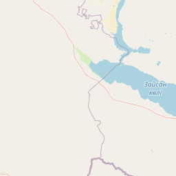
Rivers
Park geography
Spatial analysis, natural feature distribution, and regional context in East Kazakhstan
Comprehensive Geographic Profile and Mapped Boundaries of Tarbagatai National Park
Examine the physical characteristics of Tarbagatai National Park, spanning over 1364 square kilometers in the East Kazakhstan Region. This structured geography profile covers mapped perimeter measurements, regional location data, and major natural features such as the Arkaly mountains and associated river systems within the protected landscape.
Related tags
Mountain-steppe ecosystemWild fruit tree forestsEastern KazakhstanProtected areaMountain ranges
Kazakhstan's mountain-steppe sanctuary protecting isolated wild fruit tree forests
Tarbagatai National Park
Tarbagatai National Park is a protected area established in 2018 in the eastern region of Kazakhstan, spanning the Tarbagatai mountain range and adjacent landscapes. The park covers approximately 136,367 hectares along the south slopes of the Tarbagatai ridge, with additional coverage of the Karabas and Arkaly Mountains and the river valleys of Urzhar and Emel. This mountain-steppe ecosystem represents a significant ecological zone in Central Asia, characterized by a humid continental climate with warm summers and pronounced seasonal temperature variation. The park was specifically created to protect stands of wild fruit trees that have remained genetically isolated from commercial agricultural varieties, making it an important repository of biodiversity and a living example of natural forest ecosystems in the region.
- Location
- Kazakhstan
- Park type
- National park
- Established
- 2018
- Area
- 1,364 km²
Location overview
Territorial positioning within the East Kazakhstan Region
Geographic Setting and Location of Tarbagatai National Park
Tarbagatai National Park is situated entirely within the East Kazakhstan Region of Kazakhstan. The terrestrial protected area represents an interior reserve with no transboundary or marine classifications.
- Countries
- Kazakhstan
- Regions
- East Kazakhstan Region
- Primary location
- East Kazakhstan Region
- Geographic setting
- Inland
Boundary and coordinates
Explore mapped territory outlines and derived spatial measurements.
Tarbagatai National Park Boundary Map and Spatial Extent
Interactive boundary mapping defines the spatial configuration and geographic reach of the protected area. Structured metrics provide calculated area totals alongside coordinate limits and centre spans.
- Boundary area
- 2,000.2 km²
- Boundary perimeter
- 656.6 km
- Northernmost point
- 47.4616° N
- Southernmost point
- 46.2858° N
- Easternmost point
- 82.8465° E
- Westernmost point
- 81.0206° E
- Geographic centre
- 47.1555° N, 81.8745° E
- North–south span
- 130.7 km
- East–west span
- 139.2 km
Terrain and natural features
Mapped mountain classifications and recorded natural water bodies
Tarbagatai National Park Terrain and Natural Features
Tarbagatai National Park features a mountain terrain classification with multiple recorded rivers, streams, peaks, and lakes located within the boundaries. Linked feature cards provide verified names, types, and spatial relationships for each recorded natural formation.
Selected named natural features
Rivers
Көктерек
Peaks
Арқалы таулары
Streams
Көктерек
Rivers
Егінсу
Rivers
Emil River
Environmental setting
Mountain relief, temperate climate zones, and partial forest cover records
Tarbagatai National Park Environmental Setting and Physical Classifications
Recorded landscape features, habitat types, and relief classifications form complementary interpretations of physical terrain settings within Tarbagatai National Park. Stored environmental categories connect directly to broader atlas destinations and regional protected-area contexts.
- Relief
- Mountain
- Climate
- Temperate
- Water
- Minor water
- Forest cover
- Partial forest
Landscape features
Mountains · Valleys · Grassland
Habitat types
Grassland · Steppe
Park atlas
Explore the regional spread of protected mountain-steppe landscapes and diverse ecosystems throughout Eastern Kazakhstan, providing further park discovery.
Discover Adjacent National Parks and Protected Areas Near Tarbagatai National Park
Discover other national parks and protected areas in Eastern Kazakhstan, focusing on adjacent mountain-steppe ecosystems and similar landscapes to Tarbagatai National Park. Comparing these conservation landscapes provides rich geographic context, enabling you to trace regional ecological patterns and understand broader protected-area networks.

Nature reserveKazakhstan
About 23 km away#1 closest
South

Alakol Nature Reserve: Mapped Protected Landscapes and Wetland Geography in Kazakhstan
Protected lake basin and avian flyway conservation site.
Alakol Nature Reserve offers a deep look into the desert-wetland interface of southeastern Kazakhstan. Centered on the Tentek River delta and Lake Alakol islands, the reserve safeguards rare colonial bird habitats within a striking arid tectonic basin. Discover the geographic interplay between saline flats, riparian vegetation, and expansive lake environments that define this international conservation site.
- Area
- 656.72 km²
- Established
- 1998
- IUCN
- Ia
- Relief
- Lowland
Nature reserveTacheng Prefecture
About 68 km away#2 closest
Southeast

Xinjiang Barkol Mountain National Nature Reserve: Protected Terrain and Regional Geography
Mountain forest sanctuary in Tacheng Prefecture, Xinjiang
The Xinjiang Barkol Mountain National Nature Reserve protects a diverse mountain environment where the Barkol range captures moisture-bearing winds. Known for its globally significant stands of wild almond and Xinjiang wild apple, the reserve features a complex landscape of rocky ridges, forested slopes, and deep river valleys that sustain rare montane species and resilient endemic flora.
- Area
- 1,150.37 km²
- Established
- 1980
- Relief
- Mountain
- Climate
- Temperate
Nature reserveXinjiang
About 193 km away#3 closest
Southeast
新疆甘家湖梭梭林国家级自然保护区: Arid Ecosystems and Protected Haloxylon Woodland Mapping
Examining desert terrain and dune geomorphology in northwestern Xinjiang
Explore the structured geography of the Xinjiang Ganjiahu Haloxylon National Nature Reserve, which guards an expansive and ecologically critical saxaul woodland corridor. This protected area stands as a representative example of temperate desert systems in the Ebinur Basin, offering insight into wind-shaped dune landscapes, saline-alkali soil patterns, and the historic riverbeds that once connected Tien Shan meltwater to the regional basin floor.
- Area
- 546.67 km²
- Established
- 1983
- Relief
- Lowland
- Climate
- Arid
Nature reserveXinjiang
About 195 km away#4 closest
South
Xinjiang Wenquan Xinjiang Salamander National Nature Reserve Protected Landscape and Atlas Geography
A vital montane spring and alpine grassland protected area in the Western Tianshan.
The Xinjiang Wenquan Xinjiang Salamander National Nature Reserve serves as a dedicated refuge for relict amphibian populations within the Tianshan mountain system. Its small footprint concentrates on preserving the integrity of cold-water spring brooks and snowmelt-driven seepage zones that form the backbone of this regional ecosystem. The reserve provides a clear example of targeted habitat management within the diverse topography of northwestern China.
- Area
- 6.95 km²
- Established
- 1997
- Relief
- Mountain
- Climate
- Arid
National parkAlmaty Region
About 209 km away#5 closest
Southwest
Zhongar-Alatau National Park: Protected Mountain Landscape and Genetic Heritage Atlas
Almaty Region's critical wild apple forest and glaciated terrain.
Zhongar-Alatau National Park in Kazakhstan's Almaty Region is a significant protected landscape renowned for its role in conserving the genetic origins of cultivated apples. The park encompasses dramatic glaciated mountain ranges, deep canyons, and diverse ecosystems within the Dzungarian Alatau. Its mapped boundaries define an area vital for protecting unique wild fruit tree species, including the Sievers apple, and preserving the distinctive alpine terrain of southeastern Kazakhstan, offering rich context for geographic exploration.
- Area
- 36 km²
- Established
- 2010
- IUCN
- II
- Relief
- Mountain
Nature reserveXinjiang Uyghur Autonomous Region
About 239 km away#6 closest
South
新疆霍城四爪陆龟国家级自然保护区: Mapped Landscape and Tianshan Foothills Geography
Nature reserve boundaries within the Xinjiang Uyghur Autonomous Region
Located in the Xinjiang Uyghur Autonomous Region, the 新疆霍城四爪陆龟国家级自然保护区 represents a unique loess hill ecosystem. This atlas profile details the protected boundaries, erosion-carved terrain, and the semi-arid sagebrush steppe habitat essential for the four-clawed tortoise population, providing deep geographic context for this national nature reserve.
- Area
- 350 km²
- Established
- 1983
- Relief
- Upland
- Climate
- Arid

National parkEast Kazakhstan Region
283 km away#7 closest
Northeast
Katon-Karagay National Park: Discover Kazakhstan's Largest Protected Mountain Landscape
Explore the geography and park boundaries of East Kazakhstan's premier national park.
Katon-Karagay National Park, the largest national park in Kazakhstan, offers a deep dive into the protected landscapes of the Southern Altai Mountains. This page provides essential geographic context, detailing the park's terrain, its significance as a protected area within East Kazakhstan Region, and its role in mapping the natural contours of this ecologically diverse mountain system. Understand the park's boundaries and its contribution to regional conservation.
- Area
- 6,435 km²
- Established
- 2001
- IUCN
- II
- Relief
- Mountain
Nature reserveXinjiang
About 288 km away#8 closest
South
新疆伊犁小叶白蜡国家级自然保护区: Regional Protected Landscape and Tianshan Mountain Geography
Conservation focus on rare riparian ash forest ecosystems in Xinjiang
Spanning the alluvial floodplains of the Kashi and Ili Rivers, this nature reserve is a scientific stronghold for the narrow-leaved ash. The protected area showcases multi-generational forest structures and diverse ancient plant lineages, shaped by a sheltered Tianshan valley microclimate that remains unusually humid for the arid landscapes of inland Xinjiang.
- Area
- 91.03 km²
- Established
- 1983
- Relief
- Mixed relief
- Climate
- Temperate
MoriAtlas Explorer
Continue Atlas Exploration of Tarbagatai National Park's Geographic Context
Delve deeper into the protected landscape of Tarbagatai National Park by examining its precise mapped boundaries and its unique position within the geography of East Kazakhstan Region. MoriAtlas provides structured data to understand how this national park contributes to the regional conservation mosaic and the broader atlas of protected lands. Continue charting the natural terrain and ecological significance of this vital Central Asian ecosystem.
Browse next
Global natural geography
Explore related park routes
Explore MoriAtlas Global ParksBrowse All MoriAtlas ParksGlobal Park Map DiscoveryMoriAtlas: Browse All CountriesBrowse All MoriAtlas ContinentsNational Park Environment AtlasGrand Canyon National Park AtlasYellowstone National Park AtlasYosemite National Park Atlas and GeographySerengeti National Park AtlasGalápagos National Park Protected LandscapeBanff National Park Geography and AtlasKruger National Park Atlas EntryUluṟu-Kata Tjuṯa National Park AtlasExplore Uluru-Kata Tjuta National Park GeographyPlitvice Lakes National Park AtlasFiordland National Park Protected LandscapeGreat Smoky Mountains National Park AtlasAfghanistan National Parks and Protected AreasAlbania National Parks and Protected AreasAlgeria National Parks and Protected AreasAmerican Samoa National Parks and Protected AreasAndorra National Parks and Protected AreasAngola National Parks and Protected AreasAntarctica National Parks and Protected AreasAntigua and Barbuda Park List