Mori Atlas logo
National parkTerrick Terrick National Park

Discover the semi-arid woodland and native grassland ecosystems of this key Australian national park.

Terrick Terrick National Park: Mapped Protected Landscape and Regional Geography

Terrick Terrick National Park stands as a vital protected area within the Australian national park system, safeguarding a significant expanse of semi-arid Box-Ironbark woodland and native grasslands. Situated in northern Victoria, this park offers a distinct geographic perspective compared to the wetter regions of the state, characterized by gently undulating terrain and a unique mosaic of flora adapted to dry conditions. Its mapped boundaries encompass a landscape rich in natural heritage, providing a clear representation of this ecosystem for atlas-driven exploration and understanding.

Box-Ironbark forestEndangered species conservationPlains-wanderer habitatBirdwatchingNorthern VictoriaSemi-arid woodland

Terrick Terrick National Park

National park

Park overview

Structured park overview, official facts, and landscape profile for Terrick Terrick National Park

Terrick Terrick National Park park facts, protected area profile, and essential visitor context
Review the core facts for Terrick Terrick National Park, including designation, size, terrain, visitor scale, habitats, and operating context in one park-focused overview.

About Terrick Terrick National Park

Terrick Terrick National Park is a protected area in northern Victoria, Australia, established in June 1988. The park covers approximately 3,880 hectares of semi-arid woodland and grassland landscapes, situated roughly 225 kilometres northwest of Melbourne near the small town of Mitiamo. The terrain is relatively flat, with elevations ranging from 82 to 196 metres above sea level, characteristic of the northern Victorian plains region.

Park context

Deeper park guide and search-rich context for Terrick Terrick National Park

Terrick Terrick National Park history, landscape, wildlife, and travel context
Explore Terrick Terrick National Park through its history, landscape character, ecosystems, wildlife, conservation priorities, cultural context, and seasonal travel timing in a structured park guide built for atlas discovery and search intent.

Terrick Terrick National Park history and protected-area timeline

The national park was established in June 1988, representing a relatively recent addition to Victoria's protected area network. The declaration of the park protected what remained of the Box-Ironbark forests and northern grass plains in this part of the state, a landscape that had been heavily modified by agricultural development. Prior to national park status, the area existed as a state forest with limited protection, and the formal declaration reflected growing recognition of the ecological significance of the remaining woodland and grassland communities. The establishment of Terrick Terrick National Park coincided with increased understanding of the importance of remnant vegetation in fragmented landscapes, particularly for species like the Plains-wanderer that had suffered severe population declines across their former range.

Terrick Terrick National Park landscape and geographic character

The park occupies gently undulating terrain on the northern Victorian plains, with elevations ranging from 82 to 196 metres above sea level. The landscape is characterised by a mosaic of Box-Ironbark woodland on the rises and native grassland on the flatter areas, creating a semi-open environment quite different from the wet forests of Victoria's mountain regions. The ironbark eucalypts dominate the taller vegetation, with their deeply furrowed bark and grey-green foliage creating the distinctive appearance of this forest type. The underlying geology supports soils that are relatively nutrient-poor, conditions to which the Box-Ironbark species are well adapted. Subtle drainage lines cross the landscape, carrying water during wet periods to create ephemeral wetlands that add diversity to the otherwise flat terrain. The overall impression is one of quiet, expansive plains softened by the woodland canopy, with long views across the grasslands typical of this part of Victoria.

Terrick Terrick National Park ecosystems, habitats, and plant life

Terrick Terrick National Park protects a rare example of Box-Ironbark forest and associated northern grass plains, two vegetation classes that have been extensively cleared across Victoria. The Box-Ironbark ecosystem is characterised by ironbark eucalypts as the dominant trees, with various box species forming a significant component of the woodland. The understory contains native grasses and shrubs adapted to the semi-arid conditions, creating a layered structure that provides habitat for diverse wildlife. The grassland component of the park represents some of the last remaining native grass plains in northern Victoria, an ecosystem that once covered large areas but now exists mainly in isolated remnants. The combination of woodland and grassland within a protected area makes the park significant for maintaining the ecological character of this dry landscape region.

Terrick Terrick National Park wildlife and species highlights

The Plains-wanderer is the park's most significant wildlife species, a ground-dwelling bird that inhabits native grasslands and open woodlands across much of the park. This endangered bird nests on the ground among tall grasses, where its mottled brown plumage provides effective camouflage. The species has declined dramatically across its former range in southeastern Australia, making the protected population at Terrick Terrick increasingly important for survival. The Box-Ironbark forests support additional wildlife including various marsupial species, reptiles, and an array of insects that form the base of the food web. BirdLife International has identified the broader Patho Plains region as an Important Bird Area specifically because of its significance for Plains-wanderer conservation, highlighting the international importance of this area for biodiversity.

Terrick Terrick National Park conservation status and protection priorities

The park represents one of the most important conservation areas in Victoria for the endangered Plains-wanderer, a species found only in Australia and dependent on the native grassland and woodland habitats that the park protects. The broader Box-Ironbark ecosystem is itself considered endangered, with most of the original forest cover having been cleared for agriculture across Victoria. Protecting remaining examples like Terrick Terrick helps maintain biodiversity in a heavily modified landscape where native vegetation has been reduced to fragmented remnants. The park's inclusion in the Patho Plains Important Bird Area, designated by BirdLife International, provides international recognition of the area's global significance for bird conservation. Management by Parks Victoria focuses on maintaining the ecological integrity of the forest and grassland communities while providing opportunities for visitor enjoyment of this distinctive landscape.

Terrick Terrick National Park cultural meaning and human context

The park lies in close proximity to Kow Swamp Archaeological Site, a location of major palaeontological and archaeological significance located just outside the national park boundaries. Excavations at Kow Swamp have revealed ancient human remains and artifacts that have contributed substantially to scientific understanding of Indigenous Australian origins and settlement patterns. The traditional lands of Aboriginal peoples encompass this region of northern Victoria, and the landscape holds cultural significance for local Indigenous communities. While the park itself does not contain prominent cultural heritage sites, its location near Kow Swamp connects the protected area to the broader human history of the Victorian plains.

Top sights and standout views in Terrick Terrick National Park

The park protects one of the best remaining examples of Box-Ironbark forest ecosystem in Victoria, representing a landscape type that has been drastically reduced by clearing for agriculture. The endangered Plains-wanderer population makes the park globally significant, as this bird is found nowhere else in the world in meaningful numbers. The close association with the Kow Swamp Archaeological Site adds cultural depth to the natural values, connecting visitors to the ancient human history of the plains. The basic campground and walking tracks provide straightforward access to this distinctive landscape, though the lack of developed facilities reinforces the park's back-to-nature character. The dry woodland environment, featuring ironbark and box eucalypts on gentle terrain, offers a contrasting experience to the wetter forests of Victoria's mountain and coastal parks.

Best time to visit Terrick Terrick National Park

The most favourable time to visit Terrick Terrick National Park is during the cooler months from autumn through to early spring, when temperatures are more comfortable for walking and the landscape exhibits the subtle beauty of the season. Winter and early spring often bring green grass growth and wildflower displays, though conditions can be wet and muddy in places. Summer temperatures in the northern Victorian plains can become quite high, making outdoor activities challenging and increasing fire risk during the dry period. The park can be visited year-round, but the cooler months generally provide more pleasant conditions for exploring the walking tracks and campground. Wildlife viewing opportunities exist throughout the year, though the Plains-wanderer is most easily observed during the breeding season when birds are more active and vocal. Birdwatchers interested in seeing this endangered species should consider visiting during the spring and early summer months when breeding activity peaks.
Park location guide

Geography guide, regional context, and park location map for Terrick Terrick National Park

Terrick Terrick National Park park geography, regions, and map view in Australia
Understand where Terrick Terrick National Park sits in Australia through a broader geographic reading of the surrounding landscape, nearby location context, and its mapped position within the national park landscape.

How Terrick Terrick National Park fits into Australia

Australia is a constitutional monarchy and federal parliamentary democracy comprising six states and ten territories. With a population of nearly 28 million, it is one of the world's most urbanised countries, with most people concentrated on the eastern seaboard. The country has a high Human Development Index and is known for its cultural diversity, ancient Aboriginal heritage, and unique wildlife.

Wider geography shaping Terrick Terrick National Park in Australia

Australia occupies the entire Australian continent, the island of Tasmania, and numerous smaller islands. It is the world's flattest and driest inhabited continent, featuring vast deserts in the interior (the Outback), tropical rainforests along the eastern coast, and a coastline bordering the Indian and Pacific Oceans.

Map view of Terrick Terrick National Park

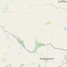
Use this park location map to pinpoint Terrick Terrick National Park in Australia, understand its exact geographic position, and read its mapped placement within the surrounding landscape more clearly.

Pigeon | © OpenStreetMap contributors
Park atlas

Compare Box-Ironbark Woodlands and Grassland Ecosystems Across Northern Victoria's Protected Landscapes

Explore Other National Parks and Protected Areas Near Terrick Terrick National Park
After exploring Terrick Terrick National Park, continue your geographic discovery by browsing other national parks and protected areas across Victoria's diverse Box-Ironbark and grassland regions. Compare varying conservation landscapes and understand the regional spread of similar dry woodland ecosystems, mapping their locations and distinct ecological features for comprehensive atlas-style exploration.
National park

Greater Bendigo National Park: Essential Protected Landscape and Regional Geography Details

Map exploration of its box-ironbark forest and woodland ecosystems.

Delve into Greater Bendigo National Park, a protected area in Victoria renowned for its extensive box-ironbark forests. This national park is crucial for maintaining the distinct woodland ecosystems that support rich bird populations and provide essential habitat for the endangered swift parrot. Users can explore its mapped geographic extent, understand its landscape character, and appreciate its significance within Australia's protected natural areas.

Area
170 km²
Established
2002
IUCN
II
Relief
Lowland
National park

Lower Goulburn National Park: Australia's River Red Gum Woodland Protected Landscape

Explore mapped boundaries and riparian geography.

Lower Goulburn National Park in Victoria, Australia, safeguards a critical segment of the Goulburn River, celebrated for its magnificent river red gum woodlands. This protected area offers a linear exploration of a rare riparian ecosystem, providing essential habitat and scenic beauty. Understand its geographic layout, mapped extent, and the distinctive landscape formed by these iconic Australian trees, offering a vital natural contrast to the surrounding agricultural areas.

Area
93.1 km²
Established
2010
IUCN
II
Relief
Lowland
Watercolor illustration of a river landscape with green hills, trees, and pink reeds
National park

Barmah National Park National Park: World's Largest River Red Gum Forest Landscape

Explore Mapped Boundaries and Wetland Geography

Barmah National Park in Victoria, Australia, is renowned for protecting the largest river red gum floodplain forest on Earth, a globally significant Ramsar-listed wetland. This protected area's landscape is defined by majestic eucalypts bordering freshwater marshes along the Murray River. Dive into its distinct geography, mapped terrain, and the protected status of this remarkable ecosystem, offering unparalleled opportunities for understanding regional natural landscapes and conservation.

Area
285.21 km²
Established
2010
IUCN
II
Relief
Lowland
Watercolor painting of green trees, rolling hills, and a pastel sky.
National park

Heathcote-Graytown National Park: Protected Box-Ironbark Forests and Swift Parrot Habitat

Mapping the landscape and geography of this Australian National Park.

Heathcote-Graytown National Park is a significant protected area safeguarding one of Victoria's remaining box-ironbark forest ecosystems. Its landscape, nestled within the Great Dividing Range, provides essential habitat for migratory swift parrots and supports diverse woodland bird species recognized by BirdLife International. Explore the park's mapped terrain and understand its role within the Central Highlands' regional geography as a vital conservation landscape.

Area
128.33 km²
Established
2002
IUCN
II
Relief
Mountain
National park

Kara Kara National Park: Mapped Protected Landscape and Box-Ironbark Forest Ecology

Explore Victoria's protected natural geography and woodland habitats.

Kara Kara National Park is an essential protected area in Victoria, Australia, recognized for its significant box-ironbark forest ecosystems and the conservation of the endangered swift parrot. The park's geography is defined by the St Arnaud Range, offering a distinct topography of ridges and valleys that contrast with the surrounding plains. Understanding this park's mapped boundaries and its role within the regional landscape provides critical insight into its ecological value and its representation of historical woodland environments.

Area
139.9 km²
Established
2002
IUCN
II
Relief
Upland
National park

Kinglake National Park: Protected Mountain Ash Forests and Geological Heritage

Explore the mapped landscape and regional geography of this Australian National Park.

Kinglake National Park is a significant protected natural area in Victoria, Australia, distinguished by its mountainous terrain dominated by eucalyptus forests, including towering mountain ash trees. The park's unique geology features sedimentary layers with marine fossils, offering a glimpse into its ancient submerged history. This National Park provides a rich environment for exploring diverse landscapes, understanding fire ecology, and appreciating the mapped boundaries of a resilient natural area.

Area
232.1 km²
Established
1928
IUCN
II
Relief
Upland
National parkNew South Wales

Yanga National Park National Park: Mapped Boundaries and Regional Geographic Context in New South Wales

Protected landscape atlas entry for New South Wales.

Examine Yanga National Park, a dedicated national park situated in New South Wales, Australia. This entry provides essential details for atlas-based discovery, focusing on its mapped boundaries, protected area status, and integration into the regional geography. Understanding Yanga National Park contributes to a broader comprehension of protected lands and their distribution, offering a clear geographic perspective on conservation efforts within New South Wales for users seeking structured landscape data.

Area
667.34 km²
Established
2007
IUCN
II
Relief
Lowland
National park

Organ Pipes National Park: Victoria National Park Featuring Columnar Basalt and Volcanic Geology

Explore unique mapped terrain and ancient protected landscapes near Melbourne.

Organ Pipes National Park stands as a crucial protected area in Victoria, Australia, celebrated for its exceptional columnar basalt formations and deep geological heritage. This national park preserves a striking landscape where ancient Silurian marine sediments meet relatively recent Pleistocene volcanic basalt, offering a profound glimpse into regional geography and land formation. Discover the park's mapped boundaries, the dramatic geological features along Jacksons Creek, and the ecological restoration efforts that highlight its value as a natural monument.

Area
1.21 km²
Established
1972
IUCN
III
Visitors
50K annual

Common questions about visiting, size, designation, and location context for Terrick Terrick National Park

Terrick Terrick National Park FAQs for park facts, access, geography, and protected area context
Find quick answers about Terrick Terrick National Park, including protected-area facts, park geography, trail and visitor context, and how the park fits into its surrounding country and regional landscape.
MoriAtlas Explorer

Continue Your Protected Areas Search Across the Global Atlas

Deepen your exploration by continuing the structured search for national parks and protected areas worldwide. Utilize the comprehensive filtering capabilities to compare different conservation landscapes and refine your understanding of global park geography. Discover more about the distribution and characteristics of protected natural areas.

Global natural geography