
Mori Atlas logo
National parkValday National Park

Mapping the distinctive upland terrain, historic heritage sites, and diverse wetland ecosystems of the northern Valdai Hills.

Valday National Park: A Protected Landscape of Glacial Lakes and Forests in Novgorod Oblast, Russia

(National Park Valdaysky)

Valday National Park serves as a protected sanctuary for the unique lake and forest mosaic of the northern Valdai Hills in Novgorod Oblast. This vast region of northwestern Russia features a complex glacial landscape defined by deep coniferous forests, raised bogs, and over 200 interconnected lakes. Beyond its natural terrain, the area preserves centuries of cultural heritage, including historic manor parks and the significant Iversky Monastery on Lake Valdai.

national parkRussiaNovgorod Oblastlake districtglacial landscapemixed forest
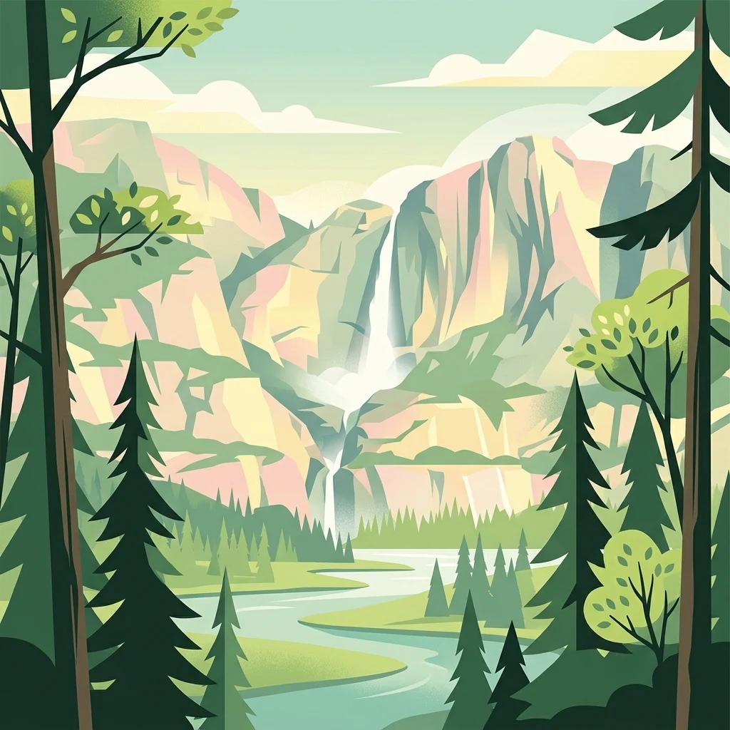
A stylized, flat-design illustration showing a tall waterfall cascading down high cliffs into a river, framed by evergreen trees in the foreground.

Valday National Park

National park

Park overview

Structured park overview, official facts, and landscape profile for Valday National Park

Valday National Park park facts, protected area profile, and essential visitor context

Review the core facts for Valday National Park, including designation, size, terrain, visitor scale, habitats, and operating context in one park-focused overview.

About Valday National Park

Valday National Park occupies a strategic position on the northern flank of the Valdai Hills, a broad glacial upland that forms part of the watershed between the Baltic and Caspian seas. The park was created specifically to preserve the integrity of this lake-and-forest complex, which had long been appreciated for its scenery but was increasingly under pressure from logging, peat extraction, and recreational development. By 1990, when the park was formally established, the area already had a strong cultural identity rooted in the town of Valdai, its monasteries, and its traditional craft industries.

Geographically, the protected zone forms a contiguous block of forested upland crossed by moraines, drumlins, and hundreds of lakes of varying size. Roughly 56 lakes exceed 20 hectares, and the total lake count approaches two hundred, with Lake Valdai and nearby Lake Seliger being the largest and most familiar to visitors. The intervening land is dominated by coniferous and mixed forests, patchy raised bogs, meadows, and difficult-to-pass thicket areas that reinforce the park's reputation as a wilderness within easy reach of Saint Petersburg and Moscow.

The cultural dimension of the park is unusually rich for a Russian national park. Archaeologists have documented 82 separate heritage sites, including ancient settlements dating to the 7th through 6th centuries BCE, hill forts, burial mounds, and old manor complexes. Religious architecture is represented by the Iversky Monastery, founded in 1653 on an island in Lake Valdai, and by 17th- to 19th-century churches and wooden buildings. The town of Valday, which celebrated its 500th anniversary in 1996, is associated with the famous Valdai bell, displayed in a local museum inside a church designed by the architect N. A. Lvov. The village of Nikolskoye, also within the park, hosts Russia's first scientific fish hatchery, established in the mid-19th century by V. P. Vrasky and recognized internationally for pioneering systematic fish breeding.

Together these natural and cultural features define the park's identity as a place where glacially formed terrain, historic Russian settlement patterns, and conserved wilderness converge. It remains one of the most visited national parks in Russia, owing to its accessibility from the country's two largest urban centers, while continuing to function as a working protected landscape.

Quick facts and research context for Valday National Park

Valday National Park is a federal protected area in Novgorod Oblast, Russia, established on 17 May 1990 and managed as an IUCN Category II national park. It covers approximately 1,585 square kilometers of the northern Valdai Hills and spans three administrative districts: Okulovsky, Valdaysky, and Demyansky. The landscape is defined by forested uplands, numerous glacial lakes, and extensive wetlands. The park also encompasses a rich cultural layer, including 82 recorded archaeological monuments and several historic estates and monasteries, most famously the Iversky Monastery on an island of Lake Valdai.

Protection and recognition

Terrestrial protected area conservation records and management scope details

Valday National Park Protection Status and International Recognition Data

Valday National Park maintains a documented terrestrial conservation scope within the global protected area network. Official records aggregate designation history and international recognition frameworks for structured geographic analysis.

Protection details

Protection scope
Terrestrial
Transboundary protection
No
Park context

Deeper park guide and search-rich context for Valday National Park

Valday National Park history, landscape, wildlife, and travel context

Explore Valday National Park through its history, landscape character, ecosystems, wildlife, conservation priorities, cultural context, and seasonal travel timing in a structured park guide built for atlas discovery and search intent.

Why Valday National Park stands out

The park is best known for protecting the lake-and-forest mosaic of the northern Valdai Hills, where dozens of glacial lakes, raised bogs, and tracts of mature forest coexist within a single protected landscape. It is equally recognized as a cultural heritage zone, anchored by the Iversky Monastery and the historic town of Valdai with its long tradition of bell-casting. The combination of upland natural scenery and layered human history, from prehistoric settlements to 19th-century estates, gives the park a distinctive identity among Russia's protected areas.
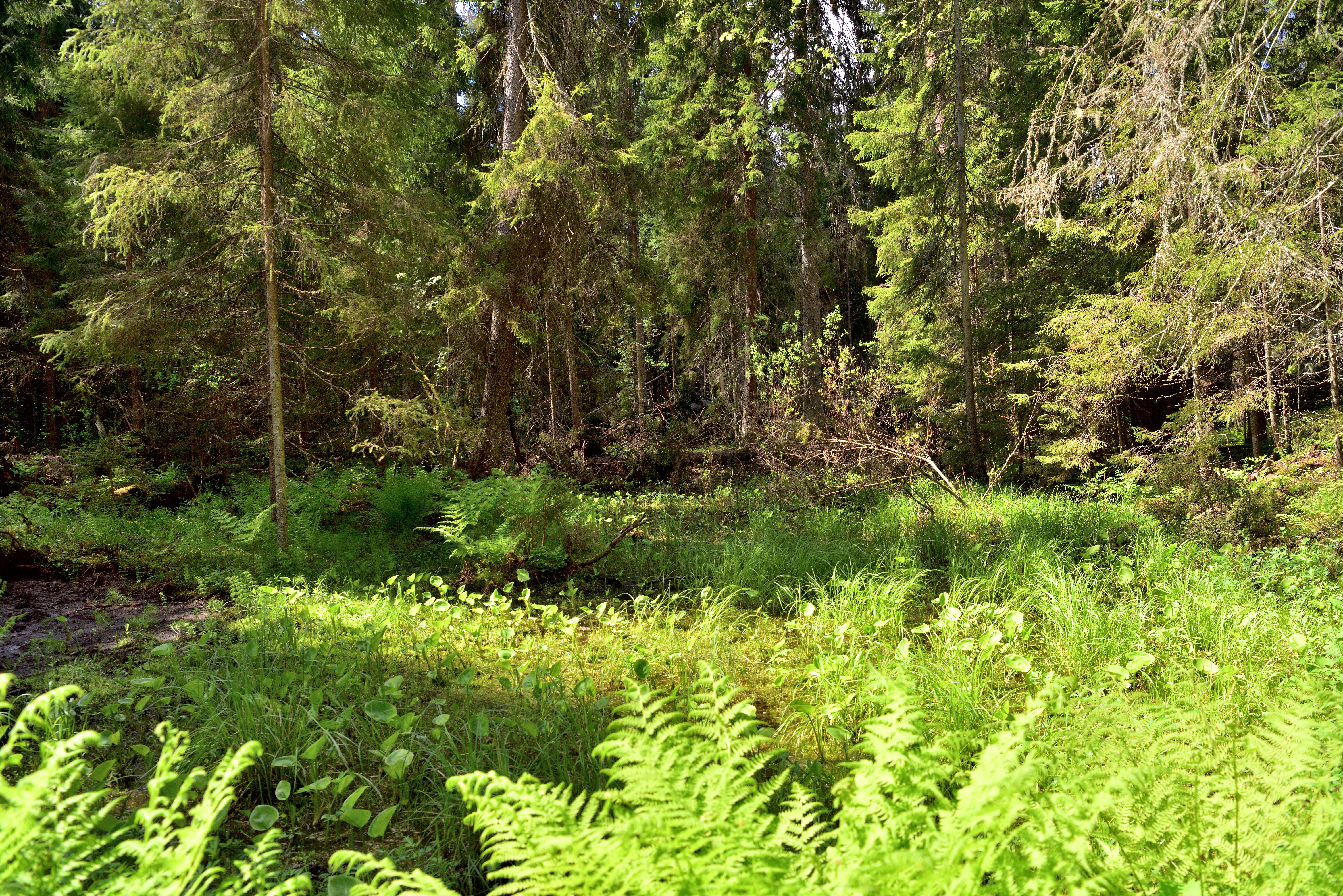
A sunlit, dense forest floor covered in ferns and lush green vegetation, with tall coniferous trees in the background.
A lush, dense forest thicket with a vibrant fern undergrowth in Valday National Park.

Valday National Park history and protected-area timeline

Valday National Park was formally established on 17 May 1990. Its creation reflected a growing recognition that the lake-and-forest zone of the northern Valdai Hills required a unified conservation regime after decades of piecemeal land use. The park's remit extended beyond ecological protection to include the management of organized recreation, ensuring that the area's longstanding appeal to visitors could be channeled in a sustainable way.

The territory's human history, however, stretches back much further. Archaeological surveys have identified 82 separate monuments within the park, ranging from prehistoric settlements of the 7th through 6th centuries BCE to hill forts, villages, burial mounds, and old manor estates. The most prominent religious site, the Iversky Monastery, was founded in 1653 on an island in Lake Valdai by Patriarch Nikon and remains a central landmark of the region.

Several episodes of broader Russian history are tied to the park's territory. Near the village of Yazhelbitsy stands the so-called Ignach Cross, traditionally identified as the place where the forces of Khan Batu turned back from their advance on Novgorod. In 1456, the same locality gave its name to the Yazhelbitsy Peace between Novgorod and Moscow, a pivotal moment in the political consolidation of the Russian state.

The 19th century brought a different kind of landmark: the fish hatchery in the village of Nikolskoye, founded by V. P. Vrasky and regarded as the first scientific fish-breeding operation in Russia. Its achievements earned recognition from agricultural societies in both Russia and Paris, embedding the park's territory into the early history of applied biology. The town of Valday, whose name the park carries, marked its 500th anniversary in 1996, underscoring the depth of settlement history in the area.

Valday National Park landscape and geographic character

The landscape of Valday National Park is shaped by the northern Valdai Hills, a wide glacial upland with elevations that vary between gentle ridges and low, rolling plateaus. The terrain is marked by moraines, drumlins, and other depositional features left by Pleistocene ice sheets, producing a mosaic of low hills, shallow basins, and waterlogged depressions. The result is a region of constantly shifting scenery, where dense forest gives way to boggy openings, open meadows, and stretches of still water.

Water is the park's defining element. Approximately 200 lakes are distributed across the territory, including around 56 lakes with surface areas exceeding 20 hectares. Lake Valdai and the much larger Lake Seliger are the most prominent and act as anchors for the park's recreational geography. Smaller lakes tucked between forest stands and bog edges form quieter interludes within the broader landscape.

Vegetation and substrate reinforce the visual character of the park. Coniferous and mixed forests dominate much of the area, broken by patches of raised bog, transitional mire, and meadow clearings. Difficult-to-pass thickets, fallen timber, and old drainage channels add textural complexity, while flowering-rich openings such as globeflower meadows and lily-of-the-valley understory contribute seasonal variety. The overall impression is of a deeply forested, lake-intersected upland that has retained much of its glacial-era structure.
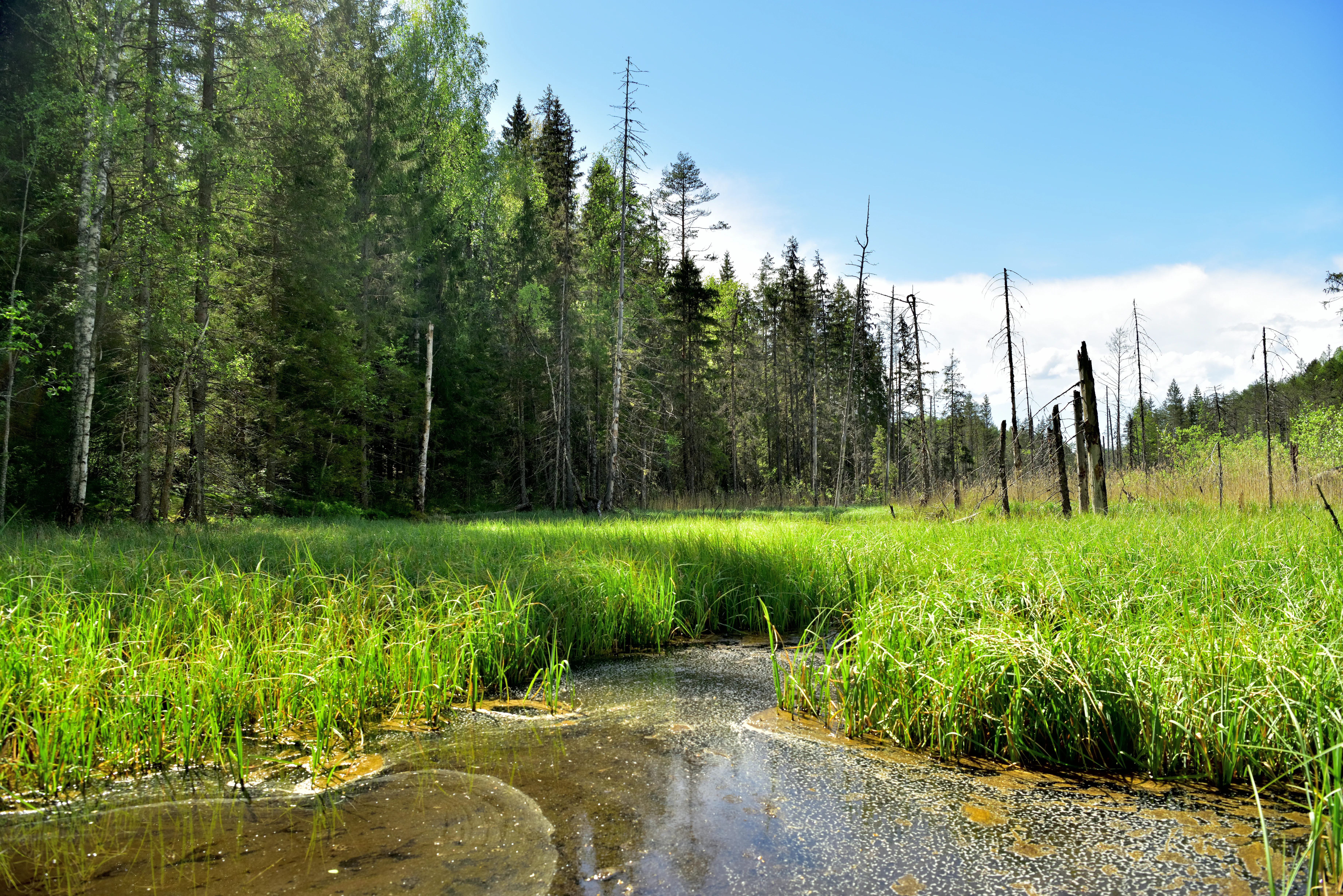
A small stream winds through a lush, grassy marsh with a dense mixed forest in the background under a blue sky.
A serene forest wetland scene in Valday National Park, characteristic of the region's diverse ecosystems.

Valday National Park ecosystems, habitats, and plant life

The natural environment of Valday National Park reflects the typical ecological profile of the Valdai Hills, a transitional zone between the taiga landscapes of the Russian North and the mixed forests further south. Coniferous species, including spruce and pine, share the canopy with birches and other broadleaf trees, producing mixed forest stands that vary with soil conditions and moisture. This composition supports a wide range of microhabitats, from dry ridge woodlands to permanently wet mires.

Wetlands are a defining ecological feature. The park contains substantial areas of raised bog, swamp forest, and wet meadow, interspersed with the lakes that punctuate the upland. These waterlogged environments are part of the broader hydrological network of the Valdai Hills, which feeds into rivers flowing both toward the Baltic basin and toward the Volga system. Drainage channels and small streams further thread through the forested interior, reinforcing the connection between land and water.

Seasonal dynamics are pronounced. Spring brings high water levels, snowmelt-driven flooding in low-lying areas, and the rapid greening of forest floors with species such as lily of the valley. Summer opens up meadows rich in herbaceous flowering plants, including European globeflower, a conspicuous component of damp clearings. As autumn advances, the mixed forests shift through a range of warm hues before the long winter sets in, freezing the lakes and blanketing the bogs in snow.
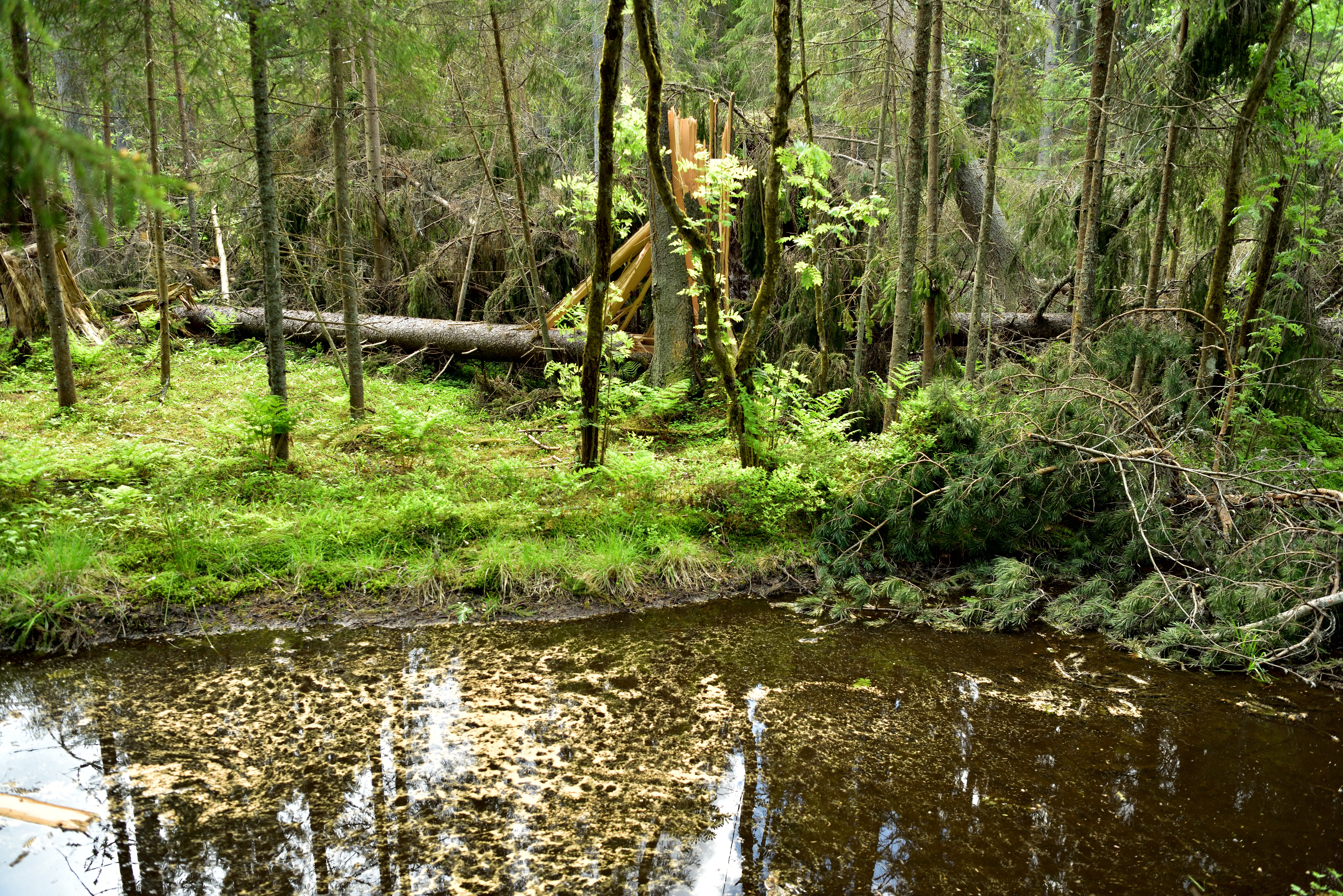
A dense, overgrown forest area featuring fallen trees and a small, dark stream with surface vegetation.
Dense forest and woodland stream within Valday National Park.

Valday National Park conservation status and protection priorities

Valday National Park was established in 1990 with the explicit purpose of protecting the unique lake-and-forest complex of the Valdai Hills. Its conservation mandate covers a landscape shaped by glacial processes and characterized by an unusual density of lakes, mires, and mature forest stands. By placing this upland under a single coordinated management framework, the park aims to safeguard hydrological integrity, forest continuity, and the associated wetland systems that depend on both.

The park's significance extends beyond its immediate boundaries. As part of the headwater zone feeding multiple major river systems of European Russia, the Valdai upland has an outsized role in regional water quality and flow regulation. Protecting its forests and wetlands therefore contributes to downstream ecological stability as well as to local biodiversity. The park also serves as a refuge for forest, bog, and lake-margin species whose habitats have been heavily modified elsewhere in central and northwestern Russia.

Cultural heritage is treated as an integral part of the conservation framework. The protection of 82 archaeological monuments, historic manor parks, the Iversky Monastery complex, and vernacular architecture reflects a recognition that the Valdai landscape is the product of long human presence as well as natural forces. This combined natural-and-cultural approach positions Valday among the more comprehensive protected-area models in the Russian system.

Valday National Park cultural meaning and human context

The cultural identity of Valday National Park is inseparable from the long history of human settlement in the Valdai Hills. The region has been occupied since at least the 7th through 6th centuries BCE, and the archaeological record includes ancient camps, hill forts, villages, burial mounds, and sacred mounds. These layers of prehistoric and early historic land use remain visible across the park and frame how the landscape is experienced today.

Religious architecture is a defining strand of the park's cultural life. The Iversky Monastery, founded in 1653 by Patriarch Nikon on an island of Lake Valdai, is the most prominent landmark and a major pilgrimage and heritage site. Smaller churches, wooden buildings, and manorial complexes from the 17th through 19th centuries add texture to the cultural map, and the historic town of Valday itself is considered a heritage landmark, having marked its 500th anniversary in 1996.

Local craft and scientific traditions are similarly woven into the park's identity. Valday is historically associated with the production of small bells, a craft preserved through museum displays in the former Church of Catherine designed by N. A. Lvov. In the village of Nikolskoye, the country's first scientific fish-breeding hatchery, founded by V. P. Vrasky, links the park to the early history of Russian applied biology. The Yazhelbitsy Peace of 1456 and the legendary Ignach Cross further tie the territory to pivotal moments in medieval Russian political history.
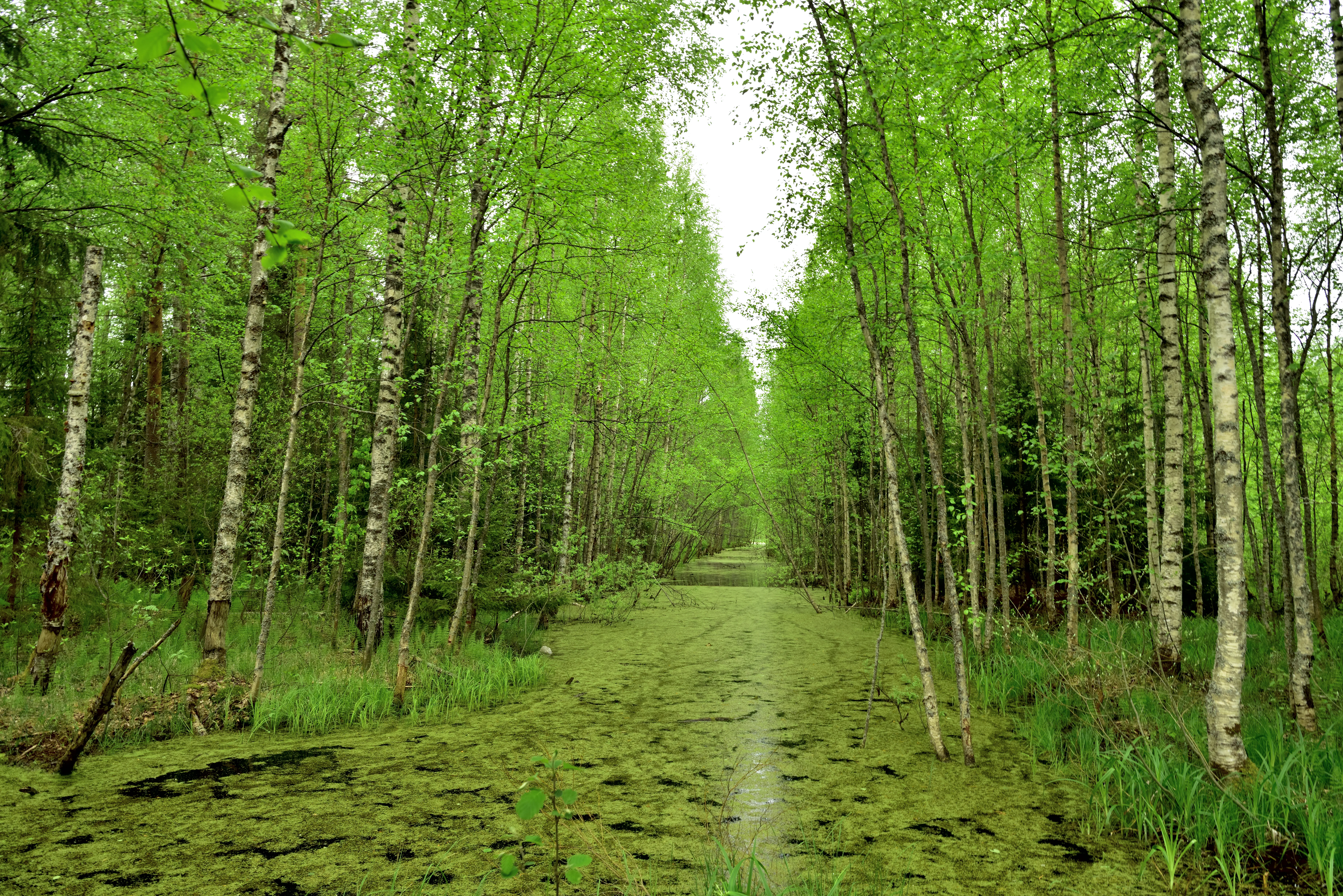
A narrow, straight channel of water covered in green algae stretches into the distance, flanked by rows of slender birch trees in a lush, green forest.
A narrow reclamation channel running through a dense, green forest in Valday National Park.

Top sights and standout views in Valday National Park

The strongest points of distinction at Valday National Park include its dense concentration of glacial lakes, its extensive forests and raised bogs, and its unusually rich overlay of human history. The Iversky Monastery on Lake Valdai, the historic manor parks, and the record of 82 archaeological monuments give the park a heritage depth that few purely natural reserves can match.

Equally notable is the park's accessibility. Positioned within a few hours' travel of both Moscow and Saint Petersburg, Valday functions as a major recreation zone for residents of Russia's two largest cities, while still preserving tracts of remote, difficult-to-pass forest. The combination of wilderness and cultural landmarks, anchored by the iconic town of Valday and its bell-making heritage, defines the park's distinctive character.
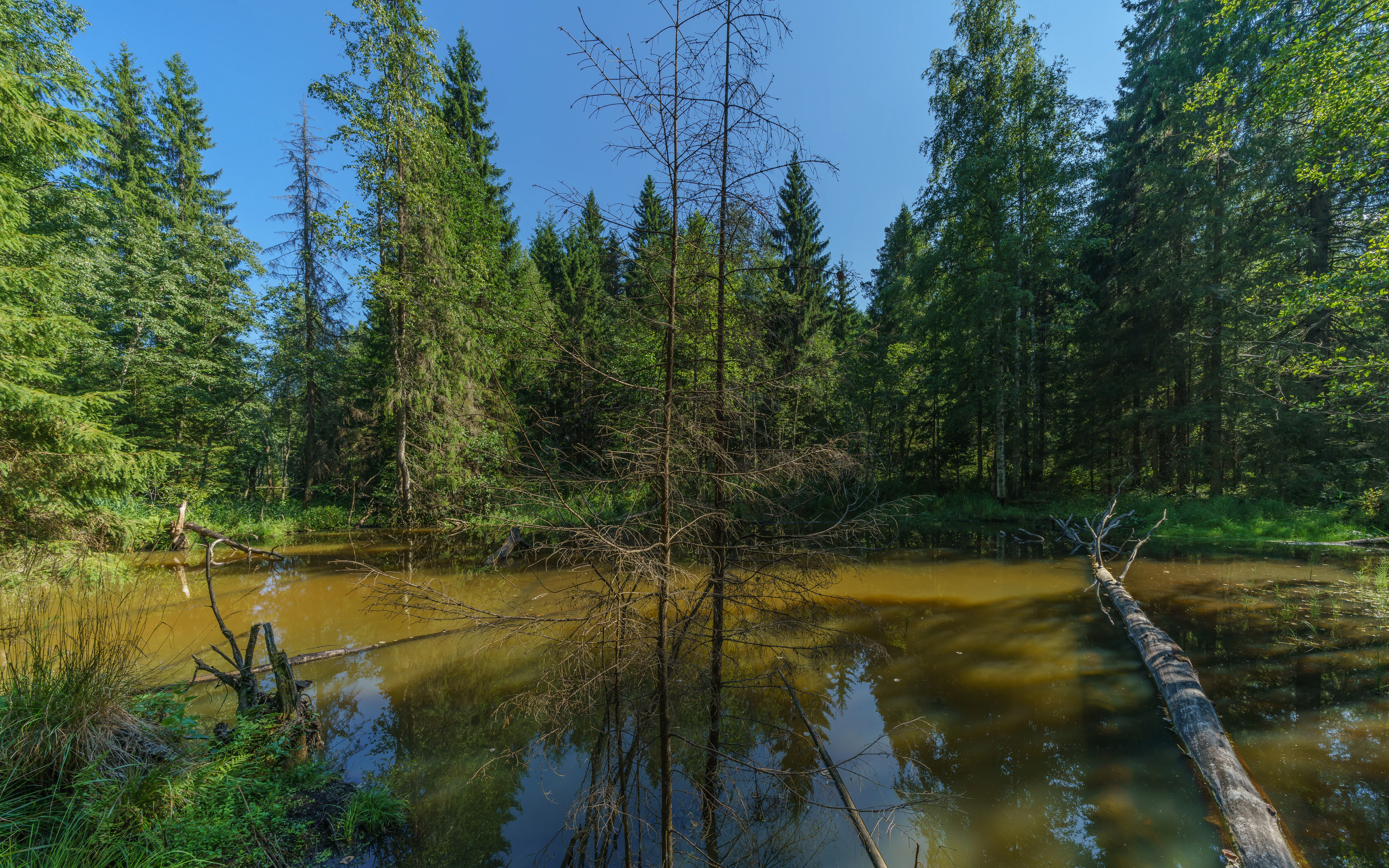
A calm, brownish pond surrounded by dense coniferous and deciduous forest in Valday National Park under a bright blue sky.
A forest pond scene within the Valday National Park area, showing lush vegetation and fallen trees.

Best time to visit Valday National Park

Seasonal character at Valday National Park follows the rhythm of a moderately continental climate. Summer is relatively warm and brings the most active period for water-based recreation on lakes such as Valdai and Seliger, as well as the seasonal flowering of forest understory plants like lily of the valley and the conspicuous blooms of European globeflower in damp meadows.

Winter brings a quieter and more austere atmosphere. Temperatures drop well below freezing, snowfall accumulates across the park's forests and bogs, and the lakes freeze, reshaping the landscape into a still, white expanse under short daylight hours. Spring and autumn occupy transitional roles: spring brings meltwater, rising lake levels, and the rapid emergence of greenery, while autumn colors the mixed forests in warmer hues before the long winter sets in. Each season offers a different reading of the same glacial upland.

Monthly climate preview

Long-term representative measurements of monthly temperature and precipitation for Valday National Park

Valday National Park Climate Normals, Annual Temperature and Precipitation Rhythms

Valday National Park records a measured annual temperature range from deep sub-zero winter minimums to warm summer maximums alongside consistent monthly precipitation. Reviewing the complete twelve-month climate profile reveals the detailed long-term averages for representative coordinates across the protected terrain.
Annual mean4 °C
-9 °C17 °C
Jan-9°
Feb-9°
Mar-4°
Apr
May11°
Jun15°
Jul17°
Aug16°
Sep10°
Oct
Nov-3°
Dec-7°
Warmest month
July

17.5 °C

Coolest month
January

-9.3 °C

Wettest month
June

3.5 mm/day

Driest month
February

1.7 mm/day

Park location guide

Geography guide, regional context, and park location map for Valday National Park

Valday National Park park geography, regions, and map view in Russia

Understand where Valday National Park sits in Russia through a broader geographic reading of the surrounding landscape, nearby location context, and its mapped position within the national park landscape.

How Valday National Park fits into Russia

Russia is a transcontinental nation spanning eleven time zones, bordered by fourteen countries. It is the world's largest country by area, covering 17,098,246 km². Moscow is the capital and largest city, while Saint Petersburg is the second-largest and a major cultural centre.

Wider geography shaping Valday National Park in Russia

Russia spans Eastern Europe and North Asia, covering 17,098,246 km². It shares land borders with fourteen countries, more than any other nation, and spans eleven time zones. The landscape includes vast plains, mountain ranges such as the Urals and Caucasus, and extensive coastlines along the Arctic Ocean, Pacific Ocean, Baltic Sea, Black Sea, and Caspian Sea.

Map view of Valday National Park

Use this park location map to pinpoint Valday National Park in Russia, understand its exact geographic position, and read its mapped placement within the surrounding landscape more clearly.

Pigeon | © OpenStreetMap contributors

Location context for Valday National Park

Novgorod Oblast

Visualizing glacial lakes, dense mixed forests, and protected upland terrain

Valday National Park Photos and Landscape Scenery

Visual records capture the distinctive lake and forest mosaic of the northern Valdai Hills, where glacial waters and mature woodlands define the protected terrain. Examining these protected area views helps reveal the environmental character and topography that shape the regional ecosystem.

A sunlit, dense forest floor covered in ferns and lush green vegetation, with tall coniferous trees in the background.

A dense patch of yellow globe-like flowers growing in a grassy meadow surrounded by green trees and shrubs.

A small stream winds through a lush, grassy marsh with a dense mixed forest in the background under a blue sky.

A dense, overgrown forest area featuring fallen trees and a small, dark stream with surface vegetation.

A carpet of bright green lily of the valley sprouts emerging from the brown soil of a forest floor.

A narrow, straight channel of water covered in green algae stretches into the distance, flanked by rows of slender birch trees in a lush, green forest.

A calm, brownish pond surrounded by dense coniferous and deciduous forest in Valday National Park under a bright blue sky.

A calm wetland area in Valday National Park featuring dead, leafless trees standing in shallow water, surrounded by lush green grasses and a background of dense forest under a cloudy sky.

A dense forest interior with multiple fallen, decaying tree trunks lying across the forest floor surrounded by ferns and standing trees.

Park atlas

Compare regional lake and forest ecosystems across the surrounding territory.

Explore Other Parks Near Valday National Park and Protected Landscapes

Visitors exploring Valday National Park can continue browsing adjacent protected areas and upland reserves throughout the broader regional network. Examining these neighboring conservation zones provides deeper geographic context for the glacial lake systems and forested terrain of the Russian Northwest.
Watercolor illustration of a lake with green forests and grassy foreground, distant hills, and purple and orange water tones
National parkRussia
About 1.4 km away#1 closest

North

Valdaysky National Park: Russia's National Park & Protected Landscape Explorer

Discover its mapped boundaries and regional geographic context.

Valdaysky National Park represents a significant protected area, offering a focused entry into Russia's natural landscapes. This MoriAtlas page provides detailed geographic context, mapping the park's protected boundaries and its position within the regional terrain. Use this resource to understand the park's unique landscape identity and its value for structured atlas-based discovery of protected lands.

Area
1,585 km²
Established
1990
IUCN
II
Visitors
60K annual
Watercolor illustration of a lake surrounded by forests and mountains under a light sky
National parkTver Oblast
About 245 km away#2 closest

Southeast

Zavidovo National Park: Geographic and Protected Landscape Atlas of Tver Oblast

Exploring river floodplains and mixed forest terrain.

Zavidovo National Park represents a distinctive protected landscape within Russia, characterized by its flat glacial moraine terrain and complex water systems. The park protects critical wetlands, peat bogs, and river corridors that sustain diverse game and avian populations. Explore the geographic boundaries and ecological features that define this notable natural zone situated in the heart of Tver Oblast.

Area
1,329 km²
Established
2015
IUCN
II
Relief
Lowland
National parkMoscow Oblast
About 245 km away#3 closest

Southeast

Zavidovo National Park: Mapping the Protected Landscapes of the Upper Volga Lowland

A study of glacial plains, forest mosaics, and riverine habitats.

Zavidovo National Park occupies a sprawling area of the Upper Volga Lowland, characterized by gentle relief and an exceptional concentration of water-based habitats. The park serves as a prime example of a managed conservation territory that integrates river valleys, lowland forests, and marshlands. Its geographic identity remains deeply rooted in the glacial history of central Russia, supporting a continuous protected block within the Moscow Oblast.

Area
1,250 km²
Established
1972
IUCN
II
Relief
Lowland
National parkSmolensk Oblast
About 294 km away#4 closest

Southwest

Smolenskoye Poozerye National Park: Protected Landscape and Regional Geography

Explore mapped boundaries and geographic context within Smolensk Oblast.

Smolenskoye Poozerye National Park is a protected natural area offering valuable insights into the geography of Smolensk Oblast. As a national park, its mapped boundaries define a significant landscape within Central Russia. This resource provides detailed information for atlas-based exploration, allowing users to understand the park's protected status and its place within the regional natural terrain.

Area
1,462 km²
Established
1992
IUCN
II
Visitors
250K annual
Watercolor painting of a lake with green forested islands and distant mountains under a pastel sky
National parkPskov Oblast
About 344 km away#5 closest

Southwest

Sebezhsky National Park: National Park within Pskov Oblast's Regional Geography

Mapped protected landscape and regional context

Sebezhsky National Park is a designated national park offering a distinct protected landscape within the Pskov Oblast of northwestern Russia. This page provides essential details for atlas exploration, focusing on the park's mapped boundaries, its role as a protected area, and its contribution to the regional geography of the Pskov Oblast. Users can understand its place within a broader mapping of Russia's natural territories and protected lands.

Area
500.21 km²
Established
1996
IUCN
II
Relief
Highland
A horizontal watercolor painting depicting a calm lake with grassy banks and soft rolling hills in the background.
National parkЯмало-Ненецкий автономный округ
About 356 km away#6 closest

East

Плещеево озеро National Park: Glacial Lake Geography and Protected Area Atlas

Mapped terrain, forest mosaic, and Upper Volga basin protected landscapes.

Плещеево озеро National Park centers on a significant glacial lake, framed by an ecological mosaic of boreal and broadleaf forests, extensive peat bogs, and coastal wetlands. This protected area within the Upper Volga basin offers a look at a layered natural environment where diverse bird populations, endemic fish, and historical landmarks meet across the East European Plain.

Area
237.9 km²
Established
1988
IUCN
II
Relief
Lowland
Watercolor painting showing a lake with grasses in the foreground and distant shoreline
National parkYaroslavl Oblast
About 356 km away#7 closest

East

Pleshcheyevo Ozero National Park: National Park Mapping and Regional Protected Area Atlas

Discover its protected landscape and geographic setting.

Pleshcheyevo Ozero National Park is a key protected area within the geography of Yaroslavl Oblast, Russia. This page offers detailed insights into the park's specific landscape character, its mapped boundaries, and its significance as a national park. It serves as an entry point for understanding the protected lands of the region and exploring its natural terrain within a broader atlas context.

Area
238 km²
Established
1997
IUCN
II
Relief
Lowland
Watercolor illustration of a winding river, trees, and hills in the background
National parkMoscow Oblast
About 358 km away#8 closest

Southeast

Losiny Ostrov National Park: Mapping the Boundaries of a Unique Urban Wilderness

Protected forest and wetland geography in Moscow Oblast.

Spanning over 116 square kilometers, Losiny Ostrov National Park represents a significant conservation effort as Europe's largest urban national park. Its geography encompasses dense mixed forests, the Upper Yauza Swamps, and a convergence of regional watersheds, providing a rare study of wilderness persistence within a densely populated metropolitan environment.

Area
116 km²
Established
1983
IUCN
II
Relief
Lowland

Common questions about visiting, size, designation, and location context for Valday National Park

Valday National Park FAQs for park facts, access, geography, and protected area context

Find quick answers about Valday National Park, including protected-area facts, park geography, trail and visitor context, and how the park fits into its surrounding country and regional landscape.
MoriAtlas Explorer

Continue Your Protected Areas Search Across the Global Atlas

Deepen your exploration by continuing the structured search for national parks and protected areas worldwide. Utilize the comprehensive filtering capabilities to compare different conservation landscapes and refine your understanding of global park geography. Discover more about the distribution and characteristics of protected natural areas.

Global natural geography