
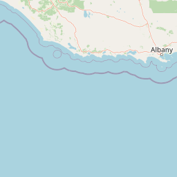
Beaches
Park geography
Structured landscape analysis including regional terrain, coastal features, and river systems.
Geographic Profile and Mapped Boundaries of Walpole-Nornalup National Park, Western Australia
Walpole-Nornalup National Park covers 194.48 square kilometers of diverse terrain within Western Australia. This structured profile maps the regional boundaries, internal river networks, coastal cliffs, and island features that define the park geography. Data encompasses the comprehensive spatial layout and environmental characteristics inherent to this Mediterranean climate region.
Related tags
Ancient forestKarri forestTingle treesValley of the GiantsSouth West Australia
Ancient tingle and karri forests of the Walpole Wilderness
Walpole-Nornalup National Park
Walpole-Nornalup National Park is a protected area in the South West region of Western Australia, situated approximately 355 kilometres south of Perth along the state's southern coast. The park encompasses a distinctive landscape of towering karri and tingle forests, with the famous Valley of the Giants providing access to some of the region's most impressive ancient trees. Red tingle trees (Eucalyptus jacksonii) are endemic to this area, making the park uniquely significant in botanical terms. The protected area forms part of the larger Walpole Wilderness Area, which was established in 2004 and is recognized as part of a global biodiversity hotspot. The park extends from inland forest environments to coastal heathland, with the Walpole-Nornalup Inlets adding marine and wetland habitats to its ecological diversity.
- Location
- Australia
- Park type
- National park
- Established
- 1910
- Area
- 194.5 km²
Location overview
Regional positioning and coastal status in Western Australia
Geographic Setting of Walpole-Nornalup National Park in Australia
Walpole-Nornalup National Park belongs to the regional territory of Western Australia within the nation of Australia. Designated as a coastal park, its geographic profile highlights regional administrative relationships.
- Countries
- Australia
- Regions
- Western Australia
- Primary location
- Western Australia
- Geographic setting
- Coastal
Boundary and coordinates
Interactive boundary geometry and calculated area metrics
Walpole-Nornalup National Park Boundary Map and Spatial Extent
Mapped park outlines provide clear spatial context for the protected territory across digital cartography. Accompanying boundary facts detail total calculated area spans without claiming formal survey precision.
- Boundary area
- 184.9 km²
- Boundary perimeter
- 383.9 km
- Northernmost point
- 34.9304° S
- Southernmost point
- 35.0644° S
- Easternmost point
- 116.9643° E
- Westernmost point
- 116.5708° E
- Geographic centre
- 35.0018° S, 116.7814° E
- North–south span
- 14.9 km
- East–west span
- 35.9 km
Terrain and natural features
Upland terrain classifications and recorded natural features
Walpole-Nornalup National Park Terrain and Named Natural Features
Stored upland relief classifications define the primary landform context across Walpole-Nornalup National Park. Linked feature cards supply names, types, and spatial relationships for recorded rivers, beaches, islands, and peaks.
Selected named natural features
Cliffs
Cliffs
Rivers
Bow River
Beaches
Circus Beach
Islands
Newdegate Island (Snake Island)
19 m
Rivers
Frankland River
Environmental setting
Temperate forest cover, upland relief, and Mediterranean climate classifications
Walpole-Nornalup National Park Environmental Classification and Protected Setting
Recorded landscape features, habitat types, and water presence classifications outline the physical setting across the protected area. Structured categories connect recorded environmental properties to relevant atlas destinations.
- Relief
- Upland
- Climate
- Mediterranean
- Water
- Major water bodies
- Forest cover
- Dense forest cover
- Seasonality
- Year-round
Landscape features
Forest · Cliffs · Coast · Beach · Rivers · Wetland
Habitat types
Temperate broadleaf forest · Heath · Shrubland · Wetland · Coastal habitat · Riverine habitat
Park atlas
Trace the regional spread of diverse conservation landscapes in Western Australia.
Compare Protected Areas and National Parks Near Walpole-Nornalup National Park, Western Australia
Browse an atlas of national parks and protected areas geographically adjacent to Walpole-Nornalup National Park, revealing comparable forest ecosystems, coastal features, and biodiversity hotspots across Western Australia. Gain geographic context to compare diverse protected landscapes, understand regional conservation efforts, and trace the spread of unique tingle and karri forests beyond a single park boundary.
National parkWestern Australia
Park boundaries overlap#1 closest
Northwest

D'Entrecasteaux National Park: Discover Western Australia's Protected National Park Landscape
Mapping protected boundaries and regional natural terrain.
D'Entrecasteaux National Park stands as a significant protected natural area, offering a focused lens for geographic discovery within Western Australia. This park's identity as a National Park provides a concrete point for understanding mapped landscapes and regional conservation efforts. Explore its specific boundaries and terrain to build a comprehensive picture of its role within the broader atlas of Western Australia's natural heritage.
- Area
- 1,187.79 km²
- Established
- 1980
- IUCN
- II
- Visitors
- 168.5K annual
National parkWestern Australia
0.1 km away#2 closest
Northwest
Mount Frankland South National Park: Western Australia's Protected Natural Landscape
Explore its mapped boundaries and regional geographic context.
Mount Frankland South National Park is a critical protected area defined by its unique natural landscape and mapped boundaries within Western Australia. This entry provides detailed insights into its geographic setting and the protected land it encompasses, offering a focused view for atlas exploration. Understand the park's significance as a protected natural reserve and its contribution to the regional geography of Western Australia, with a clear emphasis on mapped terrain and conservation landscapes.
- Area
- 422.99 km²
- Established
- 2004
- IUCN
- II
- Relief
- Mixed relief
National parkGreat Southern
3.6 km away#3 closest
Northeast
Mount Roe National Park: Detailed Protected Landscape and Geographic Exploration
Mapped boundaries and natural terrain of this national park.
Mount Roe National Park offers a distinct protected landscape for atlas exploration, situated within the geographic scope of the Great Southern region. This detail page provides a structured view of the park's mapped boundaries and its natural terrain. Understand how Mount Roe National Park contributes to the regional geography and the overall map of protected areas in Australia.
- Area
- 1,278 km²
- Established
- 2004
- IUCN
- II
- Scope
- Terrestrial
Marine protected areaWestern Australia
5.5 km away#4 closest
East
South-west Corner Marine Park: An Atlas of Deep-Sea Landscapes and Marine Protected Areas
Western Australia offshore marine and seabed geography
South-west Corner Marine Park represents one of the most ecologically diverse marine reserves in Australian Commonwealth waters. Stretching from the coast of Western Australia into the depths of the Southern Ocean, the park protects unique underwater terrain including extensive reef systems, submarine canyons, and isolated plateaus. This area serves as a primary migratory corridor for whales and provides a vital, mapped environment for threatened shark and seabird populations within the regional marine food web.
- Area
- 271,833 km²
- Established
- 2013
- Climate
- Temperate
- Access
- Remote access
National parkWestern Australia
7.1 km away#5 closest
North
Mount Frankland National Park: Explore Western Australia's Old-Growth Forested Landscape
Granite peaks and unique regional geography within a protected wilderness area.
Mount Frankland National Park in Western Australia is a protected area renowned for its exceptional old-growth karri and red tingle forests, some of the world's tallest tree species. The park's landscape is shaped by low granite hills and dramatic peaks, including the 411-meter Mount Frankland, offering expansive views across the wilderness. As a key component of the Walpole Wilderness Area, this national park provides a rich geographical context for understanding conservation and mapped natural landscapes in Southwest Australia.
- Area
- 373.59 km²
- Established
- 1988
- IUCN
- II
- Relief
- Upland
National parkWestern Australia
16 km away#6 closest
East
William Bay National Park: Mapped Protected Area in Western Australia's Geography
Explore its national park boundaries and regional landscape context.
Delve into the protected landscape of William Bay National Park, a designated national park situated within the diverse geography of Western Australia. This resource provides critical information on its mapped boundaries and its role as a protected natural area. Understand the park's specific geographic setting and its contribution to the regional atlas of conservation landscapes, essential for detailed park and landscape discovery.
- Area
- 17.34 km²
- Established
- 1971
- IUCN
- II
- Visitors
- 238K annual
National parkAustralia
20 km away#7 closest
North
Mount Frankland North National Park: Protected Jarrah Forest Landscape Exploration
Explore mapped boundaries and regional geography of this Western Australian national park.
Mount Frankland North National Park offers an immersive exploration of one of Western Australia's most significant Jarrah forest ecosystems. As a protected national park and integral part of the Walpole Wilderness Area, it showcases the unique character of the Southwest Australia woodlands. The park's landscape is defined by its tall Jarrah trees and undulating terrain, providing critical habitat and representing a vital conservation effort in a globally recognized biodiversity hotspot. Discover its geographic spread and protected land identity.
- Area
- 220.69 km²
- Established
- 2004
- IUCN
- II
- Relief
- Mountain
National parkGreat Southern
25 km away#8 closest
East
Mount Lindesay National Park: Australian National Park Protected Landscape Details
Explore mapped boundaries and regional geographic context in Great Southern.
Gain a structured understanding of Mount Lindesay National Park, a designated national park in Australia's Great Southern region. This detail view focuses on its protected landscape identity, mapped geographic features, and its place within the nation's network of conservation areas. Discover the specific terrain and regional atlas context that makes this park a distinct element of Australia's natural geography.
- Area
- 395.73 km²
- Established
- 2004
- IUCN
- II
- Relief
- Mountain
MoriAtlas Explorer
Continue Exploring Walpole-Nornalup National Park's Geographic Identity and Map Context
Deepen your understanding of Walpole-Nornalup National Park's protected landscape and its regional geographic significance. Explore how its mapped boundaries contribute to the atlas of Western Australia, providing a factual foundation for landscape and terrain discovery. This focused exploration clarifies the park's unique attributes for those seeking structured geographic information.
Browse next
Global natural geography
Explore related park routes
Explore MoriAtlas Global ParksBrowse All MoriAtlas ParksGlobal Park Map DiscoveryMoriAtlas: Browse All CountriesBrowse All MoriAtlas ContinentsNational Park Environment AtlasGrand Canyon National Park AtlasYellowstone National Park AtlasYosemite National Park Atlas and GeographySerengeti National Park AtlasGalápagos National Park Protected LandscapeBanff National Park Geography and AtlasKruger National Park Atlas EntryUluṟu-Kata Tjuṯa National Park AtlasExplore Uluru-Kata Tjuta National Park GeographyPlitvice Lakes National Park AtlasFiordland National Park Protected LandscapeGreat Smoky Mountains National Park AtlasAfghanistan National Parks and Protected AreasAlbania National Parks and Protected AreasAlgeria National Parks and Protected AreasAmerican Samoa National Parks and Protected AreasAndorra National Parks and Protected AreasAngola National Parks and Protected AreasAntarctica National Parks and Protected AreasAntigua and Barbuda Park List