
Mori Atlas logo
National parkWigierski Park Narodowy

Geographic analysis of postglacial lake networks and spruce forest terrain in Podlaskie Voivodeship.

Wigierski Park Narodowy: A Mapped Exploration of Northeast Poland Protected Landscapes

Wigierski Park Narodowy serves as a critical protected area in northeastern Poland, defined by its complex postglacial morphology and extensive boreal woodland habitats. This map-focused profile examines the region's diverse terrain, from the deep basins of Lake Wigry to the rare dystrophic peat lakes known locally as suchary. Users can trace the park's hydrological networks, including the Czarna Hańcza River, and understand the ecological distribution of native spruce forests and wetlands.

national parkpostglacial lakeslake districtboreal forestspruce forestpine forest
A digital illustration of a mountainous valley featuring a tiered waterfall descending into a river, framed by stylized pine trees in the foreground.

Wigierski Park Narodowy

National park

Park overview

Structured park overview, official facts, and landscape profile for Wigry National Park

Wigry National Park park facts, protected area profile, and essential visitor context

Review the core facts for Wigry National Park, including designation, size, terrain, visitor scale, habitats, and operating context in one park-focused overview.

About Wigry National Park

Wigry National Park protects one of the most scenically and ecologically distinctive corners of northeastern Poland, where a dense lattice of postglacial lakes interlocks with boreal coniferous forests and open peatlands. Located in the Podlaskie Voivodeship on the northern fringe of the Augustów Forest, the park encompasses the heart of the Suwałki lake district and the central watershed of the Czarna Hańcza River, a tributary of the Neman flowing toward the Baltic. The result is a landscape shaped almost entirely by the retreating Pleistocene glaciers, with rolling moraines, kettle lakes, wetland basins, and sandy outwash plains combining into a single mosaic of habitats.

At the geographic center of the park lies Lake Wigry, a large, deeply incised lake with a winding shoreline, numerous bays, and more than a dozen islands. Its narrow inlets, mid-lake shoals, and underwater hills create a remarkable diversity of aquatic environments, and together with smaller adjacent lakes it forms a complex system of postglacial water bodies. Surrounding the lake, coniferous forests dominated by spruce and pine cloak much of the terrain, while fragments of open raised bog, transitional mire, and wet meadow add landscape variety and ecological depth. The park is also notable for a network of small dystrophic lakes known as suchary, whose dark, humus-rich waters and sphagnum shores make them among the most ecologically distinctive inland waters in Poland.

Ecologically, the park supports an unusually rich flora, with approximately 800 vascular plant species, more than 200 mosses and liverworts, and roughly 300 lichen species recorded within its boundaries. Its fauna includes around 300 vertebrate species, with notable populations of European beaver, breeding waterbirds, and forest-dwelling mammals. The park is a stronghold for orchid diversity, housing about 22 native orchid species and serving as a refuge for critically rare taxa such as the cross-flowered gentian.

Beyond its conservation role, Wigry National Park functions as a center for environmental education, regional tourism, and long-term ecological research. It maintains a network of marked hiking and biking trails, a well-known kayaking route along the Czarna Hańcza, educational nature paths, and field stations supporting fish stocking and habitat restoration work. Together, these qualities give Wigry a strong identity as a multifaceted protected landscape: a working national park that conserves distinctive glacial and wetland habitats while remaining closely connected to the cultural and recreational life of the Suwałki region.

Quick facts and research context for Wigry National Park

Wigry National Park lies in the Podlaskie Voivodeship of northeastern Poland, near the border with Lithuania and Belarus. It was established in 1989, becoming the fifteenth Polish national park, and now covers approximately 15,090 hectares, of which forests make up about 63 percent and surface waters around 19 percent. A surrounding protective buffer zone adds roughly 11,280 hectares of additional landscape protection.

The park is part of the Suwałki lake district, a region shaped by Pleistocene glaciation, and lies largely within the Czarna Hańcza river basin, a tributary of the Neman. Its central feature is Lake Wigry, the largest and deepest of more than 40 lakes within park boundaries, together with numerous small dystrophic lakes known as suchary. Wigry National Park is administered from Krzywe and is recognized both for ecological conservation and for supporting regional recreation, education, and long-term biodiversity monitoring.

Protection and recognition

Review documented conservation management scope and official area designations.

Wigierski Park Narodowy Protection Status and Terrestrial Conservation Data

Wigierski Park Narodowy maintains a defined terrestrial protection scope within its primary conservation boundaries. Documented management records compile verified designation status and administrative frameworks for structural analysis.

Protection details

Protection scope
Terrestrial
Transboundary protection
No
Buffer area
112.84 km²
Park context

Deeper park guide and search-rich context for Wigry National Park

Wigry National Park history, landscape, wildlife, and travel context

Explore Wigry National Park through its history, landscape character, ecosystems, wildlife, conservation priorities, cultural context, and seasonal travel timing in a structured park guide built for atlas discovery and search intent.

Why Wigry National Park stands out

Wigry National Park is best known for its constellation of postglacial lakes set within spruce-dominated boreal forests and raised bog landscapes. Lake Wigry itself, with its deeply indented shoreline, numerous islands, and depths exceeding 70 meters, anchors the park's identity and serves as both an ecological centerpiece and a focal point for recreation. Equally distinctive are the small dystrophic forest lakes called suchary, which are ringed by floating sphagnum mats and peat bogs and represent a classic northern European wetland habitat. The park is also widely recognized for its conservation work with European beavers and a remarkable assemblage of native orchid species, including the critically threatened cross gentian and hooded helleborine varieties, that together give Wigry a strong identity as both a lake park and a plant-rich protected landscape.
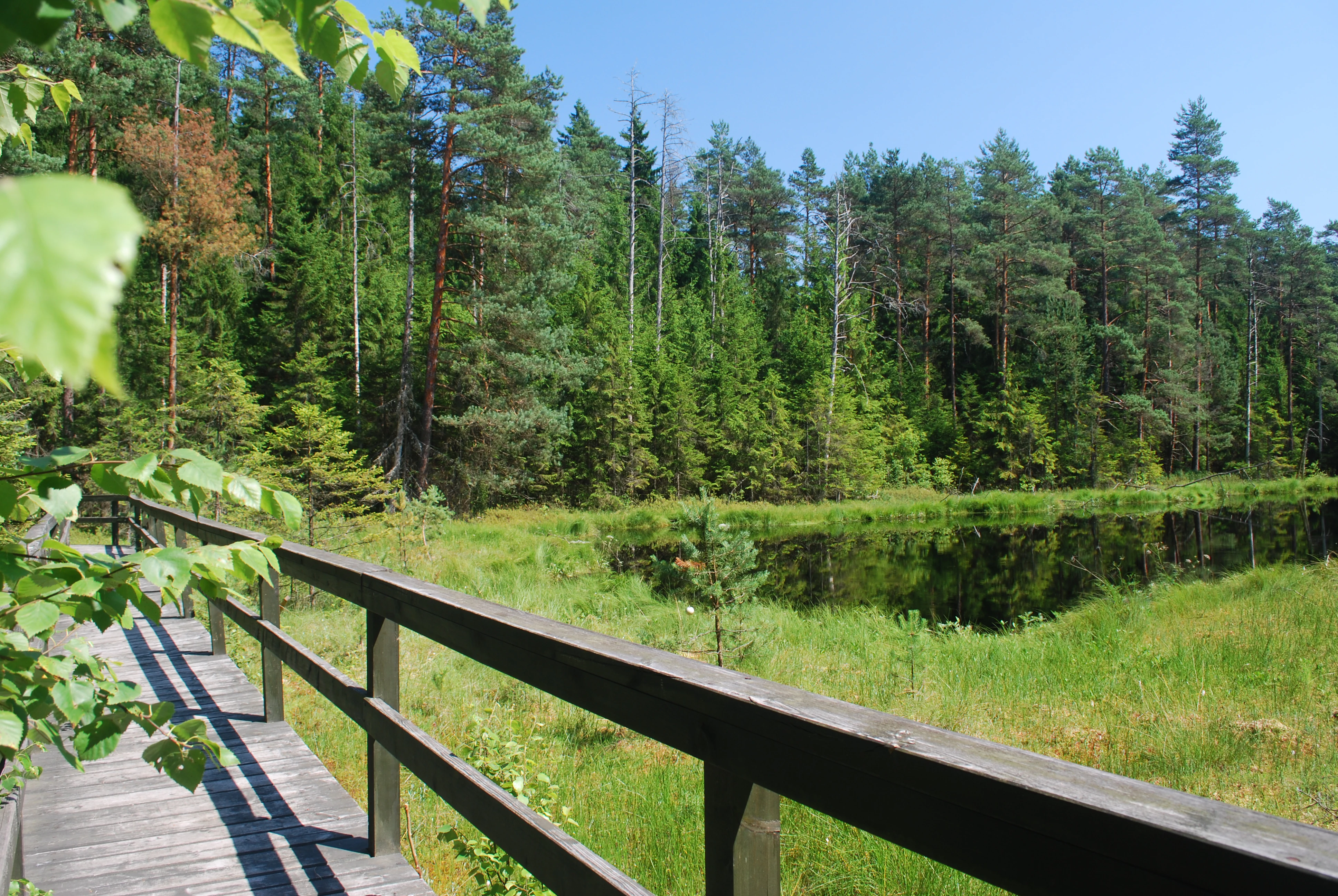
A wooden boardwalk with railings traverses a marshy area near a dark forest lake on a sunny day.
A wooden boardwalk winding through the wetland environment of a dystrophic lake.

Wigry National Park history and protected-area timeline

The history of nature protection in the Wigry area begins in the early 1920s, when naturalists such as Kazimierz Kulwieć and later Bolesław Hryniewiecki and Alfred Lityński developed plans to establish a reserve around Lake Wigry. Although these early proposals were not realized, the scientific work they generated led to the founding of a Hydrobiological Station on the lakeshore. Until the destruction of World War II, that station helped place Lake Wigry on the map of European freshwater science.

Practical conservation in the Wigry area truly began in the 1950s, when beavers crossing from the Soviet Union settled along the Czarna Hańcza River near Lake Wigry. To protect these animals, the 'Ostoja bobrów Stary Folwark' reserve was created in 1959, followed by additional small reserves such as 'Ostoja bobrów Zakąty' and the tiny 'Wądołek' reserve protecting a bog lake with floating peat islands. In the 1970s, Lake Wigry was incorporated into the international Aqua Project, which catalogued the world's most scientifically valuable water bodies.

A decisive step came in 1976, when the provincial council in Suwałki established the Wigry Landscape Park, covering more than 10,000 hectares of lakes, forests, peatlands, and farmland. From 1982 onward, systematic scientific and administrative work transformed this landscape park into a full national park. On January 1, 1989, the Wigry National Park was officially created by Council of Ministers decree, becoming the fifteenth national park in Poland. Since then, the park has grown in area, expanded its strict and active protection zones, and developed an active program of species conservation, habitat restoration, and environmental education.

Wigry National Park landscape and geographic character

The landscape of Wigry National Park is a textbook example of a glacially formed northern European terrain. The park lies within the Lithuanian Lake District and includes parts of three mesoregions: the Western and Eastern Suwałki Lake Districts and the Augustów Plain. Its terrain was shaped primarily by the Pleistocene ice sheets, whose retreat left behind a patchwork of moraine ridges, kettle holes, outwash plains, and depressions filled with water or organic deposits.

The dominant scenic feature is Lake Wigry, a large and unusually shaped postglacial lake occupying the central part of the park. Its deeply indented coastline, numerous bays, scattered islands, and underwater hills produce a varied microtopography of cliffs, shallow sandy shelves, sheltered coves, and open deep basins. Around the lake, the surrounding upland is a rolling mosaic of spruce and pine forest interspersed with peat bogs, wet meadows, and small glacial lakes.

A distinctive element of the park's landscape is the network of dystrophic lakes called suchary. These small, dark forest pools are surrounded by floating sphagnum mats and peat bog vegetation, giving them a unique character that contrasts sharply with the larger, clearer waters of Lake Wigry. The Czarna Hańcza River, the park's main watercourse, winds through forests and connects several lakes, carving its own corridors of marsh, sandbank, and reed vegetation as it flows through the protected landscape.
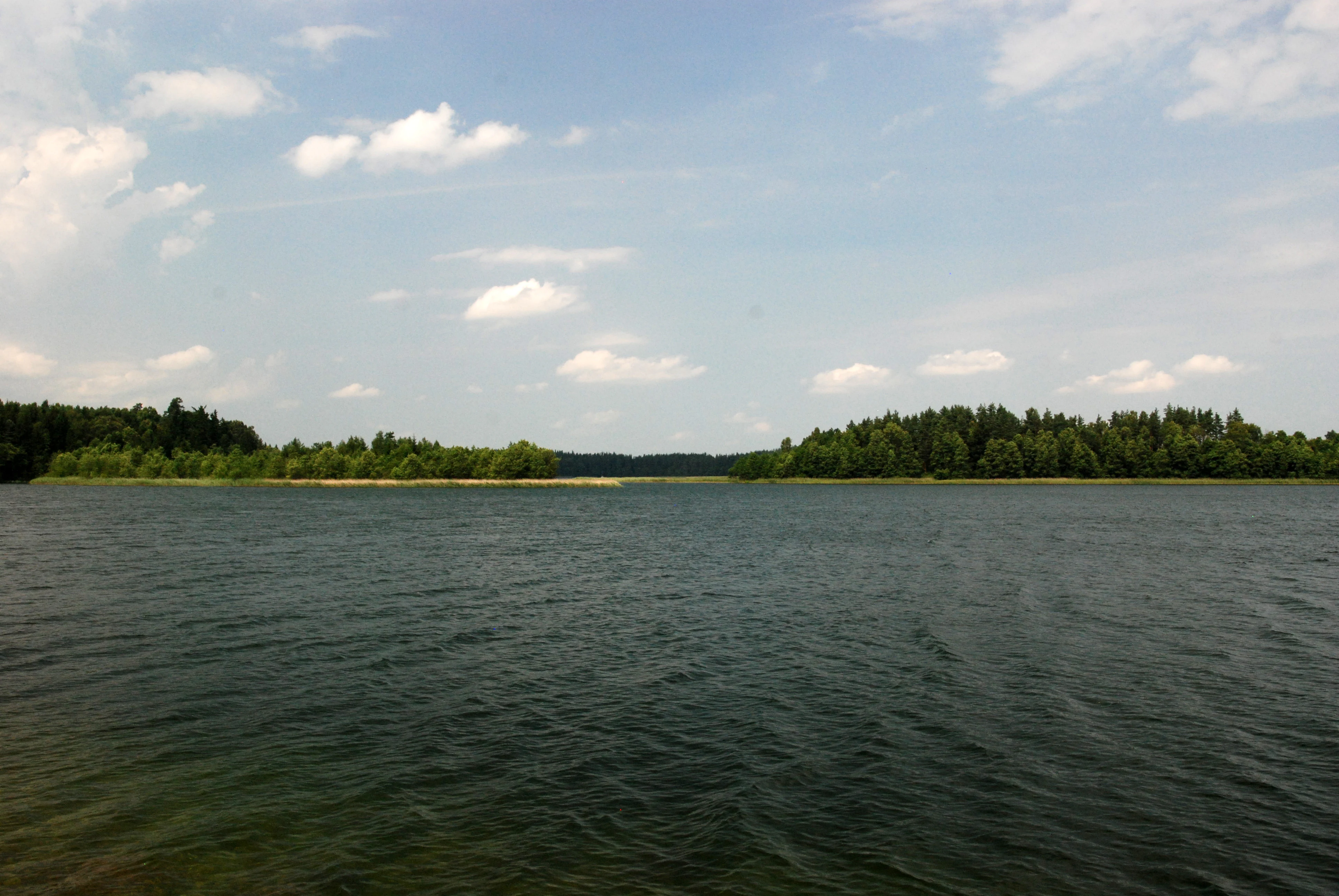
A wide view across the calm, dark water of Lake Wigry, with tree-lined shores in the distance under a blue sky with scattered clouds.
A view across Lake Wigry, the central body of water within Wigierski National Park.

Wigry National Park ecosystems, habitats, and plant life

Wigry National Park represents the geobotanical character of northeastern Europe, where mossy coniferous forests with spruce and pine dominate the landscape. Within its boundaries, approximately 800 species of vascular plants have been recorded, alongside more than 200 species of mosses and liverworts and roughly 300 species of lichens, supported by a wide variety of soils, moisture conditions, and microhabitats. Wetland and aquatic flora also benefit from the park's extensive lakes, peat bogs, and mires, which harbor rare plant communities and serve as refuges for species that have disappeared from many neighboring regions.

Roughly 75 plant taxa in the park are protected by law, including 61 under strict protection and 14 under partial protection. Among these, the orchid flora is particularly significant: about 22 native orchid species occur in the park, representing nearly half of Poland's total orchid diversity. The park has also been the site of targeted conservation projects, including the relocation of orchids from threatened sites to newly purchased protected lands in selected forest districts.

Beyond vascular plants and orchids, the park hosts rich bryophyte and lichen communities adapted to cool, humid, often shaded forest conditions. Sphagnum-dominated peatlands, transitional mires, and floating bog mats around the suchary lakes contribute to the park's character as a stronghold of northern wetland and boreal forest vegetation, a landscape type that is increasingly rare in the more intensively managed lowlands of central Europe.
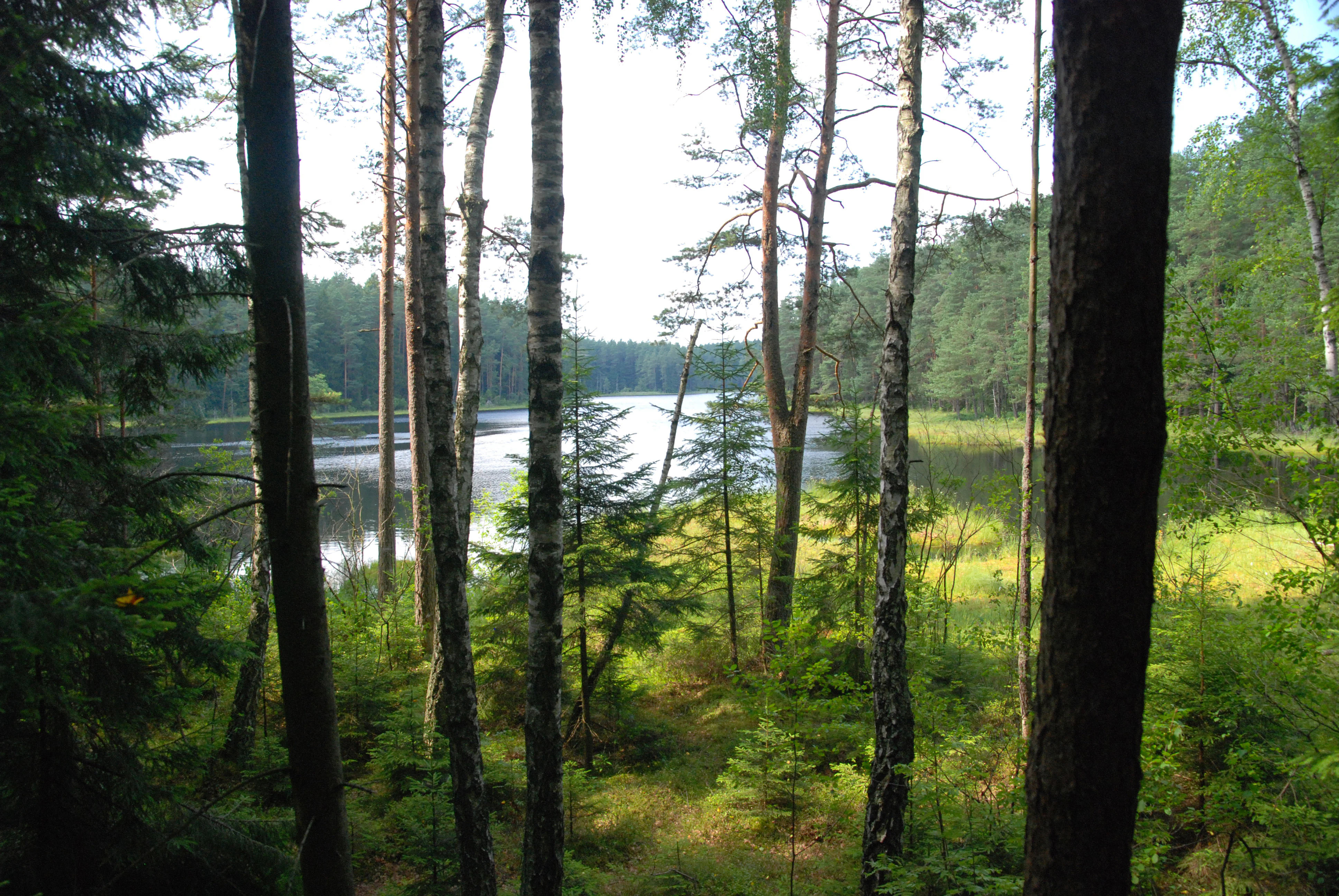
A view through dense forest trees looking out onto a small lake surrounded by peat bog vegetation.
View of the Suchar Wielki peat bog within Wigierski National Park.

Wigry National Park wildlife and species highlights

The fauna of Wigry National Park is both diverse and unusually well documented, reflecting decades of scientific study at the former Hydrobiological Station and ongoing monitoring within the park. Approximately 300 vertebrate species have been recorded, including 32 fish species, 12 amphibians, 5 reptiles, 205 birds, and 46 mammals. More than 80 percent of these species are legally protected, and they collectively represent nearly half of all protected vertebrate species in Poland, underscoring the park's exceptional conservation value.

Birds form the largest protected group, with around 185 protected species relying on the park's lakes, wetlands, and forests for breeding, migration, or wintering habitat. The lake and bog complexes provide important stopover and breeding habitat for waterbirds, while the surrounding forests support species typical of the eastern European boreal zone.

Among mammals, the park is perhaps most famous for its European beaver population. Beavers were first recorded in the park area in the late 1940s, and early protection measures around Lake Wigry helped anchor a population that grew and spread across the Suwałki region. By the mid-1990s, the park alone supported roughly 250 beavers, and the broader Suwałki population eventually numbered close to 5,000. The park also supports typical forest mammals such as red fox and maintains active habitat management for bats and small carnivores. Fish conservation programs, including hatchery operations at Tartak and collaborations with angling associations, support populations of vendace, whitefish, and pike in the park's lakes and rivers.
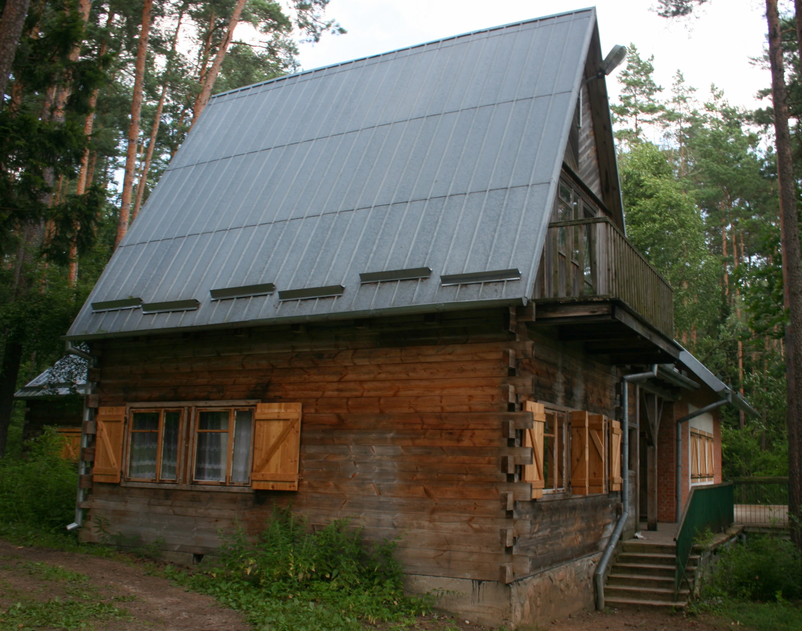
A rustic log cabin style building with a steep, silver-colored metal roof and wooden shutters, situated in a forest setting.
The Environmental Education Center located near Lake Wigry in Wigierski National Park.

Wigry National Park conservation status and protection priorities

Wigry National Park holds a central position in Poland's conservation network for freshwater, wetland, and boreal forest habitats. Its creation in 1989 was the culmination of decades of effort to protect a landscape combining postglacial lakes, peatlands, and Augustów Forest habitats under a unified national framework. Today the park is divided into strict-protection, active-protection, and landscape-protection zones, with strict protection covering roughly 1,820 hectares of the most sensitive ecosystems surrounding Lake Wigry and the suchary lakes.

The park plays a leading role in the conservation of European beavers, having served as the source population from which beavers recolonized much of the Suwałki region after near-extinction in Poland. Habitat management for rare orchids, including translocations of critically threatened species into protected forest districts such as Lipniak, Leszczewek, and Krusznik, demonstrates the park's active role in plant conservation. Purchase of private lands within park boundaries has enabled restoration of open habitats, including mowing and scrub removal on more than a dozen hectares of former agricultural land to halt secondary succession.

Aquatic conservation is likewise a core focus. Fish stocking work from the Tartak hatchery and cooperation with angling organizations support populations of vendace, whitefish, pike, and lake trout in the park's lakes and rivers. Strict fishing regulations, seasonal restrictions on key waters, and protected shoreline zones ensure breeding habitat for waterbirds and safeguard vulnerable aquatic vegetation. Together these efforts make Wigry National Park an important stronghold for lake district biodiversity in northeastern Europe.

Wigry National Park cultural meaning and human context

Wigry National Park occupies a region with a deep cultural resonance, where centuries of small-scale farming, forestry, fishing, and religious life are interwoven with the natural landscape. The Suwałki region to which the park belongs has long been a meeting point of Polish, Lithuanian, and Belarusian cultural traditions, and the area around Lake Wigry preserves historic villages, traditional rural buildings, and small churches that reflect this layered heritage.

The park hosts cultural and ethnographic exhibitions that complement its natural programs, including displays on regional fishing traditions and rural life designed to preserve local knowledge for future generations. Strolling past fishery buildings at Czerwony Folwark, exploring an ethnography exhibit in Krzywe, or paddling the Czarna Hańcza, visitors encounter a landscape in which the work of generations of foresters, fishers, and farmers continues to shape the cultural identity of the protected area.

Top sights and standout views in Wigry National Park

Wigry National Park stands out for combining three highly distinctive landscape elements in one protected area: the large, island-rich Lake Wigry; a network of small dystrophic peat lakes known as suchary; and extensive spruce-dominated boreal forests characteristic of northeastern Europe. Together these habitats produce a varied scene of open water, dark mirror-like bog pools, raised peatlands, and dense coniferous woodland.

Equally notable are the park's conservation achievements, particularly its central role in restoring European beaver populations and its wealth of native orchid species. Combined with a well-developed network of hiking, biking, educational, and kayaking routes, including the celebrated Czarna Hańcza paddle, the park offers an unusually complete picture of lake district nature, both ecologically and culturally.

Best time to visit Wigry National Park

Wigry National Park has a distinctly seasonal character shaped by the continental climate of northeastern Poland. Late spring and early summer are often considered the most rewarding time to visit, when the lakes and forests come alive, waterbird breeding activity is at its peak across Lake Wigry and the surrounding bog lakes, and the park's orchid-rich meadows and mires are in bloom. Summer also marks the main season for water-based recreation on Lake Wigry and the Czarna Hańcza, with the official paddling season typically running from May through October.

Autumn brings a quieter, contemplative atmosphere, with cooler weather, lower visitor numbers, and vivid foliage across the spruce and pine forests, making it a rewarding period for hiking, wildlife watching, and photography. Winter offers a starkly different experience, when the lakes freeze and the park's trails take on a hushed, snow-covered quality; visitors should be aware that many water-based activities become unavailable during this period. Across all seasons, the park's character shifts significantly with the weather, but the combination of lakes, forests, and peatlands ensures that each period of the year has its own distinct appeal.
Monthly climate preview

Long-term representative point measurements tracking monthly temperature and precipitation rhythm

Wigierski Park Narodowy Climate Normals and Annual Weather by Month

Representative coordinates record long-term average monthly temperatures ranging from sub-zero winter minimums to warm summer maximums alongside consistent precipitation rates. Examining the full twelve-month profile provides detailed meteorological context for evaluating regional protected area conditions.
Annual mean7 °C
-5 °C18 °C
Jan-5°
Feb-4°
Mar
Apr
May13°
Jun16°
Jul18°
Aug18°
Sep13°
Oct
Nov
Dec-3°
Warmest month
July

18.3 °C

Coolest month
January

-5.2 °C

Wettest month
July

2.8 mm/day

Driest month
March

1.4 mm/day

Park location guide

Geography guide, regional context, and park location map for Wigry National Park

Wigry National Park park geography, regions, and map view in Poland

Understand where Wigry National Park sits in Poland through a broader geographic reading of the surrounding landscape, nearby location context, and its mapped position within the national park landscape.

How Wigry National Park fits into Poland

Poland, officially the Republic of Poland, is a Central European country spanning from the Baltic Sea in the north to the Carpathian Mountains in the south. It borders Germany, Czech Republic, Slovakia, Ukraine, Belarus, Lithuania, and Kaliningrad Oblast. The country has a temperate climate, diverse landscapes, and is known for its rich history, cultural heritage, and strong economic position within the EU.

Wider geography shaping Wigry National Park in Poland

Poland occupies 312,696 km2 in Central Europe, extending from the Baltic Sea coast in the north to the Sudetes and Carpathian Mountains in the south. It borders Germany to the west, Czech Republic and Slovakia to the south, Ukraine and Belarus to the east, and Lithuania and Kaliningrad Oblast to the northeast. The landscape includes lowland plains, uplands, and mountain ranges.

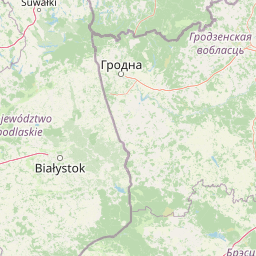
Map view of Wigry National Park

Use this park location map to pinpoint Wigry National Park in Poland, understand its exact geographic position, and read its mapped placement within the surrounding landscape more clearly.

Pigeon | © OpenStreetMap contributors

Location context for Wigry National Park

Podlaskie Voivodeship
Natural feature types

Examine the Natural Landforms and Aquatic Features of Wigierski Park Narodowy

Continue geographic discovery by exploring the named natural landmarks associated with Wigierski Park Narodowy. This collection organizes the park's glacial lakes, forest pools, and diverse terrain types to provide a deeper understanding of the physical geography and landscape evolution within the protected region.

Visual reference of postglacial lakes, boreal forests, and wetland habitats in northeastern Poland

Wigierski Park Narodowy Landscape Photos and Scenery

Visual records capture the distinctive postglacial terrain, island-studded waters, and dense spruce woodlands defining Wigierski Park Narodowy. Photographic documentation provides direct insight into the protected habitats, bog pools, and glacial topography shaping the regional environment.

A wooden boardwalk with railings traverses a marshy area near a dark forest lake on a sunny day.

A wide panoramic photograph of a dark, still forest lake surrounded by dense evergreen trees and grassy marshland, viewed from beneath a wooden structure.

A wide view across the calm, dark water of Lake Wigry, with tree-lined shores in the distance under a blue sky with scattered clouds.

A view through dense forest trees looking out onto a small lake surrounded by peat bog vegetation.

A rustic log cabin style building with a steep, silver-colored metal roof and wooden shutters, situated in a forest setting.

Park atlas

Discover related regional landscapes, postglacial lakes, and neighboring protected habitats.

Explore Protected Areas and Parks Near Wigierski Park Narodowy

Continue geographic exploration by comparing Wigierski Park Narodowy with other protected areas located across the surrounding region. Analyzing adjacent national parks reveals broader patterns in regional terrain, boreal forest distribution, and wetland ecosystems.
Watercolor painting of a tranquil marshland scene with reeds in the foreground, rolling green hills, and a pale sky.
Nature reservePodlaskie Voivodeship
Park boundaries overlap#1 closest

Southeast

Ostoja Augustowska Nature Reserve: Protected Forest and Wetland Atlas of Podlaskie

Mapped wilderness corridors in the Polish lowlands

Ostoja Augustowska serves as a major ecological hub in Podlaskie Voivodeship, comprising extensive pine and spruce woodlands linked with diverse peatland systems. The site provides a critical corridor for rare forest wildlife while preserving ancient stands of old-growth timber. Gain insights into the complex geography of this Natura 2000 protected territory through its documented terrain, hydrological networks, and mosaic of rare boreal habitat types.

Area
1,070.69 km²
Established
2009
Relief
Lowland
Climate
Temperate
Watercolor illustration showing lakes, green vegetation, and hills in the background
National parkPodlaskie Voivodeship
Park boundaries overlap#2 closest

Southwest

Wigry National Park: Protected Area Atlas of Poland's Glacial Lake District

Explore mapped landscapes and wetland ecosystems in Podlaskie Voivodeship

Delve into the geography of Wigry National Park, a national park situated in the Podlaskie Voivodeship of northeastern Poland. This protected area is defined by its glacial landscape, featuring 42 lakes including the expansive Lake Wigry, alongside critical wetland habitats and significant peat bogs. Discover the mapped boundaries and ecological importance of Wigry National Park, renowned as a prime location for beaver populations and a vital component of Poland's protected lands atlas.

Area
150.86 km²
Established
1989
IUCN
II
Visitors
110K annual
Nature reservePodlaskie Voivodeship
About 14 km away#3 closest

Southeast

Rezerwat przyrody Mały Borek: Pine Bore Forest and Peatland Geography in Podlaskie

Protected nature reserve in the Augustów Primeval Forest

Rezerwat przyrody Mały Borek is a significant nature reserve located in the Podlaskie Voivodeship of Poland. The area is defined by its extensive pine bore forests, central raised bogs, and transition zones of alder swamp. As part of the Natura 2000 network, it provides essential habitat and stands as a key scientific reference for the natural forest landscape of the Augustów Plain.

Area
0.905 km²
Established
1959
Relief
Lowland
Scope
Terrestrial
Protected landscapePodlaskie Voivodeship
About 18 km away#4 closest

Northwest

Suwalski Park Krajobrazowy: Glacial Terrain and Protected Landscape Atlas

Mapping the post-glacial geography of Podlaskie Voivodeship

Suwalski Park Krajobrazowy represents a highly distinct glacial environment within the Polish lowlands. Explore the distribution of its iconic morainic landforms, extensive boulder reserves, and the deep basin of Lake Hańcza. The park provides critical geographic context for understanding the interplay between ice-transported geology and local hydrological features in northeastern Poland.

Area
63.38 km²
Established
1976
Relief
Upland
Climate
Temperate
Watercolor painting showing a wetland scene with reeds, patches of water, and trees under a light sky
National parkPodlaskie Voivodeship
27 km away#5 closest

Southwest

Biebrza National Park: Protected Fenlands and River Basin Geography in Northeastern Poland

Tracing the largest lowland peat bog complex in the European landscape

Biebrza National Park serves as the premier protected wetland area in Poland, characterized by its vast, intact marshlands and the meandering Biebrza River valley. This geographic profile details the park's critical fen ecosystems, floodplain dynamics, and distinctive habitats that support diverse avian and mammalian populations within the Podlaskie region.

Area
592.23 km²
Established
1993
IUCN
II
Relief
Lowland
A watercolor painting of a flat wetland landscape with a winding river in the foreground, small clusters of trees, and rolling hills in the soft, distant background.
National parkPodlaskie Voivodeship
27 km away#6 closest

South

Biebrzański Park Narodowy: A Protected Wetland Landscape in Podlaskie Voivodeship, Poland

Mapped river valley and peatland geography.

Located in the northeast of Poland, Biebrzański Park Narodowy protects a sprawling, flat basin defined by the slow-meandering Biebrza River. This critical protected area encompasses rare peat bogs, floodplain meadows, and alder carrs, functioning as a vital refuge for wetland species within the broader Podlaskie Voivodeship landscape.

Area
592.23 km²
Established
1993
Visitors
23.2K annual
Relief
Lowland
Nature reserveWarmian-Masurian Voivodeship
About 45 km away#7 closest

Northwest

Mechacz Wielki Nature Reserve: Geographic Records of Protected Peatlands in Northeastern Poland

Mapping the raised bog and forest ecosystems of the Romincka Forest.

Mechacz Wielki Nature Reserve represents a critical example of raised bog geography and peat-forming processes in Poland. This record details the reserve as a core feature of the Romincka Forest, focusing on its transition from open moss-dominated surfaces to complex boggy pine forests and wetland habitats. Gain insight into the regional landscape characteristics that shape this unique northeastern protected area.

Area
1.467 km²
Established
1974
Relief
Lowland
Scope
Terrestrial
Watercolor illustration showing a landscape with forests, a river, and distant hills
National parkLithuania
48 km away#8 closest

East

Dzūkija National Park: Explore Lithuania's Largest Protected Forest and Inland Dune Landscapes

Mapped protected area geography and natural terrain of the Dainava region.

Delve into the protected landscape of Dzūkija National Park, Lithuania's expansive national park renowned for its vast primeval pine forests and extraordinary inland dune formations. This page provides a detailed atlas-style view of the park's mapped boundaries, diverse terrain, and significant natural features, offering insight into its protected territory and regional geographic importance. Examine the unique wetland systems and forest ecosystems that make this a crucial area for protected land discovery.

Area
584.53 km²
Established
1991
IUCN
II
Visitors
30K annual

Common questions about visiting, size, designation, and location context for Wigry National Park

Wigry National Park FAQs for park facts, access, geography, and protected area context

Find quick answers about Wigry National Park, including protected-area facts, park geography, trail and visitor context, and how the park fits into its surrounding country and regional landscape.
MoriAtlas Explorer

Continue Your Protected Areas Search Across the Global Atlas

Deepen your exploration by continuing the structured search for national parks and protected areas worldwide. Utilize the comprehensive filtering capabilities to compare different conservation landscapes and refine your understanding of global park geography. Discover more about the distribution and characteristics of protected natural areas.

Global natural geography