
Mori Atlas logo
Nature reserveZwarte Meer

A vital freshwater border lake shaped by extensive reedlands, marshes, and riverine terrain.

Zwarte Meer Nature Reserve: Mapping the Protected Wetland Landscapes of Overijssel

Zwarte Meer serves as a critical freshwater wetland complex on the boundary between Overijssel and Flevoland. This protected nature reserve features a mosaic of shallow open water, dense reed fringes, and managed marshlands that function as a key corridor for avian migration. The geography reflects a complex history of land reclamation and water management, creating a unique lowland environment that sustains significant populations of waterbirds and marsh species.

wetlandsreedlandsborder lakerandmeerbird sanctuarynatura 2000
A flat-style digital illustration showing a waterfall flowing into a river surrounded by forested cliffs and rocky terrain under a pale blue sky.

Zwarte Meer

Nature reserve

Park overview

Structured park overview, official facts, and landscape profile for Zwarte Meer

Zwarte Meer park facts, protected area profile, and essential visitor context

Review the core facts for Zwarte Meer, including designation, size, terrain, visitor scale, habitats, and operating context in one park-focused overview.

About Zwarte Meer

Zwarte Meer occupies a transitional position in the Dutch water landscape, sitting between engineered polders to the west and an older river-fed shoreline to the east. As one of the Randmeren Noord, it functions both as a practical shipping route and as a buffer between the reclaimed Noordoostpolder and the rest of the country. The lake fills a basin that was originally part of the Zuiderzee and took its modern shape after the Noordoostpolder was dammed and drained during the 1940s.

The character of Zwarte Meer is defined by shallow water and a richly fringed shoreline. Outside the maintained shipping channels, depths rarely exceed two meters, allowing aquatic plants and emergent vegetation to thrive. Along the banks and around Vogeleiland, broad bands of reed form continuous habitat, while a large reed marsh along the southern shore adds another layer of wetland cover. Remnants of rushes reflect the older wet-meadow landscape that once extended along the Zwarte Water river system before the polders reshaped the region.

Ecologically, Zwarte Meer carries weight well beyond its modest size. It is a Natura 2000 site designated under both the Habitats Directive and the Birds Directive, and BirdLife International has listed it as an Important Bird Area. Reedbeds host a community of secretive marshland species, while the open water and adjoining meadows attract large concentrations of wintering and migrating waterfowl. Conservation management, including reed cutting and targeted grazing for rare flowers such as kievitsbloem, reflects an effort to keep both the open water and the surrounding traditional wet-grassland landscape in healthy condition.

Quick facts and research context for Zwarte Meer

Zwarte Meer is a Dutch randmeer, or border lake, belonging to the Randmeren Noord together with Ketelmeer and Vossemeer. It sits on the provincial boundary between Flevoland and Overijssel, near the towns of Kampen, Genemuiden, Vollenhove, and Zwolle. The lake is generally shallow, averaging only one to two meters outside the shipping channels, and connects eastward to the Zwarte Water river and northeastward to the Kadoelermeer.

A 21.62 square kilometer area around the lake, including open water, reed fringes, a large southern reed marsh, the artificial Vogeleiland, and remnants of rush meadows, is protected as a Natura 2000 site under both the Habitats Directive and the Birds Directive. BirdLife International has also recognized the lake as an Important Bird Area. A portion of the shore is managed by the Vereniging Natuurmonumenten, which oversees mowing and grazing to safeguard rare meadow plants and reed-nesting birds.

Protection and recognition

Documented protection history, terrestrial scope, and international recognition sources

Zwarte Meer Protection Status, Natura 2000 Designation, and Ramsar Site Recognition

Zwarte Meer maintains terrestrial protection status alongside formal international recognition sources including Natura 2000 and Ramsar wetland designations established in 2010. Structured conservation records compile official designation history, management scope, and verified administrative frameworks for this protected area.

International recognition

Protection details

Protection scope
Terrestrial
Designated year
2010
Transboundary protection
No
Park context

Deeper park guide and search-rich context for Zwarte Meer

Zwarte Meer history, landscape, wildlife, and travel context

Explore Zwarte Meer through its history, landscape character, ecosystems, wildlife, conservation priorities, cultural context, and seasonal travel timing in a structured park guide built for atlas discovery and search intent.

Why Zwarte Meer stands out

Zwarte Meer is best known for its extensive reedlands and its importance as a waterbird habitat on one of Europe's busiest bird migration corridors. The lake's protected borders combine open water, broad reed fringes, a managed southern reed marsh, the artificial Vogeleiland, and surviving rush meadows, creating a layered wetland mosaic that supports breeding bitterns, marsh harriers, great reed warblers, and purple herons. In winter, the same landscape hosts large flocks of white-fronted geese, gadwalls, and increasingly frequent white-tailed eagles.
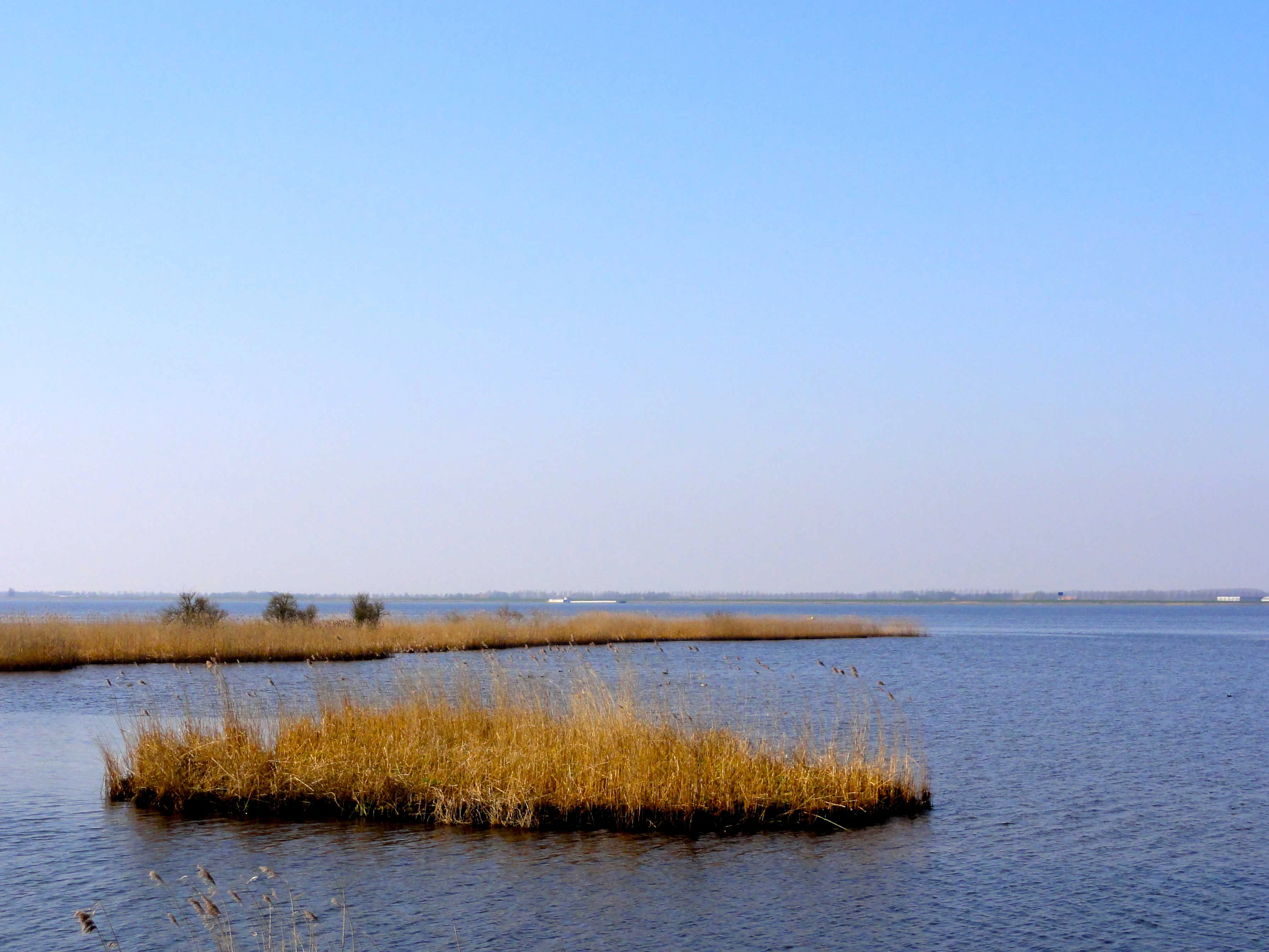
A calm lake landscape featuring patches of tall yellow reeds and bullrushes growing in the water under a clear blue sky.
Bullrush fields bordering the Zwarte Meer nature reserve waters.

Zwarte Meer history and protected-area timeline

The modern form of Zwarte Meer is a product of twentieth-century Dutch land reclamation. During the 1940s, construction of the Noordoostpolder cut off a section of the former Zuiderzee, transforming it into a shallow freshwater lake on the western side of the historic shoreline. The lake remained connected eastward through the Zwarte Water and northeastward through the Kadoelermeer, preserving its role as part of the inland water network while gaining a clearly defined western boundary.

In the decades that followed, the lake gradually developed into a valued ecological area. Conservation organizations, including the Vereniging Natuurmonumenten, began acquiring shoreline parcels and managing reed areas and wet meadows. In 2010, a 21.62 square kilometer area covering the lake and its fringing habitats was formally designated as a Natura 2000 site under the European Habitats Directive and Birds Directive, with a subsequent modification in 2022. BirdLife International separately recognized the lake as an Important Bird Area, underlining its growing international profile for waterbird conservation.

Zwarte Meer landscape and geographic character

Zwarte Meer presents a flat, open, and unmistakably Dutch landscape shaped by water management. The lake itself is broad but shallow, with most of its surface consisting of open water interrupted only by vegetated fringes and a few small islands, including Vogeleiland, De Snörre, and Kraggenoog. The shoreline alternates between drained polders on the Flevoland side and a more varied riverine fringe on the Overijssel side, where former floodplains and meadows remain close to the water.

Around the lake, the visual character changes slowly with the seasons. Reed stands along the southern shore form dense green or golden walls depending on the time of year, while the northern polder edge is more geometric, with clean lines of reclaimed farmland meeting the water. To the east, the landscape transitions into the Zwarte Water floodplain and the historic towns of Genemuiden, Zwartsluis, and Zwolle, giving the lake a clear cultural backdrop of small river communities working in close relationship with the water.

Zwarte Meer ecosystems, habitats, and plant life

The ecological character of Zwarte Meer is built around a few interlocking habitats. Open shallow water, shallow reedbeds along the shore, a large reed marsh on the southern side, the artificial Vogeleiland, and remnants of rush meadows together form a wetland complex that supports a wide range of birds, plants, and invertebrates. The combination of open water and dense emergent vegetation is rare in the Netherlands at this scale and is central to the area's conservation value.

The lake's productivity depends heavily on careful management. Reed is regularly cut in selected areas to keep stands vigorous and attractive to nesting birds. Along the shore, mowing and grazing regimes maintain the wet-meadow conditions required by plants such as kievitsbloem, while the open water itself supports aquatic plant communities typical of nutrient-rich, sheltered lowland lakes. The result is a balanced mosaic where reed, meadow, and open water each play a role in sustaining the broader ecosystem.

Zwarte Meer wildlife and species highlights

Zwarte Meer is primarily known for its birdlife, both as a breeding area and as a refuge for wintering and migrating waterfowl. Reedbeds around the lake and across Vogeleiland host breeding populations of roerdomp, bruine kiekendief, grote karekiet, and purperreiger, four species that depend on the structural quality of the reeds and on the management regime that keeps them suitable for nesting.

The lake is also an important wintering and stopover site for migratory species. BirdLife International has highlighted the significance of kolgans and krakeend populations, among other waterbirds, that use the area in large numbers during the colder months. The presence of zeearend has also been noted, reflecting the broader recovery of this large raptor across the Dutch water landscape. Outside the bird community, the lake's reedbeds and wet meadows sustain characteristic reedland invertebrates and meadow flora tied to traditional, lightly grazed landscapes.

Zwarte Meer conservation status and protection priorities

Conservation is central to the identity of Zwarte Meer. The 21.62 square kilometer site covering the lake and its fringing habitats is protected under the Natura 2000 network through both the Habitats Directive and the Birds Directive, reflecting its importance at the European level. The initial designation took effect in 2010, with a later modification in 2022, and the site carries the European code NL9802031.

On the ground, a substantial portion of the shoreline, 283 hectares in total, is managed by the Vereniging Natuurmonumenten. Management focuses on maintaining reed vigor through controlled cutting, sustaining wet-meadow conditions for rare flowers such as kievitsbloem, and protecting the northern shoals and Vogeleiland as core breeding and roosting areas. BirdLife International's Important Bird Area recognition further strengthens the site's international standing and supports coordinated efforts to conserve waterbird populations across the broader Randmeren system.

Zwarte Meer cultural meaning and human context

Although Zwarte Meer itself is a relatively young landscape shaped by reclamation, it sits within an older cultural setting defined by river towns and traditional water-based livelihoods. Towns such as Kampen, Genemuiden, Zwartsluis, and Vollenhove have long histories tied to the Zwarte Water river system, with fishing, shipping, and reed and rush harvesting once forming the backbone of local economies. The remnants of rush meadows around the lake echo this older use of the landscape and connect the modern protected area to a deeper regional identity.

The surrounding polders also reflect the Dutch tradition of land management. The Noordoostpolder, whose creation gave Zwarte Meer its modern form, is itself a monument to twentieth-century engineering, and the lake now functions as a soft ecological edge between that engineered landscape and the older, river-shaped counties of Overijssel.

Top sights and standout views in Zwarte Meer

Zwarte Meer's strongest qualities lie in its combination of open water, dense reedbeds, and protected meadow margins within a single Natura 2000 site. The presence of Vogeleiland, the southern reed marsh, and the surviving rush meadows gives the area a layered structure that supports both secretive reed-nesting birds and large wintering flocks of waterfowl.

The lake is also notable for its accessibility of birdwatching opportunities, including breeding bitterns, marsh harriers, great reed warblers, purple herons, white-fronted geese, gadwalls, and increasingly regular white-tailed eagles. Recognition as both a Natura 2000 site and a BirdLife International Important Bird Area places Zwarte Meer firmly within the network of Europe's most important wetland reserves.

Best time to visit Zwarte Meer

Zwarte Meer is meaningful across the full annual cycle, but different seasons emphasize different aspects of the lake. Late spring and early summer are the best periods to encounter breeding reedbed species such as bitterns, marsh harriers, great reed warblers, and purple herons, when the reed is tall and birds are most active around their nests.

In autumn and winter, the lake shifts into a different mode, with large flocks of white-fronted geese, gadwalls, and other waterfowl gathering on the open water and surrounding meadows. Migrating raptors, including occasional white-tailed eagles, can also be more visible at this time. Reed cutting operations, weather permitting, sometimes make individual birds easier to observe during the colder months.

Monthly climate preview

Long-term representative point measurements tracking monthly weather patterns in Overijssel

Zwarte Meer Climate Normals and Measured Annual Temperature and Precipitation Rhythm

Zwarte Meer records long-term monthly averages spanning a thermal range from sub-zero winter minimums to warm summer maximums alongside measured precipitation rates. Examining the complete twelve-month dataset reveals detailed shifts in temperature and moisture distributions across the protected area.
Annual mean10 °C
2 °C18 °C
Jan
Feb
Mar
Apr
May13°
Jun16°
Jul18°
Aug18°
Sep15°
Oct11°
Nov
Dec
Warmest month
July

17.9 °C

Coolest month
January

2.5 °C

Wettest month
December

2.6 mm/day

Driest month
April

1.4 mm/day

Park location guide

Geography guide, regional context, and park location map for Zwarte Meer

Zwarte Meer park geography, regions, and map view in Netherlands

Understand where Zwarte Meer sits in Netherlands through a broader geographic reading of the surrounding landscape, nearby location context, and its mapped position within the national park landscape.

How Zwarte Meer fits into Netherlands

The Netherlands is a low-lying coastal country in Northwestern Europe, famous for its extensive dike and canal systems that reclaim land from the sea. It consists of twelve provinces and is known for tulips, windmills, and cycling culture. The country is a founding member of the European Union with Amsterdam as its capital and The Hague as the seat of government.

Wider geography shaping Zwarte Meer in Netherlands

The Netherlands is located in Northwestern Europe along the North Sea coastline to the north and west. It borders Germany to the east and Belgium to the south. The country is notably flat, with a significant portion of its territory lying below sea level, protected by dikes and dune systems. It consists of twelve provinces and also includes overseas municipalities in the Caribbean.

Map view of Zwarte Meer

Use this park location map to pinpoint Zwarte Meer in Netherlands, understand its exact geographic position, and read its mapped placement within the surrounding landscape more clearly.

Pigeon | © OpenStreetMap contributors

Location context for Zwarte Meer

FlevolandOverijssel
Recorded earthquake history

Review the Historical Earthquake Catalogue for the Zwarte Meer Region

Access a detailed archive of recorded seismic events associated with the geography of Zwarte Meer. This MoriAtlas dataset provides structured event information, allowing for a transparent look at the historical seismic record in the context of these protected Dutch wetlands.

Zwarte Meer Earthquake History

Catalogued events

1 event

Strongest magnitude

Magnitude 3

Most recent event

Jun 21, 2004

This history includes earthquakes recorded inside the park or within 50 km of its borders

Visual reference for the reedlands, open waters, and avian habitats of Zwarte Meer

Zwarte Meer Photos and Protected Wetland Landscapes

Visual documentation captures the flat terrain, open waters, and broad reed fringes defining the Zwarte Meer wetland environment. Photographic records reveal the shifting seasonal colors of the protected shoreline and provide clear insight into its regional ecology.

A calm lake landscape featuring patches of tall yellow reeds and bullrushes growing in the water under a clear blue sky.

A green navigational road-style sign reading Genemuiden stands on a grassy bank beside a river, with vast reed beds and open water in the background.

Park atlas

Discover related wetland reserves and regional border lakes for broader geographic comparison

Exploring Parks Near Zwarte Meer And Surrounding Protected Landscapes

Compare Zwarte Meer with other nearby protected areas and wetland reserves across the surrounding region. Broaden your geographic exploration by examining connected lowland lakes and marshland habitats.
Protected areaFlevoland
0 km away#1 closest

West

Ketelmeer & Vossemeer: Protected Area Geography, Boundaries, and Landscape Context

Mapping freshwater lake dynamics in the Flevoland and Overijssel border region.

Ketelmeer & Vossemeer constitutes a significant Natura 2000 wetland complex where riverine floodplains meet engineered polder landscapes. This analysis provides insights into the site's role as a critical Important Bird Area and its position within the broader IJssel delta network of lakes and water channels.

Area
38.43 km²
Established
2013
Relief
Lowland
Climate
Temperate
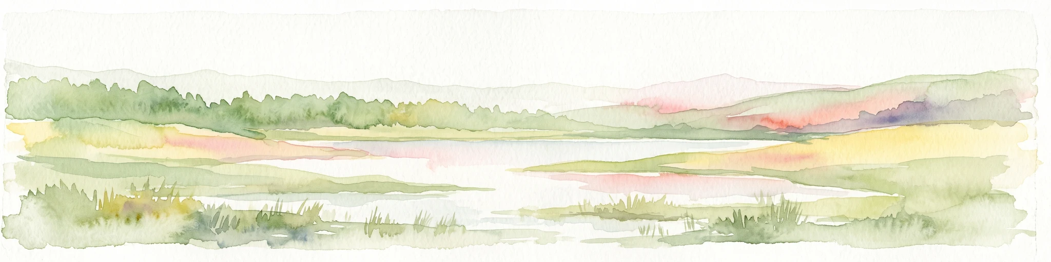
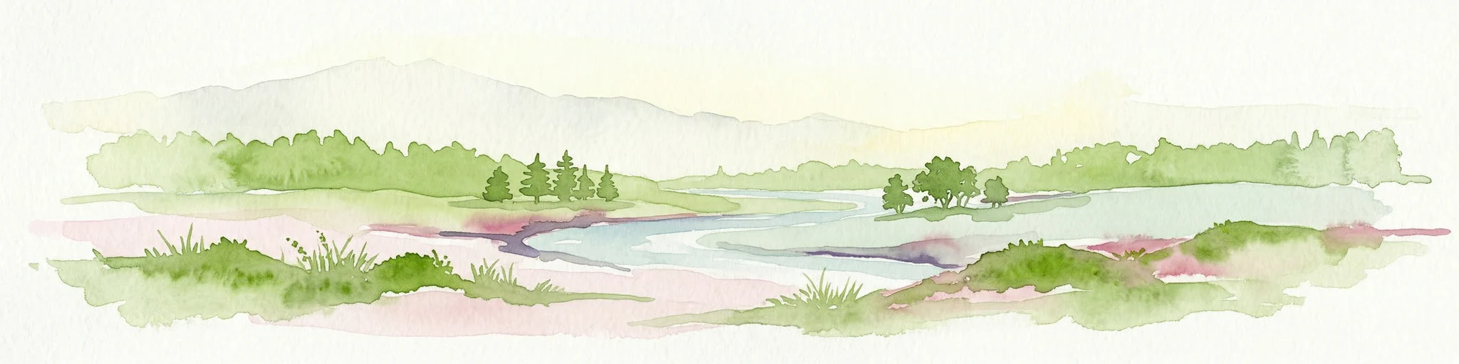
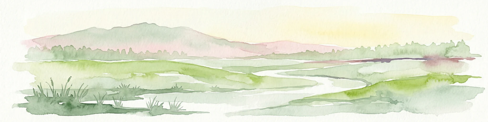
Watercolor painting of a wetland scene with a winding river, grassy areas, and distant hills
National parkOverijssel
1.2 km away#2 closest

Northeast

Weerribben-Wieden National Park: A Premier Lowland Peat Bog National Park in Overijssel

Explore mapped protected wetlands and unique hydrological landscapes.

Weerribben-Wieden National Park stands as a remarkable example of a large-scale lowland peat bog ecosystem, recognized as the most extensive and well-preserved in Northwestern Europe. Located in the Overijssel province, this protected area showcases a complex mosaic of interconnected waterways, expansive reed beds, and marshy woodlands. Our platform provides structured geographic context, enabling detailed map-based discovery of the park's unique terrain and ecological significance as a vital conservation landscape.

Area
105 km²
Established
1992
IUCN
II
Relief
Lowland
Nature reserveNetherlands
About 6.2 km away#3 closest

East

Olde Maten en Veerslootlanden Nature Reserve: Peatland and Strip Field Atlas

A preserved Natura 2000 cultural landscape in Overijssel

Discover the narrow pipe shaped parcels of Olde Maten en Veerslootlanden, a uniquely preserved peat meadow reserve in the eastern Netherlands. The landscape features a high concentration of alder woodlands, species rich ditches, and historic duck decoys that define this significant regional ecosystem.

Area
7.95 km²
Established
2013
Relief
Lowland
Scope
Terrestrial
A watercolor landscape painting of a calm, shallow body of water surrounded by grassy, low-lying shores and soft, distant hills under a pale, white sky.
Protected areaNetherlands
13 km away#4 closest

Northwest

IJsselmeer: Geography and Protected Wetland Mapping of the Netherlands

Engineered freshwater landscapes and polder geography

The IJsselmeer acts as the central freshwater reservoir for the Netherlands, providing a expansive, horizon-dominated landscape shaped by the Afsluitdijk. As an internationally recognized wetland, it supports diverse waterbird populations within its intricate system of dikes, former tidal channels, and emerging nature islands. This protected area stands as a definitive example of large-scale, adaptive hydraulic management in a low-lying coastal nation.

Area
1,133 km²
Established
1932
Relief
Lowland
Climate
Temperate
Protected areaNetherlands
17 km away#5 closest

South

Veluwe: A Comprehensive Geographic Atlas of the Central Netherlands Protected Area

Glacial moraines, heathlands, and inland sand systems

Investigate the Veluwe, a premier protected area in the Gelderland province characterized by its historic push moraines and extensive ecological zones. The region encompasses significant sand drift complexes, dense woodlands, and vital spring-fed streams, offering a clear view of the diverse natural terrain found throughout the central Netherlands.

Area
1,000 km²
Relief
Upland
Climate
Temperate
Access
Easy access
National parkFlevoland
26 km away#6 closest

West

Nieuw Land National Park: Mapped Wetland Landscape on Flevoland's Reclaimed Land

Protected area geography and ecological discovery in the Netherlands

Nieuw Land National Park offers a distinctive protected landscape forged on land recently reclaimed from the sea in the Dutch province of Flevoland. This national park is characterized by its vast expanse of wetlands, artificial islands like the Marker Wadden, and critical importance for migratory bird populations. Delve into the park's geographic context and mapped features to understand its unique conservation value and role within the wider European atlas of protected areas.

Area
289 km²
Established
2018
IUCN
II
Relief
Lowland
Watercolor painting depicting a body of water, trees, and distant hills under a light sky
National parkDrenthe
27 km away#7 closest

Northeast

Dwingelderveld National Park: Drenthe's Vast Wet Heathland and Unique Pingo Lakes

Explore a protected landscape of heath, bogs, and ancient geography.

Dwingelderveld National Park represents a significant protected landscape in the Drenthe region of the Netherlands, celebrated as the largest wet heathland in Western Europe. This 37-square-kilometer area provides exceptional opportunities for atlas exploration, revealing a terrain composed of sandy ridges interspersed with waterlogged depressions. The park's defining features include more than forty natural pools, known as vennen, many of which are geologically important pingo-ruins. Discover the rich archaeological heritage, including ancient Celtic fields and burial mounds, all situated within this unique natural setting. MoriAtlas offers a structured view of Dwingelderveld National Park's distinct geography and protected ecological value.

Area
37 km²
Established
1991
IUCN
II
Relief
Lowland
Watercolor illustration of a landscape with green fields, trees, a body of water, and distant hills under a light sky
National parkDrenthe
29 km away#8 closest

Northeast

Drents-Friese Wold National Park: Protected Landscape and Geographic Exploration in Drenthe

Explore unique heathlands, drift-sands, and regional natural geography.

This entry details Drents-Friese Wold National Park, a crucial protected landscape in the Drenthe province. Understand its mapped boundaries, distinctive heath and drift-sand terrain, and its significance as a natural area. Discover the park's regional geographic setting and its role in the broader Dutch landscape atlas, providing context for its unique ecological and historical character.

Area
61 km²
Established
2000
IUCN
II
Relief
Lowland

Common questions about visiting, size, designation, and location context for Zwarte Meer

Zwarte Meer FAQs for park facts, access, geography, and protected area context

Find quick answers about Zwarte Meer, including protected-area facts, park geography, trail and visitor context, and how the park fits into its surrounding country and regional landscape.
MoriAtlas Explorer

Continue Your Protected Areas Search Across the Global Atlas

Deepen your exploration by continuing the structured search for national parks and protected areas worldwide. Utilize the comprehensive filtering capabilities to compare different conservation landscapes and refine your understanding of global park geography. Discover more about the distribution and characteristics of protected natural areas.

Global natural geography