Mori Atlas logo
Countries

Browse mapped natural landscapes and conservation lands across Ecuador's diverse geography.

Ecuador National Parks and Protected Areas: A Geographic Atlas Explorer

Ecuador offers a rich tapestry of national parks and protected areas, providing a unique lens through which to explore its remarkable biodiversity and varied terrains. This atlas serves as a gateway to understanding the geographic distribution of these vital conservation landscapes, from Andean peaks and cloud forests to the unique ecosystems of the Galápagos Islands. Navigate the nation's protected lands to gain context on regional geography and the spread of natural areas.

Ecuador National Parks and Protected Areas: A Geographic Atlas Explorer
Park system

Geographic Snapshot of the Ecuador Park System and Protected Areas

Comparing land scale, historical establishment, and ecological zones across diverse regions

Natural-area explorers can evaluate diverse ecological profiles from the Pacific coast and Galapagos Islands to high Andean paramos and Amazonian forests. Aggregated metrics from known records provide structural comparisons of park size, age, designations, and climate zones to help categorize the country's protected landscapes.

Known protected area

53,590 km²

Area data available for 42 of 44 parks.

Median park size

451 km²

Median across 42 parks with known area.

Oldest known park

Established in 1959.

Largest known park

Recorded area: 10,227 km².

Designation distribution

National park15
Nature reserve11
Wildlife reserve11
Protected area4
Marine protected area2

1 more category represented

Habitat distribution

Tropical forest25
Montane forest22
Alpine meadow16
Wetland16
Riverine habitat14

9 more categories represented

Climate distribution

Tropical19
Alpine12
Subtropical3
Arid2
About

Browse the geographic distribution of protected areas, from Andean mountains to the Galápagos Islands.

National Parks in Ecuador: An Atlas of Protected Areas and Conservation Landscapes

Explore Ecuador's national parks and protected areas, spanning its diverse geography from the Pacific coast to the high Andes and the unique Galápagos Islands. MoriAtlas provides a country-level overview for navigating these vital conservation landscapes, offering context for each park's mapped terrain and regional significance.

Ecuador is a presidential republic located in northwestern South America, with Quito as its capital and Guayaquil as its largest city. The country spans 283,561 km² and encompasses the Galápagos Islands, a volcanic archipelago famous for unique wildlife that helped shape Darwin's theory of evolution. Ecuador is a plurinational state with Spanish as the official language, though Kichwa and Shuar are recognized for indigenous peoples.

Ecuador, officially the Republic of Ecuador, is a country in northwestern South America. It borders Colombia to the north, Peru to the east and south, and the Pacific Ocean to the west. The country includes the Galápagos Islands in the Pacific Ocean, about 1,000 km west of the mainland. Historically, the territory was home to indigenous peoples before being incorporated into the Inca Empire and later colonized by Spain. Ecuador gained independence in 1822 as part of Gran Colombia and became a sovereign state in 1830. Today, it is a megadiverse country with a population of approximately 17.5 million, known for its remarkable biodiversity and the 2008 constitution that was the first to legally recognize rights of nature.

Largest city:Guayaquil
Currency code:USD
ISO code:EC
Parks count
44
Capital
Quito
Area
283,561 km²
Population
17,483,326 (2,023)

Coastal
Island
Mountainous
Landlocked
Park atlas44 parks

Mapped Protected Landscapes of Ecuador, from Andean Cloud Forests to the Galápagos Islands

National Parks and Protected Areas in Ecuador: Browse the Full List

Browse national parks and other protected areas spanning Ecuador's diverse geography, from its Andean mountain ranges to Amazonian lowlands and Pacific coast. This country-level atlas view helps trace conservation landscapes, understand regional distribution, and discover unique ecosystems like those found in the Galápagos Islands.
Watercolor painting showing a lake surrounded by mountains and green hills under a soft pastel sky
National parkGalápagos Islands

Galápagos National Park: A Protected Volcanic Archipelago for Evolutionary Discovery

Explore unique endemic species and mapped landscapes of the Galápagos Islands.

Galápagos National Park stands as a beacon of conservation, protecting the majority of the remote Galápagos Islands archipelago. This UNESCO World Heritage Site is a pivotal location for understanding evolution, featuring dramatic volcanic terrain and an extraordinary array of endemic wildlife, including giant tortoises and marine iguanas. Users can explore the park's protected boundaries, distinct ecosystems, and its significance as a global natural laboratory, offering rich context for landscape and geographic discovery.

Area
7,995.4 km²
Established
1959
IUCN
II
Relief
Mixed relief
Watercolor illustration showing a mountain landscape with a snow-capped peak, a lake, and green hills.
National parkEcuador

Sangay National Park: Ecuador's National Park for Mapped Landscape and Geographic Discovery

Explore Ecuador's protected area boundaries and regional terrain.

Sangay National Park serves as a crucial protected landscape within Ecuador, offering rich opportunities for atlas and geography exploration. This page details the park's specific mapped boundaries and its natural terrain, providing essential context for understanding its place within South America's broader geographic tapestry. Investigate Sangay National Park's identity as a protected national park and its value for focused landscape and regional discovery.

Area
5,177.65 km²
Established
1979
IUCN
II
National parkAzuay

Parque nacional Cajas: Mapping the Glacial Lakes and Paramo of the Ecuadorian Andes

Geographic analysis of high-elevation protected lands

Parque nacional Cajas encompasses a rugged, glacial-sculpted plateau characterized by cushion vegetation, boggy wetlands, and frequent fog. This protected area offers deep insight into the highland Andean geography of Azuay, where water bodies and mountain ridges intersect to form an essential ecological and cultural corridor for the region.

Area
293.89 km²
Established
1977
IUCN
II
Visitors
53K annual
National parkEcuador

Yasuní National Park: Ecuador's Protected Landscape and Geographic Atlas Entry

Explore the mapped boundaries and regional terrain of this key national park.

Delve into the atlas-level details of Yasuní National Park, Ecuador's designated national park. This entry provides essential geographic context, focusing on the park's mapped boundaries and its role as a protected landscape within the region. Understand the specific terrain and protected area distribution that makes Yasuní National Park a significant point of geographic interest for atlas exploration.

Area
10,227.4 km²
Established
1979
IUCN
II
Relief
Lowland
National parkEcuador

Podocarpus National Park: Ecuador's Diverse National Park and Protected Landscape

Discover elfin forests, paramo, and over 100 lagoons.

Podocarpus National Park, situated in southeastern Ecuador, stands as a prime example of a protected natural area at a unique biogeographic crossroads. This national park spans dramatic elevational zones, from montane rain forests to high-elevation paramo ecosystems dotted with more than 100 lagoons, offering rich mapped landscape exploration. Its significance lies in the convergence of four distinct ecological systems, contributing to exceptional biodiversity and a rich tapestry of natural terrain.

Area
1,462.8 km²
Established
1982
IUCN
II
Relief
Mountain
National parkEcuador

Sumaco Napo-Galeras National Park: Ecuador's Volcanic National Park Landscape

Explore protected areas and biodiversity in the Andean-Amazon transition.

Sumaco Napo-Galeras National Park protects a dramatic volcanic landscape in Ecuador, showcasing a significant elevation gradient that supports diverse cloud forest and Amazonian rainforest habitats. This national park is recognized for its endemic species and rich avifauna, offering a compelling case study for understanding protected land geography and ecological transitions within South America.

Area
2,067.49 km²
Established
1994
IUCN
II
Relief
Mountain
National parkCotopaxi Province

Cotopaxi National Park: Ecuador's Mapped Protected Landscape and Regional Geography

Explore the geographic context of this national park.

Cotopaxi National Park represents a key protected landscape within Ecuador, located in Cotopaxi Province. This page facilitates detailed exploration of the park's mapped boundaries and its contribution to the regional geography. Understand the specific characteristics of this national park as part of a broader atlas of protected areas and natural terrains.

Area
333.93 km²
Established
1975
IUCN
II
Relief
Mountain
National parkImbabura

Cotacachi Cayapas National Park: A Study of Andean and Chocó Protected Geographic Landscapes

Exploring the extreme vertical transition across the northern Ecuadorian Andes

Cotacachi Cayapas National Park stands as a vital protected area, linking high-altitude páramo around Volcán Cotacachi to the lowland forests of the Chocó. The park features the iconic Laguna de Cuicocha and a dramatic range of ecosystems that define its complex terrain. This resource offers a clear look at the park's boundaries, geological features, and the distinct ecological zones that make it a central pillar of northern Ecuadorian geography.

Area
2,609.61 km²
Established
1968
IUCN
II
Visitors
50.2K annual
National parkEcuador

Llanganates National Park: Detailed Atlas Entry for Ecuador's Protected Landscape

Explore the mapped geography and regional context of this Ecuadorian national park.

Llanganates National Park is a designated national park offering rich opportunities for geographic and landscape exploration. As a significant protected area in Ecuador, it provides crucial context for understanding the country's natural terrain and the distribution of its conservation landscapes. This entry is designed to facilitate an atlas-style discovery of the park's location, boundaries, and its role within the broader geography of the region.

Area
2,197.07 km²
Established
1996
IUCN
II
Relief
Mountain
National parkEcuador

El Cajas National Park National Park: Ecuador's Protected Landscape Geography and Map Context

Explore the mapped protected areas and regional geography of El Cajas National Park.

El Cajas National Park is a protected national park in Ecuador, serving as a focal point for atlas-driven geographic exploration. This page provides detailed insight into the park's mapped boundaries and its significance as a protected natural landscape within Ecuador's broader geography. Understand the context of El Cajas National Park for structured discovery of protected lands and natural terrains across South America.

National parkManabí Province

Machalilla National Park: Protected Area and Geographic Context in Manabí Province

Explore mapped natural landscapes and regional geography.

Delve into Machalilla National Park, a protected national park situated in Ecuador's Manabí Province. This page provides a focused view on its protected landscape character, emphasizing its geographic setting and mapped natural terrain. Understand how Machalilla National Park fits into the regional geography, offering a distinct case study for protected-area discovery and landscape atlas exploration.

Area
750.59 km²
Established
1979
IUCN
II
National parkEcuador

Parque nacional Cayambe-Coca: Regional Geography and Protected Landscape Analysis

Equatorial volcanic peaks and Amazonian slope geography

Examine the physical geography of Parque nacional Cayambe-Coca, a protected area in Ecuador known for its extreme elevation shifts. The mapped terrain transitions from the glaciated summit of Volcán Cayambe through extensive páramo wetlands and montane cloud forests into the Amazonian foothills, providing a comprehensive case study of Andean environmental gradients.

Area
4,031.03 km²
Established
1970
IUCN
II
Relief
Mountain
Landscape and environment

Understand how Ecuador is shaped by terrain, ecosystems, and seasonal conditions

Ecuador geography, nature, climate, and landscape context for park-focused travel research

Explore the physical geography, natural setting, and climate patterns of Ecuador through a location-first overview built for travel research, national park discovery, and broader regional context. This section helps explain how landscapes, habitats, and environmental conditions shape what people search for, where they travel, and how they experience protected areas in Ecuador.

Ecuador geography and landscape

Ecuador is located in northwestern South America along the Pacific coast. It shares borders with Colombia to the north and Peru to the east and south. The country includes the Galápagos Islands, a volcanic archipelago in the Pacific Ocean approximately 1,000 km west of the mainland. The territory encompasses diverse terrain including the Amazon rainforest in the east, the Andean highlands in the center, and coastal plains along the Pacific.

Ecuador nature and environment

Ecuador is one of 17 megadiverse countries in the world, hosting a remarkable variety of endemic plants and animals. The Galápagos Islands are particularly famous for unique species that influenced Charles Darwin's theory of evolution. The country contains multiple ecosystems including the Amazon rainforest, Andean cloud forests, coastal mangroves, and the unique volcanic landscapes of the Galápagos archipelago.

Ecuador climate and seasonal conditions

Ecuador's climate varies by region due to its diverse geography. The coastal lowlands have a tropical climate, the Andean highlands experience temperate conditions, and the Amazon region has a humid tropical climate. The Galápagos Islands have a subtropical climate.

Explore this place

Related topics and popular queries

Ways to explore Ecuador

Useful phrases, related topics, and discovery prompts connected to Ecuador.
where is ecuador locatedwhat is ecuador known forecuador capital citygalapagos islands ecuadorecuador population and areaecuador climate and geographyecuador languages and cultureecuador countryecuador geographysouth america nationsgalapagos islandsecuador biodiversityecuador travelandean countriespacific coast countries
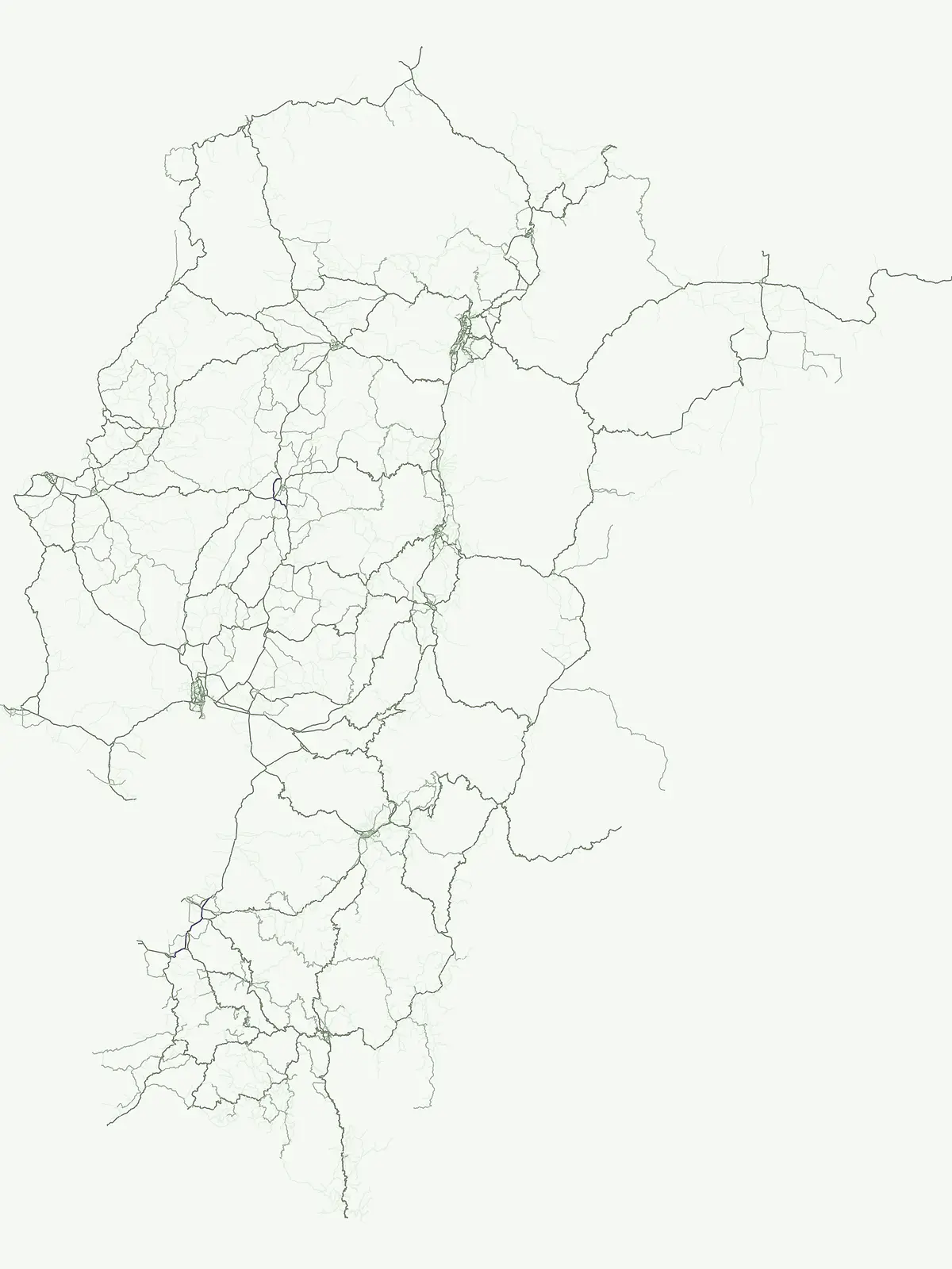
Park map

Visualize the geographic spread of Ecuador's protected areas, encompassing Andean ecosystems and the Galápagos Islands.

Explore Ecuador National Parks Map: Trace Protected Areas Across Andean Peaks and Galápagos Islands

Explore the national parks map of Ecuador to locate its diverse protected areas, tracing key conservation landscapes across the Andean region, Amazon basin, and the Galápagos Islands. A dedicated country map provides a clear geographic overview, allowing users to compare park distribution and understand the spatial context of Ecuador's vital natural heritage.
Natural feature types

Discover the Full Range of Ecuador Natural Features and Protected Landmarks

Begin exploring the geographic diversity found within the park network of Ecuador through MoriAtlas. This index allows for the systematic review of natural landmarks and terrain types identified across the country to support your regional geography research.

Explore Ecuador's unique park geography, tracing the distribution of protected areas from Andean peaks to the Galápagos Islands.

Understanding Ecuador's National Parks and Protected Areas: Common Questions on Geography

Browse comprehensive answers to frequently asked questions about national parks and protected areas across Ecuador's diverse geography. Understand the country's unique conservation landscapes, including the Andean mountains, Amazon basin, and the biologically rich Galápagos Islands, for enhanced geographic discovery.
Other countries

Compare national park geography across South American countries, tracing varied protected landscapes beyond Ecuador.

Discover National Parks in Countries Near Ecuador: Explore South American Protected Areas

After reviewing Ecuador's national parks, explore other South American countries to discover their distinct protected areas, Andean mountain ranges, and diverse coastal conservation landscapes. Continue your geographic atlas exploration to compare regional park systems, trace the spread of conservation, and plan broader protected area discovery throughout the continent.

Venezuela National Parks and Protected Areas: A Geographic Overview

Explore Venezuela through its network of national parks and protected areas. This section provides a structured view of the country's conserved natural landscapes, highlighting their geographic distribution and mapped boundaries. Understand how these protected areas contribute to the regional geography and offer diverse terrain for atlas-based discovery.

69 parks

Colombia National Parks and Protected Areas: Mapped Landscape Explorer

Navigate the diverse protected areas and national parks within Colombia using a structured geographic atlas. This resource highlights the mapped distribution of conservation lands, offering insights into the natural terrain and regional landscape context across the country. Understand where Colombia's key protected areas are located and their significance within the broader South American geography.

37 parks

Peru National Parks and Protected Areas: Browse the Geographic Atlas and Mapped Landscapes

Access a structured overview of Peru's national parks and protected areas, designed for geographic exploration and atlas-style discovery. Understand the distribution of conservation landscapes from the coast to the Amazon, examining their mapped boundaries and regional significance. This resource facilitates a deeper appreciation of Peru's natural terrain and its role in preserving biodiversity across diverse ecosystems.

34 parks

Costa Rica National Parks and Protected Areas: A Geographic Atlas

Access a structured atlas for exploring Costa Rica's national parks and protected natural areas. This platform offers detailed insights into the geographic scope of conservation efforts, highlighting park boundaries, regional terrain, and the distribution of diverse natural landscapes across the country. It serves as a vital tool for understanding the mapped protected geography of Central America.

30 parks

Panama National Parks and Protected Areas: Geographic Atlas and Map Explorer

Uncover the geographic richness of Panama through its national parks and protected areas. This atlas provides a structured way to view mapped protected landscapes, understand their regional context, and explore the natural terrain. Focus on the distribution and boundaries of conservation areas across the country, from watershed protection zones to tropical rainforests.

16 parks

Nicaragua National Parks and Protected Areas Atlas for Geographic Discovery

Navigate Nicaragua's protected natural areas with this geography-focused atlas. Users can explore the mapped boundaries of national parks and other conservation lands, gaining insight into their distribution across the country's diverse terrain. This resource facilitates a deeper understanding of Nicaragua's protected landscapes and their regional significance, serving as a structured point of entry for geographic research.

10 parks

Armenia National Parks and Protected Areas: Geographic Browse

Delve into Armenia's protected natural areas with a focus on geographic structure and mapped park boundaries. MoriAtlas offers a comprehensive view of the nation's protected lands, highlighting their regional context within the Armenian Highlands and South Caucasus geography. Understand the distribution of these vital conservation zones.

8 parks

Aruba National Parks and Protected Areas: A Comprehensive Geographic Atlas Entry

Access a structured inventory of protected lands across Aruba, including national parks and marine reserves. This resource highlights the geographic distribution, natural terrain characteristics, and park boundaries that define the island's conservation landscape, providing a clear reference for researchers and geographic enthusiasts alike.

2 parks

Protected area types

Continue Exploring Ecuador's Park Designations and Geographic Context

Deepen your understanding of Ecuador's conservation map by continuing to browse its represented park designation groups. Each classification offers a unique lens through which to explore the nation's geography, from Andean mountains to Amazonian rainforests and the Galápagos Islands. Utilize this pathway to access detailed atlas information and context for Ecuador's vital protected landscapes.

Ecuador Protected Area Designations
MoriAtlas Explorer

Continue Your Global Geographic Exploration with MoriAtlas Park Discovery

Dive deeper into the world's protected landscapes and national parks through MoriAtlas's structured atlas interface. Discover how continents and countries are organized, and how individual park geography fits into the broader map. Our platform is built for understanding the distribution and context of protected areas worldwide, facilitating your journey through global natural geography.

Global natural geography