Mori Atlas logo
Protected landscapeBalta Mică a Brăilei Natural Park

Explore the mapped boundaries and wetland ecosystem of this vital protected landscape in Brăila County.

Balta Mică a Brăilei Natural Park: Protected Landscape Atlas and Geographic Discovery

(Parcul Natural Balta Mică a Brăilei)

Balta Mică a Brăilei Natural Park stands as a crucial protected landscape within Brăila County, Romania, representing an internationally significant wetland ecosystem in the Lower Danube region. This natural park offers a unique window into the complex interplay of riverine and steppe environments, providing critical habitats for migratory waterfowl along the Black Sea-Mediterranean flyway. As a designated Category V protected landscape and a key Natura 2000 site, Balta Mică a Brăilei showcases the mapped geography and ecological richness of southeastern Europe's vital floodplains, making it a cornerstone for structured atlas exploration.

wetland reservenature parkprotected landscapewaterfowl habitatdelta wetlandDanube floodplain
Stylized illustration of a winding river through a mountainous valley with forests and cliffs

Balta Mică a Brăilei Natural Park

Protected landscape

Park overview

Structured park overview, official facts, and landscape profile for Balta Mică a Brăilei Natural Park

Balta Mică a Brăilei Natural Park park facts, protected area profile, and essential visitor context
Review the core facts for Balta Mică a Brăilei Natural Park, including designation, size, terrain, visitor scale, habitats, and operating context in one park-focused overview.

About Balta Mică a Brăilei Natural Park

Balta Mică a Brăilei Natural Park protects a complex mosaic of aquatic and terrestrial habitats within the Danube's lower floodplain. The protected area encompasses rivers, lakes, marshes, peat bogs, natural meadows, steppe grasslands, and riparian forests that collectively support remarkable biodiversity. The park's location on the Small Brăila Island places it at the heart of the Danube's deltaic system in Romania, where the river's ancient course has created a labyrinth of channels, oxbow lakes, and seasonal flooded areas.

The ecological character of the park is defined by the dynamic interaction between the Danube's hydrological regime and the continental climate of the Bărăgan region. Seasonal flooding replenishes wetlands and creates ideal conditions for fish spawning and waterbird foraging. The surrounding agricultural landscape of the Brăila Plain has increasingly influenced the park's hydrology, making its role as a natural water retention area even more valuable. Management of the protected area balances conservation objectives with sustainable use of natural resources by local communities who have traditionally exploited fisheries and pastures within the floodplain.

The park's significance extends beyond national boundaries as part of a network of protected wetlands that support migratory species across international frontiers. Collaboration with neighboring Romania and the broader Danube Delta biosphere reserve system ensures coordinated conservation of shared species populations. Visitor facilities remain limited, reflecting the park's primary conservation focus, though boat access across Danube branches allows for controlled nature observation activities.

Quick facts and research context for Balta Mică a Brăilei Natural Park

Balta Mică a Brăilei Natural Park spans approximately 17,500 to 20,600 hectares of Danube floodplain wetland in Brăila County, Romania. The protected area encompasses the Small Brăila Island and surrounding aquatic habitats, positioned between the Brăila Plain and Great Brăila Island in the southeastern part of the country. The park was established by Law Number 5 of March 2000 and holds IUCN Category V status as a protected landscape. It operates as a Ramsar site and Natura 2000 special area of conservation and special protection area for birds. The nearest major city is Brăila, situated to the north of the protected area.

Park context

Deeper park guide and search-rich context for Balta Mică a Brăilei Natural Park

Balta Mică a Brăilei Natural Park history, landscape, wildlife, and travel context
Explore Balta Mică a Brăilei Natural Park through its history, landscape character, ecosystems, wildlife, conservation priorities, cultural context, and seasonal travel timing in a structured park guide built for atlas discovery and search intent.

Why Balta Mică a Brăilei Natural Park stands out

The park is particularly renowned for its exceptional waterfowl populations and serves as one of the most important nesting and migratory bird habitats in the Lower Danube region. The Dalmatian pelican, red-breasted goose, pygmy cormorant, and black stork represent flagship species that draw attention from conservationists and ornithologists. The wetland complex supports globally significant populations of colonial waterbirds and serves as a critical staging area during spring and autumn migrations. The presence of the critically endangered red-breasted goose during winter months makes this area especially notable on the European conservation map.

Landscape view of a river with dense green trees in the foreground, a body of water in the midground, and distant mountains under a clear blue sky
Danube River view with Măcin Mountains in the background

Balta Mică a Brăilei Natural Park history and protected-area timeline

The formal protection of Balta Mică a Brăilei evolved through several phases reflecting Romania's changing approach to nature conservation. Initial designation in 1978 marked the first recognition of the area's ecological importance, though implementation remained limited during the communist period. The comprehensive legal framework established by Law Number 5 of March 6, 2000 provided the modern foundation for park management, published in the Romanian Official Paper and providing clear legal status for the protected area.

Romania's subsequent integration into the European Union in 2007 brought additional protection mechanisms through the Natura 2000 network. The designation as both a Site of Community Importance and a Special Protection Area for birds formalized the park's role in European-level conservation. The Ramsar Convention designation in June 2001 confirmed the wetland's international importance under the global treaty for wetland conservation. These overlapping protection frameworks have strengthened management capacity and aligned conservation practices with European standards.

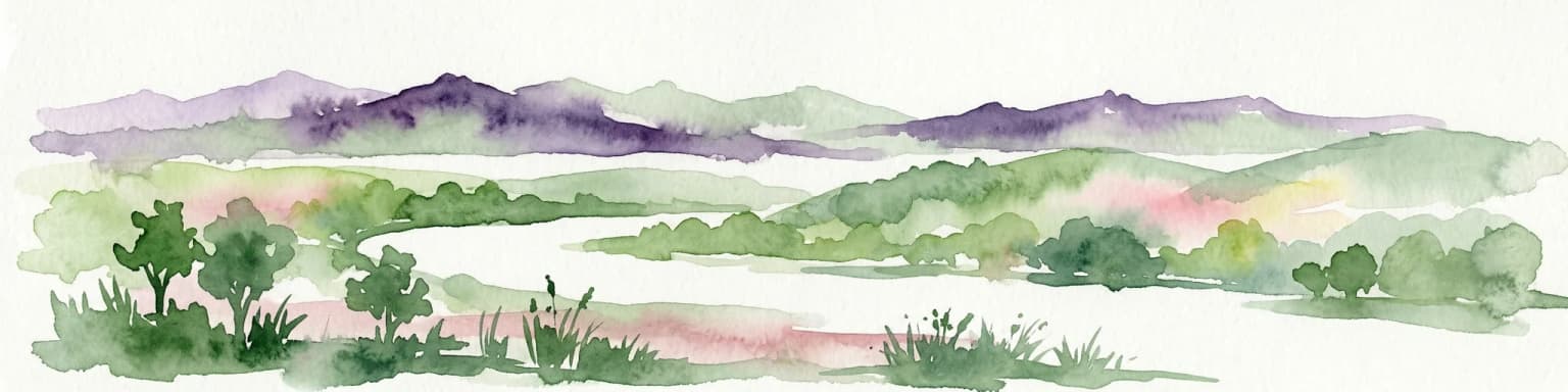
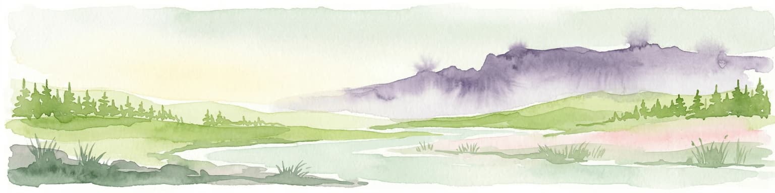
Balta Mică a Brăilei Natural Park landscape and geographic character

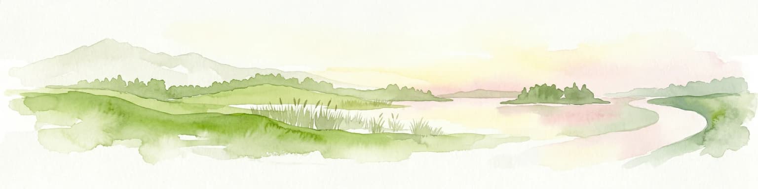
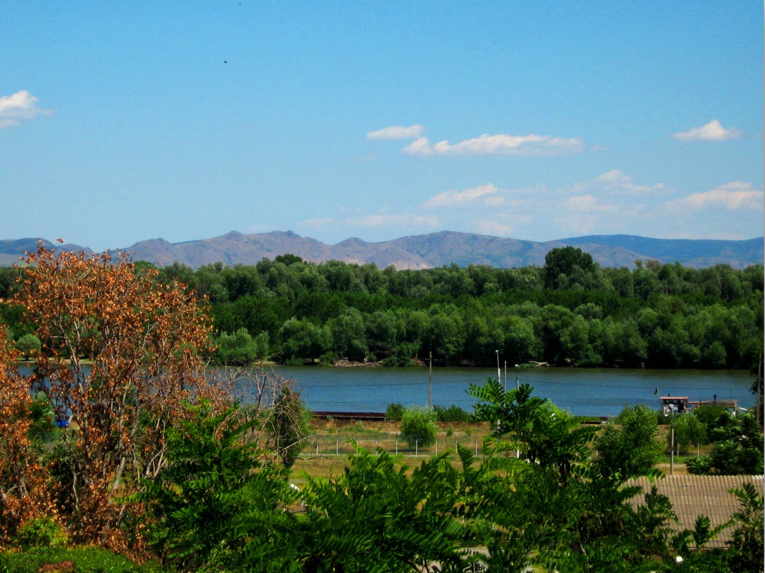
The physical landscape of Balta Mică a Brăilei is characterized by the flat, low-lying terrain typical of major river floodplains in southeastern Romania. The terrain consists almost entirely of alluvial deposits deposited by the Danube over millennia, creating a landscape with minimal topographic variation. The Small Brăila Island rises only slightly above the surrounding floodplain, with elevation changes rarely exceeding a few meters.

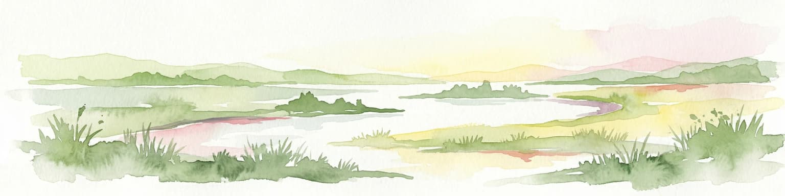
The park's hydrological network includes the main Danube channel, secondary distributary channels, oxbow lakes, permanent marshes, and seasonally flooded depressions. These water bodies range from open lake surfaces with extensive emergent vegetation to narrow, tree-lined channels winding through riparian forests. The vegetation pattern reflects the complex hydrology, with hydrophilic plant communities dominating areas with permanent water saturation while drought-tolerant species occupy higher ground that floods only during exceptional events.

The surrounding landscape beyond the park boundaries consists primarily of agricultural land cultivated for cereals and other crops, representing the transformed Bărăgan Plain. The Macin Mountains appear as a low, rocky backdrop visible from higher points within the park on clear days, adding visual context to the otherwise horizontal landscape.

Balta Mică a Brăilei Natural Park ecosystems, habitats, and plant life

The ecological diversity of Balta Mică a Brăilei reflects the combination of aquatic, wetland, and steppe habitats within a relatively compact area. The park contains over a dozen distinct habitat types recognized under European conservation legislation, ranging from oligotrophic to mesotrophic standing water communities to riparian forests and steppe grasslands. These habitats support approximately 25,000 hectares of interconnected wetland environments within the broader floodplain complex.

The aquatic habitat component includes rivers with muddy banks supporting specialized vegetation communities, oxbow lakes and ponds with floating and emergent plant assemblages, and extensive reed beds that provide critical nesting habitat for colonial waterbirds. The terrestrial habitats encompass floodplain forests dominated by oak, elm, and ash species, willow and poplar galleries along water channels, and steppe grasslands that represent the western extension of the Bărăgan steppe bioregion. The mosaic of habitats creates ecological corridors that support species movement between different ecosystem types.

The biodiversity inventory documents numerous species protected under the EU Birds Directive and Habitats Directive, confirming the park's importance for European nature conservation. The presence of both aquatic and terrestrial species communities reflects the transitional character of the site between pure aquatic ecosystems and continental steppe environments.

Balta Mică a Brăilei Natural Park wildlife and species highlights

The avifauna of Balta Mică a Brăilei represents the park's most internationally significant wildlife asset, with over 150 bird species documented within the protected area. Waterfowl populations include numerous duck species such as northern pintail, wigeon, northern shoveler, mallard, gadwall, and teal, along with diving ducks including ferruginous duck. Geese are represented by the globally threatened red-breasted goose and the more common greater white-fronted goose and gray goose, with the latter two species forming large wintering flocks.

Colonial nesting species include great cormorant, purple heron, squacco heron, night heron, little egret, and the iconic Dalmatian pelican, which nests in the reed beds and adjacent islands. The park supports significant populations of the Dalmatian pelican, one of the rarest pelican species globally and a species for which the park holds international responsibility for conservation. Wading birds such as black stork, white stork, spoonbill, and various heron species forage in the shallow wetlands and adjacent meadows.

The fish community includes economically important species such as pike, zander, wels catfish, and common carp, along with migratory species including Danube shad, Pontic shad, and sturgeon species. Mammals include European otter, roe deer, red fox, and badger, while the European pond turtle represents the reptile community. The European hamster and undervine moth represent species of conservation concern associated with grassland and agricultural edge habitats.

Balta Mică a Brăilei Natural Park conservation status and protection priorities

Balta Mică a Brăilei holds exceptional conservation significance as one of the most important wetland complexes in southeastern Europe. The Ramsar designation confirms the site's international importance for waterbird conservation, while Natura 2000 status integrates it into the European Union's protected area network. The combination of Special Area of Conservation and Special Protection Area designations provides comprehensive coverage of both habitat and species conservation requirements.

The park contributes to conservation of species listed in the EU Birds Directive Annex I, including the red-breasted goose, Dalmatian pelican, pygmy cormorant, and black stork. The wetland habitats support populations of species listed in the EU Habitats Directive, including various fish species and the European pond turtle. Management measures focus on maintaining natural hydrological processes, controlling invasive species, and reducing disturbance to nesting waterbirds.

Challenges facing the park include hydrological modifications from upstream water management, agricultural runoff affecting water quality, and potential disturbance from increasing recreational use. Climate change poses additional threats through altered flooding patterns and potential shifts in species distributions. Conservation efforts prioritize maintaining the ecological connectivity between the park and the broader Danube floodplain system to ensure long-term viability of migratory species populations.

Balta Mică a Brăilei Natural Park cultural meaning and human context

The landscape of Balta Mică a Brăilei reflects centuries of human interaction with the Danube floodplain, though the park itself remains relatively free of extensive permanent settlement. The surrounding Brăila Plain has been intensively cultivated since medieval times, transforming the steppe grassland into agricultural land. The floodplain itself has historically supported fishing communities who utilized the rich fish stocks and seasonal floodplain pastures.

Traditional land use within the park area has included seasonal grazing of livestock, fishing, and limited agriculture on higher ground. These activities created the cultural landscape that characterizes the region today, with the park preserving elements of traditional floodplain use within a modern conservation framework. The name "Balta Mică" (Small Swamp) reflects historical understanding of the wetland's character and seasonal dynamics.

The administrative communes surrounding the park include Berteștii de Jos, Chiscani, Gropeni, Mărașu, Stăncuța, and Tichilești, all within Brăila County. These communities maintain connections to the floodplain through fishing, agriculture, and increasingly through tourism and nature-based activities associated with the protected area.

Top sights and standout views in Balta Mică a Brăilei Natural Park

The park's defining characteristic is its role as a major European waterbird habitat, supporting globally significant populations of Dalmatian pelican and red-breasted goose. The wetland complex provides critical staging and wintering grounds for migratory waterfowl moving between northern breeding areas and southern wintering grounds. The diversity of habitat types within a relatively compact area creates exceptional opportunities for wildlife observation, particularly for colonial nesting birds and wintering waterfowl concentrations. The park's location within the Lower Danube region positions it as part of a larger conservation landscape connecting with the Danube Delta Biosphere Reserve.

Best time to visit Balta Mică a Brăilei Natural Park

The optimal time to visit Balta Mică a Brăilei depends on the wildlife viewing objectives, with each season offering distinct experiences. Spring migration (March through May) brings large numbers of waterfowl moving northward, with species diversity at its peak and active breeding behavior providing excellent observation opportunities. The breeding season from May through July features colonial nesting activity by herons, cormorants, and pelicans, with chicks visible in nests and adults engaged in feeding behavior.

Autumn migration (September through November) again brings substantial bird numbers as species move southward, with particularly impressive gatherings of geese and swans during October and November. Winter months (December through February) feature the red-breasted goose, which winters in the area alongside large flocks of greater white-fronted geese and whooper swans. Summer months offer opportunity to observe the full complement of breeding species but also coincide with higher temperatures and increased insect activity. The park's wetland character means that access by boat provides the best wildlife viewing opportunities regardless of season.

Park location guide

Geography guide, regional context, and park location map for Balta Mică a Brăilei Natural Park

Balta Mică a Brăilei Natural Park park geography, regions, and map view in Romania
Understand where Balta Mică a Brăilei Natural Park sits in Romania through a broader geographic reading of the surrounding landscape, nearby location context, and its mapped position within the national park landscape.

How Balta Mică a Brăilei Natural Park fits into Romania

Romania is a unitary semi-presidential republic located in Southeast and Central Europe. It borders Ukraine, Hungary, Serbia, Bulgaria, Moldova, and the Black Sea. The country has a population of approximately 19 million and covers an area of 238,397 km². Bucharest is the capital and largest city. Romania joined the European Union in 2007.

Wider geography shaping Balta Mică a Brăilei Natural Park in Romania

Romania lies on the lower course of the Danube River, north of the Balkan Peninsula, and on the northwestern shore of the Black Sea. The terrain is varied, featuring the Carpathian Mountains in the center, the Transylvanian Plateau, the Moldavian Plateau, and plains along the Danube and in the south. The country has a diverse landscape that includes forests, meadows, and wetland areas.

Map view of Balta Mică a Brăilei Natural Park

Use this park location map to pinpoint Balta Mică a Brăilei Natural Park in Romania, understand its exact geographic position, and read its mapped placement within the surrounding landscape more clearly.

Pigeon | © OpenStreetMap contributors

Location context for Balta Mică a Brăilei Natural Park

Brăila County

A visual atlas of Romania's crucial Danube wetland habitats, showcasing its unique riverine ecosystem and protected landscapes.

Balta Mică a Brăilei Natural Park Photos: Explore Wetland Landscapes and Protected Area Scenery
Explore extensive imagery of Balta Mică a Brăilei Natural Park, visually navigating its characteristic Danube floodplain terrain, intricate hydrological network, and vital wetland habitats. These park photos provide critical understanding of the protected landscape's unique riverine environment, showcasing its significance for waterfowl and regional biodiversity.

Landscape view of a river with dense green trees in the foreground, a body of water in the midground, and distant mountains under a clear blue sky

Black-crowned night heron standing on a branch in a wetland with aquatic plants and reeds

Park atlas

Map surrounding Danube River floodplain ecosystems and compare wetland conservation landscapes across Brăila County and southeastern Romania.

Explore Related Parks and Protected Areas Near Balta Mică a Brăilei Natural Park
Explore other protected areas and natural parks near Balta Mică a Brăilei Natural Park, tracing their mapped geography across Brăila County and the Lower Danube region of Romania. Compare diverse wetland habitats and riparian ecosystems, gaining regional context on conservation landscapes beyond this internationally significant Danube floodplain.
Watercolor painting of a river flowing through a wetland with green hills and distant mountains
Protected landscapeGalați County

Lunca Joasă a Prutului Inferior Natural Park: Protected Landscape Atlas and Geographic Context

Explore its wetland terrain and mapped protected area boundaries.

Lunca Joasă a Prutului Inferior Natural Park is a crucial protected landscape within Galați County, Romania, recognized for its extensive wetland ecosystems and role as a vital bird migration hub. This atlas-focused entry details the park's mapped geography, showcasing its complex network of lakes, canals, and floodplains, and its significant habitats that support exceptional biodiversity along major European flyways.

Area
82.47 km²
Established
2005
IUCN
V
Relief
Lowland
Protected area

Danube Delta Protected Area: Mapping Europe's Largest River Delta Geography and Wetland Landscape

Explore the mapped protected area, its unique terrain, and regional landscape context.

The Danube Delta, a protected area in Romania, presents a remarkable geography defined by its extensive wetland terrain, intricate waterways, and significant biodiversity. As Europe's largest and best-preserved river delta, it offers a unique landscape for atlas-based exploration, focusing on its mapped boundaries, regional geographic context, and its role as a critical ecological zone where the Danube River merges with the Black Sea. Understand the delta's horizontal expanse, its network of channels, and its evolving landforms within a protected landscape of global importance.

Area
4,152 km²
Established
1998
Relief
Lowland
Climate
Temperate
Protected landscapeVrancea County

Putna-Vrancea Natural Park: A Protected Landscape in Vrancea County's Carpathian Mountains

Explore mapped terrain, natural park boundaries, and regional geography.

Putna-Vrancea Natural Park, designated as a protected landscape, offers detailed geographic insights into the Vrancea Mountains in Romania. Users can explore the park's mapped terrain, understand its protected boundaries, and contextualize its natural park status within Vrancea County and the broader Eastern Carpathians region. This atlas-focused view highlights the unique landscape features and regional geographic significance of this Romanian protected area.

Area
302.04 km²
Established
2005
IUCN
V
Relief
Mountain
Protected landscapeGiurgiu County

Comana Natural Park: Protected Landscape Atlas and Regional Geography

Giurgiu County, Romania: Mapped protected area context.

Navigate the geographic features and protected landscape boundaries of Comana Natural Park, situated within Giurgiu County. This dedicated atlas entry provides a clear view of the park's mapped territory and its significance as a protected area, offering essential context for understanding its regional setting and natural terrain within Romania.

Area
249.63 km²
Established
2005
IUCN
V
Relief
Lowland
National parkBilhorod-Dnistrovskyi Raion

Tuzly Lagoons National Nature Park: National Park Atlas and Geographic Context

Mapped protected landscape within Bilhorod-Dnistrovskyi Raion, Ukraine.

Navigate the protected landscape of Tuzly Lagoons National Nature Park through a detailed geographic lens. This national park entry within MoriAtlas provides structured information on its mapped boundaries and regional context within Bilhorod-Dnistrovskyi Raion, part of Ukraine's Bessarabia region. Understand its position and significance as a protected natural area, facilitating a deeper exploration of its geographical attributes and its place in the broader atlas of Ukrainian protected lands.

Area
278.65 km²
Established
2010
IUCN
II
Relief
Lowland
Protected landscape

Bucegi Natural Park: Protected Landscape Mapping and Regional Geographic Overview

Explore its mapped boundaries and natural terrain.

As a protected landscape in Romania, Bucegi Natural Park offers a distinct focus for geographic study and atlas exploration. This detail page provides access to its mapped protected boundaries, helping users understand its specific location and regional context. Discover how this natural area contributes to the broader understanding of protected lands within the national geography. MoriAtlas enables a clear view of Bucegi Natural Park's landscape characteristics and its place within a mapped system of natural reserves.

Area
0.327 km²
Established
2000
IUCN
V
Relief
Mountain
National park

Piatra Craiului National Park: Protected Landscape Atlas and Geographic Context

Explore Romania's unique national park and its mapped terrain.

Navigate the protected geography of Piatra Craiului National Park, a key national park entity. This page details its mapped boundaries and situates its natural landscape within Romania's regional geography, offering a structured point of discovery for geographic atlas enthusiasts. Understand the park's identity as a protected natural area and its contribution to the mapped terrain of the region.

Area
147.66 km²
Established
2000
IUCN
II
Relief
Mountain
Watercolor illustration of a landscape with hills, a river, and green vegetation
National parkOdesa Oblast

Lower Dniester National Nature Park: National Park Map and Protected Landscape Atlas

Explore Odesa Oblast's protected natural geography and park boundaries.

The Lower Dniester National Nature Park is a vital component of Ukraine's protected lands, situated within the expansive Odesa Oblast. This page offers detailed geographic context, focusing on the park's mapped boundaries and its contribution to the regional landscape. Dive into an atlas-style exploration that highlights the park's protected terrain and its significance within the natural geography of southwestern Ukraine, offering structured discovery beyond basic park facts.

Area
213 km²
Established
2008
IUCN
II
Relief
Lowland

Common questions about visiting, size, designation, and location context for Balta Mică a Brăilei Natural Park

Balta Mică a Brăilei Natural Park FAQs for park facts, access, geography, and protected area context
Find quick answers about Balta Mică a Brăilei Natural Park, including protected-area facts, park geography, trail and visitor context, and how the park fits into its surrounding country and regional landscape.
MoriAtlas Explorer

Continue Your Protected Areas Search Across the Global Atlas

Deepen your exploration by continuing the structured search for national parks and protected areas worldwide. Utilize the comprehensive filtering capabilities to compare different conservation landscapes and refine your understanding of global park geography. Discover more about the distribution and characteristics of protected natural areas.

Global natural geography