
Viewpoints
Park geography
Analyzing the regional landscape, riverine environments, and spatial dimensions
Blackwood River National Park: A Comprehensive Geographic Profile and Mapped Boundaries
Examine the physical geography of Blackwood River National Park in Western Australia. This profile details the 204.75 square kilometer protected area, highlighting the characteristic riverine terrain, plateau landscapes, and Mediterranean climate zones that define this significant regional territory.
Related tags
National ParkWestern AustraliaRiver EcosystemOld-Growth ForestJarrah Forest
Protecting the largest river system of South West Australia
Blackwood River National Park
Blackwood River National Park is a protected area in the South West region of Western Australia, established in 2004 to preserve the middle reaches of the Blackwood River, which is the largest river system in South West Australia. The park encompasses approximately 205 square kilometers of diverse landscape along the river's course, where it flows westward through the park before turning south to empty into the Southern Ocean. The protected area sits within the shires of Augusta-Margaret River and Nannup, surrounded by extensive state forest lands including Blackwood State Forest, South Blackwood State Forest, and Milyeannup State Forest. The park straddles two significant bioregions, the Jarrah Forest bioregion in the north and the Warren bioregion to the south, creating a mosaic of woodland and forest habitats that support considerable biodiversity. This designation represents a key conservation outcome from the Regional Forest Agreement for the South-West Forest Region, aimed at better protecting old-growth forest ecosystems in Western Australia.
- Location
- Australia
- Park type
- National park
- Established
- 2004
- Area
- 204.8 km²
Location overview
Regional and national administrative placement in Western Australia
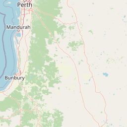
Geographic Location of Blackwood River National Park in Australia
Blackwood River National Park is situated in Western Australia, Australia. Factual mapping of regional and national borders establishes key location placement for the protected area.
- Countries
- Australia
- Regions
- Western Australia
- Primary location
- Western Australia
Boundary and coordinates
Explore the spatial extent and estimated 204.75 square kilometer area
Geographic Boundary and Spatial Map of Blackwood River National Park
Mapped boundary outlines provide key spatial orientation and geographic context for Blackwood River National Park. Regional spatial facts detail the estimated area, coordinate spans, and calculated center coordinates.
- Boundary area
- 204.8 km²
- Boundary perimeter
- 265.6 km
- Northernmost point
- 33.9733° S
- Southernmost point
- 34.1608° S
- Easternmost point
- 115.6794° E
- Westernmost point
- 115.1866° E
- Geographic centre
- 34.0887° S, 115.4205° E
- North–south span
- 20.8 km
- East–west span
- 45.5 km
Terrain and natural features
Upland terrain classifications and recorded natural features
Blackwood River National Park Terrain and Natural Features
Upland terrain classifications define the regional protected landscape within Blackwood River National Park. Linked feature cards supply names, types, measurements, and spatial relationships for recorded features.
Selected named natural features
Rivers
Blackwood River
Environmental setting
Temperate forest, Mediterranean climate, and upland riverine habitats
Blackwood River National Park Environmental and Landscape Classifications
Recorded landscape features and habitat classifications outline the dominant forest, plateau, and riverine settings across the terrain. Each structured category connects directly to broader environmental records within the park atlas.
- Relief
- Upland
- Climate
- Mediterranean
- Water
- Major water bodies
- Forest cover
- Dense forest cover
Landscape features
Forest · Rivers · Plateau
Habitat types
Temperate broadleaf forest · Shrubland · Riverine habitat
Park atlas
Discover Connected Protected Landscapes and Diverse Forest Bioregions Across Western Australia's South West.
Explore Other National Parks and Protected Areas Near Blackwood River National Park in Western Australia
After exploring Blackwood River National Park, continue your geographic discovery by browsing other national parks and protected areas across Western Australia's South West region. Compare diverse protected landscapes, river ecosystems, and old-growth forest habitats to understand broader conservation patterns and regional park geography.
National parkAustralia
Park boundaries overlap#1 closest
Northeast

Wiltshire-Butler National Park: Mapped Jarrah Forest Landscape in Western Australia
Explore protected boundaries and regional geographic context
Wiltshire-Butler National Park stands as a protected natural area celebrated for its representation of Western Australia's iconic jarrah forest ecosystems. This National Park, created in 2004, offers rich opportunities for atlas-based discovery, focusing on its distinct landscape character, mapped park boundaries, and its geographical placement within the broader South West region. Understanding its terrain and conservation significance provides valuable insight into the protected lands of the Jarrah Forest bioregion.
- Area
- 116.45 km²
- Established
- 2004
- IUCN
- II
- Relief
- Highland
National parkAustralia
1.2 km away#2 closest
Southeast
Milyeannup National Park: Explore its Protected Landscape and Geographic Atlas Context
Discover the mapped terrain and boundaries of this Australian national park.
Milyeannup National Park offers a unique focus for atlas-based geographic exploration. This entry details the park's identity as a protected area, highlighting its landscape context and mapped geographic features within Australia. Use this resource to understand its role in the national park system and its specific place within the broader landscape.
- Area
- 186.92 km²
- Established
- 2004
- Scope
- Terrestrial
- Forest
- Mostly forested
National parkAustralia
3 km away#3 closest
West
Forest Grove National Park: Mapped Boundaries of a Jarrah Forest Protected Landscape
Western Australia's National Park in the Margaret River Region.
Forest Grove National Park represents a vital protected area within Western Australia's Jarrah Forest bioregion, offering a clear look at the characteristic tall open forest and woodland ecosystems of the region. While nearby areas are known for their dramatic coastlines, this national park highlights the inland natural terrain and its unique ecological importance. Its mapped boundaries are integral to understanding the contiguous forest corridors developed to preserve these valuable Southwest Australian habitats.
- Area
- 13.79 km²
- Established
- 2004
- Relief
- Lowland
- Climate
- Temperate
National parkWestern Australia
7.8 km away#4 closest
Southwest
Leeuwin-Naturaliste National Park: Western Australia's Protected Landscape and Geographic Context
Explore mapped natural terrain and protected boundaries.
Leeuwin-Naturaliste National Park provides a distinct focus for understanding protected lands within Western Australia. This national park offers rich opportunities to examine its mapped boundaries and unique landscape characteristics, contributing valuable context to the regional geography of the state. Discover the natural terrain and protected area status that define this significant location for atlas-based discovery and geographic comprehension.
- Area
- 190.92 km²
- Established
- 1957
- IUCN
- II
- Visitors
- 2.3M annual
National parkAustralia
8.7 km away#5 closest
Southeast
Hilliger National Park: Western Australian Protected Jarrah Forest and Memorial Landscape
Mapped boundaries of a vital national park in the South West region.
Hilliger National Park stands as a testament to forest conservation in Western Australia's South West. This 16,962-hectare national park, established in 2004, protects representative old-growth jarrah forest ecosystems and honors a significant firefighting legacy. Explore its terrain and its geographic placement within a broader network of protected lands, offering a concrete example of conservation strategy in the region. The park's mapped area contributes valuable data to the understanding of regional natural landscapes.
- Area
- 169.62 km²
- Established
- 2004
- Climate
- Temperate
- Scope
- Terrestrial
National parkWestern Australia
9 km away#6 closest
Southwest
Scott National Park National Park: Mapped Protected Landscape in Western Australia
Geographic Context and Natural Terrain Discovery
Scott National Park serves as a significant protected area within the diverse geography of Western Australia. This national park provides a focal point for understanding regional landscape patterns and mapped natural features. Explore its role as a protected land, offering insight into the state's broad natural heritage and supporting detailed geographic discovery for atlas enthusiasts.
- Area
- 32.73 km²
- Established
- 1959
- IUCN
- II
- Relief
- Lowland
National parkWestern Australia
11 km away#7 closest
Northwest
Wooditjup National Park: Protected Forest Landscape and Regional Geographic Context
Explore mapped boundaries of this Western Australia national park.
Wooditjup National Park stands as a testament to Western Australia's unique forest ecosystems, specifically within the Jarrah Forest bioregion. This protected area offers a distinct natural landscape contrasting with the nearby coastal attractions of Margaret River. Delve into the park's mapped geography, understand its role as a national park, and appreciate its position within the broader South West Australian landscape and its traditional Wardandi Country heritage.
- Area
- 38.92 km²
- Established
- 2004
- IUCN
- II
- Relief
- Lowland
National parkWestern Australia
14 km away#8 closest
Southeast
Easter National Park: Protected Jarrah Forest Landscape Atlas
Explore its mapped terrain and regional geography.
Easter National Park serves as a protected national park in Western Australia, preserving crucial jarrah forest ecosystems within the Warren bioregion. As part of the Southwest Australia biodiversity hotspot, it contributes to a contiguous block of protected land safeguarding the region's distinctive woodland and forest communities. Users can explore its mapped boundaries and understand its role within the broader South West Australian geography, offering a detailed look at a representative forest reserve.
- Area
- 29.85 km²
- Established
- 2004
- IUCN
- II
- Relief
- Lowland
MoriAtlas Explorer
Continue Exploring Blackwood River National Park's Geographic Identity and Mapped Boundaries
Deepen your understanding of Blackwood River National Park by exploring its detailed geographic setting and protected landscape characteristics. This entry provides critical context for appreciating its mapped boundaries and its place within Western Australia's wider natural geography. Continue your atlas discovery journey to uncover the structured details of this significant national park.
Browse next
Global natural geography
Explore related park routes
Explore MoriAtlas Global ParksBrowse All MoriAtlas ParksGlobal Park Map DiscoveryMoriAtlas: Browse All CountriesBrowse All MoriAtlas ContinentsNational Park Environment AtlasGrand Canyon National Park AtlasYellowstone National Park AtlasYosemite National Park Atlas and GeographySerengeti National Park AtlasGalápagos National Park Protected LandscapeBanff National Park Geography and AtlasKruger National Park Atlas EntryUluṟu-Kata Tjuṯa National Park AtlasExplore Uluru-Kata Tjuta National Park GeographyPlitvice Lakes National Park AtlasFiordland National Park Protected LandscapeGreat Smoky Mountains National Park AtlasAfghanistan National Parks and Protected AreasAlbania National Parks and Protected AreasAlgeria National Parks and Protected AreasAmerican Samoa National Parks and Protected AreasAndorra National Parks and Protected AreasAngola National Parks and Protected AreasAntarctica National Parks and Protected AreasAntigua and Barbuda Park List