
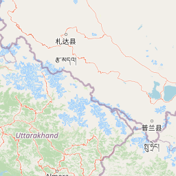
Streams
Park geography
Examining mapped boundaries, terrain elevation, and regional physical characteristics.
Jim Corbett National Park in Uttarakhand: A Detailed Geographic and Topographic Profile
This geographic profile details the physical scope of Jim Corbett National Park situated within the Nainital district of Uttarakhand. The record covers the 1288.31 square kilometer protected area, highlighting the recorded elevation range from 360 to 1040 meters and identifying its integrated riverine systems, varied forest cover, and complex terrain features.
Related tags
National ParkTiger ReserveWildlife ConservationProject TigerDeciduous Forest
India's pioneering national park and flagship tiger reserve in the Himalayan foothills
Jim Corbett National Park
Jim Corbett National Park is India's first and most renowned national park, established in 1936 in the sub-Himalayan belt of Uttarakhand state. The park occupies a strategic position in the Doon Valley between the Lesser Himalaya and the Siwalik Hills, encompassing diverse terrain that includes dense moist deciduous forests, riverine belts, marshy depressions, grasslands, and a large lake ecosystem. Spanning approximately 520.8 square kilometres of core protected area, the park serves as the flagship tiger reserve under India's Project Tiger initiative, launched here in 1974. The park's elevation ranges from 400 to 1,220 metres, creating a temperate microclimate that supports remarkable biodiversity. Nearly 73 percent of the park is covered by sal-dominated forest, with over 110 tree species and 617 plant species documented. The reserve is home to around 260 tigers and 1,100 elephants, alongside 50 mammal species, 580 bird species, and 25 reptile species, making it one of India's most ecologically significant protected areas.
- Location
- India
- Park type
- National park
- Established
- 1936
- Area
- 1,288.3 km²
- Highest point
- 1,040 m
Location overview
National and regional placement within Uttarakhand and Nainital district
Geographic Location and Regional Context of Jim Corbett National Park
Jim Corbett National Park is located within India and American Samoa, encompassing Uttarakhand and Nainital district. Official data confirms its geographic status as an inland, non-transboundary protected area.
- Countries
- India
- Regions
- Nainital district, Uttarakhand
- Primary location
- Uttarakhand
- Geographic setting
- Inland
Boundary and coordinates
Spatial limits and geographic coordinates across 1,288 square kilometers
Jim Corbett National Park Boundary Map and Spatial Dimensions
Interactive map outlines provide spatial context for understanding the physical shape of the conservation area. Calculated indicators detail key regional metrics including total area, coordinate limits, and central points.
- Boundary area
- 648 km²
- Boundary perimeter
- 116.8 km
- Northernmost point
- 29.6883° N
- Southernmost point
- 29.429° N
- Easternmost point
- 79.0879° E
- Westernmost point
- 78.6708° E
- Geographic centre
- 29.5498° N, 78.8783° E
- North–south span
- 28.7 km
- East–west span
- 40.4 km
Elevation and terrain
Mixed relief classification and recorded natural features across the terrain
Jim Corbett National Park Elevation Profile and Terrain Geography
Recorded elevation metrics span from 360 meters to a high point of 1040 meters across the terrain. Linked cards detail official water bodies and streams located within the protected area boundaries.
- Minimum elevation
- 360 m
- Maximum elevation
- 1,040 m
- Highest point
- 1,040 m
Selected named natural features
Streams
Kilani Sot
Streams
Dhela Nala
Streams
Patairpani Rao
Streams
Khakasgadi Sot
Rivers
Ramganga
Environmental setting
Interpreting stored landscape features, habitat types, and forest cover
Jim Corbett National Park Environmental Classifications and Physical Settings
Recorded classifications frame the physical setting through complementary categories covering relief, water presence, and climate zones. Selected classifications connect directly to broader protected area records across the regional atlas.
- Relief
- Mixed relief
- Climate
- Temperate
- Water
- Major water bodies
- Forest cover
- Mostly forested
- Seasonality
- Seasonal
Landscape features
Hills · Rivers · Wetland · Grassland · Lakes · Mountains · Valleys · Plateau · Forest · Waterfalls
Habitat types
Tropical forest · Riverine habitat · Wetland · Grassland · Lacustrine habitat
Park atlas
Compare diverse protected landscapes, mountain foothills, and riverine habitats across the surrounding Doon Valley region.
Explore National Parks and Protected Areas Near Jim Corbett National Park in India
Discover national parks and protected areas located geographically near Jim Corbett National Park, exploring interconnected conservation landscapes across India's sub-Himalayan belt. Compare diverse forest types, riverine ecosystems, and wildlife habitats within the Doon Valley and adjacent protected regions to understand broader ecological context and regional park distribution.
Wildlife reserveUttar Pradesh
60 km away#1 closest
West

Haiderpur Wetland Wildlife Reserve: Exploring the Ganges Floodplain and Migratory Flyways
A critical Ramsar-designated freshwater marshland within Uttar Pradesh
Spanning over 6,900 hectares, Haiderpur Wetland represents a significant protected area where open water and floodplain terrain create a haven for migratory birds along the Central Asian Flyway. The reserve, positioned within the broader Hastinapur Wildlife Sanctuary, offers a detailed look at how artificial water control impacts local riverine biodiversity and landscape development in North India.
- Area
- 69 km²
- Established
- 1984
- Water
- Water-dominated
National parkUttarakhand
About 70 km away#2 closest
Northwest
Rajaji National Park: Uttarakhand National Park and Tiger Reserve Landscape
Sivalik Hills geography and protected area context
Rajaji National Park is a vital protected landscape situated in the Uttarakhand region of India, recognized as both a national park and a tiger reserve. Its territory spans across the Sivalik Hills, offering a diverse terrain characterized by deciduous forests and riparian ecosystems. The park's location along the Ganga river significantly influences its ecology, providing a unique geographic context for its protected status and wildlife significance.
- Area
- 820.5 km²
- Established
- 1983
- IUCN
- II
- Relief
- Highland
National parkUttarakhand
107 km away#3 closest
Northeast
Nanda Devi National Park: High-Altitude Protected Landscape and Himalayan Geography
Explore mapped glacial basins and alpine terrain in Uttarakhand.
Nanda Devi National Park is a prime example of a high-altitude protected area, nestled in the Garhwal Himalayas of Uttarakhand, India. Established in 1982, this national park protects a vast glacial sanctuary, renowned for its dramatic peaks, including Nanda Devi, India's second-highest mountain. The park's landscape is defined by rugged terrain, extensive glaciers like the Uttari Rishi and Dakshini Rishi, and a striking ring of mountains over 6,000 meters, providing critical context for understanding protected land geography and Himalayan atlas exploration.
- Area
- 630.33 km²
- Established
- 1982
- IUCN
- II
- Relief
- Mountain
National parkSudurpashchim Province
About 129 km away#4 closest
Southeast

Shuklaphanta National Park: A National Park in Nepal's Sudurpashchim Province
Explore mapped protected areas and regional landscape context.
Shuklaphanta National Park is a key protected landscape within Sudurpashchim Province, Nepal. As a designated national park, its geographic identity is significant for understanding regional conservation and natural terrain. This entry focuses on its mapped boundaries and role as a protected area, providing foundational geographic context for atlas exploration and discovery of Nepal's natural landscapes.
- Area
- 305 km²
- Established
- 2017
- IUCN
- II
- Relief
- Lowland
Wildlife reserveUttarakhand
130 km away#5 closest
Northwest
Asan Conservation Reserve: Protected Wetland and Reservoir Geography in Uttarakhand
Mapping the landscape of North India's premier Ramsar site
Located in the Doon Valley of Uttarakhand, Asan Conservation Reserve creates a distinct natural refuge within a working hydrological system. This wildlife reserve features shallow reservoir basins and marshy shorelines, providing a key corridor for migratory bird species and serving as an anchor for regional conservation efforts.
- Area
- 4 km²
- Established
- 1967
- Water
- Water-dominated
- Season
- Year-round
National parkChamoli district
About 137 km away#6 closest
Northeast
Valley of Flowers National Park: National Park Protected Landscape and Geographic Context
Explore the mapped terrain and regional boundaries of this Himalayan national park.
Valley of Flowers National Park is a distinct protected area within India's Garhwal region, situated in the Chamoli district. This park detail page facilitates atlas-focused discovery, highlighting its mapped boundaries and geographic significance. Users can explore the protected landscape's role within its regional context, providing essential data for understanding its ecological and geographical importance for landscape exploration.
- Area
- 87.5 km²
- Established
- 1982
- Relief
- Mountain
- Climate
- Alpine
National parkHaryana
About 141 km away#7 closest
Northwest
Kalesar National Park: Exploring Haryana's Unique Sal Forest Protected Landscape
Discover mapped terrain and regional geography within the Shivalik foothills.
Kalesar National Park, located in the Shivalik foothills of Haryana, is a crucial protected area renowned for its natural sal forest, a rare ecological feature in the state. Spanning approximately 53 square kilometers, the park's diverse terrain offers insights into regional geography and conservation, serving as a vital habitat for leopards and a corridor for wild elephants. Its mapped boundaries encompass a unique landscape that contrasts sharply with surrounding agricultural lands, making it a significant point of study for protected-area enthusiasts.
- Area
- 53 km²
- Established
- 2003
- IUCN
- IV
- Relief
- Highland
National parkIndia
About 150 km away#8 closest
Northwest
Simbalbara National Park: National Park in India's Himalayan Foothills
Explore its dense sal forests and unique terrain.
Simbalbara National Park is a protected area recognized for its extensive sal forests and its role as a vital habitat for tigers and other large mammals in the Himalayan foothills of India. The park's landscape is defined by the Kiyarda Dun valley, featuring a mix of dense forest-covered slopes, open grassy glades, and a perennial stream. This protected area offers a representative sample of the sal-dominated forest ecosystems at lower Himalayan elevations, providing a distinct geographic and ecological context for exploration.
- Area
- 27.88 km²
- Established
- 2010
- IUCN
- II
- Relief
- Upland
MoriAtlas Explorer
Continue Exploring Jim Corbett National Park's Protected Landscape and Geography
Delve deeper into the mapped outlines and regional geographic setting of Jim Corbett National Park. Understanding the specific boundaries and landscape character of this protected area enhances your appreciation of its role within the atlas of Indian natural landscapes. Continue your exploration to uncover the intricate details of its terrain and its place within the broader ecological tapestry of the Himalayan region.
Browse next
Global natural geography
Explore related park routes
Explore MoriAtlas Global ParksBrowse All MoriAtlas ParksGlobal Park Map DiscoveryMoriAtlas: Browse All CountriesBrowse All MoriAtlas ContinentsNational Park Environment AtlasGrand Canyon National Park AtlasYellowstone National Park AtlasYosemite National Park Atlas and GeographySerengeti National Park AtlasGalápagos National Park Protected LandscapeBanff National Park Geography and AtlasKruger National Park Atlas EntryUluṟu-Kata Tjuṯa National Park AtlasExplore Uluru-Kata Tjuta National Park GeographyPlitvice Lakes National Park AtlasFiordland National Park Protected LandscapeGreat Smoky Mountains National Park AtlasAfghanistan National Parks and Protected AreasAlbania National Parks and Protected AreasAlgeria National Parks and Protected AreasAmerican Samoa National Parks and Protected AreasAndorra National Parks and Protected AreasAngola National Parks and Protected AreasAntarctica National Parks and Protected AreasAntigua and Barbuda Park List