
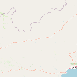
Rivers
Park geography
Structured data on regional boundaries, arid terrain, and natural landscape features
Comprehensive Geographic and Terrain Profile of South Africa's Karoo National Park
Karoo National Park covers 767.9 square kilometers within the Western Cape region of South Africa. This geographic profile details the park boundary, elevation measurements ranging from 850 to 1300 meters, and diverse landscape elements such as arid shrublands, mountain peaks, and flowing river systems.
Related tags
South Africa national parksSemi-desert wildernessGreat KarooGreat EscarpmentNuweveld Mountains
South Africa's semi-desert wildlife sanctuary in the Great Karoo
Karoo National Park
Karoo National Park is a wildlife reserve situated in the Great Karoo region of the Western Cape, South Africa, near the town of Beaufort West. This semi-desert protected area spans approximately 767.9 square kilometres and encompasses a remarkable diversity of terrain, from theLower Karoo plains at roughly 850 metres above sea level to the Upper Karoo plateau exceeding 1,300 metres altitude. The Nuweveld portion of the Great Escarpment runs through the park, creating a dramatic backdrop of cliffs and flat-topped hills formed by resistant dolerite sills. The park represents one of South Africa's most distinctive semi-arid ecosystems, offering visitors an opportunity to experience the stark yet ecologically rich landscape that defines much of the Karoo's interior.
- Location
- South Africa
- Park type
- Wildlife reserve
- Established
- 1979
- Area
- 767.9 km²
Location overview
Regional placement within South Africa and the Western Cape province
Geographic Location and Regional Setting of Karoo National Park
Karoo National Park sits entirely within the Western Cape region of South Africa. As a continental interior reserve, the park contains no marine, island, or transboundary territories.
- Countries
- South Africa
- Regions
- Western Cape
- Primary location
- Western Cape
- Geographic setting
- Inland
Boundary and coordinates
Geographic measurements and spatial extent across the protected landscape
Geographic Boundary Map and Spatial Limits of Karoo National Park
Mapped geometry visualises the physical shape and spatial limits of Karoo National Park. Accompanying records detail the calculated area, geographic centre, and regional footprint.
- Boundary area
- 883.4 km²
- Boundary perimeter
- 172.1 km
- Northernmost point
- 32.1252° S
- Southernmost point
- 32.4084° S
- Easternmost point
- 22.5803° E
- Westernmost point
- 21.9951° E
- Geographic centre
- 32.2544° S, 22.3041° E
- North–south span
- 31.4 km
- East–west span
- 55.1 km
Elevation and terrain
Recorded figures from 850 to 1,300 metres with seventeen links
Karoo National Park mountain terrain, elevation, and features
Karoo National Park has mountain relief with minimum and maximum elevations of 850 and 1,300 metres. Seventeen within-park cards include rivers, streams, peaks, viewpoints, a saddle, waterfall, and reservoir, with types and names preserved.
- Minimum elevation
- 850 m
- Maximum elevation
- 1,300 m
Selected named natural features
Rivers
Leeu
Rivers
Sand
Rivers
Gamka River
Viewpoints
Rooivalle Viewpoint
Peaks
Korannasfonteinberg
1,636.5 m
Environmental setting
Arid climate zones, desert shrublands, and mountainous relief profiles
Karoo National Park Environmental Setting and Classified Landscape Features
These recorded classifications offer complementary perspectives on the physical terrain within Karoo National Park. The structured environmental component connects active categories to related atlas destinations.
- Relief
- Mountain
- Climate
- Arid
- Water
- Minor water
- Forest cover
- No forest cover
- Seasonality
- Year-round
Landscape features
Mountains · Valleys · Cliffs · Plateau
Habitat types
Grassland · Desert habitat · Shrubland
Park atlas
Trace the mapped geography and protected-landscape spread across the Great Karoo, exploring nearby conservation areas for comparison.
Explore More National Parks, Protected Areas, and Regional Landscapes Near Karoo National Park
Browse other national parks and protected areas situated within or adjacent to the Great Karoo region, extending your geographic exploration beyond Karoo National Park's unique semi-desert and escarpment landscapes. This curated view provides essential regional context, allowing for a structured comparison of diverse conservation efforts and geological formations across the Western Cape.
Nature reserveWestern Cape
About 154 km away#1 closest
South

Gamkaberg Nature Reserve: An Atlas Overview of Mountain Geography and Protected Biomes
A vital conservation landscape within the Western Cape of South Africa.
Gamkaberg Nature Reserve stands as a focal point for ecological research and conservation in the Little Karoo. Defined by a rugged mountain range and deep gorges, the reserve protects the critical habitat of the Cape mountain zebra. Its landscape reveals an unusual overlap of four Cape biomes, offering a deep look into the regional geography and biological history of the South African interior.
- Area
- 94 km²
- Established
- 1974
- Relief
- Mountain
- Climate
- Mediterranean
National parkNorthern Cape
157 km away#2 closest
West
Tankwa Karoo National Park National Park: Mapped Protected Landscape in Northern Cape
Explore regional geography and protected area boundaries.
Tankwa Karoo National Park is a key protected area situated in the vast Northern Cape region of South Africa. This entry provides a detailed atlas perspective, focusing on the park's mapped geography and its significance as a national park. Understand the park's landscape context and its position within the broader regional geography for informed exploration and geographic discovery.
- Area
- 1,436 km²
- Established
- 1986
- Relief
- Upland
- Climate
- Arid
National parkSouth Africa
159 km away#3 closest
Southeast
Garden Route National Park: South Africa's Protected Landscape and Forest Atlas
Explore indigenous forests, coastal cliffs, and lake systems.
Garden Route National Park is a key national park in South Africa, celebrated for its rich indigenous forests and dramatic coastline. As a protected landscape, it offers a unique geographic profile, blending ancient woodlands with rugged coastal terrain and interconnected lake systems. This page serves as an atlas entry, detailing the park's spatial extent and its significance as a conservation area within the broader geography of South Africa.
- Area
- 1,210 km²
- Established
- 2009
- IUCN
- II
- Relief
- Mixed relief
National parkEastern Cape
173 km away#4 closest
East
Camdeboo National Park: Protected Landscape Atlas and Eastern Cape Geographic Context
Discover the mapped geography and protected area identity of this Eastern Cape national park.
Camdeboo National Park represents a key protected landscape within the Eastern Cape province of South Africa. This entry provides essential details for understanding its protected-area status, geographic footprint, and its role within the regional atlas. Examine its mapped boundaries and explore the unique natural terrain it encompasses, gaining specific insight into its protected landscape characteristics.
- Area
- 194.05 km²
- Established
- 2005
- Relief
- Mountain
- Climate
- Arid
National parkNorthern Cape
About 175 km away#5 closest
Northwest
Meerkat National Park National Park: Geographic Atlas and Protected Landscape Details
Explore the mapped boundaries and regional geography of Meerkat National Park.
Meerkat National Park is a significant protected area identified as a national park within the expansive Northern Cape region of South Africa. This detail page offers insight into its specific landscape character and mapped geographic extent, serving as a crucial node for atlas-based exploration. Understand the park's role as a protected national landscape and its relationship to the broader regional geography of Northern Cape, contributing to a structured understanding of conservation areas.
- Area
- 1,352.45 km²
- Established
- 2020
- IUCN
- II
- Relief
- Lowland
Biosphere reserveWestern Cape
About 177 km away#6 closest
South
Gouritz Cluster Biosphere Reserve: Geographic Overview and Protected Area Boundaries
A diverse protected landscape spanning the Western Cape coastline to high mountain ridges.
Spanning from the southern African coast into the interior mountain ranges, this biosphere reserve captures an unmatched variety of landforms including estuaries, rocky headlands, and arid Karoo basins. It serves as a vital protected system for threatened species and endemic flora, representing one of the most ecologically significant landscapes within the Cape Floristic Region.
- Area
- 31,878.9 km²
- Established
- 2015
- Relief
- Mixed relief
- Climate
- Mediterranean
National parkSouth Africa
About 192 km away#7 closest
Southeast
Knysna National Lake Area National Park: A Protected Landscape in South Africa
Explore its mapped boundaries and regional natural geography.
Knysna National Lake Area National Park is a key protected area in South Africa, offering a focused lens for understanding national park geography and protected landscapes. This entry provides an atlas-centric perspective on its landscape context, mapped terrain, and its significance as a distinct natural area within the broader South African geography. Explore the structured details of this park's protected boundaries and its contribution to the country's conservation map.
- Access
- Easy access
- Scope
- Mixed
- Water
- Water-dominated
National parkWestern Cape
About 192 km away#8 closest
Southeast
Wilderness National Park: National Park in Western Cape Province, South Africa
Explore mapped protected areas and regional geography.
Wilderness National Park stands as a significant protected area within the Western Cape province of South Africa. This page provides a detailed view of its role as a national park, emphasizing its geographic placement and mapped boundaries. Understand the park's contribution to the region's natural landscape and its significance within the broader atlas of protected lands.
- Area
- 1,210 km²
- Established
- 2009
- Relief
- Lowland
- Access
- Easy access
MoriAtlas Explorer
Continue Karoo National Park Landscape and Geography Exploration
Deepen your understanding of Karoo National Park by exploring its specific mapped boundaries and surrounding regional geography. Discover how this wildlife reserve fits into the broader atlas of protected landscapes in South Africa's Western Cape, offering detailed context for further geographic discovery and comparison.
Browse next
Global natural geography
Explore related park routes
Explore MoriAtlas Global ParksBrowse All MoriAtlas ParksGlobal Park Map DiscoveryMoriAtlas: Browse All CountriesBrowse All MoriAtlas ContinentsNational Park Environment AtlasGrand Canyon National Park AtlasYellowstone National Park AtlasYosemite National Park Atlas and GeographySerengeti National Park AtlasGalápagos National Park Protected LandscapeBanff National Park Geography and AtlasKruger National Park Atlas EntryUluṟu-Kata Tjuṯa National Park AtlasExplore Uluru-Kata Tjuta National Park GeographyPlitvice Lakes National Park AtlasFiordland National Park Protected LandscapeGreat Smoky Mountains National Park AtlasAfghanistan National Parks and Protected AreasAlbania National Parks and Protected AreasAlgeria National Parks and Protected AreasAmerican Samoa National Parks and Protected AreasAndorra National Parks and Protected AreasAngola National Parks and Protected AreasAntarctica National Parks and Protected AreasAntigua and Barbuda Park List