
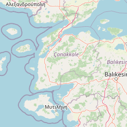
Rivers
Park geography
Structured data on regional topography, wetland landscapes, and mapped area coverage.
Detailed Geography and Mapped Boundary Profile for Kuşcenneti National Park in Turkey
Kuşcenneti National Park encompasses 240.47 square kilometers of temperate terrain within Balıkesir Province. This geographic profile documents the park boundary coordinates, land span, and associated riverine habitats including Manyas Kuşgölü, Kocaçay, and Karacay.
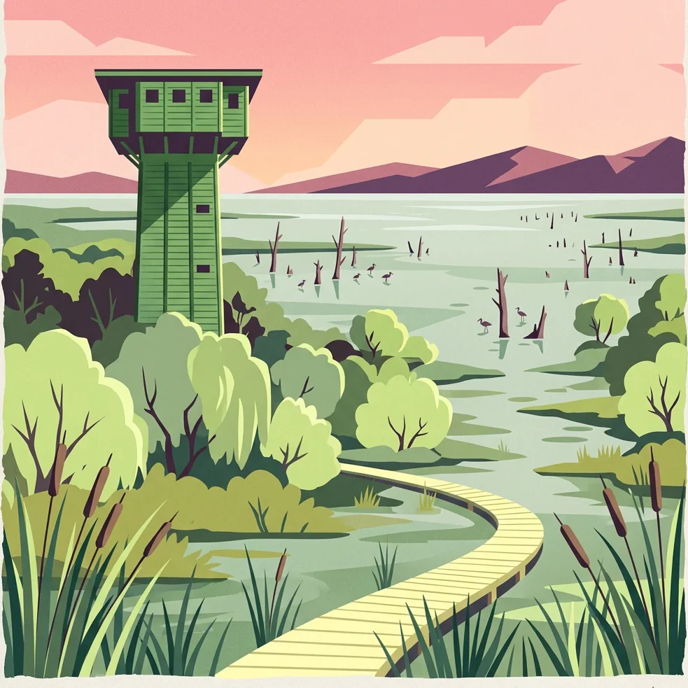
Turkey's premier bird sanctuary and Ramsar wetland on Lake Kuş
Kuşcenneti National Park
Kuşcenneti National Park is Turkey's oldest protected area dedicated specifically to bird conservation, established in 1959 at the northeastern shores of Lake Kuş in northwestern Turkey. The park derives its name from the Turkish words kuş (bird) and cenneti (paradise), reflecting its extraordinary significance as a nesting, wintering, and migratory stopover site for millions of birds. Located in the Bandırma district of Balıkesir Province, the park encompasses both terrestrial and aquatic habitats spanning approximately 24,000 hectares, with the lake itself covering roughly 16,400 hectares on average. The national park sits at a critical juncture of the Palearctic bird migration route, where Asia, Europe, and Africa converge, making it one of the most ornithologically important wetlands in Turkey and the broader Mediterranean region. Each year, between two and three million birds representing over 230 species visit the park, either to breed, winter, or pause during their seasonal journeys between continents. The wetland ecosystem comprises flooded willow and ash tree communities, freshwater lakes, wet meadows, and extensive reed beds that together support this remarkable avian diversity. What makes Kuşcenneti distinctive among Turkey's national parks is its singular focus on avian protection and its remarkable international recognition. Despite being one of Turkey's smallest national parks by land area, it attracts some of the highest visitor numbers, drawing nature enthusiasts, ornithologists, and conservationists who come to witness the spectacular bird congregations that have made this wetland famous across Europe and beyond.
- Location
- Turkey
- Park type
- National park
- Established
- 1959
- Area
- 240.5 km²
Location overview
Administrative boundaries and regional context in Balıkesir Province
Geographic Location and Regional Setting of Kuşcenneti National Park
Kuşcenneti National Park is located within the Balıkesir Province of Turkey. Protected-area records indicate a single national jurisdiction with no marine or transboundary borders.
- Countries
- Turkey
- Regions
- Balıkesir Province
- Primary location
- Balıkesir Province
- Geographic setting
- Inland
Boundary and coordinates
Interactive boundary geometry and calculated spatial measurements
Kuşcenneti National Park Boundary Map and Spatial Extent
Mapped park outlines provide spatial context for analyzing protected area boundaries and regional configuration. Accompanying boundary facts detail recorded area measurements, coordinate limits, and geographic spans.
- Boundary area
- 223.9 km²
- Boundary perimeter
- 67.3 km
- Northernmost point
- 40.2564° N
- Southernmost point
- 40.12° N
- Easternmost point
- 28.0839° E
- Westernmost point
- 27.8393° E
- Geographic centre
- 40.1879° N, 27.9683° E
- North–south span
- 15.1 km
- East–west span
- 20.8 km
Terrain and natural features
Lowland landscape classification and linked hydrological features
Kuşcenneti National Park Terrain and Named Natural Features
Recorded terrain classifications indicate a lowland landscape containing rivers, streams, and lakes within the protected area boundaries. Individual feature cards document names, types, measurements, and spatial relationships for each recorded natural water body.
Selected named natural features
Lakes
Manyas Kuşgölü
Rivers
Sığırcı Deresi
Streams
Kavaklıazmak Deresi
Rivers
Kocaçay
Environmental setting
Temperate lowland terrain featuring wetlands, lakes, and partial forest cover
Kuşcenneti National Park Environmental Classifications and Physical Setting
Recorded landscape features, habitat types, and climate classifications provide complementary ways to read the physical setting of Kuşcenneti National Park. Stored environmental categories connect directly to relevant atlas destinations across the protected area.
- Relief
- Lowland
- Climate
- Temperate
- Water
- Major water bodies
- Forest cover
- Partial forest
- Seasonality
- Year-round
Landscape features
Wetland · Lakes · Forest
Habitat types
Wetland · Riverine habitat · Temperate broadleaf forest
Park atlas
Compare wetland ecosystems and discover connected protected landscapes in Turkey's Marmara region.
Related National Parks and Protected Areas to Explore After Kuşcenneti National Park
After exploring Kuşcenneti National Park, continue your geographic discovery by browsing other national parks and protected areas across Turkey's Marmara region and beyond. Compare diverse conservation landscapes, map regional wetland ecosystems, and trace the spread of unique bird habitats within a broader protected-area context.
National parkTurkey
About 90 km away#1 closest
East

Uludağ National Park: Turkey's Oldest National Park's Alpine Landscape and Geography
Mapped protected area in Turkey's Marmara region.
Delve into the protected landscape of Uludağ National Park, Turkey's first national park, renowned for its distinctive alpine environment and dramatic mountain terrain. This page offers a detailed atlas view of the park's geography, mapped boundaries, and unique ecosystems, providing essential context for understanding this significant protected area within Turkey's natural heritage.
- Established
- 1961
- IUCN
- II
- Relief
- Mountain
- Climate
- Temperate

National parkTurkey
About 96 km away#2 closest
Southwest
Kazdağı National Park: Explore Turkey's Protected Mountainous Terrain and Forest Ecosystem
Mapped geography and protected landscape context within Turkey's Aegean region.
Kazdağı National Park is a significant protected area in Turkey, renowned for its dramatic mountain landscape encompassing Mount Ida. This park safeguards a critical subalpine forest ecosystem, characterized by diverse tree species that transition into rocky summits and alpine meadows. Understanding Kazdağı National Park's mapped boundaries provides essential insight into the regional geography, watershed protection, and the unique natural terrain found in western Turkey's Mediterranean mountain ranges, offering a solid foundation for geographic discovery.
- IUCN
- II
- Scope
- Terrestrial

Protected areaTurkey
About 138 km away#3 closest
West
Ancient Troya National Park: A Mapped Protected Landscape with Deep Historical Significance
Explore the terrain and protected boundaries of this key Turkish heritage site.
Ancient Troya National Park offers a unique window into history, preserving the layers of the ancient city of Troy within its protected boundaries. Situated in Turkey, this park encompasses a significant archaeological site on a commanding hilltop, overlooking rolling Mediterranean terrain and coastal plains. Its landscape, characterized by fortified walls, gates, and the remnants of ancient structures, provides a rich context for understanding its mythological and historical importance. MoriAtlas provides detailed mapping and geographic context for this vital protected area, enhancing its atlas exploration value.
- Established
- 1996
- IUCN
- II
- Relief
- Lowland
- Climate
- Mediterranean
National parkTurkey
About 155 km away#4 closest
Northwest
Lake Gala National Park: A Key Protected Wetland Landscape in Turkey's Maritsa Delta
Discover its bird habitats and mapped geographic context.
Lake Gala National Park is a nationally significant protected area, designated in 2005 to conserve the unique wetland ecosystem of the Maritsa Delta. Encompassing the shallow lakes Pamuklu and Küçük Gala, this park spans approximately 6,090 hectares of diverse wetland and forest habitats. It is internationally recognized as a Ramsar site and serves as a critical sanctuary for over 160 bird species, making it a premier birdwatching destination in Turkey and an important locus for understanding protected landscapes within a regional geographic framework.
- Area
- 60.9 km²
- Established
- 2005
- IUCN
- II
- Relief
- Lowland
National parkKırklareli Province
168 km away#5 closest
North
İğneada Floodplain Forests National Park: Kırklareli Province Protected Wetland Exploration
Mapped geography of a rare Turkish floodplain forest ecosystem.
İğneada Floodplain Forests National Park, located in Kırklareli Province, stands as a testament to Turkey's rare floodplain ecosystems. This protected national park features a remarkable landscape blending coastal sand dunes stretching along the Black Sea with inland lakes, marshes, and ancient deciduous forests. Its unique 'longoz' configuration and rich biodiversity offer significant value for atlas exploration, revealing the intricate interplay of landforms and water systems within this protected natural area. Discover the geographic context and mapped boundaries of this important conservation landscape.
- Area
- 31.55 km²
- Established
- 2007
- IUCN
- II
- Relief
- Lowland
National parkEastern Macedonia and Thrace
About 173 km away#6 closest
Northwest

Dadia-Lefkimi-Soufli Forest National Park: Protected Landscape Atlas and Raptor Habitat
Mapped terrain and protected area context in Eastern Macedonia and Thrace.
This canonical entry for Dadia-Lefkimi-Soufli Forest National Park provides a structured atlas view of its protected landscape. Understand the park's geographic setting within Eastern Macedonia and Thrace, its mapped boundaries, and its significance as a critical sanctuary for raptors across Europe. Explore the diverse natural terrain that defines this protected area and its ecological importance.
- Area
- 428 km²
- Established
- 2006
- IUCN
- VI
- Visitors
- 50K annual
National parkTurkey
About 179 km away#7 closest
South
Mount Spil National Park: Turkey's National Park and Protected Landscape Atlas Entry
Explore its mapped boundaries and regional geographic context.
Mount Spil National Park is presented here as a key protected area within Turkey's atlas of natural landscapes. This detail page focuses on its identity as a national park, providing a structured overview of its mapped boundaries and geographic setting. Understand its landscape context and its significance within Turkey's network of protected lands for detailed atlas exploration and geographic discovery.
- IUCN
- II
- Scope
- Mixed
- Water
- Minor water

Natural monumentLesvos
About 199 km away#8 closest
Southwest
Lesvos Petrified Forest: Protected Volcanic Fossil Landscapes and Aegean Geological Atlas
Natural monument and ancient Miocene fossil forest zones in western Lesvos, Greece.
This protected natural monument preserves an early Miocene forest transformed into stone by volcanic activity. The landscape features fossilized coniferous trunks, including rare upright specimens, scattered throughout volcanic deposits and coastal andesite outcrops on the island of Lesvos. It serves as a vital reference for the geological history of the North Aegean region.
- Area
- 150 km²
- Established
- 1985
- Relief
- Upland
- Climate
- Subtropical
MoriAtlas Explorer
Continue Exploring the Geography of Kuşcenneti National Park and Balıkesir Province
Delve deeper into the mapped landscape and regional geography surrounding Kuşcenneti National Park. Understanding this protected wetland's place within Balıkesir Province offers crucial context for its ecological importance and its role as a vital stopover for millions of migratory birds. Use MoriAtlas to trace the park's boundaries and discover its unique contribution to avian conservation geography.
Browse next
Global natural geography
Explore related park routes
Explore MoriAtlas Global ParksBrowse All MoriAtlas ParksGlobal Park Map DiscoveryMoriAtlas: Browse All CountriesBrowse All MoriAtlas ContinentsNational Park Environment AtlasGrand Canyon National Park AtlasYellowstone National Park AtlasYosemite National Park Atlas and GeographySerengeti National Park AtlasGalápagos National Park Protected LandscapeBanff National Park Geography and AtlasKruger National Park Atlas EntryUluṟu-Kata Tjuṯa National Park AtlasExplore Uluru-Kata Tjuta National Park GeographyPlitvice Lakes National Park AtlasFiordland National Park Protected LandscapeGreat Smoky Mountains National Park AtlasAfghanistan National Parks and Protected AreasAlbania National Parks and Protected AreasAlgeria National Parks and Protected AreasAmerican Samoa National Parks and Protected AreasAndorra National Parks and Protected AreasAngola National Parks and Protected AreasAntarctica National Parks and Protected AreasAntigua and Barbuda Park List