
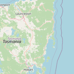
Streams
Park geography
Mapped terrain, environmental classifications, and natural landscape features
Detailed Geographic Profile of Mole Creek Karst National Park in Tasmania Australia
This geographic profile provides a detailed overview of Mole Creek Karst National Park, a protected area in Tasmania. Explore the mapped perimeter of 87.69 kilometers and the protected area covering 13.45 square kilometers, while identifying local natural features including karst cave systems, mountain peaks, and flowing river corridors.
Related tags
karst landscapecave systemsglow wormstroglobite speciesWorld Heritage Area
Tasmania's unique karst landscape protecting over 300 caves and rare cave-dwelling species
Mole Creek Karst National Park
Mole Creek Karst National Park is a distinctive protected area in northern Tasmania, Australia, established in 1996 specifically to preserve the region's exceptional karst landscape. Located 168 kilometers northwest of Hobart on the slopes of the Great Western Tiers, the park encompasses approximately 13.45 square kilometers of terrain containing one of Tasmania's most extensive underground cave systems. This national park holds the distinction of being the only protected area in Tasmania created specifically to safeguard karst landforms, and it forms part of the broader Tasmanian Wilderness World Heritage Site. The park comprises twelve separate blocks of land, some surrounded by private agricultural land, with many cave entrances and karst features extending beyond the official park boundaries. The national park protects an impressive network of more than 300 known caves and sinkholes, making it a significant site for both geological and biological research. Two of the most notable caves, King Solomons Cave and Marakoopa Cave, have been developed as show caves offering guided tours to visitors. Marakoopa Cave is particularly famous for its spectacular glow worm display, while King Solomons Cave showcases impressive speleothem formations including stalactites, stalagmites, and decorative shawl features. The cave systems support a remarkable array of endemic species that have evolved to survive in the complete darkness of the underground environment, including several rare and threatened troglobite species found nowhere else on Earth.
- Location
- Australia
- Park type
- National park
- Established
- 1996
- Area
- 13.5 km²
Location overview
National park regional mapping and island status in Tasmania
Geographic Location of Mole Creek Karst National Park in Australia
Mole Creek Karst National Park is located within the island state of Tasmania in Australia. Geographic records categorize the protected area as an island park, reflecting its isolated regional context.
- Countries
- Australia
- Regions
- Tasmania
- Primary location
- Tasmania
- Geographic setting
- Island
Boundary and coordinates
Interactive boundary geometry and calculated spatial metrics
Mole Creek Karst National Park Boundary Map and Geographic Extent
Mapped park outlines provide precise spatial context for examining protected boundaries across the terrain. Accompanying boundary facts detail recorded area measurements, coordinate limits, and geographic spans without claiming legal survey precision.
- Boundary area
- 46.5 km²
- Boundary perimeter
- 87.7 km
- Northernmost point
- 41.5312° S
- Southernmost point
- 41.6261° S
- Easternmost point
- 146.4158° E
- Westernmost point
- 146.222° E
- Geographic centre
- 41.5803° S, 146.2761° E
- North–south span
- 10.5 km
- East–west span
- 16.2 km
Terrain and natural features
Explore recorded caves, peaks, and streams within the mountain park geography
Mole Creek Karst National Park Mountain Terrain and Natural Features
This protected area features a mountain terrain classification encompassing recorded streams, peaks, and cave entrances. Linked feature cards supply names, types, and spatial relationships for each recorded natural feature.
Selected named natural features
Rivers
Mersey River
Peaks
Solomons Dome
695 m
Cave entrances
Honeycomb Caves
Cave entrances
Marakoopa Cave
Streams
Sassafras Creek
Environmental setting
Temperate mountain relief, major water systems, and connected karst habitats
Mole Creek Karst National Park Environmental Settings and Landscape Classifications
Recorded landscape features, habitat types, and climate zones offer complementary ways to read the physical setting of Mole Creek Karst National Park. Stored environmental categories link directly to relevant atlas destinations across the protected terrain.
- Relief
- Mountain
- Climate
- Temperate
- Water
- Major water bodies
- Forest cover
- Mostly forested
- Seasonality
- Year-round
Landscape features
Karst · Cave · Mountains · Forest · Wetland · Islands
Habitat types
Temperate broadleaf forest · Karst habitat · Peatland · Wetland
Park atlas
Explore the surrounding Tasmanian protected landscapes and compare adjacent cave systems or wilderness areas.
Discover Other National Parks and Protected Areas Near Mole Creek Karst National Park
Explore nearby national parks and protected areas to understand the regional geographic context surrounding Mole Creek Karst National Park, including connected karst systems and adjacent wilderness. Directly compare conservation landscapes and gain deeper insight into Tasmania's unique protected-area spread.
National parkTasmania
9 km away#1 closest
Southwest

Cradle Mountain, Lake St Clair National Park: Tasmania's Mapped Protected Landscape and Geography
Explore national park boundaries and regional natural terrain.
Gain insight into Cradle Mountain, Lake St Clair National Park, a protected national park in Tasmania, Australia. This entry provides a foundational understanding of its mapped terrain, geographic setting, and protected area status. Delve into the specific landscape characteristics that define this significant conservation zone and its place within the national atlas.
- Area
- 1,614.43 km²
- Established
- 1922
- IUCN
- II
- Visitors
- 209K annual
National parkTasmania
9.3 km away#2 closest
South
Walls of Jerusalem National Park: A Mapped Alpine Wilderness in Tasmania
Explore protected landscapes with biblical place names.
Walls of Jerusalem National Park in Tasmania is a distinguished national park characterized by its rugged alpine terrain and dramatic quartzite formations, most notably King Davids Peak. The park's landscape is further distinguished by a unique series of features named after biblical locations, offering an evocative exploration for those interested in geographic discovery. As a protected wilderness area within the Tasmanian Wilderness World Heritage Area, it provides valuable insight into Australia's significant natural landscapes and their mapped representation.
- Area
- 518 km²
- Established
- 1978
- IUCN
- II
- Relief
- Mountain
Nature reserveTasmania
About 35 km away#3 closest
East
Liffey Valley Reserve: Geographic Overview of a Tasmania Nature Reserve and Landscape
Protected sclerophyll forest and temperate rainforest sequences
Liffey Valley Reserve in Tasmania provides a focused look at how protected land boundaries align with natural elevation gradients. Its four component parcels protect a complete sequence of Tasmanian vegetation, spanning from ridge-top alpine heath to mossy rainforest depressions. This site acts as a key reference for understanding private conservation geography and the rugged terrain characterizing the eastern edge of the central highlands.
- Area
- 2.75 km²
- Established
- 1991
- Water
- Major water bodies
- Season
- Year-round
National parkTasmania
46 km away#4 closest
Northeast
Narawntapu National Park: Tasmania's Coastal Protected Landscape and Wildlife Atlas
Explore mapped boundaries, heathland, woodland, and intertidal bird habitats.
Narawntapu National Park showcases a remarkable protected coastal landscape on Tasmania's north coast, renowned for its exceptional density of marsupial wildlife and significant intertidal bird populations. Its diverse terrain, including heathland, woodland, and extensive mudflats, offers unique opportunities for geographic discovery and understanding the park's ecological importance. Examine its mapped natural features and protected status within the broader atlas of Australian reserves.
- Area
- 43.49 km²
- Established
- 1976
- IUCN
- II
- Visitors
- 10.1K annual
National parkTasmania
66 km away#5 closest
West
Savage River National Park: Discover Tasmania's Protected Landscape Geography
Explore mapped boundaries and regional park context.
Savage River National Park represents a distinct protected area within Tasmania, Australia, offering valuable insights into the island's natural geography and conservation landscape. As a designated national park, its mapped territory contributes to the understanding of regional protected areas and their distribution across Tasmania. This entity serves as a crucial point for atlas-based exploration, allowing users to grasp its geographic identity and its place within a broader map of Australian natural territories.
- Area
- 179.8 km²
- Established
- 1999
- IUCN
- II
- Climate
- Temperate
National parkTasmania
85 km away#6 closest
Northwest
Rocky Cape National Park: Tasmania's Coastal National Park with Ancient Aboriginal Heritage
Explore the dramatic headland, heath ecosystems, and mapped park boundaries.
Rocky Cape National Park on Tasmania's North West Coast is a nationally significant protected area recognized for its ancient Aboriginal archaeological heritage, representing at least 8,000 years of continuous occupation. The park's landscape unfolds across a dramatic coastal headland, featuring rugged rocky shores, expansive heathlands, and coastal woodlands that define this wild section of Tasmania. Its protected status underscores its importance for both cultural discovery and the preservation of unique Australian coastal ecosystems. Understanding Rocky Cape National Park offers direct insight into the region's geography and the enduring legacy of its first peoples.
- Area
- 30.64 km²
- Established
- 1967
- IUCN
- II
- Relief
- Lowland
National parkTasmania
About 89 km away#7 closest
South
Franklin, Gordon Wild Rivers National Park: Mapped Protected Landscape Identity in Tasmania's Geography
Explore the mapped boundaries of this Tasmanian National Park.
Franklin, Gordon Wild Rivers National Park stands as a testament to Tasmania's commitment to preserving its natural heritage. This national park provides a unique opportunity to examine protected land boundaries and understand its specific geographic setting within the Australian state. Its landscape context is integral to the regional atlas, offering a clear representation of conservation priorities and natural geographic features for detailed study.
- Area
- 4,463.42 km²
- Established
- 1908
- Relief
- Mountain
- Climate
- Temperate
National parkAustralia
94 km away#8 closest
East
Ben Lomond National Park: Tasmania's Premier Alpine Protected Landscape & Geography
Explore unique dolerite geology, plateau scenery, and alpine ecosystems.
Ben Lomond National Park is a premier alpine protected area within Australia, known for its dramatic dolerite geology and extensive plateau terrain. This national park offers a distinct mountain landscape shaped by glacial history, featuring notable peaks and significant alpine ecosystems. Discover the mapped boundaries and regional geographic context of this unique Australian protected land, understanding its place within the broader atlas of natural landscapes.
- Area
- 162 km²
- Established
- 1947
- IUCN
- II
- Relief
- Mountain
MoriAtlas Explorer
Continue Your Atlas Exploration of Mole Creek Karst National Park's Protected Geography
Deepen your understanding of Mole Creek Karst National Park by delving into its specific geographic setting and mapped protected area features. This park detail page serves as a gateway to appreciating its place within Tasmania's diverse natural landscapes and contributes to a structured overview of Australia's protected territories. Uncover the mapped terrain and regional context that define this significant national park.
Browse next
Global natural geography
Explore related park routes
Explore MoriAtlas Global ParksBrowse All MoriAtlas ParksGlobal Park Map DiscoveryMoriAtlas: Browse All CountriesBrowse All MoriAtlas ContinentsNational Park Environment AtlasGrand Canyon National Park AtlasYellowstone National Park AtlasYosemite National Park Atlas and GeographySerengeti National Park AtlasGalápagos National Park Protected LandscapeBanff National Park Geography and AtlasKruger National Park Atlas EntryUluṟu-Kata Tjuṯa National Park AtlasExplore Uluru-Kata Tjuta National Park GeographyPlitvice Lakes National Park AtlasFiordland National Park Protected LandscapeGreat Smoky Mountains National Park AtlasAfghanistan National Parks and Protected AreasAlbania National Parks and Protected AreasAlgeria National Parks and Protected AreasAmerican Samoa National Parks and Protected AreasAndorra National Parks and Protected AreasAngola National Parks and Protected AreasAntarctica National Parks and Protected AreasAntigua and Barbuda Park List