
Peninsulas
Park geography
A comprehensive look at marine areas, coastal wetlands, and regional landscape relief
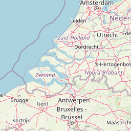
Geographic Profile and Mapped Boundaries of Oosterschelde National Park in Zeeland, Netherlands
Examine the detailed geographic structure of Oosterschelde National Park, covering its total 370 square kilometer area and extensive marine environment. This profile includes mapped boundaries, regional coastal positioning in Zeeland, and a catalog of natural features such as wetlands, beaches, and viewpoints found throughout the lowland terrain.
Netherlands' largest national park protecting a dynamic tidal marine landscape
Oosterschelde National Park
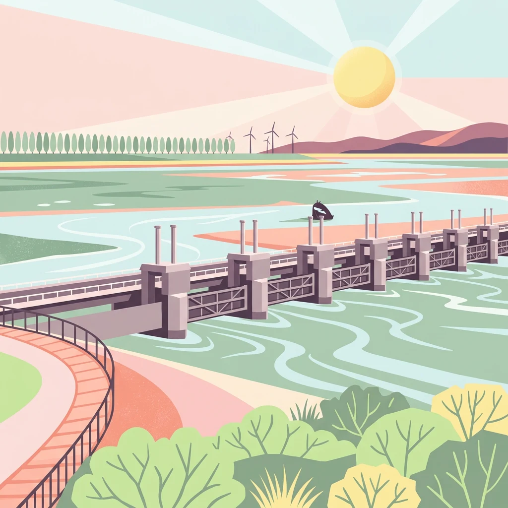
Oosterschelde National Park is the largest national park in the Netherlands, established on May 8, 2002. Located in the Dutch province of Zeeland, the park encompasses the Eastern Scheldt (Oosterschelde), a vast tidal lagoon system along with several adjacent water bodies including Keeten-Mastgat, Krabbenkreek, Zijpe, Slaak, and Krammer. The park covers approximately 37,000 hectares, with about 350 square kilometers lying outside the protective dikes. This dynamic marine environment is characterized by its tidal flats, sandbanks, and salt marshes that emerge and disappear with the twice-daily tidal cycles, creating one of the most productive and ecologically significant coastal ecosystems in Western Europe. The park is surrounded by the islands of Schouwen-Duiveland, Tholen, Zuid-Beveland, and Noord-Beveland, all of which form part of the distinctive Zeeland landscape. The Zeeland Bridge, an impressive engineering structure, crosses through the national park, connecting the various islands and providing visitors with panoramic views of the tidal landscape. The area's geography has been profoundly shaped by centuries of human intervention, including the construction of the massive Oosterscheldekering storm surge barrier in 1986, which fundamentally altered the hydrology of the Eastern Scheldt while still preserving the marine environment's essential character. Oosterschelde National Park represents a unique conservation challenge and success story, where a working marine landscape has been integrated with nature protection. The park supports exceptional biodiversity in both its underwater and above-water environments, making it a destination of particular significance for marine conservation, birdwatching, and recreational activities such as sport diving.
- Location
- Netherlands
- Park type
- National park
- Established
- 2002
- Area
- 370 km²
Location overview
Marine and island park status within the Zeeland region
Geographic Profile of Oosterschelde National Park
Oosterschelde National Park is situated within the Zeeland region of the Netherlands. The protected area holds designated coastal, island, and marine status without crossing international borders.
- Countries
- Netherlands
- Regions
- Zeeland
- Primary location
- Zeeland
- Geographic setting
- Coastal · Island · Marine
Boundary and coordinates
Interactive boundary geometry and derived spatial measurements
Oosterschelde National Park Boundary Map and Spatial Extent
Visualized park boundaries establish immediate spatial context through interactive mapping layers. Associated regional metrics outline total area coverage and coordinate limits for comprehensive geographic study.
- Boundary area
- 380 km²
- Boundary perimeter
- 243.3 km
- Northernmost point
- 51.706° N
- Southernmost point
- 51.4281° N
- Easternmost point
- 4.2233° E
- Westernmost point
- 3.6799° E
- Geographic centre
- 51.578° N, 3.9686° E
- North–south span
- 30.9 km
- East–west span
- 37.7 km
Terrain and natural features
Lowland relief classification and documented natural feature records
Oosterschelde National Park Terrain and Named Natural Features
Stored lowland relief classifications define the protected landscape topography across Oosterschelde National Park. Linked feature cards supply names, types, and spatial relationships for recorded wetlands, peninsulas, and viewpoints.
Selected named natural features
Wetlands
Plaat van Yerseke
Viewpoints
Trapjes
Viewpoints
Slikweg
Viewpoints
Plompe Toren
Ponds
Katse Rak/ Katse Gat
Environmental setting
Temperate lowland terrain, dominant water presence, and sparse forest cover
Oosterschelde National Park Environmental Setting and Physical Geography
Recorded classifications group coastal, marine, and wetland features into complementary lenses for reading the physical setting. Linked categories connect specific environmental traits directly to related atlas destinations.
- Relief
- Lowland
- Climate
- Temperate
- Water
- Water-dominated
- Forest cover
- Sparse forest
- Seasonality
- Year-round
Landscape features
Coast · Islands · Wetland · Rivers
Habitat types
Coastal habitat · Marine habitat · Wetland · Riverine habitat
Park atlas
Compare regional protected landscapes, tracing coastal environments and adjacent nature reserves across the Netherlands.
Explore Nearby National Parks and Protected Areas Beyond Oosterschelde National Park
After exploring Oosterschelde National Park, continue your geographic discovery by browsing other national parks and protected areas within the Dutch coastal region. Compare diverse landscapes, from additional tidal wetlands to forest reserves and river deltas, understanding broader conservation efforts across the Netherlands' mapped geography.
National parkBelgium
About 16 km away#1 closest
Southeast

De Zoom, Kalmthoutse Heide Cross-Border Park: Transboundary National Park & Heathland Atlas
Explore mapped protected boundaries and regional geography.
This page details the De Zoom, Kalmthoutse Heide Cross-Border Park, a significant national park that merges Belgian and Dutch protected territories. It is recognized for its expansive heathland, a crucial ecosystem in the Benelux region, offering a rich visual and ecological study. The park's mapped landscape context reveals its unique geography, from dry heathlands to Ramsar-designated wetlands, providing valuable insight for atlas-based exploration of protected areas. Understand the park's protected area identity and its role within the regional landscape.
- Area
- 37.5 km²
- Established
- 2001
- IUCN
- II
- Relief
- Lowland
National parkNetherlands
32 km away#2 closest
East

De Biesbosch National Park: A Dutch National Park Mapping Tidal Wetlands and Flood Forests
Explore mapped waterways and diverse protected landscapes.
Delve into the geography of De Biesbosch National Park, a remarkable protected area in the Netherlands renowned for its extensive freshwater tidal wetlands. This national park showcases a unique landscape defined by intricate river systems, dominant willow flood forests, and vital reed beds, serving as a critical habitat for migratory birds and a prime example of wetland restoration. Understand its place within the regional geography through our atlas-driven approach to protected land discovery.
- Area
- 90 km²
- Established
- 1994
- IUCN
- II
- Relief
- Lowland
Nature reserveBelgium
34 km away#3 closest
Southwest
Zwin Nature Reserve: Belgium's Coastal Wetland and Historic Tidal Inlet Landscape
Mapped protected area boundaries and coastal wetland geography.
Delve into the Zwin Nature Reserve, a significant protected landscape on Belgium's North Sea coast. This area preserves the unique geography of a historical tidal creek system, characterized by extensive salt marshes, mudflats, and specialized coastal vegetation. As a vital habitat for diverse bird species and a showcase of tidal dynamics, Zwin offers a compelling case study in coastal conservation and landscape evolution, providing rich context for geographic and atlas-based exploration.
- Area
- 1.58 km²
- Established
- 1952
- IUCN
- IV
- Relief
- Lowland
Nature reserveGelderland
54 km away#4 closest
East
Loevestein, Pompveld & Kornsche Boezem: Regional Geography and Protected Area Mapping
A composite Natura 2000 network in the central Dutch river delta.
Spanning the Bommelerwaard and Land van Heusden en Altena, Loevestein, Pompveld & Kornsche Boezem represents a vital approach to protecting fragmented lowland habitats. This record provides geographic insight into the diverse riverine mosaic of floodplains, wet grasslands, and historical stream channels that define this protected landscape in the heart of the Netherlands.
- Area
- 7.5 km²
- Established
- 2013
National parkNorth Brabant
56 km away#5 closest
East
Van Gogh National Park: National Park in North Brabant with Dune Landscapes
Explore mapped protected areas and regional geography.
Van Gogh National Park is a significant protected landscape in North Brabant, Netherlands, covering approximately 1,200 square kilometers. This national park is distinguished by its extensive drift sand dune systems, notable heathlands, and wooded valleys, offering a diverse terrain within the Dutch context. Named in tribute to Vincent van Gogh, it merges rich natural landscapes with cultural heritage, serving as a model for collaborative conservation and regional development, all mapped for detailed atlas exploration.
- Area
- 1,200 km²
- Established
- 2024
- IUCN
- II
- Relief
- Lowland
National parkNetherlands
60 km away#6 closest
East
De Loonse en Drunense Duinen National Park: Explore Dutch Protected Sand Drift Landscapes and Heathlands
National Park with unique living sand drift and dune terrain.
Navigate the geographic contours and protected land boundaries of De Loonse en Drunense Duinen National Park, a premier Dutch natural area. This national park is celebrated for its extensive living sand drift, one of the largest in Northern Europe, alongside significant heathlands and coniferous forests. Gain a structured understanding of its landscape character and its role within regional geography through detailed map context and atlas exploration tools.
- Area
- 35 km²
- Established
- 2002
- IUCN
- II
- Relief
- Lowland
Nature reserveGelderland
About 67 km away#7 closest
East
Lingegebied & Diefdijk-Zuid: Protected Nature Reserve in Central Netherlands
A fragmented river landscape spanning three provinces
Lingegebied & Diefdijk-Zuid is a designated Natura 2000 nature reserve characterized by its scattered parcels of protected land. The area is deeply integrated into the Dutch river landscape, following the path of the Linge river and the historic Diefdijk. Its unique geography across four municipalities showcases the complex relationship between regional water management and protected European habitat types.
- Area
- 7.5 km²
- Established
- 2013
- Relief
- Lowland
- Climate
- Temperate
National parkNorth Holland
82 km away#8 closest
Northeast
Zuid-Kennemerland National Park: Coastal Dune Protected Landscape in North Holland
Explore its unique mapped terrain and protected area geography.
Zuid-Kennemerland National Park showcases a remarkable coastal dune ecosystem situated in the North Holland province. This national park entry provides detailed insight into its protected landscape, from calcium-rich dune soils supporting rare flora to ancient woodlands and extensive walking trails. Users can explore the park's mapped boundaries, understand its geographic setting within the Netherlands, and appreciate its significance as a conservation area. Discover the natural terrain and ecological richness that characterize this important Dutch protected land.
- Area
- 38 km²
- Established
- 1995
- IUCN
- II
- Visitors
- 1.8M annual
MoriAtlas Explorer
Continue Your Geographic Exploration of Oosterschelde National Park and Zeeland
Broaden your understanding of Oosterschelde National Park by exploring its detailed geographic context within the Zeeland region. MoriAtlas offers structured insights into its mapped protected boundaries, tidal landscape features, and its place within the Netherlands' network of significant natural areas. Continue your atlas exploration to compare its unique characteristics with other protected regions, uncovering more about coastal geography and conservation landscapes.
Browse next
Global natural geography
Explore related park routes
Explore MoriAtlas Global ParksBrowse All MoriAtlas ParksGlobal Park Map DiscoveryMoriAtlas: Browse All CountriesBrowse All MoriAtlas ContinentsNational Park Environment AtlasGrand Canyon National Park AtlasYellowstone National Park AtlasYosemite National Park Atlas and GeographySerengeti National Park AtlasGalápagos National Park Protected LandscapeBanff National Park Geography and AtlasKruger National Park Atlas EntryUluṟu-Kata Tjuṯa National Park AtlasExplore Uluru-Kata Tjuta National Park GeographyPlitvice Lakes National Park AtlasFiordland National Park Protected LandscapeGreat Smoky Mountains National Park AtlasAfghanistan National Parks and Protected AreasAlbania National Parks and Protected AreasAlgeria National Parks and Protected AreasAmerican Samoa National Parks and Protected AreasAndorra National Parks and Protected AreasAngola National Parks and Protected AreasAntarctica National Parks and Protected AreasAntigua and Barbuda Park List