
Mori Atlas logo
Nearby park discovery

Geographic distribution and map context of natural areas surrounding this alpine site

Regional Protected Areas and Alpine Landscapes Near Pian del Re in the Cottian Alps

Explore the collection of protected natural areas situated in the proximity of Pian del Re within the Piemonte region. This geographic overview highlights the surrounding alpine terrain, glacial landscapes, and regional park boundaries that define the rugged character of the Cottian Alps, offering a spatial understanding of the wider environment.

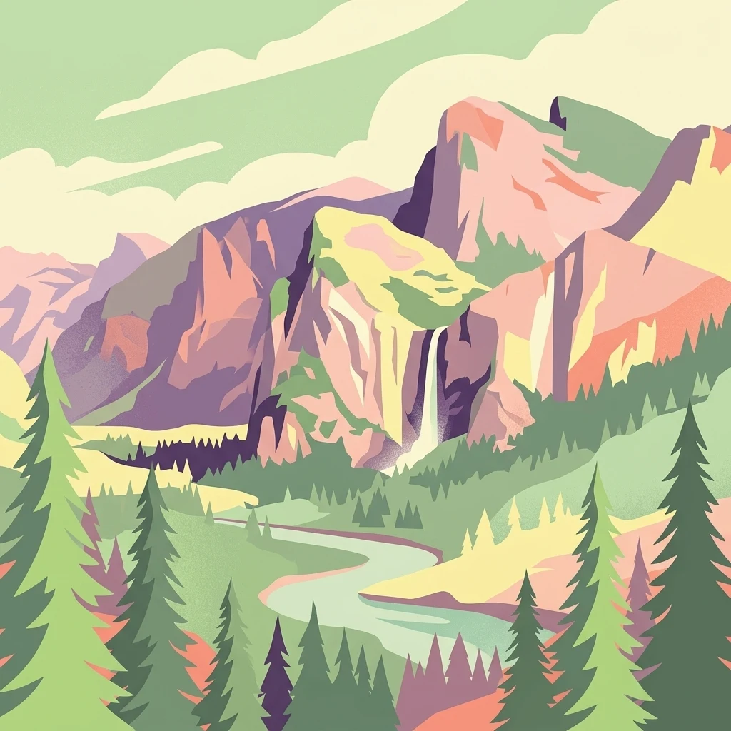
A flat-style vector illustration of a mountain valley scene, showing a waterfall cascading between cliffs into a river with evergreen trees in the foreground and a bright sun in the sky.

The alpine birthplace of Italy's longest river, at the foot of Monviso.

Pian del Re

Pian del Re is a high-altitude alpine locality set at roughly 2,020 meters in the upper Po Valley, within the Cottian Alps of northwestern Italy. Located in the municipality of Crissolo, in the Province of Cuneo in Piedmont, the site sits inside the protected perimeter of the Parco del Monviso and lies at the foot of the Monviso massif. The locality is best known as the area where the Po River, Italy's longest watercourse, springs from the mountainside. Its combination of glacial springs, wet meadows, and bog habitat gives the area strong ecological value, and it supports rare alpine amphibians such as the Lanza's salamander. The name itself reflects the area's historical significance, recalling the encampments of the French army under Francis I of France during the early sixteenth-century campaigns against the Duchy of Savoy. Beyond its natural and historical character, Pian del Re is a gateway to some of the most celebrated alpine excursions in the western Alps. It serves as a key starting point for routes to the Quintino Sella, Giacoletti, and Viso mountain huts, and as an entry to the historic Buco di Viso tunnel as well as the multi-day Giro di Viso trek around the Monviso massif.

Location
Italy
Park type
Regional park
Highest point
2,020 m
Explore Pian del Re Regional Park
Regional park map

See the ranked park cluster in its geographic setting

Nearby parks around Pian del Re

This regional map shows the same 20 nearby parks ranked below around Pian del Re. Select a ranked marker to highlight that park’s boundary where boundary data is available.
Reference park: Pian del ReRanked nearby park20 nearby parks shown
20 nearby parks

Distance-ranked collection and regional geographic comparison signals for Pian del Re

Parks and Protected Areas Geographically Near Pian del Re

Examine the ranked collection of protected areas situated near Pian del Re using direct geographic separation and direction metrics. Compare recorded environmental characteristics across surrounding regional landscapes to analyze broader ecological patterns without relying on driving routes.
Watercolor illustration of a mountainous landscape featuring a river, rolling hills, and green vegetation
National parkFrance
About 35 km away#1 closest

South

Mercantour National Park: Mapped Alpine Protected Landscape and Regional Geography

Explore France's dramatic Alps, park boundaries, and unique ecotones.

Mercantour National Park stands as a premier protected area within the French Alps, distinguished by its remarkable geographic diversity and ecological significance. This national park encompasses mountainous terrain featuring dramatic peaks, deep glacial valleys, and a unique ecotone where Mediterranean and Alpine ecosystems converge. MoriAtlas facilitates a detailed atlas-style exploration of Mercantour National Park, highlighting its mapped protected boundaries, varied natural landscapes, and its pivotal role in regional geography and conservation efforts.

Area
679 km²
Established
1979
IUCN
II
Visitors
800K annual
Watercolor illustration showing mountains, a winding river, and pine trees in a landscape
National parkFrance
About 46 km away#2 closest

West

Écrins National Park: Alpine Glaciated Terrain and Protected Landscape Details

Mapped boundaries and regional geography of a major French National Park.

Delve into Écrins National Park, a defining national park within the French Alps. This page provides a comprehensive overview of its protected landscape, focusing on its dramatic glaciated terrain, significant peaks such as the Barre des Écrins, and its position within the regional geographic context. Explore the mapped extent and understand the unique alpine environment of this protected area.

Area
925 km²
Established
1973
IUCN
II
Visitors
800K annual
A watercolor painting on a white background showing a landscape with rolling green hills, a small lake, and distant mountain ridges in shades of pink, purple, and green.
Nature reserveProvence-Alpes-Côte d'Azur
About 48 km away#3 closest

Northwest

Réserve naturelle régionale des Partias: Alpine Geography and Protected Nature Reserve Data

High-altitude mountain terrain in the southern French Alps

Covering slopes west of Briançon, Réserve naturelle régionale des Partias protects a layered alpine environment ranging from forested basins to rocky crests. This atlas entry provides a detailed geographic overview of the protected area, focusing on its distinctive mountain lakes, diverse soil substrates, and essential role in conserving alpine ecosystems.

Area
8.018 km²
Established
2009
IUCN
IV
Relief
Mountain
Watercolor painting depicting mountains, a river, and trees under a light sky
National parkSavoie
About 66 km away#4 closest

North

Vanoise National Park: Explore France's Original National Park in the Savoie Alps

Mapped Alpine geography, glacial terrain, and protected landscape.

Vanoise National Park is France's pioneering national park, a protected landscape of immense alpine beauty situated in the Savoie department. Renowned for its dramatic glacial terrain, over 100 peaks above 3,000 meters, and the iconic Alpine ibex, this park offers a profound geographic context. Explore its mapped boundaries and discover the unique atlas-level insights into France's mountainous protected areas and their ecological significance.

Area
534 km²
Established
1963
IUCN
II
Relief
Mountain
A watercolor painting of a river valley with soft green trees, rolling hills, and distant mountains under a light sky.
Nature reserveProvence-Alpes-Côte d'Azur
About 68 km away#5 closest

West

Réserve naturelle nationale de la haute vallée de la Séveraisse: Protected Alpine Corridor

High-mountain riverine landscape and buffer zone in Hautes-Alpes

This nature reserve encompasses a 4-kilometer stretch of the upper Séveraisse valley, focusing on alluvial riverbed habitat and peripheral mountain terrain. Located in the French Alps, the reserve provides a protected transition zone characterized by its narrow, U-shaped valley floor and steep rocky inclines, offering a key geographic link to the wider Écrins ecosystem.

Area
1.55 km²
Established
1974
IUCN
IV
A watercolor illustration of a landscape with purple and pink layered mountain peaks in the background and soft green trees in the foreground, set against a plain white background.
Nature reserveAuvergne-Rhône-Alpes
About 68 km away#6 closest

Northwest

Réserve naturelle nationale de la haute vallée du Vénéon: Alpine Geography and Protected Boundaries

High-altitude mountain terrain in the French Alps

The Réserve naturelle nationale de la haute vallée du Vénéon occupies 61 hectares of striking alpine terrain near the hamlet of La Bérarde. Its landscape of steep slopes and glacial deposits functions as a key protected buffer zone, supporting diverse flora and fauna within the broader mountainous geography of the Auvergne-Rhône-Alpes region.

Area
0.61 km²
Established
1974
IUCN
IV
A watercolor illustration showing a landscape with red rock formations, green vegetation, and a winding blue river.
Nature reserveProvence-Alpes-Côte d'Azur
About 75 km away#7 closest

South

Réserve naturelle régionale des gorges de Daluis: Red Rock Canyon and Geological Atlas

Protected canyon landscape in Provence-Alpes-Côte d'Azur

Defined by its vivid red pelite cliffs, Réserve naturelle régionale des gorges de Daluis functions as a significant protected canyon system. The terrain preserves rare mineralogy and diverse microhabitats, ranging from river-carved walls to upland slopes that support unique regional biodiversity in the Alpes-Maritimes.

Area
10.82 km²
Established
2012
IUCN
IV
Relief
Mountain
Watercolor illustration depicting green valleys, forests, and distant mountain peaks
National parkItaly
About 78 km away#8 closest

North

Gran Paradiso National Park: Italy's National Park Protected Landscape Atlas

Mapped boundaries and regional geography for a key Italian protected area.

Gran Paradiso National Park is a distinct national park entity within Italy, offering rich potential for atlas-driven geographic discovery. This MoriAtlas profile focuses on its protected landscape identity, providing essential context for understanding its mapped boundaries and its role within the regional geography of Italy. Explore the structured geographic details that make Gran Paradiso National Park a valuable component of any mapped landscape analysis.

Area
703 km²
Established
1922
IUCN
II
Relief
Mountain
A soft watercolor illustration featuring rolling green hills, a winding path, and distant mountain ridges in a muted, painterly style.
Nature reserveFrance
About 84 km away#9 closest

West

Réserve naturelle nationale de la haute vallée du Béranger: Mountain Protected Area Map

Tracing the alpine terrain and torrent corridors in the French Alps.

Covering roughly 84 hectares in the Isère region, this nature reserve integrates traditional pastoral landscapes with steep-sided forest slopes and rocky alpine ridges. It functions as a key protective buffer for the larger Écrins National Park, preserving a representative slice of southern French Alpine geography within a single, cohesive valley setting.

Area
0.84 km²
Established
1974
Relief
Mountain
Climate
Alpine
State or regional parkAlpes-Maritimes
About 93 km away#10 closest

South

Parc naturel départemental de l'Estéron: Riverside Geography in Alpes-Maritimes

A departmental park focusing on the wild Estéron River corridor

Located in the hinterland of the Côte d'Azur, Parc naturel départemental de l'Estéron provides a protected environment focused on the Estéron river valley. Its geography encompasses sun-exposed Mediterranean hillsides and riparian zones, reflecting the intersection of mountain terrain and historic cross-border heritage in the Alpes-Maritimes department.

Area
0.2 km²
Established
2011
Scope
Terrestrial
Water
Major water bodies
A soft watercolor painting of a rolling hilly landscape with muted greens, yellows, and purples on a white background.
Nature reserveProvence-Alpes-Côte d'Azur
About 93 km away#11 closest

Southwest

Réserve naturelle géologique de Haute-Provence: Geological Protected Area and Map Atlas

Tracing fossil-rich outcrops across the French Pre-Alps regional landscape

Spanning 269 hectares, the Réserve naturelle géologique de Haute-Provence preserves iconic fossil sites like the Dalle aux Ammonites and diverse tectonic terrains. This repository offers insight into the reserve's unique sedimentary layers, folded mountain strata, and deeply incised river valleys that document prehistoric marine environments in France.

Area
2.69 km²
Established
1984
IUCN
III
Relief
Mountain
Watercolor painting of a soft, green landscape with hills, a meandering river, and trees against a pale background.
Nature reservePiemonte
About 94 km away#12 closest

Northeast

Riserva naturale dei Monti Pelati: A Protected Nature Reserve in Northern Italy

Geological landscape context and peridotite terrain in Piemonte.

Riserva naturale dei Monti Pelati is a vital protected area in Italy known for its unusual peridotite bedrock. This ridge provides a stark contrast to the nearby Ivrea Morainic Amphitheater, serving as an essential site for studying specialized flora and the geological history of the Western Alps in the Piedmont region.

Area
1.46 km²
Established
1993
Relief
Upland
Climate
Temperate
A pale, soft-focus watercolor painting of rolling green hills, a forested valley, and layered distant mountains.
Nature reserveLiguria
About 104 km away#13 closest

East

Riserva naturalistica dell'Adelasia: Protected Forest Landscapes and Geography in Liguria, Italy

A woodland nature reserve and legendary ridge landscape in the upper Bormida valley

Spanning elevations between 400 and 860 meters, Riserva naturalistica dell'Adelasia anchors the northern flank of the Ligurian Apennines. This nature reserve provides essential habitat in a historically industrialized valley, featuring a mix of mature forest, cascading stream corridors, and the iconic Rocca dell'Adelasia landmark, which ties the region to local folklore and historic geography.

Established
1989
Relief
Mountain
Climate
Temperate
Scope
Terrestrial
A soft watercolor illustration depicting a panoramic view of rolling green hills under a pale, warm sky with distant mountains.
State or regional parkProvence-Alpes-Côte d'Azur
About 105 km away#14 closest

South

Parc naturel départemental du Plan des Noves: Protected Landscapes and Regional Geography

Upland limestone plateau in the French Baous massif

Covering 904 hectares above the town of Vence, this park features a unique combination of Mediterranean woodlands, open pastoral mosaics, and historic agricultural terraces. The terrain serves as a vital ecological corridor, recognized for its birdlife and reptiles, while its elevation offers expansive vistas across the surrounding regional geography from the coast to the high mountain summits.

Area
9.04 km²
Established
1987
Relief
Upland
Scope
Terrestrial
Marine protected areaFrance
About 107 km away#15 closest

Southeast

Sanctuaire Pelagos Marine Protected Area: Mediterranean Geography and Seascape

A transboundary conservation zone spanning 87,500 square kilometers.

Sanctuaire Pelagos represents a unique collaborative effort in marine conservation across the Mediterranean. Spanning the waters between France, Italy, and Monaco, this protected maritime area is defined by its deep-sea canyons and nutrient-rich currents that sustain diverse cetacean populations. Its immense scale and international governance make it a focal point for understanding Mediterranean marine biodiversity and environmental policy.

Area
87,500 km²
Established
1999
IUCN
IV
Relief
Lowland
A digital illustration of a valley featuring jagged mountain peaks, a waterfall, a winding river, and pine forests in the foreground.
Marine protected areaMonaco
About 109 km away#16 closest

South

Larvotto and Portier Coastal Reserve: Marine Protected Area and Coastal Habitat Atlas

Mapped marine refuge along the dense Monaco shoreline.

The Larvotto and Portier Coastal Reserve represents a distinct marine protected area in Monaco, featuring significant seagrass meadows and transplanted rocky habitats. This coastal zone acts as an essential refuge for Mediterranean biodiversity, providing a rare example of structured marine conservation embedded within a highly developed urban landscape.

Area
0.23 km²
Watercolor painting of distant purple hills and foreground pine trees in soft washes of green, yellow, and red on a white background.
State or regional parkProvence-Alpes-Côte d'Azur
About 111 km away#17 closest

South

Parc naturel départemental du Vinaigrier: Protected Limestone Landscapes near Nice

Regional state park with diverse Mediterranean woodland ecosystems

Parc naturel départemental du Vinaigrier offers a dense, 25 hectare mosaic of limestone plateaus and slopes near the Mediterranean coast. Its landscape is defined by traditional dry stone terraces and a rare flowering ash forest, creating a significant ecological bridge between the urban expansion of Nice and the hilly interior of the Alpes-Maritimes.

Area
0.25 km²
Established
1980
IUCN
IV
A watercolor painting showing a soft-focus, panoramic landscape with green trees, gentle hills, a central body of water, and pale mountains in the background against a white backdrop.
Nature reserveBiella
About 114 km away#18 closest

Northeast

Riserva naturale speciale della Bessa: Protected Nature Reserve in Northern Piedmont

Glacial moraines and archaeological mining landscapes near Biella

Located in the foothills of the Alps, the Riserva naturale speciale della Bessa is defined by its austere, stone-filled plateau. This nature reserve offers a unique look at Pleistocene glacial deposits and the extensive traces of Roman placer gold extraction. The geography includes erratic boulders, deep erosional channels, and historic terrace systems that reveal a deep connection between ancient labor and natural geological forces.

Area
7.5 km²
Established
2009
IUCN
IV
A pale, soft watercolor illustration showing a horizontal landscape of a pond and wetlands bordered by trees, with faint mountain silhouettes in the distance.
Nature reserveIsère
About 116 km away#19 closest

Northwest

Réserve naturelle régionale de l'étang de Haute-Jarrie, Isère Protected Wetland Landscape

Regional nature reserve and migratory bird sanctuary

Situated on the Plateau de Champagnier in Isère, this regional nature reserve offers a concentrated example of glacial pond ecology and wetland biodiversity. Covering 11 hectares, it acts as a critical stopover within the Grésivaudan valley migratory corridor. This protected site features diverse habitats, including reedbeds and wet meadows, that support hundreds of recorded bird species and a variety of dragonflies and amphibians, making it a significant area for ecological study.

Area
0.11 km²
Established
2008
IUCN
IV
Relief
Upland
A soft watercolor painting depicting a winding river through a lush green valley with distant hills in the background.
Nature reserveAuvergne-Rhône-Alpes
About 118 km away#20 closest

West

Réserve naturelle régionale des Isles du Drac: Braided River Landscape and Regional Map Context

A vital riverine conservation corridor in the Auvergne-Rhône-Alpes region of France

The Réserve naturelle régionale des Isles du Drac occupies an expansive alluvial floodplain where the river transitions into a braided system. This reserve preserves dynamic gravel bars and woodland habitats that support exceptional biodiversity within the northern Alpine landscape. It offers a detailed look at how riverine corridors persist alongside significant hydroelectric and industrial infrastructure in the Grenoble area.

Area
8.048 km²
Established
2009
IUCN
IV
Relief
Lowland
Distance methodology

Geographic measurements, not driving distances

How nearby park distances are calculated

Distances use park boundaries whenever the available geometry allows it. When one or both boundaries are missing, the mapped park locations provide a clearly labelled estimate. Every value represents straight-line geographic separation and does not use roads or routing.

Boundary distance

Calculated between the nearest points of both park boundaries.

Location-to-boundary estimate

Estimated from one mapped park location to the nearest boundary of the other park.

Mapped-location estimate

Estimated between the mapped locations of both parks.

MoriAtlas Explorer

Continue Exploring the Protected Alpine Geography of Pian del Re

Examine the detailed landscape and mapping of Pian del Re within the wider MoriAtlas collection of protected areas. Gain insight into the alpine hydrology, glacial features, and significant regional terrain of the Monviso massif as they exist in this high-altitude Italian setting.

Global natural geography