
Rivers
Park geography
Detailed assessment of mountain terrain, regional spatial data, and landscape features
Comprehensive Geographic Profile and Mapped Boundaries of Turrialba Volcano National Park
This geographic profile details the spatial extent and physical features of Turrialba Volcano National Park in the Cartago Province of Costa Rica. The data encompasses recorded boundary dimensions, mountain relief, and identified environmental markers including volcanic activity and river networks within the protected area.
Related tags
Volcanic landscapesActive volcanoCentral AmericaNational parksMontane ecosystems
Costa Rica's active volcanic peak with crater views across the Central Valley
Turrialba Volcano National Park
Turrialba Volcano National Park is a protected area in central Costa Rica that centers on the active Turrialba Volcano, one of the country's most significant volcanic peaks. The park is situated in Cartago Province within the Central Conservation Area, spanning approximately 3,900 acres around the volcano's crater and slopes. Established on July 30, 1955, the park provides protection for a dramatic volcanic landscape characterized by steep terrain, crater formations, and sweeping views that extend across the Caribbean lowlands and the Talamanca mountain range. The park holds IUCN category II designation as a national park and is managed by Costa Rica's National System of Conservation Areas. Beyond its geological significance, the park supports notable biodiversity including dozens of bird and mammal species, making it a destination of interest for both scientific study and nature-based tourism.
- Location
- Costa Rica
- Park type
- National park
- Established
- 1955
- Area
- 16 km²
Location overview
Regional placement within Cartago Province, Costa Rica
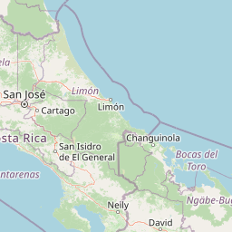
Geographic Location of Turrialba Volcano National Park in Costa Rica
Turrialba Volcano National Park is situated within Cartago Province in the nation of Costa Rica. Atlas records confirm the interior reservation has no coastal, marine, or transboundary designations.
- Countries
- Costa Rica
- Regions
- Cartago Province
- Primary location
- Costa Rica
- Geographic setting
- Inland
Boundary and coordinates
Volcanic park outline with spatial measurements
Turrialba Volcano National Park mapped boundary and 16 km² area
Turrialba Volcano National Park has stored boundary geometry defining its 16 km² protected extent on the map. That recorded total is not separated into land and marine values, and no perimeter is available.
- Boundary area
- 12.6 km²
- Boundary perimeter
- 12.6 km
- Northernmost point
- 10.0365° N
- Southernmost point
- 10.0004° N
- Easternmost point
- 83.7465° W
- Westernmost point
- 83.783° W
- Geographic centre
- 10.0185° N, 83.7648° W
- North–south span
- 4 km
- East–west span
- 4 km
Terrain and natural features
Explore recorded mountain terrain classifications and internal natural features
Turrialba Volcano National Park Terrain and Natural Features
This mountain terrain classification organizes the natural features located within Turrialba Volcano National Park. Linked feature cards supply names, types, measurements, and spatial relationships for each recorded entity.
Selected named natural features
Rivers
RIO GUAYABITO
Rivers
RIO AQUIARES
Peaks
Cerro San Carlos
3,340 m
Rivers
Quebrada División
Rivers
QUEBRADA UVITA
Environmental setting
Tropical mountain relief and forest habitat categories across the terrain
Turrialba Volcano National Park Environmental and Landscape Classifications
Recorded mountain terrain, tropical forest habitats, and volcano features serve as interpretive categories for physical settings. Stored classifications link directly to relevant atlas destinations and regional geographic contexts.
- Relief
- Mountain
- Climate
- Tropical
- Water
- Minor water
- Seasonality
- Year-round
Landscape features
Mountains · Volcano · Forest
Habitat types
Tropical forest · Montane forest
Park atlas
Trace Costa Rica's protected landscapes and volcanic terrain near Turrialba Volcano National Park
Explore Nearby National Parks and Protected Areas around Turrialba Volcano National Park, Costa Rica
After exploring Turrialba Volcano National Park, continue your discovery of Costa Rica's active volcanic peaks and diverse montane protected areas throughout the Central Conservation Area. Compare neighboring national parks and conservation zones to understand the broader regional geography and trace the spread of protected volcanic and forest landscapes.
National parkCartago Province
6.1 km away#1 closest
Southwest

Irazú Volcano National Park: National Park Protected Area Atlas
Mapped Boundaries and Volcanic Terrain
Irazú Volcano National Park stands as a distinct protected area within the landscape of Cartago Province, Costa Rica. This page provides an atlas-centric view, detailing the park's mapped boundaries and its identity as a national park. Explore the volcanic geography and regional context, understanding its contribution to the protected lands of Central America.
- Area
- 20 km²
- Established
- 1955
- IUCN
- II
- Relief
- Mountain
National parkHeredia Province
11 km away#2 closest
Northwest
Braulio Carrillo National Park: Costa Rica's Protected Landscape in Heredia Province
National Park Boundaries and Regional Geography Exploration
Braulio Carrillo National Park represents a vital protected area, offering deep insights into its geographic setting within Heredia Province. This entry provides a focused view on the park's mapped boundaries and its identity as a national park, contributing essential data for regional geography and landscape atlas exploration. Understand the character of its protected terrain and its place within the broader mapped context.
- Area
- 475.8 km²
- Established
- 1978
- IUCN
- II
- Relief
- Mountain
National parkCosta Rica
24 km away#3 closest
South
Tapantí National Park: Costa Rica National Park Atlas and Mapped Landscape Exploration
Explore protected boundaries and natural terrain within its geographic setting.
Tapantí National Park is a designated national park in Costa Rica, offering specific insights into the country's protected natural landscapes. This page provides an atlas-style view of its geographic placement, the extent of its protected area, and the character of its natural terrain. Users can investigate the park's mapped context and understand its significance within the broader geography of Costa Rica, facilitating focused exploration of protected lands and regional landscape features.
- Area
- 583.2 km²
- Established
- 1982
- IUCN
- II
- Relief
- Mountain
National parkLimón Province
About 37 km away#4 closest
East
Barbilla National Park: National Park Atlas Exploration and Geographic Context
Mapped protected landscape in Limón Province, Costa Rica
Barbilla National Park offers a focused view into Costa Rica's protected natural areas, specifically within the Limón Province. This entry provides an atlas-centric understanding of its geographic footprint and the character of its protected landscape. Explore the mapped boundaries and regional setting of this national park to enhance your structured geographic discovery.
- Area
- 119 km²
- Established
- 1982
- IUCN
- II
- Relief
- Mountain
National parkCosta Rica
41 km away#5 closest
South
Los Quetzales National Park: Costa Rica National Park Landscape and Mapped Geography
Explore protected area boundaries and regional terrain context.
Los Quetzales National Park, a designated national park within Costa Rica, offers a focused entry point for exploring protected landscapes. This page provides detailed insight into the park's geographic setting, emphasizing its mapped boundaries and its role within the national atlas. Users can discover the specific landscape characteristics and regional terrain that define Los Quetzales National Park, enriching their understanding of Costa Rican protected areas.
- Area
- 50 km²
- Established
- 2006
- IUCN
- II
- Relief
- Mountain
National parkLimón Province
44 km away#6 closest
Northeast
Tortuguero National Park: Protected Landscape and Regional Geographic Context
National Park mapped in Limón Province, Costa Rica.
Delve into Tortuguero National Park, a significant national park situated in Limón Province, Costa Rica. This entry offers detailed insights into its protected area status, mapped geographic extent, and its role within the regional natural landscape context. Ideal for users seeking a structured atlas view of protected lands and their geographical distribution, providing foundational data for understanding this specific conservation landscape.
- Area
- 312 km²
- Established
- 1975
- IUCN
- II
- Visitors
- 10K annual
National parkCartago Province
45 km away#7 closest
Southeast
Chirripó National Park: A Protected Landscape within Cartago Province's Geography
Explore its mapped boundaries and natural terrain.
This page provides detailed geographic context for Chirripó National Park, a designated national park located in the Cartago Province of Costa Rica. It focuses on the park's protected landscape identity, its position within the regional geography, and its distinct mapped boundaries. Understanding Chirripó National Park through its geographic and atlas-centric attributes offers a foundational insight into its natural significance.
- Area
- 508.49 km²
- Established
- 1975
- IUCN
- II
- Climate
- Alpine
National parkAlajuela Province
48 km away#8 closest
West
Poás Volcano National Park: National Park Protected Landscape in Alajuela Province
Mapped park boundaries and regional terrain context.
Poás Volcano National Park represents a vital protected landscape within Costa Rica's Alajuela Province. This detail page offers an atlas-centric view, emphasizing the park's geographic identity, its specific mapped boundaries, and its significance as a national park. Explore the natural terrain and understand the regional context of this protected area, ideal for geographic discovery and landscape exploration.
- Area
- 65 km²
- Established
- 1971
- IUCN
- II
- Relief
- Mountain
MoriAtlas Explorer
Continue Exploring Turrialba Volcano National Park's Protected Landscape and Geography
Deepen your understanding of Turrialba Volcano National Park by exploring its precise geographic boundaries and regional landscape context. This detailed view within the MoriAtlas platform allows for structured discovery of the park's natural terrain and its role as a vital protected area within Costa Rica's geography. Continue your exploration to grasp the full atlas perspective of this significant natural landscape.
Browse next
Global natural geography
Explore related park routes
Explore MoriAtlas Global ParksBrowse All MoriAtlas ParksGlobal Park Map DiscoveryMoriAtlas: Browse All CountriesBrowse All MoriAtlas ContinentsNational Park Environment AtlasGrand Canyon National Park AtlasYellowstone National Park AtlasYosemite National Park Atlas and GeographySerengeti National Park AtlasGalápagos National Park Protected LandscapeBanff National Park Geography and AtlasKruger National Park Atlas EntryUluṟu-Kata Tjuṯa National Park AtlasExplore Uluru-Kata Tjuta National Park GeographyPlitvice Lakes National Park AtlasFiordland National Park Protected LandscapeGreat Smoky Mountains National Park AtlasAfghanistan National Parks and Protected AreasAlbania National Parks and Protected AreasAlgeria National Parks and Protected AreasAmerican Samoa National Parks and Protected AreasAndorra National Parks and Protected AreasAngola National Parks and Protected AreasAntarctica National Parks and Protected AreasAntigua and Barbuda Park List