
Mori Atlas logo
Countries

Browse mapped protected landscapes and understand Ghana's regional park geography.

Ghana National Parks and Protected Areas: A Geographic Atlas and Discovery Platform

Ghana, a West African nation, offers a rich tapestry of natural landscapes protected for conservation and geographic study. This atlas provides a structured entry point to explore Ghana's national parks and protected areas, detailing their geographic distribution and mapped boundaries. Understand the regional context of these vital protected lands, from coastal savannas to inland rainforests, and navigate Ghana's diverse natural terrain through an authoritative geographic lens.

Ghana National Parks and Protected Areas: A Geographic Atlas and Discovery Platform
About

Trace the geographic spread of Ghana's protected landscapes, from the Gulf of Guinea coast to inland ecosystems.

Discover Ghana's National Parks: A Comprehensive Atlas of West African Protected Areas
Explore the national parks and protected areas across Ghana, a West African nation with ecosystems ranging from coastal savannas to tropical rainforests. Map these diverse protected landscapes to understand their regional distribution, offering a valuable geographic context for conservation in the Gulf of Guinea region.

Ghana, officially the Republic of Ghana, is a West African nation spanning approximately 240,000 km² along the Gulf of Guinea. It achieved independence from Britain in 1957, becoming the first Sub-Saharan colony to do so, and transitioned to a republic in 1960. The country has a population of over 35 million, with Accra as its capital and largest city. Ghana features diverse ecosystems from coastal savannas to tropical rainforests and is linguistically and ethnically rich, with English as the official language.

Largest city:Accra
Currency code:GHS
ISO code:GH
Parks count
8
Capital
Accra
Area
239,567 km²
Population
35,039,451 (2,025)

Coastal
Island
Mountainous
Landlocked
Park atlas8 parks

Trace Ghana's protected landscapes: from coastal savannas to tropical rainforests, mapped for geographic context.

Explore National Parks and Protected Areas in Ghana: A Comprehensive West African Park Atlas
Browse the national parks and protected areas of Ghana, featuring diverse landscapes from coastal savannas to lush tropical rainforests. The country-level atlas view provides essential geographic context, aiding discovery of Ghana's conservation landscapes and regional significance within West Africa.
National park

Kakum National Park: Ghana's Landmark Protected Rainforest and Canopy Walkway

Mapped tropical forest landscape and unique elevated park exploration.

Kakum National Park represents a significant protected area within Ghana, characterized by its 375 square kilometers of moist evergreen tropical rainforest. The park's identity is strongly linked to its iconic canopy walkway, an engineering feat offering elevated views into the forest structure. As a national park, Kakum provides crucial mapped context for understanding West African biodiversity and regional geography, including notable primate populations and the densest concentration of forest elephants in Ghana. Its community-driven establishment also marks it as a key site for participatory conservation examples.

Area
375 km²
Established
1992
IUCN
II
Visitors
135.9K annual
National parkSavannah Region

Mole National Park: A Premier Protected Landscape in Ghana's Savannah Region

Explore mapped boundaries and Guinea savannah ecosystems.

Mole National Park represents a significant protected landscape within Ghana's Savannah Region, serving as the country's largest national park and a crucial conservation area for West African wildlife. The park's geography is defined by extensive Guinea savannah, characterized by grasslands with scattered woodlands and a prominent escarpment along its southern edge. Its vast expanse offers a unique opportunity to study mapped park boundaries and understand the ecosystem's role in regional conservation efforts. Discover the unique landscape context and protected area identity of this major West African wildlife refuge.

Area
4,840 km²
Established
1958
IUCN
II
Visitors
17.8K annual
National parkGhana

Bui National Park: Protected Savanna Landscape and Black Volta River Geography in Ghana

Explore the mapped boundaries and unique ecosystems of this national park.

Bui National Park, a protected national park in Ghana, offers a rich geographic discovery of savanna ecosystems bisected by the Black Volta River. Its vast mapped area provides a unique setting for understanding riparian corridors, woodland savanna, and mountainous terrain. The park is critically important for its significant hippopotamus population and its designation as an Important Bird Area, showcasing its ecological value. Exploration of Bui National Park provides insight into Ghana's protected landscapes and their strategic position within West African geography, serving as a key entity for any natural atlas.

Area
1,820 km²
Established
1971
IUCN
II
Relief
Mixed relief
National parkOti Region

Kyabobo National Park: Ghana's Highland National Park with Mount Dzebobo and Forest-Savanna Transition

Explore mountainous terrain, park boundaries, and regional geography in Oti Region.

Kyabobo National Park is a significant protected landscape in Ghana's Oti Region, celebrated for its mountainous topography and the commanding presence of Mount Dzebobo. This national park, established in 1993, safeguards a critical ecological transition zone featuring diverse habitats from dense forests to open tree savanna. Its unique geography and protected status make it a vital site for understanding regional conservation and atlas-based landscape exploration in West Africa, offering insights into varied terrain and ecosystems.

Area
360 km²
Established
1993
IUCN
II
Relief
Mountain
National parkGhana

Nini-Suhien National Park: Ghana's Coastal Forest Protected Landscape and Avian Sanctuary

Explore mapped boundaries of vital tropical forest habitat.

Nini-Suhien National Park in Ghana is recognized for its protected coastal forest, a habitat type critically endangered across West Africa. Established in 1976, this national park spans 160 square kilometers, serving as a key component of the Ankasa Conservation Area and a vital corridor for wildlife. Its designation as an Important Bird Area highlights its global importance for birdlife, offering a unique geographic and ecological study within the nation's atlas of protected lands.

Area
160 km²
Established
1976
IUCN
II
Relief
Lowland
National parkBono East Region

Digya National Park: Ghana's Oldest National Park, Bordering Lake Volta

Explore its unique geography and mapped protected boundaries.

Digya National Park is a significant protected area in Ghana, renowned as the nation's oldest, established in 1900 and gazetted as a national park in 1971. Occupying 3,743 square kilometers in the Bono East Region, it is distinctively bordered on three sides by the vast Lake Volta, creating an unparalleled terrestrial-aquatic habitat interface. This national park represents a key point in Ghana's geographic atlas, situated in a transitional zone between forest and savanna ecosystems, and is a vital hub for wildlife conservation and the study of its unique landscape character.

Area
3,743 km²
Established
1971
IUCN
II
Relief
Lowland
National parkWestern North Region

Bia National Park: Ghana's Vital Protected Forest Landscape with West Africa's Tallest Trees

Explore the unique mapped geography and biodiversity of this key conservation area.

Bia National Park serves as a crucial protected landscape in Ghana's Western North Region, celebrated for harboring some of West Africa's tallest trees and a rich diversity of wildlife. This detailed entry provides context on its mapped boundaries and ecological significance as one of the last relatively untouched forest remnants in the region. Understand the park's place within Ghana's geography and its value for conservation research, showcasing its unique transitional forest ecosystem and the documented species it protects.

Area
563 km²
Established
1974
IUCN
II
Climate
Tropical
Landscape and environment

Understand how Ghana is shaped by terrain, ecosystems, and seasonal conditions

Ghana geography, nature, climate, and landscape context for park-focused travel research
Explore the physical geography, natural setting, and climate patterns of Ghana through a location-first overview built for travel research, national park discovery, and broader regional context. This section helps explain how landscapes, habitats, and environmental conditions shape what people search for, where they travel, and how they experience protected areas in Ghana.

Ghana geography and landscape

Ghana is located in West Africa along the Gulf of Guinea and Atlantic Ocean to its south. It borders Côte d'Ivoire to the west, Burkina Faso to the north, and Togo to the east. The country spans diverse ecologies including coastal savannas and tropical rainforests.

Ghana nature and environment

Ghana contains diverse biomes ranging from coastal savannas along the Gulf of Guinea to tropical rainforests in the interior. The country's varied ecology supports multiple ecosystems across its territory.

Ghana climate and seasonal conditions

Ghana has a tropical climate with wet and dry seasons, typical of West African coastal and inland regions.

Explore this place

Related topics and popular queries

Ways to explore Ghana
Useful phrases, related topics, and discovery prompts connected to Ghana.
where is ghana locatedwhat is ghana known forcapital of ghanaghana population and areaghana independence historyghana ethnic groups and languagesghana geography and climaterepublic of ghana factsrepublic of ghanawest africa countryghana populationghana capital accraghana independence 1957ghana ethnic groupsghana economyghana geographyghana climateghana Akan people
Park map

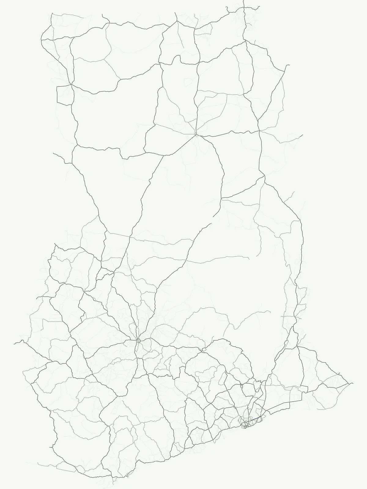
Map the distribution of national parks and protected areas, charting Ghana's unique West African landscapes.

Explore Ghana National Parks Map: Discover West Africa's Protected Areas Geography
Preview the mapped locations of Ghana's national parks and designated protected areas, understanding their geographic spread across West Africa's diverse ecosystems. Continue to the dedicated country map for a comprehensive, interactive view, allowing deeper exploration of specific park locations and their regional context.

Understand Ghana's protected area network, tracing the geographic distribution of its national parks and diverse conservation landscapes.

Ghana National Parks FAQ: Common Questions on Protected Areas and Geography
Delve into frequently asked questions about Ghana's national parks and designated protected areas, covering their essential geography, conservation context, and diverse natural landscapes. This dedicated resource helps clarify the regional spread of Ghana's protected landscapes and supports structured discovery of its most significant national parks.
Other countries

Trace the geographic spread of West African protected landscapes and compare park systems across the global atlas.

Discover National Parks and Protected Areas in Countries Beyond Ghana
After exploring Ghana's national parks, expand your protected-area discovery by browsing conservation landscapes and mapped terrain across neighboring countries in West Africa and beyond. Compare diverse ecosystems, understand regional park distributions, and gain broader context on global conservation efforts through the country-level atlas.

Nigeria's National Parks and Protected Areas: A Mapped Geographic Overview

Navigate Nigeria's national parks and protected areas with a focus on geographic discovery. This atlas provides a structured view of protected lands, highlighting their regional placement and natural landscape context. Understand the breadth of conservation areas within Nigeria, from savanna ecosystems to island berg landscapes, aiding in detailed geographical exploration and comparison.

9 parks

Ivory Coast National Parks and Protected Areas: Mapped Landscapes and Geographic Context

Ivory Coast's protected natural areas offer a window into its diverse landscapes, from gallery forests to savanna ecosystems. This geographic atlas entry provides a structured overview of national parks and other protected lands, highlighting their mapped boundaries and regional context. Explore the country's conservation network and understand the distribution of significant natural territories for informed discovery.

8 parks

Liberia National Parks and Protected Areas: Explore Geographic Distribution and Mapped Landscapes

Access a structured overview of Liberia's national parks and protected areas. This atlas-style exploration details the geographic spread and mapped boundaries of conservation lands, offering insight into the country's natural terrain and regional ecological significance. Understand where protected landscapes are situated across Liberia and their relation to broader West African geography.

8 parks

Mali National Parks and Protected Areas: Browse Protected Landscapes and Geography

Navigate Mali's protected natural areas, from the Sudanian savanna to woodland ecosystems, using this comprehensive atlas view. Explore the geographic distribution and mapped boundaries of national parks and conservation lands across this West African nation. Gain structured insight into the country's natural terrain and its importance for regional geography and habitat protection.

4 parks

Togo National Parks and Protected Areas: An Atlas Exploration of Natural Landscapes

Access a structured geographic overview of Togo's national parks and protected natural areas. This atlas-style resource details the mapped boundaries and regional spread of conservation landscapes, offering insight into the country's protected terrain. Understand how Togo's protected areas fit into the broader West African geographic context.

3 parks

Burkina Faso National Parks and Protected Areas: Mapped Geographic Distribution

Navigate the protected areas and national parks of Burkina Faso, a landlocked country in West Africa. This atlas provides a geographic lens to understand the spread of conservation landscapes, from savanna ecosystems to gallery forests. Examine mapped park boundaries and their placement within the country's regional geography for structured discovery.

3 parks

Guinea National Parks and Protected Areas Atlas: Browse Protected Landscapes

Understand the breadth of protected lands across Guinea. This atlas provides a geographic overview, detailing the mapped boundaries and regional context of national parks and other protected areas. Explore the distribution of Guinea's natural landscapes and understand their placement within the country's diverse terrain.

3 parks

Benin National Parks and Protected Areas: Geographic Overview and Map Exploration

Navigate the protected natural areas of Benin through an atlas-focused approach. This resource highlights the geographic spread of national parks and conservation landscapes, offering a clear view of the country's protected territories. Understand the regional context and mapped boundaries of Benin's natural heritage, facilitating structured discovery for those interested in conservation geography and landscape analysis.

1 park

Protected area types

Continue Exploring Ghana's Park Designations and Protected Landscape Geography

Deepen your understanding of Ghana's protected natural areas by exploring its specific park designations. This hub offers a structured pathway to investigate the classification categories that define the nation's conservation landscape, facilitating a richer atlas-based appreciation of its mapped geography and protected territories.

Ghana Park Designation Types
MoriAtlas Explorer

Continue Your Global Geographic Exploration with MoriAtlas Park Discovery

Dive deeper into the world's protected landscapes and national parks through MoriAtlas's structured atlas interface. Discover how continents and countries are organized, and how individual park geography fits into the broader map. Our platform is built for understanding the distribution and context of protected areas worldwide, facilitating your journey through global natural geography.

Global natural geography