Mori Atlas logo
National parkAlaniya National Park

Discover dramatic alpine terrain, unique biodiversity, and ancient archaeological sites.

Alaniya National Park: Glacial Mountain Protected Landscape in North Ossetia-Alania, Russia

(National Park «Alaniya»)

Alaniya National Park represents a significant protected landscape on the northern slopes of the Central Caucasus Mountains in Russia's North Ossetia-Alania region. This national park preserves a dramatic geography of heavily glaciated alpine terrain, spanning high-altitude peaks and deep river valleys, offering a unique atlas-driven perspective on the Caucasus ecoregion. Explore its remarkable biodiversity, the unique descent of the Karaugom Glacier, and the profound archaeological heritage of ancient civilizations.

Glacial landscapesMountain parksCaucasus mountainsAlpine environmentsProtected forestsEndemic species

Alaniya National Park

National park

Park overview

Structured park overview, official facts, and landscape profile for Alaniya National Park

Alaniya National Park park facts, protected area profile, and essential visitor context
Review the core facts for Alaniya National Park, including designation, size, terrain, visitor scale, habitats, and operating context in one park-focused overview.

About Alaniya National Park

Alaniya National Park occupies a central position in the Caucasus Mountains, serving as a protected corridor along the northern slope of the Central Caucasus. The park's territory encompasses the southern third of Irafsky District in North Ossetia-Alania, a republic within the Russian Federation. The landscape is characterized by dramatic vertical relief, with the park's highest point at Mount Uilpata reaching 4,646 meters while the valley floors in the north descend to 800 meters. This extreme elevation range creates distinct ecological zones within very short horizontal distances. The Urukh River, fed by the Karaugom Glacier and numerous glacial tributaries, forms the primary valley corridor through the park. The park's position on the continental divide between Europe and Asia places it at a significant biogeographical crossroads where species from Europe, Asia, the Middle East, and North Africa converge. Alaniya was established to protect both the exceptional natural values of this mountainous landscape and the significant cultural heritage embedded in its terrain, making it one of the more comprehensive protected areas in the Caucasus region.

Quick facts and research context for Alaniya National Park

Alaniya National Park covers 549 square kilometers of the Central Caucasus in North Ossetia-Alania, Russia. The protected area features over 70 rivers and streams fed by glacial meltwater, 45 small glacial lakes, and approximately 80 square kilometers of modern glaciation. The park contains the Karaugom Glacier, which descends to a lower altitude than any other glacier in the Caucasus, reaching well into the forested zone. The landscape exhibits strong altitudinal zoning, with alpine glaciers and bare rock at higher elevations, mixed forest at mid-levels covering roughly 20% of the park, and steppe grasslands in northern valleys. The region experiences a humid continental climate with long snowy winters and short cool summers, receiving 400-700mm of precipitation in lower areas and over 1,000mm in the mountains.

Park context

Deeper park guide and search-rich context for Alaniya National Park

Alaniya National Park history, landscape, wildlife, and travel context
Explore Alaniya National Park through its history, landscape character, ecosystems, wildlife, conservation priorities, cultural context, and seasonal travel timing in a structured park guide built for atlas discovery and search intent.

Why Alaniya National Park stands out

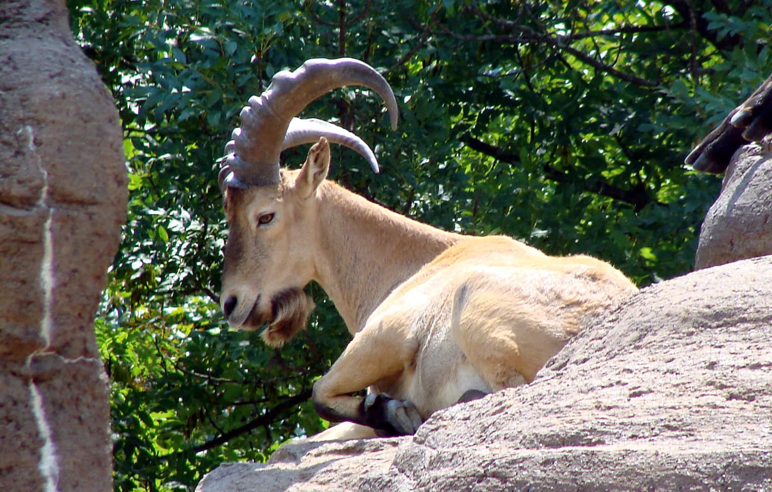
Alaniya National Park is best known for its dramatic glaciated mountain landscapes and exceptional biodiversity within the Caucasus mixed forests ecoregion. The park protects critical habitat for the near-endangered west Caucasian tur, a wild mountain goat unique to the region, as well as the bearded vulture and Caucasian grouse. The Karaugom Glacier represents a notable geological feature as the lowest-descending glacier in the Caucasus. The park also preserves extensive archaeological evidence of ancient civilizations, particularly the Bronze Age Koban culture and the medieval Alan people, after whom the protected area is named. The combination of glacial peaks, endemic biodiversity, and significant archaeological heritage makes this park distinctive within the Caucasus region.

Alaniya National Park history and protected-area timeline

The territory of Alaniya National Park has been inhabited for millennia due to its fertile valleys and strategic position along important trade routes through the Caucasus. The Bronze Age Koban culture established presence in the area from approximately 1100 BCE through 400 BCE, leaving behind archaeological evidence of skilled metal-working workshops that utilized local mineral resources. The Koban people also developed terrace agriculture, a practice that would have lasting environmental consequences for the region's soil stability. In the early first millennium, the Alan people—a warlike, nomadic Iranian-speaking tribe—settled in the region and established a powerful medieval kingdom centered in what is now the park area. The Alans, whose name ultimately connects to both the park's designation and the term Aryan, were eventually overcome by Mongols around 1300 CE and retreated into the mountainous interior, remaining relatively isolated for approximately 500 years. These medieval Alans are the ancestors of the contemporary Ossetian people. The present-day park was preceded by a protected forestry reserve established in 1958, with the full national park status achieved in 1998. Today the park operates under the management of FGBU Alania, with enforcement conducted by the Department of Forestry and Protection through patrols by car, horse, and foot.

Alaniya National Park landscape and geographic character

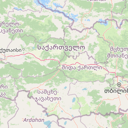
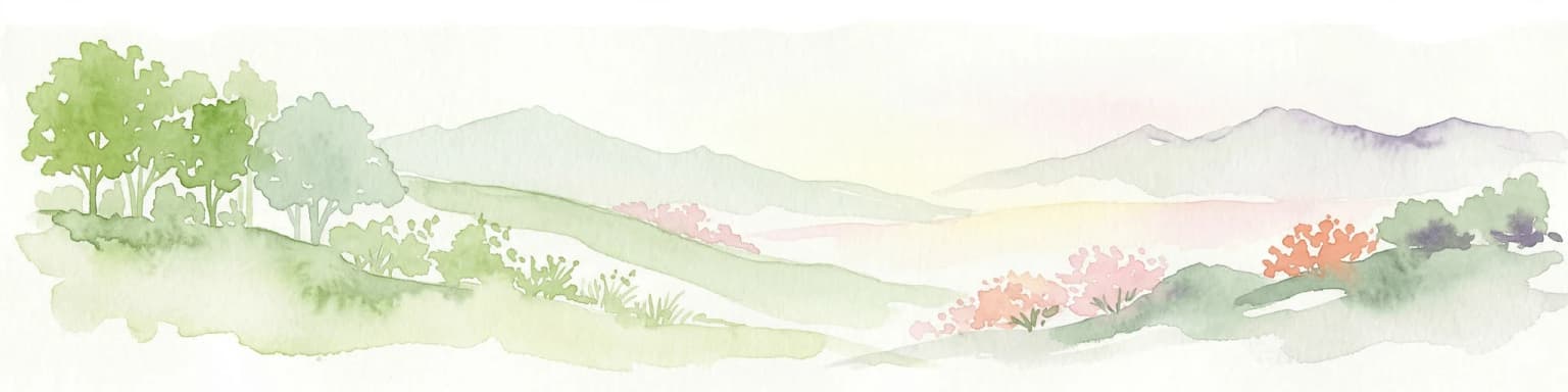
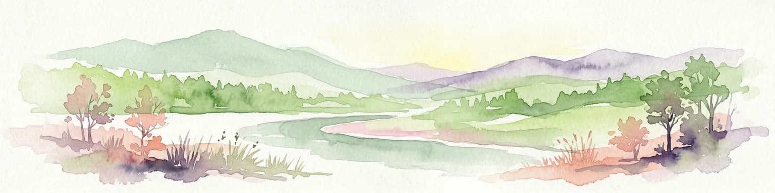
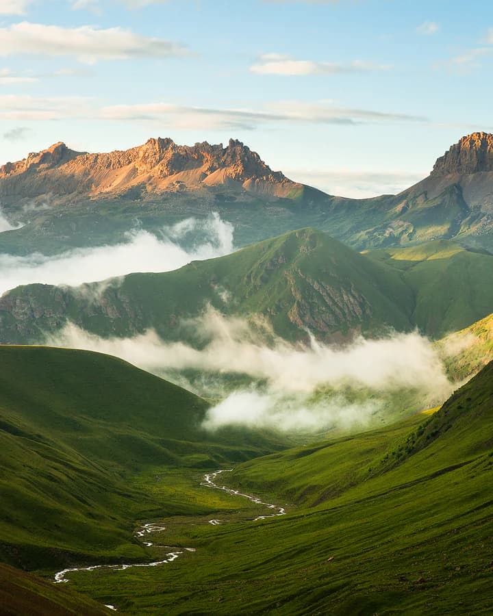
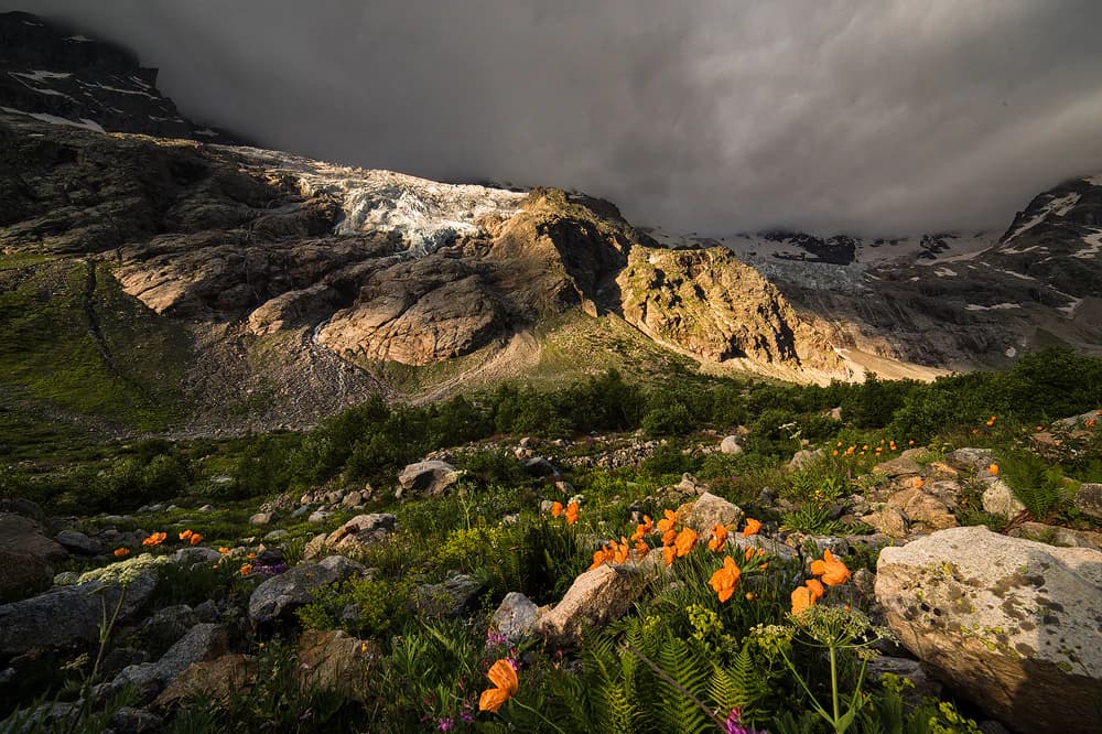
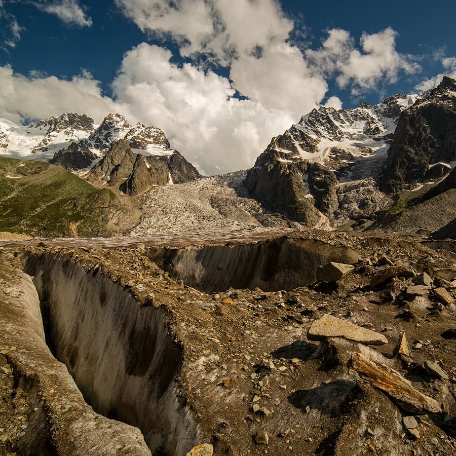
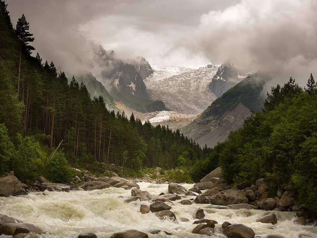
The landscape of Alaniya National Park is defined by its position in the Central Caucasus, a mountain system that forms the continental divide between Europe and Asia. The terrain is predominantly glacial and alpine, with the park's main ridge and side ridges composed of ancient granites, gneisses, and schists, while younger sedimentary rocks are concentrated in large fan-shaped folds. Altitudes span nearly 4,000 meters vertically within the park, creating dramatic transitions from ice-capped peaks to valley floors. The park contains more than 70 rivers and streams, predominantly glacial in origin, along with 45 small glacial lakes covering a total of just 11 hectares and five alpine marshes totaling 103 hectares. Glacial coverage spans approximately 80 square kilometers, with the Karaugom Glacier being particularly notable at 1.3 kilometers long and 26.6 square kilometers in area. The glacier descends from 3,440 meters at its head to 1,830 meters at its terminus—uniquely reaching lower than any other glacier in the Caucasus and extending into the forested zone. Mineral springs emerge in upper valleys, and the landscape features numerous waterfalls and forest glades on terraces. The park's southern border follows the ridgeline along the international boundary with Georgia.

Alaniya National Park ecosystems, habitats, and plant life

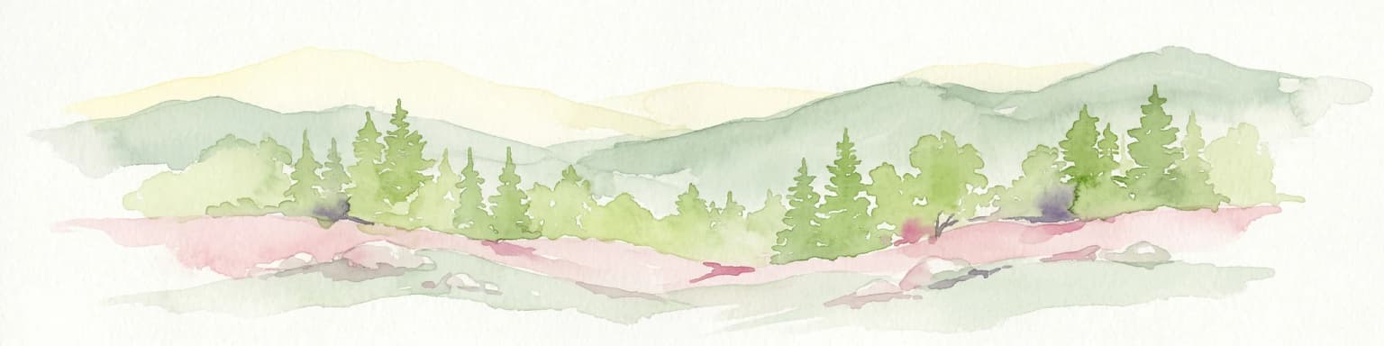
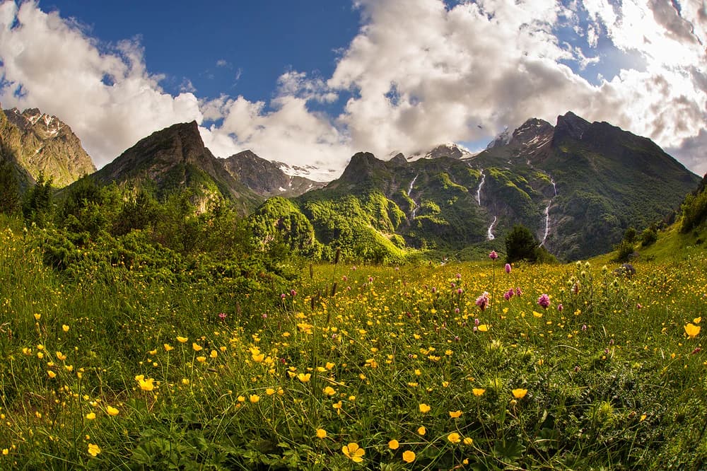
Alaniya National Park lies within the Caucasus mixed forests ecoregion, recognized by the World Wildlife Fund as one of the most biologically rich and culturally diverse regions on Earth. The park's altitudinal zoning creates distinct habitat bands: alpine and sub-alpine zones above 1,800 meters, approximately 20% forest cover at mid-level altitudes featuring pine, rhododendron, yellow birch, juniper, and wild rose, and grassland communities in northern valleys and river plains. Over 1,000 plant species have been documented within the park, with approximately 200 species endemic to the Caucasus. A particularly notable botanical feature is the Chifandzar Swamp at 2,400 meters elevation, a 3-hectare peatland dominated by sphagnum, sedge, and northern flowers including the golden buttercup. At an estimated 5,000 years old with a depth of 3 meters, this sphagnum bog represents an ancient and ecologically significant wetland. The park's position at a biological crossroads means species from multiple biogeographical realms meet and interact within this mountainous landscape.

Alaniya National Park wildlife and species highlights

The mammal fauna of Alaniya National Park reflects the typical assemblages of the Caucasus north slope forests and alpine zones, with 34 species documented. Notable among these is the west Caucasian tur, a near-threatened mountain goat species endemic to the Caucasus region. Other mammals include wolves, jackals, chamois, lynx, and foxes. The park has been designated an Important Bird and Biodiversity Area by BirdLife International due to the presence of vulnerable species including the near-threatened bearded vulture and Caucasian grouse. Bird diversity includes 116 species with 42 known to breed within the park. The only fish found in the park's streams is the brook trout. Among the five reptile species present, the vulnerable steppe viper is notably present. The park's diverse mycota includes notable species such as Rubroboletus satanas, known as Satan's mushroom, which can develop caps reaching 12 inches in diameter.

Alaniya National Park conservation status and protection priorities

Alaniya National Park was established in 1998 with a dual purpose of ecological protection and cultural heritage preservation. The park protects exceptionally high biodiversity within the Caucasus, a global biodiversity hotspot, and provides crucial habitat for near-threatened species including the west Caucasian tur and bearded vulture. Its designation as an Important Bird and Biodiversity Area by BirdLife International recognizes the global significance of its bird populations. The park preserves the Caucasus mixed forests ecoregion, described as one of Earth's most biologically rich regions. The protected area also safeguards archaeological sites from the Koban culture and medieval Alan civilization, representing thousands of years of human history. Management by FGBU Alania includes active enforcement through patrol activities by car, horse, and foot to protect both natural and cultural resources. The park faces challenges related to climate change, with recent studies documenting glacial retreat in the Central Caucasus at rates of approximately 8 meters per year.

Alaniya National Park cultural meaning and human context

The cultural heritage of Alaniya National Park spans multiple millennia and reflects the park's position on important trans-Caucasian trade routes. The Bronze Age Koban culture left evidence of sophisticated metal-working operations that utilized local mineral resources, along with terraced agricultural systems that shaped the landscape. The medieval Alan people, after whom the park is named, established a powerful kingdom in this area during the early first millennium. The name Alaniya derives from the Alans, and this linguistic connection extends to the broader term Aryan, reflecting the Iranian heritage of these medieval peoples. The contemporary Ossetian people are descended from the Alans, and present-day populations in western North Ossetia, known historically as Digoria, sometimes speak the Digor dialect. The park contains designated cultural zones with archaeological ruins, including the village of Galiat on the northeastern border. This cultural dimension adds significant historical depth to the park's natural values, creating a protected area that preserves both ecological systems and tangible evidence of human civilization in the Caucasus.

Top sights and standout views in Alaniya National Park

Alaniya National Park combines dramatic glacial mountain scenery with exceptional biodiversity and significant archaeological heritage. The Karaugom Glacier descends lower than any other glacier in the Caucasus, reaching into the forested zone—a striking example of glacial dynamics in a mountainous protected area. The park protects the near-endangered west Caucasian tur and serves as an Important Bird and Biodiversity Area for species including the bearded vulture and Caucasian grouse. Over 1,000 plant species occur here, with 200 endemic to the Caucasus, including the ancient Chifandzar Swamp peatland estimated at 5,000 years old. Archaeological evidence spans from the Bronze Age Koban culture through the medieval Alan civilization, after whom both the park and the term Aryan are named. The park offers mountain climbing opportunities ranging from simple routes to technical 6B climbs on peaks including Uilpata at 4,649 meters.

Best time to visit Alaniya National Park

The best time to visit Alaniya National Park aligns with the summer months when conditions are most favorable for exploration. The climate features long snowy winters and short cool summers, with average January temperatures at minus 5 degrees Celsius and average July temperatures at 24 degrees Celsius. Summer precipitation exceeds 1,000 millimeters in the mountains, so visitors should anticipate variable weather. Permits for the recreational zones are issued in Chikola, with additional permits required for the border security zone. Access typically involves travel to Vladikavkaz by train or plane, followed by bus or taxi to Chikola. Mountain climbing activities are most feasible during the warmer months when routes are accessible and glacial hazards are more predictable.

Park location guide

Geography guide, regional context, and park location map for Alaniya National Park

Alaniya National Park park geography, regions, and map view in Russia
Understand where Alaniya National Park sits in Russia through a broader geographic reading of the surrounding landscape, nearby location context, and its mapped position within the national park landscape.

How Alaniya National Park fits into Russia

Russia is a transcontinental nation spanning eleven time zones, bordered by fourteen countries. It is the world's largest country by area, covering 17,098,246 km². Moscow is the capital and largest city, while Saint Petersburg is the second-largest and a major cultural centre.

Wider geography shaping Alaniya National Park in Russia

Russia spans Eastern Europe and North Asia, covering 17,098,246 km². It shares land borders with fourteen countries, more than any other nation, and spans eleven time zones. The landscape includes vast plains, mountain ranges such as the Urals and Caucasus, and extensive coastlines along the Arctic Ocean, Pacific Ocean, Baltic Sea, Black Sea, and Caspian Sea.

Map view of Alaniya National Park

Use this park location map to pinpoint Alaniya National Park in Russia, understand its exact geographic position, and read its mapped placement within the surrounding landscape more clearly.

Pigeon | © OpenStreetMap contributors

Location context for Alaniya National Park

Irafsky DistrictNorth Ossetia-Alania
Park atlas

Compare Alaniya National Park's alpine environments with other glaciated mountain parks and protected landscapes across the Central Caucasus.

Discover Nearby Protected Areas: National Parks and Landscapes Beyond Alaniya National Park
Continue your journey beyond Alaniya National Park, discovering other national parks and protected areas across North Ossetia-Alania and the Central Caucasus mountains. Compare the distinct glaciated terrains, diverse alpine ecosystems, and significant cultural heritage found within these adjacent conservation landscapes.
National parkMtskheta-Mtianeti

Kazbegi National Park: Georgia's Alpine Protected Landscape & Regional Geography

Explore its dramatic terrain and protected area boundaries.

Kazbegi National Park offers a unique glimpse into the dramatic alpine geography of the Greater Caucasus. As a protected national park in the Mtskheta-Mtianeti region, it showcases rugged terrain, high-altitude ecosystems, and significant natural features. MoriAtlas provides a structured way to understand the park's physical characteristics, its mapped presence, and its place within the broader regional atlas, highlighting the distinct landscape of this Georgian protected area.

Area
1,446.17 km²
Established
1976
IUCN
II
Relief
Mountain
Watercolor painting of mountains, lake, and forest landscape with greenery and distant peaks
National parkKabardino-Balkaria

Prielbrusye National Park: Mapped Protected Landscape within Kabardino-Balkaria's Geography

Explore regional park boundaries and natural terrain context.

Prielbrusye National Park is a significant protected area featured in the MoriAtlas geographic discovery platform. This page details its identity as a national park, emphasizing its mapped boundaries and its position within the broader landscape of Kabardino-Balkaria. Users can explore the park's unique geographic context, understand its protected status, and integrate its information into a larger atlas-based understanding of regional natural territories.

Area
10,102 km²
Established
1986
IUCN
II
Relief
Mountain
Watercolor painting showing a landscape with green hills, trees, and distant mountains
National parkMtskheta-Mtianeti

Pshav-Khevsureti National Park: Protected Mountain Landscape and Regional Geography in Mtskheta-Mtianeti

Explore rugged terrain and alpine ecosystems in Georgia's Caucasus.

Pshav-Khevsureti National Park is a key protected area in Georgia's Mtskheta-Mtianeti region, recognized for its dramatic mountain terrain, deep river valleys, and alpine zones. Established as a national park, it safeguards the watersheds of major rivers, supporting significant wildlife and offering a compelling geographic context for atlas exploration. This protected landscape provides insight into the unique natural and cultural heritage of the Khevsureti region, making it a focal point for understanding Georgia's protected area network and mountainous geography.

Area
1,400.44 km²
Established
2014
IUCN
II
Relief
Mountain
National parkGeorgia

Borjomi-Kharagauli National Park: Protected Landscape Atlas of Georgia's Lesser Caucasus

Explore its unique forests, wildlife, and mountain terrain.

Delve into Borjomi-Kharagauli National Park, a significant protected area in Georgia's Lesser Caucasus region. This national park is renowned for its extensive old-growth forests, including rare Colchian fragments, and a remarkable concentration of endemic species. The park's dramatic mountainous terrain, spanning over 1,000 square kilometers, offers a rich tapestry of landscapes from deep valleys to alpine meadows, providing critical habitat for large mammals and contributing significantly to the region's biodiversity. Explore its mapped boundaries and geographic context for a deeper understanding of this vital conservation landscape.

Area
1,093 km²
Established
1995
IUCN
II
Relief
Mountain
National park

Kislovodsk National Park: A Russian National Park Defined by Protected Landscape and Geography

Explore its mapped terrain and regional natural context.

Kislovodsk National Park represents a significant protected landscape within the Russian Federation, recognized as a national park. This MoriAtlas entry focuses on its distinct geographic identity and the character of its protected territory. Discover its mapped boundaries, understand its relationship to the surrounding regional geography, and gain context for its natural landscape within a structured atlas framework. This provides a foundation for exploring its place in the broader map of protected areas.

Area
10 km²
Established
2016
IUCN
II
Watercolor illustration of a mountainous landscape with green forests, rolling hills, and distant mountains under a light sky
National parkGeorgia

Algeti National Park: Explore Georgia's Protected Coniferous Forest Landscape

Mountain terrain, protected forests, and regional geography.

Algeti National Park, located in Georgia's Kvemo Kartli region, serves as a critical protected area preserving the easternmost populations of Caucasian Spruce and Nordmann Fir. This national park features a dramatic mountainous landscape within the Trialeti Range, characterized by deeply incised valleys, flowing rivers, and extensive old-growth forest ecosystems. Users can explore the park's geographic context, mapped boundaries, and the ecological significance of its unique coniferous and mixed forests, contributing to a broader understanding of protected lands in the Caucasus.

Area
68.22 km²
Established
2007
IUCN
II
Visitors
8K annual
Watercolor illustration of a landscape with mountains, a river, trees, and grassy fields
National parkMtskheta Municipality

Tbilisi National Park: Oldest Protected Landscape in Mtskheta Municipality

Explore Georgia's oldest national park and its mapped forest terrain.

Tbilisi National Park represents Georgia's oldest protected area, nestled in the Saguramo Range within Mtskheta Municipality. This page provides an atlas-focused view of its geographic features, including mountainous terrain and deciduous forest ecosystems. Users can explore the park's mapped boundaries and understand its significance as a crucial natural landscape close to Tbilisi, contributing to the region's protected areas network.

Area
380.02 km²
Established
1973
IUCN
II
Relief
Highland
National parkGeorgia

Tusheti National Park National Park: Geographic Exploration of Caucasus Protected Landscapes

Mapped protected area boundaries and alpine terrain in Georgia.

Tusheti National Park offers a deep dive into the rugged geography of the Greater Caucasus. This national park, situated in a remote corner of Georgia, protects a dramatic landscape characterized by high mountain ridges, glacial valleys, and diverse ecosystems. The park's mapped boundaries encompass significant alpine terrain, providing essential habitat and serving as a critical area for understanding regional protected land distribution and landscape context. Explore the unique geographic identity of Tusheti National Park.

Area
1,276.43 km²
Established
2003
IUCN
II
Relief
Mountain

Common questions about visiting, size, designation, and location context for Alaniya National Park

Alaniya National Park FAQs for park facts, access, geography, and protected area context
Find quick answers about Alaniya National Park, including protected-area facts, park geography, trail and visitor context, and how the park fits into its surrounding country and regional landscape.
MoriAtlas Explorer

Continue Your Protected Areas Search Across the Global Atlas

Deepen your exploration by continuing the structured search for national parks and protected areas worldwide. Utilize the comprehensive filtering capabilities to compare different conservation landscapes and refine your understanding of global park geography. Discover more about the distribution and characteristics of protected natural areas.

Global natural geography