
Mori Atlas logo
Nature reserveAuenschutzgebiet Maggia

Mapping dynamic river processes and alluvial habitats within the Canton Ticino region

Auenschutzgebiet Maggia Nature Reserve: Alpine Floodplain Geography and Protected Landscapes

Auenschutzgebiet Maggia represents a nationally designated floodplain reserve within the Swiss Alps, capturing one of the most intact braided river corridors in the region. This protected area showcases complex hydromorphological dynamics where the Maggia River continuously reshapes its gravel banks, sand flats, and riparian woodland patches. The reserve serves as a critical reference site for natural alpine river processes, integrating varied amphibian habitats and bird protection zones across a thirteen kilometer stretch within the rugged Lepontine Alps.

floodplainalpine riverbraided riverriparian forestwetlandamphibian habitat
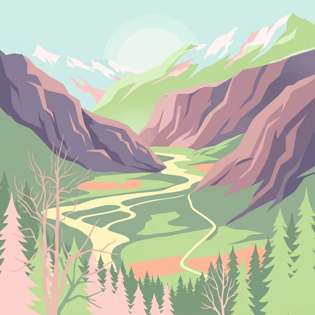
A graphic illustration showing a meandering river running through a valley between steep mountains, with a forest in the foreground.

Auenschutzgebiet Maggia

Nature reserve

Park overview

Structured park overview, official facts, and landscape profile for Auenschutzgebiet Maggia

Auenschutzgebiet Maggia park facts, protected area profile, and essential visitor context

Review the core facts for Auenschutzgebiet Maggia, including designation, size, terrain, visitor scale, habitats, and operating context in one park-focused overview.

About Auenschutzgebiet Maggia

The Auenschutzgebiet Maggia is a protected floodplain landscape of national significance in the Swiss canton of Ticino. It follows the Maggia River through the middle section of the Maggiatal, a lateral valley that cuts deep into the Lepontine Alps before the river ultimately reaches the Lago Maggiore. Spanning roughly 13 kilometers and about 406 hectares, the reserve encompasses the active riverbed, side channels, and adjacent transitional habitats that together form one of the most naturally dynamic alpine floodplain systems in Switzerland.

The protected area includes an unusually complete range of alluvial features for an alpine valley. Kiesinseln and Schotterflächen (gravel and shingle islands and flats), sandy substrates, dry meadows, Auwald riparian forest, standing pools, broader wetland zones, and extensively used agricultural fringe land all occur along the Maggia's course. Between Lodano and the village of Maggia lies the Lanca Saligin area, a particularly well developed wetland that is also listed in the Federal Inventory of Amphibian Spawning Areas of National Importance. South-east of Someo, the floodplain margin is designated as the Da l'Ovi nature reserve.

The valley itself is narrow and steeply walled, with ridges of Antigorio gneiss rising in several-hundred-meter cliffs along its flanks. Smaller torrents descending from these slopes have deposited large alluvial cones over millennia, enriching the sedimentary load of the Maggia and helping to determine its position within the valley floor. The soils of the reserve are therefore a mixture of glacial moraine material and the coarse debris supplied by the side streams, producing geologically varied substrates typical of the complex Lepontine structural history.

Although large hydropower schemes in Ticino, particularly the Maggia Kraftwerke system, divert significant amounts of water from the river, the Maggia retains enough natural flow during snowmelt and major rainfall events to periodically rework its bed. Peak discharges can exceed normal flow by more than a thousand times, a reminder of the river's capacity to remodel its own floodplain. Major historical floods, including those in 1648, 1868, 1924, and 1978, have shaped both the landscape and the human settlements that line the valley edges.

Quick facts and research context for Auenschutzgebiet Maggia

The Auenschutzgebiet Maggia lies along the Maggia River in the Maggiatal, a side valley of Ticino in southern Switzerland. The reserve covers about 406 hectares and extends approximately 13 kilometers along the river, primarily within the municipalities of Cevio and Maggia.

It has been part of the Swiss Federal Inventory of Floodplains of National Importance since 1992 and gained additional legal protection through a cantonal protection decree in 2010. The floodplain is also linked to the Important Bird Area Valle Maggia and contains the Lanca Saligin site, listed in the Federal Inventory of Amphibian Spawning Areas of National Importance.

The landscape sits between steep Lepontine Alps slopes and a relatively narrow valley floor, where glacial moraines and centuries of debris from mountain torrents have shaped the river's course toward the Lago Maggiore.

Protection and recognition

Documented conservation status, management scope, and recognition data

Auenschutzgebiet Maggia Protection Status and Designation Records

Auenschutzgebiet Maggia maintains structured records detailing official protection status and designation history within global conservation databases. Protected area data brings together verified international frameworks, administrative attributes, and geographic metadata.

Protection details

WDPA ID
148723
Park context

Deeper park guide and search-rich context for Auenschutzgebiet Maggia

Auenschutzgebiet Maggia history, landscape, wildlife, and travel context

Explore Auenschutzgebiet Maggia through its history, landscape character, ecosystems, wildlife, conservation priorities, cultural context, and seasonal travel timing in a structured park guide built for atlas discovery and search intent.

Why Auenschutzgebiet Maggia stands out

The reserve is best known for preserving one of the most intact unconstrained braided river systems in the Swiss Alps. The Maggia still shifts its channels across a broad alluvial corridor, producing a dynamic sequence of gravel islands, sandflats, and pioneer vegetation. It is also recognized for the combination of hydromorphological diversity and ecological richness: riparian woodland, pools, wet meadows, and agricultural fringe habitats occur alongside dry grasslands and freshly disturbed gravel beds, all within an alpine valley setting. The floodplain is closely associated with the Important Bird Area Valle Maggia and with priority amphibian habitat, reinforcing its status as a key reference site for natural river ecology in the Alps.
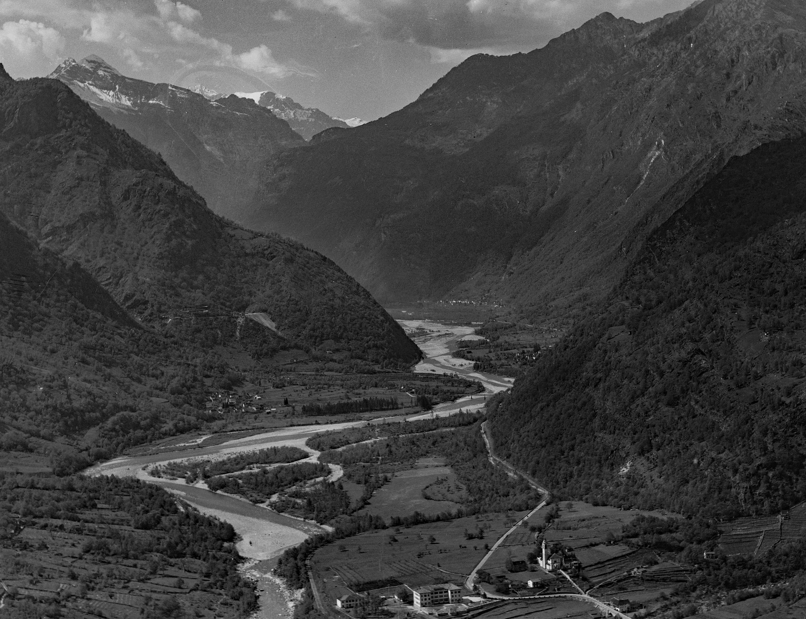
A black and white aerial photograph of the Maggia Valley in Switzerland, featuring a wide river winding through a deep mountain valley, with agricultural fields and small structures in the foreground.
A historical aerial view of the Maggia Valley taken in 1954, showing the meandering river course and surrounding alpine terrain.

Auenschutzgebiet Maggia history and protected-area timeline

The Auenschutzgebiet Maggia was formally entered into the Federal Inventory of Floodplains of National Importance in 1992, recognizing the exceptional ecological value of the Maggia floodplain within the Swiss alpine context. This designation placed the area under a coordinated national framework for the protection of dynamic river landscapes.

In 2010, the canton of Ticino issued a dedicated protection decree for the Maggia floodplains, adding binding cantonal regulation on top of the federal inventory status. The decree provides a stronger legal basis for managing land use, infrastructure, and interventions along the protected stretch. Local partners, including the Nature Section of the canton of Ticino, the municipality of Maggia, and the Centro Natura Vellemaggia, have supported the reserve's management and public outreach.

The surrounding landscape carries a long history of human adjustment to the Maggia's floods and sediment regime. Settlements and infrastructure have repeatedly been threatened by extreme high-water events over the centuries, with major flood damage documented in 1648, 1868, 1924, and 1978. A 2024 flood further damaged the historic bridge near Visletto, illustrating that flood risk and natural river dynamics remain part of the living context for the reserve.

Auenschutzgebiet Maggia landscape and geographic character

The Maggiatal is a steep-sided alpine valley cut into the Lepontine Alps, dominated by Antigorio gneiss that is exposed in cliffs rising several hundred meters along the flanks. The valley floor is narrow, but in a few sections the riverine lowland broadens to more than half a kilometer, opening up space for the floodplain reserve. Within these wider reaches, the Maggia meanders and occasionally braids across a shifting mosaic of gravel islands, sandy flats, and older vegetated surfaces.

Mountain torrents descend sharply from the valley sides, and one of the most significant contributors within the reserve is the Rovana, the second-largest tributary of the Maggia. Over thousands of years, these side streams built large debris cones that influenced the position and gradient of the main river, contributing sediment that ultimately produced a substantial delta where the Maggia enters the Lago Maggiore.

The soils throughout the reserve mix glacial moraine deposits with the bedload delivered by tributaries, producing heterogeneous substrates that include gneiss, mica schist, quartzite, calcite marble, amphibolite, and other rock types. Where the Maggia is constrained, channels are tight and confined; where the valley opens, the river can spread across a wide active bed, illustrating a textbook example of an alpine floodplain that still responds to its own hydrology, with all the associated risks and benefits for nearby villages.
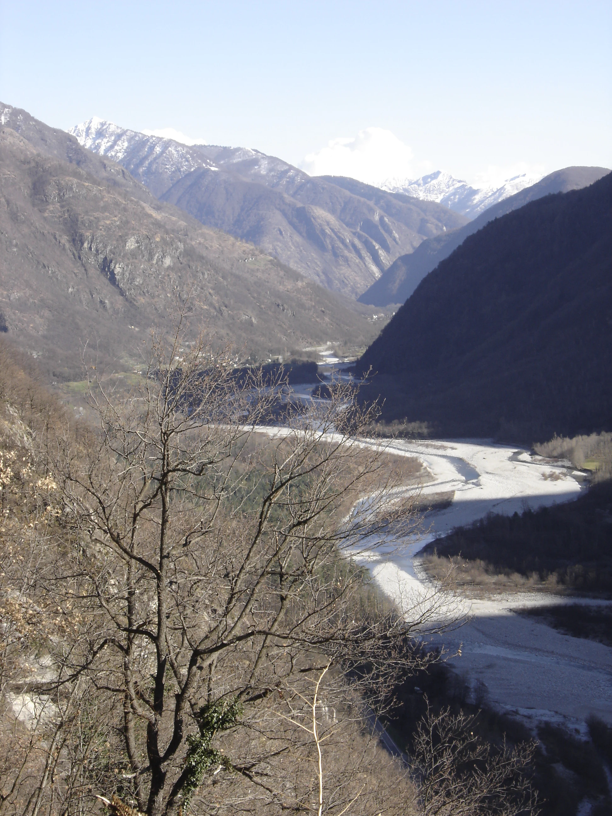
A high-angle scenic view looking down into the Maggia Valley, featuring the winding gravel-bed Maggia River surrounded by steep, dark mountains with snow-capped peaks in the far distance.
The Maggia River flowing through the Maggia Valley in Switzerland.

Auenschutzgebiet Maggia ecosystems, habitats, and plant life

Ecologically, the Auenschutzgebiet Maggia is defined by the gradient between active gravel bars and established terrestrial habitats. Pionier-Pflanzengemeinschaften (pioneer plant communities) colonize freshly disturbed shingle and sand, while longer-stable surfaces support Auwald riparian woodland, dry meadows, and humid grasslands. Pools and side channels add aquatic and semi-aquatic habitats, and a network of extensively managed farmland at the edges connects the natural core to traditional agricultural land.

A major hotspot within the reserve is the expanded Feuchtgebiet (wetland) of the Lanca Saligin between Lodano and Maggia village, recognized under the Federal Inventory of Amphibian Spawning Areas of National Importance. This wetland enlarges the spectrum of habitats available for amphibians, aquatic invertebrates, and wetland plants, while dry grasslands and open gravel provide contrasting microhabitats. Near Someo, the small Da l'Ovi reserve protects additional sensitive margin habitat.

Along with the surrounding mountain slopes of the eastern Maggiatal, the floodplain forms part of the Important Bird Area Valle Maggia, reflecting the significance of the valley as a continuous ecological unit rather than an isolated river corridor. The combination of dynamic disturbance, hydrological variation, and habitat diversity makes the area an important reference for natural river ecology across the Alps.

Auenschutzgebiet Maggia wildlife and species highlights

The floodplain's wildlife depends on the interplay between shifting gravel, standing water, riparian woodland, and dry meadows. The mosaic of habitats supports diverse breeding and feeding conditions for birds linked to the Valle Maggia Important Bird Area, including species typically associated with braided river systems, riverine forest, and open alpine valley margins.

The Lanca Saligin wetland is particularly important for amphibians and is formally recognized through the Federal Inventory of Amphibian Spawning Areas. Pools, slow side channels, and humid depressions offer spawning and rearing habitat, while the wider mosaic of forest, meadow, and gravel provides foraging and shelter for associated fauna.

Wild ungulates and other larger mammals using the broader Maggiatal landscape also benefit from the connectivity between the protected riverbed and adjacent mountain slopes, while the dynamic flow regime supports fish populations adapted to alpine river conditions. A local nature trail maintained by the cantonal Nature Section, the municipality of Maggia, and Centro Natura Vellemaggia helps interpret the river's flora and fauna for visitors.

Auenschutzgebiet Maggia conservation status and protection priorities

The Auenschutzgebiet Maggia is significant for conservation because it preserves a rare example of an essentially unconstrained alpine braided river system in Switzerland. Its designation within the Federal Inventory of Floodplains of National Importance in 1992 recognized both its ecological value and the importance of maintaining natural flow dynamics, sedimentation, and vegetation succession in the floodplain.

The 2010 cantonal protection decree strengthened the legal basis for safeguarding the area against interventions that would undermine its ecological function, including inappropriate construction, gravel extraction, or artificial regulation of the river. The reserve is closely linked to the Valle Maggia Important Bird Area and to the amphibian priorities around Lanca Saligin, meaning the conservation framework operates across multiple biodiversity policies.

Conservation challenges include the lasting effects of large hydropower diversions on natural discharge, the cumulative sediment disturbance from quarrying operations near Riveo, ongoing flood risk for settlements, and the long-term pressures of climate change on alpine hydrology. Managing these pressures while preserving the floodplain's natural dynamics is central to the reserve's conservation significance.

Auenschutzgebiet Maggia cultural meaning and human context

The Maggiatal has long been inhabited by Alpine communities whose villages sit at the edge of the riverine lowland. Settlements such as Cevio, Someo, Visletto, Riveo, and Lodano have historically adapted to the Maggia's flood rhythms, with major flood events in 1648, 1868, 1924, 1978, and 2024 leaving lasting marks on local infrastructure and land use. The historical arc bridge near Visletto, built around 1830, and the iron truss bridge of the former Maggiatalbahn are tangible reminders of the valley's transport heritage, while two long pedestrian suspension bridges reflect the modern relationship between communities and the active river.

Local institutions, including the municipality of Maggia and the Centro Natura Vellemaggia, play an active role in interpreting the floodplain. A dedicated nature trail developed with the cantonal Nature Section links the valley's cultural landscape with its ecological significance, framing the river not just as a natural system but as a historical and educational resource for the local population.

Top sights and standout views in Auenschutzgebiet Maggia

Spanning roughly 13 kilometers along the Maggia River, the reserve holds one of the most intact braided floodplain systems still found in the Swiss Alps. Its combination of shifting gravel islands, riparian forest, and pools creates an unusually complete representation of alpine alluvial processes within a single protected corridor.

Recognition under the Federal Inventory of Floodplains of National Importance, the integrated Important Bird Area Valle Maggia, and the Federal Inventory of Amphibian Spawning Areas via the Lanca Saligin wetland gives the site a layered national and international significance. The local nature trail and partnership-based management further embed the reserve in regional landscape identity.

Monthly climate preview

Long term representative measurements detailing monthly temperature and precipitation patterns

Auenschutzgebiet Maggia Climate Normals and Annual Temperature Rhythm

Auenschutzgebiet Maggia experiences measured long term temperature variations alongside recorded monthly precipitation rates across the representative coordinate. Examining the complete twelve month profile provides detailed climate normals for comparative geographic research.
Annual mean2 °C
-8 °C12 °C
Jan-8°
Feb-8°
Mar-4°
Apr
May
Jun10°
Jul12°
Aug12°
Sep
Oct
Nov-3°
Dec-7°
Warmest month
July

12.1 °C

Coolest month
January

-8.3 °C

Wettest month
June

5.5 mm/day

Driest month
February

2.2 mm/day

Park location guide

Geography guide, regional context, and park location map for Auenschutzgebiet Maggia

Auenschutzgebiet Maggia park geography, regions, and map view in Switzerland

Understand where Auenschutzgebiet Maggia sits in Switzerland through a broader geographic reading of the surrounding landscape, nearby location context, and its mapped position within the national park landscape.

How Auenschutzgebiet Maggia fits into Switzerland

Switzerland is a landlocked federal republic in Central Europe comprising 26 cantons, with Bern as the federal city and Zurich as the largest city. The country features the Swiss Alps, Swiss Plateau, and Jura Mountains, with German, French, Italian, and Romansh as official languages. It is noted for its political neutrality, direct democracy traditions, and strong economy.

Wider geography shaping Auenschutzgebiet Maggia in Switzerland

Switzerland is located in Central Europe at the intersection of Western and Southern Europe. It is bordered by Germany to the north, France to the west, Austria and Liechtenstein to the east, and Italy to the south. The country is geographically divided among the Swiss Alps (covering most of the territory), the Swiss Plateau (where most of the population resides), and the Jura Mountains. Switzerland is landlocked.

Map view of Auenschutzgebiet Maggia

Use this park location map to pinpoint Auenschutzgebiet Maggia in Switzerland, understand its exact geographic position, and read its mapped placement within the surrounding landscape more clearly.

Pigeon | © OpenStreetMap contributors

Location context for Auenschutzgebiet Maggia

Canton Ticino

Visualizing braided river habitats and alpine floodplain environments

Auenschutzgebiet Maggia Photos and Landscape Scenery Exploration

Visual documentation reveals the shifting gravel islands, riparian woodlands, and unconstrained river channels that define the protected landscape. Detailed photography illustrates the natural hydrology and ecological habitats within the alpine valley corridor.

A black and white aerial photograph of the Maggia Valley in Switzerland, featuring a wide river winding through a deep mountain valley, with agricultural fields and small structures in the foreground.

A first-person perspective view walking across a narrow metal suspension bridge, with sparse forest and a rocky mountainside in the background.

A high-angle scenic view looking down into the Maggia Valley, featuring the winding gravel-bed Maggia River surrounded by steep, dark mountains with snow-capped peaks in the far distance.

Park atlas

Compare protected areas across the Lepontine Alps and adjacent river valleys

Explore Other Parks Near Auenschutzgebiet Maggia And Surrounding Alpine Reserves

Visitors exploring Auenschutzgebiet Maggia can continue browsing protected landscapes throughout the surrounding mountain region. Expanding the search reveals related alpine reserves and river valley habitats for comparative geographic analysis.
Watercolor illustration showing green mountains, forests, a river, and snow-capped peaks in the distance
National parkPiedmont
About 22 km away#1 closest

Southwest

Val Grande National Park: National Park Protected Landscape in Piedmont

Explore its mapped boundaries and regional geographic context.

Val Grande National Park represents a key protected landscape within the Piedmont region of northwest Italy. This canonical page offers detailed insights into the park's designated status as a national park, its specific geographic placement, and its mapped protected boundaries. Users can navigate its atlas-level details to understand its role in the regional geography and conservation landscape, providing a structured foundation for further discovery of Italy's natural protected areas.

Area
170.21 km²
Established
1992
IUCN
II
Relief
Mountain
A soft watercolor illustration of a green alpine valley with distant mountains in light yellow and purple tones.
Regional parkCanton of Graubünden
About 32 km away#2 closest

Naturpark Calancatal: Protected Alpine Valleys and Mountain Geography in Graubünden

Mapping regional landscapes and mountain terrain in Southern Switzerland

Spanning 13,900 hectares, Naturpark Calancatal protects a near-entire alpine side valley defined by the Calancasca stream. From high glacier-fed headwaters to Mediterranean-influenced gorges, the park offers a unique look at the diverse mountain terrain, alpine pastures, and protected forests within the Canton of Graubünden.

Area
139.21 km²
Established
2024
Relief
Mountain
Climate
Alpine
A watercolor illustration of a soft, rolling alpine landscape with a winding path and distant mountain peaks against a pale yellow sky.
Regional parkValais
About 37 km away#3 closest

West

Landschaftspark Binntal: Alpine Geography and Regional Protected Area in Valais, Switzerland

Mapping deep mountain valleys and glacial alpine terrain

Landschaftspark Binntal serves as a vital protected area in the Valais Alps, showcasing a vertical sequence of ecosystems from river gorges to 3000 meter peaks. The park preserves a living cultural landscape alongside significant mineralogical heritage, offering a detailed view into the high-altitude geography and remote valleys that define this distinctive corner of the Swiss mountain landscape.

Area
180 km²
Established
2008
Relief
Mountain
Climate
Alpine
Watercolor painting of a green landscape with rolling hills, meadows, and a water body in the foreground against a light background.
Protected areaSwitzerland
About 37 km away#4 closest

Northwest

Rhonegletschervorfeld Protected Area: Alpine Glacier Geography and Mapping

Proglacial landscape and glacial history in the Swiss Alps.

The Rhonegletschervorfeld provides an unparalleled view into the geomorphology of the Swiss Alps, showcasing a continuous record of ice loss through moraines, exposed bedrock, and emerging meltwater systems. Situated near the Furka Pass, this protected area serves as an essential reference for glaciology, offering a clear visual timeline of glacier retreat that has shaped modern alpine tourism and climate science. Explore the mapped terrain where the Rhone River headwaters emerge from the retreating ice.

Area
13.58 km²
Relief
Mountain
Climate
Alpine
Access
Easy access
A soft watercolor painting of a panoramic landscape featuring a marshy fen area in the foreground with distant mountain ranges in the background, rendered in pastel greens, purples, and yellows.
Nature reserveBern
About 41 km away#5 closest

Northwest

Chessibidmer Nature Reserve: Glacial Granite and Protected Alpine Moorland Landscapes

Protected alpine bog and granite terrace in the Bernese Oberland

Chessibidmer offers a detailed look at a nationally significant flat bog and moorland landscape situated above the upper Aare valley in the Bernese Oberland. The area provides an exceptional map of glacial geomorphology, featuring granite domes, rock-bound tarns, and successional peatlands that sit as a protected mosaic within the surrounding high-alpine terrain of the Swiss Alps.

Area
0.5 km²
Established
1998
IUCN
IV
Relief
Mountain
Watercolor painting of soft, rolling alpine terrain, green vegetation, and distant purple-toned mountains under a pale sky.
Nature reserveBern
About 41 km away#6 closest

Northwest

Naturschutzgebiet Mederlouwenen: Alpine Moor and Protected Glacial Terrain in the Bernese Oberland

A high-elevation nature reserve featuring rare flat-moor vegetation and peat-forming bogs.

Naturschutzgebiet Mederlouwenen occupies a distinctive series of glacial granite terraces in the Bernese Oberland, where high-altitude slope bogs and relict conifer forests create a vital refuge for rare alpine flora. This protected area stands as a primary example of Swiss mountain ecology, blending ancient geological history with the fragile, moisture-dependent ecosystems found at the head of the Aare valley.

Area
0.053 km²
Established
2004
IUCN
IV
Relief
Mountain
A horizontal watercolor painting depicting a soft-focus mountain landscape with green rolling hills in the foreground and pale yellow mountain silhouettes in the distance.
Protected landscapeGraubünden
About 42 km away#7 closest

Northeast

Greina, Piz Medel: Exploring the Geography of a Swiss Protected Landscape

High-alpine plateau, glacier forelands, and mountain peaks.

The Greina, Piz Medel protected area is defined by the contrast between its broad, level plateau and the surrounding ring of summits in the Adula Alps. This high-altitude region holds nationally important floodplains, diverse dry meadows, and active glacial basins that cross the European watershed, providing a profound study in alpine terrain and environmental conservation.

Area
150 km²
Established
1996
Relief
Mountain
Climate
Alpine
A minimalist watercolor painting depicting a winding river through a flat alpine valley surrounded by gentle mountain ridges.
Nature reserveGraubünden
About 46 km away#8 closest

Northeast

Aue Plaun la Greina Nature Reserve: Geography and Mapped Landscape Context

A protected high-alpine floodplain in the Swiss canton of Graubünden.

Aue Plaun la Greina sits within a high plateau between three major Adula mountain massifs, defined by its braided river channels, glacial moraines, and sensitive alpine mire habitats. The reserve protects a unique ecosystem that survives in a harsh, tundra-like climate at the heart of the European watershed, representing a major achievement in regional landscape preservation and geological study.

Area
0.39 km²
Established
1992
IUCN
IV
Relief
Mountain

Common questions about visiting, size, designation, and location context for Auenschutzgebiet Maggia

Auenschutzgebiet Maggia FAQs for park facts, access, geography, and protected area context

Find quick answers about Auenschutzgebiet Maggia, including protected-area facts, park geography, trail and visitor context, and how the park fits into its surrounding country and regional landscape.
MoriAtlas Explorer

Continue Your Protected Areas Search Across the Global Atlas

Deepen your exploration by continuing the structured search for national parks and protected areas worldwide. Utilize the comprehensive filtering capabilities to compare different conservation landscapes and refine your understanding of global park geography. Discover more about the distribution and characteristics of protected natural areas.

Global natural geography