Mori Atlas logo
National parkBalaton Uplands National Park

Discover mapped boundaries and the unique geology of this Hungarian national park.

Balaton Uplands National Park: Volcanic Landscape & Protected Terrain Atlas

(Balaton-felvidéki Nemzeti Park)

Balaton Uplands National Park protects a remarkable volcanic landscape in western Hungary, characterized by ancient basalt 'witness mountains' that rise dramatically from the surrounding terrain. This national park, encompassing diverse geography from conical peaks to wetlands and karst formations, offers a unique atlas-level view of Quaternary geological activity. Explore the mapped protected boundaries of this significant Hungarian landscape and understand its place within the broader regional geography through structured data and detailed visual context.

volcanic landscapeLake Balatonbasalt formationswetlandsRamsar siteprotected landscape

Balaton Uplands National Park

National park

Park overview

Structured park overview, official facts, and landscape profile for Balaton Uplands National Park

Balaton Uplands National Park park facts, protected area profile, and essential visitor context
Review the core facts for Balaton Uplands National Park, including designation, size, terrain, visitor scale, habitats, and operating context in one park-focused overview.

About Balaton Uplands National Park

Balaton Uplands National Park protects a remarkable volcanic landscape in western Hungary that represents one of the country's most geologically distinctive and ecologically diverse protected areas. The park encompasses the rolling uplands and volcanic formations that rise along the northern shores of Lake Balaton, extending from the lake's edge northward toward the Rába plain and from the Marcal valley to the Kis-Balaton wetland area in the southwest.

The geological foundation of the park is shaped by Quaternary volcanic activity that produced widespread basalt flows and volcanic cones across the region. Over time, erosive forces have stripped away softer materials, leaving behind the characteristic 'witness mountains' - isolated basalt peaks that now stand as iconic landmarks. These include the celebrated Badacsony, Szent György-hegy, Gulács, and Tóti Hills, among others. The volcanic bedrock has created specialized habitats supporting rare plant species adapted to basalt rock environments.

The park's six constituent landscape protection areas each possess distinct character. The Tihany Peninsula contains the oldest protected area in Hungary, established in 1952, featuring volcanic craters, geyser cones, and unique alkaline meadow habitats. The Káli Basin protects a landscape of basalt cones and 'stone seas' - boulder-strewn slopes formed from collapsed lava flows. The Keszthely Mountains are built on dolomite substrate supporting specialized flora and fauna. The Pécselyi Basin preserves traditional agricultural landscapes alongside natural values. The Kis-Balaton area protects significant wetland habitat critical for waterfowl.

The park's management authority, the Balaton Uplands National Park Directorate, is based in Csopak and works to balance conservation with sustainable use of the region's natural and cultural resources.

Quick facts and research context for Balaton Uplands National Park

Balaton Uplands National Park spans roughly 57,000 hectares along the northern edge of Lake Balaton in western Hungary. The park was established in 1997 by combining six landscape protection areas that had accumulated protection status over several decades. The park headquarters are located in Csopak. The landscape protection areas within the park include the Badacsonyi, Káli Basin, Keszthelyi, Kis-Balaton, Pécselyi Basin, and Tihany Peninsula areas. The Tihany Peninsula holds distinction as the first landscape protection area established in Hungary in 1952.

Park context

Deeper park guide and search-rich context for Balaton Uplands National Park

Balaton Uplands National Park history, landscape, wildlife, and travel context
Explore Balaton Uplands National Park through its history, landscape character, ecosystems, wildlife, conservation priorities, cultural context, and seasonal travel timing in a structured park guide built for atlas discovery and search intent.

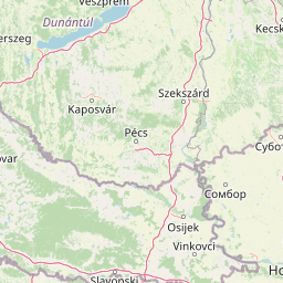
Why Balaton Uplands National Park stands out

The park is best known for its distinctive volcanic landscape of basalt 'witness mountains' - isolated volcanic peaks that stand as testament to ancient volcanic activity and subsequent erosion. The Badacsony area, with its dramatic basalt cliffs and stone seas, has long been celebrated as one of Hungary's most beautiful landscapes. The Kis-Balaton wetland area is renowned internationally as a bird habitat and Ramsar site. The Tihany Peninsula, Hungary's first protected landscape area, contains unique geological features including geyser cones and crater lakes formed from volcanic activity.

Balaton Uplands National Park history and protected-area timeline

Balaton Uplands National Park was established in 1997, representing the culmination of decades of conservation effort across the Balaton Uplands region. The park was created by combining six previously separate landscape protection areas that had accumulated protected status over nearly five decades.

The earliest protected area within the current park boundaries was the Tihany Peninsula, designated as Hungary's first landscape protection area in 1952. This pioneering protection was supported by extensive research conducted by the Hungarian Balaton Limnological Research Institute, founded in Tihany in 1927, which produced hundreds of publications on the peninsula's geology, fauna, and flora.

The Badacsonyi Landscape Protection Area was established in 1965 as Hungary's second landscape protection area, with the Szentgyörgy-hegy area added in 1978. The Káli Basin received protection in 1984, followed by the Keszthelyi area in the same year. The Kis-Balaton area, recognized internationally for its birdlife, was designated as a landscape protection area in 1986.

A significant chapter in the region's conservation history involves the struggle to halt basalt quarrying that had scarred the volcanic hills since 1903. Through the efforts of conservationists including playwright Ferenc Herczeg, who lobbied in parliament during the 1920s, and sustained public campaigns, the quarries were gradually closed - the last operations ending in 1964, while quarries on Gulács and Tóti Hills were abandoned at the end of World War II and early 1950s.

Balaton Uplands National Park landscape and geographic character

The park protects a distinctive volcanic landscape characterized by isolated basalt peaks known as 'witness mountains' that rise abruptly from the surrounding terrain. These formations are the remnants of volcanic activity during the Quaternary period, where erosion has stripped away surrounding softer material leaving behind resistant basalt cores.

The most famous of these volcanic cones is Badacsony, a dramatic peak rising from the lake shore with steep basalt cliffs and extensive stone seas - accumulations of basalt boulders formed from the breakup of lava flows. Similar formations occur on Szent György-hegy, Csobánc, and other peaks throughout the park.

The landscape also includes karstic elements, particularly in the Pécselyi Basin where karren fields and other limestone dissolution features occur alongside the volcanic terrain. The Keszthelyi Plateau is built on dolomite bedrock, featuring distinctive rock pillars, sinkholes, and cave entrances.

The Tihany Peninsula contains unique volcanic features including geyser cones - raised mounds formed by mineral deposits from hot spring activity - and two crater lakes known as the Inner and Outer Lakes. The Kis-Balaton area in the west represents a flat wetland landscape quite different from the volcanic hills, where peat soils and alluvial deposits create marshland habitat.

Balaton Uplands National Park ecosystems, habitats, and plant life

The park supports a mosaic of habitats reflecting its geological diversity. Volcanic rock habitats host specialized plant communities including rare species such as the rock rose (Halacsya.sendtneri) and Hungarian iris. The basalt stone seas provide habitat for thermophilous species adapted to the hot, dry conditions created by the dark rock surfaces.

The park's meadows include significant areas of alkaline grassland and steppe-like vegetation on south-facing slopes. These dry grassland habitats support characteristic species including spring adonis, pasque flower, and various orchids. The Tihany Peninsula is particularly noted for its diverse steppe flora.

Forests within the park include oak-hornbeam communities on lower slopes, beech forests on cooler northern aspects, and scree woodlands in rocky areas. The Tátika area contains a primeval beech forest that has been protected since 1953 and now functions as a forest reserve.

The wetland habitats of Kis-Balaton represent one of the most important waterbird areas in Hungary, with extensive reed beds, marshes, and shallow lakes providing breeding and feeding habitat for diverse waterfowl and marsh birds.

Balaton Uplands National Park wildlife and species highlights

The Kis-Balaton wetland area is internationally recognized for its birdlife, providing critical habitat for waterfowl and marsh birds. The area has been designated a Ramsar site since 1979, recognizing its international importance as a waterbird habitat. Significant species include the great egret, purple heron, and various duck species.

The volcanic hills provide nesting habitat for species including the raven, red-footed falcon, and wheatear. The diverse forest communities support woodpeckers including the black woodpecker, green woodpecker, and lesser spotted woodpecker, as well as the hoopoe and various tit species.

The mammal fauna includes species adapted to the diverse habitats, with the marten and weasel families being commonly observed. The beech forests of the Tátika area provide habitat for species including the Alpine longhorn beetle, blue pigeon, and the greater mouse-eared bat.

Balaton Uplands National Park conservation status and protection priorities

Balaton Uplands National Park represents significant conservation value across multiple dimensions. The park protects representative examples of Hungary's volcanic landscape heritage, preserving geological processes and formations that are unique within the country. The Kis-Balaton wetland holds international recognition under the Ramsar Convention, acknowledging its significance as waterfowl habitat of international importance.

The park's establishment in 1997 represented a recognition that the individual landscape protection areas, while valuable, needed coordinated management to address broader conservation challenges. The consolidation enabled integrated management of ecological corridors, migratory bird routes, and watershed systems that crossed individual protected area boundaries.

The protection of the Tihany Peninsula in 1952 marked a milestone in Hungarian conservation history, establishing the concept of landscape-level protection rather than merely protecting individual notable features. This pioneering approach influenced subsequent conservation policy in Hungary.

Conservation challenges include managing visitor pressure around the popular Badacsony area, maintaining traditional agricultural practices that sustain meadow habitats, and addressing the ecological needs of species that require connectivity between different habitat patches within and beyond the park boundaries.

Balaton Uplands National Park cultural meaning and human context

The Balaton Uplands region has been inhabited for millennia, and the park contains evidence of human interaction with the landscape spanning archaeological periods. The traditional agricultural landscape of the Pécselyi Basin, with its historic wine cellars and farming practices, reflects centuries of rural land use that has shaped the current cultural landscape.

The Tihany Peninsula has particular historical significance, with the Tihany Abbey founded in the 12th century and the peninsula serving as a center of religious and cultural activity. The region's wine production tradition is deeply connected to the volcanic soils of the slopes.

The Badacsony area has long held cultural significance in Hungarian arts and literature, celebrated by poets, novelists, and painters as an iconic Hungarian landscape. This cultural appreciation contributed to the movement to protect the area from quarrying, with playwright Ferenc Herczeg's parliamentary efforts in the 1920s representing an early example of environmental advocacy in Hungary.

Top sights and standout views in Balaton Uplands National Park

The park's most distinctive features include the volcanic 'witness mountains' with their dramatic basalt cliffs and stone seas, particularly around Badacsony. The Kis-Balaton wetland provides exceptional birdwatching opportunities in a European context. The Tihany Peninsula represents the birthplace of Hungarian landscape conservation and contains unique geological features. The diverse mosaic of habitats supports over 80 protected plant species, including orchids. The park preserves traditional cultural landscapes where historic wine cellars and agricultural practices continue.

Best time to visit Balaton Uplands National Park

The park can be visited throughout the year, with each season offering distinct experiences. Spring brings wildflower displays across the meadows and the return of migratory birds to the Kis-Balaton wetlands. Summer offers the warmest conditions for exploring the volcanic hills and the opportunity to experience the lake-shore location. Autumn provides colorful foliage in the forests and the traditional wine harvest activities in the region. Winter can be cold but offers a different perspective on the landscape with fewer visitors. The lake moderates local climate, making the area suitable for visitors seeking to combine park exploration with the broader Lake Balaton experience.

Park location guide

Geography guide, regional context, and park location map for Balaton Uplands National Park

Balaton Uplands National Park park geography, regions, and map view in Hungary
Understand where Balaton Uplands National Park sits in Hungary through a broader geographic reading of the surrounding landscape, nearby location context, and its mapped position within the national park landscape.

How Balaton Uplands National Park fits into Hungary

Hungary is a landlocked Central European country occupying the Carpathian Basin, also known as the Pannonian Basin. It borders Slovakia, Ukraine, Romania, Serbia, Croatia, Slovenia, and Austria. Budapest serves as both the capital and largest city. The population is predominantly ethnic Hungarians (Magyars), with Hungarian as the official language.

Wider geography shaping Balaton Uplands National Park in Hungary

Hungary occupies the Carpathian Basin in Central Europe, a large lowland plain surrounded by the Carpathian Mountains. It is bordered by Slovakia to the north, Ukraine to the northeast, Romania to the east and southeast, Serbia to the south, Croatia and Slovenia to the southwest, and Austria to the west. The Danube River flows through the country, providing its primary drainage.

Map view of Balaton Uplands National Park

Use this park location map to pinpoint Balaton Uplands National Park in Hungary, understand its exact geographic position, and read its mapped placement within the surrounding landscape more clearly.

Pigeon | © OpenStreetMap contributors

Location context for Balaton Uplands National Park

Veszprém County
Park atlas

Map the diverse protected landscapes and compare their geological formations across the broader Hungarian region.

Explore Other National Parks and Protected Areas Around Balaton Uplands
Browse a curated selection of national parks and other protected areas geographically adjacent or ecologically relevant to Balaton Uplands National Park in Hungary. This allows for direct comparison of diverse landscapes, tracing the regional patterns of volcanic uplands, important wetlands, and karstic terrains across the country.
Watercolor illustration of a river landscape with grassy banks, trees, and hills in the background
National park

Danube-Drava National Park: Hungary's Premier Riverine Protected Area and Floodplain Landscape

Mapping the protected river corridors and vital wetland ecosystems

Danube-Drava National Park showcases the dynamic geography of Central Europe's largest riverine protected area, integrating floodplains, riparian woodlands, and extensive marshes along the Danube and Drava rivers. As a National Park and a Ramsar site, it protects crucial habitats like the Gemenc forest and supports exceptional biodiversity, including significant populations of white-tailed eagles. This page provides a structured overview of its mapped boundaries and ecological importance within the European protected lands atlas.

Area
490 km²
Established
1996
Relief
Lowland
Climate
Temperate
National parkPest County

Danube-Ipoly National Park: Protected Landscape and Geographic Atlas

Mapping Hungary's diverse terrain and protected natural areas.

Delve into Danube-Ipoly National Park, a significant protected area renowned for its extraordinary ecological diversity. This page explores the park's distinct landscapes, from the volcanic formations of the Börzsöny Mountains to the deep karst cave systems of the Pilis, set against the backdrop of the Danube and Ipoly river floodplains. Understand its geographic placement within Pest County and its role as a vital protected landscape for conservation and atlas-based discovery.

Area
603.14 km²
Established
1997
Relief
Mixed relief
Climate
Temperate
Watercolor painting showing a landscape with rolling terrain, water features, and distant mountains
National parkBurgenland

Neusiedler See-Seewinkel National Park: Protected Steppe Lake Landscape in Burgenland

Explore mapped wetland geography and birdwatching significance.

Neusiedler See-Seewinkel National Park showcases a rare steppe lake environment and extensive wetland habitats at the eastern edge of Austria, within the Burgenland region. This protected area is globally recognized for its exceptional avian diversity and the unique ecological mosaic formed by reed beds, salt marshes, and seasonal pools. Explore its mapped boundaries and distinctive Pannonian geography for a deep understanding of this vital European protected landscape.

Area
97 km²
Established
1993
IUCN
II
Relief
Lowland
Watercolor illustration of a landscape with green hills, a body of water, and trees under a soft sky
National parkGyőr-Moson-Sopron

Fertő-Hanság National Park: Central European Wetland and Salt Lake Protected Area

Mapped Geographic Boundaries and Landscape Context

Fertő-Hanság National Park, situated in Győr-Moson-Sopron, Hungary, is a vital protected landscape renowned for its shallow salt lake and expansive marshlands. This page provides an atlas-focused discovery of its protected area, highlighting the unique interplay of reed beds and alkaline grasslands. Understand the park's geographic setting and its role as a significant wetland ecosystem for bird populations and specialized flora.

Area
235.88 km²
Established
1991
Relief
Lowland
Climate
Temperate
National parkLower Austria

Danube-Auen National Park: Protected Floodplain Ecosystem and Regional Geography

Mapped boundaries and vital riparian landscape in Lower Austria.

Delve into the unique protected landscape of Danube-Auen National Park, a cornerstone of Central European riparian conservation. This page offers detailed insights into its mapped boundaries, the dynamic interplay of river channels, lowland forests, and wetlands, and its significant role within the geographic context of Lower Austria. Understand the atlas value of this protected area, ideal for discovering rich natural terrain and ecosystem context.

Area
93 km²
Established
1996
IUCN
II
Relief
Lowland
Watercolor painting of a mountain landscape featuring a river, hills, and vegetation
Nature reservePožega-Slavonia County

Papuk Nature Park: Explore Croatia's Foremost Geopark and Mountain Landscape

Mapped protected area with significant geological heritage in Slavonia.

Papuk Nature Park stands as a cornerstone of geological discovery in Croatia, celebrated as the nation's first UNESCO Global Geopark. Within Požega-Slavonia County, its mountainous terrain features dramatic ridgelines, ancient rock formations like Sokoline stijene, and extensive forests. This protected area offers a unique landscape context for atlas-driven exploration, detailing its mapped boundaries and its critical role in preserving Slavonia's highland geography and geological heritage.

Established
1999
Relief
Highland
Climate
Temperate
Access
Moderate access
Watercolor illustration of a winding river through grassy fields with wildflowers and distant hills
Protected landscape

Subotička Peščara Protected Landscape: A Mapped Inland Dune System in Serbia

Explore unique Pannonian Plain geography and rare habitats.

Subotička Peščara Protected Landscape offers a deep dive into an exceptional inland dune ecosystem, a key feature of Serbia's Pannonian Plain geography. This protected area's mapped terrain includes a mosaic of forest, steppe, and wetland habitats, supporting rare flora and fauna. Discover the unique contours of this aeolian landscape and its significance within the regional geographic context.

Area
53.7 km²
Established
2002
Relief
Lowland
Climate
Temperate
Watercolor illustration of a river flowing through wetland vegetation with distant hills under a light sky
Protected landscapeOsijek-Baranja County

Kopački Rit Protected Landscape: A Key European Wetland Ecosystem in Osijek-Baranja County

Mapped natural terrain and protected landscape geography.

Delve into the protected landscape of Kopački Rit, a pivotal European wetland situated within Osijek-Baranja County, Croatia. This page offers a detailed look at its dynamic floodplain ecosystem, mapped water channels, marshes, and riparian forests, highlighting its importance for biodiversity and regional geography. Understand the park's extensive protected boundaries and its place in the broader continental atlas.

Area
177 km²
Established
1976
IUCN
V
Relief
Lowland

Common questions about visiting, size, designation, and location context for Balaton Uplands National Park

Balaton Uplands National Park FAQs for park facts, access, geography, and protected area context
Find quick answers about Balaton Uplands National Park, including protected-area facts, park geography, trail and visitor context, and how the park fits into its surrounding country and regional landscape.
MoriAtlas Explorer

Continue Your Protected Areas Search Across the Global Atlas

Deepen your exploration by continuing the structured search for national parks and protected areas worldwide. Utilize the comprehensive filtering capabilities to compare different conservation landscapes and refine your understanding of global park geography. Discover more about the distribution and characteristics of protected natural areas.

Global natural geography