
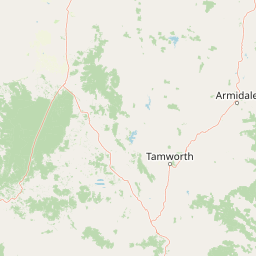
Streams
Park geography
Detailed spatial analysis of forest landscapes, river catchments, and mapped park boundaries
Geographic Profile and Protected Land Boundaries of Ben Halls Gap National Park in New South Wales
This geographic profile examines the 30.18 square kilometer boundary of Ben Halls Gap National Park located in New South Wales, Australia. The analysis covers the temperate broadleaf forest environment and the integration of the Barnard River and Gulf Gully systems within the protected landscape.
Related tags
National ParkStrict Nature ReserveEucalyptus ForestOld-Growth ForestNorthern Tablelands
Ancient eucalyptus forests in the NSW Northern Tablelands
Ben Halls Gap National Park
Ben Halls Gap National Park is a strict nature reserve located in New South Wales, Australia, approximately 251 kilometers north of Sydney in the Northern Tablelands region. The park encompasses roughly 30 square kilometers of rugged terrain and is classified as an IUCN Category Ia protected area, representing the highest level of protection for truly wilderness environments. Established in 1995, the park is managed by the National Parks and Wildlife Service of New South Wales and sits near the small villages of Nundle and Murrurundi, with the town of Quirindi nearby. The park's defining feature is its extraordinary ancient eucalyptus forests, which represent some of the oldest and most ecologically significant woodland environments in eastern Australia. This strict nature reserve status means access is limited and the area is managed primarily for scientific research and ecological preservation rather than public recreation.
- Location
- Australia
- Park type
- National park
- Established
- 1995
- Area
- 30.2 km²
Location overview
Territorial alignment and regional records in New South Wales
Geographic Location of Ben Halls Gap National Park, Australia
Ben Halls Gap National Park is situated within the state of New South Wales in Australia. Records confirm its status as a landlocked, single-country protected area with no marine or transboundary borders.
- Countries
- Australia
- Regions
- New South Wales
- Primary location
- New South Wales
- Geographic setting
- Inland
Boundary and coordinates
Charting the 30.18 square kilometer territorial extent and coordinates
Ben Halls Gap National Park Boundary Map and Spatial Limits
Analyzing the digital boundary outline of Ben Halls Gap National Park provides essential spatial context for the reserve. Accompanying data profiles outline the recorded area, calculated center coordinates, and geographic spans.
- Boundary area
- 5.2 km²
- Boundary perimeter
- 13.9 km
- Northernmost point
- 31.5656° S
- Southernmost point
- 31.5973° S
- Easternmost point
- 151.241° E
- Westernmost point
- 151.2183° E
- Geographic centre
- 31.5818° S, 151.2296° E
- North–south span
- 3.5 km
- East–west span
- 2.2 km
Terrain and natural features
Explore recorded streams and geographical landforms within the protected area.
Ben Halls Gap National Park Terrain and Named Natural Features
Recorded natural features include the Barnard River and Gulf Gully situated within the protected landscape boundaries. Linked feature cards provide names, types, measurements, and spatial relationships where recorded.
Selected named natural features
Streams
Gulf Gully
Environmental setting
Temperate broadleaf forest cover and landscape feature classifications
Ben Halls Gap National Park Environmental Classification and Forest Setting
Stored classifications provide structured context for reading the physical forest setting and broad landscape features of Ben Halls Gap National Park. Recorded categories link directly to relevant atlas destinations where available for comparative geographic exploration.
- Water
- Minor water
- Forest cover
- Mostly forested
Landscape features
Forest
Habitat types
Temperate broadleaf forest
Park atlas
Map the regional spread of national parks and protected areas across the Northern Tablelands, offering geographic context around Ben Halls Gap National Park.
Compare Nearby Protected Areas and National Parks Around Ben Halls Gap National Park
Explore national parks and other protected areas situated near Ben Halls Gap National Park in the rugged Northern Tablelands of New South Wales. Compare diverse conservation landscapes, map regional park geography, and deepen your understanding of Australia's significant eucalyptus forests and wilderness reserves.
National parkNew South Wales
23 km away#1 closest
East

Nowendoc National Park: Protected Area Identity and New South Wales Geography
Mapping the natural landscapes and protected boundaries within this national park.
Nowendoc National Park in New South Wales, Australia, offers a distinct protected landscape for atlas-driven discovery. This entry provides critical geographic context, detailing the park's mapped boundaries and its place within the regional terrain. Explore the specific identity of Nowendoc National Park as a protected natural area, crucial for understanding Australian conservation landscapes and geographic context.
- Area
- 88 km²
- Established
- 1999
- IUCN
- II
- Relief
- Upland
Protected areaNew South Wales
35 km away#2 closest
Southeast
Barrington Tops State Conservation Area: Protected Plateau and Volcanic Landscape Context
Highland geography within the Mount Royal Range, New South Wales
This protected area represents a significant upland region in New South Wales, characterized by weathered plateau edges and cool mountain environments. The terrain supports high-altitude peat wetlands and diverse montane forests, rooted in the ancient geological legacy of the Barrington Volcano. Its protected boundaries link directly to the Gondwana Rainforests, providing essential habitat continuity across the Great Dividing Range.
- Area
- 84.46 km²
- Established
- 2003
- Relief
- Mountain
- Climate
- Temperate
National parkNew South Wales
39 km away#3 closest
Southeast
Barrington Tops National Park: A Protected National Park in New South Wales
Explore ancient Gondwana rainforests and dramatic volcanic terrain.
Barrington Tops National Park represents a significant protected landscape in New South Wales, Australia, offering a deep dive into diverse ecosystems. Its unique altitudinal vegetation gradient supports the southernmost subtropical rainforests in Australia and showcases geological formations dating back millions of years. This park is crucial for understanding Australia's natural heritage, providing a rich context for landscape exploration and the study of ancient flora within a mapped geographic setting.
- Area
- 765.12 km²
- Established
- 1969
- IUCN
- Ib
- Relief
- Mountain
National parkNew South Wales
43 km away#4 closest
West
Towarri National Park: A Mapped Protected Area within New South Wales Geography
Explore its geographic boundaries and landscape context.
Towarri National Park serves as a vital protected area, offering distinct insights into the regional geography of New South Wales. This entry focuses on its mapped boundaries and protected landscape characteristics, providing a structured point for atlas-based discovery and geographic understanding of this Australian national park. Examine its unique position within the broader natural terrain.
- Area
- 36.39 km²
- Established
- 1998
- IUCN
- II
- Access
- Access unknown
National parkNew South Wales
46 km away#5 closest
East
Woko National Park: Explore Its Protected Landscape and Geographic Boundaries
Discover the mapped terrain and regional atlas context of Woko National Park.
Woko National Park presents a unique opportunity for geographic discovery, situated within New South Wales, Australia. This detail page focuses on the park's protected landscape and its mapped boundaries, providing a clear understanding of its geographic identity. Engage with Woko National Park as a key component of the Australian national park atlas, highlighting its regional setting and natural terrain.
- Area
- 85.98 km²
- Established
- 1982
- IUCN
- II
- Relief
- Highland
National parkNew South Wales
55 km away#6 closest
East
Barakee National Park: New South Wales Protected Landscape Atlas Explorer
Mapped Boundaries and Regional Geography Insights
Barakee National Park is a vital component of New South Wales's protected natural areas, offering a focused point for geographic discovery. This page provides key details on its protected landscape identity and its place within the mapped terrain of the region. Examine the structured data to grasp the park's geographic footprint and understand its significance as a designated national park within Australia.
- Area
- 50.11 km²
- Established
- 1999
- IUCN
- II
- Relief
- Mixed relief
National parkNew South Wales
56 km away#7 closest
Northeast
Mummel Gulf National Park: New South Wales Protected Area & Mapped Gorge Landscape
Rugged escarpment terrain with diverse forest ecosystems.
Mummel Gulf National Park is a protected area in New South Wales, Australia, renowned for its dramatic V-shaped gorge carved by the Mummel River, reaching depths over 400 metres. This rugged escarpment landscape hosts a variety of vegetation communities, including tall open eucalypt, wet sclerophyll, snow gum forests, and subtropical rainforest patches. The park's geography is central to its ecological significance, providing habitat for numerous species and showcasing a distinct natural terrain within the New England region, ideal for geographic exploration.
- Area
- 122 km²
- Established
- 1999
- IUCN
- II
- Relief
- Mountain
National parkNew South Wales
63 km away#8 closest
South
Mount Royal National Park: A National Park in New South Wales for Geographic Discovery
Explore its protected boundaries and landscape context.
Mount Royal National Park is a key protected area in New South Wales, offering an opportunity to delve into its specific geographic identity and mapped landscape features. As a national park, it provides structured data for understanding protected lands within Australia. This detailed entry supports exploration of the park's unique regional context and its contribution to the broader atlas of natural landscapes.
- Area
- 69 km²
- Established
- 1997
- IUCN
- II
- Relief
- Mountain
MoriAtlas Explorer
Continue exploring Ben Halls Gap National Park's unique geography and ancient eucalyptus ecosystems
Investigate the mapped natural terrain and protected landscape features of Ben Halls Gap National Park. Understanding its specific geographic setting within New South Wales and its ecological characteristics provides valuable context for comprehending Australia's protected natural areas. Deepen your atlas exploration by discovering the unique aspects of this significant old-growth forest reserve.
Browse next
Global natural geography
Explore related park routes
Explore MoriAtlas Global ParksBrowse All MoriAtlas ParksGlobal Park Map DiscoveryMoriAtlas: Browse All CountriesBrowse All MoriAtlas ContinentsNational Park Environment AtlasGrand Canyon National Park AtlasYellowstone National Park AtlasYosemite National Park Atlas and GeographySerengeti National Park AtlasGalápagos National Park Protected LandscapeBanff National Park Geography and AtlasKruger National Park Atlas EntryUluṟu-Kata Tjuṯa National Park AtlasExplore Uluru-Kata Tjuta National Park GeographyPlitvice Lakes National Park AtlasFiordland National Park Protected LandscapeGreat Smoky Mountains National Park AtlasAfghanistan National Parks and Protected AreasAlbania National Parks and Protected AreasAlgeria National Parks and Protected AreasAmerican Samoa National Parks and Protected AreasAndorra National Parks and Protected AreasAngola National Parks and Protected AreasAntarctica National Parks and Protected AreasAntigua and Barbuda Park List