Mori Atlas logo
National parkBwindi Impenetrable National Park

Discover the geographic context and natural terrain of this significant national park.

Bwindi Impenetrable National Park: Uganda's Protected Landscape Atlas and Mapped Boundaries

Bwindi Impenetrable National Park stands as a key protected area within Uganda's diverse geography, located in the Kanungu District. This page serves as your gateway to understanding its mapped boundaries and unique natural landscape context. Explore the detailed geography and protected land distribution that define this significant national park for comprehensive atlas-style discovery.

Mountain Gorilla HabitatUNESCO World Heritage SiteAfromontane ForestAlbertine RiftPrimate ConservationBirdwatching Destination

Bwindi Impenetrable National Park

National park

Park overview

Structured park overview, official facts, and landscape profile for Bwindi Impenetrable National Park

Bwindi Impenetrable National Park park facts, protected area profile, and essential visitor context

Review the core facts for Bwindi Impenetrable National Park, including designation, size, terrain, visitor scale, habitats, and operating context in one park-focused overview.

About Bwindi Impenetrable National Park

Bwindi Impenetrable National Park stands as one of Uganda's most significant conservation landscapes, a UNESCO World Heritage Site that protects a critical portion of the Albertine Rift's extraordinary biodiversity. The park occupies a strategic position along the border with the Democratic Republic of the Congo, connecting to the broader Virunga ecosystem that spans two countries. Its ancient forest, predating glaciations of the Pleistocene epoch, has served as a species refuge through climatic upheavals, enabling the accumulation of remarkable biological diversity that continues to surprise researchers and conservationists. The park's montane character distinguishes it from other East African forests, with elevations exceeding 2,000 meters across sixty percent of its territory, creating a cool, misty environment where specialized species have evolved. Access remains restricted to foot travel, preserving the park's wilderness quality and limiting human impact on its sensitive ecosystems. Gorilla tracking has become the park's signature activity since 1993, drawing visitors from around the world to encounter these endangered primates in their natural habitat while generating vital revenue for conservation and local communities.

Quick facts and research context for Bwindi Impenetrable National Park

Bwindi Impenetrable National Park occupies 331 square kilometers in Kanungu District, southwestern Uganda, at the eastern edge of the Albertine Rift adjacent to Virunga National Park. The park was established in 1991 and designated a UNESCO World Heritage Site in 1994. It protects one of the few remaining tracts of afromontane forest in East Africa, with elevations ranging from 1,190 meters at its lowest northern point to 2,607 meters at Rwamunyonyi Hill. The forest serves as a critical water catchment, feeding rivers that flow to Lake Edward, Lake Mutanda, and Lake Bunyonyi. The park is managed by the Uganda Wildlife Authority and contains 14 habituated mountain gorilla groups across four sectors.

Protection and recognition

Mapping the terrestrial protection framework and global conservation credentials established in 1994.

Bwindi Impenetrable National Park Protection Status and UNESCO Recognition

Established as a protected terrestrial reserve in 1994, Bwindi Impenetrable National Park represents a critical anchor in East African conservation geography. Official registry records detail the park's formal boundary management status alongside its global standing as a designated UNESCO World Heritage site.

International recognition

Protection details

Protection scope
Terrestrial
Designated year
1994
Park context

Deeper park guide and search-rich context for Bwindi Impenetrable National Park

Bwindi Impenetrable National Park history, landscape, wildlife, and travel context

Explore Bwindi Impenetrable National Park through its history, landscape character, ecosystems, wildlife, conservation priorities, cultural context, and seasonal travel timing in a structured park guide built for atlas discovery and search intent.

Why Bwindi Impenetrable National Park stands out

Bwindi is best known for its population of approximately 400 mountain gorillas, representing nearly half of the world's total population of this endangered species. The park provides habitat for fourteendistinct gorilla groups across the Buhoma, Ruhijja, Rushaga, and Nkuringo sectors, making it the premier destination for gorilla tracking tourism in Africa. Beyond the gorillas, the park's exceptional biodiversity includes over 350 bird species, 310 butterfly species, and remarkable plant diversity with more than 220 tree species and 104 fern species. The forest's afromontane character, spanning from lowland Guineo-Congolian flora to high-elevation montane vegetation, represents one of the most ecologically significant and botanically diverse protected areas in East Africa.

Bwindi Impenetrable National Park history and protected-area timeline

The protection history of Bwindi Impenetrable Forest spans nearly a century, beginning in 1932 when two blocks were designated as Crown Forest Reserves named Kayonza and Kasatora, covering a combined area of 207 square kilometers. In 1942, these reserves were combined and expanded to form the Impenetrable Central Crown Forest, growing to 298 square kilometers under joint management of Uganda's game and forest departments. The year 1964 marked a significant shift when the reserve was redesignated as an animal sanctuary specifically to provide enhanced protection for mountain gorillas, receiving the new name Impenetrable Central Forest Reserve. By 1966, additional forest reserves had been incorporated, bringing the total area to nearly 321 square kilometers. The transformation to national park status occurred in 1991 when the Impenetrable Central Forest Reserve, along with Mgahinga and Rwenzori Mountains National Parks, was declared a national park and renamed Bwindi Impenetrable National Park. This change brought higher protection status but also resulted in the eviction of the indigenous Batwa people who had historically relied on the forest. Gorilla tracking opened to tourists in April 1993. In 1994, the park was inscribed on the UNESCO World Heritage List following incorporation of an additional 10 square kilometers. A significant tragedy occurred in March 1999 when Interahamwe guerrillas from Rwanda infiltrated the park, kidnapping and murdering eight tourists in an effort to destabilize Uganda and disrupt tourism. The park subsequently closed temporarily and implemented enhanced security measures including armed guards for all visitor groups.

Bwindi Impenetrable National Park landscape and geographic character

The landscape of Bwindi Impenetrable National Park is defined by its rugged, mountainous terrain within the Kigezi Highlands, formed through up-warping of the Western Rift Valley. The topography features narrow valleys carved by numerous streams, steep hillsides, and a complex network of watercourses that descend in all directions from the central highlands. Elevations range from 1,190 meters at the northern tip to 2,607 meters at Rwamunyonyi Hill on the eastern boundary, with approximately sixty percent of the park above 2,000 meters. The underlying geology consists of Precambrian age metamorphic rocks including shale, phyllite, quartz, quartzite, schist, and granite, creating generally impermeable conditions that limit groundwater infiltration and result in abundant surface runoff. This geological setting, combined with high annual rainfall between 1,400 and 1,900 millimeters, generates a dense network of streams feeding rivers including the Ivi, Munyaga, Ihihizo, Ishasha, and Ntengyere, which flow northward to Lake Edward. The forest itself forms an important water catchment, regulating downstream water supply for agricultural areas and contributing to regional climate stability through high rates of evapotranspiration that increase precipitation in surrounding areas and reduce soil erosion.

Bwindi Impenetrable National Park ecosystems, habitats, and plant life

The ecological character of Bwindi Impenetrable National Park is defined by its afromontane forest, a rare vegetation type on the African continent that occurs where lowland and mountain forest ecosystems meet. This transition creates a continuous gradient of primary forest from lower elevations dominated by Guineo-Congolian flora to higher montane zones, representing one of the few large intact forest tracts in East Africa where this ecological continuum remains functional. The park's botanical diversity is extraordinary, with more than 220 tree species representing over fifty percent of Uganda's total tree flora, and more than 100 fern species. The northern lowland sector contains particularly significant Guineo-Congolian elements including two endangered tree species, brown mahogany and Brazzeia longipedicellata. The park's position at the Albertine Rift contributes to its exceptional endemism, with numerous species found nowhere else on Earth. The forest functions as a critical water catchment, with dense stream networks and significant hydrological influence on the broader Kigezi region, helping to regulate local climate patterns and prevent soil erosion in surrounding agricultural areas.

Bwindi Impenetrable National Park wildlife and species highlights

Bwindi Impenetrable National Park supports remarkable wildlife diversity, with approximately 120 mammal species including ten primate species and over forty-five small mammal species. The park's flagship species is the mountain gorilla, with approximately 400 individuals distributed across fourteen habituated groups in four different sectors, representing nearly half of the world's entire population of this endangered great ape. Beyond mountain gorillas, the park hosts populations of common chimpanzees, L'Hoest's monkeys, black and white colobus, red-tailed monkeys, and vervets. The mammal community also includes African elephants and the giant forest hog. Avian diversity is equally impressive, with over 350 bird species including the African green broadbill and numerous hornbill and turaco species. Invertebrate populations are exceptionally rich, with more than 310 butterfly species and numerous moth species contributing to the park's biological significance. The first systematic chimpanzee census conducted in 2025 identified 426 individuals in the park, underscoring its importance as a great ape habitat. Reptile and amphibian communities include 27 frog species along with various chameleons and geckos, though the fish species in the park's rivers remain poorly documented.

Bwindi Impenetrable National Park conservation status and protection priorities

Bwindi Impenetrable National Park represents one of Africa's most important conservation priorities, designated as a UNESCO World Heritage Site in 1994 due to its outstanding universal value. The park's global significance centers on its role as the primary stronghold for mountain gorilla conservation, with roughly half of the world's population depending on protection within its boundaries. Conservation challenges are significant, arising from the high population density exceeding 300 people per square kilometer in surrounding communities and the economic pressures these populations face. Ninety percent of local residents depend on subsistence agriculture, creating ongoing habitat encroachment pressures. Poaching, disease transmission from humans and domestic animals, and habitat loss represent the primary threats to gorilla populations. The park's transition from forest reserve to national park in 1991 brought stricter protection but also created social tensions by ending traditional access for indigenous Batwa communities who had historically lived within the forest without causing ecological damage. Gorilla habituation for tourism has provided both benefits and challenges, generating revenue for conservation while potentially increasing crop raiding by gorillas that have lost their natural fear of humans. Management by the Uganda Wildlife Authority balances protection objectives with community relations, though the pressure from surrounding populations remains one of the most difficult conservation challenges.

Bwindi Impenetrable National Park cultural meaning and human context

The cultural history of Bwindi is deeply connected to the Batwa people, an indigenous ethnic group who traditionally inhabited the forest and relied on its resources for generations. The Batwa fished in forest streams, harvested wild yams and honey, and maintained ancestral sacred sites throughout what is now the park. Their traditional lifestyle coexisted with the forest ecosystem without causing the destructive impact that characterized later human uses. When the park was gazetted as a national park in 1991, the Batwa were evicted without receiving compensation from national programs, despite their historical claim to the land. This eviction stands in stark contrast to the treatment of non-Batwa farmers who had cleared forest for cultivation and received compensation and land rights recognition. The displacement of the Batwa represents a significant social justice concern within the park's history, as communities that had maintained sustainable relationships with the forest for generations were removed while those who had contributed to deforestation were compensated. Local communities surrounding the park continue to experience wildlife conflict, with livestock and crop losses to animals including gorillas, and occasional human fatalities creating ongoing tensions between conservation objectives and community welfare.

Top sights and standout views in Bwindi Impenetrable National Park

Bwindi Impenetrable National Park offers one of Africa's most profound wildlife experiences through gorilla tracking, allowing visitors to observe mountain gorillas in their natural montane forest habitat. The park's four gorilla tracking sectors, Buhoma, Ruhijja, Rushaga, and Nkuringo, each host multiple habituated groups at varying distances from park headquarters. Beyond primates, the forest provides exceptional birdwatching opportunities with species including the African green broadbill, various hornbills, and colorful turacos. The challenging terrain and foot-only access ensure a wilderness experience far removed from more developed tourism destinations. The park's status as a UNESCO World Heritage Site recognizes its global significance as a biodiversity hotspot and critical conservation area. The scenery, with its steep hills, mist-shrouded valleys, and ancient trees, provides a spectacular backdrop for trekking activities. The combination of mountain gorilla viewing, ecological diversity, and relatively remote location makes Bwindi a premier destination for nature-focused travel in Africa.

Best time to visit Bwindi Impenetrable National Park

Bwindi can be visited year-round, though certain seasons offer advantages for different activities. The drier periods from December to February and June to August generally provide easier conditions for forest trekking, with less muddy trails and clearer visibility. The long rainy seasons from March to April and September to November bring heavier precipitation and more challenging terrain but also offer richer vegetation and potentially fewer visitors. Temperature remains relatively constant throughout the year, with daily highs ranging from 20 to 27 degrees Celsius and cooler conditions at higher elevations where morning mist is common. Gorilla tracking is possible in all seasons, though permits should be booked well in advance as availability is limited. The mountain environment means that rain gear and sturdy hiking boots are essential year-round, and visitors should prepare for variable conditions regardless of when they travel.

Monthly climate preview

Examine long-term representative temperature ranges and precipitation patterns across the year.

Bwindi Impenetrable National Park Annual Climate Normals and Weather by Month

Representative coordinates record persistent monthly variations in mean temperature and daily precipitation across the terrain. Reviewing the comprehensive twelve-month record provides deeper insight into long-term climate normals for this protected area.
Annual mean21 °C
20 °C22 °C
Jan21°
Feb22°
Mar22°
Apr21°
May21°
Jun21°
Jul21°
Aug22°
Sep21°
Oct21°
Nov20°
Dec20°
Warmest month
March

21.7 °C

Coolest month
November

20.2 °C

Wettest month
November

5.5 mm/day

Driest month
July

1.4 mm/day

Park location guide

Geography guide, regional context, and park location map for Bwindi Impenetrable National Park

Bwindi Impenetrable National Park park geography, regions, and map view in Uganda

Understand where Bwindi Impenetrable National Park sits in Uganda through a broader geographic reading of the surrounding landscape, nearby location context, and its mapped position within the national park landscape.

How Bwindi Impenetrable National Park fits into Uganda

Uganda is a landlocked East African nation spanning approximately 241,000 km². It borders five countries and contains part of Lake Victoria, the world's second-largest freshwater lake. The country operates as a presidential republic with Kampala as its capital and largest city.

Wider geography shaping Bwindi Impenetrable National Park in Uganda

Uganda is situated in East Africa, bordered by Kenya to the east, South Sudan to the north, the Democratic Republic of the Congo to the west, Rwanda to the southwest, and Tanzania to the south. The southern portion includes a substantial part of Lake Victoria. The terrain features volcanic hills, mountains, and lakes.

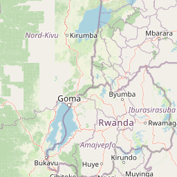
Map view of Bwindi Impenetrable National Park

Use this park location map to pinpoint Bwindi Impenetrable National Park in Uganda, understand its exact geographic position, and read its mapped placement within the surrounding landscape more clearly.

Pigeon | © OpenStreetMap contributors

Location context for Bwindi Impenetrable National Park

Kanungu District
Recorded earthquake history

Review the Historical Earthquake Catalogue for Bwindi Impenetrable National Park

Examine recorded seismic events and their proximity to Bwindi Impenetrable National Park. This MoriAtlas catalogue organizes historical data to provide insight into regional tectonic context and earthquake history without implying current hazard or predictive capability.

Bwindi Impenetrable National Park Earthquake History

Catalogued events

11 events

Strongest magnitude

Magnitude 5.2

Most recent event

May 4, 2025

This history includes earthquakes recorded inside the park or within 50 km of its borders

Park atlas

Compare surrounding protected landscapes, mapping the regional geography of the Albertine Rift and its unique conservation areas.

Discover More National Parks and Protected Areas Near Bwindi Impenetrable National Park

Explore other national parks and protected areas near Bwindi Impenetrable National Park, tracing the geographic spread of montane forests and Albertine Rift ecosystems. Compare these protected landscapes to gain insight into regional biodiversity, shared conservation challenges, and the broader context of East Africa's natural heritage.
Watercolor illustration of rolling hills, mountains, and a river or lake
National parkDemocratic Republic of the Congo
13 km away#1 closest

West

Virunga National Park: Democratic Republic of the Congo's Premier Protected Landscape

Mapped boundaries and diverse Albertine Rift endemic geography.

Virunga National Park represents a pivotal protected area within the Democratic Republic of the Congo, characterized by an exceptional range of geographic features and vital ecosystems. Its protected landscape includes active volcanoes like Nyiragongo with its lava lake, the towering Rwenzori Mountains, and diverse lowland savannas. This atlas-focused entry highlights the park's unique position in the Albertine Rift, crucial for numerous endemic species and offering significant insight into regional geography and protected land context.

Area
7,800 km²
Established
1925
IUCN
II
Relief
Mountain
National parkUganda
About 19 km away#2 closest

South

Mgahinga Gorilla National Park: Atlas of Protected Volcanic Landscapes in Uganda

Mapping the Virunga Mountains and high altitude conservation terrain.

Located in southwestern Uganda, Mgahinga Gorilla National Park protects a significant portion of the transboundary Virunga ecosystem. The park encompasses the peaks of Mount Muhabura, Mount Gahinga, and Mount Sabyinyo, providing a unique look at the vertical transition of habitats from bamboo forests to alpine zones. Access detailed geographic data and spatial context for one of the most ecologically important protected areas in the Albertine Rift.

Area
33.9 km²
Established
1991
IUCN
II
Relief
Mountain
National parkKisoro District
About 29 km away#3 closest

South

Mgahinga Gorilla National Park: A Geographic Study of Virunga Mountain Landscapes

Exploring protected boundaries and volcanic terrain in Kisoro District.

Mgahinga Gorilla National Park covers an essential range of montane forest and alpine zones across three dormant volcanoes in the Kisoro District of Uganda. This protected area functions as a key element of the broader Virunga mountain ecosystem, providing specialized habitats for endangered primate populations and endemic bird species. The dramatic vertical relief from bamboo forests to summit peaks defines this critical segment of the Albertine Rift conservation network.

Area
33.9 km²
Established
1991
IUCN
II
Relief
Mountain
National parkRwanda
About 44 km away#4 closest

South

Volcanoes National Park: Rwanda's Protected Volcanic Landscape and Regional Geography

Mapped park boundaries and East African geographic context.

Delve into Volcanoes National Park, a crucial protected area within Rwanda's northwest. This page offers detailed insight into its geography, highlighting the volcanic terrain and mapped boundaries that define this important national park. Understand its placement within the Virunga Mountains and its contribution to the natural landscape of East Africa, providing a foundation for atlas-based exploration of protected lands.

Area
160 km²
Established
1925
IUCN
II
Relief
Mountain
Watercolor painting showing green and pink trees, hills in background, and grass in foreground
National parkRwanda
About 44 km away#5 closest

South

Volcans National Park: Explore its Protected Landscape and Geographic Identity

Mapped boundaries and regional natural terrain.

Volcans National Park represents a vital national park entity, offering a distinct protected landscape for geographic study. Its mapped boundaries and natural terrain provide crucial context for understanding regional geography and the broader atlas of protected areas. This page serves as a dedicated point for exploring the park's specific contribution to natural landscape discovery, focusing on its geographic character and protected status.

Area
160 km²
Established
1925
Relief
Mountain
Climate
Temperate
National parkWestern Province
About 76 km away#6 closest

South

Gishwati Forest National Park: Discover Rwanda's Protected Landscape Geography

Mapped protected area boundaries and regional natural landscape.

Gishwati Forest National Park offers a focused exploration of a significant protected natural landscape in Rwanda's Western Province. This resource provides detailed geographic context, highlighting the park's mapped boundaries and its role within the country's conservation areas. Understand its terrain and regional landscape importance through an atlas-centric view.

Area
32.02 km²
Established
2015
IUCN
IV
Relief
Mountain
National parkRwanda
About 76 km away#7 closest

South

Gishwati-Mukura National Park: Rwanda's Protected Montane Forest Landscape in the Albertine Rift

Explore its mapped boundaries and regional geography.

Gishwati-Mukura National Park, located in western Rwanda, is a vital protected area renowned for its montane forest ecosystems. This national park occupies mountainous terrain characteristic of the Albertine Rift, contributing significantly to watershed protection and regional biodiversity. Users can explore its specific geographic context, mapped landscape features, and its role within Rwanda's broader conservation atlas.

Area
32.02 km²
Established
2015
IUCN
II
Relief
Highland
National parkKagera Region
About 82 km away#8 closest

East

Ibanda-Kyerwa National Park: Tanzania's Tri-Border Protected Landscape and Geographic Atlas

Savanna, riparian habitats, and vital regional geography exploration.

Delve into Ibanda-Kyerwa National Park, a recently established national park in Tanzania's Kagera Region. This protected area is distinguished by its critical location at the tri-border with Uganda and Rwanda, with the Kagera River system defining its unique savanna and riparian landscapes. Understanding its mapped boundaries and ecological context provides essential insight into protected land discovery in northwestern Tanzania and its role within the wider regional atlas.

Area
200 km²
Established
2019
IUCN
II
Relief
Highland

Common questions about visiting, size, designation, and location context for Bwindi Impenetrable National Park

Bwindi Impenetrable National Park FAQs for park facts, access, geography, and protected area context

Find quick answers about Bwindi Impenetrable National Park, including protected-area facts, park geography, trail and visitor context, and how the park fits into its surrounding country and regional landscape.
MoriAtlas Explorer

Continue Your Protected Areas Search Across the Global Atlas

Deepen your exploration by continuing the structured search for national parks and protected areas worldwide. Utilize the comprehensive filtering capabilities to compare different conservation landscapes and refine your understanding of global park geography. Discover more about the distribution and characteristics of protected natural areas.

Global natural geography