Peaks
Madonna della Montagna
1,162 m

Analyzing the terrain, elevation gradients, and physical landscapes within Italy
Examine the technical geographic footprint of Cilento, Vallo di Diano and Alburni National Park, covering an expansive area of 1810.48 square kilometers across the Campania region. This profile details the vertical relief spanning from sea level to peaks reaching 1898 meters, alongside the complex distribution of karst formations, coastal cliffs, and Mediterranean forests.
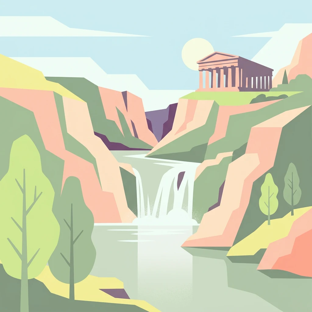
Italy's largest national park, blending Mediterranean coastline, limestone peaks, and ancient Greek heritage
Cilento, Vallo di Diano and Alburni National Park is Italy's largest national park, spanning over 1,800 square kilometers along the southern Campania coastline and interior mountain regions. The park encompasses the Cilento peninsula, the Vallo di Diano basin, and the Alburni mountain range, protecting a remarkable diversity of Mediterranean landscapes from sandy beaches and rocky coves to forested peaks and karst cave systems. Established in 1991 to safeguard the territory from uncontrolled development and mass tourism, the park holds dual UNESCO recognition as a World Heritage Site since 1998 and as a Biosphere Reserve since 1997, making it one of Italy's most significant protected areas. The park also became the first Italian national park to achieve UNESCO Geopark status in 2010, recognizing its exceptional geological heritage.
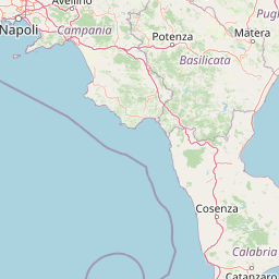
National park location and coastal status in Campania, Italy
Spatial extent and mapped coordinates covering over 1,810 square kilometers
Mountain relief span from sea level to peaks reaching 1898 meters
Peaks
1,162 m
Peaks
Cave entrances
Cave entrances
Peaks
895 m
Peaks
1,192 m
Recorded mountain terrain, Mediterranean forest habitats, and coastal relief zones
Mountains · Valleys · Coast · Cliffs · Beach · Forest · Rivers · Cave · Karst
Temperate broadleaf forest · Mediterranean forest · Montane forest · Grassland · Wetland · Coastal habitat · Karst habitat
Compare a wider selection of Mediterranean coastal, mountain, and karst protected landscapes surrounding this UNESCO World Heritage Site in Southern Italy.
Northeast

Explore its geography, mapped terrain, and ecological role.
Gain insight into Appennino Lucano - Val d'Agri - Lagonegrese National Park, a significant protected mountain landscape in the heart of Basilicata. This detailed page focuses on the park's distinct geographic features, its role as a crucial ecological corridor connecting major southern Italian protected areas, and the mapped contours of its diverse terrain. Understand its place within the Lucano Apennine range and the broader natural atlas of Italy.
Southeast
Italy's largest national park and UNESCO Global Geopark
Pollino National Park, located in the Basilicata region, is a significant protected landscape renowned for its extensive ancient forests, particularly its rare Bosnian pines, and its dramatic, high-altitude mountain geography. Covering over 1,925 square kilometers, this national park is also recognized as a UNESCO Global Geopark, highlighting its exceptional geological heritage and unique ecosystems. The park's rugged terrain, soaring peaks, and rare ancient trees offer rich opportunities for understanding regional protected areas and mapped natural landscapes in southern Italy.
Northwest
Explore mapped boundaries and regional geography.
Discover Vesuvius National Park, a vital protected area safeguarding Italy's iconic active volcano. This page provides essential geographic context, detailed mapped terrain, and insights into the park's unique volcanic landscape within the Campania region. It serves as a key entry point for understanding the park's protected status and its geological significance for structured atlas exploration.
Northeast
Explore mapped terrain and regional geography.
Alta Murgia National Park is a designated national park offering unique opportunities for geographic discovery. Delve into its protected landscape, understand its mapped boundaries, and situate it within the broader Italian atlas. This entry provides essential context for exploring the park's terrain and regional significance.
Southeast
Explore its mapped boundaries and regional natural area.
Sila National Park represents a vital protected landscape within the Calabria region, situated in southern Italy. This page details its specific geographic features and mapped park boundaries, offering a focused view of its place within the broader Italian atlas. Understanding Sila National Park provides insight into the region's natural terrain and the distribution of its protected lands, serving as a key point for geographic discovery.
North
Mapped boundaries and natural terrain of a key Italian national park.
Delve into Gargano National Park, a designated national park situated in the Apulia region of Italy. This protected landscape offers valuable insights into the geography of the Gargano promontory. Through MoriAtlas, users can explore its mapped boundaries, understand its terrain, and connect it to the broader regional geography of southern Italy, providing a solid foundation for protected-area discovery.
Northwest
Explore mapped park boundaries and natural terrain.
Delve into the protected landscape of Maiella National Park, situated within the Abruzzo region of southern Italy. This page offers detailed atlas-level insights into its mapped boundaries, allowing for a clear understanding of its geographic setting. Discover how this national park contributes to the regional natural terrain and protected area context, providing a foundation for structured geographic exploration.
North
Mapping protected Adriatic dune and wetland ecosystems
This nature reserve protects a vital 3-kilometer strip of the Adriatic coastline in Abruzzo, acting as a rare sanctuary for specialized flora and fauna. By managing a delicate ecotone of shifting sand dunes and brackish wetland basins, the area maintains a high degree of ecological significance within the regional landscape. The geography provides an important look at integrated coastal conservation at the meeting point of urbanized hinterlands and the Adriatic sea.
Deepen your understanding of Cilento, Vallo di Diano and Alburni National Park by exploring its precise geographic setting and mapped protected area context. MoriAtlas provides structured data to help you navigate the relationships between this National Park and its surrounding landscapes, offering a clear view of its atlas-defined significance. Continue your discovery journey into the mapped terrain and regional geography that defines this important Italian natural area.