Mori Atlas logo
Protected areaCommander Islands

Atlas exploration of protected lands within Russia's Kamchatka Krai.

Commander Islands Protected Area: Geographic Context and Mapped Landscape Boundaries

The Commander Islands Protected Area represents a distinct geographic entity within Russia's Kamchatka Krai, offering a focal point for atlas-based discovery. This page details the protected landscape, its mapped boundaries, and its relation to the surrounding natural terrain. Understand how this protected area fits into the broader regional geography and explore its unique landscape context through structured map data.

Remote islandsMarine mammalsSeabird coloniesBering SeaAleutian IslandsFur seal rookeries

Commander Islands

Protected area

Park overview

Structured park overview, official facts, and landscape profile for Commander Islands

Commander Islands park facts, protected area profile, and essential visitor context
Review the core facts for Commander Islands, including designation, size, terrain, visitor scale, habitats, and operating context in one park-focused overview.

About Commander Islands

The Commander Islands represent one of the most isolated and ecologically significant protected areas in the Russian Far East, forming a critical corridor between Asian and North American ecosystems. The archipelago sits at the boundary between the Pacific Ocean and the Bering Sea, where cold oceanic currents create extraordinary biological productivity that supports diverse marine communities. As part of the Komandorsky Zapovednik, the islands and surrounding marine waters benefit from strict protection as a Russian zapovednik, the highest level of environmental protection in the country. The reserve was nominated for UNESCO World Heritage status in 2005, recognizing its outstanding universal value as a natural site.

The geological foundations of the islands trace to ancient volcanic activity along the Aleutian volcanic arc, a submarine ridge extending from Alaska to Kamchatka that began forming during the Paleogene period. The landscape presents a diverse topography of folded-block mountains, volcanic plateaus, terraced plains, and low coastal mountains, creating varied habitats across the islands despite their relatively limited land area. This geological diversity, combined with the islands' position at the crossroads of Pacific and Arctic ecosystems, produces a remarkable concentration of biodiversity in both marine and terrestrial environments.

The human dimension of the islands centers on Nikolskoye, a small village that serves as the administrative center for the Aleutsky District of Kamchatka Krai. The community includes descendants of Aleut people relocated from the Aleutian Islands by the Russian-American Company in the early 19th century for the seal trade, as well as Russian settlers. This cultural heritage is reflected in the unique Medny Aleut language, a mixed language with Aleut vocabulary but Russian verb inflections, spoken by some island residents.

Quick facts and research context for Commander Islands

The Commander Islands comprise the westernmost section of the Aleutian Islands chain, sitting at roughly 55 degrees north latitude. Bering Island covers the majority of the archipelago's 1,846 square kilometer land area, while Medny Island is significantly narrower. The islands lie on a submarine volcanic ridge dating to the early Paleogene period, approximately 60 to 70 million years ago, and represent the geological edge of the Pacific and North American tectonic plates. The surrounding marine environment, spanning 36,488 square kilometers, is protected as the Komandorsky Zapovednik, one of Russia's strict nature reserves. The population centers around Nikolskoye, the only permanently inhabited locality, though several abandoned settlements dot the islands.

Park context

Deeper park guide and search-rich context for Commander Islands

Commander Islands history, landscape, wildlife, and travel context
Explore Commander Islands through its history, landscape character, ecosystems, wildlife, conservation priorities, cultural context, and seasonal travel timing in a structured park guide built for atlas discovery and search intent.

Why Commander Islands stands out

The Commander Islands are best known for their extraordinary marine wildlife concentrations, particularly the massive northern fur seal colonies that gather on the islands' rocky shores during summer months. The islands hold global significance as the former habitat of Steller's sea cow, a massive sirenian discovered by naturalist Georg Wilhelm Steller during Vitus Bering's ill-fated 1741 expedition that was hunted to extinction within just 27 years. The surrounding waters support critically important feeding and migratory habitat for numerous whale species, including endangered North Pacific right whales and fin whales. The islands also host over a million seabirds nesting along coastal cliffs, including the rare red-legged kittiwake and significant populations of Steller's eider, making them recognized as an Important Bird Area by BirdLife International.

Commander Islands history and protected-area timeline

The Commander Islands entered recorded history through one of the most dramatic episodes in Bering Sea exploration. In 1741, Commander Vitus Bering's ship the St. Peter was wrecked on Bering Island during the return leg of the Great Northern Expedition from Alaska. Bering died on the island along with much of his crew, though approximately half survived the winter thanks to the extraordinary abundance of wildlife and the medical knowledge of naturalist Georg Wilhelm Steller, who treated scurvy by compelling crew members to eat seaweed. The survivors eventually constructed a small vessel from the wreckage and returned to Kamchatka, bringing valuable sea otter pelts that sparked the Russian expansion into Alaska.

The islands subsequently became significant in the Russian fur trade. In 1825, the Russian-American Company relocated Aleut people from Atka and Attu Islands in the Aleutian chain to the Commander Islands to support seal harvesting operations. This relocation established the contemporary Aleut population, which maintains a distinct cultural identity on the islands today. The Russian period saw the development of the unique Medny Aleut language and sustained economic activity centered on marine resources. During World War II, the waters south of the islands were the site of the 1943 Battle of the Komandorski Islands, a naval engagement between American and Japanese forces.

Commander Islands landscape and geographic character

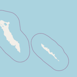
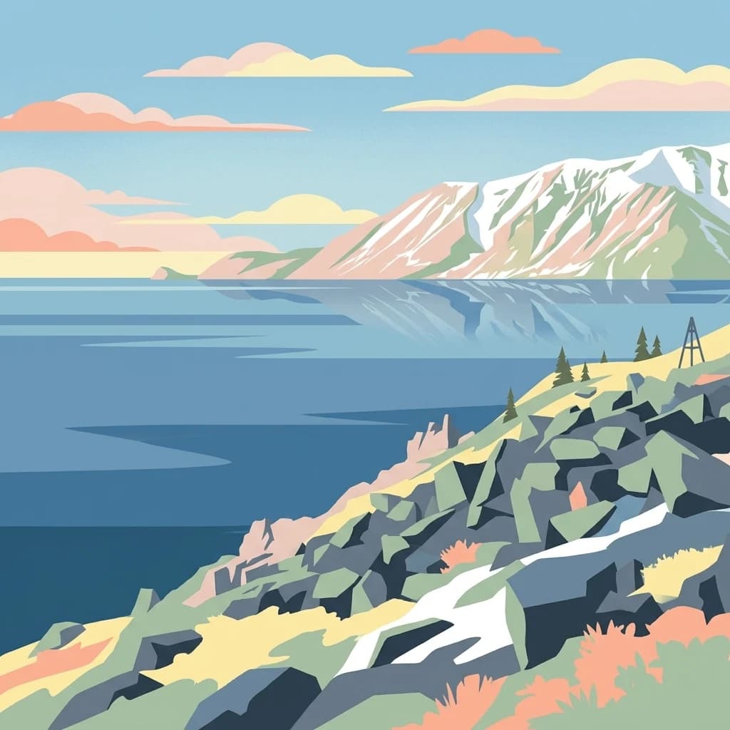
The Commander Islands present a dramatic landscape of treeless subarctic terrain shaped by volcanic origins and maritime exposure. Bering Island dominates the archipelago with its elongated 95-kilometer length and 15-kilometer width, rising to Steller's Peak at 755 meters above sea level. The terrain includes folded-block mountains, volcanic plateaus, and terraced coastal plains that create varied topography across relatively limited land area. Medny Island, though smaller at 55 kilometers long and 5 kilometers wide, reaches 647 meters at Stenjeger's Peak and features more rugged, cliff-dominated coastlines.

The absence of trees defines the terrestrial landscape, replaced instead by extensive cover of lichens and mosses that carpet the ground in the subarctic conditions. Marshy plant associations with low grasses and dwarf vegetation dominate the terrain, while very tall umbellifers provide seasonal color in summer months. The coastal regions feature dramatic cliffs that host massive seabird nesting colonies, interspersed with rocky beaches and wave-cut platforms where marine mammals haul out. The surrounding seabed drops off quickly into the productive waters of the Bering Sea shelf and Pacific slope, creating ideal conditions for marine life.

Commander Islands ecosystems, habitats, and plant life

The ecological character of the Commander Islands reflects their position at the confluence of Pacific and Arctic marine ecosystems, combined with the constraints of a harsh subarctic climate. The surrounding waters of the Bering Sea support extraordinary biological productivity, with cold currents bringing nutrients to the surface and creating rich feeding grounds for marine mammals and seabirds. This marine productivity forms the foundation of the islands' ecological significance, supporting populations of northern fur seals, Steller sea lions, sea otters, and numerous whale species that depend on the waters for feeding, breeding, and migration.

The terrestrial ecology is more limited due to the harsh conditions and lack of forest cover, but supports specialized species adapted to tundra and coastal habitats. The lichen communities have been identified as particularly significant, with recent surveys recognizing the islands as a regional center of diversity for the Teloschistales order of lichen-forming fungi. The diversity includes both widely distributed boreal and circumpolar species and forms otherwise associated with the western coast of North America or maritime northeast Asia, suggesting the Aleutian Arc functions as a dispersal corridor. The islands also support specialized populations of Arctic fox, with two distinct endemic subspecies recognized.

Commander Islands wildlife and species highlights

The Commander Islands support some of the most significant marine wildlife concentrations in the North Pacific, with the surrounding waters and coastal habitats supporting extraordinary populations of seals, sea lions, and whales. Northern fur seals number approximately 200,000 individuals during summer months, gathering in massive reproductive rookeries along the islands' coastlines. Steller sea lions, though present in smaller numbers around 5,000 individuals, still represent an important population in the western Pacific. Sea otter populations are stable or even increasing on the Commanders, in contrast to precipitous declines throughout the rest of the Aleutian chain, making the islands critically important for conservation of this species.

The marine mammalian fauna includes various seal species, with common seals and larga seals abundant in coastal waters. The surrounding seas provide essential habitat for sperm whales, orcas, minke whales, beaked whales, porpoises, and humpback whales, as well as endangered species including North Pacific right whales and fin whales. The islands support over 180 bird species, with over a million seabirds nesting in colonies along almost every coastal cliff. Key species include northern fulmar, multiple guillemot species, horned and tufted puffins, cormorants, gulls, and the locally significant red-legged kittiwake, which nests in very few colonies worldwide. Waterfowl and shorebirds are abundant in suitable habitat, while raptors including Steller's sea eagle and gyrfalcon hunt the islands.

Commander Islands conservation status and protection priorities

The Commander Islands and surrounding marine waters are protected as the Komandorsky Zapovednik, a Russian strict nature reserve that provides the highest level of environmental protection in the country. The reserve encompasses both the terrestrial islands and approximately 36,488 square kilometers of adjacent marine habitat, creating a comprehensive protected area that preserves both terrestrial and marine ecosystems. This protection has been particularly important for marine mammals and seabirds, allowing populations to remain relatively stable despite pressures that have depleted species elsewhere in the Aleutian chain.

The conservation significance of the islands extends to global recognition, with the site nominated for UNESCO World Heritage status in 2005. BirdLife International has designated the islands as an Important Bird Area due to their populations of threatened bird species, particularly waterbirds and seabirds. The marine environment serves as critical habitat for endangered whale species, while the terrestrial ecosystems support endemic subspecies of Arctic fox. The successful conservation of sea otters on the Commanders, contrasting with declines elsewhere, demonstrates the effectiveness of strict protection in maintaining healthy populations of marine mammals.

Commander Islands cultural meaning and human context

The human heritage of the Commander Islands reflects the complex history of Russian exploration, settlement, and interaction with indigenous peoples of the North Pacific. The Aleut (Unangan) population traces its origins to a forced relocation in 1825, when the Russian-American Company moved Aleut people from Atka and Attu Islands to support seal harvesting operations. Those inhabiting Bering Island came primarily from Atka, while residents of Medny Island originated from Attu, both now American territories. This displacement created the contemporary Aleut community that maintains cultural connections to the broader Unangan people.

The unique Medny Aleut language that developed among the population represents a fascinating linguistic adaptation, combining Aleut vocabulary with Russian verb inflection. Today the population remains approximately two-thirds Russian and one-third Aleut, with the community centered on Nikolskoye. The village includes a school, satellite tracking station, and small airstrip, providing basic services for this remote community. Traditional activities including fishing, mushroom gathering, and ecotourism form the contemporary economic base, alongside administration of the zapovednik.

Top sights and standout views in Commander Islands

The Commander Islands offer extraordinary wildlife viewing opportunities in one of the most remote locations in the Russian Far East. The massive northern fur seal colonies during summer provide unforgettable encounters with these marine mammals in their natural habitat, while Steller sea lions haul out on rocky shores. Seabird colonies numbering over a million birds create spectacular displays along coastal cliffs, with puffins, guillemots, and gulls providing constant activity. The islands' history is preserved at Bering's grave site, a modest monument marking where the explorer died following his ship's wreck in 1741, while the story of Steller's sea cow's rapid extinction serves as a powerful conservation message.

Best time to visit Commander Islands

The optimal time to visit the Commander Islands coincides with the summer months when marine wildlife is most active and accessible. July and August bring the northern fur seals to their rookeries for breeding, creating excellent opportunities to observe these animals in substantial numbers. However, visitors should anticipate foggy conditions, as cool summers are notoriously foggy on the islands. The extended daylight hours of the subarctic summer provide extended viewing opportunities, though the weather can change rapidly. Winter conditions are harsh and access is severely limited, making the short summer window the primary season for any meaningful visitation.

Park location guide

Geography guide, regional context, and park location map for Commander Islands

Commander Islands park geography, regions, and map view in Russia
Understand where Commander Islands sits in Russia through a broader geographic reading of the surrounding landscape, nearby location context, and its mapped position within the national park landscape.

How Commander Islands fits into Russia

Russia is a transcontinental nation spanning eleven time zones, bordered by fourteen countries. It is the world's largest country by area, covering 17,098,246 km². Moscow is the capital and largest city, while Saint Petersburg is the second-largest and a major cultural centre.

Wider geography shaping Commander Islands in Russia

Russia spans Eastern Europe and North Asia, covering 17,098,246 km². It shares land borders with fourteen countries, more than any other nation, and spans eleven time zones. The landscape includes vast plains, mountain ranges such as the Urals and Caucasus, and extensive coastlines along the Arctic Ocean, Pacific Ocean, Baltic Sea, Black Sea, and Caspian Sea.

Map view of Commander Islands

Use this park location map to pinpoint Commander Islands in Russia, understand its exact geographic position, and read its mapped placement within the surrounding landscape more clearly.

Pigeon | © OpenStreetMap contributors

Location context for Commander Islands

Kamchatka Krai
Park atlas

Compare protected marine and subarctic landscapes, tracing geographic connections across the Bering Sea and Kamchatka Krai.

Explore Related Protected Areas: Commander Islands and Nearby Kamchatka Krai Parks
After exploring Commander Islands' unique subarctic marine ecosystems, browse other significant protected areas and national parks in the broader Kamchatka Krai region. Compare diverse landscapes, from volcanic mountain ranges to expansive coastal territories, to understand the regional context of conservation across the Russian Far East.
National parkChukotka Autonomous Okrug

Beringia National Park: Protected Arctic Tundra and Land Bridge History in Chukotka

Mapped geography and protected landscape of a remote Russian national park.

Beringia National Park in the Chukotka Autonomous Okrug safeguards an extraordinary expanse of subarctic tundra, embodying the historical land bridge that once linked Asia and North America. This protected area offers a unique window into paleobiological history and pristine Arctic wilderness. Explore its vast mapped terrain, understand its geographic significance at the Bering Strait, and appreciate the context of its protected landscape within the broader regional geography of Russia's Far East.

Area
30,532 km²
Established
2013
IUCN
II
Relief
Mixed relief
National parkKhabarovsk Krai

Shantar Islands National Park: Remote Archipelago Atlas with Rugged Terrain

Mapping protected marine and island geography in Khabarovsk Krai.

Shantar Islands National Park represents a significant protected landscape within Khabarovsk Krai, notable for its dramatic coastal geography, mountainous terrain, and rich marine ecosystems. This national park, encompassing a chain of islands in the Sea of Okhotsk, is a vital habitat for marine mammals and seabird colonies. Explore its mapped boundaries and unique regional atlas context, understanding its role as a protected coastal area in the Russian Far East.

Area
5,155 km²
Established
2013
IUCN
II
Relief
Mountain
National parkSakha Republic

Kytalyk National Park: A Protected Landscape in Sakha Republic's Vast Geography

Explore mapped protected area boundaries and regional context.

Kytalyk National Park stands as a significant protected territory within the expansive Sakha Republic, a region notable for its sheer scale and Arctic geography. This national park offers a focal point for exploring mapped natural landscapes and understanding the distribution of protected areas across Siberia. Through MoriAtlas, users can access detailed geographic information, including the precise boundaries of Kytalyk National Park, facilitating a structured approach to regional geography and protected land discovery.

Area
18,856 km²
Established
2020
IUCN
II
Watercolor painting of a river flowing through green hills with pink flowering trees and distant mountains under a light sky
National parkKhabarovsk Krai

Anyuysky National Park: Mapped Protected Landscape and Geographic Setting in Khabarovsk Krai

Explore its unique terrain and ecological corridor status.

Delve into Anyuysky National Park, a crucial protected area in Khabarovsk Krai known for its role as an ecological corridor linking the Amur River floodplain to the Sikhote-Alin mountains. This page provides detailed insight into the park's mapped landscape, from its western alluvial plains to its eastern mountain canyons, highlighting its distinct geographic features and the diverse habitats it safeguards. Understand its significance as a protected zone and its place within the regional geography for atlas-based discovery.

Area
4,294 km²
Established
1999
IUCN
II
Relief
Mixed relief
National parkAmur Oblast

Tokinsko-Stanovoy National Park: Protected Landscape Geography and Atlas Context

National Park in Amur Oblast, Russia

Delve into the specifics of Tokinsko-Stanovoy National Park, a designated national park within Amur Oblast. This entry provides essential context on its protected landscape characteristics and its place in the regional geography. Understand the park's mapped boundaries and discover its natural terrain as part of a larger atlas-driven exploration of protected areas in the Russian Far East.

Area
2,430 km²
Established
2019
IUCN
II
National parkPrimorsky Krai

Bikin National Park: A Vast Protected Landscape in Primorsky Krai's Sikhote-Alin Mountains

Explore Russia's largest old-growth forest and Amur tiger stronghold.

Bikin National Park is a monumental protected area safeguarding the largest remaining tract of old-growth temperate rainforest in the Northern Hemisphere. Situated within Primorsky Krai, it serves as a vital refuge for an estimated 10% of the world's wild Amur tigers, making its mapped boundaries essential for conservation. Recognized as a World Heritage Site, the park's extensive forests and complex terrain offer a unique glimpse into one of Asia's last great wilderness areas, supporting unparalleled biodiversity and crucial ecological processes.

Area
11,600 km²
Established
2015
IUCN
II
Relief
Mountain
Watercolor illustration showing green hills, a river, and grassy foreground
Nature reserveSakha Republic

Lena Pillars Nature Reserve: Mapped Protected Area in Sakha Republic's Vast Geography

Explore the regional landscape and park boundaries.

Discover Lena Pillars Nature Reserve, a key protected area located within the expansive Sakha Republic of Russia. This page offers focused atlas exploration, detailing the park's geographic setting and its mapped boundaries against the backdrop of Siberia's largest federal subject. Understand the unique natural landscape context and its significance within regional conservation efforts, providing structured geographic data for your exploration.

Area
13,870 km²
Relief
Lowland
Climate
Subpolar
Access
Moderate access
Watercolor painting of a landscape featuring green forests, distant mountains, and a body of water in the foreground
National parkPrimorsky Krai

Udegeyskaya Legenda National Park: National Park with Mapped Protected Boundaries

Explore Protected Landscape Geography in Primorsky Krai

Gain an atlas-level understanding of Udegeyskaya Legenda National Park, a designated national park situated in Russia's Primorsky Krai. This resource provides insights into the park's geographic setting and the extent of its protected landscape. It is designed for users interested in the mapped features and regional context of protected natural areas, offering a clear view of the park's role within its geographic domain.

Area
1,037 km²
Established
2007
IUCN
II
Relief
Mountain

Common questions about visiting, size, designation, and location context for Commander Islands

Commander Islands FAQs for park facts, access, geography, and protected area context
Find quick answers about Commander Islands, including protected-area facts, park geography, trail and visitor context, and how the park fits into its surrounding country and regional landscape.
MoriAtlas Explorer

Continue Your Protected Areas Search Across the Global Atlas

Deepen your exploration by continuing the structured search for national parks and protected areas worldwide. Utilize the comprehensive filtering capabilities to compare different conservation landscapes and refine your understanding of global park geography. Discover more about the distribution and characteristics of protected natural areas.

Global natural geography