
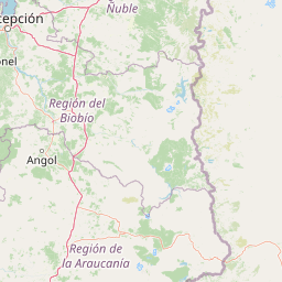
Streams
Park geography
Analyzing the protected landscape, volcanic features, and alpine forest boundaries
Comprehensive Geographic Profile and Mapped Terrain of Conguillío National Park in Chile
Examine the detailed geographic structure of Conguillío National Park, spanning 608 square kilometers across the La Araucanía Region of Chile. This profile details the mountain relief, volcanic terrain reaching 3150 meters, and diverse hydrological features including internal lakes and waterfalls within protected boundaries.
Related tags
Volcanic landscapesAraucaria forestsAndean mountainsProtected forestsMountain parks
Volcanic landscapes of the Chilean Andes crowned with ancient araucaria forests
Conguillío National Park
Conguillío National Park is a protected area in the Chilean Andes, located in the Araucanía Region of south-central Chile. The park encompasses approximately 608 square kilometers of dramatic volcanic terrain, dense forests, and alpine landscapes centered around the iconic Conguillío Lake. Its name derives from the Mapudungun language, meaning "water with araucaria seeds," reflecting the park's defining feature: the ancient monkey puzzle trees that dominate its forests. The park is part of the UNESCO-designated Araucarias Biosphere Reserve and the Kütralkura Geopark, recognizing its exceptional geological and ecological significance within the Global Geoparks Network.
- Location
- Chile
- Park type
- National park
- Established
- 1950
- Area
- 608 km²
Location overview
Regional placement within Chile's La Araucanía administrative division
Geographic Location and Regional Setting of Conguillío National Park
Conguillío National Park is situated within Chile, positioned in the prominent La Araucanía Region. Examining regional relationships helps clarify the administrative framework of the protected area.
- Countries
- Chile
- Regions
- La Araucanía Region
- Primary location
- La Araucanía Region
Boundary and coordinates
Spatial footprint and regional extent covering 608 square kilometers
Geographic Boundary Map and Spatial Limits of Conguillío National Park
Mapped geometric outlines provide essential spatial context for the protected wilderness boundary. Geographic datasets detail the 608 square kilometer area, coordinate limits, and central points.
- Boundary area
- 574.2 km²
- Boundary perimeter
- 220.3 km
- Northernmost point
- 38.4986° S
- Southernmost point
- 38.8119° S
- Easternmost point
- 71.4933° W
- Westernmost point
- 71.8907° W
- Geographic centre
- 38.6736° S, 71.6773° W
- North–south span
- 34.8 km
- East–west span
- 34.6 km
Elevation and terrain
Mountain relief metrics and recorded natural features
Conguillío National Park Terrain and Elevation Geography
Explore the recorded elevation summary and mountain relief metrics spanning up to 3150 meters across the protected terrain. Review the connected natural feature cards detailing individual streams, peaks, and lakes located within the park.
- Maximum elevation
- 3,150 m
Selected named natural features
Streams
Estero El Manzano
Viewpoints
Mirador Los Cóndores
Waterfalls
Salto Lan Lan
26 m high
Natural arches
Arco de Lava
Ridges
Cordillera de las Raíces
Environmental setting
Alpine climate zones, montane forests, and major water features across mountain terrain
Conguillío National Park Environmental Classifications and Physical Setting
Recorded landscape features, habitat types, and seasonal classifications provide structured ways to read the physical setting of Conguillío National Park. Stored environmental categories connect directly to relevant atlas destinations to support detailed geographic exploration.
- Relief
- Mountain
- Climate
- Alpine
- Water
- Major water bodies
- Forest cover
- Mostly forested
- Seasonality
- Strongly seasonal
Landscape features
Mountains · Valleys · Forest · Lakes · Rivers · Waterfalls · Volcano
Habitat types
Montane forest · Alpine meadow · Lacustrine habitat · Riverine habitat
Park atlas
Explore the surrounding volcanic terrain, ancient araucaria forests, and diverse protected landscapes across Chile's Araucanía Region.
Discover Other National Parks and Protected Areas Near Conguillío National Park
Continue your park exploration by comparing national parks and protected areas within Chile's Araucanía Region, many sharing Conguillío's dramatic volcanic origin and ancient araucaria forests. This curated geographic view allows for deeper understanding of regional conservation efforts and how distinct landscapes are preserved across the Andean mountain range.
National parkLa Araucanía Region
29 km away#1 closest
South

Huerquehue National Park: Ancient Araucaria Forests and Glacial Lakes in La Araucanía
Mapped protected area in the Andean foothills of Southern Chile.
Delve into the protected landscape of Huerquehue National Park, a key component of Chile's southern conservation efforts within the La Araucanía Region. This national park is defined by its ancient araucaria forests, home to the iconic monkey puzzle tree, and a network of clear glacial lakes including Tinquilco Lake. Its mountainous terrain, rising from 720 to 2,000 meters, showcases a vital representative of the Andean-Patagonian forest ecosystem, offering rich context for map exploration and understanding protected-area geography.
- Area
- 125 km²
- Established
- 1967
- IUCN
- II
- Visitors
- 35.5K annual
National parkChile
30 km away#2 closest
North
Tolhuaca National Park National Park: Mapped Boundaries and Chilean Geography
Explore the protected landscape and regional context of this park.
Tolhuaca National Park is a protected national park located in Chile, offering a distinct point for geographic and landscape discovery. This detailed view focuses on the park's mapped boundaries, its environmental setting within Chile, and its overall protected-area identity. Engage with structured data that clarifies its position in the broader atlas of natural landscapes, providing context for regional geography and conservation efforts.
- Area
- 64.74 km²
- Established
- 1935
- IUCN
- II
- Visitors
- 6.5K annual
National parkNeuquén Province
42 km away#3 closest
South

Lanín National Park: Volcanic Landscapes and Ancient Forests in Neuquén Province
Explore the protected area's mapped terrain and glacial lakes.
Lanín National Park offers a deep dive into the dramatic geography of Argentine Patagonia, centered around the prominent Lanín volcano. This national park preserves ancient araucaria forests, diverse ecosystems, and breathtaking glacial lakes like Huechulafquen and Lácar. Its extensive protected landscape provides critical habitat and opportunities to explore unique Andean terrain through map-driven discovery.
- Area
- 3,790 km²
- Established
- 1937
- IUCN
- II
- Relief
- Mountain
National parkLa Araucanía Region
57 km away#4 closest
South
Villarrica National Park: Chile's Protected Landscape in La Araucanía Region
Mapped boundaries and regional geography exploration
Villarrica National Park represents a crucial protected area within the diverse geography of Chile's La Araucanía Region. This atlas-focused entry provides detailed geographic context and mapped park boundaries, essential for understanding the park's landscape identity. Explore the foundational elements of this national park for structured geographic discovery.
- Area
- 630 km²
- Established
- 1940
- IUCN
- II
- Visitors
- 115.8K annual
National parkNeuquén Province
103 km away#5 closest
East
Laguna Blanca National Park: National Park in Neuquén Province, Patagonia
Mapped protected area and regional landscape context.
Laguna Blanca National Park represents a key protected landscape within the expansive geography of Neuquén Province, located in the Patagonia region of Argentina. This national park entity serves as a critical node for atlas exploration, allowing users to understand its specific protected boundaries and its contribution to the regional protected-area network. Investigate Laguna Blanca National Park to gain insight into its unique geographic setting and its role within the mapped natural areas of Western Argentina.
- Area
- 112.5 km²
- Established
- 1940
- IUCN
- II
- Relief
- Upland
National parkBío Bío Region
115 km away#6 closest
North
Laguna del Laja National Park: Mapped Protected Area in Chile's Bío Bío Region
Explore regional park geography and landscape context.
Laguna del Laja National Park represents a key protected area with distinct geographic attributes within the Bío Bío Region. This profile focuses on its identity as a national park, providing context for its mapped boundaries and natural landscape. Discover its place in regional geography, offering valuable insights for any atlas-focused exploration of Chile's protected lands.
- Area
- 119 km²
- Established
- 1958
- IUCN
- II
- Visitors
- 48.8K annual
National parkLa Araucanía Region
132 km away#7 closest
Northwest
Nahuelbuta National Park: Ancient Araucaria Forests and Protected Highland Geography
Discover its mapped boundaries atop the Cordillera de Nahuelbuta.
Nahuelbuta National Park is a significant national park in Chile's La Araucanía Region, celebrated for its ancient monkey puzzle tree forests atop the Cordillera de Nahuelbuta. This protected area showcases a unique highland landscape with rugged terrain and exposed rocky outcrops, preserving species more typical of Andean and Patagonian environments. Understanding its mapped geography and protected landscape identity is key to appreciating its ecological importance and distinct position within South America's natural atlas.
- Area
- 68 km²
- Established
- 1939
- IUCN
- II
- Relief
- Mountain
National parkRío Negro Province
148 km away#8 closest
South
Nahuel Huapi National Park: Protected Area Landscape and Geographic Context in Río Negro
Explore mapped natural terrain and park boundaries within Patagonia.
Nahuel Huapi National Park is a crucial protected area offering a deep dive into the Patagonian landscape. Situated in Argentina's Río Negro Province, this national park provides a detailed view of mapped natural terrain and its environmental context. Users can explore the park's geographic identity and protected boundaries, making it an essential stop for understanding the regional geography and conservation significance of this part of South America.
- Area
- 7,050 km²
- Established
- 1934
- IUCN
- II
- Relief
- Mountain
MoriAtlas Explorer
Continue Exploring Conguillío National Park's Mapped Terrain and Geographic Significance
Delve deeper into the structured geographic data for Conguillío National Park. Understanding its protected landscape identity and mapped features within La Araucanía Region offers crucial insights into regional natural context. Continue your atlas exploration by examining the park's specific geographic attributes and its place within the broader mapped environment.
Browse next
Global natural geography
Explore related park routes
Explore MoriAtlas Global ParksBrowse All MoriAtlas ParksGlobal Park Map DiscoveryMoriAtlas: Browse All CountriesBrowse All MoriAtlas ContinentsNational Park Environment AtlasGrand Canyon National Park AtlasYellowstone National Park AtlasYosemite National Park Atlas and GeographySerengeti National Park AtlasGalápagos National Park Protected LandscapeBanff National Park Geography and AtlasKruger National Park Atlas EntryUluṟu-Kata Tjuṯa National Park AtlasExplore Uluru-Kata Tjuta National Park GeographyPlitvice Lakes National Park AtlasFiordland National Park Protected LandscapeGreat Smoky Mountains National Park AtlasAfghanistan National Parks and Protected AreasAlbania National Parks and Protected AreasAlgeria National Parks and Protected AreasAmerican Samoa National Parks and Protected AreasAndorra National Parks and Protected AreasAngola National Parks and Protected AreasAntarctica National Parks and Protected AreasAntigua and Barbuda Park List