Mori Atlas logo
Nearby park discovery

Mapping regional landscapes and conserved environments within the Brandenburg area

Geographic Distribution of Protected Areas and Parks Near Cöthener Fließtal

This geographic overview visualizes the spatial context of protected areas situated in proximity to Cöthener Fließtal. By examining the surrounding natural terrain and regional boundaries, the data highlights the distribution of diverse habitats and landscapes across this part of Brandenburg. Each mapped location provides insight into the broader environmental mosaic surrounding the Cöthener Fließtal stream valley.

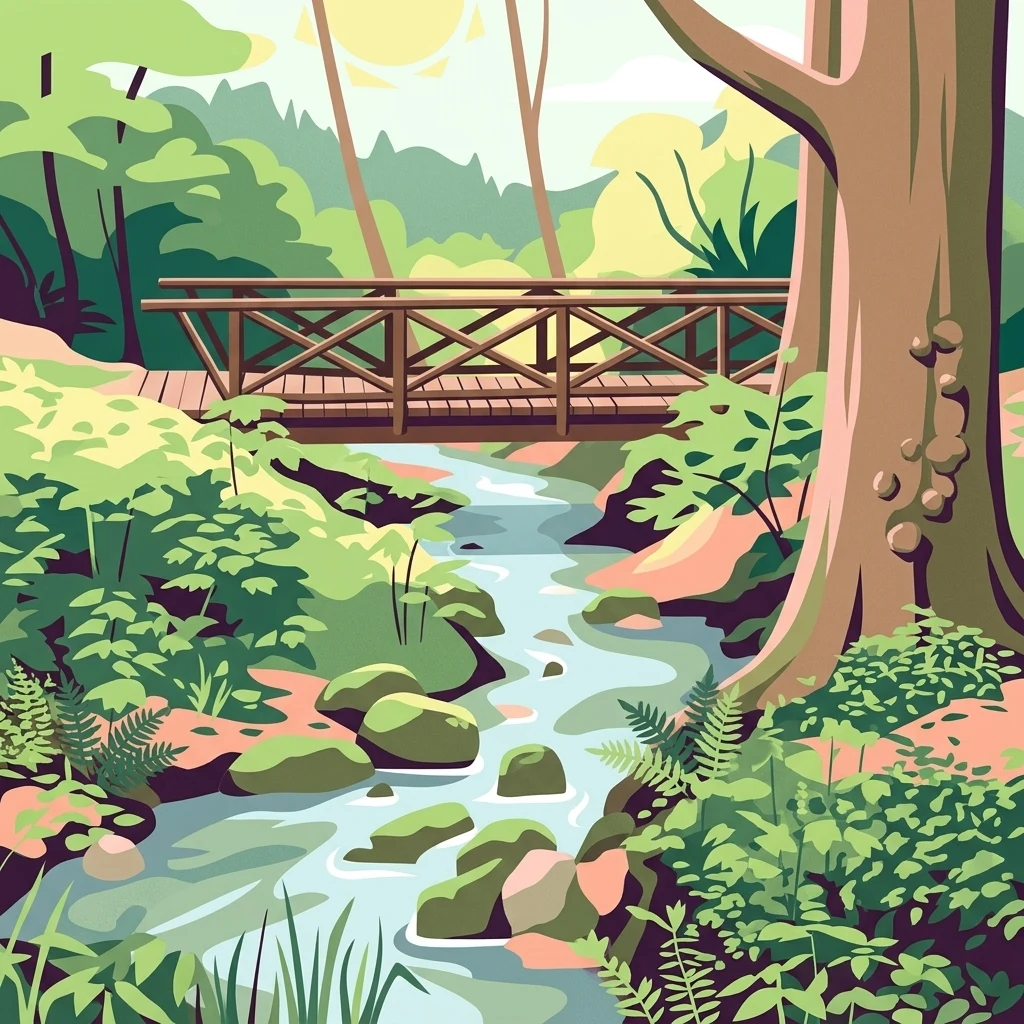
An illustrative art style drawing of a small wooden bridge crossing a winding stream in a lush, green forest setting with rocks in the water and dense vegetation.

A small Natura 2000 woodland valley northeast of Berlin, where a glacial stream meets the old Oderbruch landscape.

Cöthener Fließtal

Cöthener Fließtal is a small protected natural area of about 75 hectares in the northeastern corner of Brandenburg, Germany, just northeast of Berlin. It sits where the hilly Barnim plateau meets the old Oder valley, and it follows the Cöthener Fließ, a small stream that rises in spring-fed hills before flowing down through the village of Falkenberg and into the open Oderbruch and the old Oder river. The site is recognized as a European Natura 2000 Flora-Fauna-Habitat area, classified under IUCN Category IV as a Habitat/Species Management Area, and is valued for its diverse woodland habitats, glacial landforms, and protected species. The area is mostly forested, shaped by Weichsel glaciation and characterized by strongly pushed end-moraine ridges in its upper reaches. Woodland types range from alder and ash swamp forests around the spring mires to oak, hornbeam, beech, and sycamore stands in lower and drier locations. Pine, larch, and black locust appear as non-native admixtures. The stream valley also shelters rare insects, birds, and bats, including the greater mouse-eared bat, the western barbastelle, and the hermit beetle. Beyond its ecological value, the Fließtal carries a strong landscape-park heritage from the early nineteenth century, when Carl Friedrich von Jena laid out a romantic park around the Cöthener Schloss. Restored features such as a waterwheel, an artificial waterfall, and the hunting lodge known as Carlsburg still shape the character of the area today, making it both a nature protection site and a local recreational destination.

Location
Germany
Park type
Nature reserve
Established
2003
Area
0.8 km²
Highest point
82 m
Explore Cöthener Fließtal Nature Reserve
Regional park map

See the ranked park cluster in its geographic setting

Nearby parks around Cöthener Fließtal

This regional map shows the same 20 nearby parks ranked below around Cöthener Fließtal. Select a ranked marker to highlight that park’s boundary where boundary data is available.
Reference park: Cöthener FließtalRanked nearby parkSelected boundary: Cöthener Fließtal20 nearby parks shown
20 nearby parks

Distance ranked regional geography and surrounding protected landscapes

Parks and Protected Areas Geographically Near Cöthener Fließtal

Explore the ranked collection of protected areas situated geographically near Cöthener Fließtal, ordered by direct spatial proximity and measured boundary separation. Examining these surrounding protected landscapes provides structured environmental comparison signals across the regional terrain without implying shared habitats or route connections.
Nature reserveBrandenburg
5.8 km away#1 closest

Northeast

Tongruben Neuenhagen Nature Reserve: Protected Wetland Geography in Brandenburg, Germany

Examining post-industrial clay-pit habitats and protected wetland boundaries

Tongruben Neuenhagen is a designated nature reserve located in Brandenburg, Germany, established to protect biological communities that have developed within former clay extraction pits. The area features a complex mosaic of open water, wetland margins, and transitional scrub habitats. This reserve provides a notable example of how historical industrial land use can be repurposed into valuable habitat for protected species, serving as a key element of the local conservation network in the Märkisch-Oderland region.

Area
1.196 km²
Established
1990
IUCN
IV
Relief
Lowland
Protected landscapeWest Pomeranian Voivodeship
12 km away#2 closest

Northeast

Cedynia Landscape Park: Mapped Protected Landscapes and Regional Geography in Poland

Protected mosaic of sandy forests and river valleys

Spanning 308 square kilometers, Cedynia Landscape Park protects a complex transition zone in Poland. The area features the expansive Puszcza Piaskowa pine forests, the hilly moraine relief of the Cedynia Carpathians, and the biodiverse wetlands of the lower Oder River. This protected landscape represents an essential study in lowland ecological gradients and postglacial terrain development within the West Pomeranian Voivodeship.

Area
308.5 km²
Established
1993
Relief
Upland
Climate
Temperate
Watercolor painting depicting a river flowing through a valley with green vegetation and distant mountains
National parkBrandenburg
17 km away#3 closest

Northeast

Lower Oder Valley National Park: Unique Polder Landscape and Bird Sanctuary

Discover protected area maps and regional geography in Brandenburg

Delve into the Lower Oder Valley National Park, a national park recognized for its extraordinary polder landscape and extensive wetland ecosystems. This page provides detailed geographic context, highlighting the park's unique engineered floodplain, its role as a sanctuary for numerous bird species, and its position within the regional geography of Brandenburg. Understand the mapped boundaries and ecological importance of this exceptional protected area.

Area
103.23 km²
Established
1995
IUCN
II
Visitors
150K annual
Nature reserveBrandenburg
25 km away#4 closest

Southeast

Stobbertal Nature Reserve: Geography, Mapped Boundaries, and Protected Landscape Context

A detailed geographic study of the Stöbber river valley in Brandenburg, Germany

Stobbertal represents a compact yet ecologically dense protected area in Brandenburg. This study provides access to information regarding its diverse forest and wetland habitats, ranging from ancient oak-hornbeam woodlands to rare floodplain remnants. Gain insight into the regional importance of the river corridor, its hydrologic features, and the protected species that inhabit this distinct northeastern German landscape.

Area
8.84 km²
Established
1990
IUCN
IV
A soft watercolor painting of a pastoral landscape featuring green rolling hills, distant trees, and a foreground with grassy vegetation and pinkish marsh-like reflections.
Protected landscapeBrandenburg
About 26 km away#5 closest

South

Naturpark Märkische Schweiz: A Protected Landscape Discovery in Brandenburg

Glacial terrain, kettle lakes, and river basin geography.

Situated near Berlin, this protected landscape features a textbook glacial relief shaped by retreating ice sheets. The area encompasses the Schermützelsee, deep kettle ponds known as Sölle, and the narrow valleys of the Stobber river. Learn about the park's layered conservation framework, which combines European habitat protection with rich fieldstone architecture and cultural history.

Area
205 km²
Established
1990
Relief
Upland
Climate
Temperate
A watercolor painting of a serene fen or wetland with reeds in the foreground, calm water, and rolling hills in the background under a soft pastel sky.
Nature reserveBarnim District
About 26 km away#6 closest

Southwest

Ladeburger Schaeferpfuhle: Nature Reserve and Protected Landscape in Barnim District

Mapped lowland fen ecosystems and habitat geography

Located in the Barnim District of Germany, Ladeburger Schaeferpfuhle is a designated nature reserve defined by its post-glacial lowland fen terrain. This area preserves a mosaic of wet meadows, shrub thickets, and pools that support specialized plant and wildlife populations. The site serves as a vital example of regional hydrology, maintaining open landscapes through traditional grazing practices that protect this fragile habitat.

Area
0.267 km²
Established
2000
Relief
Lowland
Climate
Temperate
Watercolor painting of a tranquil, flat wetland landscape with pale green, pink, and yellow hues representing water, vegetation, and a soft sky.
Nature reserveBrandenburg
About 26 km away#7 closest

Southeast

Europäisches Vogelschutzgebiet Altfriedländer Teich- und Seengebiet: Protected Area Geography

Nature reserve wetland network in eastern Brandenburg

Discover the geographic structure of this extensive pond and lake complex in Märkisch-Oderland. This protected area features shallow open water, sprawling reedbeds, and remnants of lowland peat that support dense populations of migratory waterfowl and rare breeding waterbirds within a working cultural landscape.

Area
7 km²
Relief
Lowland
Climate
Temperate
Scope
Terrestrial
Protected landscapeWest Pomeranian Voivodeship
27 km away#8 closest

Northeast

Wzgórza Krzymowskie Protected Landscape: Moraine Geography and Map Context

Glacial ridges and forest landscapes in West Pomeranian Voivodeship

Wzgórza Krzymowskie serves as a primary example of compressed postglacial relief in northwestern Poland. The protected area features a unique combination of sandy inland dunes, internal moraine hills, and a steep western escarpment that carves deep ravines towards the Oder. This geographic analysis highlights the structural connection between the Puszcza Piaskowa forest, spring-fed stream networks, and elevated viewpoints across the regional landscape.

Relief
Upland
Access
Easy access
Scope
Terrestrial
Water
Major water bodies
A horizontal watercolor painting showing layers of soft-toned hills in green and purple, with tall blades of grass in the foreground.
Nature reserveBrandenburg
28 km away#9 closest

Southeast

Klobichsee Nature Reserve: Protected Landscape and Glacial Lake Geography in Brandenburg

Mapping aquatic ecosystems and protected boundaries in eastern Germany

Klobichsee Nature Reserve covers roughly 5.59 square kilometers, centering on the Großer Klobichsee and Kleiner Klobichsee glacial lakes. This protected area in Brandenburg preserves essential forest and wetland habitats, maintaining the ecological character of the region situated between Buckow and Münchehofe.

Area
5.59 km²
Established
1990
IUCN
IV
Climate
Temperate
Watercolor painting of a lake surrounded by green trees, grassy banks, and soft rolling hills under a pale sky.
Protected areaBrandenburg
29 km away#10 closest

Northeast

Felchowseegebiet Protected Area: Mapped Glacial Lakes and Woodland in Brandenburg

Examining the ecological landscape and forest boundaries of the Uckermark region

Felchowseegebiet functions as a vital refuge for aquatic and forest species in Brandenburg. This protected landscape is defined by its glacial lakes, including the central Felchowsee, which are framed by forests managed for natural development. The area offers a detailed view of the Uckermark terrain, highlighting the interaction between moist woodland and protected water surfaces in northeastern Germany.

Area
9.72 km²
Established
2003
Relief
Lowland
Climate
Temperate
A horizontal watercolor illustration showing a pinkish-purple foreground of heathland vegetation transitioning into a line of light green trees against a pale, washed-out hilly background.
Nature reserveBrandenburg
29 km away#11 closest

West

Schönower Heide Nature Reserve: An Atlas View of Brandenburg Protected Heathlands

A restored landscape of glacial dunes and sandy heath

Schönower Heide stands as a significant nature reserve in Brandenburg, Germany. The area protects a unique combination of open sand heath, pine woodland, and wetland meadows formed on post-glacial outwash plains. This protected landscape is recognized for its successful transition from former military terrain into a vibrant habitat for diverse flora and fauna, including managed populations of red deer and mouflon within its fenced boundaries.

Area
5.334 km²
Established
2000
IUCN
V
Relief
Lowland
A watercolor illustration of a rural landscape with low hills, trees, and grassy meadow areas.
Nature reserveBrandenburg
About 30 km away#12 closest

Southwest

Faule Wiesen bei Bernau Nature Reserve: Mapped Landscapes and Geography of Brandenburg

A vital Panke river corridor protecting rare meadow and woodland biomes.

Spanning 37 hectares near the northern edge of Berlin, Faule Wiesen bei Bernau offers a study in contrasting landscapes. The reserve features open wet meadows and small ponds alongside sandy dry grasslands and oak woodlands. It remains an essential ecological link within the Barnim district, preserving critical habitats for amphibians and orchids within the broader Brandenburg geography.

Area
0.37 km²
Established
2000
Relief
Lowland
Scope
Terrestrial
Nature reserveBrandenburg
31 km away#13 closest

Northwest

Winkel Nature Reserve: Glacial Landscape and Wetland Geography in Brandenburg, Germany

Mapping kettle-hole basins and moraine terrain

Winkel Nature Reserve serves as a vital protected area for studying the hydrological character of the Uckermark. The reserve features a dense network of small, water-filled kettle holes formed by melting glacial ice. This geographic record explores the interconnected wetland habitats and ground moraine surfaces that define this sensitive protected landscape in northeastern Germany.

Area
1.45 km²
Established
1990
IUCN
IV
A horizontal watercolor painting showing a soft-focus landscape of light green trees, yellow fields, and pale blue rolling hills in the background.
Nature reserveBrandenburg
About 31 km away#14 closest

South

Lange Dammwiesen und Unteres Annatal: Glacial Ridges and Nature Reserve Geography

A mapped protected area in the state of Brandenburg, Germany

Lange Dammwiesen und Unteres Annatal represents a compact but ecologically rich nature reserve featuring signature osar ridges and varied meadow habitats. This site provides valuable insight into the glacial landscape of the North German Plain, illustrating the effectiveness of conservation grazing in maintaining diverse ecosystems within the Brandenburg region.

Area
0.013 km²
Established
1990
IUCN
IV
Relief
Lowland
Watercolor painting of a gentle green hilly landscape with a foreground of soft pink and purple tones, set against a light background.
Nature reserveLandkreis Uckermark
32 km away#15 closest

Northwest

Endmoränenlandschaft bei Ringenwalde: Nature Reserve and Glacial Landscape Exploration

Geomorphology and protected forest geography in Landkreis Uckermark

This nature reserve stands as a textbook example of end moraine morphology shaped by Pleistocene glaciers. The area serves as a vital component of the broader Schorfheide-Chorin Biosphere Reserve, preserving a distinct system of forested ridges, basin lakes, and varied micro-relief that offers deep insight into the natural history of the Brandenburg region.

Area
5.69 km²
Established
1990
IUCN
IV
A horizontal watercolor illustration of a wetland scene with soft pink and green tones, showing sparse trees on the banks of a shallow, marshy water area under a pale sky.
Nature reserveBrandenburg
About 33 km away#16 closest

Southwest

Ausstichgelände Röntgental: Brandenburg Nature Reserve and Protected Wetland Atlas

Mapped ecological landscapes on the Berlin metropolitan fringe

Investigate the detailed geography of Ausstichgelände Röntgental, a compact nature reserve in Brandenburg. Formed from nineteenth-century railway sand quarries, this protected area features a diverse mosaic of reed beds, open water, and alder carr forest. The site provides a compelling case study of post-industrial ecological recovery within the broader Barnim Nature Park landscape.

Area
0.248 km²
Established
1990
IUCN
IV
A soft watercolor illustration of a lake landscape with calm water, a green tree-lined shore, and gently rolling hills in the background.
Nature reserveBrandenburg
33 km away#17 closest

Northwest

Krinertseen Nature Reserve: Protected Glacial Lakes and Bog Landscapes in Brandenburg

Essential geographic data for the Uckermark wetland conservation area.

Krinertseen provides a concentrated view of Brandenburg's post-glacial terrain. This nature reserve serves as an ecologically significant area defined by mesotrophic-alkaline lakes and active lake-succession mires. The site acts as a key component of the wider Schorfheide-Chorin conservation network, showcasing the complex relationship between regional hydrology and protected forest ecosystems.

Area
3.51 km²
Established
1990
IUCN
IV
Relief
Lowland
A soft, artistic watercolor painting of a green landscape leading to a lake, with rolling hills in the background and soft morning or evening light.
Nature reserveBrandenburg
34 km away#18 closest

Northwest

Bollwinwiesen/Großer Gollinsee Nature Reserve: Brandenburg Protected Area Atlas

Oligotrophic lake chains and peat-forming mire landscapes

Bollwinwiesen/Großer Gollinsee forms a critical ecological anchor within the Schorfheide-Chorin Biosphere Reserve. The area preserves a distinct glacial mosaic where clear water, Sphagnum-dominated mires, and traditional wet meadows converge to create a protected landscape defined by its high ecological integrity and historic conservation status.

Area
9.075 km²
Established
1990
IUCN
IV
Relief
Lowland
Watercolor illustration showing a soft landscape with a pond, marsh vegetation, and a background of rolling hills or meadows.
Nature reserveBerlin
About 34 km away#19 closest

Southwest

Mittelbruch Nature Reserve: Mapped Wetland Geography and Protected Landscape in Berlin

Examining lowland peat diggings and protected moorland ecosystems

Mittelbruch stands as a compact nature reserve in northeastern Berlin, featuring a layered landscape of former peat diggings and open moor meadows. This area plays a critical role in urban conservation by providing essential refuge for waterbirds and diverse meadow flora. Utilize the atlas to study the reserve's internal geography, including its managed reed belts and surrounding forest edges that form a distinct ecological mosaic within the city landscape.

Area
0.282 km²
Established
1997
IUCN
IV
Relief
Lowland
A watercolor painting of a flat, marshy landscape with soft green trees in the midground and pale hills under a light sky in the background.
Nature reserveBerlin
35 km away#20 closest

Southwest

Falkenberger Rieselfelder Nature Reserve: A Detailed Atlas of Berlin Protected Lands

Reclaimed wetland geography and urban conservation habitats

Falkenberger Rieselfelder acts as an ecologically rich refuge where former industrial irrigation fields have been repurposed into a mosaic of seasonal pools and meadows. Located on the urban fringe of Berlin, this nature reserve offers a unique look at how conservation grazing and habitat management support species like the great crested newt within a dense metropolitan region.

Area
0.881 km²
Established
1995
IUCN
IV
Relief
Lowland
Distance methodology

Geographic measurements, not driving distances

How nearby park distances are calculated

Distances use park boundaries whenever the available geometry allows it. When one or both boundaries are missing, the mapped park locations provide a clearly labelled estimate. Every value represents straight-line geographic separation and does not use roads or routing.

Boundary distance

Calculated between the nearest points of both park boundaries.

Location-to-boundary estimate

Estimated from one mapped park location to the nearest boundary of the other park.

Mapped-location estimate

Estimated between the mapped locations of both parks.

MoriAtlas Explorer

Explore the Geographic Boundaries and Landscapes of Cöthener Fließtal

Delve into the protected terrain of Cöthener Fließtal to understand its glacial formation and ecological significance. MoriAtlas provides detailed insight into the valley's unique composition, spanning its spring-fed forests to the historic features integrated within this Brandenburg landscape.