Mori Atlas logo
Nearby park discovery

Explore the regional geography and distribution of protected lands in the Coahuila landscape transition zone.

Protected Areas and Natural Landscapes Near Cuenca Alimentadora del Distrito Nacional de Riego 004 Don Martín

Examine the geographic distribution of protected areas surrounding Cuenca Alimentadora del Distrito Nacional de Riego 004 Don Martín. This regional overview highlights the proximity of conservation landscapes within the Coahuila ecological transition, mapping the relationship between watershed protection zones and the surrounding terrain of the Sierra Madre Oriental.

Related tags

watershed protectionChihuahuan DesertSierra Madre Orientalriparian habitatpine-oak forest

A vast northern Mexican watershed reserve where the Chihuahuan Desert gives way to the Sierra Madre Oriental.

Cuenca Alimentadora del Distrito Nacional de Riego 004 Don Martín

Cuenca Alimentadora del Distrito Nacional de Riego 004 Don Martín is a large natural resources protection area in central Coahuila, in northern Mexico. The protected area is centered on the upper watershed of the Salado River, capturing the headwaters and tributaries that ultimately feed the Don Martín irrigation district downstream. The reserve straddles the dramatic ecological transition between the arid Chihuahuan Desert and the eastern slope of the Sierra Madre Oriental. This geography creates a layered landscape of dry shrublands and grasslands in the lowlands, riparian forests along the rivers, and oak and pine woodlands climbing the higher mountain slopes. The protected area is administered by Mexico's National Commission of Natural Protected Areas under IUCN Category VI management. Its core purpose is watershed protection: safeguarding the integrity of rivers such as the Sabinas, Alamós, and Mimbres so that downstream agriculture can continue to rely on a stable water supply. The designation also delivers significant conservation value, protecting habitat across one of Mexico's most ecologically variable arid-to-montane transition zones and supporting a portion of the Sabinas River that is recognized internationally as a wetland of importance.

Location
Mexico
Park type
Protected area
Established
1949
Area
15,193.8 km²
Cuenca Alimentadora del Distrito Nacional de Riego 004 Don Martín Atlas
Regional park map

See the ranked park cluster in its geographic setting

Nearby parks around Cuenca Alimentadora del Distrito Nacional de Riego 004 Don Martín

This regional map shows the same 20 nearby parks ranked below around Cuenca Alimentadora del Distrito Nacional de Riego 004 Don Martín. Select a ranked marker to highlight that park’s boundary where boundary data is available.
Reference park: Cuenca Alimentadora del Distrito Nacional de Riego 004 Don MartínRanked nearby park20 nearby parks shown
20 nearby parks

Ranked geographic separation and regional environmental comparison signals for surrounding protected landscapes

Parks and Protected Areas Geographically Near Cuenca Alimentadora del Distrito Nacional de Riego 004 Don Martín

Spatial proximity rankings establish a structured index of nearby protected areas surrounding Cuenca Alimentadora del Distrito Nacional de Riego 004 Don Martín, mapping direct geographic separation and regional environmental traits. Country context and recorded ecological characteristics provide baseline comparison signals for analyzing surrounding terrain without relying on travel routes.
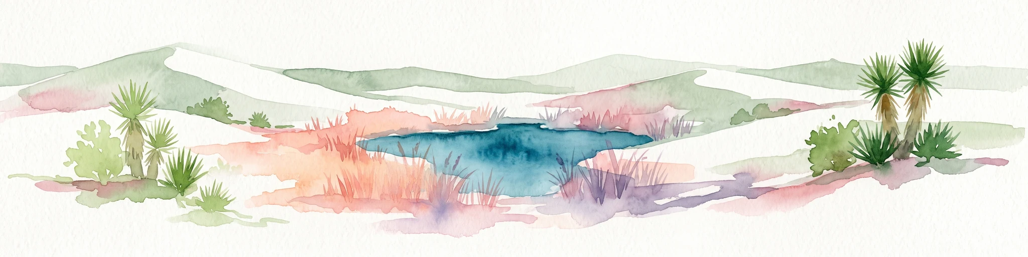
Watercolor painting of a desert landscape with white gypsum dunes, a central turquoise blue pool, and yucca plants.
Wildlife reserveCoahuila
About 139 km away#1 closest

Southwest

Área de Protección de Flora y Fauna Cuatrociénegas: Protected Landscape and Atlas Map

Desert wetlands and gypsum dune geography in Coahuila, Mexico

This wildlife reserve in Coahuila represents a globally significant desert wetland complex. Featuring hundreds of spring-fed pozas and the second-largest gypsum dune field in the Americas, the reserve offers a unique look at isolated ecosystems and specialized biodiversity within the Chihuahuan Desert.

Area
843.47 km²
Established
1994
Relief
Lowland
Climate
Arid
Protected landscapeTexas
About 174 km away#2 closest

North

Amistad National Recreation Area: Mapped Protected Landscapes in Texas

Desert reservoir geography and canyon ecosystems

Amistad National Recreation Area represents a distinct protected landscape located in Val Verde County, Texas. Centered on the expansive Amistad Reservoir at the United States-Mexico border, the area features rugged limestone canyons and extensive water-based terrain where the Rio Grande, Devils, and Pecos rivers meet. The site offers deep insight into desert canyon geography and historic rock art distributions.

Area
237 km²
Established
1965
Visitors
912.3K annual
Relief
Upland
Watercolor painting of soft, layered green mountain silhouettes against a pale sky.
Wildlife reserveCoahuila
About 206 km away#3 closest

Northwest

Área de protección de flora y fauna Maderas del Carmen: Protected Desert Mountain Geography

Rugged limestone ranges and conservation corridors in northern Coahuila

The Área de protección de flora y fauna Maderas del Carmen protects an expansive, high-elevation desert mountain landscape. Featuring the Sierra del Carmen and Sierra el Jardín, the reserve bridges arid desert basins with forested upland terrain, creating one of northern Mexico's most significant ecological corridors for scientific study and wilderness preservation.

Area
2,083.81 km²
Established
1994
Relief
Mountain
Climate
Arid
Wildlife reserveCoahuila
About 209 km away#4 closest

Northwest

Ocampo Flora and Fauna Protection Area: Mapping Desert and Riverine Geography in Coahuila

A vital transboundary wildlife reserve in northern Mexico

Ocampo Flora and Fauna Protection Area provides a massive, contiguous block of protected wilderness characterized by rugged mountain foothills and desert flats. As a cornerstone of the El Carmen Big Bend Complex, the reserve offers a unique look at how river-cut canyons and arid scrublands support diverse life forms in the northern Chihuahuan Desert of Coahuila.

Area
3,442.38 km²
Established
2009
IUCN
VI
Relief
Mixed relief
National parkBrewster County
About 226 km away#5 closest

Northwest

Big Bend National Park: National Park, Mapped Protected Landscape, and Regional Geography

Explore Brewster County's protected natural terrain.

Big Bend National Park is a prominent national park defined by its protected landscape and geographic features within Brewster County. This destination provides users with detailed atlas-style information, focusing on the park's mapped boundaries and its contribution to the understanding of regional natural geography. Delve into the specific context of this protected area to enhance your geographic discovery.

Area
3,242.19 km²
Established
1944
IUCN
II
Visitors
568.1K annual
Protected areaNuevo León
About 258 km away#6 closest

Southeast

Sierra de Picachos Protected Area: Geographic Boundaries and Regional Landscapes

Mountain geography in northern Nuevo León

Sierra de Picachos represents a vital conservation zone spanning north of Monterrey. The landscape is defined by its dramatic elevation changes, moving from desert-like plains to cool coniferous slopes. This atlas entry focuses on the physical boundaries, ecological zones, and the rugged, peak-studded terrain that distinguish the range from the surrounding Sierra Madre Oriental.

Area
1,405 km²
Established
2000
Relief
Mountain
Climate
Subtropical
Watercolor illustration of layered mountain ranges with purple peaks fading into a green and yellow foreground.
Natural monumentNuevo León
About 264 km away#7 closest

South

Cerro de la Silla: Protected Natural Monument Geography and Regional Map Context

A rugged mountain landscape in Nuevo León, Mexico

Cerro de la Silla is defined by its unmistakable saddle-shaped silhouette and its status as a vital protected area within the urban matrix of Monterrey. The mountain features complex folded limestone geology and a diverse habitat mosaic that transition from arid scrubland to forested peaks. Use this atlas resource to understand its topographical boundaries, summit formations, and regional environmental significance within the Sierra Madre Oriental fold belt.

Area
60 km²
Established
1991
Relief
Mountain
Climate
Subtropical
Watercolor painting of a mountain range featuring gentle slopes and low-lying shrubs against a white background.
Protected areaCoahuila
About 281 km away#8 closest

South

Serranía de Zapalinamé: Protected Mountain Geography and Watershed in Coahuila

Ecological transition zone within the Sierra Madre Oriental

The Serranía de Zapalinamé forms a dramatic mountain corridor rising over Saltillo, Coahuila. This state natural reserve protects a vital watershed and biodiversity hotspot where Chihuahuan Desert scrub meets pine and oak montane forests. Its steep canyons and high ridges offer a significant case study in regional landscape conservation and natural water security.

Area
253.74 km²
Established
1996
Relief
Mountain
Climate
Arid
National parkMexico
About 282 km away#9 closest

South

Cumbres de Monterrey National Park: National Park Protected Landscape Discovery

Explore Mexico's Mapped Terrain and Regional Geography

Understand Cumbres de Monterrey National Park as a distinct protected landscape within Mexico. This page provides detailed atlas-oriented information focused on its geographic boundaries, mapped terrain, and its role in regional conservation. It serves as a valuable entry point for exploring the park's natural context and understanding its place in the national geography.

Area
1,773.96 km²
Established
1939
IUCN
II
Relief
Mountain
Protected areaCoahuila
About 283 km away#10 closest

South

Cuenca Alimentadora del Distrito Nacional de Riego 026 Bajo Rio San Juan Protected Landscape

Mountain watershed and forest habitat in Coahuila

An expansive protected area encompassing the upper catchments of the San Juan River. The terrain features a significant altitudinal gradient, ranging from semi-arid matorral shrublands to rare high-altitude conifer groves including Mexican Douglas-fir, defining the regional water supply landscape.

Area
1,971.57 km²
Established
1949
IUCN
VI
Relief
Mountain
A horizontal watercolor illustration depicting soft, rolling hills, a small stream in the foreground, and pine forests, using a muted pastel palette.
Wildlife reserveChihuahua
About 300 km away#11 closest

Northwest

Área de Protección de Flora y Fauna Cañón de Santa Elena Wildlife Reserve Map and Geography

Chihuahuan Desert conservation area in Chihuahua, Mexico

This wildlife reserve protects a vast expanse of the Chihuahuan Desert along the Mexico-United States border. The landscape is defined by deep river-cut canyons, volcanic uplifts, and broad valleys. Discover the geological structure and ecological boundaries of this protected area, which mirrors the conservation efforts of neighboring regions to maintain a vital desert ecosystem.

Area
2,772.09 km²
Established
1994
Relief
Mountain
Climate
Arid
State or regional parkDurango
About 370 km away#12 closest

Southwest

Cañon de Fernández State Park: A Protected Wetland and Canyon Landscape in Durango

Geography and riparian forest mapping in northern Mexico

Cañon de Fernández State Park is an ecologically vital protected area in Durango, defined by the Nazas River corridor. Spanning desert canyons and ancient riparian forests, this site serves as a crucial Ramsar wetland in the Chihuahuan Desert. Learn about its unique geographic boundaries and the centuries-old cypress trees that define this rare northern Mexican landscape.

Area
170.19 km²
Established
2004
Relief
Mixed relief
Climate
Arid
A soft, watercolor-style illustration of a landscape with rolling dunes, sparse grasses, and a lone yucca plant.
Protected landscapeTexas
About 385 km away#13 closest

East

Padre Island National Seashore: Protected Barrier Island Geography and Mapping

Coastal landscapes and hypersaline lagoon ecosystems in South Texas

Padre Island National Seashore serves as a critical protected landscape on the Texas Gulf Coast, characterized by seventy miles of undeveloped shoreline and the hypersaline Laguna Madre. This atlas entry provides geographic context on the barrier island terrain, including active dune fields, tidal flats, and the diverse habitats that support significant migratory bird populations and sea turtle recovery efforts.

Area
527.85 km²
Established
1962
IUCN
V
Visitors
573.3K annual
Nature reserveTexas
About 402 km away#14 closest

East

Mission-Aransas National Estuarine Research Reserve: A Texas Coastal Protected Landscape

Mapped estuarine habitats and regional coastal geography

Encompassing a unique mix of terrestrial and marine environments, Mission-Aransas National Estuarine Research Reserve stands as a significant protected corridor on the Texas Coast. The landscape features deep-water bays, sheltered seagrass meadows, and open coastal prairie, offering a clear view of how riverine processes shape the complex shoreline of the western Gulf of Mexico.

Relief
Lowland
Climate
Subtropical
Access
Easy access
Scope
Mixed
Wildlife reserveTamaulipas
About 458 km away#15 closest

Southeast

Laguna Madre Wildlife Reserve: Geography and Protected Coastal Landscapes of Tamaulipas

Mapping the hypersaline lagoons and barrier island chains of Mexico

Laguna Madre represents a singular coastal ecosystem characterized by its extreme salinity, expansive seagrass meadows, and sheltered barrier island configuration. As a vital protected wetland, the area serves as a primary migratory flyway and habitat for diverse shorebirds and sea turtles, revealing a distinct arid coastal landscape along the Tamaulipas shore.

Area
5,728.08 km²
Established
2005
IUCN
VI
Relief
Lowland
National parkSombrerete Municipality
About 523 km away#16 closest

Southwest

Sierra de Órganos National Park National Park: Mapped Protected Landscape Details

Explore geographic context and park boundaries within Sombrerete Municipality.

Sierra de Órganos National Park stands as a vital national park, offering a unique opportunity for geographic and atlas-based discovery. This dedicated entry focuses on its protected landscape identity, providing detailed insights into its mapped boundaries and its place within the regional geography of Sombrerete Municipality. Understand the park's role as a protected natural area through structured data and landscape context, essential for comprehensive geographic exploration.

Area
11.25 km²
Established
2000
IUCN
II
Relief
Mountain
National parkChihuahua
About 533 km away#17 closest

West

Cumbres de Majalca National Park: National Park Discovery and Geographic Context in Chihuahua

Mapped protected landscape exploration in Chihuahua.

Delve into the protected landscape of Cumbres de Majalca National Park, a national park situated in the Chihuahua region of Mexico. This entry provides essential geographic context and details on its mapped boundaries, serving as a key point for atlas-based exploration of Mexico's protected areas. Understand its specific contribution to the regional geography and conservation landscape.

Area
47.72 km²
Established
1939
IUCN
II
Relief
Mountain
National parkCulberson County
About 565 km away#18 closest

Northwest

Guadalupe Mountains National Park: Mapped Boundaries and Protected Landscape Identity

Explore the geography and terrain of this Texas national park.

Guadalupe Mountains National Park is a key protected area within Culberson County, West Texas. This national park offers a distinct geographic focus, allowing for detailed exploration of its mapped boundaries and the unique natural landscapes that define its protected status. Understanding its place within the Trans-Pecos region provides valuable context for regional geography and atlas-based discovery of conservation lands in Texas.

Area
349.51 km²
Established
1972
IUCN
II
Visitors
206.4K annual
National parkEddy County
About 568 km away#19 closest

Northwest

Carlsbad Caverns National Park: Detailed Protected Area and Landscape Exploration

View mapped terrain and geographic context for this Eddy County national park.

Gain a deep understanding of Carlsbad Caverns National Park through its specific geographic features and protected landscape identity. This entry provides foundational atlas-level information on the park's mapped boundaries and its role as a designated national park within the broader regional geography of Eddy County. It is designed to offer precise context for users focused on understanding the specific natural terrain and conservation geography of this important protected area, facilitating structured discovery.

Area
189.26 km²
Established
1930
IUCN
II
Visitors
410.8K annual
Watercolor painting showing layers of rolling hills and distant mountains in shades of soft green, pink, and yellow.
Protected landscapeNew Mexico
About 574 km away#20 closest

Northwest

Lincoln National Forest Protected Landscape: Mapping the New Mexico Environmental Gradient

Geography of the Sacramento, Capitan, and Guadalupe Mountains

Lincoln National Forest encompasses a remarkable vertical transition across three ranger districts in New Mexico. The area protects complex mountain landscapes including the east-west Capitan range and the ancient reef geology of the Guadalupe Mountains, serving as a critical example of ecological diversity within a single federal unit.

Area
4,467.31 km²
Established
1902
Visitors
735.2K annual
Relief
Mountain
Distance methodology

Geographic measurements, not driving distances

How nearby park distances are calculated

Distances use park boundaries whenever the available geometry allows it. When one or both boundaries are missing, the mapped park locations provide a clearly labelled estimate. Every value represents straight-line geographic separation and does not use roads or routing.

Boundary distance

Calculated between the nearest points of both park boundaries.

Location-to-boundary estimate

Estimated from one mapped park location to the nearest boundary of the other park.

Mapped-location estimate

Estimated between the mapped locations of both parks.

MoriAtlas Explorer

Explore the Protected Landscape of Cuenca Alimentadora del Distrito Nacional de Riego 004 Don Martín

Examine the mapped boundaries and natural terrain of this essential watershed reserve. MoriAtlas provides a clear view into how this protected area supports the ecological stability of the Salado River basin and its surrounding mountain systems in Coahuila, Mexico.