Mori Atlas logo
Park earthquake history

Review recorded seismic events, epicentre distances, and magnitude data for this protected landscape.

Historical Catalogue of Earthquakes Near De Loonse en Drunense Duinen National Park

This historical collection archives documented seismic activity associated by location with the terrain of De Loonse en Drunense Duinen National Park. The catalogue provides structured details on event dates, magnitudes, and depths for researchers and map enthusiasts interested in the seismic context of this Dutch national park. All records are derived from available scientific datasets, helping to trace the history of ground movement surrounding the dunes and heathlands without implying any causal relationship to the local geology.

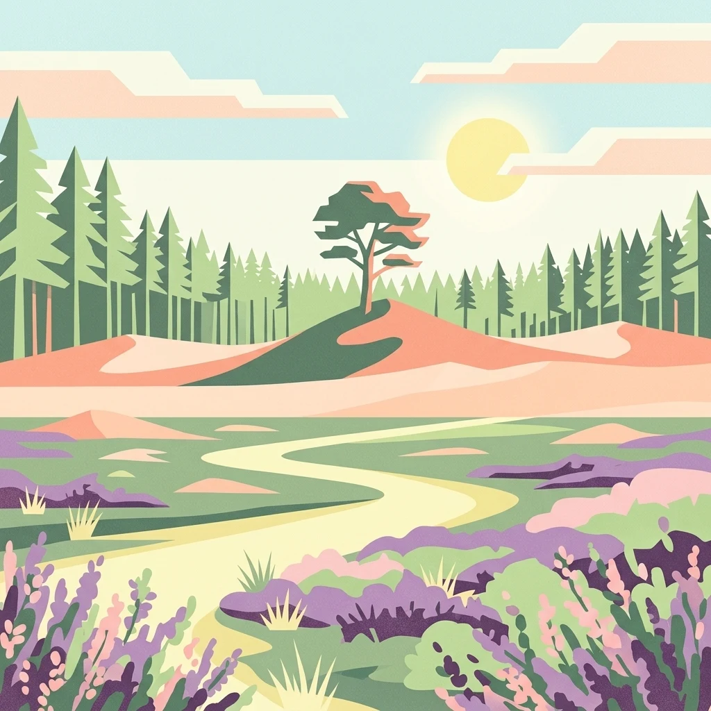
Colorful illustration of a landscape with sand dunes, pine trees, a winding path, and purple flowers under a sunny sky with clouds

North Brabant's remarkable sand dune landscape, the "Brabant Sahara"

De Loonse en Drunense Duinen National Park

De Loonse en Drunense Duinen National Park is a distinctive Dutch national park situated in the province of North Brabant, in the southern Netherlands. The park occupies approximately 35 square kilometers between the cities of Tilburg, Waalwijk, and 's-Hertogenbosch, spanning the municipalities of Loon op Zand, Heusden, and Vught. The landscape is characterized by an extraordinary combination of extensive heathlands, large dunes, and coniferous forests that create a unique microclimate unusual for the Netherlands. Originally designated as an independent national park in 2002, the area became part of the newly created Van Gogh National Park in 2024, forming its core conservation area. The park is notable for containing one of the largest living sand drift (stuifzand) areas in North Europe, a rare and dynamically maintained landscape that requires active management to prevent natural succession from transforming the open sand plains into forest.

Location
Netherlands
Park type
National park
Established
2002
Area
35 km²
De Loonse en Drunense Duinen National Park Atlas

Review De Loonse en Drunense Duinen National Park event details and distances

Earthquake records near De Loonse en Drunense Duinen National Park

De Loonse en Drunense Duinen National Park is associated with earthquake reports by epicentre and computed distance, not proof of occurrence within its dune boundary. The collection retains timing, magnitude, depth, reported locality, park separation, and source links for historical review without attributing dune or woodland formation to the events, asserting seismic cause, or forecasting hazard.

Sort by
Magnitude
Location

This page describes catalogued earthquakes associated with the park by epicentre location and distance. It does not establish causation, assess current danger, or predict future earthquakes.

No earthquake records match the current filters

Park atlas

Continue beyond De Loonse en Drunense Duinen National Park earthquake records

Other parks after De Loonse en Drunense Duinen National Park

From De Loonse en Drunense Duinen National Park's earthquake catalogue, discovery continues beyond North Brabant's sand dunes, heathland, and Natura 2000 landscape into other parks. Nothing about those destinations establishes common national-park designation, habitat status, proximity, geology, seismic evidence, hazards, risk, or comparable documentation.
Watercolor illustration of rolling hills, a winding river, and fields with distant mountains
National parkNorth Brabant
Park boundaries overlap#1 closest

East

Van Gogh National Park: National Park in North Brabant with Dune Landscapes

Explore mapped protected areas and regional geography.

Van Gogh National Park is a significant protected landscape in North Brabant, Netherlands, covering approximately 1,200 square kilometers. This national park is distinguished by its extensive drift sand dune systems, notable heathlands, and wooded valleys, offering a diverse terrain within the Dutch context. Named in tribute to Vincent van Gogh, it merges rich natural landscapes with cultural heritage, serving as a model for collaborative conservation and regional development, all mapped for detailed atlas exploration.

Area
1,200 km²
Established
2024
IUCN
II
Relief
Lowland
A horizontal watercolor painting of a winding river flowing through a lush, green countryside with soft trees and a pale, pastel-colored sky.
Nature reserveGelderland
9.8 km away#2 closest

North

Loevestein, Pompveld & Kornsche Boezem: Regional Geography and Protected Area Mapping

A composite Natura 2000 network in the central Dutch river delta.

Spanning the Bommelerwaard and Land van Heusden en Altena, Loevestein, Pompveld & Kornsche Boezem represents a vital approach to protecting fragmented lowland habitats. This record provides geographic insight into the diverse riverine mosaic of floodplains, wet grasslands, and historical stream channels that define this protected landscape in the heart of the Netherlands.

Area
7.5 km²
Established
2013
Watercolor illustration showing a network of rivers, trees, and hills in a wetland landscape
National parkNetherlands
14 km away#3 closest

West

De Biesbosch National Park: A Dutch National Park Mapping Tidal Wetlands and Flood Forests

Explore mapped waterways and diverse protected landscapes.

Delve into the geography of De Biesbosch National Park, a remarkable protected area in the Netherlands renowned for its extensive freshwater tidal wetlands. This national park showcases a unique landscape defined by intricate river systems, dominant willow flood forests, and vital reed beds, serving as a critical habitat for migratory birds and a prime example of wetland restoration. Understand its place within the regional geography through our atlas-driven approach to protected land discovery.

Area
90 km²
Established
1994
IUCN
II
Relief
Lowland
Nature reserveGelderland
About 22 km away#4 closest

North

Lingegebied & Diefdijk-Zuid: Protected Nature Reserve in Central Netherlands

A fragmented river landscape spanning three provinces

Lingegebied & Diefdijk-Zuid is a designated Natura 2000 nature reserve characterized by its scattered parcels of protected land. The area is deeply integrated into the Dutch river landscape, following the path of the Linge river and the historic Diefdijk. Its unique geography across four municipalities showcases the complex relationship between regional water management and protected European habitat types.

Area
7.5 km²
Established
2013
Relief
Lowland
Climate
Temperate
Watercolor painting of a lush, green landscape with ferns and grasses in the foreground and a soft, hazy forest line in the background.
Protected areaNetherlands
About 38 km away#5 closest

Northeast

Kolland en Overlangbroek: Mapping the Rare Ash Floodplain Forest of the Netherlands

Historic estate landscape and protected woodland habitat.

Located between Wijk bij Duurstede and the Utrechtse Heuvelrug, Kolland en Overlangbroek preserves a vital fragment of alluvial ash forest. This protected area offers deep insight into Dutch floodplain geography, featuring a distinct mosaic of sandy ridges, silty backswamps, and centuries-old woodland managed for its unique bryophyte flora and groundwater-fed ecosystem.

Area
1.1 km²
Relief
Lowland
Climate
Temperate
Scope
Terrestrial
Watercolor landscape showing green hills, forests, and a small stream with grassy patches
National parkUtrecht Province
About 43 km away#6 closest

Northeast

Utrechtse Heuvelrug National Park: Mapped Protected Landscape and Geographic Atlas

Discover Utrecht Province's glacial ridge and diverse natural terrain.

Utrechtse Heuvelrug National Park is a significant protected natural area located in Utrecht Province, renowned for its unique glacial ridge topography. This entry provides detailed information about its mapped boundaries, diverse landscapes including heathlands and forests, and its importance as an ecological corridor within the Netherlands. Explore the park's distinct geography and its role in regional conservation through our structured atlas view.

Area
100 km²
Established
2003
IUCN
II
Visitors
1M annual
A watercolor painting showing a soft, idyllic landscape with rolling hills in the background, a winding path or stream in the middle ground, and grasses and trees in the foreground.
Nature reserveGelderland
About 46 km away#7 closest

Northeast

Binnenveld Nature Reserve: Protected Wetland and Meadowland in Gelderland

Rare blue grasslands and stream valley quaking bogs

Located in the Gelderse Vallei, Binnenveld stands as a vital nature reserve representing the complex history of Dutch polder landscapes. The area combines traditional meadowland with strictly protected habitats like the Bennekomse Meent, serving as a haven for meadow birds and an important site for ecological restoration and wetland preservation.

Area
1.11 km²
Established
2014
Relief
Lowland
Climate
Temperate
Protected areaNetherlands
47 km away#8 closest

Northeast

Veluwe: A Comprehensive Geographic Atlas of the Central Netherlands Protected Area

Glacial moraines, heathlands, and inland sand systems

Investigate the Veluwe, a premier protected area in the Gelderland province characterized by its historic push moraines and extensive ecological zones. The region encompasses significant sand drift complexes, dense woodlands, and vital spring-fed streams, offering a clear view of the diverse natural terrain found throughout the central Netherlands.

Area
1,000 km²
Relief
Upland
Climate
Temperate
Access
Easy access
MoriAtlas Explorer

Continue Exploring the Geography of De Loonse en Drunense Duinen National Park

Deepen your understanding of De Loonse en Drunense Duinen National Park's place in the Dutch landscape by exploring its mapped protected boundaries and the surrounding regional geography. MoriAtlas provides structured data to comprehend the unique characteristics of this national park, moving beyond simple descriptions to offer a clear geographic and atlas-centric perspective on its natural heritage.