
Natural springs
Park geography
Detailed analysis of terrain elevations, coastal features, and regional landscape context
Comprehensive Geographic Profile and Mapped Boundaries of Doñana National Park, Spain
Examine the structured geographic data for Doñana National Park, spanning 543 square kilometers across the Huelva, Seville, and Cádiz regions. This profile includes elevation metrics from 0 to 40 meters, internal river systems, and coastal dune formations that define this Mediterranean landscape.
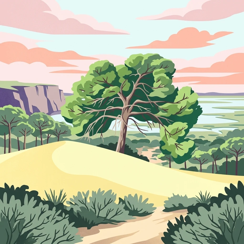
Europe's largest wetland reserve protecting critical migratory bird habitats and endangered species
Doñana National Park
Doñana National Park is a vast protected area in southern Spain spanning the provinces of Huelva, Cádiz, and Seville in the region of Andalucía. The park encompasses approximately 543 square kilometers of marshes, shallow streams, and sand dunes located in Las Marismas, the delta where the Guadalquivir River flows into the Atlantic Ocean. This wetland complex represents the largest nature reserve in Europe and serves as a critical ecological corridor between the European and African continents. The park was established as a nature reserve in 1969 through a partnership between the World Wildlife Fund and the Spanish government, with the national park formally created that same year. Doñana was designated a UNESCO World Heritage Site in 1994 and a Ramsar Wetland in 1982, recognizing its exceptional ecological significance. The park is named after Doña Ana de Silva y Mendoza, wife of the 7th Duke of Medina Sidonia, who established a hunting retreat on the estate in the 16th century.
- Location
- Spain
- Park type
- National park
- Established
- 1969
- Area
- 543 km²
Location overview
Regional mapping across Andalusia, Huelva, Seville, and Cádiz
Geographic Position and Coastal Boundaries of Doñana National Park
Doñana National Park is situated within Spain, spanning the region of Andalusia across Huelva, Seville, and Cádiz. As a coastal protected area, the reserve features clear regional relationships and administrative boundaries.
- Countries
- Spain
- Regions
- Andalusia, Cádiz, Huelva, Seville
- Primary location
- Huelva
- Geographic setting
- Coastal
Boundary and coordinates
Analyzing the 543 square kilometer extent and spatial coordinate span
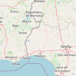
Doñana National Park Geographic Boundary Map and Spatial Limits
Interactive spatial mapping of the park outline provides essential context regarding its physical footprint. Accompanying datasets detail the estimated area of 543 square kilometers alongside calculated coordinate spans and center points.
- Boundary area
- 533.5 km²
- Boundary perimeter
- 122.9 km
- Northernmost point
- 37.1422° N
- Southernmost point
- 36.7948° N
- Easternmost point
- 6.2519° W
- Westernmost point
- 6.5619° W
- Geographic centre
- 36.9893° N, 6.4049° W
- North–south span
- 38.6 km
- East–west span
- 27.6 km
Elevation and terrain
Lowland topography paired with recorded hydrological features
Doñana National Park Elevation Profile and Terrain Geography
Recorded elevation metrics outline the lowland relief profile across the protected territory. Associated feature cards detail constituent springs, streams, and wetlands located within the protected boundary.
- Minimum elevation
- 0 m
- Maximum elevation
- 40 m
Selected named natural features
Streams
Arroyo de la Cañada Martín
Streams
Caño del Rompido Sur
Streams
Caño o Canal de Brenes
Natural springs
Fuente del Duque
Bays
Gulf of Cádiz
Environmental setting
Analysis of lowland relief, Mediterranean climate, and major water systems.
Doñana National Park Environmental Settings and Landscape Classifications
Recorded habitat types and landscape features serve as interpretive categories for reading the physical setting of Doñana National Park. Stored environmental classifications link directly to relevant atlas destinations where available.
- Relief
- Lowland
- Climate
- Mediterranean
- Water
- Major water bodies
- Forest cover
- Mostly forested
- Seasonality
- Year-round
Landscape features
Dunes · Wetland · Beach · Rivers · Forest · Grassland
Habitat types
Temperate broadleaf forest · Wetland · Riverine habitat · Coastal habitat · Grassland · Marine habitat
Park atlas
Compare Doñana National Park with other protected areas, tracing regional geography and connected landscapes across the Huelva region.
Parks Near Doñana National Park: Discover Other Protected Areas and Landscapes
From Doñana National Park, expand your discovery to other national parks and diverse protected areas found within the Huelva province and surrounding Andalucía region. This comparison offers valuable insights into the varied landscapes, conservation efforts, and regional park geography that define southern Spain's unique protected natural heritage.
Protected landscapeBeja District
100 km away#1 closest
Northwest

Guadiana Valley Natural Park: Protected Landscape Discovery in Beja District
Explore its mapped geography and protected land context.
Guadiana Valley Natural Park is identified as a protected landscape, providing a specific focus for geographic study and map-based exploration. This entry details the park's unique protected-area status and its contextual placement within the expansive Beja District of southern Portugal. Understand the mapped boundaries and landscape features that define this area, serving as a key point for regional geographic understanding on MoriAtlas.
- Area
- 697 km²
- Established
- 1995
- IUCN
- V
- Visitors
- 749 annual
National parkSpain
110 km away#2 closest
East

Sierra de las Nieves National Park: Ancient Fir Forests and Karst Geography in Andalusia
Mapped protected landscape and unique geologic features
Sierra de las Nieves National Park stands as a remarkable protected area in Andalusia, Spain, celebrated for its world-leading Spanish fir forests and intricate karst topography. This national park showcases significant geological diversity, from towering limestone formations and deep caves to the striking red peridotite mountains of Sierra Bermeja. Its elevation, reaching Pico Torrecilla at 1,919 meters, offers a unique alpine landscape context within southern Europe, mapped for detailed geographic discovery and protected area exploration.
- Area
- 939.3 km²
- Established
- 1989
- IUCN
- II
- Visitors
- 100K annual
Protected landscapeAlgarve
About 116 km away#3 closest
West
Ria Formosa Natural Park Protected Landscape: Algarve Regional Geography
Explore mapped protected landscapes and regional geographic context.
Examine Ria Formosa Natural Park, a protected landscape that defines a significant portion of the Algarve's natural heritage. This atlas-focused exploration details the park's geographic features, its protected status, and its position within the wider regional geography. Understand the mapped extent of this protected landscape and its contribution to the natural context of southern Portugal.
- Area
- 179.01 km²
- Established
- 1978
- IUCN
- V
- Relief
- Lowland
Protected landscapeAlentejo Litoral
194 km away#4 closest
West
Southwest Alentejo and Vicentine Coast Natural Park: A Protected Landscape in Alentejo Litoral
Explore its mapped boundaries and regional geographic context.
This detail page offers a deep dive into the Southwest Alentejo and Vicentine Coast Natural Park, a protected landscape situated in Portugal's Alentejo Litoral region. Understand the park's identity as a protected area through its geographic features and mapped extent. MoriAtlas facilitates a structured understanding of this natural landscape, enabling focused discovery of its protected boundaries and regional geographical significance.
- Area
- 895.7 km²
- Established
- 1988
- IUCN
- V
- Visitors
- 12.7K annual
Protected areaMorocco
212 km away#5 closest
South

Merja Zerga Protected Area: Moroccan Coastal Wetland Map and Geography
Explore the protected landscape and regional context of Merja Zerga.
Merja Zerga is a designated protected area situated on Morocco's Atlantic coast, characterized by its important wetland ecosystems. This entry facilitates detailed atlas exploration, providing users with mapped geographic data and insights into the park's protected boundaries. Understanding Merja Zerga offers valuable context for the distribution of protected lands and natural landscapes within the broader North African region.
- IUCN
- VI
Nature reserveAndalusia
217 km away#6 closest
East
Acantilados de Maro-Cerro Gordo: Protected Coastal Cliffs and Marine Geography Atlas
Mapping the rugged Mediterranean boundary in Andalusia, Spain
Discover the complex geography of Acantilados de Maro-Cerro Gordo, a protected nature reserve defined by vertical cliffs exceeding 200 meters and isolated coastal coves. This atlas entry details the transition between Betic mountain terrain and marine ecosystems, documenting prominent headlands like Cerro Gordo and the biological richness of its protected reefs and seagrass meadows.
- Area
- 19.129 km²
- Established
- 1989
- Relief
- Upland
- Climate
- Mediterranean
National parkMorocco
About 218 km away#7 closest
Southeast
Talassemtane National Park: Morocco's Premier Protected Landscape and Geographic Atlas Entry
Explore its mapped boundaries and natural terrain.
Talassemtane National Park is a vital protected area contributing to the geographic diversity of Morocco. This entry focuses on its identity as a national park, detailing its mapped boundaries and providing context within the broader atlas of protected lands. Discover the specific geographic and landscape characteristics that define this Moroccan national park, offering a unique lens for regional exploration.
- Area
- 589.5 km²
- Established
- 2004
- IUCN
- II
- Relief
- Mountain
Protected landscapePortalegre District
228 km away#8 closest
North
Serra de São Mamede Natural Park: A Protected Landscape Defined by Ecological Transition
Explore the unique mountain terrain and ecosystems of Portalegre District.
Delve into the geographic and ecological identity of Serra de São Mamede Natural Park, a significant protected landscape situated in Portugal's Portalegre District. This area is renowned for its dramatic quartzite ridges and its role as a crucial meeting point for Atlantic and Mediterranean plant communities, offering a unique atlas perspective on regional biodiversity. Examining its mapped boundaries and diverse terrain provides essential context for understanding its ecological importance and its distinct position within the Alentejo region's geography.
- Area
- 560.6 km²
- Established
- 1989
- IUCN
- V
- Visitors
- 4.5K annual
MoriAtlas Explorer
Continue Atlas Exploration of Doñana National Park's Mapped Geography
Deepen your understanding of Doñana National Park by exploring its specific geographic features and protected landscape context. This page serves as a gateway to comprehending its position within the Huelva region and the broader atlas of Spain's natural areas. Continue your discovery of its mapped terrain and its significance as a protected natural entity.
Browse next
Global natural geography
Explore related park routes
Explore MoriAtlas Global ParksBrowse All MoriAtlas ParksGlobal Park Map DiscoveryMoriAtlas: Browse All CountriesBrowse All MoriAtlas ContinentsNational Park Environment AtlasGrand Canyon National Park AtlasYellowstone National Park AtlasYosemite National Park Atlas and GeographySerengeti National Park AtlasGalápagos National Park Protected LandscapeBanff National Park Geography and AtlasKruger National Park Atlas EntryUluṟu-Kata Tjuṯa National Park AtlasExplore Uluru-Kata Tjuta National Park GeographyPlitvice Lakes National Park AtlasFiordland National Park Protected LandscapeGreat Smoky Mountains National Park AtlasAfghanistan National Parks and Protected AreasAlbania National Parks and Protected AreasAlgeria National Parks and Protected AreasAmerican Samoa National Parks and Protected AreasAndorra National Parks and Protected AreasAngola National Parks and Protected AreasAntarctica National Parks and Protected AreasAntigua and Barbuda Park List