Mori Atlas logo
National parkDoñana National Park

Discover the regional geography and atlas context of this key national park in southern Spain.

Doñana National Park: Protected Landscape Geography and Mapped Boundaries in Huelva

(Parque Nacional y Natural de Doñana)

Doñana National Park stands as a significant national park entity within the Huelva region, offering a unique focal point for geographic discovery and protected landscape exploration. This page provides an in-depth view of its mapped boundaries and its place within the regional terrain, serving as a crucial node for understanding Spain's protected areas. Navigate through its landscape context and appreciate its role as a distinct natural area documented on the MoriAtlas map-based exploration platform.

wetlandsbirdwatchingmigratory birdsIberian lynxsalt marshUNESCO World Heritage Site

Doñana National Park

National park

Park overview

Structured park overview, official facts, and landscape profile for Doñana National Park

Doñana National Park park facts, protected area profile, and essential visitor context
Review the core facts for Doñana National Park, including designation, size, terrain, visitor scale, habitats, and operating context in one park-focused overview.

About Doñana National Park

Doñana National Park represents one of Europe's most significant protected wetland ecosystems, forming the heart of the larger Doñana Natural Area that encompasses over 77,000 hectares of protected land. The park's location at the mouth of the Guadalquivir River has created a complex landscape of marshes, lagoons, sand dunes, and sandy beaches that support remarkable biodiversity. The Doñana spit, a wide sandy littoral barrier with mobile dune systems, protects the interior marshes from ocean forces while creating a dynamic coastal environment. The wetlands consist of both permanent and temporary water bodies, with inland depressions known locally as lucios creating specialized habitats throughout the marsh system. The park's ecological importance stems from its position along the Strait of Gibraltar migration corridor, making it an essential breeding ground and transit point for millions of birds moving between European and African territories each year. The surrounding landscape includes pine forests, eucalyptus woods, and agricultural areas that together form an ecological buffer around the core protected zones. The Doñana Biological Station, established in 1964, conducts ongoing research into the park's ecosystems and contributes to conservation science throughout Spain and Europe.

Quick facts and research context for Doñana National Park

Doñana National Park occupies a strategic position on the Atlantic coast of southern Spain, where the Guadalquivir River delta creates an extensive wetland system known as Las Marismas. The park sits at the crossroads of European and African migration routes, making it one of the most important bird habitats in the continent. The landscape features a flat marshland topography protected by a coastal sand spit with mobile dune systems. Altitude ranges from sea level to just 40 meters above sea level. The park experiences a Mediterranean climate with dry summers and relatively wet winters. The protected area includes both the national park established in 1969 and the surrounding Natural Park created in 1989, which together form a unified natural landscape with different levels of environmental protection.

Park context

Deeper park guide and search-rich context for Doñana National Park

Doñana National Park history, landscape, wildlife, and travel context
Explore Doñana National Park through its history, landscape character, ecosystems, wildlife, conservation priorities, cultural context, and seasonal travel timing in a structured park guide built for atlas discovery and search intent.

Why Doñana National Park stands out

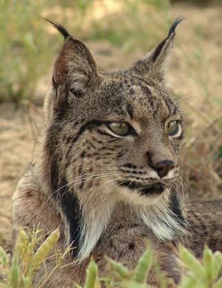
Doñana is renowned for its extraordinary biodiversity and its role as a major stopover for migratory birds traveling between Europe and Africa. The park shelters the largest concentration of waterfowl in Europe, with over 300 bird species recorded annually and winter populations reaching up to 200,000 individuals. The wetlands are particularly famous for hosting significant populations of greater flamingos, Eurasian spoonbills, and numerous heron species. Doñana is also one of the last strongholds of the critically endangered Iberian lynx, a species whose survival in the wild depends heavily on the park's protected habitats. The Spanish imperial eagle, another endangered raptor, breeds within the park boundaries. The park's salt marshes, sand dunes, and diverse freshwater habitats create a unique ecological mosaic found nowhere else in Europe.

Doñana National Park history and protected-area timeline

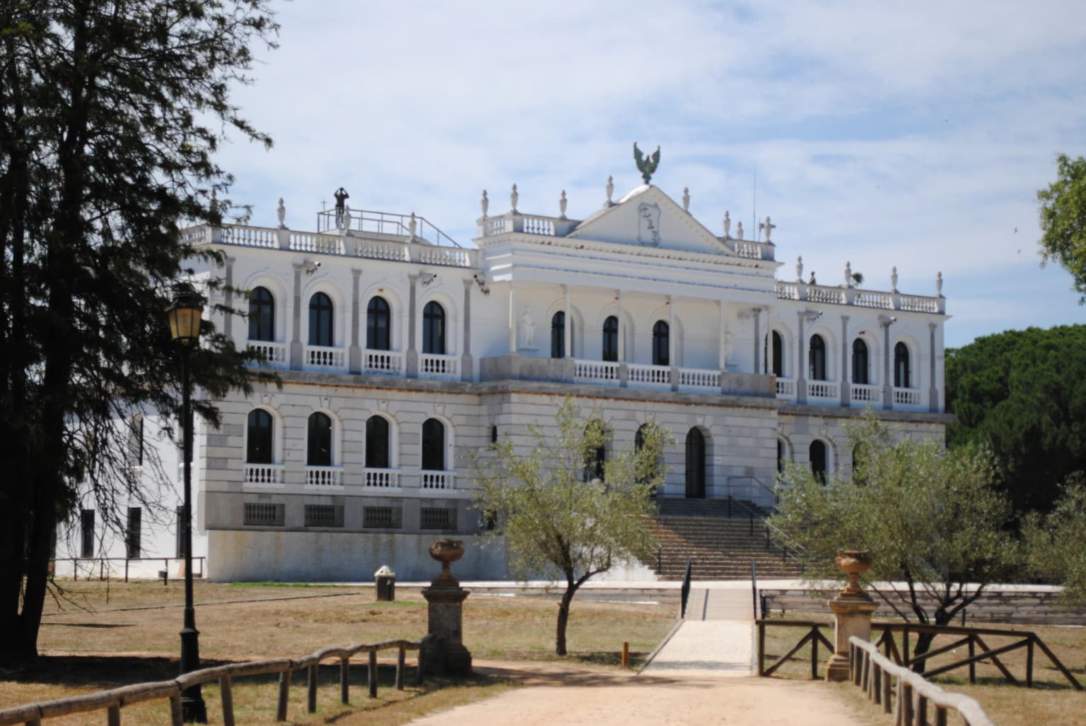
The Doñana region has a rich historical legacy extending back to prehistoric times, with Neolithic tools discovered in the area suggesting human presence thousands of years ago. Ancient civilizations including the Phoenicians, Phocaean Greeks, and Tartessians likely inhabited the region, though direct archaeological evidence remains limited. The area was known to Romans as Lacus Ligustinus, a large inland lagoon that gradually infilled with sediment over centuries to become the modern marshes. In 1262, King Alfonso X of Castile established a royal hunting preserve called Real Cazadero in the Las Rocinas forest between the Rio Tinto and Guadalquivir rivers, recognizing the area's abundance of deer and other wildlife. The estate remained under the control of the House of Medina-Sidonia for over six centuries following Sancho IV's grant to Guzmán el Bueno in 1297. The modern name Doñana derives from Doña Ana de Silva y Mendoza, wife of the 7th Duke of Medina Sidonia, who established a country retreat called Coto de Doña Ana in the 16th century. The palace hosted notable figures including King Philip IV in 1624 and painter Francisco Goya in 1797. Conservation awareness grew in the mid-20th century when ornithologists José Antonio Valverde and Francisco Bernis, together with the González-Gordon family, successfully persuaded the Franco government to abandon plans to drain the marshes. The World Wildlife Fund became involved in the 1960s, purchasing land and helping establish the national park in 1969.

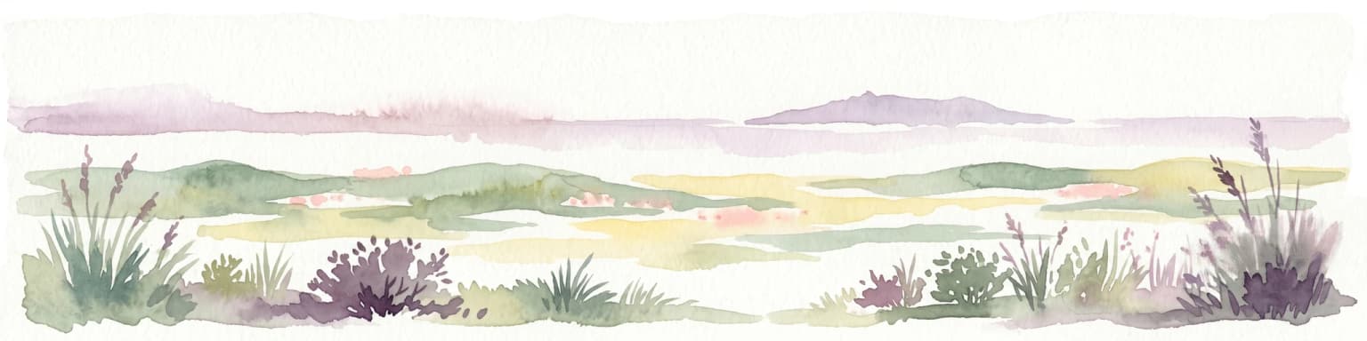
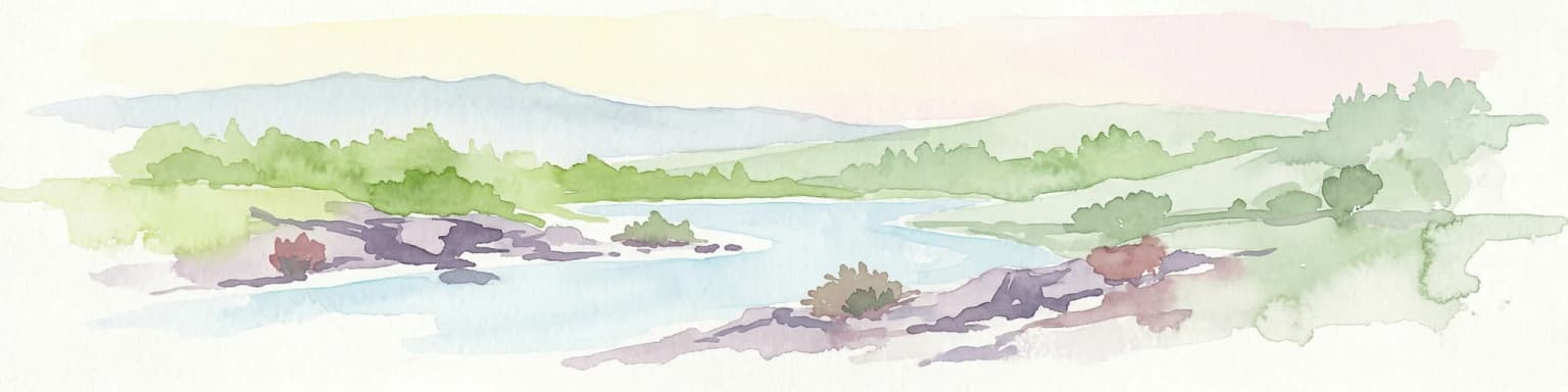
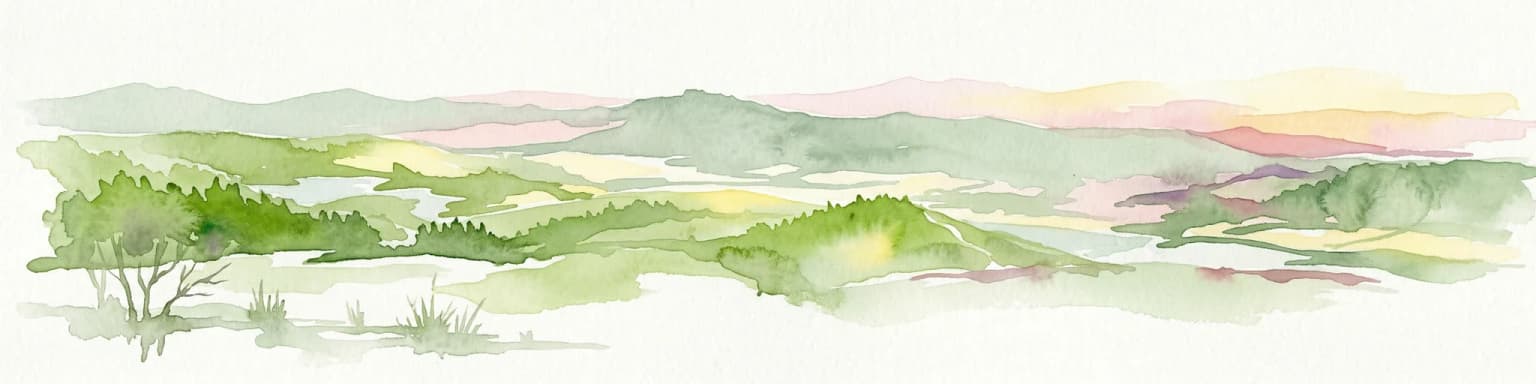
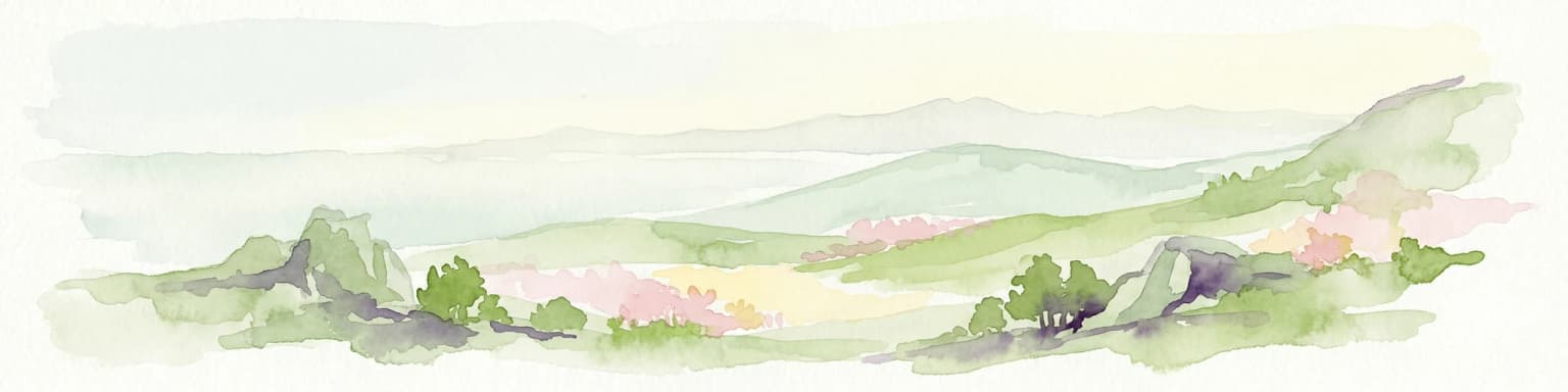
Doñana National Park landscape and geographic character

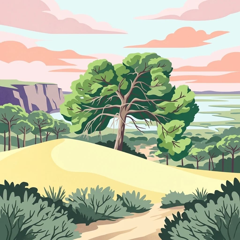
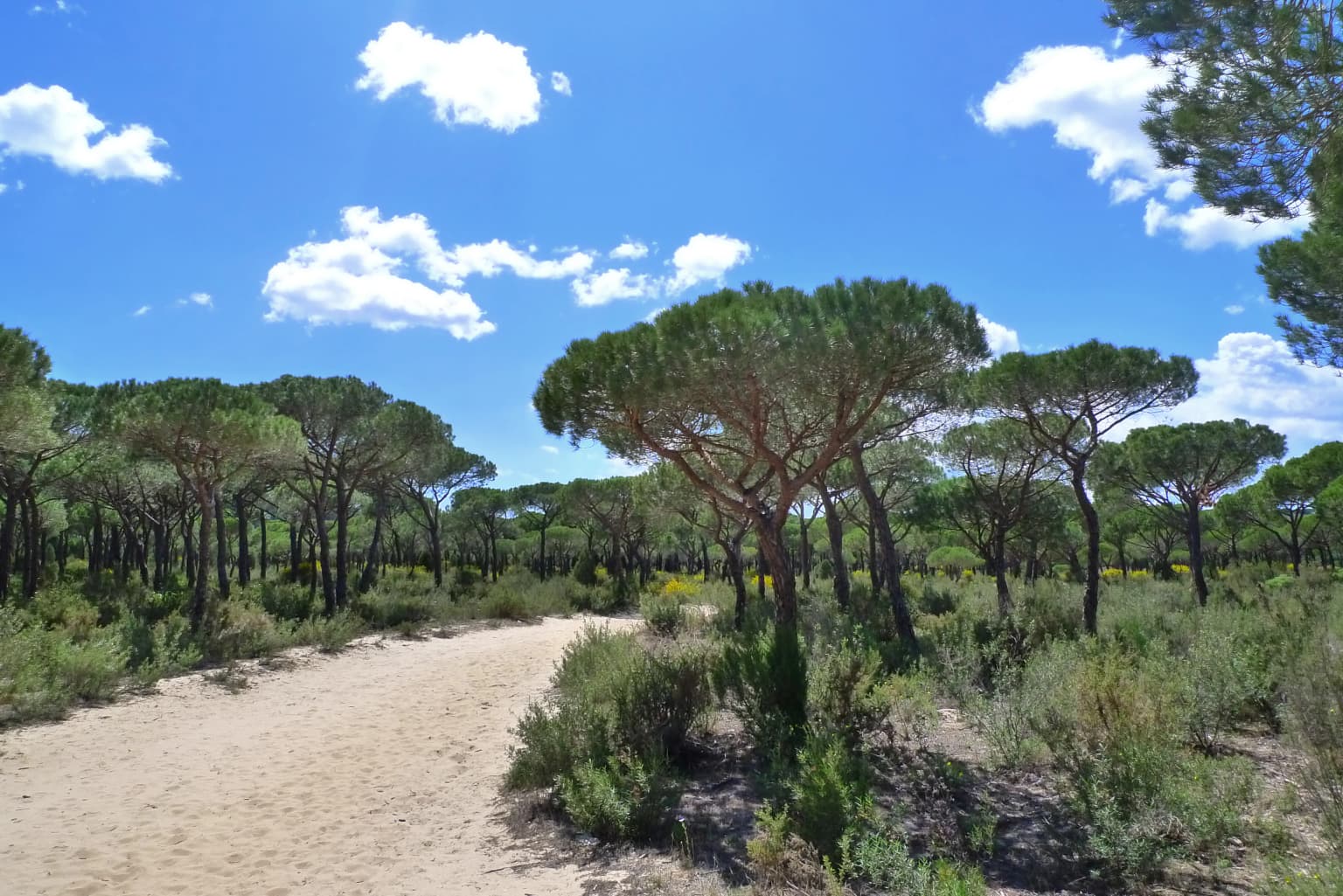
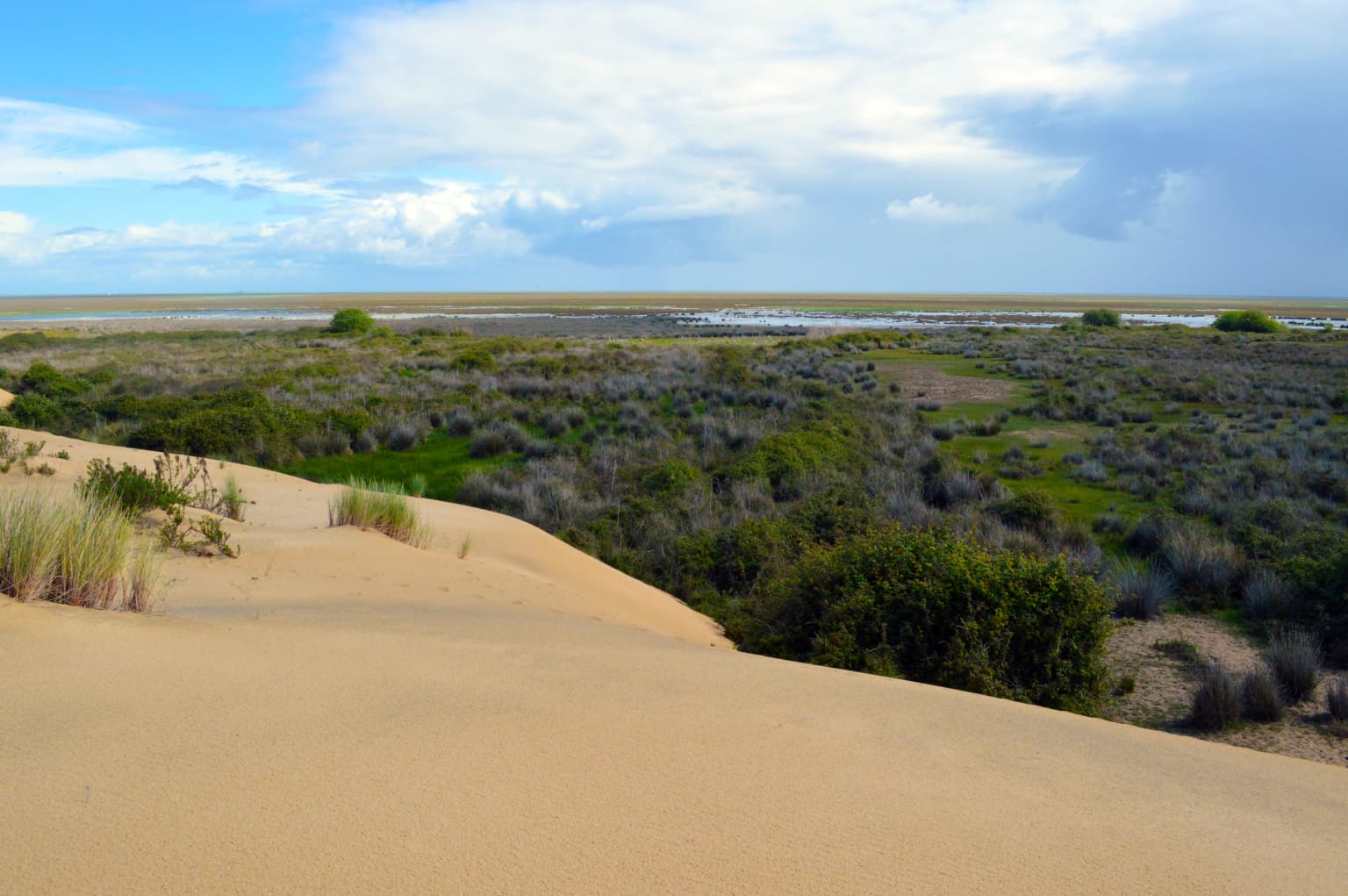
The landscape of Doñana National Park is characterized by its flat marshland topography and dynamic coastal dune systems. The park occupies the Guadalquivir River delta, where the river's ancient course has created an extensive system of wetlands, lagoons, and tidal channels known as caños that penetrate the muddy marshland. The Doñana spit, a wide sandy barrier beach with mobile dune systems, runs along the coast and grows southeastward under the influence of prevailing southwest winds. These moving dunes create a harsh ecosystem with specialized plant species adapted to burial by shifting sand, a phenomenon rarely found elsewhere on the Iberian Peninsula. Inland, the marshes feature both permanent and temporary wetlands called lucios, which flood during rainy seasons and dry partially during summer. The transition zones between marsh and coastal areas support distinctive vegetation communities adapted to varying salinity and moisture levels. The surrounding landscape includes forested areas of pine and eucalyptus, particularly in the northern and eastern buffer zones. The overall impression is one of vast open spaces where sky meets water across a nearly flat terrain broken only by the dune ridges and occasional tree-covered areas.

Doñana National Park ecosystems, habitats, and plant life

The ecological diversity of Doñana is exceptional, with the park containing a great variety of ecosystems within its boundaries. The marsh system represents the core habitat, supporting both freshwater and brackish water environments that change dramatically with seasonal rainfall patterns. The salt marshes near the coast experience tidal influence and support specialized halophyte vegetation. The sand dune ecosystem, particularly the mobile transdunes, represents a rare Iberian habitat with unique plant adaptations. The park contains over 875 plant species indigenous to the Doñana ecosystems, including several endangered species such as Vulpia fontquerana, Juniperus macrocarpa (maritime juniper), and Hydrocharis morsus-ranae. The groundwater aquifer beneath the park is a critical component of the wetland system, fed by rainfall in the surrounding hills and providing the freshwater that maintains the marsh hydrology. The park also includes Mediterranean scrubland, pine forests, and temporary ponds that each support distinct ecological communities. This mosaic of habitats creates the foundation for the park's remarkable biodiversity and its importance as a European ecological landmark.

Doñana National Park wildlife and species highlights

Doñana hosts an extraordinary diversity of wildlife, with over 300 bird species recorded annually making it one of Europe's most important birdwatching destinations. The wetlands support massive concentrations of waterfowl, with winter populations reaching 200,000 individuals including greater flamingos, Eurasian spoonbills, various heron and egret species, and numerous duck species. The park is particularly important for endangered birds including the Spanish imperial eagle, marbled teal, white-headed duck, and red-knobbed coot. Migratory birds use the park as both a breeding ground and a critical transit point between Europe and Africa, with species ranging from purple herons to European rollers passing through each year. The mammal population includes 37 species, with the Iberian lynx being the most celebrated resident; Doñana represents one of only two remaining populations of this critically endangered cat in the world. Other mammals include red deer, wild boar, European badger, Egyptian mongoose, and various bat species. The park supports 142 fish species including eight endemics to the Iberian Peninsula, with the critically endangered Baetican toothcarp found only in the Doñana system. Reptiles include European pond turtles, spur-thighed tortoises, and several snake species.

Doñana National Park conservation status and protection priorities

Doñana's conservation significance is recognized internationally through its UNESCO World Heritage status, Ramsar designation, and status as a Biosphere Reserve. The park was inscribed as a World Heritage Site in 1994 under natural criteria (vii), (ix), and (x), recognizing its outstanding universal value in terms of natural phenomena and ecological processes. As a Ramsar Wetland since 1982, the park is protected under the international convention for wetland conservation. The biosphere reserve designation encompasses a core zone of 50,720 hectares within the national park, a buffer zone of 54,250 hectares in the surrounding natural park, and a transition zone covering over 255,000 hectares as expanded in 2012. Conservation efforts have focused on protecting endangered species, particularly the Iberian lynx through captive breeding programs at the Acebuche Breeding Centre. The park faces significant environmental challenges including water extraction for agriculture, pollution from strawberry farming, and the legacy of the 1998 Aznalcóllar mine disaster when toxic sludge contaminated the Guadiamar River. Ongoing management involves balancing ecological protection with the socio-economic interests of surrounding municipalities.

Doñana National Park cultural meaning and human context

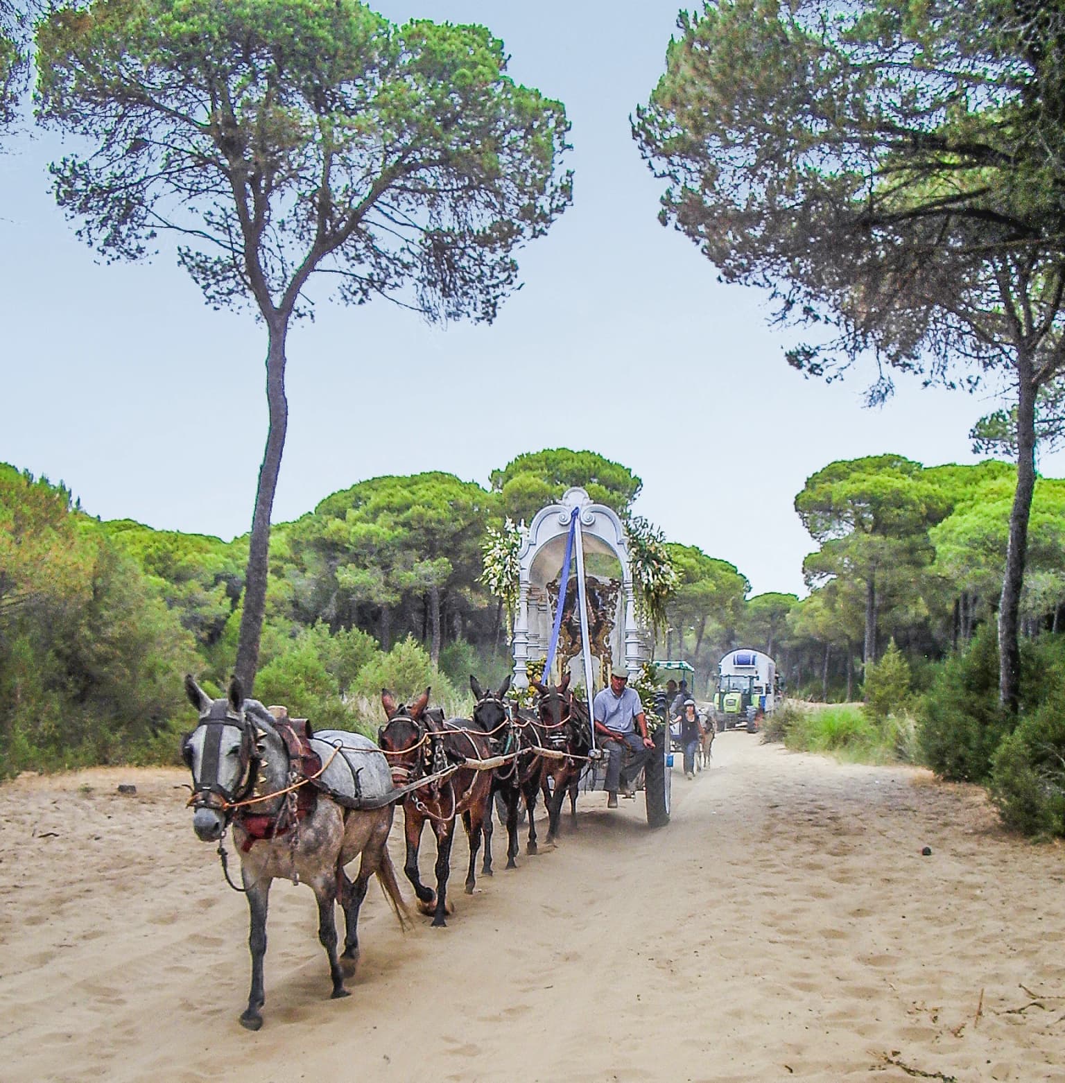
Doñana's cultural heritage reflects the long human history of interaction with this landscape. The area was historically a royal hunting ground, with the royal preserve established by Alfonso X in the 13th century maintaining its importance for deer and boar hunting through centuries of noble ownership. The estate's connection to the House of Medina-Sidonia produced the park's name from Doña Ana de Silva y Mendoza in the 16th century. The palace within the park hosted Spanish royalty including Philip IV and later became a retreat for painters such as Francisco Goya. The nearby village of El Rocío maintains strong religious traditions, with the annual Romería pilgrimage drawing over a million visitors through the park each year to the Hermitage of El Rocío. Traditional practices such as the Saca de las Yeguas, an annual gathering of the indigenous Marismeño horse breed, continue in the marshlands. The park contains remnants of Roman settlements from the 2nd through 5th centuries AD engaged in fishing and fish salting operations. These cultural layers add depth to the park's identity beyond its purely ecological significance.

Top sights and standout views in Doñana National Park

The ecological significance of Doñana as Europe's largest wetland reserve makes it a landmark destination for nature conservation and birdwatching. The park's critical role in supporting the endangered Iberianlynx population represents one of the most successful captive breeding and conservation stories in Europe. The vast concentrations of wintering waterfowl, particularly flamingos and spoonbills, create spectacular viewing opportunities across the marsh landscapes. The dynamic sand dune systems along the coast provide a rare opportunity to observe coastal geomorphological processes in action. The historical connection to Spanish nobility and the cultural traditions surrounding El Rocío add cultural depth to the visitor experience. The park's designation as a UNESCO Biosphere Reserve reflects its importance as a model for integrating conservation with sustainable development in a Mediterranean context.

Best time to visit Doñana National Park

The optimal time to visit Doñana depends on the experience sought, with different seasons offering distinct advantages. Winter months from December through February bring the highest waterfowl populations, with thousands of flamingos, ducks, and other waterbirds present throughout the marshes. This period offers excellent birdwatching opportunities as migratory species from northern Europe arrive to winter in the wetlands. Spring brings the passage of migratory birds heading to Africa, creating dynamic bird activity throughout the park. The breeding season for some species occurs in late spring and early summer. Summer months can be extremely hot and dry, with many marsh areas drying out, though this period allows observation of species adapted to drier conditions. Autumn offers another migratory passage period. The summer pilgrimage to El Rocío in late May or early June draws enormous crowds and significantly impacts park access, so those seeking tranquility may want to avoid this period. Generally, the cooler months from October through April provide the most comfortable conditions for exploring the park.

Park location guide

Geography guide, regional context, and park location map for Doñana National Park

Doñana National Park park geography, regions, and map view in Spain
Understand where Doñana National Park sits in Spain through a broader geographic reading of the surrounding landscape, nearby location context, and its mapped position within the national park landscape.

How Doñana National Park fits into Spain

Spain, officially the Kingdom of Spain, is a unitary parliamentary constitutional monarchy located in Southern and Western Europe. The country occupies most of the Iberian Peninsula and includes territories in the Mediterranean and Atlantic. With a population of approximately 49.6 million and an area of 506,030 km², Spain is a major European economy and cultural force. Its capital is Madrid, and the country is known for its diverse landscapes ranging from mountainous regions to coastal areas.

Wider geography shaping Doñana National Park in Spain

Spain occupies the Iberian Peninsula in Southern and Western Europe. Peninsular Spain is bordered to the north by France, Andorra, and the Bay of Biscay; to the east and south by the Mediterranean Sea and Gibraltar; and to the west by Portugal and the Atlantic Ocean. The territory includes the Canary Islands in the Atlantic Ocean, the Balearic Islands in the Mediterranean Sea, and the autonomous cities of Ceuta and Melilla in mainland Africa. Spain features diverse terrain including the Pyrenees in the northeast, the Sierra Nevada in the south, and the Meseta Central plateau.

Map view of Doñana National Park

Use this park location map to pinpoint Doñana National Park in Spain, understand its exact geographic position, and read its mapped placement within the surrounding landscape more clearly.

Pigeon | © OpenStreetMap contributors

Location context for Doñana National Park

AndalusiaCádizHuelvaSeville
Park atlas

Compare Doñana National Park with other protected areas, tracing regional geography and connected landscapes across the Huelva region.

Parks Near Doñana National Park: Discover Other Protected Areas and Landscapes
From Doñana National Park, expand your discovery to other national parks and diverse protected areas found within the Huelva province and surrounding Andalucía region. This comparison offers valuable insights into the varied landscapes, conservation efforts, and regional park geography that define southern Spain's unique protected natural heritage.
Protected landscapeAlgarve

Ria Formosa Natural Park Protected Landscape: Algarve Regional Geography

Explore mapped protected landscapes and regional geographic context.

Examine Ria Formosa Natural Park, a protected landscape that defines a significant portion of the Algarve's natural heritage. This atlas-focused exploration details the park's geographic features, its protected status, and its position within the wider regional geography. Understand the mapped extent of this protected landscape and its contribution to the natural context of southern Portugal.

Area
179.01 km²
Established
1978
IUCN
V
Relief
Lowland
Watercolor illustration showing a river flowing through a valley with hills and vegetation
Protected landscapeBeja District

Guadiana Valley Natural Park: Protected Landscape Discovery in Beja District

Explore its mapped geography and protected land context.

Guadiana Valley Natural Park is identified as a protected landscape, providing a specific focus for geographic study and map-based exploration. This entry details the park's unique protected-area status and its contextual placement within the expansive Beja District of southern Portugal. Understand the mapped boundaries and landscape features that define this area, serving as a key point for regional geographic understanding on MoriAtlas.

Area
697 km²
Established
1995
IUCN
V
Visitors
749 annual
National park

Sierra de las Nieves National Park: Ancient Fir Forests and Karst Geography in Andalusia

Mapped protected landscape and unique geologic features

Sierra de las Nieves National Park stands as a remarkable protected area in Andalusia, Spain, celebrated for its world-leading Spanish fir forests and intricate karst topography. This national park showcases significant geological diversity, from towering limestone formations and deep caves to the striking red peridotite mountains of Sierra Bermeja. Its elevation, reaching Pico Torrecilla at 1,919 meters, offers a unique alpine landscape context within southern Europe, mapped for detailed geographic discovery and protected area exploration.

Area
939.3 km²
Established
1989
IUCN
II
Visitors
100K annual
Protected landscapeAlentejo Litoral

Southwest Alentejo and Vicentine Coast Natural Park: A Protected Landscape in Alentejo Litoral

Explore its mapped boundaries and regional geographic context.

This detail page offers a deep dive into the Southwest Alentejo and Vicentine Coast Natural Park, a protected landscape situated in Portugal's Alentejo Litoral region. Understand the park's identity as a protected area through its geographic features and mapped extent. MoriAtlas facilitates a structured understanding of this natural landscape, enabling focused discovery of its protected boundaries and regional geographical significance.

Area
895.7 km²
Established
1988
IUCN
V
Visitors
12.7K annual
Watercolor illustration of a landscape with green hills, scattered trees, and distant mountains under a pink and yellow sky
Protected landscapePortalegre District

Serra de São Mamede Natural Park: A Protected Landscape Defined by Ecological Transition

Explore the unique mountain terrain and ecosystems of Portalegre District.

Delve into the geographic and ecological identity of Serra de São Mamede Natural Park, a significant protected landscape situated in Portugal's Portalegre District. This area is renowned for its dramatic quartzite ridges and its role as a crucial meeting point for Atlantic and Mediterranean plant communities, offering a unique atlas perspective on regional biodiversity. Examining its mapped boundaries and diverse terrain provides essential context for understanding its ecological importance and its distinct position within the Alentejo region's geography.

Area
560.6 km²
Established
1989
IUCN
V
Visitors
4.5K annual
Protected landscapePortugal

Arrábida Natural Park: Protected Landscape Atlas and Geographic Context in Portugal

Mapped boundaries of this key Portuguese protected area.

Arrábida Natural Park is presented here as a significant protected landscape, offering rich details for geographic exploration and atlas-based research. Users can investigate its specific mapped boundaries, understand its environmental setting within Portugal, and utilize this data for comparative analysis of protected areas. This resource focuses on the park's inherent geographic identity and its role as a defined natural landscape.

Area
176.41 km²
Established
1976
IUCN
V
Visitors
23.1K annual
National parkAndalusia

Sierra Nevada National Park: Protected Alpine Terrain and Geographic Context in Andalusia

Explore Spain's highest mountain range mapped across Andalusia's atlas.

Sierra Nevada National Park offers a profound exploration of Spain's highest alpine environments and a significant entry in the regional geography atlas. This protected area showcases classic glacial landforms, U-shaped valleys, and numerous high-mountain lakes, alongside a remarkable abundance of endemic plant species thriving in its unique microclimates. Understanding its mapped boundaries reveals a landscape vital for both biodiversity and watershed, situated prominently within the broader geographic context of Andalusia.

Area
858.83 km²
Established
1999
IUCN
II
Relief
Mountain
National park

Monfragüe National Park: Protected Landscape Atlas of Spanish Raptor Colonies

Explore mapped terrain and regional geography within this Spanish National Park.

As a national park in Spain's Extremadura region, Monfragüe National Park offers a distinct protected landscape shaped by the Tagus River and dramatic limestone cliffs. It is globally recognized for its exceptional birdlife, especially its large griffon vulture colonies and populations of Spanish imperial eagles, making it a significant site for ecological study and atlas-based exploration of protected areas. The park's landscape, characterized by Mediterranean woodlands and rugged terrain, provides crucial habitat and a unique geographic context for understanding Iberian Peninsula conservation.

Scope
Terrestrial

Common questions about visiting, size, designation, and location context for Doñana National Park

Doñana National Park FAQs for park facts, access, geography, and protected area context
Find quick answers about Doñana National Park, including protected-area facts, park geography, trail and visitor context, and how the park fits into its surrounding country and regional landscape.
MoriAtlas Explorer

Continue Your Protected Areas Search Across the Global Atlas

Deepen your exploration by continuing the structured search for national parks and protected areas worldwide. Utilize the comprehensive filtering capabilities to compare different conservation landscapes and refine your understanding of global park geography. Discover more about the distribution and characteristics of protected natural areas.

Global natural geography