Mori Atlas logo
National parkDrina National Park

Discover the mapped geography and endemic ecosystems of this significant Balkan national park.

Drina National Park: Bosnia and Herzegovina's Dramatic Canyon and Protected Landscape

Drina National Park, established in 2017, represents a significant protected area in eastern Bosnia and Herzegovina. This national park is defined by the spectacular, deeply carved canyon landscape of the Drina River, reaching depths of nearly 1,000 meters. It safeguards unique endemic species like the Serbian spruce and supports a rich mountain ecosystem, offering a profound glimpse into the region's natural and cultural heritage for atlas-based exploration.

national parkcanyon landscapeprotected areaendemic speciestransboundary conservationmountain ecosystem
Stylized illustration of a river flowing through a mountainous canyon with trees

Drina National Park

National park

Park overview

Structured park overview, official facts, and landscape profile for Drina National Park

Drina National Park park facts, protected area profile, and essential visitor context
Review the core facts for Drina National Park, including designation, size, terrain, visitor scale, habitats, and operating context in one park-focused overview.

About Drina National Park

Drina National Park occupies a rugged mountainous landscape in eastern Bosnia and Herzegovina, centered on the canyon-valley of the Drina River. The park was established in 2017, making it one of the country's most recently designated protected areas, and represents Bosnia and Herzegovina's fourth national park overall and the third within Republika Srpska. The protected area is situated directly across the Drina River from Tara National Park in Serbia, creating an international conservation corridor along this significant Balkan waterway. The park's headquarters are located in Skelani, a settlement that also contains important archaeological significance. The dramatic terrain features steep canyon walls, cascading tributaries, and forested slopes that descend into the river valley. The Drina River canyon has been carved over millennia, with the most pronounced gorge section reaching a depth of 976 meters where Crni Potok joins the main river. This hydrological system has created diverse microhabitats and ecological niches that support the park's notable biodiversity. The park sits within the historical region known as Osat, an area that was once an administrative unit and which developed distinctive cultural traditions related to construction and building crafts.

Quick facts and research context for Drina National Park

Drina National Park covers approximately 63 square kilometers of mountainous terrain in eastern Bosnia and Herzegovina. The park's defining geographic feature is the deep canyon-valley of the Drina River, which reaches depths of nearly 1,000 meters at its most pronounced point near the mouth of Crni Potok tributary. The protected area was established in 2017, making it one of Bosnia and Herzegovina's newest national parks. The park shares its western border with Tara National Park in Serbia, creating a contiguous protected transboundary region along the Drina River basin.

Park context

Deeper park guide and search-rich context for Drina National Park

Drina National Park history, landscape, wildlife, and travel context
Explore Drina National Park through its history, landscape character, ecosystems, wildlife, conservation priorities, cultural context, and seasonal travel timing in a structured park guide built for atlas discovery and search intent.

Why Drina National Park stands out

Drina National Park is best known for its spectacular canyon landscape, which represents one of the deepest river-cut gorges in the Balkans. The park protects significant populations of large mammals including brown bears and chamois, as well as the iconic golden eagle. The Serbian spruce, a Tertiary relict and endemic species found only in the Drina River basin and the Tara Mountains, is among the most botanically significant plants in the protected area. The park also encompasses the Skelani Archaeological Site, a declared National Monument containing Roman settlement remains and early Christian basilicas.

Mountainous landscape featuring a body of water with misty peaks and forested slopes
Mountainous landscape with lake and misty peaks

Drina National Park history and protected-area timeline

The territory of Drina National Park falls within the historical region called Osat, which functioned as an administrative unit in past centuries. During the last century, this area gained recognition for its skilled builders, known locally as dunđers, who practiced a distinctive architectural tradition. The Nobel laureate Ivo Andrić documented this tradition in his short story Osatičani, describing the unique building techniques and cultural practices of the Osat builders. Their legacy is visible in numerous log cabin structures throughout both Serbia and Bosnia and Herzegovina. The park also contains the Skelani Archaeological Site, spread across multiple locations within the protected area. This site has been declared a National Monument of Bosnia and Herzegovina and consists of a Roman settlement (historically known as Malvesiatium), two early Christian basilicas, burial grounds, and movable artifacts now housed in the National Museum of Bosnia and Herzegovina in Sarajevo and the Archaeological Museum in Skelani. The establishment of the national park in 2017 represents the most recent chapter in the area's long history of human habitation and cultural significance.

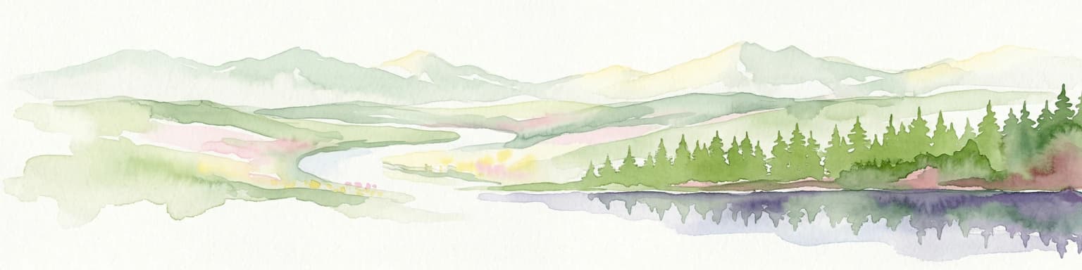
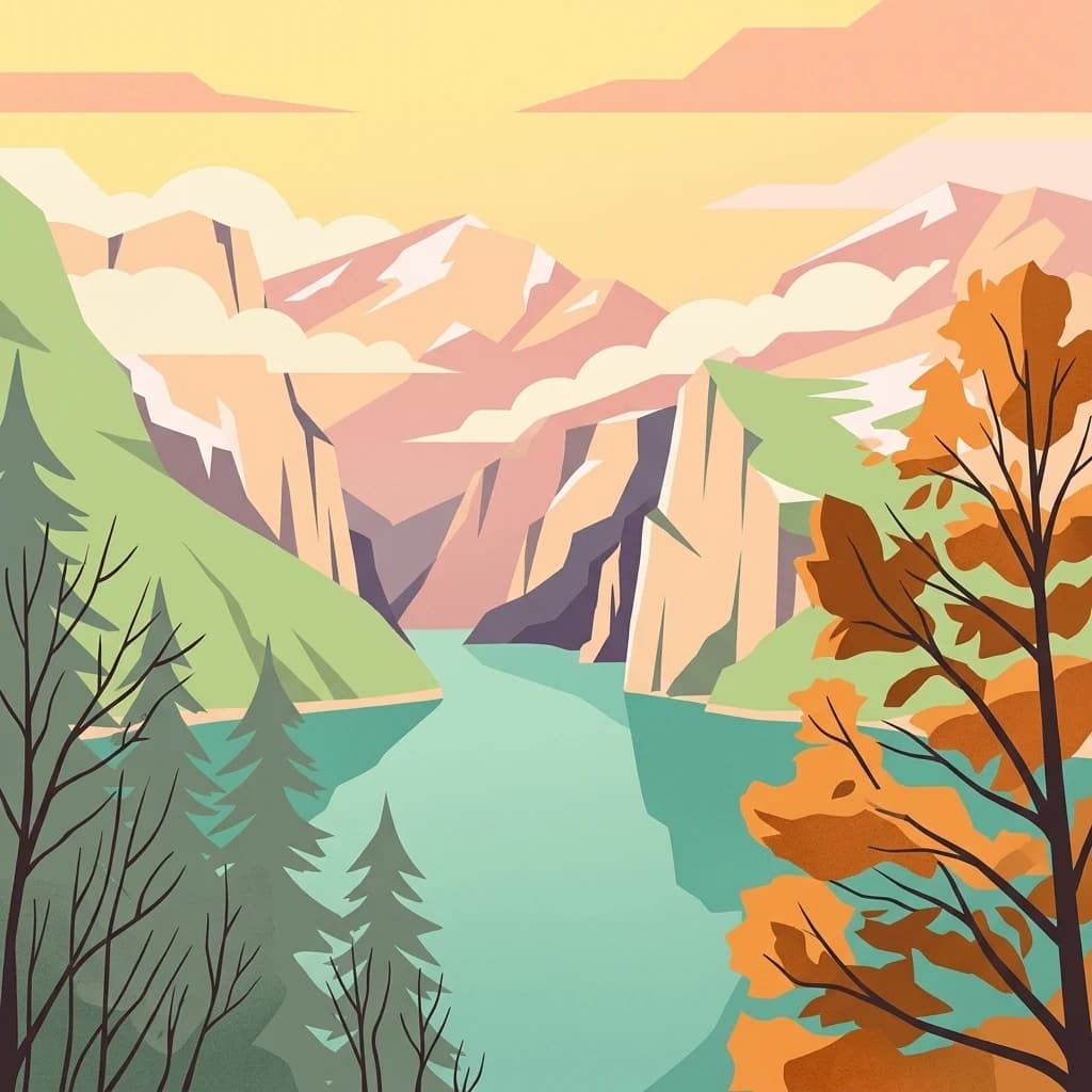
Drina National Park landscape and geographic character

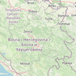
The landscape of Drina National Park is defined by the dramatic canyon-valley system carved by the Drina River and its tributaries. The gorge reaches its maximum depth of 976 meters at the confluence of Crni Potok with the Drina, making this one of the deepest canyon systems in the region. Crni Potok itself originates at elevations exceeding 1,100 meters above sea level and descends dramatically over its 6-kilometer course to the Drina, dropping more than 800 meters in elevation. The terrain features steep forested slopes descending from the surrounding mountains to the river valley, with the Drina cutting through the landscape as a major watercourse flowing northward. The canyon walls expose rock formations and create a visually striking landscape of vertical relief. The park's position along the border with Serbia means that the river itself forms a natural boundary, while the protected area extends into the mountainous terrain on the Bosnian side.

Drina National Park ecosystems, habitats, and plant life

The nature of Drina National Park is distinguished by its unique botanical heritage and diverse habitats associated with the canyon ecosystem. The most significant plant species is the Serbian spruce, an endemic and Tertiary relict species that today occurs naturally only in the middle Drina River basin across the territories of several municipalities including Rogatica, Srebrenica, Foča, Čajniče, and Višegrad in Bosnia and Herzegovina, and on Mount Tara in Serbia. This limited distribution makes the species globally significant from a conservation perspective. The park also supports endemic plant communities including the Derventanski različak, which together with Edraianthus jugoslavicus, Daphne malyana, and Sesleria tenuifolia forms communities of endemic character. The diverse topography creates varied habitats ranging from riverine corridors to forested slopes and rocky outcrops, supporting the park's ecological complexity.

Drina National Park wildlife and species highlights

Drina National Park supports populations of notable large mammals and birds that represent significant conservation value. The brown bear inhabits the forested mountain slopes and canyon terrain, representing one of the park's most impressive mammalian species. The chamois, a mountain-dwelling goat-antelope, occupies the rocky sections and steep terrain characteristic of the canyon walls. The golden eagle patrols the open skies above the canyon, using the thermal currents rising from the gorge for hunting and patrolling its territory. These three species—brown bear, chamois, and golden eagle—are identified as particularly important animal species within the protected area, reflecting both their conservation significance and their role as flagship species for the park's ecosystem. The river system itself supports aquatic biodiversity, while the varied habitats create conditions for a range of smaller mammals, birds, and other wildlife.

Drina National Park conservation status and protection priorities

Drina National Park represents an important addition to Bosnia and Herzegovina's protected area network, established in 2017 to preserve the significant natural and cultural values of the Drina canyon region. The park protects critical habitat for the Serbian spruce, an endemic species of global conservation concern due to its restricted range. The protected area also contributes to transboundary conservation by connecting with Tara National Park in Serbia, creating a larger contiguous zone for species that require extensive territories, such as the brown bear. The designation as a national park provides formal protection to the canyon ecosystem, its habitats, and the archaeological heritage within the boundaries. The Skelani Archaeological Site's status as a National Monument of Bosnia and Herzegovina provides additional protection to the cultural heritage components within the park.

Drina National Park cultural meaning and human context

The cultural context of Drina National Park is deeply connected to the historical region of Osat, which once functioned as an administrative unit encompassing the park's territory. The area developed a distinctive building tradition practiced by craftspeople known as dunđers, whose skill in constructing log cabins was renowned throughout the region. This tradition and the associated linguistic practices were documented by Ivo Andrić, Bosnia and Herzegovina's Nobel Prize-winning author, in his literary work Osatičani. The log cabin architecture represents a traditional building style adapted to the mountainous terrain and available materials. The presence of the Skelani Archaeological Site demonstrates even older human presence, with Roman settlement remains and early Christian religious structures indicating the area's long-standing significance as a settlement location and religious center.

Top sights and standout views in Drina National Park

Drina National Park's most compelling highlights include its status as one of Bosnia and Herzegovina's newest national parks established in 2017, protecting the spectacular Drina River canyon with depths reaching nearly 1,000 meters. The park safeguards populations of brown bears, chamois, and golden eagles in a relatively intact mountain ecosystem. The Serbian spruce, found only in this region, represents a globally significant endemic species. The Skelani Archaeological Site adds cultural depth, with Roman and early Christian heritage declared a National Monument. The park forms a transboundary conservation unit with Tara National Park in Serbia, creating an international protected corridor along the Drina.

Best time to visit Drina National Park

The best time to visit Drina National Park would typically be during the warmer months from late spring through early autumn, when weather conditions in the mountainous canyon environment are most suitable for outdoor exploration. The summer months offer warm temperatures in the valley and provide opportunities to experience the river and forest environments. Spring brings blooming vegetation and increased water flow in the tributaries, while autumn displays fall colors in the deciduous and mixed forests. Winter conditions in the mountainous terrain can be severe with snow and cold temperatures limiting access to higher elevations. The park's relatively recent establishment means that visitor infrastructure may still be developing, and checking current conditions before planning a visit would be advisable.

Park location guide

Geography guide, regional context, and park location map for Drina National Park

Drina National Park park geography, regions, and map view in Bosnia and Herzegovina
Understand where Drina National Park sits in Bosnia and Herzegovina through a broader geographic reading of the surrounding landscape, nearby location context, and its mapped position within the national park landscape.

How Drina National Park fits into Bosnia and Herzegovina

Bosnia and Herzegovina is a federal parliamentary republic in Southeast Europe on the Balkan Peninsula. It borders Serbia, Montenegro, and Croatia, with a 20-kilometre coastline on the Adriatic Sea. The country has a population of approximately 2.9 million and features diverse geography ranging from mountainous Dinaric Alps in the north to Mediterranean climate in the southern Herzegovina region. Sarajevo serves as the capital and largest city.

Wider geography shaping Drina National Park in Bosnia and Herzegovina

Bosnia and Herzegovina occupies the central and eastern parts of the Balkan Peninsula. The country is largely mountainous, dominated by the Dinaric Alps in the central and eastern regions. Bosnia occupies the northern and central areas, while Herzegovina covers the southern region. The country has a small coastline along the Adriatic Sea, approximately 20 kilometres long, near the town of Neum.

Map view of Drina National Park

Use this park location map to pinpoint Drina National Park in Bosnia and Herzegovina, understand its exact geographic position, and read its mapped placement within the surrounding landscape more clearly.

Pigeon | © OpenStreetMap contributors

Location context for Drina National Park

Republika Srpska

Discover the mapped terrain, deep river canyon, steep forested slopes, and diverse protected habitats defining Drina National Park's environment.

Drina National Park: Visual Exploration of its Dramatic Canyon Landscapes and Protected Habitats
Visually explore the striking canyon landscape of Drina National Park, its dramatic river gorge, and the rich biodiversity, including the endemic Serbian spruce and brown bears. These images provide essential geographic context, revealing the protected area's terrain, unique habitats, and the visual character of this significant Balkan conservation landscape.

Mountainous landscape featuring a body of water with misty peaks and forested slopes

Mountain lake surrounded by rocky hills and autumn trees under a cloudy sky

Park atlas

Trace the protected landscapes that border Drina National Park and connect its significant river canyon system with adjacent conservation areas.

Discover Protected Areas Near Drina National Park, Exploring Its Canyon Geography and Regional Context
Continue protected area discovery by exploring other national parks and reserves in the broader Drina River basin and surrounding Balkan mountains. Compare Drina National Park's unique canyon landscape and endemic species with nearby park geographies, gaining deeper regional insights into connected conservation and varied terrain.
Watercolor painting depicting a river flowing through a valley with mountains in the background and trees on both sides
National park

Tara National Park: Endemic Flora and Dramatic Dinaric Alps Geography

Discover Serbia's iconic protected mountain landscape and its unique botanical heritage.

Tara National Park is a significant protected area in Serbia, celebrated for its exceptional botanical value and dramatic mountainous terrain. It is the last refuge for Pančić's spruce, a living fossil conifer, and hosts a remarkable diversity of Balkan flora. The park's landscape is defined by steep limestone cliffs, deep river valleys like the Drina canyon, and expansive forest ecosystems, offering a unique geographic study of protected lands. Explore its mapped features and discover a vital conservation area within the Dinaric Alps.

Area
249.92 km²
Established
1981
IUCN
II
Relief
Mountain
Watercolor illustration showing rolling hills, a river, trees, and distant mountains
Protected landscape

Zlatibor Protected Landscape: Explore its Mapped Geography and Unique Alpine Meadows

Discover Dinaric Alps protected terrain and landscape context.

Zlatibor Protected Landscape offers a distinct exploration of mountainous terrain and protected natural areas in Serbia. Situated in the Dinaric Alps, its landscape is defined by rolling upland plateaus, dense coniferous forests, and open alpine meadows, creating a visually rich environment. The park's geography includes notable karst features and extensive cave systems, complemented by the natural boundaries of significant rivers. Delve into the mapped protected area to understand its landscape character, from the highest peak at Tornik to the unique geological formations and the rare endemic pine subspecies, providing a concrete geographic perspective for atlas-based discovery.

Area
0.419 km²
Established
2017
IUCN
VI
Relief
Mixed relief
Watercolor illustration of a river flowing through a valley with mountains, greenery, and pink flowers
Protected landscape

Ovčar-Kablar Gorge Protected Landscape: Serbia's River Gorge and Monastery Atlas

Explore karst terrain, monastery sites, and mapped river meanders.

Ovčar-Kablar Gorge is a protected landscape in Serbia renowned for its dramatic karst geology and the West Morava river's pronounced meanders. This area offers a unique atlas perspective, highlighting over a dozen historic Serbian Orthodox monasteries nestled within the dramatic canyon setting. The protected landscape reveals a confluence of significant natural features, including karst cliffs and thermal springs, alongside centuries of spiritual heritage, making it a distinct point for geographic discovery and understanding Serbia's mapped natural and cultural resources.

Area
25 km²
Established
2001
IUCN
V
Relief
Mixed relief
Watercolor illustration of mountain ranges, a lake, and forested hills in soft pastel colors
National park

Sutjeska National Park: Bosnia and Herzegovina's Oldest National Park and Primeval Forest Reserve

Explore the mapped geography and protected landscape of this vital Balkan natural area.

Sutjeska National Park, Bosnia and Herzegovina's inaugural national park, protects a dramatic mountainous region defined by primeval forests and its highest peak, Maglić. As a strict nature reserve, Perućica's ancient trees represent a rare ecological treasure within the Balkan landscape. This page offers a detailed look at the park's protected boundaries, its diverse natural terrain, and its significant geographic setting for atlas exploration.

Area
160.52 km²
Established
1962
IUCN
II
Relief
Mountain
Watercolor illustration showing mountains, a winding river, and forested areas
National park

Durmitor National Park: Dramatic Balkan Alpine Landscape & Protected Area

Explore its rugged terrain and glacial geography.

Durmitor National Park, a protected area in Montenegro, offers a spectacular alpine landscape defined by sharp limestone peaks, deep glacial valleys, and pristine mountain lakes. This national park preserves extensive old-growth forests and unique karst features, showcasing one of the Balkans' most significant wilderness areas. Its dramatic terrain and geological diversity make it a key destination for understanding regional protected lands and mountain geography.

IUCN
II
Relief
Mountain
Climate
Alpine
Scope
Terrestrial
Watercolor painting showing green forests, a river, and pink-hued mountains in the background
Protected landscape

Kosmaj Protected Landscape: Explore Serbia's Island Mountain Geography and Forests

Mapped terrain, historic monasteries, and biodiversity near Belgrade.

Kosmaj, a unique protected landscape and island mountain, presents a compelling study in regional geography and mapped terrain for atlas enthusiasts. Rising prominently near Belgrade, its landscape is characterized by dense deciduous forests of beech and oak blanketing its steeper slopes, along with distinct peaks like Mali Vis and Goli Vis. This area serves as a vital watershed source and boasts significant biodiversity, offering a rich context for understanding Serbia's natural and historic environments through structured geographic data and map exploration.

Area
0.035 km²
Established
2005
IUCN
V
Relief
Lowland
Watercolor painting of a landscape featuring rolling hills, a lake, trees, and a sky with clouds
Natural monument

Avala Natural Monument: Iconic Protected Landscape and Regional Geography Near Belgrade

Explore Avala's mapped terrain and natural monument significance.

Avala Natural Monument offers a unique protected landscape and significant geographic context for the Belgrade metropolitan area. As one of Serbia's oldest protected natural sites, its distinct mountain terrain, geological composition, and panoramic views provide a rich subject for atlas-based discovery. Explore the mapped boundaries and natural features that define this prominent Serbian natural monument.

Area
5.01 km²
Established
1859
IUCN
III
Relief
Mountain
Watercolor painting showing a mountain landscape with green forests, valleys, and distant hills
National park

Biogradska Gora National Park: Ancient Beech Forest and Protected Landscape Exploration

Discover Montenegro's oldest national park with mapped terrain and regional geography.

Biogradska Gora National Park represents a critical protected area in Montenegro, celebrated for its exceptionally well-preserved ancient beech forest. This national park features a heterogeneous terrain of rolling hills and river valleys that create a unique natural setting. The dense, old-growth canopy offers an immersive experience of a primeval forest ecosystem, providing significant value for understanding Balkan nature and protected forest dynamics. Explore the mapped boundaries and discover the distinct landscape character that defines this remarkable natural reserve.

IUCN
II

Common questions about visiting, size, designation, and location context for Drina National Park

Drina National Park FAQs for park facts, access, geography, and protected area context
Find quick answers about Drina National Park, including protected-area facts, park geography, trail and visitor context, and how the park fits into its surrounding country and regional landscape.
MoriAtlas Explorer

Continue Your Protected Areas Search Across the Global Atlas

Deepen your exploration by continuing the structured search for national parks and protected areas worldwide. Utilize the comprehensive filtering capabilities to compare different conservation landscapes and refine your understanding of global park geography. Discover more about the distribution and characteristics of protected natural areas.

Global natural geography