

Mori Atlas logo
National parkEl Kala National Park

Discover the geographic extent and atlas context of Algeria's vital protected areas.

El Kala National Park: Protected Mediterranean Wetlands and Mapped Landscape

(El Kala National Park and Biosphere Reserve)

El Kala National Park, situated in Algeria's El Tarf Province, is a significant protected area renowned for its diverse Mediterranean ecosystems. This national park encompasses a rich tapestry of coastal marshlands, freshwater lakes, rolling hills, and forested slopes, forming a critical hub for regional geography and protected land exploration. Its designation as a UNESCO Biosphere Reserve underscores its international ecological importance, offering a unique glimpse into the natural landscapes of the Mediterranean basin. Users can delve into the mapped boundaries and topographic features of this vital conservation landscape, understanding its strategic placement within North Africa.

Mediterranean wetlandsBiosphere reserveRamsar siteLakes and lagoonsCork oak forestsBarbary stag

El Kala National Park

National park

Park overview

Structured park overview, official facts, and landscape profile for El Kala National Park

El Kala National Park park facts, protected area profile, and essential visitor context

Review the core facts for El Kala National Park, including designation, size, terrain, visitor scale, habitats, and operating context in one park-focused overview.

About El Kala National Park

El Kala National Park and Biosphere Reserve represents one of Algeria's most ecologically significant protected areas, situated in the country's extreme northeastern corner where the Mediterranean coast meets the Tellian Atlas mountains. The park's creation was formalized by decree in 1983, and it subsequently achieved recognition as a UNESCO biosphere reserve in December 1990, acknowledging its role as a model for sustainable conservation and ecological research. The park's landscape is characterized by a remarkable diversity of habitats, from the wetlands and shallow lakes of the coastal plain to the forested slopes of the interior hills. Lake Mellah stands out as Algeria's only true coastal lagoon, maintaining a connection to the Mediterranean Sea and supporting specialized brackish water ecosystems. The park's forests are dominated by cork oak, which forms extensive pure stands in some areas, mixed with Zeen oak, kermes oak, and Aleppo pine in higher elevations. Riparian zones along watercourses feature alder, willow, and white poplar, creating verdant corridors through the more xeric landscapes. The combination of lakes, marshes, forests, and Mediterranean shoreline creates an ecological mosaic that supports exceptional species diversity.

Quick facts and research context for El Kala National Park

El Kala National Park lies in El Tarf Province of northeastern Algeria, with its highest point at djebel El-Ghorra reaching 1,202 meters above sea level. The park contains six lakes including Lake Tonga (2,600 hectares), Lake Oubeira (2,200 hectares), and Lake Mellah, which is Algeria's only coastal lagoon connected to the Mediterranean. The region experiences Mediterranean climate with average temperatures ranging from 9°C in winter to 30°C in summer. The park supports remarkable biodiversity with 40 mammal species, 89 bird species, and over 1,500 plant species documented through surveys conducted between 1996 and 2010. The park received approximately 30,000 visitors in 2001 and serves as an important ecological anchor for northern Algeria.

Protection and recognition

Documenting the conservation framework and official international recognition of the park.

Protection Status and UNESCO Biosphere Reserve Designation of El Kala National Park

Map the formal boundaries and management classifications assigned to El Kala National Park since its official establishment in 1983. Natural area enthusiasts can analyze key environmental designations, including the regional status as an active UNESCO Biosphere Reserve.

International recognition

Protection details

Protection scope
Mixed
Designated year
1983
Transboundary protection
No
Core area
226.3 km²
Buffer area
745.32 km²
Park context

Deeper park guide and search-rich context for El Kala National Park

El Kala National Park history, landscape, wildlife, and travel context

Explore El Kala National Park through its history, landscape character, ecosystems, wildlife, conservation priorities, cultural context, and seasonal travel timing in a structured park guide built for atlas discovery and search intent.

Why El Kala National Park stands out

El Kala is best known for its network of Mediterranean wetlands and freshwater lakes that serve as crucial habitats for migratory birds and waterfowl. The park's population of Barbary stag, a distinctive North African subspecies of red deer, represents one of the few remaining populations of this iconic animal in the region. The park's Ramsar-designated wetlands, including Lake Oubeira, Lake Tonga, Lake Mellah, and the Black Lake peat bog, are recognized internationally for their ecological importance. The diverse mosaic of cork oak forests, Zeen oak, Aleppo pine, and riparian woodlands creates a distinctive Mediterranean landscape that supports exceptional biodiversity.

El Kala National Park history and protected-area timeline

The El Kala National Park and Biosphere Reserve was formally established through Algerian governmental decree number 83-462 on July 23, 1983, creating the legal framework for protection of this Mediterranean ecosystem. The UNESCO Man and the Biosphere Programme recognized the park's international significance on December 17, 1990, designating it as a biosphere reserve and integrating it into the global network of protected areas dedicated to conservation, research, and sustainable development. Between 1994 and 1999, the World Bank financed a significant natural resources management project that helped develop sustainable approaches to managing the park's resources while balancing conservation with the needs of local communities. Multiple wetland areas within the park have been recognized under the Ramsar Convention, with Lake Oubeira and Lake Tonga designated in 1983, followed by the Black Lake peat bog in 2003, Lake El Mellah in 2004, and the Bourdim marshes in 2009.

El Kala National Park landscape and geographic character

The physical landscape of El Kala National Park presents a varied topography that ascends from sea level along the Mediterranean shoreline to elevations exceeding 1,200 meters at djebel El-Ghorra, the park's highest summit. The coastal zone features a series of lakes and wetlands that fringe the Mediterranean, with Lake Mellah serving as a unique coastal lagoon that maintains direct connection to the sea. The park's interior contains a network of freshwater lakes set within rolling terrain, including the extensive Lake Tonga and Lake Oubeira, which form the heart of the wetland system. The landscape transitions from the lacustrine environments through marshy corridors to forested hillsides, where cork oak and mixed deciduous woodlands cover the slopes. The park maintains approximately 50 kilometers of Mediterranean coastline, providing additional habitat diversity through beach, cliff, and shallow marine environments.

El Kala National Park ecosystems, habitats, and plant life

The ecological character of El Kala National Park reflects its position within the Mediterranean basin, supporting a complex mosaic of habitats that harbor remarkable biodiversity. Comprehensive surveys conducted between 1996 and 2010 documented 1,590 plant species and 718 animal species within the park's boundaries. The forested ecosystems are dominated by cork oak, which forms extensive pure stands in many areas, accompanied by Zeen oak, kermes oak, Aleppo pine, and various riparian species including alder, willow, and white poplar. Eucalyptus, acacia, maritime pine, and bald cypress have also been introduced or occur in specific habitats. The wetland environments support diverse aquatic vegetation and provide critical habitat for waterbirds, while the peat bog of the Black Lake represents a rare acidic wetland ecosystem in the region. The park's biodiversity extends to fungi, with 175 mushroom species documented, highlighting the ecological richness of these Mediterranean forests.

El Kala National Park wildlife and species highlights

El Kala National Park supports impressive wildlife diversity, with 40 mammal species, 25 bird of prey species, 64 freshwater bird species, and 9 marine bird species recorded within its boundaries. The Barbary stag (Cervus elaphus barbarus), a distinctive subspecies of red deer endemic to North Africa, represents one of the park's most notable mammalian residents and thrives in the oak and pine forests. The wetlands and lakes provide critical habitat for waterfowl including greater flamingos, glossy ibis, and numerous migratory species that use these wetlands as stopping points along the Mediterranean flyway. The bird of prey community includes various eagles, hawks, and owls that hunt in the open habitats and forest edges. The lake ecosystems support fish populations and aquatic invertebrates that form the base of the food web for many bird species. The diverse habitats also support populations of smaller mammals, reptiles, and amphibians that complete the park's ecological communities.

El Kala National Park conservation status and protection priorities

The conservation significance of El Kala National Park is underscored by its multiple designations under international frameworks. As a UNESCO biosphere reserve, the park is part of a global network recognizing areas of exceptional ecological importance that also serve as living laboratories for sustainable development. Five wetland areas within the park have been designated as Ramsar sites, recognizing their international importance as waterbird habitats and wetland ecosystems: Lake Oubeira (1983), Lake Tonga (1983), Black Lake peat bog (2003), Lake Mellah (2004), and Bourdim marshes (2009). The park faces conservation challenges including proposals for highway development that could fragment habitat and threaten sensitive species, prompting concerns from conservation organizations about maintaining the integrity of this Mediterranean ecosystem.

El Kala National Park cultural meaning and human context

Approximately 87,000 people reside within the boundaries of the El Kala National Park and Biosphere Reserve, creating a landscape where human communities and protected ecosystems coexist. The local population maintains traditional connections to the land, with agriculture, fishing, and pastoral activities forming part of the regional character. The park's designation as a biosphere reserve explicitly acknowledges the importance of balancing conservation with sustainable development that supports local communities. The Arabic name محمية القالة الوطنية reflects the park's identity within Algeria's cultural landscape. This human presence adds dimension to the park's management considerations, as conservation efforts must account for the needs and livelihoods of resident communities while protecting the ecological values that justified the park's establishment.

Top sights and standout views in El Kala National Park

El Kala National Park stands out for its exceptional combination of Mediterranean coastal and wetland ecosystems within a single protected area. The park's six lakes, including two of Algeria's largest freshwater lakes, create a wetland complex of international importance recognized through Ramsar designations. The Barbary stag population represents a conservation success story for this distinctive North African subspecies. The diversity of forest types, from cork oak-dominated woodlands to riparian galleries, supports remarkable plant and fungal biodiversity. The coastal lagoon of Lake Mellah provides a unique habitat type in Algeria, while the Black Lake peat bog represents rare acidic wetland conditions. The park's role as a Mediterranean basin ecosystem with both European and African ecological influences creates a distinctive biogeographic character.

Best time to visit El Kala National Park

The optimal time to visit El Kala National Park aligns with the Mediterranean climate patterns, with spring and autumn offering the most comfortable conditions for exploration. The cooler months from October through April feature temperatures ranging from the teens to low twenties Celsius, making hiking and wildlife observation more pleasant than the hot summer period. Spring brings active bird migration, with waterfowl congregating at the lakes and visible courtship behavior among many species. Autumn provides another migration period and the opportunity to observe flamingos and other waterbirds in large concentrations. Summer temperatures can reach 30°C, which may limit midday outdoor activities but offers the longest daylight hours for exploration. The park's year-round accessibility allows for visits in any season, though the shoulder seasons provide the most favorable conditions for experiencing the full range of the park's natural values.

Monthly climate preview

Explore measured temperature variations and precipitation trends across El Tarf Province.

El Kala National Park Climate Normals and Monthly Weather Averages

Long-term climate data from a representative elevation of 52.41 meters reveals average daily mean temperatures ranging from 12.4 to 27.15 degrees Celsius. Opening the complete monthly climate normals for El Kala National Park provides a detailed twelve-month comparison of temperatures and precipitation trends.
Annual mean19 °C
12 °C27 °C
Jan13°
Feb12°
Mar14°
Apr16°
May19°
Jun23°
Jul26°
Aug27°
Sep24°
Oct21°
Nov17°
Dec14°
Warmest month
August

27.2 °C

Coolest month
February

12.4 °C

Wettest month
December

3.3 mm/day

Driest month
July

0.2 mm/day

Park location guide

Geography guide, regional context, and park location map for El Kala National Park

El Kala National Park park geography, regions, and map view in Algeria

Understand where El Kala National Park sits in Algeria through a broader geographic reading of the surrounding landscape, nearby location context, and its mapped position within the national park landscape.

How El Kala National Park fits into Algeria

Algeria is a North African country spanning over 2.38 million km², making it the largest country in Africa. It borders the Mediterranean Sea to the north and shares land borders with seven countries. The population exceeds 47 million, with most concentrated in the northern coastal region.

Wider geography shaping El Kala National Park in Algeria

Algeria occupies the central portion of the Maghreb region in North Africa. It is bordered by Tunisia and Libya to the northeast, Niger to the southeast, Mali, Mauritania, and Western Sahara to the southwest, and Morocco to the west. The Mediterranean Sea forms its northern border. The terrain consists of the Tell Atlas mountain range and coastal plains in the north, transitioning to the Sahara desert in the south.

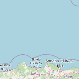
Map view of El Kala National Park

Use this park location map to pinpoint El Kala National Park in Algeria, understand its exact geographic position, and read its mapped placement within the surrounding landscape more clearly.

Pigeon | © OpenStreetMap contributors

Location context for El Kala National Park

El Tarf Province
Natural feature types

Examine the Natural Landscape and Geographic Features of El Kala National Park

Navigate the structured natural feature collection to learn about the lakes, forests, and coastal terrains that shape the identity of El Kala National Park. This MoriAtlas resource maps the diverse geological and hydrological elements found across this vital Mediterranean protected landscape for deeper geographic study.
Recorded earthquake history

Examine the Recorded Earthquake History of El Kala National Park

Browse the historical record of earthquakes documented near the boundaries of El Kala National Park. This MoriAtlas catalogue provides event-specific data including magnitude and epicentre distance, allowing for a clearer understanding of the seismic context across this unique Mediterranean protected landscape.

El Kala National Park Earthquake History

Catalogued events

10 events

Strongest magnitude

Magnitude 5.1

Most recent event

Jan 9, 2012

This history includes earthquakes recorded inside the park or within 50 km of its borders

Park atlas

Explore the diverse Mediterranean landscapes and crucial wetlands adjacent to El Kala National Park, tracing regional conservation efforts.

Discover Nearby National Parks and Protected Areas Beyond El Kala National Park

Explore other national parks and protected areas geographically connected to El Kala National Park, browsing a wider spread of Mediterranean wetlands, coastal zones, and forested slopes in North Africa. Compare these diverse conservation landscapes and their regional context, enriching your atlas exploration of Algeria's protected ecosystems and unique biodiversity.
National parkJendouba Governorate
About 4 km away#1 closest

East

El Feidja National Park: National Park Mapping and Protected Landscape Discovery

Explore geographic context within Jendouba Governorate.

Gain a clear understanding of El Feidja National Park's protected status and its geographic footprint. This page offers detailed insights into the park's mapped boundaries and landscape characteristics, situated within the Jendouba Governorate. It serves as a primary resource for atlas exploration, highlighting the natural terrain and regional significance of this Tunisian national park.

Area
27.65 km²
Established
1990
IUCN
II
Relief
Mountain
National parkTunisia
About 20 km away#2 closest

East

Oued Zeen National Park: Tunisia's National Park Entry for Geographic and Landscape Atlas Exploration

Explore the mapped protected area and regional geography of Oued Zeen National Park.

Oued Zeen National Park is a designated national park in Tunisia, offering a crucial point for geographic exploration within the country's atlas. This page details its protected landscape identity, contributing to a structured understanding of regional natural areas and park boundaries. Users can examine its geographic setting and landscape context to deepen their appreciation of Tunisia's protected lands.

Area
67 km²
Established
2010
Scope
Terrestrial
Water
Major water bodies
National parkBizerte Governorate
About 35 km away#3 closest

Northeast

Jebel Chitana-Cap Négro National Park: National Park Protected Area & Landscape Identity

Explore the mapped geography of Jebel Chitana-Cap Négro National Park.

As a designated national park, Jebel Chitana-Cap Négro National Park represents a key protected area for understanding the regional geography of Bizerte Governorate. This entry provides structured information focused on the park's geographic scope, its mapped boundaries, and its significance as a protected landscape. It is designed for users seeking detailed, atlas-style context on Jebel Chitana-Cap Négro National Park's natural setting and its place within Tunisia's protected lands network.

Area
101.2 km²
Established
2010
Relief
Mountain
Scope
Terrestrial
National parkTunisia
85 km away#4 closest

East

Ichkeul National Park: Tunisia's Key Protected Landscape for Geographic Discovery

Explore the mapped geography and regional context of this Tunisian national park.

Ichkeul National Park is a crucial protected area located in Tunisia, offering a distinct focal point for geographic exploration and atlas-based understanding. This park's mapped boundaries and protected status are central to appreciating its role within Tunisia's natural landscapes and the wider North African region. Through structured data and detailed geographic context, users can gain insight into Ichkeul National Park's unique environmental identity and its significance as a protected natural resource.

National parkTunisia
About 124 km away#5 closest

Southeast

Jebel Serj National Park: Central Tunisia's Distinctive Mountain Protected Area

Explore its terrain and protected landscape context.

Jebel Serj National Park, established in 2010, safeguards a significant mountainous territory in central Tunisia, distinguishing itself from the broader semi-arid plains. This protected landscape showcases the Djebel Serj massif, a unique topographical feature that serves as an ecological bridge between Tunisia's northern and southern regions. Users exploring this page can gain an atlas-level understanding of the park's mapped boundaries, its geological character, and its contribution to the conservation of representative natural diversity within North Africa's transitional ecosystems.

Area
17.2 km²
Established
2010
IUCN
II
Scope
Terrestrial
National parkTunisia
About 153 km away#6 closest

East

Boukornine National Park: A Protected Mediterranean Mountain Landscape in Tunisia

Explore its mapped terrain and unique protected ecosystem.

Boukornine National Park in Tunisia represents a significant protected landscape, notable for its central granite peak, Jebel Boukornine, which rises sharply above the surrounding coastal plains. This national park, covering approximately 1,939 hectares, preserves a distinctive Mediterranean mountain ecosystem. Its rugged terrain, rocky slopes, and the presence of Aïn Zargua spring support a unique concentration of species, including notable flora and fauna. Understanding Boukornine National Park provides insight into the regional geography and the importance of conserving these mountainous protected areas within Tunisia.

Area
19.39 km²
Established
1987
IUCN
II
Relief
Mountain
National parkKasserine Governorate
About 158 km away#7 closest

South

Chambi National Park: Mountain Geography and Protected Landscape Analysis

High elevation terrain in the Kasserine Governorate

Chambi National Park encompasses 67 square kilometers of rugged, high-altitude terrain in Tunisia. This resource maps the park's mountain ecosystem, from its forested valleys to its exposed rocky peaks, providing a structured overview of this significant protected landscape near the Algerian border.

Area
67.23 km²
Established
1980
IUCN
II
Relief
Mountain
National parkTunisia
About 158 km away#8 closest

South

Chambi National Park: Mapping Tunisia's Premier Mountain Protected Area and Alpine Terrain

Regional alpine geography and protected highland ecosystems

Explore the distinct mountainous geography of Chambi National Park, situated in the Kasserine Governorate of Tunisia. This protected area encompasses the nation's highest peak and serves as a vital refuge for endemic mountain species. The landscape features a complex interaction between Aleppo pine forests, holm oak woodlands, and high-altitude steppe plateaus that define this significant Mediterranean mountain region.

Area
67.23 km²
Established
1980
IUCN
II
Relief
Mountain

Common questions about visiting, size, designation, and location context for El Kala National Park

El Kala National Park FAQs for park facts, access, geography, and protected area context

Find quick answers about El Kala National Park, including protected-area facts, park geography, trail and visitor context, and how the park fits into its surrounding country and regional landscape.
MoriAtlas Explorer

Continue Your Protected Areas Search Across the Global Atlas

Deepen your exploration by continuing the structured search for national parks and protected areas worldwide. Utilize the comprehensive filtering capabilities to compare different conservation landscapes and refine your understanding of global park geography. Discover more about the distribution and characteristics of protected natural areas.

Global natural geography